×

Belize🇧🇿 | hikesAntelope Falls TrailTea-colored plunge pool, cohune palms, Mayflower mounds, stream crossing | things to do and best time to go

Explore Tiger Fern TrailExplore Bacalar Chico National Park and Marine Reserve

Backpacking in Antelope Falls Trail
👌 Worth visitinghike ranked #3
By Johan Kruseman 🇳🇱 | Updated October 22, 2026

Your boots slap onto wet red clay, a howler monkey roars somewhere above the cohune palms, and the air smells of rotting leaves and river stone. Then the canopy opens and Antelope Falls drops into a green pool, the spray cool on your sweaty forearms. Antelope Falls Trail runs through Mayflower Bocawina National Park in the Stann Creek District of southern Belize, inland from the Caribbean coast. It is a moderate walk of a few hours return, with muddy slopes, a couple of steep pitches and a stream crossing that soaks your socks. Humidity makes it feel harder than the numbers suggest. Getting to the park gate by bus along the Southern Highway is easy, though the access road leading in means a further walk or a ride. Hikers who like swimming holes and bird calls will love it. Anyone wanting a pavement-smooth stroll or big summit views will not.

Discover everything you want to know in the 📖 Belize Travel Guide.
Best time to go: November - April
Duration: 4 hours
Distance: 6 kilometers
Total ascent: 250 meters


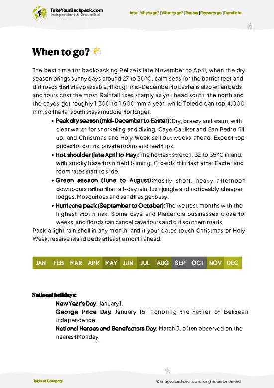
example page 0 from our offline Travel Guide for Belize
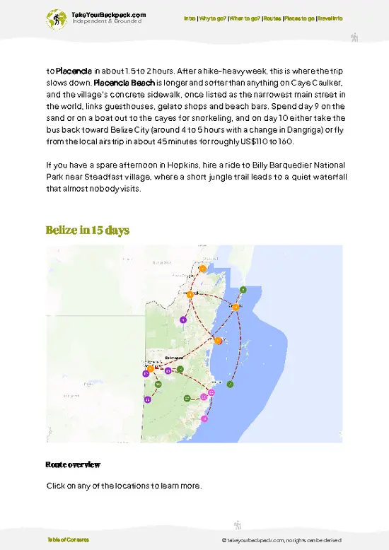
example page 1 from our offline Travel Guide for Belize
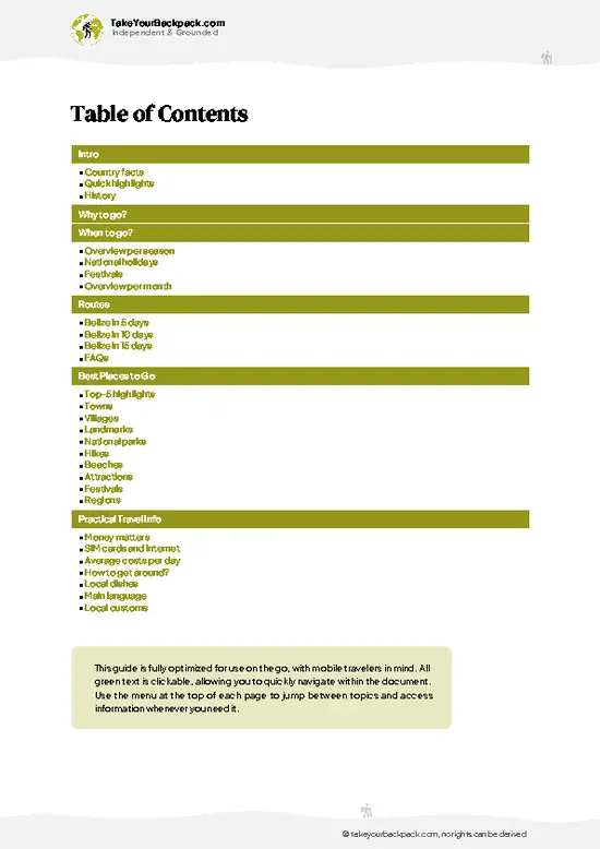
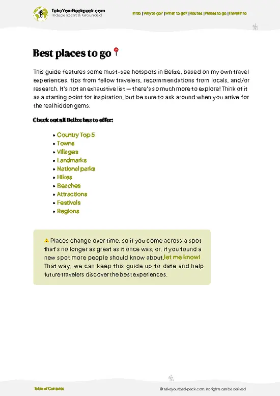
example page 2 from our offline Travel Guide for Belize
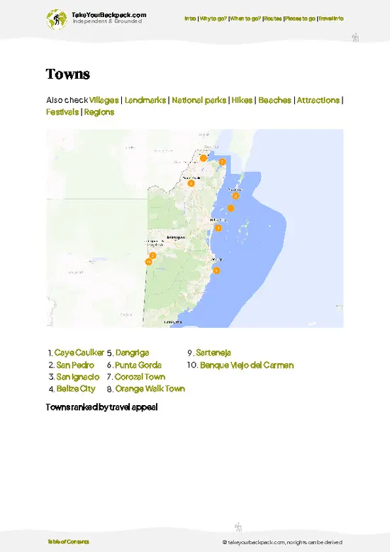
example page 3 from our offline Travel Guide for Belize
example page 4 from our offline Travel Guide for Belize
example page 5 from our offline Travel Guide for Belize
example page 6 from our offline Travel Guide for Belize
example page 7 from our offline Travel Guide for Belize
Loading the map 🌍
CLICK TO FILTER
towns
villages
landmarks
national parks
hikes
beaches
attractions
festivals
regions
SHOW COUNTRY’S BESTSHOW ALL

✨ Why go?
Ranked #3 hike in Belize
Why visitors keep coming back

Antelope Falls Trail gives you a proper rainforest waterfall in a few hours of walking, which is rare in a country where many jungle sights need a guide and a full-day tour. Inside Mayflower Bocawina National Park, it sits alongside other falls and old Maya mounds, so one entrance ticket buys you a whole menu of short walks. You can do the falls alone, add a second trail, or stretch the day into an overnight at the park's camping area. The cool plunge pool at the end is the real draw, especially after hiking through damp heat. The park also lies close to the Southern Highway, so it works as a break between the cayes and the far south. Many backpackers pair it with Hopkins village, where Garifuna drumming and fried fish wait after a muddy day.

💡 HighlightsWhat this place is best known for

  1. Antelope Falls: The trail's namesake sight is a tall, narrow cascade that spills over dark rock into a swimmable pool ringed by ferns and heliconia. Go in the morning when the light slants through the trees and the pool is empty. The water is cool and a little tea-colored from the leaf litter.
  2. Bocawina Falls: The park's biggest waterfall lies on a neighboring trail and drops in a broad white sheet into a wide pool. It takes a steeper, rootier approach, so it suits those who want a harder day. Swimming at the base is the reward.
  3. Three Sisters Falls: This stepped trio of cascades sits close to the park's main trail network and is easy to add to a loop. The rocks are slick, so wear shoes with grip. The pools are good for a short dip.
  4. Cohune palm forest: Huge arching fronds shade much of the approach
… read more 👉
  1. Antelope Falls: The trail's namesake sight is a tall, narrow cascade that spills over dark rock into a swimmable pool ringed by ferns and heliconia. Go in the morning when the light slants through the trees and the pool is empty. The water is cool and a little tea-colored from the leaf litter.
  2. Bocawina Falls: The park's biggest waterfall lies on a neighboring trail and drops in a broad white sheet into a wide pool. It takes a steeper, rootier approach, so it suits those who want a harder day. Swimming at the base is the reward.
  3. Three Sisters Falls: This stepped trio of cascades sits close to the park's main trail network and is easy to add to a loop. The rocks are slick, so wear shoes with grip. The pools are good for a short dip.
  4. Cohune palm forest: Huge arching fronds shade much of the approach and rattle in the breeze. Keep an ear out for howler monkeys, whose roars carry for a long distance, and toucans flashing their bills in the upper branches. Early hikers have the best chance of seeing coatis and agoutis on the path.
  5. Mayflower Maya site: Small mounds and cleared plazas in the forest give the park a human story. They are modest compared with Belize's big temples, but there are no crowds, and you can stand where people lived long ago. Entry to the park costs roughly US$10 for foreign visitors, and the site is included.
Start with Antelope Falls Trail, because the pool is the main reward and it is much nicer to reach it while the morning is still cool and the clay path is not yet churned up.
Spotted a mistake or missing something? Contact us.

🌤️ When to go?Weather, crowds, and seasonal trade-offs

  • Dry Season (February to May): Antelope Falls Trail is at its easiest, with firm, mostly dry footing and a clear creek. Highs reach 30 to 34 °C (86 to 93 °F) and mornings sit near 21 to 23 °C (70 to 73 °F). March and April bring the lowest water, so the falls thin out.
  • Early Wet Months (June to July): Short, heavy afternoon downpours turn the clay trail slick, though the falls run fuller and the jungle turns intensely green. Temperatures stay around 24 to 32 °C (75 to 90 °F).
  • Peak Rains (August to November): Creek crossings can rise fast, trails get muddy, and insects multiply. Days run roughly 11 to 12 hours of light, and local guides can be harder to reach.
  • Cooler Months (December to January): Nights dip to about 19 to 21 °C (66 to 70 °F), showers are intermittent, and the creek holds a pleasant
… read more 👉
  • Dry Season (February to May): Antelope Falls Trail is at its easiest, with firm, mostly dry footing and a clear creek. Highs reach 30 to 34 °C (86 to 93 °F) and mornings sit near 21 to 23 °C (70 to 73 °F). March and April bring the lowest water, so the falls thin out.
  • Early Wet Months (June to July): Short, heavy afternoon downpours turn the clay trail slick, though the falls run fuller and the jungle turns intensely green. Temperatures stay around 24 to 32 °C (75 to 90 °F).
  • Peak Rains (August to November): Creek crossings can rise fast, trails get muddy, and insects multiply. Days run roughly 11 to 12 hours of light, and local guides can be harder to reach.
  • Cooler Months (December to January): Nights dip to about 19 to 21 °C (66 to 70 °F), showers are intermittent, and the creek holds a pleasant volume. Visitor numbers and Hopkins lodging prices rise slightly around the holidays.
Go on a weekday morning in February or early March for the best mix of solid footing, flowing water, and empty swimming pools.


source: climatestotravel.comJANJanuary: excellent for travelingFEBFebruary: excellent for travelingMARMarch: excellent for travelingAPRApril: highly recommended for travelingMAYMay: fair for travelingJUNJune: fair for travelingJULJuly: fair for travelingAUGAugust: fair for travelingSEPSeptember: fair for travelingOCTOctober: fair for travelingNOVNovember: highly recommended for travelingDECDecember: excellent for traveling
belize-hike-antelope-falls-trail
© Google |

✈️ The backpacker research shortcutBelize Travel Guide

An offline-friendly backpacking guide with optimized travel routes, ranked highlights, transport advice, and the best areas to stay.
example page 0 from our offline Travel Guide for Belize
example page 1 from our offline Travel Guide for Belize
example page 2 from our offline Travel Guide for Belize
example page 3 from our offline Travel Guide for Belize
example page 4 from our offline Travel Guide for Belize
example page 5 from our offline Travel Guide for Belize
example page 6 from our offline Travel Guide for Belize
example page 7 from our offline Travel Guide for Belize
The digital guide (168 pages) contains:
✅ 44 highlights, ranked by travel appeal
✅ Optimized 5, 10 & 15-day travel routes
✅ Cities, national parks, landmarks, beaches
✅ How to get around
✅ Offline-friendly for travel without Wi-Fi
👉 Click to see all 30+ guide features

📅 Plan smarter in minutes, not weeks
✅ Month by month travel advice
✅ Festivals & national holidays
✅ Budget expectations

🗺️ Go to the right places, skip the overrated ones
✅ Honest pros & cons of destinations
✅ Top hikes, parks & viewpoints
✅ Lesser-known places most travelers miss
✅ Clear “worth it vs skip it” guidance

🛏️ Travel smoothly without rookie mistakes
✅ Best areas to stay
✅ Transport systems explained simply
✅ Common scams & safety advice
✅ SIM cards, money & practical tips

🌍 Understand the country, not just visit it
✅ Culture & traditions
✅ 52 Essential phrases & customs
✅ Festivals worth planning around
✅ Traveler-friendly historical context
✅ Insights that make places more meaningful

📱 Built for real travel conditions
✅ Fully downloadable PDF
✅ Works completely offline
✅ Optimized for phone use
✅ Useful in remote areas & buses
✅ Everything in one place
Stop searching, start planning
Get instant access to your full guide. 30‑day money-back guarantee.
+ Add another guide for just

By proceeding you agree to our terms.
Sent to your inbox immediately after payment • 100% Secure Checkout
Best Backpacking Travel Advisor 2025 tourism awardBest Backpacking
Travel Advisor
2025
What others say about Take Your Backpack Guides:
⭐⭐⭐⭐⭐
Fantastic, amazing amount of information!
⭐⭐⭐⭐⭐
My goodness this is amazing, it's what I've been looking for hats off too you!
⭐⭐⭐⭐⭐
I think this is absolutely BRILLIANT
⭐⭐⭐⭐
Very complete and informative. It's still missing places, but I gotta to commend you
⭐⭐⭐⭐⭐
This is truly amazing, thank you, can't wait to explore it with my kids!
⭐⭐⭐⭐⭐
Awesome resource, thank you!
⭐⭐⭐⭐⭐
This is amazing! Can't wait to explore the ones I haven't seen
⭐⭐⭐⭐
I love this! Well done, great idea.
⭐⭐⭐⭐⭐
Thanks for taking the time to make this gem!
⭐⭐⭐⭐⭐
This might be the best website I've ever seen.
⭐⭐⭐⭐⭐
Congratulations, and thank you so much for your work; it's incredibly valuable.
⭐⭐⭐⭐
In all seriousness I think you did a great job pointing out the important spots
⭐⭐⭐⭐⭐
10/10 very good
⭐⭐⭐⭐⭐
As someone who's only just starting to visit regularly this is awesome, thank you.
⭐⭐⭐⭐
Thank you very much! I'm going to visit my dad, it's going to be very useful!
⭐⭐⭐⭐⭐
This is really cool! We'll be travelling for the first time and this definitely come in handy.
⭐⭐⭐⭐⭐
You are now our minister of culture, congratulations 👨‍💼
⭐⭐⭐⭐⭐
Just wanted to tell you that this is a pearl! Going to follow your recommendations.
⭐⭐⭐⭐⭐
This is so cool. I'll definitely be using the resource for my travels soon.
⭐⭐⭐⭐⭐
This is very impressive! Good work.
⭐⭐⭐⭐⭐
This is an amazing and informative site. Very well done!

🛏️ Where to stay?Best areas and accommodation options

If you enjoy meeting fellow travelers, consider choosing hostels with high ratings for atmosphere. On the other hand, if you prefer having your own space, a hotel might be a better option.

🥾 Hike detailsEverything you need to know before hiking Antelope Falls Trail

Total Distance: Antelope Falls Trail is a short out-and-back of roughly 3 to 4 kilometers round trip, depending on where you leave your ride and how far you wander along the creek.
Estimated Duration: Plan on 2 to 3 hours at an easy pace, including time at the falls for swimming and snacks. Add an hour if you linger or scout side paths.
Difficulty: Moderate to challenging. The second half is steep, with fixed ropes between trees, and wet clay, tree roots and creek crossings make footing slippery, so grip matters more than fitness.
Starting Point: The trail begins just behind the Mayflower Bocawina
… read more 👉
Total Distance: Antelope Falls Trail is a short out-and-back of roughly 3 to 4 kilometers round trip, depending on where you leave your ride and how far you wander along the creek.
Estimated Duration: Plan on 2 to 3 hours at an easy pace, including time at the falls for swimming and snacks. Add an hour if you linger or scout side paths.
Difficulty: Moderate to challenging. The second half is steep, with fixed ropes between trees, and wet clay, tree roots and creek crossings make footing slippery, so grip matters more than fitness.
Starting Point: The trail begins just behind the Mayflower Bocawina National Park visitor center, reached by a dirt road off the Southern Highway, and it works for independent travelers without a car.
  • Public Transport: Regional buses run along the highway through the area, so ask the driver to let you off at the turnoff and walk in.
  • Alternative: A taxi or a local driver can take you to the trailhead and arrange a pickup time, which helps because afternoon traffic thins out.
Major Landmarks:
  • The Trailhead: A dirt track flanked by farm plots and tall grass, where the air smells of damp earth and woodsmoke.
  • Creek Crossings: Shallow stretches you wade or hop across on rocks. Water is usually ankle to knee deep, higher after heavy rain.
  • Antelope Falls: The waterfall is the destination, with a cool plunge pool below and a steady roar that you hear well before you see it.
Terrain and Scenery: Packed dirt gives way to rooty, muddy forest track and then limestone and boulders beside the stream. Light drops under the canopy, and the pool at the end is a bright, green-tinted contrast.
Vegetation: Tropical broadleaf forest with palms, ferns, strangler vines and big buttressed trees. Near the start you pass cleared land, banana and corn patches and open sun.
Wildlife: Expect birdsong all along the walk, with motmots, toucans and flycatchers the likeliest sightings. Butterflies gather on wet sand at the creek, and lizards scatter from the path. Keep an eye out for snakes on the trail and shake out your boots if you leave them by the water.
What to Bring: Shoes with tread that you do not mind soaking, a dry bag for your phone, insect repellent, a swimsuit and at least 1.5 liters of water. Treat creek water before drinking it.
Practical Notes: Go in the morning so you are back on the highway while rides are still easy to catch. After rain the creek rises and turns brown, so skip the crossings if the current looks strong.
⚠️ Hiking info can sometimes be outdated or inaccurate. Before you hit the trail, check the latest conditions with locals. If you do spot anything that's off, I'd love to hear from you, so I can update it for fellow travelers.

🛡️ SafetyScams, Hazards, and Annoyances

Antelope Falls Trail is a short, manageable jungle walk, and the main hazards are slippery ground and heat. Red clay and wet roots get greasy after rain, so wear shoes with real tread, not flip-flops, and take your time on the descent toward the water. Creek levels can climb quickly after upstream storms, so skip any crossing that looks brown and fast. Rocks around the falls are polished and slick, so test each step before you commit and check pool depth before jumping. Carry at least a liter and a half of water per person, insect repellent, and a light rain layer. The jungle here holds snakes, including the fer-de-lance, so watch where you put your hands and feet, stay on the path, and never reach into leaf litter. Walking with a local guide cuts navigation worries.

FAQTraveler FAQ

Antelope Falls Trail takes roughly 3 to 4 hours round trip, including time to swim at the falls. The trail climbs about 1.8 km (1.1 miles) each way from the Mayflower Bocawina visitor center, steeply in its second half. Plan a half-day outing from Hopkins, about 12 miles away, or Dangriga, about 17 miles away.
Antelope Falls Trail is moderately challenging. The route is short, but its second half is steep, with fixed ropes, and muddy clay, roots, and a few creek crossings slow you down, especially from June to November. Anyone comfortable on uneven ground and carrying a liter or two of water can manage it, and kids with decent balance usually do fine.
Antelope Falls Trail lies inside Mayflower Bocawina National Park, so you pay the park entrance fee at the visitor center; no other permit is needed. Hiring a local guide is recommended, especially after rain when the path is muddy and creeks run high. Arrange it through your Hopkins or Dangriga guesthouse or at the visitor center, and carry small bills in US dollars or Belize currency.
⚠️ Things can change over time, so always validate details locally before you go.

Other Belizean hikes near Antelope Falls Trail

Explore more nearby:

  • Tiger Fern Trail—Jaguar preserve, icy waterfall pool, rooty climb, creek tubing| 19 km away
  • Victoria Peak—Maya Mountains summit, multi-day, base camp, guided permit| 28 km away

💡 Not sure where to go next?
Create a personalized itinerary for Belize including Antelope Falls Trail and the places that fit your trip.

Generate my itinerary

👉 Discover all hikes

Or checkout all Belize has to offer (think cities, towns, villages, national parks, hikes, beaches, festivals)
Country photo of Belize

We 💚 feedbackSumming up the experience

Antelope Falls Trail fits best as the muddy highlight between sea and village days, so I would pair it with a night in Hopkins afterward and a Placencia stay further south. Go early, wear shoes you do not mind ruining, and pack a dry shirt for the bus. If you have energy left, add Bocawina Falls rather than doing a second park elsewhere.

✍️ Help improve this page!
The information on this page is based on in-depth research, insights shared by experienced travelers, and feedback from the local travel community in Belize. While every effort is made to keep the information accurate and current, conditions can change — so if you spot anything incorrect or outdated, please get in touch.


🙋‍♂️ Give feedback

👋 Meet the founderWho’s Behind Take Your Backpack?

Johan, backpacker and founder of TakeYourBackpackHi, I’m Johan (Netherlands 🇳🇱), the creator of TakeYourBackpack. Over the past 3 decades, I’ve backpacked through 90+ countries across six continents, gaining extensive experience with independent travel, long-term trips, and overland routes.

This site is built on a combination of firsthand travel experience and carefully curated insights from other backpackers. Many guides are based on places I’ve personally visited, while others bring together tips, observations, and practical advice shared by trusted travelers I’ve met along the way.

The goal is to provide realistic, experience-driven guidance — not generic itineraries — so you can explore destinations with better context, clearer expectations, and more confidence.