×
United States 🇺🇸

backpacking North America United States 🇺🇸Road-trip endlessly through wildly contrasting landscapes.

Explore Turks and Caicos IslandsExplore United States Virgin Islands

Backpacking the USA in 2026

A complete guide including when and where to go, costs, transport, itineraries, and practical travel advice.
Traveling in the USA: what to expect

Backpacking the USA
By Johan Kruseman 🇳🇱 | Updated August 1, 2026

In the United States (USA), your trip lives and dies by driving. Distances are epic, trains are romance not a network, and flights can torch the budget you swore you’d save for brisket and park fees. That tension between time, money, and comfort is the country in miniature—huge, tempting, and always asking you to pick your battle.

Pick time and you earn the classic road trip: long horizons, diner coffee at 2 a.m., and sunrise alone on a Utah overlook you reached by willpower and gummy bears. Pick money and you leapfrog hubs—New York to New Orleans to Vegas—trading serendipity for a clean bed and a faster path to jazz, neon, and canyons. Pick comfort and you shrink the map on purpose: one region, deeper conversations, the same great taco stand three days in a row. The payoff is range like nowhere else: bison steaming in Yellowstone, granite cathedrals in Yosemite, red rock mazes that make your legs honest, mossy rainforests that drip and sing, blues on a Delta porch, a Brooklyn slice eaten on a stoop because you couldn’t wait. Yes, there are quirks: reservation systems for popular parks, summer crowds that turn viewpoints into parking lots, surprise taxes at the checkout, a tipping culture that keeps a calculator busy, heat that melts your ambitions, and winters that slam doors shut. But the work you put in—leaving at 4 a.m., carrying extra water, learning the rhythm of park shuttles—makes the moment land harder; you earned the quiet, and it tastes like cold air and victory.

Compared with Canada, the USA feels louder, messier, and more condensed with icons; you trade a calmer pace for denser cultural hits and bigger swings in weather and attitude. Compared with Mexico, buses are weaker but the road-trip canvas is king, and the mash-up of music scenes and regional food is a cheat code for momentum. Go if you love choosing your own line through the chaos—road-trippers, national park collectors, live-music pilgrims, and anyone willing to spend a little sweat to make the map feel personal.

👉 Get the 📖 Travel Guide of the USA

Northeast Corridor (Boston–New York–Philadelphia–Washington, DC)

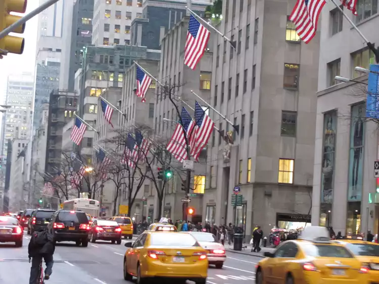
If you want maximum culture per hour, this is the USA’s conveyor belt. Trains run often; book early and they’re reasonable, book late and you’re paying “I made a mistake” prices. Buses are cheapest and chew time like taffy. No car needed, which saves money and nerves; subways move you faster than taxis when traffic seizes. Hotels cost more than most of the country; you win back value by walking everywhere and stacking museums, food, and history in single days. Winter is slush and grit. Summer is humid. Rewards planners, walkers, and night owls.

California Coast Spine (San Diego–Los Angeles–Santa Barbara–San Luis Obispo; add San Francisco only if you have time)

Here, distance lies. The map looks simple; traffic says “try again.” The Pacific Surfliner train is the sanity play: slower than flying, faster than driving on a bad Friday, with ocean views and zero parking drama. Driving Highway 1 is gorgeous work—also closures, hairpins, and lodgings that price like Manhattan-by-the-sea. Food is excellent if you chase neighborhoods, not trends. Budget goes faster than in the Midwest; life gets easier with carry-on luggage and low expectations for punctuality. Rewards surfers, food scavengers, and people who accept that “beach day” might be windbreaker weather.

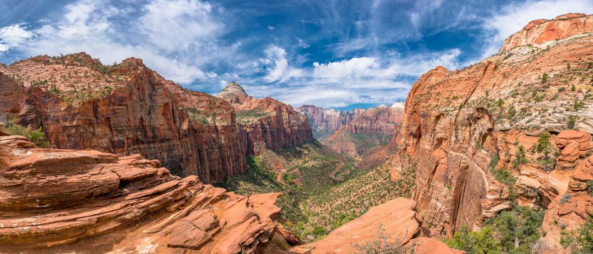
Desert Southwest Parks Loop (Las Vegas–Zion–Bryce–Page–Grand Canyon)

This is the big-sky, early-alarm shift. Car required. You trade comfort for access: pre-dawn starts to beat heat and parking, rationing water like it’s currency, dust in everything. Permits gate the famous hikes; miss out and pivot to less-hyped trails that are quieter and just as physical. Lodging in Springdale, Bryce, Page, and Tusayan jumps in peak season; camping makes the budget sane if you actually like sleeping outside. Distances look short but eat hours—switchbacks and scenic pullouts will win. Rewards hikers and photographers who enjoy dehydration as a personality test.

Pacific Northwest (Seattle–Olympia/Olympic Peninsula–Portland)

Coffee, trees, and a functional train between the cities. The Cascades line is time-efficient and calmer than I-5; use it to keep the city bits tight. For the Olympics you’ll want a car and a rain shell that actually works. Expect drizzle nine months, perfection for a few weeks, and trailheads that punish late risers. Prices land below coastal California but above the rural South. Ferries are charming until you miss one and lose an hour. Rewards bookish hikers, tidepool nerds, and anyone who thinks “camping in light rain” counts as ambiance.

Southern Appalachians & Blue Ridge (Asheville–Great Smoky Mountains–Blue Ridge Parkway)

Slow roads, big payoffs for patience. The Parkway is 45 mph on purpose; fog shows up with its own agenda. The Smokies are the most visited park in the USA and also free—so you trade money for time in traffic unless you start early. Cabins and campgrounds are cheaper than coastal cities; you’ll spend on gas and biscuits. Cell service disappears; paper maps still matter. Summer brings humidity and thunderstorms; shoulder seasons deliver cooler temps and leaf-peeper gridlock. Rewards road-trippers, waterfall chasers, and hikers who don’t mind a little mud with their views.
Seeing the layout at a glance
Loading the map 🌍
CLICK TO FILTER
cities
towns
villages
landmarks
national parks
hikes
beaches
attractions
festivals
regions
SHOW COUNTRY’S BESTSHOW ALL

Why go?What makes this country worth the trip

Scenery

The USA does scenery like it does everything else: oversized, occasionally ridiculous, and worth the … read more 👉
The USA does scenery like it does everything else: oversized, occasionally ridiculous, and worth the hassle. You can chase lakes that swallow horizons (Lake Superior’s North Shore), caves that erase the sun (Mammoth and Carlsbad), volcanoes that glow after dark (Hawai‘i Volcanoes), and forests that make your phone give up (redwoods). The price isn’t just dollars—it’s sleep, miles, and dignity.

Time trade: sunrise equals empty trails and wildlife, but you’ll be setting alarms starting with a 3. Skip noon; nap then. Money trade: pay for lodging near trailheads and shave hours off driving, or camp free on public land and live with dust and cold mornings. Comfort trade: desert heat, alpine wind, mosquitoes the size of opinions, sulfur, and altitude headaches; the photos don’t show the chapped lips.

Pro tip: the annual park pass pays off after a few parks. Keep a puffy, gloves, and a headlamp in the trunk year-round; desert dawn is colder than it looks.

I once froze on Haleakalā at sunrise, then watched the crater light up while everyone else fumbled with rental-car heaters. Lost sleep, numb hands, zero crowds. That’s the deal—and the payoff.

Mountains

The USA does mountains like it does everything else: oversized, varied, and occasionally ridiculous … read more 👉
The USA does mountains like it does everything else: oversized, varied, and occasionally ridiculous to reach. You trade time for solitude, money for access, and comfort for altitude. Pick your currency.

Time: distances are huge. A “quick” loop can mean half a day of driving between the Sierra and the desert, or between Colorado ranges. Permits for Whitney and popular High Sierra basins eat planning time; the Wind River Range or Colorado’s San Juans cost more sweat, less paperwork.

Money: rental cars climb faster than you do, national parks charge at the gate, and huts in the White Mountains can cost as much as a motel. The flip side is free dispersed camping on public land and trails that don’t charge you per mile of granite.

Comfort: afternoon lightning in the Rockies, black flies in the Northeast, snow lingering on Cascade volcanoes, and thin air everywhere. Start before dawn, finish before clouds build.

Pro tip: the America the Beautiful pass pays off at three parks. Personal: I learned the “off the summit by noon” rule on Longs Peak—hail at 1 p.m. rewires habits faster than any guidebook.

Wildlife

The USA is built for wildlife road-trips: you can drive from desert bighorn to coastal whales to wolf … read more 👉
The USA is built for wildlife road-trips: you can drive from desert bighorn to coastal whales to wolf country without leaving one map. You pay in miles, early alarms, and the occasional mosquito swarm, but the payout is big animals doing real animal things.

Pick one ecosystem and go deep. Yellowstone for bison, wolves, and geothermal fog that hides them until the sun burns through. Everglades for alligators, wading birds, and humidity that chews on you. Alaska for bears and whales, plus rain that finds its way through “waterproof” everything. I’ve shivered in Lamar Valley at 5 a.m. and watched wolves ghost the sage—worth the toes I couldn’t feel until lunch.

Pro tip: dawn and dusk or don’t bother. Bring 8x42 binoculars and sit still longer than feels reasonable; the animals show up when the influencers leave. Another: one well-chosen guided day (Monterey small-boat whale trip; fly-out bears at Katmai) saves two days of blind searching—costly compared to DIY, but unmatched for sightings per hour.

Money saver: the America the Beautiful Pass pays off after two or three national parks. Comfort hedge: headnet in Florida, bear spray in Montana, and a thermos strong enough to wake a moose.

Beach life

The USA does beach life in stereo: Atlantic, Pacific, Gulf, plus volcanic edges out in Hawaii. You can … read more 👉
The USA does beach life in stereo: Atlantic, Pacific, Gulf, plus volcanic edges out in Hawaii. You can snorkel living reef before breakfast, chase fish tacos at lunch, and end up barefoot in a neon crowd by night. The range is the hook. Key Largo gives you clear water and actual coral; San Diego rolls a mellow surf culture you can paddle into; Miami turns sand into a dance floor; the Outer Banks dishes wind, space, and riptides that keep you honest.

You trade ease for payoff. The farther you go from the boardwalk, the clearer the water and the emptier the sand—plus the greater the chance your parking meter eats your budget. Pro tip: in the Florida Keys, take the first morning boat at John Pennekamp State Park; the reef is calmer and you’re back before the sun gets mean. Pro tip: in Hawaii, wear a rash guard and reef-safe sunscreen; it’s cheaper than reapplying SPF every hour and kinder to the fish you paid to see.

I chase early light. Dawn paddles in California, dawn snorkels in Hawaii, and I’m napping while the crowds stand in line for margaritas.
Want the complete picture of the USA?
The offline Travel Guide brings everything together — routes, highlights & planning.

See what's included in the guide 👉

Get the Travel Guide -

⭐ HighlightsThe places that define a trip here

💡 Not sure where to go?
Get a personalized backpacking itinerary for the USA generated in under 10 seconds.

Generate my itinerary
  • Grand Canyon, South Rim: The rim swallows sound and patience—ravens float on thermals while the Colorado chews at rock you can’t even see yet. Time buys solitude here: start in the blue hour and hike South Kaibab to Ooh Aah Point or Skeleton; you’ll trade sleep and calf mercy for a sunrise that makes silence feel loud. Money buys shortcuts—heli flights and mule rides—brief, pricey, and nowhere near as earned as red dust in your socks and salt on your lips. Comfort? Nonexistent by noon; shade is a rumor and water is a rule. Off the map: Shoshone Point’s quiet rim, Moran Point at first light, the rough road to Toroweap; I’ll take Shoshone’s picnic tables and big sky every time.
  • Brooklyn Bridge at Dawn, New York City: The planks hum under your boots, the East River breathes cold, and the skyline looks freshly sharpened before the day starts yelling. Time is your weapon—arrive before sunrise and the bridge belongs to you; wait an hour and you’re dodging tripods and wedding shoots. Money is
read more 👉
  • Grand Canyon, South Rim: The rim swallows sound and patience—ravens float on thermals while the Colorado chews at rock you can’t even see yet. Time buys solitude here: start in the blue hour and hike South Kaibab to Ooh Aah Point or Skeleton; you’ll trade sleep and calf mercy for a sunrise that makes silence feel loud. Money buys shortcuts—heli flights and mule rides—brief, pricey, and nowhere near as earned as red dust in your socks and salt on your lips. Comfort? Nonexistent by noon; shade is a rumor and water is a rule. Off the map: Shoshone Point’s quiet rim, Moran Point at first light, the rough road to Toroweap; I’ll take Shoshone’s picnic tables and big sky every time.
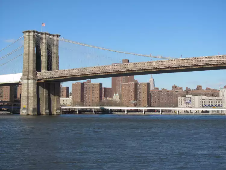
  • Brooklyn Bridge at Dawn, New York City: The planks hum under your boots, the East River breathes cold, and the skyline looks freshly sharpened before the day starts yelling. Time is your weapon—arrive before sunrise and the bridge belongs to you; wait an hour and you’re dodging tripods and wedding shoots. Money is optional: observation decks charge for high-altitude bragging rights, but this view is free if you can outwalk the crowds. Comfort swings with the season—winter wind cuts through wool, summer sticks to your back—but a hot bagel and coffee steam in your hands like a small victory. Off the map: Manhattan Bridge’s pedestrian path, Red Hook’s Louis Valentino Jr. Pier, the Roosevelt Island Tram; I’ll vote for Red Hook’s rusty waterfront and Statue views.
  • French Quarter and Frenchmen Street, New Orleans: Brass hits you in the ribs before you see the band, and powdered sugar from a beignet settles on your shirt like travel confetti. Time means late nights—music blooms after 10, and the best sets ignore your bedtime; sleep when the tuba stops. Money flows in tips and covers; keep small bills and you’ll buy better moments than any tour ever will. Comfort isn’t part of the deal: humidity clings, sidewalks sweat, and the perfume is equal parts jasmine and last night’s beer, but the payoff is a trumpet two feet from your face. Off the map: Bywater murals, the ferry to Algiers Point at sunset, Bacchanal’s courtyard jams; I keep drifting back to Algiers for golden light and quiet porches.
  • Upper Geyser Basin, Yellowstone: Steam drifts across the boardwalk like a living thing, fogging your glasses and salting the air with sulfur while geysers hiss and cough on their own schedule. Time is the real ticket—arrive early, linger, and Old Faithful turns from a cattle call into a front-row seat, with bonus eruptions from neighbors that tour buses miss. Money buys lodging close by; otherwise, you’ll spend it at the pump crossing half a state of park roads. Comfort is thin: car-bison traffic, cold mornings that numb fingers, midday sun that cooks you, and that smell, but the earth literally boils at your feet. Off the map: bike to Lone Star Geyser, prowl Blacktail Plateau Drive, hit LeHardy Rapids in June; my pick is Lone Star—just you, pine, and a geyser on a forest timer.
  • Mist Trail, Yosemite Valley: Granite walls rise like judgment while the falls blast your eardrums and turn the staircase into a carwash; you taste the spray before it hits your face. Time is king: leave before dawn and you’ll climb in cool air with mule deer for company; roll in late and you inherit a conga line. Money shifts the edges—camping is cheap if you win the reservation lottery, the lodge eats your budget but saves sanity, the shuttle is free patience training. Comfort is sacrificed outright: wet boots, slick railings, and a stair count that humbles hubris, but the rainbow at Vernal’s lip pays you back. Off the map: Taft Point’s fissures at dusk, Sentinel Dome’s 360-degree stroll, Hetch Hetchy to Wapama on a hot day; I’ll take Taft’s cliff-edge drama at golden hour.
Spotted a mistake or missing a highlight? Contact us.

But the USA offers more...

Discover and compare all of its highlights per category

🧭 RoutesSuggested travel routes through the USA

The 14-Day Desert Trails Route

The vibe: A focused Southwest adventure built around red rock hikes and canyon time, with a relaxed pace and just enough driving to link the big landscapes without burning out. Expect early mornings on the trail, quiet evenings in small towns, and a steady rhythm of hiking days and recovery days.
  • Base yourself in Sedona for red rock warm-ups and the Devil’s Bridge Trail.
  • Spend multiple days around Grand Canyon National Park, with the option to tackle the Grand Canyon Rim-to-Rim.
  • Reset in Flagstaff’s laid-back mountain-town atmosphere.
  • Finish strong in Zion National Park with the Zion Narrows and Angels Landing.

The 21-Day West Coast & Canyons Route

The vibe: A classic three-week sweep from Pacific coast to canyon country, balancing big cities, iconic drives, and national park heavy-hitters at a steady, satisfying pace. You’ll mix museum days and beach sunsets with granite domes and sandstone slot canyons.
  • Start in San Francisco, then cruise the coast toward Big
read more 👉

The 14-Day Desert Trails Route

The vibe: A focused Southwest adventure built around red rock hikes and canyon time, with a relaxed pace and just enough driving to link the big landscapes without burning out. Expect early mornings on the trail, quiet evenings in small towns, and a steady rhythm of hiking days and recovery days.
  • Base yourself in Sedona for red rock warm-ups and the Devil’s Bridge Trail.
  • Spend multiple days around Grand Canyon National Park, with the option to tackle the Grand Canyon Rim-to-Rim.
  • Reset in Flagstaff’s laid-back mountain-town atmosphere.
  • Finish strong in Zion National Park with the Zion Narrows and Angels Landing.

The 21-Day West Coast & Canyons Route

The vibe: A classic three-week sweep from Pacific coast to canyon country, balancing big cities, iconic drives, and national park heavy-hitters at a steady, satisfying pace. You’ll mix museum days and beach sunsets with granite domes and sandstone slot canyons.
  • Start in San Francisco, then cruise the coast toward Big Sur.
  • Spend several days in Yosemite National Park, with the option to hike Half Dome.
  • Recharge in Los Angeles with time on Santa Monica Beach and Venice Beach.
  • Wrap up with Las Vegas, Valley of Fire State Park, Zion National Park, and Grand Canyon National Park.

The 30-Day Cross-Country Icons Route

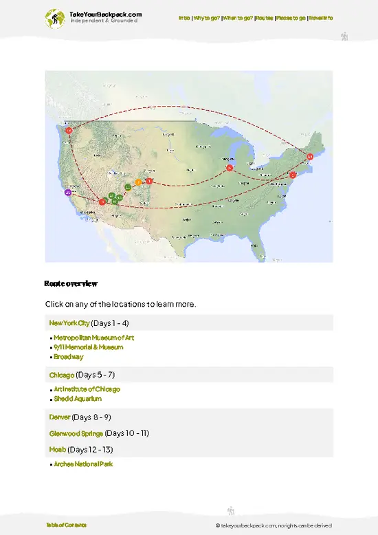
The vibe: A month-long, coast-to-coast journey linking America’s marquee cities with its most legendary national parks, paced so you can actually feel each place instead of just passing through. It’s for travelers who want museums and monuments, but also geysers, glaciers, and Pacific sunsets in one big arc.
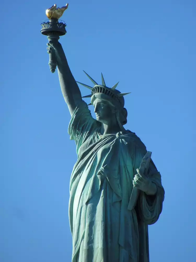
  • Kick off in New York City and Washington D.C. with the Statue of Liberty, the Metropolitan Museum of Art, and key Smithsonian museums.
  • Head to Chicago for lakefront city life and the Art Institute of Chicago.
  • Move into the mountains with Denver, Rocky Mountain, Grand Teton, Yellowstone, and Glacier National Park.
  • Finish on the West Coast with Seattle, Olympic National Park, and a San Francisco finale at the Golden Gate Bridge.
🧭 Looking for a route that fits your  trip?
Get a personalized the USA backpacking itinerary based on your trip length, interests, and start location—in under 10 seconds.

Generate my itinerary

🌤️ When to go?When to go for the best experience

The practical sweet spots for backpacking the USA are mid-May to mid-June and mid-September to mid-October. In late spring, deserts cool to human settings, coastal fog hasn’t fully locked in, and high trails begin to thaw without unleashing the full mosquito brigades; prices haven’t jumped yet and school is still in session, which keeps crowds manageable. Early fall flips the equation: kids are back in class, gateway-town rates soften, wildfire smoke usually eases with the first fronts, and you get crisp mornings with stable, dry afternoons from the Rockies westward; just steer inland if the Atlantic and Gulf start spinning storms. These windows let you string together desert slots, mid-elevation forests, and lower alpine without playing temperature roulette or paying peak-season surcharges for the privilege.
  • Peak Summer: This is crowded buses, sold-out permits, and cold plunge pools packed like beach clubs. Prices climb in gateway towns and trailheads look like stadium parking. But the payoff is pure high-country access: snow-free Sierra granite, long days to link ridges without a headlamp, blueberries staining your fingers in the Cascades, thunderheads booming over a lake you actually get to swim in. If you can stomach the scrum, you earn the widest trail menu of the year, plus alpine sunsets that stretch forever.
  • Spring Shoulder: The country wakes up. Crews clear blowdowns, seasonal roads creak open, and snowlines retreat by the week. Rivers roar, waterfalls flex, and desert blooms hang on at dawn if you start early. You move with the thaw—Zion narrows before heat sets in, then Colorado foothills as the melt climbs. Watch for rotten snow above treeline, swollen creek crossings, and the first bug waves; a headnet weighs less than your regret. Narrow-window gold: the Smokies’ synchronous fireflies flash in early June—if you time it, you’ll feel like you hacked nature’s scheduling system.
  • Deep Winter: The USA goes quiet. Empty campgrounds, low sun, and big skies that make every step sound louder. Desert trails turn runnable, the Everglades trade mosquitoes for birds, and red rock glows like a wood stove at 4 p.m. Cold snaps still bite, ice lingers in shaded gullies, and mountain storms end plans fast. Survival hack: sleep with your water filter and a hot water bottle in the bag; frozen filters die silently, and you’ll wake ready instead of brittle.

Tactical tip: For first-come campsites in popular parks during the shoulder, arrive midweek and stand by at checkout time; turnover beats any online refresh war.

source: climatestotravel.comJANJanuary: fair for travelingFEBFebruary: fair for travelingMARMarch: good for travelingAPRApril: good for travelingMAYMay: excellent for travelingJUNJune: highly recommended for travelingJULJuly: good for travelingAUGAugust: good for travelingSEPSeptember: excellent for travelingOCTOctober: highly recommended for travelingNOVNovember: good for travelingDECDecember: fair for traveling
📅 Traveling in a specific month?
Get a full month-by-month breakdown of weather, crowds, costs, festivals, and seasonal highlights in the complete travel guide.

Get full details when to go 👉

Get the Travel Guide -
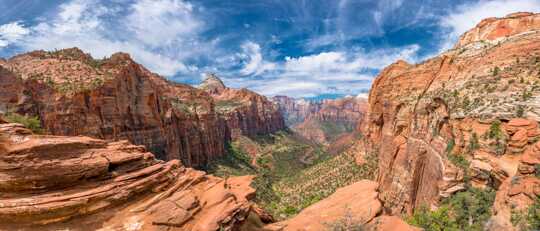
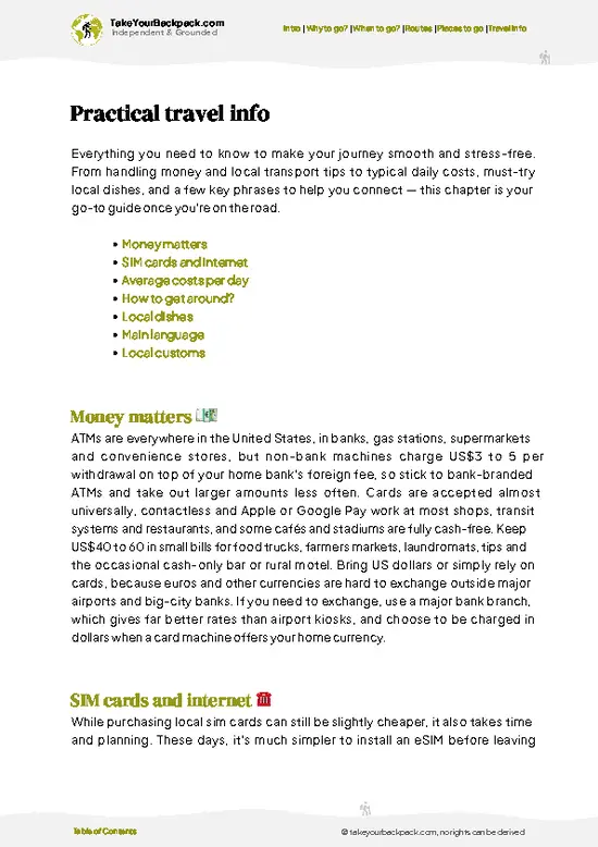
!usa - pixabay - zion-2846983

💰 Costs (as of 2026)Travel costs in the USA

Count on $80-110 per day in the USA if you use hostels, buses, and cook more than you brag about.
  • dorm accommodation: $25-40 in the South and Midwest, $45-70 on the coasts, $60-90+ in New York or San Francisco, plus 10-16% in taxes and fees that appear after you blink. Weekend spikes are real. System tip: Hostelling International membership often knocks a few dollars off, Sunday-Thursday is cheaper, and some university dorms open to travelers in summer. Relative value: pricier than Mexico by a mile, often a hair cheaper than Canada’s big cities. I’ve also used state-park hiker/biker sites on the West Coast for $5-10 when dorms went silly.
  • meals: Supermarket Survival is $12-20/day if you lean on bagels, pb&j, rotisserie chicken, and hostel pasta pots. Street food reality in the USA means food trucks and diners, not 50-cent bowls—think $8-15 for a truck meal, $6-10 for fast food, and add tax; sit-down means tip too. Tip math matters: 18-25% at restaurants, $1 per bar drink, and the “cheap burger” suddenly isn’t. Relative value: Mexico feeds you for half this; Canada is similar or slightly higher. I once stretched one supermarket chicken across two dinners and a sandwich and felt like I’d
read more 👉
Count on $80-110 per day in the USA if you use hostels, buses, and cook more than you brag about.
  • dorm accommodation: $25-40 in the South and Midwest, $45-70 on the coasts, $60-90+ in New York or San Francisco, plus 10-16% in taxes and fees that appear after you blink. Weekend spikes are real. System tip: Hostelling International membership often knocks a few dollars off, Sunday-Thursday is cheaper, and some university dorms open to travelers in summer. Relative value: pricier than Mexico by a mile, often a hair cheaper than Canada’s big cities. I’ve also used state-park hiker/biker sites on the West Coast for $5-10 when dorms went silly.
  • meals: Supermarket Survival is $12-20/day if you lean on bagels, pb&j, rotisserie chicken, and hostel pasta pots. Street food reality in the USA means food trucks and diners, not 50-cent bowls—think $8-15 for a truck meal, $6-10 for fast food, and add tax; sit-down means tip too. Tip math matters: 18-25% at restaurants, $1 per bar drink, and the “cheap burger” suddenly isn’t. Relative value: Mexico feeds you for half this; Canada is similar or slightly higher. I once stretched one supermarket chicken across two dinners and a sandwich and felt like I’d solved capitalism.
  • local transport: Intercity buses (FlixBus/Megabus/Greyhound) are the cheapest unlock at $10-40 if booked early; overnight rides save on a bed and also on sleep and dignity. City transit day passes run roughly $5-13 and go farther than you think; bike shares are solid for short hops. Amtrak is comfortable on core corridors but slow and often pricier than buses; use it when time isn’t your boss. Renting a car with two or three friends flips the math for national parks and rural areas: $35-60/day plus insurance, parking, tolls, and gas (cheaper than Canada, usually pricier than Mexico). I’ve ridden a $1 Megabus at 3 a.m. and arrived frozen but smug.
  • activities: National parks are the big driver—$15-35 per person or per car; the $80 America the Beautiful pass pays off fast if you hit multiple parks. Museums in big cities run $20-30, but D.C.’s Smithsonian museums are free and many places have monthly free days. Pro sports and theme parks torch budgets—think $60-150+—so consider minor-league games, free ranger talks, and sunrise hikes for better value. Relative value: parks are a bargain per hour of joy; theme parks cost more than in Mexico and similar to Canada.
  • miscellaneous: Budget leaks: sales tax added at the register, tips everywhere, ATM fees ($3-7), foreign card fees, luggage storage, laundry ($3-7 per load), and coffee that thinks it is dessert. Prepaid SIMs run $25-40 for usable data; Wi-Fi is common but inconsistent. Tap water is safe—carry a bottle and stop buying $3 plastic. Craft beer at $7-10 adds up faster than buses; happy hour exists for a reason. Relative value: the USA bleeds you with small add-ons more than Mexico, a bit less than Canada; knowing the leak points keeps the day under $100.
⚠️ Prices can change and everyone travels differently, so take this as a rough guide. Hope it helps you plan your adventure!

✈️ The backpacker research shortcutthe USA Travel Guide

An offline-friendly backpacking guide with optimized travel routes, ranked highlights, transport advice, and the best areas to stay.
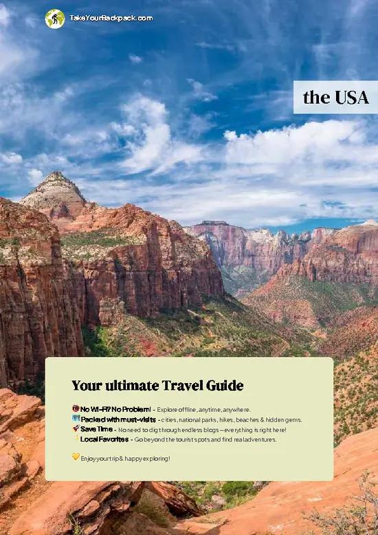
example page 0 from our offline Travel Guide for United States
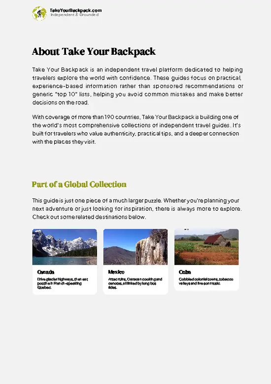
example page 1 from our offline Travel Guide for United States
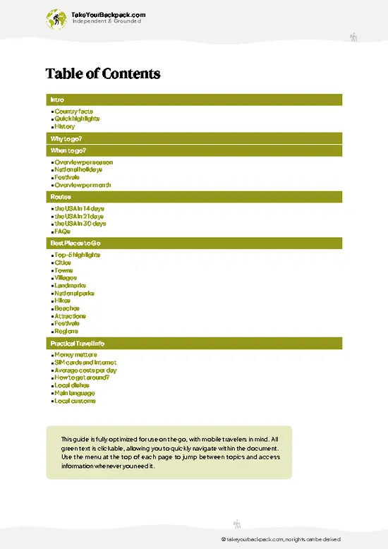
example page 2 from our offline Travel Guide for United States
example page 3 from our offline Travel Guide for United States
example page 4 from our offline Travel Guide for United States
example page 5 from our offline Travel Guide for United States
example page 6 from our offline Travel Guide for United States
example page 7 from our offline Travel Guide for United States
The digital guide (586 pages) contains:
161 highlights, ranked by travel appeal
Optimized 14, 21 & 30-day travel routes
Cities, national parks, landmarks, beaches
How to get around
Offline-friendly for travel without Wi-Fi
👉 Click to see all 30+ guide features

📅 Plan smarter in minutes, not weeks
Month by month travel advice
Festivals & national holidays
Budget expectations

🗺️ Go to the right places, skip the overrated ones
Honest pros & cons of destinations
Top hikes, parks & viewpoints
Lesser-known places most travelers miss
Clear “worth it vs skip it” guidance

🛏️ Travel smoothly without rookie mistakes
Best areas to stay
Transport systems explained simply
Common scams & safety advice
SIM cards, money & practical tips

🌍 Understand the country, not just visit it
Culture & traditions
Local customs
Festivals worth planning around
Traveler-friendly historical context
Insights that make places more meaningful

📱 Built for real travel conditions
Fully downloadable PDF
Works completely offline
Optimized for phone use
Useful in remote areas & buses
Everything in one place
Save weeks of stressful planning
Get instant access to your full guide. 30‑day money-back guarantee.


By proceeding you agree to our terms.
Sent to your inbox immediately after payment • 100% Secure Checkout
Best Backpacking Travel Advisor 2025 tourism awardBest Backpacking
Travel Advisor
2025
What others say about Take Your Backpack Guides:
⭐⭐⭐⭐⭐
Fantastic, amazing amount of information!
⭐⭐⭐⭐⭐
My goodness this is amazing, it's what I've been looking for hats off too you!
⭐⭐⭐⭐⭐
I think this is absolutely BRILLIANT
⭐⭐⭐⭐
Very complete and informative. It's still missing places, but I gotta to commend you
⭐⭐⭐⭐⭐
This is truly amazing, thank you, can't wait to explore it with my kids!
⭐⭐⭐⭐⭐
Awesome resource, thank you!
⭐⭐⭐⭐⭐
This is amazing! Can't wait to explore the ones I haven't seen
⭐⭐⭐⭐
I love this! Well done, great idea.
⭐⭐⭐⭐⭐
Thanks for taking the time to make this gem!
⭐⭐⭐⭐⭐
This might be the best website I've ever seen.
⭐⭐⭐⭐⭐
Congratulations, and thank you so much for your work; it's incredibly valuable.
⭐⭐⭐⭐
In all seriousness I think you did a great job pointing out the important spots
⭐⭐⭐⭐⭐
10/10 very good
⭐⭐⭐⭐⭐
As someone who's only just starting to visit regularly this is awesome, thank you.
⭐⭐⭐⭐
Thank you very much! I'm going to visit my dad, it's going to be very useful!
⭐⭐⭐⭐⭐
This is really cool! We'll be travelling for the first time and this definitely come in handy.
⭐⭐⭐⭐⭐
You are now our minister of culture, congratulations 👨‍💼
⭐⭐⭐⭐⭐
Just wanted to tell you that this is a pearl! Going to follow your recommendations.
⭐⭐⭐⭐⭐
This is so cool. I'll definitely be using the resource for my travels soon.
⭐⭐⭐⭐⭐
This is very impressive! Good work.
⭐⭐⭐⭐⭐
This is an amazing and informative site. Very well done!

🛏️ Where to stay?Best areas to base yourself

Yes—hostels and basic budget accommodation are common across the USA in major cities, college towns and near transit hubs; expect dorm rooms, shared facilities and big price swings by season and neighborhood.
New York (Lower East Side, Brooklyn)—easy transit and nonstop nightlife but noisy and often pricier; San Francisco (SoMa, Mission)—close to attractions and transit but expensive and hilly; Los Angeles (Downtown, Hollywood)—affordable beds and transport links but spread-out and variable safety at night; Chicago (River North, Wicker Park)—central, walkable and lively but busy on weekends; … read more 👉
Yes—hostels and basic budget accommodation are common across the USA in major cities, college towns and near transit hubs; expect dorm rooms, shared facilities and big price swings by season and neighborhood.
New York (Lower East Side, Brooklyn)—easy transit and nonstop nightlife but noisy and often pricier; San Francisco (SoMa, Mission)—close to attractions and transit but expensive and hilly; Los Angeles (Downtown, Hollywood)—affordable beds and transport links but spread-out and variable safety at night; Chicago (River North, Wicker Park)—central, walkable and lively but busy on weekends; Seattle (Capitol Hill)—good nightlife and transit access but can be loud; Miami (South Beach)—beach access and party scene but touristy and costly; Boston (Back Bay, Fenway)—compact and walkable near sights and universities but small rooms and higher rates.

If you enjoy meeting fellow travelers, consider choosing hostels with high ratings for atmosphere. On the other hand, if you prefer having your own space, a hotel might be a better option.

🚌 Getting aroundGetting around the USA

The USA moves on highways and hub-and-spoke skies. Rigid around airports, shrug-everywhere-else on the ground. Distances are big enough to make your playlist feel short. The flow is: dawn flight, noon layover, twilight bus, midnight diner. If you lean into early departures and overnight stretches, the country opens; fight the rhythm and you collect delays like state magnets on a fridge.
  • Intercity buses (Greyhound/FlixBus/Megabus) The Efficiency Trade-off: cheapest long-haul on the ground, slow by
read more 👉
The USA moves on highways and hub-and-spoke skies. Rigid around airports, shrug-everywhere-else on the ground. Distances are big enough to make your playlist feel short. The flow is: dawn flight, noon layover, twilight bus, midnight diner. If you lean into early departures and overnight stretches, the country opens; fight the rhythm and you collect delays like state magnets on a fridge.
  • Intercity buses (Greyhound/FlixBus/Megabus) The Efficiency Trade-off: cheapest long-haul on the ground, slow by design. Think 55-65 mph average after traffic, meal stops, and that one guy who’s late at Toledo. Fares can undercut trains and planes by half or more ($20-$80 for regional hops), and overnight runs double as a motel you didn’t pay for. Expect Wi-Fi to lie, outlets to be loose, and AC to be Arctic. Show up 20-30 minutes early, keep your bag within reach at stops, and screenshot your ticket in case the app goes offline in a cornfield.
  • City subways and buses The Social Fabric: headphones in, backpack low, let people off before you storm the doors. Don’t block the aisle with your existential crisis. On escalators, stand right, walk left. In many cities you can tap a credit card; in others you’ll still meet Exact Change Guy. Offer priority seats without a lecture. Small talk happens less than you think; eye contact is a high-commitment sport. Late night, sit near the driver or conductor car. Drivers appreciate a simple “thanks,” not your memoir.
  • Urban ferries The Geometric Unlock: water laughs at gridlock. Ferries in coastal cities slice diagonals across bays and rivers that buses can’t touch. They’re often priced like a fancy bus ride, faster than crawling bridges at rush hour, and they drop you where the views are earned by wind and spray. Sunday schedules thin out, last boats leave early, and weather cancels without negotiating. Line up a little early for bikes, bring a layer, and accept that salt air beats a tunnel any day time-wise when the highway jams.
  • Ultra-low-cost airlines (Spirit/Frontier/Allegiant) The Budget Disruptor: base fares that look like typos ($19-$79) and fees that do the heavy lifting. Pack to the personal-item spec or pay more than your seat for a bag. Secondary airports (OAK over SFO, BWI over DCA, MDW over ORD) often mean cheaper tickets and faster security, but add a bus or light-rail leg. Early flights dodge delay cascades. Seat selection is optional; comfort is not guaranteed. Book early, fly midweek, and treat every minute you’re not queuing as profit.

I cross the country by first locking a midweek ultra-cheap flight between secondary hubs, then stitching the ends with overnight buses or local transit, carrying only a personal item so I never wait, never check, and always move on the first departure of the day.
Atlanta (ATL) — Downtown (Five Points) is about 10 miles away. Easiest on a budget: MARTA Red/Gold Line from the on-site Airport Station. Trains take ~20 minutes and cost $2.50 (one-time $1 for a Breeze card if you need one). Runs frequently; no need to mess with traffic.

Los Angeles (LAX) — Downtown LA is roughly 18 miles. Cheapest play: take the free airport shuttle to the Metro Rail (K or C Line), then connect to the E or A Line into 7th St/Metro Center/Union Station. Figure 55-70 minutes, $1.75 with TAP (free transfers within 2 hours). If you’re tired of transfers, the FlyAway bus to Union Station is faster/simple at ~$9.75.

New York City (JFK) — Midtown is about 16 miles. Take the AirTrain to Jamaica, then the E subway to Manhattan (or AirTrain to Howard Beach, then the A). Total 50-70 minutes. Cost: AirTrain ~$8.50 + subway $2.90 ≈ $11.40. Tap in with contactless (OMNY) to skip the MetroCard line.

Chicago (O’Hare ORD) — The Loop is ~17 miles. Hop on the CTA Blue Line directly from the airport. It’s a straight shot, ~45 minutes, $5 from O’Hare (standard fare elsewhere is lower). Trains run 24/7, though late-night headways stretch.

San Francisco (SFO) — Downtown/Union Square is about 13 miles. BART from the airport to Powell St or Embarcadero takes ~30 minutes and costs about $10.25. Trains are frequent most of the day; late-night service thins out.

Miami (MIA) — Downtown is ~8 miles. Ride the free MIA Mover to the Metrorail Airport Station, then the Orange Line to Government Center. Expect 15-25 minutes, $2.25. Trains come every 10-15 minutes most of the day.

Seattle (SEA) — Downtown (Westlake) sits ~14 miles north. The Link 1 Line light rail from the Airport Station gets you there in ~35-40 minutes for $3.25. Trains are frequent; the walk to the station is signed and straightforward.

Washington, D.C. (DCA) — The National Mall/Metro Center is only ~5 miles. Take the Blue or Yellow Line from the airport; 12-15 minutes, about $2.25 off-peak (up to ~\$3.25 peak, variable by time/distance). If you land at Dulles (IAD) instead, the Silver Line reaches downtown in ~55 minutes for around $6.00.
⚠️ Prices and routes can change, so take this as a rough guide and ask for local advice when you arrive.
🚀 Don’t waste time on the road.
We’ll generate a route that minimizes unnecessary travel and fits your available days.

Generate my itinerary

🔒 Safety (risk Level: low)What first-time visitors should know

Safety for solo travelers, including women and LGBTQ+ individuals
The United States is generally safe for solo travelers, including women and LGBTQ+ individuals, but safety can vary significantly by location. Larger cities like New York, San Francisco, and Chicago tend to be more accepting and accommodating, though it’s wise to remain aware of your surroundings, especially at night. Rural areas may have different attitudes, so research specific destinations beforehand. Always stay updated on local laws and customs, and trust your instincts.


Full official government travel advisory (live updates)
View details 👉

✈️ VisaDo you need a visa to visit?

Whether you need a visa to visit the United States depends on your nationality. Citizens from Visa Waiver Program countries can travel for up to 90 days without a visa but need to apply for an ESTA. If a visa is required, apply through the U.S. Department of State’s Consular Electronic Application Center.

source: travel.state.gov
⚠️ Visa requirements can change over time, so always check the latest visa requirements with the official embassy or government website before you travel.

🎒 What to pack?Packing essentials for the trip

Packing for a trip to the United States can be a bit of a puzzle, thanks to its massive variety in climate and landscapes. Remember, the weather can swing from scorching summers in the southwest to chilling winters in the northeast. If you’re planning a cross-country adventure, pack layers to stay comfy in both the deserts and the mountains. Don’t forget that major cities like New York and Los Angeles have a pretty casual vibe, but it’s always smart to have something a bit nicer for a night out. Also, keep in mind that different regions have their own quirks—like the Pacific Northwest’s notorious rain, so a lightweight, waterproof jacket could be your best friend.

Apart from this country specific advice, I have also crafted a general packing list that should help on any trip. authorOver the years, I've learned the importance of packing minimally. It's so much easier to jump on the back of a truck or squeeze yourself into the last spot of a minibus without that supersized backpack. If you're headed to a warm destination, leave your winter jacket at home; for colder regions, opt for thin thermal underlayers. Instead of packing your entire wardrobe, bring just three sets of clothes, as laundry facilities are available everywhere.
View the full list 👉
🎒 Planning the practical side of your trip?
Get detailed information on transport, daily budgets, internet access, local customs, food, language, and other essentials in the complete Travel Guide.

Get detailed practical information 👉

Get the Travel Guide -

🙋 FAQTravel questions about the USA

Trip Planning

Planning a backpacking route through the USA can be tricky — you need to balance must-see places, travel times, budget, and how long to stay in each destination. Our personalized the USA itinerary planner creates a route based on your travel style, trip duration, and interests, so you can spend less time researching and more time exploring.


Personal tip: I normally search on good rating for atmosphere (for meeting people) and location (for easy exploring). Cleanliness as a bonus.


Travel Essentials

Routine vaccinations are usually enough for travel to the United States. This includes vaccines like measles-mumps-rubella (MMR), diphtheria-tetanus-pertussis, varicella (chickenpox), polio, and your yearly flu shot.

Consider the COVID-19 vaccine as well, as the rules might change.

If you’re coming from a country where yellow fever is a risk, you might need proof of vaccination.

Always check the latest CDC guidelines before you go.


vaccination requirements
When I first started traveling, I often spent part of my first day in a new country hunting for a local SIM card. While this can still be slightly cheaper, it also takes time and planning.

These days, it's much simpler to install an eSIM before leaving home. Once you arrive in the USA, you can activate it immediately and have mobile data from the moment you land — which is especially useful for ordering transport or navigating away from busy airports.

There are many providers nowadays, and price differences are usually small. I personally go with Holafly, as it offers excellent network coverage throughout the country and strong global coverage, so you can manage multiple countries from a single app.


HolaFly eSim

Culture & Customs

Respect personal space; Americans often prefer about an arm’s length distance during conversations. Tipping is customary in restaurants—15-20% is standard. Be punctual; lateness can be seen as disrespectful. If invited to someone’s home, bringing a small gift (like wine or dessert) is appreciated.

Avoid discussing politics or religion unless you’re familiar with the person’s views. LGBTQ+ travelers generally find acceptance in urban areas; rural areas may vary, so stay mindful. Women travelers often find the U.S. relatively safe, but standard travel safety applies—like not walking alone at night in unfamiliar areas.

Mind your volume; speaking too loudly in public can be frowned upon. Smoking is largely banned indoors and in many public places, so look for designated areas.
Trying traditional food is always a great way to experience the culture. Here are some must-try dishes for the USA.
  • Burger: A classic American staple, often featuring a beef patty sandwiched between two buns with toppings like lettuce, tomato, and cheese. It’s a symbol of fast food culture and a must-try for experiencing the American diner vibe.
  • Barbecue Ribs: Slow-cooked pork or beef ribs slathered in a tangy, smoky barbecue sauce. Popular in the Southern states, it’s a dish that showcases America’s love for grilling and communal eating.
  • Clam Chowder: A creamy soup made with clams, potatoes, and onions, originating from New England. It’s not just a dish but a warm hug in a bowl, particularly cherished in coastal areas.
  • Apple Pie: Often referred to as ”as American as apple pie,” this dessert features a flaky crust filled with spiced apples. It’s a sweet slice of American history and nostalgia, often enjoyed during holidays.
  • Buffalo Wings: Fried chicken wings coated in a spicy, tangy sauce, originally from Buffalo, New York. Perfect for sharing, they’re a game-day favorite and a testament to America’s love for finger foods.
  • Gumbo: A hearty stew from Louisiana with Creole roots, loaded with seafood, sausage, and okra. It’s a melting pot of flavors and a great way to taste the diversity of Southern cuisine.
Yes, tap water is generally safe to drink across the United States and most locals consume it without issue. However, if you’re in older cities or rural areas with outdated infrastructure, a portable filter or bottled water might be a safer bet. Always check local advisories for any specific water quality alerts.
English is the predominant language spoken in the United States, with approximately 78% of the population using it as their primary language at home. While you will find a variety of regional accents and dialects, English is widely understood and spoken across the country, making communication relatively easy for travelers.

In urban areas and tourist destinations, English is almost universally spoken, and many locals are accustomed to interacting with non-native speakers. However, in some regions, particularly in areas with high concentrations of immigrant communities, you may encounter languages such as Spanish, Mandarin, or Tagalog, but English remains the common lingua franca.

Most signage, public transportation information, and services are provided in English, which aids navigation for travelers. While you may find some individuals who speak limited English, particularly in rural areas, the overall proficiency is high.

In summary, travelers can expect to communicate effectively in English throughout the United States, making it a convenient destination for English speakers and those familiar with the language.

Money & Payments

The local currency of the USA is USD ($).

ATM Access: ATMs are everywhere in the U.S., but watch out for fees. Most banks charge a few bucks for non-customer withdrawals. Stick to ATMs affiliated with your bank if possible to dodge these costs.

Cash or Card? Credit and debit cards are widely accepted, even in small towns. Always carry a bit of cash for street vendors or small shops that might have a minimum card payment limit. Around $50 in small bills should do the trick.

Currency: Definitely stick to dollars. Euros won’t be accepted anywhere except at airports or major banks for exchange, and even then, the rates might not be in your favor.

Card Acceptance: Most places accept cards, but it’s good to have a Visa or Mastercard. American Express and Discover aren’t as universally accepted, especially at smaller establishments.

Exchanging Money: If you really need to exchange cash, airport kiosks or major banks are your best bet. Avoid those sketchy standalone exchange booths in tourist areas—they’ll rip you off. Better yet, just withdraw from ATMs for the best rates.

Tipping in the United States is a significant part of the service industry, with 15-20% being the standard for restaurant servers. In bars, a dollar per drink is common, while hotel staff like bellhops often receive $1-2 per bag. Remember, tipping is expected, so budget accordingly to avoid awkward situations.

🧩 Nearby countriesOther countries to combine with the USA

📸 PhotosA visual impression of the trip

Take your backpack - United States - 0
Take your backpack - United States - 1
Take your backpack - United States - 2
Take your backpack - United States - 3
Take your backpack - United States - 4
Take your backpack - United States - 5
Take your backpack - United States - 6
Take your backpack - United States - 7
Take your backpack - United States - 8
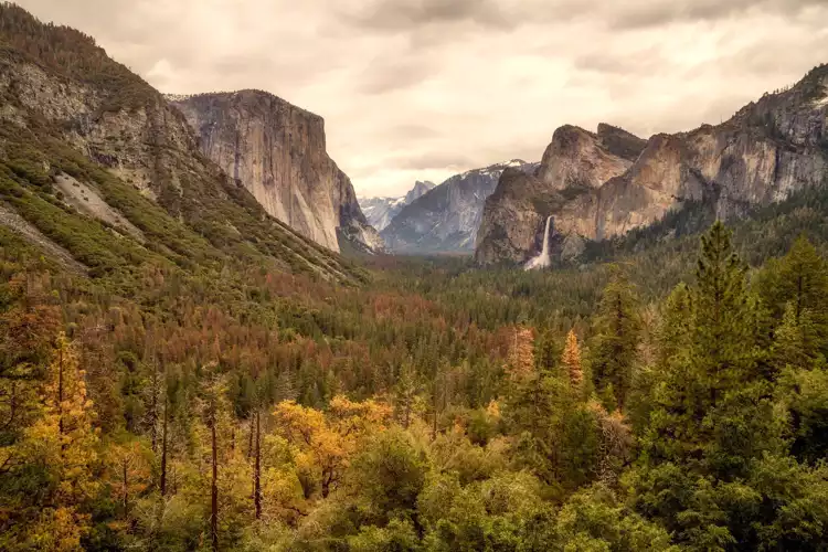
United States: Yosemite National Park
Photographed by: Johan Kruseman

We 💚 feedbackKey takeaways from the trip

The USA rewards effort and punishes sloppy planning. Distances are absurd; transit thins outside big hubs, so you’ll rent a car. One‑way drop fees bite—plan loops. Bills balloon: sales tax and tips add 25–30%, and “cheap” domestic flights pile on baggage and airport time.

Time‑rich: drive, car‑camp on public land, use library Wi‑Fi, eat grocery deli; you’ll spend little and see the in‑between. Comfort‑first: an Amtrak roomette beats red‑eye economy; in cities, pay to sleep central and walk. Value hack: fly one leg, drive the loop, use park shuttles; pick small‑city museums and minor‑league games.

Best surprise: strangers who go out of their way and the number of free bathrooms. Small warning: alcohol ID checks are strict, and open‑container rules are not a suggestion. Forward‑looking: infrastructure money is showing up—more EV chargers, better trains, smarter park reservations. Slow, but real.

✈️ When did I visit the USA?
In January 2023 I visited New York. Many years before, before digital cameras existed, I discovered most of the national parks in the West. While my visit dates back, this guide is continuously refined using feedback from locals and current backpackers (last update: 30 June 2026)

✍️ Help improve this page!
The information on this page is based on my own backpacking experience in the USA, supplemented with up-to-date research and feedback from other travelers. Travel details can change, so if you notice anything outdated or incomplete, feel free to let me know.


🙋‍♂️ Give feedback

👋 Meet the founderWho’s Behind Take Your Backpack?

Johan, backpacker and founder of TakeYourBackpackHi, I’m Johan (Netherlands 🇳🇱), the creator of TakeYourBackpack. Over the past decade, I’ve backpacked through 80+ countries across six continents, gaining extensive experience with independent travel, long-term trips, and overland routes.

This site is built on a combination of firsthand travel experience and carefully curated insights from other backpackers. Many guides are based on places I’ve personally visited, while others bring together tips, observations, and practical advice shared by trusted travelers I’ve met along the way.

The goal is to provide realistic, experience-driven guidance — not generic itineraries — so you can explore destinations with better context, clearer expectations, and more confidence.

Get full USA guide •
Instant download • 161 highlights • Full Offline guide