
- Between-Rivers Panorama (the ”Mizhrichynskyi” vista) — The whole trail is defined by being literally between rivers: long bends, sandbars and a wide floodplain open up from a few viewpoints, giving those sweeping water-and-woodland vistas you don’t get on tight forest trails. Great for sunsets and watching the light play on the river.
- Ancient mixed forest groves — Sections of old oak and pine stand like islands of quiet; trunks are thick and the understory is soft with moss. Hikers notice an immediate change in atmosphere here — cooler air, bird song, and the sense you’re walking through a landscape that’s been mostly left alone.
- Oxbow lakes and wetland mosaics — The trail threads past backwater lakes, reed edges and seasonally flooded meadows. Those changing wetlands are spectacular for … read more 👉
- Between-Rivers Panorama (the ”Mizhrichynskyi” vista) — The whole trail is defined by being literally between rivers: long bends, sandbars and a wide floodplain open up from a few viewpoints, giving those sweeping water-and-woodland vistas you don’t get on tight forest trails. Great for sunsets and watching the light play on the river.
- Ancient mixed forest groves — Sections of old oak and pine stand like islands of quiet; trunks are thick and the understory is soft with moss. Hikers notice an immediate change in atmosphere here — cooler air, bird song, and the sense you’re walking through a landscape that’s been mostly left alone.
- Oxbow lakes and wetland mosaics — The trail threads past backwater lakes, reed edges and seasonally flooded meadows. Those changing wetlands are spectacular for close-up nature: amphibians, dragonflies and a surprising variety of waterfowl (best in spring and early summer).
- Wildflower meadows and steppe fragments — Between the woods and the river lie open patches that burst into color seasonally. They contrast sharply with the shaded forest and are fantastic for butterflies, easy picnics, and panoramic photos — a nice break from the shade-dominated sections.
- Rural culture and simple field tracks — Small villages, wooden fences, dirt lanes and occasional chapels (and the farmers working the fields) give the hike a human scale. It’s not a theme-park trail — those cultural touches and quiet country roads are part of why this park feels authentically Ukrainian.
Spotted a mistake or missing something? Contact me.

 Best Backpacking
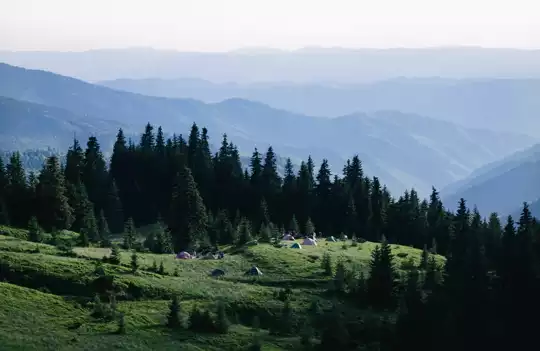


.jpg) Hi, I’m Johan (Netherlands 🇳🇱), the creator of TakeYourBackpack. Over the past decade, I’ve backpacked through 80+ countries across six continents, gaining extensive experience with independent travel, long-term trips, and overland routes.
Hi, I’m Johan (Netherlands 🇳🇱), the creator of TakeYourBackpack. Over the past decade, I’ve backpacked through 80+ countries across six continents, gaining extensive experience with independent travel, long-term trips, and overland routes.