



×

Ukraine🇺🇦 | hikesMarmarosy Mountainsborder ridge, wildflower slopes, remote borderlands | things to do and best time to go

Explore Synevyr Lake TrailExplore Polonyna Borzhava

Backpacking in Marmarosy Mountains
🏆 Top pickhike ranked #3
By Johan Kruseman 🇳🇱 | Updated May 29, 2026

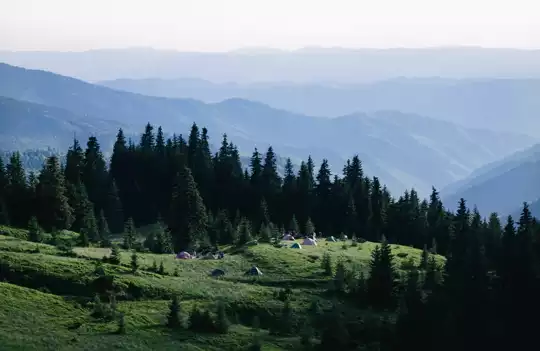
Your boots crunch through a thin crust of morning frost, wet grass soaking your socks anyway, cowbells clanking somewhere in the fog while a border marker leans out of the ground like a tired sentry. Resin from the spruce trees sticks to your fingers; your breath comes in short bursts as the ridge finally opens and the first slice of sun hits the Romanian side, lighting up a long, folded sea of green and rock. The Marmarosy Mountains sit in far southwestern Ukraine, right on the border with Romania, at the wild edge of Zakarpattia. This hike is long, rolling, and surprisingly steep in places, with big payoffs in ridge views and a real end-of-the-map feeling, but it’s harder to reach than the more famous Chornohora range and public transport only gets you partway to the trailheads. Expect fewer people, rougher logistics, and more raw, borderland drama.

Discover everything you want to know in the 📖 Ukraine Travel Guide.
Best time to go: April - October
Duration: 7 days
Distance: 100 kilometers
Total ascent: 1,200 meters
Safety warning

The current risk level for Ukraine is high. Check the advice before going.


Get your Ukraine guide
112 ranked highlights, routes & tips, works offline (425 pages)
Loading the map 🌍
CLICK TO FILTER
cities
towns
villages
landmarks
national parks
hikes
beaches
attractions
festivals
SHOW COUNTRY’S BESTSHOW ALL

✨ Why go?
Ranked #3 hike in Ukraine
What sets this place apart

The Marmarosy Mountains in Ukraine pull in backpackers like a magnet. Why? It’s all about the scenery-to-effort ratio. You’ll find yourself surrounded by jagged peaks and lush valleys without needing to be a seasoned climber. The trails are accessible, with options for both short jaunts and multi-day treks, allowing you to tailor your adventure to your energy level.

Getting there is a breeze. Public transport whisks you from bustling towns to trailheads, making it easy to dive into the wild. And let’s talk about cost—this place is a steal. You can stretch your budget while soaking in breathtaking views and fresh mountain air.

The flexible distances mean you can hike a few hours or push for a full day, all while soaking up the local culture in nearby villages. After a day on the trails, … read more 👉
The Marmarosy Mountains in Ukraine pull in backpackers like a magnet. Why? It’s all about the scenery-to-effort ratio. You’ll find yourself surrounded by jagged peaks and lush valleys without needing to be a seasoned climber. The trails are accessible, with options for both short jaunts and multi-day treks, allowing you to tailor your adventure to your energy level.

Getting there is a breeze. Public transport whisks you from bustling towns to trailheads, making it easy to dive into the wild. And let’s talk about cost—this place is a steal. You can stretch your budget while soaking in breathtaking views and fresh mountain air.

The flexible distances mean you can hike a few hours or push for a full day, all while soaking up the local culture in nearby villages. After a day on the trails, the reward is palpable: a cold beer in hand, the sunset painting the sky, and the satisfaction of having conquered yet another slice of nature. The Marmarosy Mountains fit seamlessly into any backpacking route, making them a must-visit.
Want to include Marmarosy Mountains in your Ukraine route?
Create a personalized Ukraine itinerary that includes Marmarosy Mountains and the places that fit your trip — based on your travel style, budget, and available time. Get your route in seconds.

Generate my trip

💡 HighlightsMust-see experiences and standout moments

  1. Marmarosh Ridge (the main crest) — walking the ridge is the whole point: a raw, rocky spine that drops steeply into Romania on one side and folds into Ukrainian valleys on the other. The views are wide and unbroken, perfect for sunrise or a windswept lunch, and the trail here feels more alpine than the rest of the Ukrainian Carpathians.
  2. High mountain polonyny (alpine meadows) — in summer these slopes turn into waves of wildflowers and herbs, with low stone shepherd huts dotting the grass. Open sightlines make it easy to appreciate the scale of the range and to find a quiet bench to watch clouds move across the peaks.
  3. Old-growth beech and mixed forests — descend off the crest and you hit deep, mossy woods where trunks are thick and streams run cold. The contrast with the exposed ridge is
read more 👉
  1. Marmarosh Ridge (the main crest) — walking the ridge is the whole point: a raw, rocky spine that drops steeply into Romania on one side and folds into Ukrainian valleys on the other. The views are wide and unbroken, perfect for sunrise or a windswept lunch, and the trail here feels more alpine than the rest of the Ukrainian Carpathians.
  2. High mountain polonyny (alpine meadows) — in summer these slopes turn into waves of wildflowers and herbs, with low stone shepherd huts dotting the grass. Open sightlines make it easy to appreciate the scale of the range and to find a quiet bench to watch clouds move across the peaks.
  3. Old-growth beech and mixed forests — descend off the crest and you hit deep, mossy woods where trunks are thick and streams run cold. The contrast with the exposed ridge is striking, and the forests host a quieter kind of beauty: fungus, ferns, and dripping waterfalls between rocky steps.
  4. Chance encounters with large mammals and birds — Marmarosy sits in real, connected habitat, so you’re hiking through territory used by brown bears, wolves, lynx and a variety of raptors. You’re more likely to find tracks, droppings and early-morning birdsong than close-up selfies, but that sense of wildness is what sets these trails apart.
  5. Hutsul villages and borderland culture — small mountain villages around the range (think wooden churches, local cheese and shepherding traditions) give the hike human texture. Old border markers, simple mountain pastures and local hospitality make stops off-trail rewarding in a way a pure nature hike rarely is.
Spotted a mistake or missing something? Contact us.

🌤️ When to go?Weather, crowds, and seasonal trade-offs


  • Weather: Spring and early autumn bring crisp, clear air perfect for hiking. Summers can scorch, pushing temperatures above 25°C (77°F), while winters lock the range in snow and ice, limiting access.

  • Temperature: Late May through September offers daytime highs between 15-25°C (59-77°F), ideal for long treks without overheating or freezing. Nights dip to 5-10°C (41-50°F), so pack layers.

  • Daylight Hours: Summer stretches daylight to 16 hours, giving you more trail time and flexibility. Spring and autumn offer around 12-14 hours, enough for solid day hikes but less margin for error.

  • Crowds: Peak summer draws local hikers and weekend warriors, especially on popular routes. Shoulder seasons see fewer people, letting you claim solitude on the trails.

  • Seasonal Activities: Summer is prime
read more 👉

  • Weather: Spring and early autumn bring crisp, clear air perfect for hiking. Summers can scorch, pushing temperatures above 25°C (77°F), while winters lock the range in snow and ice, limiting access.

  • Temperature: Late May through September offers daytime highs between 15-25°C (59-77°F), ideal for long treks without overheating or freezing. Nights dip to 5-10°C (41-50°F), so pack layers.

  • Daylight Hours: Summer stretches daylight to 16 hours, giving you more trail time and flexibility. Spring and autumn offer around 12-14 hours, enough for solid day hikes but less margin for error.

  • Crowds: Peak summer draws local hikers and weekend warriors, especially on popular routes. Shoulder seasons see fewer people, letting you claim solitude on the trails.

  • Seasonal Activities: Summer is prime for wildflower blooms and alpine meadows. Autumn paints the forests in fiery hues, adding a visual punch to your trek. Winter is for hardcore mountaineers only.

  • Price Fluctuations: Accommodation and guide services spike in summer. Booking in shoulder seasons can save money and snag better deals without sacrificing trail quality.


Pro-tip: Aim for late spring or early autumn to dodge crowds, enjoy stable weather, and catch the mountains at their most vivid—this is when the Marmarosy Mountains reward every step with raw, unfiltered beauty.


source: climatestotravel.comJANJanuary: below average for travelingFEBFebruary: below average for travelingMARMarch: fair for travelingAPRApril: good for travelingMAYMay: highly recommended for travelingJUNJune: excellent for travelingJULJuly: excellent for travelingAUGAugust: excellent for travelingSEPSeptember: highly recommended for travelingOCTOctober: highly recommended for travelingNOVNovember: fair for travelingDECDecember: below average for traveling
ukraine-hike-marmarosy-mountains
© Google |

✈️ The backpacker research shortcutUkraine Travel Guide

An offline-friendly backpacking guide with optimized travel routes, ranked highlights, transport advice, and the best areas to stay.
example page 0 from our offline Travel Guide for Ukraine
example page 1 from our offline Travel Guide for Ukraine
example page 2 from our offline Travel Guide for Ukraine
example page 3 from our offline Travel Guide for Ukraine
example page 4 from our offline Travel Guide for Ukraine
example page 5 from our offline Travel Guide for Ukraine
example page 6 from our offline Travel Guide for Ukraine
example page 7 from our offline Travel Guide for Ukraine
The digital guide (425 pages) contains:
112 highlights, ranked by travel appeal
Optimized 7, 14 & 21-day travel routes
Cities, national parks, landmarks, beaches
How to get around
Offline-friendly for travel without Wi-Fi
👉 Click to see all 30+ guide features

📅 Plan smarter in minutes, not weeks
Month by month travel advice
Festivals & national holidays
Budget expectations

🗺️ Go to the right places, skip the overrated ones
Honest pros & cons of destinations
Top hikes, parks & viewpoints
Lesser-known places most travelers miss
Clear “worth it vs skip it” guidance

🛏️ Travel smoothly without rookie mistakes
Best areas to stay
Transport systems explained simply
Common scams & safety advice
SIM cards, money & practical tips

🌍 Understand the country, not just visit it
Culture & traditions
52 Essential phrases & customs
Festivals worth planning around
Traveler-friendly historical context
Insights that make places more meaningful

📱 Built for real travel conditions
Fully downloadable PDF
Works completely offline
Optimized for phone use
Useful in remote areas & buses
Everything in one place
Save weeks of stressful planning
Get instant access to your full guide. 30‑day money-back guarantee.


By proceeding you agree to our terms.
Sent to your inbox immediately after payment • 100% Secure Checkout
Best Backpacking Travel Advisor 2025 tourism awardBest Backpacking
Travel Advisor
2025
What others say about Take Your Backpack Guides:
⭐⭐⭐⭐⭐
Fantastic, amazing amount of information!
⭐⭐⭐⭐⭐
My goodness this is amazing, it's what I've been looking for hats off too you!
⭐⭐⭐⭐⭐
I think this is absolutely BRILLIANT
⭐⭐⭐⭐
Very complete and informative. It's still missing places, but I gotta to commend you
⭐⭐⭐⭐⭐
This is truly amazing, thank you, can't wait to explore it with my kids!
⭐⭐⭐⭐⭐
Awesome resource, thank you!
⭐⭐⭐⭐⭐
This is amazing! Can't wait to explore the ones I haven't seen
⭐⭐⭐⭐
I love this! Well done, great idea.
⭐⭐⭐⭐⭐
Thanks for taking the time to make this gem!
⭐⭐⭐⭐⭐
This might be the best website I've ever seen.
⭐⭐⭐⭐⭐
Congratulations, and thank you so much for your work; it's incredibly valuable.
⭐⭐⭐⭐
In all seriousness I think you did a great job pointing out the important spots
⭐⭐⭐⭐⭐
10/10 very good
⭐⭐⭐⭐⭐
As someone who's only just starting to visit regularly this is awesome, thank you.
⭐⭐⭐⭐
Thank you very much! I'm going to visit my dad, it's going to be very useful!
⭐⭐⭐⭐⭐
This is really cool! We'll be travelling for the first time and this definitely come in handy.
⭐⭐⭐⭐⭐
You are now our minister of culture, congratulations 👨‍💼
⭐⭐⭐⭐⭐
Just wanted to tell you that this is a pearl! Going to follow your recommendations.
⭐⭐⭐⭐⭐
This is so cool. I'll definitely be using the resource for my travels soon.
⭐⭐⭐⭐⭐
This is very impressive! Good work.
⭐⭐⭐⭐⭐
This is an amazing and informative site. Very well done!

🛏️ Where to stay?Best areas and accommodation options

If you enjoy meeting fellow travelers, consider choosing hostels with high ratings for atmosphere. On the other hand, if you prefer having your own space, a hotel might be a better option.

🥾 Hike detailsA practical overview of the hike

Total Distance: Approximately 40 kilometers round trip, depending on the specific route taken within the Marmarosy Mountains.

Estimated Duration: Expect to spend around 2 to 4 days on the trail, depending on your pace and how much time you want to spend soaking in the views or camping.

Difficulty Level: Moderate to challenging. The trail has some steep ascents and descents, rocky sections, and can be quite demanding, especially if you’re not used to hiking in mountainous terrain.

Starting Point: The hike typically starts from the village of Rakhiv.
  • Public Transport: You can take a train or
read more 👉
Total Distance: Approximately 40 kilometers round trip, depending on the specific route taken within the Marmarosy Mountains.

Estimated Duration: Expect to spend around 2 to 4 days on the trail, depending on your pace and how much time you want to spend soaking in the views or camping.

Difficulty Level: Moderate to challenging. The trail has some steep ascents and descents, rocky sections, and can be quite demanding, especially if you’re not used to hiking in mountainous terrain.

Starting Point: The hike typically starts from the village of Rakhiv.
  • Public Transport: You can take a train or bus from Lviv or Kyiv to Rakhiv. Once in Rakhiv, local buses or taxis can get you to the trailhead.

Major Landmarks:
  • Petros Mountain: One of the higher peaks in the area, offering stunning panoramic views.
  • Lake Nesamovyte: A beautiful glacial lake that’s perfect for a rest stop.
  • Chornohora Ridge: A scenic section of the trail that showcases the rugged beauty of the Marmarosy range.

Type of Terrain and Scenery: The trail varies quite a bit. You’ll encounter rocky paths, grassy meadows, and forested areas. The scenery is breathtaking, with sweeping views of the Carpathian Mountains, deep valleys, and sometimes, if you’re lucky, the chance to see a sunset that’ll make you want to pull out your camera every five minutes.

Typical Vegetation and Wildlife:
  • Vegetation: Expect to see a mix of coniferous forests, alpine meadows, and some rare flora, especially near the higher altitudes.
  • Wildlife: Keep an eye out for deer, foxes, and a variety of birds. If you’re really lucky, you might spot a bear, but they tend to avoid humans.

This trail is a gem for independent hikers looking to experience the wild side of Ukraine, so pack your gear, bring plenty of snacks, and enjoy the adventure!
⚠️ Hiking info can sometimes be outdated or inaccurate. Before you hit the trail, check the latest conditions with locals. If you do spot anything that's off, I'd love to hear from you, so I can update it for fellow travelers.

🛡️ SafetyTraveler Safety Guide

The Marmarosy Mountains offer a rugged beauty that demands respect but rewards effort. Weather can shift quickly; sunny skies can morph into sudden rain, so pack a lightweight, waterproof jacket. The trails are well-marked, yet steep sections can test your legs and lungs. Keep your footing steady on rocky paths, and watch for loose gravel that can send you sliding.

Altitude isn’t extreme, but you’ll feel the burn as you ascend. Take your time; pace yourself to enjoy the stunning views without gasping for air. River crossings can be tricky after rain, so scout for stable rocks or logs to hop across.

Wildlife is part of the experience. You might spot deer or even a bear from a distance. Respect their space—keep food sealed and don’t approach. Prepare with sturdy boots, a reliable map, and … read more 👉
The Marmarosy Mountains offer a rugged beauty that demands respect but rewards effort. Weather can shift quickly; sunny skies can morph into sudden rain, so pack a lightweight, waterproof jacket. The trails are well-marked, yet steep sections can test your legs and lungs. Keep your footing steady on rocky paths, and watch for loose gravel that can send you sliding.

Altitude isn’t extreme, but you’ll feel the burn as you ascend. Take your time; pace yourself to enjoy the stunning views without gasping for air. River crossings can be tricky after rain, so scout for stable rocks or logs to hop across.

Wildlife is part of the experience. You might spot deer or even a bear from a distance. Respect their space—keep food sealed and don’t approach. Prepare with sturdy boots, a reliable map, and a sense of adventure. The payoff? A breathtaking panorama that makes every step worth it.

Other Ukrainian hikes near Marmarosy Mountains

Explore more nearby:

  • Hoverla—Ukraine’s highest peak, switchback ascent, summit panorama| 29 km away
  • Chornohora Ridge—alpine meadows, high summits, wind-exposed trails| 29 km away
  • Synevyr Lake Trail—mountain lake, spruce woods, wooden causeways| 75 km away

💡 Not sure where to go next?
Create a personalized itinerary for Ukraine including Marmarosy Mountains and the places that fit your trip.

Generate my itinerary

👉 Discover all hikes

Or checkout all Ukraine has to offer (think cities, towns, villages, national parks, hikes, beaches, festivals)
Country photo of Ukraine

We 💚 feedbackIs it worth it?

The Marmarosy Mountains pulse with raw energy. You’ll feel the burn in your legs as you tackle those steep trails, but the payoff? Standing atop a ridge, the valleys sprawling below, is pure magic. Don’t miss the local huts; they serve hearty borscht that warms you from the inside out. Just a heads-up: the weather can turn on a dime, so pack layers. Embrace the grit, and you’ll find a connection to this place that lingers long after you leave.

✍️ Help improve this page!
The information on this page is based on in-depth research, insights shared by experienced travelers, and feedback from the local travel community in Ukraine. While every effort is made to keep the information accurate and current, conditions can change — so if you spot anything incorrect or outdated, please get in touch.


🙋‍♂️ Give feedback

👋 Meet the founderWho’s Behind Take Your Backpack?

Johan, backpacker and founder of TakeYourBackpackHi, I’m Johan (Netherlands 🇳🇱), the creator of TakeYourBackpack. Over the past decade, I’ve backpacked through 80+ countries across six continents, gaining extensive experience with independent travel, long-term trips, and overland routes.

This site is built on a combination of firsthand travel experience and carefully curated insights from other backpackers. Many guides are based on places I’ve personally visited, while others bring together tips, observations, and practical advice shared by trusted travelers I’ve met along the way.

The goal is to provide realistic, experience-driven guidance — not generic itineraries — so you can explore destinations with better context, clearer expectations, and more confidence.

Get full Ukraine guide •
Instant download • 112 highlights • Full Offline guide