
×

Ukraine🇺🇦 | hikesHoverlaUkraine’s highest peak, switchback ascent, summit panorama | things to do and best time to go

Explore Dovbush RocksExplore Kamianets-Podilskyi Canyon

Backpacking in Hoverla
🏆 Top pickhike ranked #1
By Johan Kruseman 🇳🇱 | Updated June 7, 2026

You have to choose: do you join the crowd and day-hike Hoverla, or skip Ukraine’s highest peak for quieter trails nearby that actually feel wilder? That decision matters, because Hoverla, in the Chornohora range of the Carpathians in western Ukraine, is both a rite of passage and a bit of a circus on busy days. The hike itself is straightforward but punchy: a steady, sometimes muddy climb through spruce forest, then open alpine meadows and wind-blasted slopes with big, layered views over the Carpathian ridges. It’s not technical, but the final push is steep, exposed, and can feel brutal in bad weather. Public transport to bases like Vorokhta or Lazeshchyna is relatively easy, then you patch together taxis or minibuses to the trailhead. Compared with nearby routes like Pip Ivan or the Chornohora ridge traverse, Hoverla is shorter, more crowded, less committing—and also more instantly rewarding if you just want one hard hit of summit energy.

Discover everything you want to know in the 📖 Ukraine Travel Guide.
Best time to go: April - October
Duration: 3 to 4 hours
Distance: 10 kilometers
Total ascent: 1,000 meters
Safety warning

The current risk level for Ukraine is high. Check the advice before going.


Get your Ukraine guide
112 ranked highlights, routes & tips, works offline (425 pages)
Loading the map 🌍
CLICK TO FILTER
cities
towns
villages
landmarks
national parks
hikes
beaches
attractions
festivals
SHOW COUNTRY’S BESTSHOW ALL

✨ Why go?
Ranked #1 hike in Ukraine
What sets this place apart

The hike to Hoverla, Ukraine’s highest peak, is a magnet for backpackers seeking a blend of challenge and reward. The scenery-to-effort ratio is unbeatable. You’ll trek through lush forests, past roaring streams, and up rocky paths, all leading to a panoramic view that makes every step worthwhile.

Access is a breeze with public transport options from major cities like Lviv or Ivano-Frankivsk, dropping you right at the trailhead. This makes it easy to fit into a longer backpacking route, allowing you to explore the Carpathians without a hitch.

Cost? Minimal. The trail is free, and you can camp or find budget-friendly accommodations nearby. You can choose your distance, whether you want a quick day hike or a multi-day adventure, making it flexible for all skill levels.

As you ascend, the … read more 👉
The hike to Hoverla, Ukraine’s highest peak, is a magnet for backpackers seeking a blend of challenge and reward. The scenery-to-effort ratio is unbeatable. You’ll trek through lush forests, past roaring streams, and up rocky paths, all leading to a panoramic view that makes every step worthwhile.

Access is a breeze with public transport options from major cities like Lviv or Ivano-Frankivsk, dropping you right at the trailhead. This makes it easy to fit into a longer backpacking route, allowing you to explore the Carpathians without a hitch.

Cost? Minimal. The trail is free, and you can camp or find budget-friendly accommodations nearby. You can choose your distance, whether you want a quick day hike or a multi-day adventure, making it flexible for all skill levels.

As you ascend, the burn in your legs transforms into exhilaration. When you finally stand atop Hoverla, the world sprawls beneath you, and that first cold beer at a nearby lodge tastes like victory. This hike isn’t just about reaching the top; it’s about every moment that leads you there.
Want to include Hoverla in your Ukraine route?
Create a personalized Ukraine itinerary that includes Hoverla and the places that fit your trip — based on your travel style, budget, and available time. Get your route in seconds.

Generate my trip

💡 HighlightsMust-see experiences and standout moments

  1. Summit of Hoverla (2,061 m) — Ukraine’s highest point, so the payoff is immediate: a raw 360° panorama of the Chornohora spine and, on clear days, views spilling south into Romania; sunrise or a sudden “sea of clouds” makes the summit feel way bigger than its modest trail effort.
  2. Views of neighboring 2,000-metre peaks (Petros, Brebeneskul) — instead of a single isolated peak the hike puts you on a ridge where other big Carpathian names loom close by, giving you that alpine ring-of-peaks vibe you don’t get on lower forest trails.
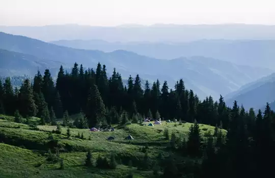
  3. High alpine meadows (polonyny) — open, flower-strewn pastures above the treeline that smell like mountain herbs in summer and offer unhindered photo angles and picnic spots; they’re a big contrast to the dark spruce lower down.
  4. Spruce forest, streams and sudden
read more 👉
  1. Summit of Hoverla (2,061 m) — Ukraine’s highest point, so the payoff is immediate: a raw 360° panorama of the Chornohora spine and, on clear days, views spilling south into Romania; sunrise or a sudden “sea of clouds” makes the summit feel way bigger than its modest trail effort.
  2. Views of neighboring 2,000-metre peaks (Petros, Brebeneskul) — instead of a single isolated peak the hike puts you on a ridge where other big Carpathian names loom close by, giving you that alpine ring-of-peaks vibe you don’t get on lower forest trails.
  3. High alpine meadows (polonyny) — open, flower-strewn pastures above the treeline that smell like mountain herbs in summer and offer unhindered photo angles and picnic spots; they’re a big contrast to the dark spruce lower down.
  4. Spruce forest, streams and sudden weather drama — the trail drops through thick, mossy spruce with cool mountain streams and then opens into wind-blasted ridgelines, so the landscape and light change fast—great for mood shifts, dramatic clouds, and close encounters with alpine birdlife or marmots if you’re lucky.
  5. Hutsul culture and simple mountain huts — the approach runs past small Carpathian villages and seasonal grazing areas where you’ll see shepherds, simple wooden huts, and local cheeses; that human touch and the roadside guesthouses make Hoverla feel like a lived-in mountain, not just a climbing objective.
Spotted a mistake or missing something? Contact us.

Things to do near Hoverla

Ratings based on Tripadvisor reviews. When you book through this link, you support our work at no extra cost to you.

🌤️ When to go?Seasonal considerations and timing


  • Weather: Hoverla’s weather swings hard. Summer (June to August) offers dry trails and clear skies, but sudden afternoon storms can soak you fast. Spring and autumn bring unpredictable rain and mud, turning paths into slick challenges.

  • Temperature: Summer highs hit 20-25°C (68-77°F), perfect for sweating it out without freezing. Winter plunges below freezing, often below -10°C (14°F), making the climb icy and treacherous unless you’re geared for snow and ice.

  • Daylight Hours: Long summer days stretch up to 16 hours, giving you plenty of time to push hard and soak in views. In late autumn and early spring, daylight shrinks to 8-10 hours, forcing earlier starts and faster paces.

  • Crowds: July and August pack the trails with locals and tourists chasing the peak experience. Shoulder seasons
read more 👉

  • Weather: Hoverla’s weather swings hard. Summer (June to August) offers dry trails and clear skies, but sudden afternoon storms can soak you fast. Spring and autumn bring unpredictable rain and mud, turning paths into slick challenges.

  • Temperature: Summer highs hit 20-25°C (68-77°F), perfect for sweating it out without freezing. Winter plunges below freezing, often below -10°C (14°F), making the climb icy and treacherous unless you’re geared for snow and ice.

  • Daylight Hours: Long summer days stretch up to 16 hours, giving you plenty of time to push hard and soak in views. In late autumn and early spring, daylight shrinks to 8-10 hours, forcing earlier starts and faster paces.

  • Crowds: July and August pack the trails with locals and tourists chasing the peak experience. Shoulder seasons (May, September) offer quieter paths and a more solitary vibe, letting you own the mountain’s raw energy.

  • Seasonal Activities: Summer is prime for hiking and wildflower spotting. Autumn paints the forest in fiery colors, rewarding the climb with a visual feast. Winter turns Hoverla into a snow playground, but only for the prepared and experienced.

  • Price Fluctuations: Peak summer sees higher prices for lodging and transport around Hoverla’s base towns. Off-season months bring deals, but some services may scale back or close, so plan accordingly.


Pro-tip: Aim for late spring or early autumn to dodge crowds, catch stable weather, and experience Hoverla’s rugged charm without the summer rush.


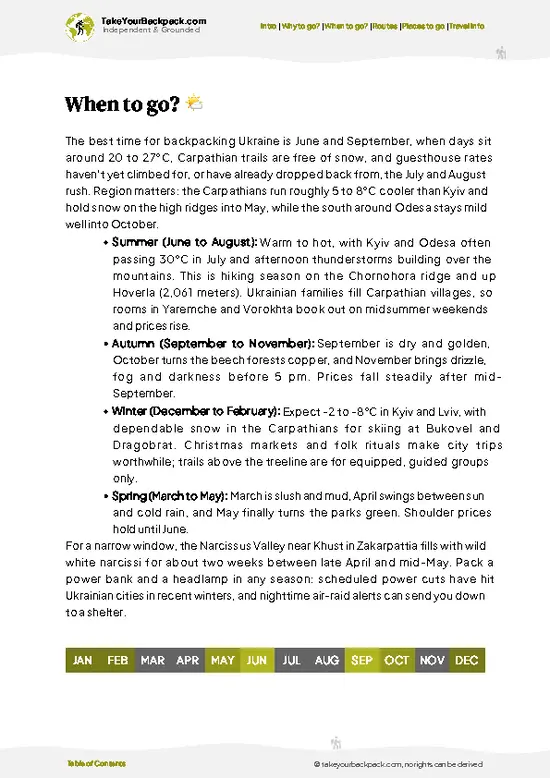
source: climatestotravel.comJANJanuary: below average for travelingFEBFebruary: below average for travelingMARMarch: fair for travelingAPRApril: good for travelingMAYMay: highly recommended for travelingJUNJune: highly recommended for travelingJULJuly: good for travelingAUGAugust: good for travelingSEPSeptember: highly recommended for travelingOCTOctober: good for travelingNOVNovember: fair for travelingDECDecember: below average for traveling
ukraine-hike-hoverla
© Google |

✈️ The backpacker research shortcutUkraine Travel Guide

An offline-friendly backpacking guide with optimized travel routes, ranked highlights, transport advice, and the best areas to stay.
example page 0 from our offline Travel Guide for Ukraine
example page 1 from our offline Travel Guide for Ukraine
example page 2 from our offline Travel Guide for Ukraine
example page 3 from our offline Travel Guide for Ukraine
example page 4 from our offline Travel Guide for Ukraine
example page 5 from our offline Travel Guide for Ukraine
example page 6 from our offline Travel Guide for Ukraine
example page 7 from our offline Travel Guide for Ukraine
The digital guide (425 pages) contains:
112 highlights, ranked by travel appeal
Optimized 7, 14 & 21-day travel routes
Cities, national parks, landmarks, beaches
How to get around
Offline-friendly for travel without Wi-Fi
👉 Click to see all 30+ guide features

📅 Plan smarter in minutes, not weeks
Month by month travel advice
Festivals & national holidays
Budget expectations

🗺️ Go to the right places, skip the overrated ones
Honest pros & cons of destinations
Top hikes, parks & viewpoints
Lesser-known places most travelers miss
Clear “worth it vs skip it” guidance

🛏️ Travel smoothly without rookie mistakes
Best areas to stay
Transport systems explained simply
Common scams & safety advice
SIM cards, money & practical tips

🌍 Understand the country, not just visit it
Culture & traditions
52 Essential phrases & customs
Festivals worth planning around
Traveler-friendly historical context
Insights that make places more meaningful

📱 Built for real travel conditions
Fully downloadable PDF
Works completely offline
Optimized for phone use
Useful in remote areas & buses
Everything in one place
Save weeks of stressful planning
Get instant access to your full guide. 30‑day money-back guarantee.


By proceeding you agree to our terms.
Sent to your inbox immediately after payment • 100% Secure Checkout
Best Backpacking Travel Advisor 2025 tourism awardBest Backpacking
Travel Advisor
2025
What others say about Take Your Backpack Guides:
⭐⭐⭐⭐⭐
Fantastic, amazing amount of information!
⭐⭐⭐⭐⭐
My goodness this is amazing, it's what I've been looking for hats off too you!
⭐⭐⭐⭐⭐
I think this is absolutely BRILLIANT
⭐⭐⭐⭐
Very complete and informative. It's still missing places, but I gotta to commend you
⭐⭐⭐⭐⭐
This is truly amazing, thank you, can't wait to explore it with my kids!
⭐⭐⭐⭐⭐
Awesome resource, thank you!
⭐⭐⭐⭐⭐
This is amazing! Can't wait to explore the ones I haven't seen
⭐⭐⭐⭐
I love this! Well done, great idea.
⭐⭐⭐⭐⭐
Thanks for taking the time to make this gem!
⭐⭐⭐⭐⭐
This might be the best website I've ever seen.
⭐⭐⭐⭐⭐
Congratulations, and thank you so much for your work; it's incredibly valuable.
⭐⭐⭐⭐
In all seriousness I think you did a great job pointing out the important spots
⭐⭐⭐⭐⭐
10/10 very good
⭐⭐⭐⭐⭐
As someone who's only just starting to visit regularly this is awesome, thank you.
⭐⭐⭐⭐
Thank you very much! I'm going to visit my dad, it's going to be very useful!
⭐⭐⭐⭐⭐
This is really cool! We'll be travelling for the first time and this definitely come in handy.
⭐⭐⭐⭐⭐
You are now our minister of culture, congratulations 👨‍💼
⭐⭐⭐⭐⭐
Just wanted to tell you that this is a pearl! Going to follow your recommendations.
⭐⭐⭐⭐⭐
This is so cool. I'll definitely be using the resource for my travels soon.
⭐⭐⭐⭐⭐
This is very impressive! Good work.
⭐⭐⭐⭐⭐
This is an amazing and informative site. Very well done!

🛏️ Where to stay?How to pick the right area

If you enjoy meeting fellow travelers, consider choosing hostels with high ratings for atmosphere. On the other hand, if you prefer having your own space, a hotel might be a better option.

🥾 Hike detailsEverything you need to know before hiking Hoverla

Total Distance: The Hoverla trail is about 16 kilometers (10 miles) round trip, with a steady incline that can feel longer, especially on the way up.

Estimated Duration: Plan for around 6 to 8 hours to complete the hike. This includes breaks for snacks, photos, and just soaking in the views.

Difficulty Level: This trail is considered moderate to challenging. While it’s doable for most hikers, be prepared for steep sections and rocky paths, especially near the summit.

Starting Point: The hike kicks off from the village of Vorokhta. To get there, you can take a train or bus from Lviv or Ivano-Frankivsk. … read more 👉
Total Distance: The Hoverla trail is about 16 kilometers (10 miles) round trip, with a steady incline that can feel longer, especially on the way up.

Estimated Duration: Plan for around 6 to 8 hours to complete the hike. This includes breaks for snacks, photos, and just soaking in the views.

Difficulty Level: This trail is considered moderate to challenging. While it’s doable for most hikers, be prepared for steep sections and rocky paths, especially near the summit.

Starting Point: The hike kicks off from the village of Vorokhta. To get there, you can take a train or bus from Lviv or Ivano-Frankivsk. The train ride is scenic and takes about 3-4 hours. Once you arrive in Vorokhta, you can walk to the trailhead, which is well-marked.

Major Landmarks Along the Route:
  • Mount Hoverla: The highest peak in Ukraine at 2,061 meters (6,762 feet), offering breathtaking panoramic views.
  • Petros Mountain: Often seen from the trail, it’s the second highest peak and a great photo backdrop.
  • Alpine Meadows: You’ll pass through beautiful meadows filled with wildflowers, especially in late spring and summer.

Type of Terrain and Scenery: The trail features a mix of forest paths, rocky inclines, and open alpine areas. The lower sections are shaded by dense beech and spruce forests, while the upper parts reveal stunning vistas of the Carpathian Mountains. Expect to see some rocky outcrops and occasional scree slopes as you approach the summit.

Typical Vegetation and Wildlife:
  • Vegetation: Look out for beech and fir trees in the lower elevations, transitioning to alpine grasses and shrubs as you climb higher.
  • Wildlife: Keep your eyes peeled for chamois, deer, and various bird species like the golden eagle. Don’t be surprised if you spot some adorable marmots, especially in the meadows.

Pack plenty of water, snacks, and a good camera—you’ll want to capture those views! And remember, the weather can change quickly, so layers are your best friend. Happy hiking!
⚠️ Hiking info can sometimes be outdated or inaccurate. Before you hit the trail, check the latest conditions with locals. If you do spot anything that's off, I'd love to hear from you, so I can update it for fellow travelers.

🛡️ SafetyTraveler Safety Guide

Hoverla, Ukraine’s highest peak, offers a straightforward yet invigorating challenge. The trail is well-marked, but don’t underestimate the weather. Conditions can shift rapidly; one moment it’s sunny, the next, clouds roll in, bringing rain or even snow. Dress in layers and pack a waterproof jacket.

The terrain varies, with steep sections that can test your footing. Trekking poles can be a game-changer here, providing stability on the rocky paths. Keep an eye on your pace; it’s easy to get caught up in the stunning views and forget to conserve energy for the ascent.

Wildlife encounters are rare, but if you spot a bear or a boar, back away slowly and give them space. Respect the environment—stick to the trails and pack out what you bring in.

Timing is key; starting early helps you avoid … read more 👉
Hoverla, Ukraine’s highest peak, offers a straightforward yet invigorating challenge. The trail is well-marked, but don’t underestimate the weather. Conditions can shift rapidly; one moment it’s sunny, the next, clouds roll in, bringing rain or even snow. Dress in layers and pack a waterproof jacket.

The terrain varies, with steep sections that can test your footing. Trekking poles can be a game-changer here, providing stability on the rocky paths. Keep an eye on your pace; it’s easy to get caught up in the stunning views and forget to conserve energy for the ascent.

Wildlife encounters are rare, but if you spot a bear or a boar, back away slowly and give them space. Respect the environment—stick to the trails and pack out what you bring in.

Timing is key; starting early helps you avoid the afternoon crowds and gives you a chance to savor the summit in peace. The reward? A breathtaking panorama and the first cold beer at the base.

Other Ukrainian hikes near Hoverla

Explore more nearby:


💡 Not sure where to go next?
Create a personalized itinerary for Ukraine including Hoverla and the places that fit your trip.

Generate my itinerary

👉 Discover all hikes

Or checkout all Ukraine has to offer (think cities, towns, villages, national parks, hikes, beaches, festivals)
Country photo of Ukraine

We 💚 feedbackSumming up the experience

Climbing Hoverla is a workout that rewards you with more than just a view. The trail can be a slog, especially when the weather turns, but that moment you crest the summit? Pure magic. You’ll feel the wind whip around you, and the landscape stretches endlessly. The best surprise? The camaraderie among fellow hikers—everyone’s in it together, sharing snacks and stories. Just a heads-up: the descent can be tougher on the knees than you expect. Pack some ibuprofen and savor that first cold beer at the base; you’ve earned it!

✍️ Help improve this page!
The information on this page is based on in-depth research, insights shared by experienced travelers, and feedback from the local travel community in Ukraine. While every effort is made to keep the information accurate and current, conditions can change — so if you spot anything incorrect or outdated, please get in touch.


🙋‍♂️ Give feedback

👋 Meet the founderWho’s Behind Take Your Backpack?

Johan, backpacker and founder of TakeYourBackpackHi, I’m Johan (Netherlands 🇳🇱), the creator of TakeYourBackpack. Over the past decade, I’ve backpacked through 80+ countries across six continents, gaining extensive experience with independent travel, long-term trips, and overland routes.

This site is built on a combination of firsthand travel experience and carefully curated insights from other backpackers. Many guides are based on places I’ve personally visited, while others bring together tips, observations, and practical advice shared by trusted travelers I’ve met along the way.

The goal is to provide realistic, experience-driven guidance — not generic itineraries — so you can explore destinations with better context, clearer expectations, and more confidence.

Get full Ukraine guide •
Instant download • 112 highlights • Full Offline guide