


×

French Polynesia🇵🇫 | hikesMount Popoti HikeBasalt plug, Popoti Ridge, lagoon bands, no summit route | things to do and best time to go

Explore Mount AoraiExplore Three Waterfalls Hike

Backpacking in Mount Popoti Hike
🌟 Highlighthike ranked #2
By Johan Kruseman 🇳🇱 | Updated October 15, 2026

Many travelers arrive expecting to stand on top of Bora Bora’s famous tooth, and what tips the decision is that the 727 meter summit of Mt. Otemanu is a sheer basalt plug with no legal or safe walking route to the top. Hikers instead choose a guided or self-guided ridge walk that looks straight at it. The mountain rises in the center of the island of Bora Bora, in the Leeward group of French Polynesia, northwest of Tahiti. The good side is scenery: the lagoon glows in several shades of blue below you, and the spire fills the frame. The bad side is heat, slick red clay after rain, and loose rock. Walks run short to half a day and range from easy to steep. Wait for a dry morning, start by 7 a.m., and skip any operator promising a summit.

Discover everything you want to know in the 📖 French Polynesia Travel Guide.
Best time to go: May - October
Duration: 2 hours
Distance: 6 kilometers
Total ascent: 700 meters


example page 0 from our offline Travel Guide for French Polynesia
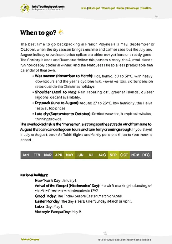
example page 1 from our offline Travel Guide for French Polynesia
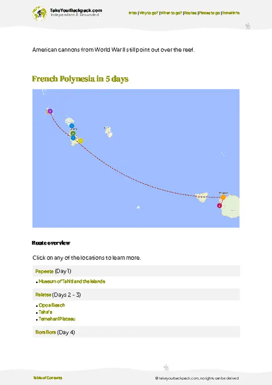
example page 2 from our offline Travel Guide for French Polynesia
example page 3 from our offline Travel Guide for French Polynesia
example page 4 from our offline Travel Guide for French Polynesia
example page 5 from our offline Travel Guide for French Polynesia
example page 6 from our offline Travel Guide for French Polynesia
example page 7 from our offline Travel Guide for French Polynesia
Loading the map 🌍
CLICK TO FILTER
towns
villages
landmarks
national parks
hikes
beaches
attractions
festivals
regions
SHOW COUNTRY’S BESTSHOW ALL

✨ Why go?
Ranked #2 hike in French Polynesia
What sets this place apart

Backpackers come for one reason: Bora Bora’s postcard view without a resort bill. The island’s roads are a single ring, so you can reach trailheads on a rented bike or by hitching a ride from Vaitape, the ferry town. Most of the lagoon’s color is visible from a modest rise, so a couple of sweaty hours gets you the same panorama that overwater-bungalow guests pay for from a boat. The 727 meter Otemanu spire is the star, and its twin neighbor Mt. Pahia sits beside it, giving the skyline a lopsided, jagged shape you will not forget. Walks are flexible: you can do a quick ridge viewpoint before breakfast, then spend the afternoon snorkeling at the public beach. Hiking here also gives you a look at the interior, which is mostly hibiscus thickets, mango trees and old taro terraces, a side of the island most lagoon visitors never see.

💡 HighlightsEssential experiences to have while hiking the Mount Popoti Hike

  1. Mt. Otemanu: The 727 meter volcanic plug is the reason anyone searches this trail. Its vertical, dark rock faces rise above the lagoon, and from a distance you can see white seabirds circling the cliffs. Admire it from below and from ridge viewpoints, since the rock itself is too crumbly and steep to climb.
  2. Mt. Pahia: At 661 meters, the neighbor is the other big silhouette in every photo. Its upper slopes are guided-only, with ropes on a few sections, so most hikers just enjoy how the two peaks stand side by side, especially in the low light of early morning.
  3. Popoti Ridge viewpoint: This is the usual short hike for the Otemanu view. The path climbs through scrubby forest to an open crest where the lagoon wraps around the island in bands of turquoise and navy. It is the best-value vantage on
… read more 👉
  1. Mt. Otemanu: The 727 meter volcanic plug is the reason anyone searches this trail. Its vertical, dark rock faces rise above the lagoon, and from a distance you can see white seabirds circling the cliffs. Admire it from below and from ridge viewpoints, since the rock itself is too crumbly and steep to climb.
  2. Mt. Pahia: At 661 meters, the neighbor is the other big silhouette in every photo. Its upper slopes are guided-only, with ropes on a few sections, so most hikers just enjoy how the two peaks stand side by side, especially in the low light of early morning.
  3. Popoti Ridge viewpoint: This is the usual short hike for the Otemanu view. The path climbs through scrubby forest to an open crest where the lagoon wraps around the island in bands of turquoise and navy. It is the best-value vantage on the island.
  4. Faanui Bay and the old US guns: Heavy naval guns left over from the American base of World War II still point out from the hillside above Faanui. A short, steep path from the road leads to them, and the angled view across the north lagoon makes the stop worth it. Pair it with the nearby marae, the old stone temple platforms of Polynesian worship.
  5. Matira Point and Matira Beach: The southern tip is the island’s public beach, with shallow, calm water for a cool-down swim. Looking back north, Otemanu fills the horizon, and sunset here turns the cliff face orange. No fee applies.
Start with the Popoti Ridge viewpoint, because early morning is the only time the heat and clouds stay off Otemanu, and the trail is short enough to leave your day free for the beach.
Spotted a mistake or missing something? Contact us.

Things to do around Mount Popoti Hike

Ratings based on Tripadvisor reviews. When you book through this link, you support our work at no extra cost to you.

🌤️ When to go?When to go for the best experience

  • Dry Season (May to October): Days run 24 to 29°C (75 to 84°F) with lower humidity and mostly clear skies, so the ridge and lagoon views are at their sharpest. Daylight lasts about 11 to 12 hours, with sunrise near 6:00 and sunset near 17:30.
  • Peak Crowds (July and August): Cruise ships and overwater bungalow guests fill the tour slots, and flights and lodging cost the most. Humpback whales pass offshore from roughly July to October.
  • Wet Season (November to April): Expect 27 to 31°C (81 to 88°F), heavy humidity, and afternoon downpours that turn red clay trails slick. Days stretch to around 13 hours. Rooms get cheaper outside the Christmas and New Year weeks, and cyclone risk is low but peaks January to March.
Book tours for the early morning in any month, since cloud tends to cap the peaks by midday.

source: climatestotravel.comJANJanuary: fair for travelingFEBFebruary: fair for travelingMARMarch: fair for travelingAPRApril: fair for travelingMAYMay: excellent for travelingJUNJune: excellent for travelingJULJuly: highly recommended for travelingAUGAugust: highly recommended for travelingSEPSeptember: excellent for travelingOCTOctober: excellent for travelingNOVNovember: fair for travelingDECDecember: fair for traveling
french-polynesia-hike-mount-popoti-hike
© Google | Catalin Lupu

✈️ The backpacker research shortcutFrench Polynesia Travel Guide

An offline-friendly backpacking guide with optimized travel routes, ranked highlights, transport advice, and the best areas to stay.
example page 0 from our offline Travel Guide for French Polynesia
example page 1 from our offline Travel Guide for French Polynesia
example page 2 from our offline Travel Guide for French Polynesia
example page 3 from our offline Travel Guide for French Polynesia
example page 4 from our offline Travel Guide for French Polynesia
example page 5 from our offline Travel Guide for French Polynesia
example page 6 from our offline Travel Guide for French Polynesia
example page 7 from our offline Travel Guide for French Polynesia
The digital guide (149 pages) contains:
✅ 41 highlights, ranked by travel appeal
✅ Optimized 2, 3 & 5-day travel routes
✅ Cities, national parks, landmarks, beaches
✅ How to get around
✅ Offline-friendly for travel without Wi-Fi
👉 Click to see all 30+ guide features

📅 Plan smarter in minutes, not weeks
✅ Month by month travel advice
✅ Festivals & national holidays
✅ Budget expectations

🗺️ Go to the right places, skip the overrated ones
✅ Honest pros & cons of destinations
✅ Top hikes, parks & viewpoints
✅ Lesser-known places most travelers miss
✅ Clear “worth it vs skip it” guidance

🛏️ Travel smoothly without rookie mistakes
✅ Best areas to stay
✅ Transport systems explained simply
✅ Common scams & safety advice
✅ SIM cards, money & practical tips

🌍 Understand the country, not just visit it
✅ Culture & traditions
✅ 52 Essential phrases & customs
✅ Festivals worth planning around
✅ Traveler-friendly historical context
✅ Insights that make places more meaningful

📱 Built for real travel conditions
✅ Fully downloadable PDF
✅ Works completely offline
✅ Optimized for phone use
✅ Useful in remote areas & buses
✅ Everything in one place
Stop searching, start planning
Get instant access to your full guide. 30‑day money-back guarantee.
+ Add another guide for just

By proceeding you agree to our terms.
Sent to your inbox immediately after payment • 100% Secure Checkout
Best Backpacking Travel Advisor 2025 tourism awardBest Backpacking
Travel Advisor
2025
What others say about Take Your Backpack Guides:
⭐⭐⭐⭐⭐
Fantastic, amazing amount of information!
⭐⭐⭐⭐⭐
My goodness this is amazing, it's what I've been looking for hats off too you!
⭐⭐⭐⭐⭐
I think this is absolutely BRILLIANT
⭐⭐⭐⭐
Very complete and informative. It's still missing places, but I gotta to commend you
⭐⭐⭐⭐⭐
This is truly amazing, thank you, can't wait to explore it with my kids!
⭐⭐⭐⭐⭐
Awesome resource, thank you!
⭐⭐⭐⭐⭐
This is amazing! Can't wait to explore the ones I haven't seen
⭐⭐⭐⭐
I love this! Well done, great idea.
⭐⭐⭐⭐⭐
Thanks for taking the time to make this gem!
⭐⭐⭐⭐⭐
This might be the best website I've ever seen.
⭐⭐⭐⭐⭐
Congratulations, and thank you so much for your work; it's incredibly valuable.
⭐⭐⭐⭐
In all seriousness I think you did a great job pointing out the important spots
⭐⭐⭐⭐⭐
10/10 very good
⭐⭐⭐⭐⭐
As someone who's only just starting to visit regularly this is awesome, thank you.
⭐⭐⭐⭐
Thank you very much! I'm going to visit my dad, it's going to be very useful!
⭐⭐⭐⭐⭐
This is really cool! We'll be travelling for the first time and this definitely come in handy.
⭐⭐⭐⭐⭐
You are now our minister of culture, congratulations 👨‍💼
⭐⭐⭐⭐⭐
Just wanted to tell you that this is a pearl! Going to follow your recommendations.
⭐⭐⭐⭐⭐
This is so cool. I'll definitely be using the resource for my travels soon.
⭐⭐⭐⭐⭐
This is very impressive! Good work.
⭐⭐⭐⭐⭐
This is an amazing and informative site. Very well done!

🛏️ Where to stay?Best areas and accommodation options

If you enjoy meeting fellow travelers, consider choosing hostels with high ratings for atmosphere. On the other hand, if you prefer having your own space, a hotel might be a better option.

🥾 Hike detailsHike details: route, duration, and difficulty of Mount Popoti Hike

Total Distance: The practical route is a short ridge walk, roughly 3 to 5 kilometers return, depending on where you begin. The summit of Mt. Otemanu itself has no route.
Estimated Duration: About 2 to 3 hours return at an unhurried pace, with time for photos.
Difficulty: Moderate. The path is steep in places, with loose dirt and tree roots. After rain the red clay becomes slick, so it is best skipped on wet days.
Starting Point: The island has one coastal road. The ferry from the airport motu lands at Vaitape, the main village, and the trailheads are reached on foot, by bike, or by the island’s local
… read more 👉
Total Distance: The practical route is a short ridge walk, roughly 3 to 5 kilometers return, depending on where you begin. The summit of Mt. Otemanu itself has no route.
Estimated Duration: About 2 to 3 hours return at an unhurried pace, with time for photos.
Difficulty: Moderate. The path is steep in places, with loose dirt and tree roots. After rain the red clay becomes slick, so it is best skipped on wet days.
Starting Point: The island has one coastal road. The ferry from the airport motu lands at Vaitape, the main village, and the trailheads are reached on foot, by bike, or by the island’s local bus service, which runs infrequently.
Major Landmarks:
  • Otemanu: The spire dominates the view from the ridge, with bare cliffs and a tangle of green below.
  • Pahia: Rising beside it, the second peak adds depth to every photo.
  • Lagoon: From the crest you can pick out the motus, the reef pass and the tint changes of the water.
Terrain and Scenery: Red-brown clay and volcanic gravel underfoot, narrow ridgelines, and a few steep scrambles where you may need your hands. Views open up near the top.
Vegetation: Hibiscus, pandanus, coconut palms, ferns and mango trees cover the lower slopes. Higher up, the forest thins to grass and shrubs.
Wildlife: Expect lizards, wild chickens, myna birds and white terns circling the cliffs. No dangerous animals live on the trail, though mosquitoes are common, especially near shaded valleys.
What to Bring: Closed shoes with grip, at least 2 liters of water, sun protection and insect repellent. Start early, since shade is limited on the open crest.
⚠️ Hiking info can sometimes be outdated or inaccurate. Before you hit the trail, check the latest conditions with locals. If you do spot anything that's off, I'd love to hear from you, so I can update it for fellow travelers.

🛡️ SafetyScams, Hazards, and Annoyances

The summit of Mt. Otemanu is off limits to hikers, and nobody legitimate guides it. The 727-meter basalt spire is nearly vertical, and the rock crumbles under hands and boots. The hikes that are actually open are guided routes such as the Popoti Ridge in the Faanui area and 4x4 tours to viewpoints below Otemanu, and those are the ones to plan around. On them, the main hazards are heat, humidity, and mud. Start early, carry at least 2 liters of water per person, and wear shoes with real tread, since the clay gets greasy after rain. Stay behind your guide on ridge sections with drops, and skip the trail altogether when it is pouring. Respect private land and old Polynesian sites along the way. Nothing here is dangerous in a way that wildlife is, though mosquitoes are persistent, so bring repellent.

FAQTraveler FAQ

No summit hike exists, because the climb up Mt. Otemanu is not open to visitors. The guided alternatives are short: the Popoti Ridge hike takes about 2 to 3 hours, and 4x4 tours to the island’s viewpoints last roughly 2.5 to 3 hours. Plan a half day including pickup from your hotel or the Vaitape dock.
The Otemanu summit is a technical climb on crumbling volcanic rock with sheer drops, and it is closed to hikers. The guided Popoti Ridge trail is moderate, with steep, muddy sections, a climb of a few hundred meters, and heat that tires first-timers more than the distance does. Fit beginners can manage it with good shoes and 2 liters of water.
Yes to a guide, and no permit exists for the summit because it is not open to the public. Guided tours on Bora Bora’s trails and 4x4 routes usually cost about 8,000 to 14,000 XPF (US$75 to 130) per person and can be booked through your hotel or in Vaitape. Going alone onto private land or the Otemanu cliffs is not advised and is not accepted by local operators.
⚠️ Things can change over time, so always validate details locally before you go.

Other French Polynesian hikes near Mount Popoti Hike

Explore more nearby:

  • Belvedere Lookout Trail—Mount Rotui views, twin bays, pine and mape forest, Col de Vaiare| 236 km away
  • Fautaua Waterfall Trail—River crossings, 100-meter cascade, mape groves, four-hour return| 264 km away
  • Mount Aorai—Two-day ascent, Fare Ata hut, knife-edge ridge, 2,066 meters| 271 km away

💡 Not sure where to go next?
Create a personalized itinerary for French Polynesia including Mount Popoti Hike and the places that fit your trip.

Generate my itinerary

👉 Discover all hikes

Or checkout all French Polynesia has to offer (think cities, towns, villages, national parks, hikes, beaches, festivals)
Country photo of French Polynesia

We 💚 feedbackWhat to keep in mind

Most first-timers look only at Otemanu and never at the sunrise side of the ridge. Go at first light and turn around to face east, where the light turns the lagoon from gray to pale green before the clouds gather around the peaks. Bring a light rain layer, because squalls roll in fast.

✍️ Help improve this page!
The information on this page is based on in-depth research, insights shared by experienced travelers, and feedback from the local travel community in French Polynesia. While every effort is made to keep the information accurate and current, conditions can change — so if you spot anything incorrect or outdated, please get in touch.


🙋‍♂️ Give feedback

👋 Meet the founderWho’s Behind Take Your Backpack?

Johan, backpacker and founder of TakeYourBackpackHi, I’m Johan (Netherlands 🇳🇱), the creator of TakeYourBackpack. Over the past 3 decades, I’ve backpacked through 90+ countries across six continents, gaining extensive experience with independent travel, long-term trips, and overland routes.

This site is built on a combination of firsthand travel experience and carefully curated insights from other backpackers. Many guides are based on places I’ve personally visited, while others bring together tips, observations, and practical advice shared by trusted travelers I’ve met along the way.

The goal is to provide realistic, experience-driven guidance — not generic itineraries — so you can explore destinations with better context, clearer expectations, and more confidence.