×

DR Congo🇨🇩 | hikesNyiragongo VolcanoLava lake, rim overnight, scree slope, Goma views | things to do and best time to go

Explore Itombwe MassifExplore Rwenzori Mountains Trail

Backpacking in Nyiragongo Volcano
🏆 Top pickhike ranked #1
By Johan Kruseman 🇳🇱 | Updated October 22, 2026

The real decision at Nyiragongo Volcano is whether to sleep on the rim or climb as a day push, and the overnight wins by a wide margin. Nyiragongo sits in Virunga National Park in the east of the Democratic Republic of the Congo, north of Goma and Lake Kivu. The reward is a lava lake roughly 250 meters below the summit shelters, glowing orange through the night. The trail is only about 6 to 7 kilometers each way, but it is a steep, relentless grind, and the rim is cold, windy and often wet. Permits come only through Virunga National Park, so book online ahead and skip any fixer offering a quicker deal. Check the current security situation around Goma before paying, since closures happen and refunds are not guaranteed. Pack real layers and a rain shell, and hire a porter for your bag. Fit hikers who want a spectacle will love it. Anyone expecting a gentle stroll or a cheap trip should skip it.

Discover everything you want to know in the 📖 DR Congo Travel Guide.
Best time to go: June - September
Duration: 2 days
Distance: 13 kilometers
Total ascent: 1400 meters
Safety warning

The current risk level for DR Congo is high. Check the advice before going.


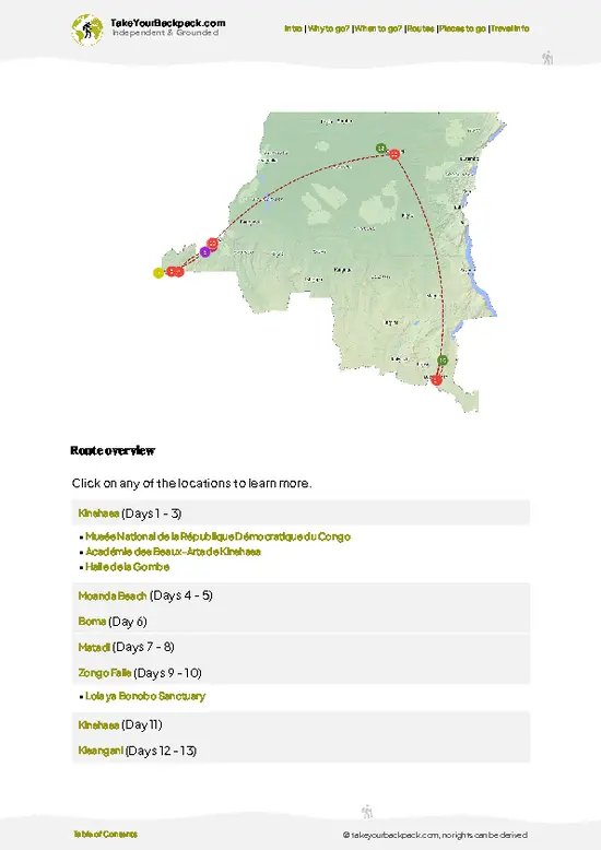
example page 0 from our offline Travel Guide for Democratic Republic of the Congo
example page 1 from our offline Travel Guide for Democratic Republic of the Congo
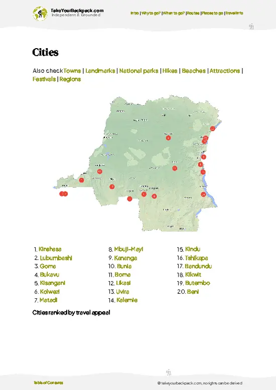
example page 2 from our offline Travel Guide for Democratic Republic of the Congo
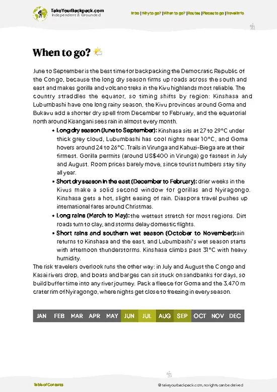
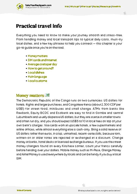
example page 3 from our offline Travel Guide for Democratic Republic of the Congo
example page 4 from our offline Travel Guide for Democratic Republic of the Congo
example page 5 from our offline Travel Guide for Democratic Republic of the Congo
example page 6 from our offline Travel Guide for Democratic Republic of the Congo
example page 7 from our offline Travel Guide for Democratic Republic of the Congo
Loading the map 🌍
CLICK TO FILTER
cities
towns
landmarks
national parks
hikes
beaches
attractions
festivals
regions
SHOW COUNTRY’S BESTSHOW ALL

✨ Why go?
Ranked #1 hike in DR Congo
What sets this place apart

Nyiragongo Volcano gives you one of the few lava lakes on earth that you can sleep beside, and that is the whole argument. At around 3,470 meters, the crater is a huge bowl with a molten surface that shifts, crusts over and fountains after dark. Most people say the night view beats the sunrise, and it is hard to disagree.

The second reason is how compact it is. The roughly four to six hour climb starts at the park post at Kibati, so you get a volcano summit in a single overnight without needing days of trekking. That makes it easy to slot between gorilla treks or a crossing of Lake Kivu on a longer route through eastern Africa.

The third is the setting. You hike under the guard of Virunga rangers, and you stay in the basic A-frame cabins on the crater rim, each with a mattress and a view … read more 👉
Nyiragongo Volcano gives you one of the few lava lakes on earth that you can sleep beside, and that is the whole argument. At around 3,470 meters, the crater is a huge bowl with a molten surface that shifts, crusts over and fountains after dark. Most people say the night view beats the sunrise, and it is hard to disagree.

The second reason is how compact it is. The roughly four to six hour climb starts at the park post at Kibati, so you get a volcano summit in a single overnight without needing days of trekking. That makes it easy to slot between gorilla treks or a crossing of Lake Kivu on a longer route through eastern Africa.

The third is the setting. You hike under the guard of Virunga rangers, and you stay in the basic A-frame cabins on the crater rim, each with a mattress and a view of the glow. Few trailheads anywhere come with such an unusual bed.

💡 HighlightsTop highlights of Nyiragongo Volcano

  1. The Lava Lake: This is why anyone climbs Nyiragongo Volcano. The crater is about 1.2 kilometers across, and the lake churns in a bowl hundreds of meters below you. It is among the largest lava lakes on Earth, and its level and activity change from year to year. After dark the surface glows orange and red, and you hear it crackle and hiss. Bring a headlamp and a thick jacket, because the rim is cold even when the lava is not.
  2. The Crater Terraces: Inside the rim, the crater walls drop in a series of ledges, black and gray steps of old solidified lava. The lava lake sits on the floor below them, and the contrast between frozen rock and molten rock is easy to read from above. The terraces give the crater its stepped, amphitheater look, and they are a good place to judge the scale of the whole bowl
… read more 👉
  1. The Lava Lake: This is why anyone climbs Nyiragongo Volcano. The crater is about 1.2 kilometers across, and the lake churns in a bowl hundreds of meters below you. It is among the largest lava lakes on Earth, and its level and activity change from year to year. After dark the surface glows orange and red, and you hear it crackle and hiss. Bring a headlamp and a thick jacket, because the rim is cold even when the lava is not.
  2. The Crater Terraces: Inside the rim, the crater walls drop in a series of ledges, black and gray steps of old solidified lava. The lava lake sits on the floor below them, and the contrast between frozen rock and molten rock is easy to read from above. The terraces give the crater its stepped, amphitheater look, and they are a good place to judge the scale of the whole bowl in daylight.
  3. The Rainforest Start: The trail begins in damp montane forest above the Kibati ranger post, with muddy ground, tangled roots and moss on the trunks. It is the softest section of the climb, and the only one with shade and birdsong. Enjoy it while it lasts. Past it the path crosses open ground and then loose volcanic rock.
  4. The Steep Scree Slope: The last stretch to the rim climbs a steep, loose slope of volcanic gravel. The footing is poor and each step slips back a little, so this is where trekking poles earn their place. The slope is also the stretch that most separates the people who reach the summit comfortably from the ones who arrive spent and cold. Go slowly, and take the short rests the guides call.
  5. The View Over Lake Kivu and Goma: From the upper trail, and on the descent in daylight, the land opens toward Lake Kivu to the south and the city of Goma on its shore. You can pick out the dark lava fields from the past eruptions that cut across the landscape. Virunga’s other volcanoes line up along the horizon, and the view makes the volcano’s power plain without any explanation.
Nyiragongo Volcano is the one item here that needs a permit, and you should book the Virunga National Park climbing permit ahead of time through the park’s official channels, since permits are tied to a fixed date and a guided group.
Spotted a mistake or missing something? Contact us.

🌤️ When to go?Weather, crowds, and seasonal trade-offs

  • Dry Season (June to August, plus December to February): Trails are firmest and the summit crater is clear more often, so these months suit most climbers. Summit nights are cold at about 0 to 5°C (32 to 41°F), while the forest base sits near 18 to 24°C (64 to 75°F).
  • Wet Seasons (March to May, September to November): Rain turns the lower forest path to mud and cloud can hide the lava lake. Expect 10 to 20°C (50 to 68°F) on the upper slopes and wind-driven drizzle at the huts.
  • Daylight: Days stay near 12 hours all year, so you start the climb in the morning and reach the rim by mid to late afternoon with light to spare.
  • Crowds and Prices: Permit slots fill fastest in July, August and around Christmas. The permit price stays fixed (about US$300), but porters and transfers cost a little more in peak
… read more 👉
  • Dry Season (June to August, plus December to February): Trails are firmest and the summit crater is clear more often, so these months suit most climbers. Summit nights are cold at about 0 to 5°C (32 to 41°F), while the forest base sits near 18 to 24°C (64 to 75°F).
  • Wet Seasons (March to May, September to November): Rain turns the lower forest path to mud and cloud can hide the lava lake. Expect 10 to 20°C (50 to 68°F) on the upper slopes and wind-driven drizzle at the huts.
  • Daylight: Days stay near 12 hours all year, so you start the climb in the morning and reach the rim by mid to late afternoon with light to spare.
  • Crowds and Prices: Permit slots fill fastest in July, August and around Christmas. The permit price stays fixed (about US$300), but porters and transfers cost a little more in peak weeks.
  • Security Windows: Climbs are sometimes suspended when conditions in North Kivu worsen, so dates can shift at short notice.
Book a flexible window of at least two extra days and confirm the park’s status shortly before you travel.


source: climatestotravel.comJANJanuary: fair for travelingFEBFebruary: fair for travelingMARMarch: fair for travelingAPRApril: fair for travelingMAYMay: fair for travelingJUNJune: highly recommended for travelingJULJuly: excellent for travelingAUGAugust: excellent for travelingSEPSeptember: highly recommended for travelingOCTOctober: fair for travelingNOVNovember: fair for travelingDECDecember: fair for traveling
when-to-go

✈️ The backpacker research shortcutDR Congo Travel Guide

An offline-friendly backpacking guide with optimized travel routes, ranked highlights, transport advice, and the best areas to stay.
example page 0 from our offline Travel Guide for Democratic Republic of the Congo
example page 1 from our offline Travel Guide for Democratic Republic of the Congo
example page 2 from our offline Travel Guide for Democratic Republic of the Congo
example page 3 from our offline Travel Guide for Democratic Republic of the Congo
example page 4 from our offline Travel Guide for Democratic Republic of the Congo
example page 5 from our offline Travel Guide for Democratic Republic of the Congo
example page 6 from our offline Travel Guide for Democratic Republic of the Congo
example page 7 from our offline Travel Guide for Democratic Republic of the Congo
The digital guide (330 pages) contains:
✅ 76 highlights, ranked by travel appeal
✅ Optimized 7, 14 & 21-day travel routes
✅ Cities, national parks, landmarks, beaches
✅ How to get around
✅ Offline-friendly for travel without Wi-Fi
👉 Click to see all 30+ guide features

📅 Plan smarter in minutes, not weeks
✅ Month by month travel advice
✅ Festivals & national holidays
✅ Budget expectations

🗺️ Go to the right places, skip the overrated ones
✅ Honest pros & cons of destinations
✅ Top hikes, parks & viewpoints
✅ Lesser-known places most travelers miss
✅ Clear “worth it vs skip it” guidance

🛏️ Travel smoothly without rookie mistakes
✅ Best areas to stay
✅ Transport systems explained simply
✅ Common scams & safety advice
✅ SIM cards, money & practical tips

🌍 Understand the country, not just visit it
✅ Culture & traditions
✅ 52 Essential phrases & customs
✅ Festivals worth planning around
✅ Traveler-friendly historical context
✅ Insights that make places more meaningful

📱 Built for real travel conditions
✅ Fully downloadable PDF
✅ Works completely offline
✅ Optimized for phone use
✅ Useful in remote areas & buses
✅ Everything in one place
Stop searching, start planning
Get instant access to your full guide. 30‑day money-back guarantee.
+ Add another guide for just

By proceeding you agree to our terms.
Sent to your inbox immediately after payment • 100% Secure Checkout
Best Backpacking Travel Advisor 2025 tourism awardBest Backpacking
Travel Advisor
2025
What others say about Take Your Backpack Guides:
⭐⭐⭐⭐⭐
Fantastic, amazing amount of information!
⭐⭐⭐⭐⭐
My goodness this is amazing, it's what I've been looking for hats off too you!
⭐⭐⭐⭐⭐
I think this is absolutely BRILLIANT
⭐⭐⭐⭐
Very complete and informative. It's still missing places, but I gotta to commend you
⭐⭐⭐⭐⭐
This is truly amazing, thank you, can't wait to explore it with my kids!
⭐⭐⭐⭐⭐
Awesome resource, thank you!
⭐⭐⭐⭐⭐
This is amazing! Can't wait to explore the ones I haven't seen
⭐⭐⭐⭐
I love this! Well done, great idea.
⭐⭐⭐⭐⭐
Thanks for taking the time to make this gem!
⭐⭐⭐⭐⭐
This might be the best website I've ever seen.
⭐⭐⭐⭐⭐
Congratulations, and thank you so much for your work; it's incredibly valuable.
⭐⭐⭐⭐
In all seriousness I think you did a great job pointing out the important spots
⭐⭐⭐⭐⭐
10/10 very good
⭐⭐⭐⭐⭐
As someone who's only just starting to visit regularly this is awesome, thank you.
⭐⭐⭐⭐
Thank you very much! I'm going to visit my dad, it's going to be very useful!
⭐⭐⭐⭐⭐
This is really cool! We'll be travelling for the first time and this definitely come in handy.
⭐⭐⭐⭐⭐
You are now our minister of culture, congratulations 👨‍💼
⭐⭐⭐⭐⭐
Just wanted to tell you that this is a pearl! Going to follow your recommendations.
⭐⭐⭐⭐⭐
This is so cool. I'll definitely be using the resource for my travels soon.
⭐⭐⭐⭐⭐
This is very impressive! Good work.
⭐⭐⭐⭐⭐
This is an amazing and informative site. Very well done!

🛏️ Where to stay?Choosing the right base

If you enjoy meeting fellow travelers, consider choosing hostels with high ratings for atmosphere. On the other hand, if you prefer having your own space, a hotel might be a better option.

🥾 Hike detailsTrail overview: what to expect on the hike

Nyiragongo Volcano is a steep, short, high-altitude trek in Virunga National Park, usually done as a two-day overnight.
Total Distance: About 12 to 14 kilometers round trip.
Estimated Duration: 4 to 6 hours up, 3 to 4 hours down, with the night spent on the rim.
Difficulty: Hard. The trail is short but climbs about 1,400 meters, and the final section is steep with loose rock. Cold and altitude add to the strain.
Starting Point: The Kibati ranger post north of Goma, reached by taxi or moto from the city. Park transport is usually arranged when you book.
Major Landmarks:
  • Kibati Post: Briefing, permit
… read more 👉
Nyiragongo Volcano is a steep, short, high-altitude trek in Virunga National Park, usually done as a two-day overnight.
Total Distance: About 12 to 14 kilometers round trip.
Estimated Duration: 4 to 6 hours up, 3 to 4 hours down, with the night spent on the rim.
Difficulty: Hard. The trail is short but climbs about 1,400 meters, and the final section is steep with loose rock. Cold and altitude add to the strain.
Starting Point: The Kibati ranger post north of Goma, reached by taxi or moto from the city. Park transport is usually arranged when you book.
Major Landmarks:
  • Kibati Post: Briefing, permit check and armed ranger escort.
  • Rest Stops: Four short breaks on the way up, roughly one per hour.
  • Summit Shelters: Cabins on the crater rim, with a basic communal area.
Terrain and Scenery: Forest gives way to old, black lava fields and then a steep slope of loose volcanic rock. The crater itself is a vast bowl with terraced walls.
Vegetation: Montane forest at the base, shrubs and heather higher up, and bare rock near the summit.
Wildlife: Birds and small forest animals on the lower slopes. Little lives near the crater.
What to Bring: A warm sleeping bag, a hat, gloves, a rain jacket and a headlamp. Temperatures at the summit fall close to freezing.
⚠️ Hiking info can sometimes be outdated or inaccurate. Before you hit the trail, check the latest conditions with locals. If you do spot anything that's off, I'd love to hear from you, so I can update it for fellow travelers.

🛡️ SafetyTraveler Safety Guide

The main physical risks on Nyiragongo Volcano are cold, altitude and the steep, loose final stretch, and all of them are manageable with decent pacing. The summit stands at about 3,470 meters (11,385 feet), and the rim is exposed to wind and sharp temperature drops after dark. Bring a down jacket, warm hat, gloves and a waterproof shell, because the hut shelters are basic and sleeping bags are often thin. The path is rocky and slippery after rain, so use trekking poles and sturdy boots, and walk slowly on the climb to avoid headaches. Keep well back from the crater edge, where rock is unstable and gas can drift across; never lean over for photos in wind. Rangers lead every group and carry weapons for security, so stay with them and follow their pace. Security around Goma can change quickly, … read more 👉
The main physical risks on Nyiragongo Volcano are cold, altitude and the steep, loose final stretch, and all of them are manageable with decent pacing. The summit stands at about 3,470 meters (11,385 feet), and the rim is exposed to wind and sharp temperature drops after dark. Bring a down jacket, warm hat, gloves and a waterproof shell, because the hut shelters are basic and sleeping bags are often thin. The path is rocky and slippery after rain, so use trekking poles and sturdy boots, and walk slowly on the climb to avoid headaches. Keep well back from the crater edge, where rock is unstable and gas can drift across; never lean over for photos in wind. Rangers lead every group and carry weapons for security, so stay with them and follow their pace. Security around Goma can change quickly, so check conditions with your operator before departure. Porters are available and worth hiring for heavy sleeping gear.

FAQTraveler FAQ

Nyiragongo Volcano takes two days and one night, with about four to six hours of climbing up and roughly three hours down. Most groups start from the Kibati ranger post around 1,900 meters, reach the summit huts by mid-afternoon, and sleep on the rim. The descent the next morning usually finishes before lunch, and Goma is about an hour away by road.
Nyiragongo Volcano is a steep, moderately hard climb that gains about 1,500 meters over roughly 6 to 7 kilometers. The last section is the toughest, with loose volcanic rock and wind that gets cold at the top. Reasonable fitness is enough, since you can go slowly with rest stops, and porters are available for about US$25 to 30 to carry your pack.
Nyiragongo Volcano requires both a permit and an accompanying ranger, and independent climbing is not allowed. The permit costs about US$300 per person, usually booked through the Virunga National Park office or its website, and covers the guide, escort and hut stay. Porters cost extra at about US$25 to 30, and you should book several weeks ahead for July, August and the Christmas period.
⚠️ Things can change over time, so always validate details locally before you go.

Other Congolese hikes near Nyiragongo Volcano

Explore more nearby:

  • Itombwe Massif—Cloud forest, Prigogine’s owl, Lake Tanganyika escarpment, guide essential| 223 km away
  • Rwenzori Mountains Trail—Glaciers, giant lobelias, Mutwanga start, multi-day trek| 223 km away
  • Mount Hoyo Trail—Ituri rainforest, Hoyo caves, Efe village visit, red mud| 314 km away

💡 Not sure where to go next?
Create a personalized itinerary for DR Congo including Nyiragongo Volcano and the places that fit your trip.

Generate my itinerary

👉 Discover all hikes

Or checkout all DR Congo has to offer (think cities, towns, villages, national parks, hikes, beaches, festivals)
Country photo of DR Congo

We 💚 feedbackWhat to keep in mind

Nyiragongo Volcano suits fit, curious people who accept discomfort for a spectacle that is hard to match. If you love camping, big views and dramatic geology, go. I would bring a down jacket, more layers than seems sensible and a headlamp, and I would book the porter. Skip it if you hate cold nights or steep steps.

✍️ Help improve this page!
The information on this page is based on in-depth research, insights shared by experienced travelers, and feedback from the local travel community in DR Congo. While every effort is made to keep the information accurate and current, conditions can change — so if you spot anything incorrect or outdated, please get in touch.


🙋‍♂️ Give feedback

👋 Meet the founderWho’s Behind Take Your Backpack?

Johan, backpacker and founder of TakeYourBackpackHi, I’m Johan (Netherlands 🇳🇱), the creator of TakeYourBackpack. Over the past 3 decades, I’ve backpacked through 90+ countries across six continents, gaining extensive experience with independent travel, long-term trips, and overland routes.

This site is built on a combination of firsthand travel experience and carefully curated insights from other backpackers. Many guides are based on places I’ve personally visited, while others bring together tips, observations, and practical advice shared by trusted travelers I’ve met along the way.

The goal is to provide realistic, experience-driven guidance — not generic itineraries — so you can explore destinations with better context, clearer expectations, and more confidence.