×

Faroe Islands🇫🇴 | hikesSlættaratindurhighest peak, sweeping island panorama, rocky ascent | things to do and best time to go

Explore Saksun to TjørnuvíkExplore Viðarlundin

Backpacking in Slættaratindur
🌟 Highlighthike ranked #2
By Johan Kruseman 🇳🇱 | Updated October 13, 2026

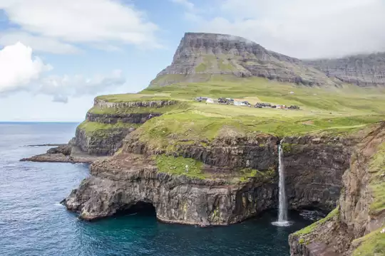
Wind slaps your hood sideways as you plant a boot into soaked turf, fingers stinging on a rock slick with mist, lungs pulling in air that smells like wet wool and ocean salt. A break in the cloud flashes open and suddenly you’re staring down at toy-sized villages and steel-grey fjords slicing the Faroe Islands into shards. This is Slættaratindur, the country’s highest peak, rising above Eysturoy in the central Faroes.

The hike itself is short but punchy: a steep, muddy grind rather than a graceful mountain trail, with sheep tracks, boggy patches, and loose stones doing their best to steal your balance. The payoff is huge, though—on a clear day you get a 360-degree sweep of islands that makes nearby coastal walks like Gjógv feel almost gentle. It’s easy to reach the trailhead by bus plus a short roadside walk, but the route is poorly marked, exposed to weather, and far more serious than its distance suggests.

Discover everything you want to know in the 📖 Faroe Islands Travel Guide.
Best time to go: May - September
Duration: 2 to 4 hours
Distance: 8 kilometers
Total ascent: 880 meters


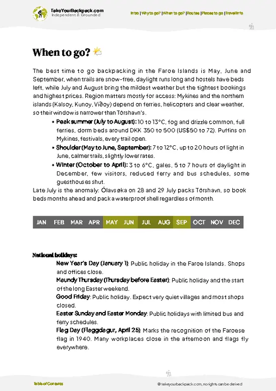
example page 0 from our offline Travel Guide for Faroe Islands
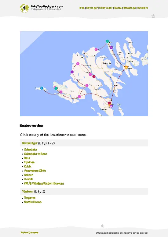
example page 1 from our offline Travel Guide for Faroe Islands
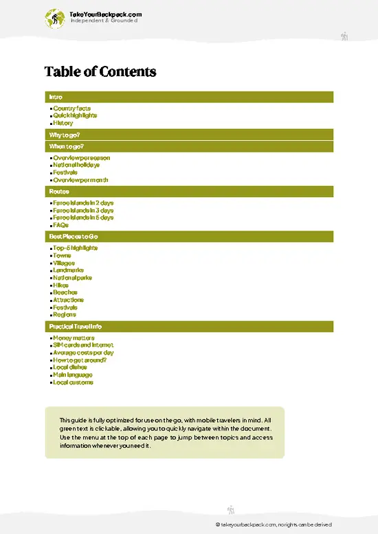
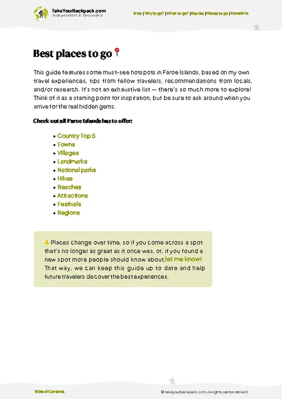
example page 2 from our offline Travel Guide for Faroe Islands
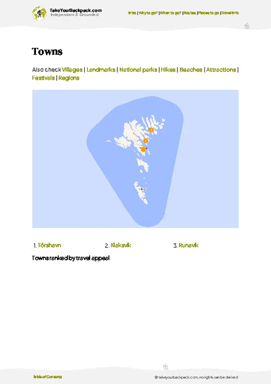
example page 3 from our offline Travel Guide for Faroe Islands
example page 4 from our offline Travel Guide for Faroe Islands
example page 5 from our offline Travel Guide for Faroe Islands
example page 6 from our offline Travel Guide for Faroe Islands
example page 7 from our offline Travel Guide for Faroe Islands
Loading the map 🌍
CLICK TO FILTER
towns
villages
landmarks
national parks
hikes
beaches
attractions
festivals
regions
SHOW COUNTRY’S BESTSHOW ALL

✨ Why go?
Ranked #2 hike in Faroe Islands
What makes this hike worth hiking

The hike to Slættaratindur is a rite of passage for backpackers in the Faroe Islands. Standing at 880 meters, it’s the highest peak, and the scenery-to-effort ratio is nothing short of spectacular. You’ll feel the burn in your legs as you ascend, but every step rewards you with sweeping views of jagged cliffs and deep fjords.

Access is a breeze; public transport can drop you off at the trailhead, making it easy to fit into your itinerary. Plus, it’s a low-cost adventure—no pricey permits or guides needed. You can tailor the hike to your pace, whether you want a quick summit push or a leisurely exploration of the surrounding landscape.

This trek seamlessly integrates into a longer backpacking route, allowing you to hop between islands and soak in the rugged beauty of the Faroe Islands. … read more 👉
The hike to Slættaratindur is a rite of passage for backpackers in the Faroe Islands. Standing at 880 meters, it’s the highest peak, and the scenery-to-effort ratio is nothing short of spectacular. You’ll feel the burn in your legs as you ascend, but every step rewards you with sweeping views of jagged cliffs and deep fjords.

Access is a breeze; public transport can drop you off at the trailhead, making it easy to fit into your itinerary. Plus, it’s a low-cost adventure—no pricey permits or guides needed. You can tailor the hike to your pace, whether you want a quick summit push or a leisurely exploration of the surrounding landscape.

This trek seamlessly integrates into a longer backpacking route, allowing you to hop between islands and soak in the rugged beauty of the Faroe Islands. The moment you reach the summit, the wind whipping through your hair, you’ll understand why this hike is a must-do. Grab that first cold beer at the end; you’ve earned it.

💡 HighlightsPlaces and moments you shouldn't skip

  1. The Summit Panorama — Standing on the highest point in the Faroes gives a supremely clean 360° view: islands, serrated ridges, and wide Atlantic horizons all laid out beneath you. That “top of the country” feeling is rare on compact archipelagos and makes the summit instantly rewarding even for a short, steep day hike.
  2. Deep Fjord Vistas — Parts of the route fall away into dramatic fjords and sheer slopes, so you get those cinematic verticals you don’t see on gentler hills. The contrast between grassy summits and knife-edge drops makes photo angles and viewpoints especially striking.
  3. Sea-of-Clouds Inversions — Weather in the Faroes flips fast; on many mornings the peak sits above low cloud like an island in a white ocean. Hikes timed for early light often reward you with that surreal, above-the-clouds
… read more 👉
  1. The Summit Panorama — Standing on the highest point in the Faroes gives a supremely clean 360° view: islands, serrated ridges, and wide Atlantic horizons all laid out beneath you. That “top of the country” feeling is rare on compact archipelagos and makes the summit instantly rewarding even for a short, steep day hike.
  2. Deep Fjord Vistas — Parts of the route fall away into dramatic fjords and sheer slopes, so you get those cinematic verticals you don’t see on gentler hills. The contrast between grassy summits and knife-edge drops makes photo angles and viewpoints especially striking.
  3. Sea-of-Clouds Inversions — Weather in the Faroes flips fast; on many mornings the peak sits above low cloud like an island in a white ocean. Hikes timed for early light often reward you with that surreal, above-the-clouds atmosphere that other trails rarely produce.
  4. Sheep Paths and Turf-Farm Traces — The route threads through working pastureland, with stone walls, sheep tracks and traces of turf-roofed summer farms—small cultural details that remind you this is lived-in landscape, not a fenced national park. It’s hiking mixed with everyday Faroese life, which is pleasantly different.
  5. Quiet Wildlife Moments — You won’t find big mammals, but expect close encounters with flocks of birds, curious sheep, and plenty of alpine plants and lichens underfoot. The solitude up top—more often than not you’ll have the summit to yourself—turns ordinary wildlife sightings into memorable moments.
Spotted a mistake or missing something? Contact us.

Things to do near Slættaratindur

Ratings based on Tripadvisor reviews. When you book through this link, you support our work at no extra cost to you.

🌤️ When to go?Seasonal considerations and timing

  • Weather: The Faroe Islands are notorious for sudden shifts—expect wind, rain, and fog even in summer. Late June through August offers the most stable weather windows, though you’ll still need waterproof gear and grit.
  • Temperature: Summer highs hover around 10-13°C (50-55°F), rarely climbing higher. It’s brisk but manageable with layers. Winter plunges below freezing, making the climb icy and treacherous.
  • Daylight Hours: Midnight sun stretches the hiking day from late May to mid-July, giving you up to 20 hours of light. This means you can start early, pause for a long lunch, and still catch the summit glow well past dinner.
  • Crowds: Peak season in July and August draws more hikers, especially on weekends. For a quieter ascent, aim for late June or early September when the trails thin out
… read more 👉
  • Weather: The Faroe Islands are notorious for sudden shifts—expect wind, rain, and fog even in summer. Late June through August offers the most stable weather windows, though you’ll still need waterproof gear and grit.
  • Temperature: Summer highs hover around 10-13°C (50-55°F), rarely climbing higher. It’s brisk but manageable with layers. Winter plunges below freezing, making the climb icy and treacherous.
  • Daylight Hours: Midnight sun stretches the hiking day from late May to mid-July, giving you up to 20 hours of light. This means you can start early, pause for a long lunch, and still catch the summit glow well past dinner.
  • Crowds: Peak season in July and August draws more hikers, especially on weekends. For a quieter ascent, aim for late June or early September when the trails thin out but conditions remain decent.
  • Seasonal Activities: Summer aligns with local festivals and sheep grazing, adding cultural texture to your trek. Outside these months, the landscape feels more raw and isolated, which some find more rewarding.
  • Price Fluctuations: Accommodation and flights spike in July and August. Booking early or targeting shoulder months like June or September can save you a solid chunk of cash without sacrificing much on weather.
Pro-tip: Hit the trail in early July—weather’s at its mildest, daylight is endless, and you’ll catch the mountain alive with local life, all before the crowds fully descend.


source: climatestotravel.comJANJanuary: below average for travelingFEBFebruary: below average for travelingMARMarch: below average for travelingAPRApril: fair for travelingMAYMay: good for travelingJUNJune: highly recommended for travelingJULJuly: excellent for travelingAUGAugust: excellent for travelingSEPSeptember: highly recommended for travelingOCTOctober: fair for travelingNOVNovember: below average for travelingDECDecember: below average for traveling

✈️ The backpacker research shortcutFaroe Islands Travel Guide

An offline-friendly backpacking guide with optimized travel routes, ranked highlights, transport advice, and the best areas to stay.
example page 0 from our offline Travel Guide for Faroe Islands
example page 1 from our offline Travel Guide for Faroe Islands
example page 2 from our offline Travel Guide for Faroe Islands
example page 3 from our offline Travel Guide for Faroe Islands
example page 4 from our offline Travel Guide for Faroe Islands
example page 5 from our offline Travel Guide for Faroe Islands
example page 6 from our offline Travel Guide for Faroe Islands
example page 7 from our offline Travel Guide for Faroe Islands
The digital guide (161 pages) contains:
✅ 39 highlights, ranked by travel appeal
✅ Optimized 2, 3 & 5-day travel routes
✅ Cities, national parks, landmarks, beaches
✅ How to get around
✅ Offline-friendly for travel without Wi-Fi
👉 Click to see all 30+ guide features

📅 Plan smarter in minutes, not weeks
✅ Month by month travel advice
✅ Festivals & national holidays
✅ Budget expectations

🗺️ Go to the right places, skip the overrated ones
✅ Honest pros & cons of destinations
✅ Top hikes, parks & viewpoints
✅ Lesser-known places most travelers miss
✅ Clear “worth it vs skip it” guidance

🛏️ Travel smoothly without rookie mistakes
✅ Best areas to stay
✅ Transport systems explained simply
✅ Common scams & safety advice
✅ SIM cards, money & practical tips

🌍 Understand the country, not just visit it
✅ Culture & traditions
✅ 52 Essential phrases & customs
✅ Festivals worth planning around
✅ Traveler-friendly historical context
✅ Insights that make places more meaningful

📱 Built for real travel conditions
✅ Fully downloadable PDF
✅ Works completely offline
✅ Optimized for phone use
✅ Useful in remote areas & buses
✅ Everything in one place
Stop searching, start planning
Get instant access to your full guide. 30‑day money-back guarantee.
+ Add another guide for just

By proceeding you agree to our terms.
Sent to your inbox immediately after payment • 100% Secure Checkout
Best Backpacking Travel Advisor 2025 tourism awardBest Backpacking
Travel Advisor
2025
What others say about Take Your Backpack Guides:
⭐⭐⭐⭐⭐
Fantastic, amazing amount of information!
⭐⭐⭐⭐⭐
My goodness this is amazing, it's what I've been looking for hats off too you!
⭐⭐⭐⭐⭐
I think this is absolutely BRILLIANT
⭐⭐⭐⭐
Very complete and informative. It's still missing places, but I gotta to commend you
⭐⭐⭐⭐⭐
This is truly amazing, thank you, can't wait to explore it with my kids!
⭐⭐⭐⭐⭐
Awesome resource, thank you!
⭐⭐⭐⭐⭐
This is amazing! Can't wait to explore the ones I haven't seen
⭐⭐⭐⭐
I love this! Well done, great idea.
⭐⭐⭐⭐⭐
Thanks for taking the time to make this gem!
⭐⭐⭐⭐⭐
This might be the best website I've ever seen.
⭐⭐⭐⭐⭐
Congratulations, and thank you so much for your work; it's incredibly valuable.
⭐⭐⭐⭐
In all seriousness I think you did a great job pointing out the important spots
⭐⭐⭐⭐⭐
10/10 very good
⭐⭐⭐⭐⭐
As someone who's only just starting to visit regularly this is awesome, thank you.
⭐⭐⭐⭐
Thank you very much! I'm going to visit my dad, it's going to be very useful!
⭐⭐⭐⭐⭐
This is really cool! We'll be travelling for the first time and this definitely come in handy.
⭐⭐⭐⭐⭐
You are now our minister of culture, congratulations 👨‍💼
⭐⭐⭐⭐⭐
Just wanted to tell you that this is a pearl! Going to follow your recommendations.
⭐⭐⭐⭐⭐
This is so cool. I'll definitely be using the resource for my travels soon.
⭐⭐⭐⭐⭐
This is very impressive! Good work.
⭐⭐⭐⭐⭐
This is an amazing and informative site. Very well done!

🛏️ Where to stay?Best areas to stay in Faroe Islands

If you enjoy meeting fellow travelers, consider choosing hostels with high ratings for atmosphere. On the other hand, if you prefer having your own space, a hotel might be a better option.

🥾 Hike detailsTrail overview: what to expect on the hike

Total Distance: The Slættaratindur trail covers about 8 kilometers (5 miles) round trip.

Estimated Duration: Most hikers take around 4 to 6 hours to complete the hike, depending on their pace and how long they linger at the summit.

Difficulty Level: This trail is considered moderate to challenging. While it’s not overly technical, the steep sections and unpredictable weather can make it tough.

Starting Point: The trailhead begins at the village of Eiði.
  • Public Transport: You can catch a bus from Tórshavn to Eiði, which takes about an hour. Check the current bus schedules, as they can vary.

Major … read more 👉
Total Distance: The Slættaratindur trail covers about 8 kilometers (5 miles) round trip.

Estimated Duration: Most hikers take around 4 to 6 hours to complete the hike, depending on their pace and how long they linger at the summit.

Difficulty Level: This trail is considered moderate to challenging. While it’s not overly technical, the steep sections and unpredictable weather can make it tough.

Starting Point: The trailhead begins at the village of Eiði.
  • Public Transport: You can catch a bus from Tórshavn to Eiði, which takes about an hour. Check the current bus schedules, as they can vary.

Major Landmarks: Along the route, you’ll encounter a few notable spots:
  • Slættaratindur Summit: The highest peak in the Faroe Islands at 880 meters (2,890 feet) offers stunning panoramic views.
  • Lake Vatnið: A picturesque lake that you’ll pass, perfect for a quick photo op.
  • Views of the Surrounding Islands: On a clear day, you can see several other islands, including Kunoy and Borðoy.

Type of Terrain and Scenery: The trail features a mix of grassy slopes, rocky paths, and some steep ascents. Expect a bit of mud, especially after rain. The scenery is breathtaking, with rugged cliffs, rolling hills, and expansive views of the ocean.

Typical Vegetation and Wildlife: You’ll find a variety of grasses and wildflowers, especially in summer. Keep an eye out for seabirds like puffins and guillemots, as well as sheep roaming the hills. If you’re lucky, you might spot a golden eagle soaring overhead.
⚠️ Hiking info can sometimes be outdated or inaccurate. Before you hit the trail, check the latest conditions with locals. If you do spot anything that's off, I'd love to hear from you, so I can update it for fellow travelers.

🛡️ SafetySafety Tips and Common Scams in Slættaratindur

The hike up Slættaratindur is a thrilling blend of challenge and reward. Weather can shift in an instant, so pack layers and be ready for everything from sun to sudden rain. The trail is well-marked but steep in sections, demanding focus on your footing. Watch for loose rocks; a misstep can send you sliding.

Altitude isn’t extreme, but the climb can leave you breathless. Take your time, especially on the final ascent. The views from the summit are worth every ounce of effort—sweeping vistas that stretch across the islands.

Wildlife is generally shy, but you might spot sheep or seabirds. Keep your distance and respect their space.

First-timers often underestimate the wind; it can be fierce up top. A sturdy windbreaker is essential. Start early to avoid crowds and enjoy the tranquility … read more 👉
The hike up Slættaratindur is a thrilling blend of challenge and reward. Weather can shift in an instant, so pack layers and be ready for everything from sun to sudden rain. The trail is well-marked but steep in sections, demanding focus on your footing. Watch for loose rocks; a misstep can send you sliding.

Altitude isn’t extreme, but the climb can leave you breathless. Take your time, especially on the final ascent. The views from the summit are worth every ounce of effort—sweeping vistas that stretch across the islands.

Wildlife is generally shy, but you might spot sheep or seabirds. Keep your distance and respect their space.

First-timers often underestimate the wind; it can be fierce up top. A sturdy windbreaker is essential. Start early to avoid crowds and enjoy the tranquility of the summit. Embrace the journey; every step is part of the adventure.

FAQFrequently asked questions about Slættaratindur

The Slættaratindur hike typically takes about 3 to 4 hours round trip, covering approximately 7 kilometers. The time can vary depending on weather conditions and individual pace. Starting early in the day is recommended to allow for a comfortable ascent and descent.
The hike is moderately difficult, suitable for hikers with a reasonable level of fitness. The trail involves steep sections and uneven terrain, with an elevation gain of around 880 meters. Proper hiking shoes and weather-appropriate clothing are essential due to rapidly changing conditions.
No guide or permit is required to hike Slættaratindur. The trail is well-marked and accessible year-round, but hikers should be prepared for sudden weather changes and ensure they have adequate navigation tools and supplies.
⚠️ Things can change over time, so always validate details locally before you go.

Other Faroese hikes near Slættaratindur

Explore more nearby:


💡 Not sure where to go next?
Create a personalized itinerary for Faroe Islands including Slættaratindur and the places that fit your trip.

Generate my itinerary

👉 Discover all hikes

Or checkout all Faroe Islands has to offer (think cities, towns, villages, national parks, hikes, beaches, festivals)
Country photo of Faroe Islands

We 💚 feedbackFinal thoughts on hiking the Slættaratindur

The climb to Slættaratindur is a sweat-soaked thrill, but the view from the top? Pure magic. You’ll feel like you’re on top of the world, with the wind whipping past and the islands sprawling below. The surprise? The wildflowers that peek through the rocks—nature’s little confetti. Just a heads-up: the weather can flip on a dime. Bring layers and a sense of humor. Trust me, that first cold beer at the bottom will taste like victory.

✍️ Help improve this page!
The information on this page is based on in-depth research, insights shared by experienced travelers, and feedback from the local travel community in Faroe Islands. While every effort is made to keep the information accurate and current, conditions can change — so if you spot anything incorrect or outdated, please get in touch.


🙋‍♂️ Give feedback

👋 Meet the founderWho’s Behind Take Your Backpack?

Johan, backpacker and founder of TakeYourBackpackHi, I’m Johan (Netherlands 🇳🇱), the creator of TakeYourBackpack. Over the past 3 decades, I’ve backpacked through 90+ countries across six continents, gaining extensive experience with independent travel, long-term trips, and overland routes.

This site is built on a combination of firsthand travel experience and carefully curated insights from other backpackers. Many guides are based on places I’ve personally visited, while others bring together tips, observations, and practical advice shared by trusted travelers I’ve met along the way.

The goal is to provide realistic, experience-driven guidance — not generic itineraries — so you can explore destinations with better context, clearer expectations, and more confidence.