×

Guatemala🇬🇹 | national parksEl Mirador-Río Azul National ParkLa Danta pyramid, five-day jungle trek, Preclassic ruins, canopy sunrise | things to do and best time to go

Explore Volcán Pacaya National ParkExplore Yaxhá-Nakum-Naranjo National Park

Backpacking in El Mirador-Río Azul
🌟 Highlightnational park ranked #4
By Johan Kruseman 🇳🇱 | Updated October 22, 2026

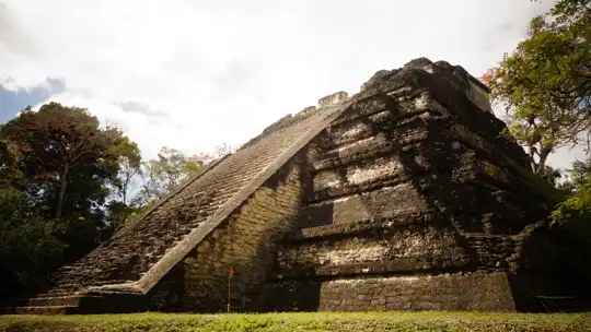
The only way into El Mirador is on foot or by helicopter, and the standard trek is a five-day round trip of roughly 40 km each way from the village of Carmelita. The park lies in the far north of Guatemala, in the Petén jungle near the Mexican border. Trails run through mud, mahogany and chicle-tapper forest, with howler monkeys roaring before dawn and coatis crossing the path. Ticks, mud and heavy packs are part of the deal. The reward is La Danta, one of the largest pyramids by volume anywhere. I expected silence at the summit, but the canopy below was loud with toucans and spider monkeys, a living soundtrack I never saw coming. Crowds are almost nonexistent. Road access is rough and a guide is required. This suits fit, patient hikers who like roughing it. It won’t suit anyone short on time, or who needs showers and clean sheets.

Discover everything you want to know in the 📖 Guatemala Travel Guide.


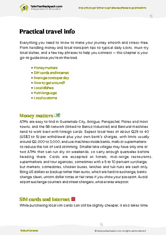
example page 0 from our offline Travel Guide for Guatemala
example page 1 from our offline Travel Guide for Guatemala
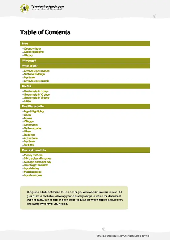
example page 2 from our offline Travel Guide for Guatemala
example page 3 from our offline Travel Guide for Guatemala
example page 4 from our offline Travel Guide for Guatemala
example page 5 from our offline Travel Guide for Guatemala
example page 6 from our offline Travel Guide for Guatemala
example page 7 from our offline Travel Guide for Guatemala
Loading the map 🌍
CLICK TO FILTER
cities
towns
villages
landmarks
national parks
hikes
beaches
attractions
festivals
regions
SHOW COUNTRY’S BESTSHOW ALL

✨ Why go?
Ranked #4 national park in Guatemala
What sets this place apart

El Mirador-Río Azul National Park draws backpackers who want an archaeological site with no ticket booth, no souvenir stalls and no tour buses. The pull is the effort itself: the jungle trek from Carmelita takes about five days round trip, and you arrive at ruins that feel earned. La Danta rises roughly 70 meters, and the Preclassic Maya city around it was far older than Tikal. Camps are simple, with hammocks, mosquito nets and cook crews, which keeps the experience affordable compared with flying in. Independent travel is limited. The park requires you to go with a licensed outfitter, so think of it as a self-chosen expedition rather than a solo wander. Even so, you pick the pace, the length (four to six days) and the side trips. The trek also passes El Tintal and Nakbé on longer routes, … read more 👉
El Mirador-Río Azul National Park draws backpackers who want an archaeological site with no ticket booth, no souvenir stalls and no tour buses. The pull is the effort itself: the jungle trek from Carmelita takes about five days round trip, and you arrive at ruins that feel earned. La Danta rises roughly 70 meters, and the Preclassic Maya city around it was far older than Tikal. Camps are simple, with hammocks, mosquito nets and cook crews, which keeps the experience affordable compared with flying in. Independent travel is limited. The park requires you to go with a licensed outfitter, so think of it as a self-chosen expedition rather than a solo wander. Even so, you pick the pace, the length (four to six days) and the side trips. The trek also passes El Tintal and Nakbé on longer routes, giving real variety. If you want remote, hard-won history over polished sightseeing, this is the place.

💡 HighlightsEssential experiences to have while exploring El Mirador-Río Azul

  1. La Danta Pyramid: The park’s signature sight, a triadic complex about 70 meters tall that ranks among the most massive Maya structures. Climbing at sunrise or sunset gives a view over an unbroken green canopy toward Tikal’s distant temples.
  2. El Tigre Pyramid: Roughly 55 meters high, with a broad platform and a steep stairway. The summit offers another canopy panorama, and the view back toward La Danta is fine.
  3. Central Acropolis: A cluster of palaces and plazas where you can see stucco fragments and the layout of elite residences, with howlers calling overhead.
  4. Jaguar Paw Temple: Famous for its restored stucco masks and carved panels from the Preclassic era, in a spot that rewards the walk.
  5. El Tintal: A major site on the trail, with large unrestored mounds and causeway remains you pass on the way
… read more 👉
  1. La Danta Pyramid: The park’s signature sight, a triadic complex about 70 meters tall that ranks among the most massive Maya structures. Climbing at sunrise or sunset gives a view over an unbroken green canopy toward Tikal’s distant temples.
  2. El Tigre Pyramid: Roughly 55 meters high, with a broad platform and a steep stairway. The summit offers another canopy panorama, and the view back toward La Danta is fine.
  3. Central Acropolis: A cluster of palaces and plazas where you can see stucco fragments and the layout of elite residences, with howlers calling overhead.
  4. Jaguar Paw Temple: Famous for its restored stucco masks and carved panels from the Preclassic era, in a spot that rewards the walk.
  5. El Tintal: A major site on the trail, with large unrestored mounds and causeway remains you pass on the way in.
  6. Nakbé: One of the earliest large Maya settlements in the region, with monumental early architecture and carved masks, usually on longer routes.
  7. Sacbe causeways: Raised white limestone roads once linking cities, still traceable as straight ridges through the forest.
  8. Jungle wildlife: Spider monkeys, ocellated turkeys, toucans and the occasional tapir or jaguar track along the trail and at camps.
El Mirador-Río Azul National Park’s best one-day pairing is La Danta and El Tigre, since the two climbs are a short walk apart and make a great sunrise and sunset combination.
Spotted a mistake or missing something? Contact us.

Things to do around El Mirador-Río Azul National Park

Ratings based on Tripadvisor reviews. When you book through this link, you support our work at no extra cost to you.

🌤️ When to go?Seasonal considerations and timing

The dry months of February to May are the most practical window for the multi-day trek into El Mirador, when trails are firmest and mud is at its minimum.
  • Dry Season (February to May): Days reach 30 to 36°C (86 to 97°F), nights drop to 18 to 22°C (64 to 72°F). Mud is minimal, so the 5 to 6 day round trip to La Danta is at its easiest. Expect the highest tour prices and the most hikers, though groups stay small.
  • Early Wet Season (June to August): Highs of 28 to 33°C (82 to 91°F) with afternoon downpours. Trails turn to deep mud, and some operators cut departures. Prices ease and the jungle is loud and green.
  • Late Wet Season (September to November): The wettest stretch, with flooded sections and frequent cancellations. Few tours run.
  • Cool Months (December to January): Highs of 26 to 30°C (79 to
… read more 👉
The dry months of February to May are the most practical window for the multi-day trek into El Mirador, when trails are firmest and mud is at its minimum.
  • Dry Season (February to May): Days reach 30 to 36°C (86 to 97°F), nights drop to 18 to 22°C (64 to 72°F). Mud is minimal, so the 5 to 6 day round trip to La Danta is at its easiest. Expect the highest tour prices and the most hikers, though groups stay small.
  • Early Wet Season (June to August): Highs of 28 to 33°C (82 to 91°F) with afternoon downpours. Trails turn to deep mud, and some operators cut departures. Prices ease and the jungle is loud and green.
  • Late Wet Season (September to November): The wettest stretch, with flooded sections and frequent cancellations. Few tours run.
  • Cool Months (December to January): Highs of 26 to 30°C (79 to 86°F), nights near 16 to 20°C (61 to 68°F), with patchy drizzle. Daylight lasts about 11 to 12 hours year-round.
Book your trek at least a few weeks ahead for March and April, when departures fill first.


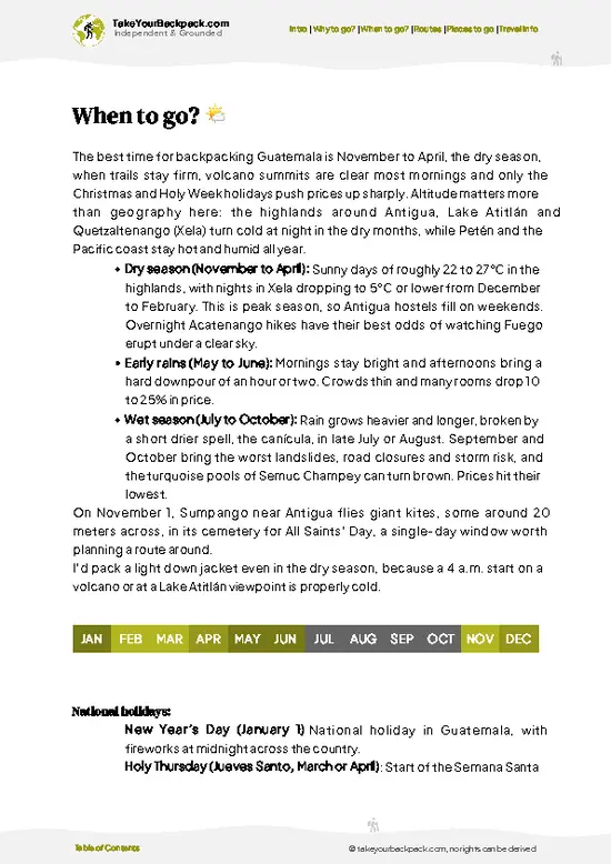
source: climatestotravel.comJANJanuary: excellent for travelingFEBFebruary: excellent for travelingMARMarch: excellent for travelingAPRApril: highly recommended for travelingMAYMay: fair for travelingJUNJune: fair for travelingJULJuly: fair for travelingAUGAugust: fair for travelingSEPSeptember: fair for travelingOCTOctober: fair for travelingNOVNovember: highly recommended for travelingDECDecember: excellent for traveling
guatemala-national-park-el-mirador-rio-azul-national-park
© Google |

✈️ The backpacker research shortcutGuatemala Travel Guide

An offline-friendly backpacking guide with optimized travel routes, ranked highlights, transport advice, and the best areas to stay.
example page 0 from our offline Travel Guide for Guatemala
example page 1 from our offline Travel Guide for Guatemala
example page 2 from our offline Travel Guide for Guatemala
example page 3 from our offline Travel Guide for Guatemala
example page 4 from our offline Travel Guide for Guatemala
example page 5 from our offline Travel Guide for Guatemala
example page 6 from our offline Travel Guide for Guatemala
example page 7 from our offline Travel Guide for Guatemala
The digital guide (272 pages) contains:
✅ 85 highlights, ranked by travel appeal
✅ Optimized 5, 10 & 15-day travel routes
✅ Cities, national parks, landmarks, beaches
✅ How to get around
✅ Offline-friendly for travel without Wi-Fi
👉 Click to see all 30+ guide features

📅 Plan smarter in minutes, not weeks
✅ Month by month travel advice
✅ Festivals & national holidays
✅ Budget expectations

🗺️ Go to the right places, skip the overrated ones
✅ Honest pros & cons of destinations
✅ Top hikes, parks & viewpoints
✅ Lesser-known places most travelers miss
✅ Clear “worth it vs skip it” guidance

🛏️ Travel smoothly without rookie mistakes
✅ Best areas to stay
✅ Transport systems explained simply
✅ Common scams & safety advice
✅ SIM cards, money & practical tips

🌍 Understand the country, not just visit it
✅ Culture & traditions
✅ 52 Essential phrases & customs
✅ Festivals worth planning around
✅ Traveler-friendly historical context
✅ Insights that make places more meaningful

📱 Built for real travel conditions
✅ Fully downloadable PDF
✅ Works completely offline
✅ Optimized for phone use
✅ Useful in remote areas & buses
✅ Everything in one place
Stop searching, start planning
Get instant access to your full guide. 30‑day money-back guarantee.
+ Add another guide for just

By proceeding you agree to our terms.
Sent to your inbox immediately after payment • 100% Secure Checkout
Best Backpacking Travel Advisor 2025 tourism awardBest Backpacking
Travel Advisor
2025
What others say about Take Your Backpack Guides:
⭐⭐⭐⭐⭐
Fantastic, amazing amount of information!
⭐⭐⭐⭐⭐
My goodness this is amazing, it's what I've been looking for hats off too you!
⭐⭐⭐⭐⭐
I think this is absolutely BRILLIANT
⭐⭐⭐⭐
Very complete and informative. It's still missing places, but I gotta to commend you
⭐⭐⭐⭐⭐
This is truly amazing, thank you, can't wait to explore it with my kids!
⭐⭐⭐⭐⭐
Awesome resource, thank you!
⭐⭐⭐⭐⭐
This is amazing! Can't wait to explore the ones I haven't seen
⭐⭐⭐⭐
I love this! Well done, great idea.
⭐⭐⭐⭐⭐
Thanks for taking the time to make this gem!
⭐⭐⭐⭐⭐
This might be the best website I've ever seen.
⭐⭐⭐⭐⭐
Congratulations, and thank you so much for your work; it's incredibly valuable.
⭐⭐⭐⭐
In all seriousness I think you did a great job pointing out the important spots
⭐⭐⭐⭐⭐
10/10 very good
⭐⭐⭐⭐⭐
As someone who's only just starting to visit regularly this is awesome, thank you.
⭐⭐⭐⭐
Thank you very much! I'm going to visit my dad, it's going to be very useful!
⭐⭐⭐⭐⭐
This is really cool! We'll be travelling for the first time and this definitely come in handy.
⭐⭐⭐⭐⭐
You are now our minister of culture, congratulations 👨‍💼
⭐⭐⭐⭐⭐
Just wanted to tell you that this is a pearl! Going to follow your recommendations.
⭐⭐⭐⭐⭐
This is so cool. I'll definitely be using the resource for my travels soon.
⭐⭐⭐⭐⭐
This is very impressive! Good work.
⭐⭐⭐⭐⭐
This is an amazing and informative site. Very well done!

🛏️ Where to stay?How to pick the right area

Flores, on an island in Lake Petén Itzá, is where almost every El Mirador trek starts and ends, and it has the best backpacker beds nearby.
Inside the park, you sleep on tour terms only. Treks stop at basic jungle camps with hammocks and mosquito nets or tents, usually included in the package. Camps at El Mirador itself, La Florida and Tintal have simple shelters, and some have bunk rooms. Bring a sleeping bag liner. Independent camping is not realistic because guides and permits are bundled together.
In Flores, dorm beds run about US$8 to 14 and private rooms US$25 to 50. Hostels near the causeway … read more 👉
Flores, on an island in Lake Petén Itzá, is where almost every El Mirador trek starts and ends, and it has the best backpacker beds nearby.
Inside the park, you sleep on tour terms only. Treks stop at basic jungle camps with hammocks and mosquito nets or tents, usually included in the package. Camps at El Mirador itself, La Florida and Tintal have simple shelters, and some have bunk rooms. Bring a sleeping bag liner. Independent camping is not realistic because guides and permits are bundled together.
In Flores, dorm beds run about US$8 to 14 and private rooms US$25 to 50. Hostels near the causeway and lakeside have rooftop terraces, tour desks and hammock lounges, which makes it easy to compare operators. Santa Elena, across the causeway, is cheaper, louder and closer to the bus terminal. El Remate, about 30 minutes from Flores toward Tikal, has quiet lakeside cabins and suits travelers wanting calm.
Carmelita is the last village on the road in, and the usual trailhead. A few basic guesthouses exist there if your tour starts early. Stay a night in Flores before and after the trek to rest and wash up.

👛 Costs (as of 22 October 2026)Travel costs and budget guide for El Mirador-Río Azul

A typical visit to El Mirador-Río Azul National Park costs around US$76 to 164 per day, because nearly everything is bought as a guided package.
CategoryBudget RangeLocal Reality
Entrance and PermitsUS$0 to 15Usually bundled into tour prices. Separate fees apply if you arrange access yourself.
Guided TrekUS$60 to 90A 5 to 6 day group trek runs about US$350 to 600 in total, covering guide, cook, camp and park fees.
AccommodationUS$8 to 14Jungle camps are included in the tour. Dorms in Flores cost US$8 to 14, and private rooms US$25 to 50.
Local TransportUS$3 to 10Shuttle or pickup from Flores to Carmelita is often included. Public minibuses cost a few dollars.
Food and WaterUS$5 to 15Meals on the trek are included. In Flores, street food and comedores cost US$3 to 8 a meal.
Optional ExtrasUS$0 to
… read more 👉
A typical visit to El Mirador-Río Azul National Park costs around US$76 to 164 per day, because nearly everything is bought as a guided package.
CategoryBudget RangeLocal Reality
Entrance and PermitsUS$0 to 15Usually bundled into tour prices. Separate fees apply if you arrange access yourself.
Guided TrekUS$60 to 90A 5 to 6 day group trek runs about US$350 to 600 in total, covering guide, cook, camp and park fees.
AccommodationUS$8 to 14Jungle camps are included in the tour. Dorms in Flores cost US$8 to 14, and private rooms US$25 to 50.
Local TransportUS$3 to 10Shuttle or pickup from Flores to Carmelita is often included. Public minibuses cost a few dollars.
Food and WaterUS$5 to 15Meals on the trek are included. In Flores, street food and comedores cost US$3 to 8 a meal.
Optional ExtrasUS$0 to 20Helicopter return, mule hire for bags, tips for guides and cooks.
Total Daily BudgetUS$76 to 164Roughly US$100 on a typical group trek in the dry season. Travelers pay in quetzales for extras.


source: inguat.gob.gt
⚠️ Prices can change and everyone travels differently, so take this as a rough guide. Hope it helps you plan your adventure!

🥾 TrailsHiking El Mirador-Río Azul national park: highlights and difficulty

El Mirador-Río Azul National Park is trekked rather than day-hiked, and the standard route starts in Carmelita and runs through dense lowland forest to the ruins. Terrain is flat to gently rolling, but mud, roots and humidity make it demanding.
  • Carmelita to El Mirador: About 40 km each way, 2 to 3 days on foot in each direction. Moderate to hard, mostly forest track, muddy in the wet months. Passes El Tintal and Nakbé on some itineraries.
  • La Danta climb: A short, steep ascent up stone stairs and roots, about 30 to 45 minutes from the camp area. Moderate difficulty, with canopy views at the top.
  • El
… read more 👉
El Mirador-Río Azul National Park is trekked rather than day-hiked, and the standard route starts in Carmelita and runs through dense lowland forest to the ruins. Terrain is flat to gently rolling, but mud, roots and humidity make it demanding.
  • Carmelita to El Mirador: About 40 km each way, 2 to 3 days on foot in each direction. Moderate to hard, mostly forest track, muddy in the wet months. Passes El Tintal and Nakbé on some itineraries.
  • La Danta climb: A short, steep ascent up stone stairs and roots, about 30 to 45 minutes from the camp area. Moderate difficulty, with canopy views at the top.
  • El Tigre and Central Acropolis loop: A half-day circuit of plazas, platforms and pyramids with short, easy to moderate climbs.
  • Jaguar Paw Temple side walk: A 1 to 2 hour round trip from the main camp on a mostly level trail to see the stucco masks.
  • Wildlife: Early mornings are best for howler monkeys, toucans, coatis and ocellated turkeys, and quiet walkers may spot peccaries or even jaguar tracks.
Practical details: most travelers reach Carmelita from Flores by road, with local shuttles or private transfers, then start the trek with a licensed guide. Public transport ends before the trailhead, so arranging a tour in Flores is the practical choice. Helicopter flights exist for those short on time. Crowds are very low, usually only a handful of groups at a time. Entry is organized through tour operators, and fees are typically bundled into the price, with the park’s remote nature meaning no independent ticket office.
⚠️ Hiking info can sometimes be outdated or inaccurate. Before you hit the trail, check the latest conditions with locals. If you do spot anything that's off, I'd love to hear from you, so I can update it for fellow travelers.

🛡️ SafetyStaying Safe: What Travelers Should Know

El Mirador-Río Azul National Park is remote rather than dangerous, and the main risks are heat, mud and being far from help.
The trek runs through dense jungle, with long days of 15 to 25 kilometers on flat, muddy tracks. Dehydration is the most common problem, so carry 3 to 4 liters a day and take electrolytes. In the wet season, boots and gaiters matter because mud can be knee-deep and trails cut up by mule traffic. Keep your pace slow and steady.
Wildlife is abundant: spider and howler monkeys, coatis, ocelots, snakes and the occasional jaguar. Encounters are rare and sightings are mostly sounds. Give animals space, never feed them, and shake out boots each morning.
A licensed guide is required, and you should use one. Trails are unmarked and phone signal is absent. Pack insect repellent, … read more 👉
El Mirador-Río Azul National Park is remote rather than dangerous, and the main risks are heat, mud and being far from help.
The trek runs through dense jungle, with long days of 15 to 25 kilometers on flat, muddy tracks. Dehydration is the most common problem, so carry 3 to 4 liters a day and take electrolytes. In the wet season, boots and gaiters matter because mud can be knee-deep and trails cut up by mule traffic. Keep your pace slow and steady.
Wildlife is abundant: spider and howler monkeys, coatis, ocelots, snakes and the occasional jaguar. Encounters are rare and sightings are mostly sounds. Give animals space, never feed them, and shake out boots each morning.
A licensed guide is required, and you should use one. Trails are unmarked and phone signal is absent. Pack insect repellent, a first-aid kit, blister care and a headlamp. Some looting-prone areas near the border are why armed escorts sometimes accompany groups.

FAQTraveler FAQ

Plan on 5 to 6 days for El Mirador-Río Azul National Park if you hike in and out. The standard round trip from Carmelita covers about 80 kilometers, with a stop at La Danta pyramid. Longer 7 to 9 day routes add Nakbé, Tintal or Río Azul. A helicopter flight from Flores shortens it to a day trip but costs several hundred dollars.
You can reach El Mirador-Río Azul National Park without a car, and in fact most travelers do. Minibuses run from Flores to Carmelita in about 3 to 4 hours on a rough road, and many tour operators include a shared shuttle. From Carmelita you walk or ride mules for the 2 to 3 day approach. Helicopter flights from Flores take roughly 20 minutes.
Yes, El Mirador-Río Azul National Park requires entry fees and an authorized guide, and tour companies normally handle both. Park and conservation fees are typically bundled into trek prices of about US$350 to 600 for 5 to 6 days. Independent entry without a registered guide is not practical. Bring your passport when booking in Flores.
⚠️ Things can change over time, so always validate details locally before you go.

Other Guatemalan national parks near El Mirador-Río Azul

Explore more nearby:


💡 Not sure where to go next?
Create a personalized itinerary for Guatemala including El Mirador-Río Azul and the places that fit your trip.

Generate my itinerary

👉 Discover all national parks

Or checkout all Guatemala has to offer (think cities, towns, villages, national parks, hikes, beaches, festivals)
Country photo of Guatemala

We 💚 feedbackIs it worth it?

El Mirador-Río Azul National Park pairs well with Tikal and Flores on a Petén route, so do the trek first while your legs are fresh, then rest and see Tikal’s polished plazas as a contrast. I would bring waterproof socks, a spare pair of dry sleeping clothes and a good headlamp, since the mud and humidity win every time.

✈️ When did I visit Guatemala?
Guatemala I visited during my half year trip through South and Central America back in 2003

✍️ Help improve this page!
The information on this page is based on my own backpacking experience in Guatemala, supplemented with up-to-date research and feedback from other travelers. Travel details can change, so if you notice anything outdated or incomplete, feel free to let me know.


🙋‍♂️ Give feedback

👋 Meet the founderWho’s Behind Take Your Backpack?

Johan, backpacker and founder of TakeYourBackpackHi, I’m Johan (Netherlands 🇳🇱), the creator of TakeYourBackpack. Over the past 3 decades, I’ve backpacked through 90+ countries across six continents, gaining extensive experience with independent travel, long-term trips, and overland routes.

This site is built on a combination of firsthand travel experience and carefully curated insights from other backpackers. Many guides are based on places I’ve personally visited, while others bring together tips, observations, and practical advice shared by trusted travelers I’ve met along the way.

The goal is to provide realistic, experience-driven guidance — not generic itineraries — so you can explore destinations with better context, clearer expectations, and more confidence.