×

Guatemala🇬🇹 | national parksMontaña ChicabalCrater lagoon, Mam ceremonies, cloud forest, stone staircase | things to do and best time to go

Explore Ixpanpajul Natural ParkExplore Parque Nacional Las Victorias

Backpacking in Montaña Chicabal
👌 Worth visitingnational park ranked #8
By Johan Kruseman 🇳🇱 | Updated October 22, 2026

The lake inside the crater is considered sacred by local Maya Mam communities, and ceremonies still take place on its shore, so visitors are asked to keep quiet and respectful. Montaña Chicabal is a dormant volcano in the western highlands of Guatemala, southeast of the town of San Martín Sacatepéquez (Chile Verde) and a little over an hour from Quetzaltenango. The hike gets you cloud forest, a steep staircase down, and a green lagoon ringed by walls of vegetation. Crowds are thin, but mist often swallows the view and the climb is muddy. I arrived at the rim to dripping ferns, a smell of wet earth and woodsmoke, and a drumming of birds I could not see. Then the fog tore open, and far below sat the lagoon, flat and dark green, with a thin ribbon of incense smoke rising from the shore.

Discover everything you want to know in the 📖 Guatemala Travel Guide.


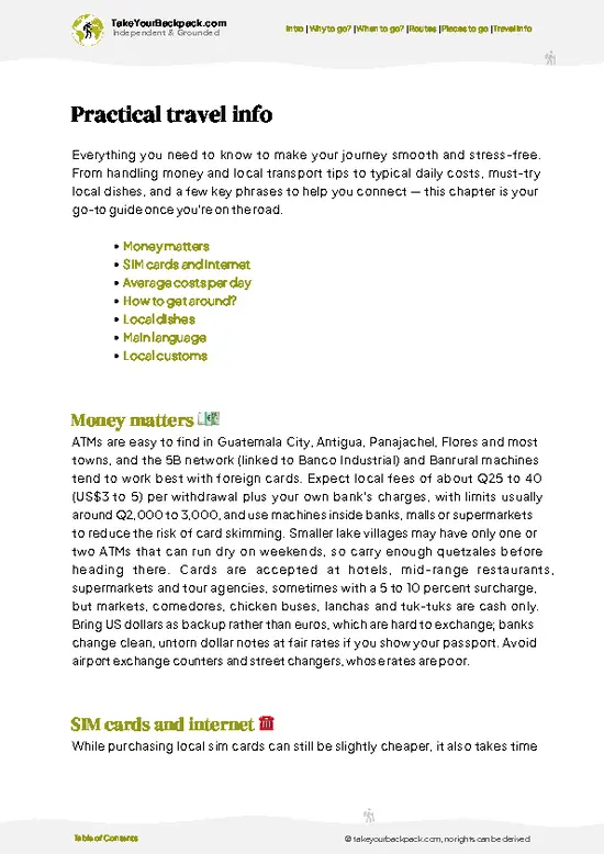
example page 0 from our offline Travel Guide for Guatemala
example page 1 from our offline Travel Guide for Guatemala
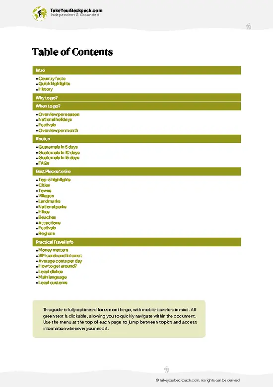
example page 2 from our offline Travel Guide for Guatemala
example page 3 from our offline Travel Guide for Guatemala
example page 4 from our offline Travel Guide for Guatemala
example page 5 from our offline Travel Guide for Guatemala
example page 6 from our offline Travel Guide for Guatemala
example page 7 from our offline Travel Guide for Guatemala
Loading the map 🌍
CLICK TO FILTER
cities
towns
villages
landmarks
national parks
hikes
beaches
attractions
festivals
regions
SHOW COUNTRY’S BESTSHOW ALL

✨ Why go?
Ranked #8 national park in Guatemala
Why visitors keep coming back

Montaña Chicabal suits independent travelers because everything happens on foot, with no tour needed. You reach the trailhead by local transport from Quetzaltenango and walk from there, which keeps the cost low and the pace yours. The big draw is the Laguna de Chicabal, a crater lake at roughly 2,700 meters that is still a living ceremonial site for Mam Maya people. That gives the hike a cultural weight most volcano climbs lack, and you share the shore with families and shamans rather than selfie crowds. The trail is also short enough to pair with a night in nearby highland villages. The stone staircase of about 600 steps down into the crater is a workout on the way back up, but the cloud forest around it, full of moss, bromeliads and birdsong, makes the effort feel quick. If you want a mellow, … read more 👉
Montaña Chicabal suits independent travelers because everything happens on foot, with no tour needed. You reach the trailhead by local transport from Quetzaltenango and walk from there, which keeps the cost low and the pace yours. The big draw is the Laguna de Chicabal, a crater lake at roughly 2,700 meters that is still a living ceremonial site for Mam Maya people. That gives the hike a cultural weight most volcano climbs lack, and you share the shore with families and shamans rather than selfie crowds. The trail is also short enough to pair with a night in nearby highland villages. The stone staircase of about 600 steps down into the crater is a workout on the way back up, but the cloud forest around it, full of moss, bromeliads and birdsong, makes the effort feel quick. If you want a mellow, atmospheric outing rather than a summit scramble, this is the one.

💡 HighlightsWhat this place is best known for

  1. Laguna de Chicabal: The emerald crater lake is the reason anyone comes. It sits inside a steep forested bowl and stays almost still, often wrapped in mist.
  2. The crater rim viewpoint: Reached after the first climb, it gives your first look down at the water when the clouds allow.
  3. The stone staircase: Hundreds of steps drop through dense forest to the shore, slippery with moisture and lined with ferns.
  4. Cloud forest trail: The approach passes oaks, pines, mosses and orchids, with the occasional call of a woodpecker or trogon.
  5. Ceremonial altars on the shore: Small cross-marked sites with flowers, candles and incense where Mam communities pray, especially around the spring season. Observe from a respectful distance.
  6. Local farmland and village approach: The walk begins past maize plots and small homes,
… read more 👉
  1. Laguna de Chicabal: The emerald crater lake is the reason anyone comes. It sits inside a steep forested bowl and stays almost still, often wrapped in mist.
  2. The crater rim viewpoint: Reached after the first climb, it gives your first look down at the water when the clouds allow.
  3. The stone staircase: Hundreds of steps drop through dense forest to the shore, slippery with moisture and lined with ferns.
  4. Cloud forest trail: The approach passes oaks, pines, mosses and orchids, with the occasional call of a woodpecker or trogon.
  5. Ceremonial altars on the shore: Small cross-marked sites with flowers, candles and incense where Mam communities pray, especially around the spring season. Observe from a respectful distance.
  6. Local farmland and village approach: The walk begins past maize plots and small homes, a quiet look at highland farming life.
Start with the lagoon itself early in the day, because clouds usually thicken later and the best views of the water come before they close in.
Spotted a mistake or missing something? Contact us.

Things to do near Montaña Chicabal

Ratings based on Tripadvisor reviews. When you book through this link, you support our work at no extra cost to you.

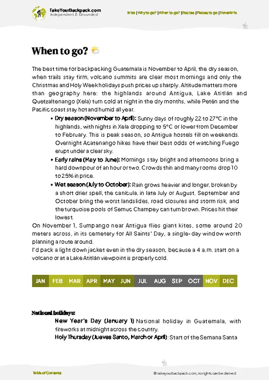
🌤️ When to go?Seasonal considerations and timing

  • Dry Season (November to April): Mornings on the crater rim run 5 to 10°C (41 to 50°F) and can dip near freezing in December and January, while afternoons reach 15 to 20°C (59 to 68°F). Trails are firmest and the lagoon is most often visible. Daylight lasts about 11 to 12 hours.
  • Holy Week and Christmas: Local crowds rise, and Quetzaltenango hostels and shuttles cost a little more.
  • Rainy Season (May to October): Clouds build by midday, and the 600-step staircase and forest paths turn muddy. Temperatures stay 8 to 18°C (46 to 64°F). Prices stay flat and you will often have the rim to yourself.
  • Maya Ceremonies: Visitors from nearby K’iche’ and Mam communities gather at the lagoon in early May, so expect quiet offerings and more people.
Start walking by 7 a.m. so you reach the rim before the cloud rolls in.

source: climatestotravel.comJANJanuary: excellent for travelingFEBFebruary: excellent for travelingMARMarch: excellent for travelingAPRApril: highly recommended for travelingMAYMay: fair for travelingJUNJune: fair for travelingJULJuly: fair for travelingAUGAugust: fair for travelingSEPSeptember: fair for travelingOCTOctober: fair for travelingNOVNovember: highly recommended for travelingDECDecember: highly recommended for traveling
guatemala-national-park-montana-chicabal
© Google |

✈️ The backpacker research shortcutGuatemala Travel Guide

An offline-friendly backpacking guide with optimized travel routes, ranked highlights, transport advice, and the best areas to stay.
example page 0 from our offline Travel Guide for Guatemala
example page 1 from our offline Travel Guide for Guatemala
example page 2 from our offline Travel Guide for Guatemala
example page 3 from our offline Travel Guide for Guatemala
example page 4 from our offline Travel Guide for Guatemala
example page 5 from our offline Travel Guide for Guatemala
example page 6 from our offline Travel Guide for Guatemala
example page 7 from our offline Travel Guide for Guatemala
The digital guide (272 pages) contains:
✅ 85 highlights, ranked by travel appeal
✅ Optimized 5, 10 & 15-day travel routes
✅ Cities, national parks, landmarks, beaches
✅ How to get around
✅ Offline-friendly for travel without Wi-Fi
👉 Click to see all 30+ guide features

📅 Plan smarter in minutes, not weeks
✅ Month by month travel advice
✅ Festivals & national holidays
✅ Budget expectations

🗺️ Go to the right places, skip the overrated ones
✅ Honest pros & cons of destinations
✅ Top hikes, parks & viewpoints
✅ Lesser-known places most travelers miss
✅ Clear “worth it vs skip it” guidance

🛏️ Travel smoothly without rookie mistakes
✅ Best areas to stay
✅ Transport systems explained simply
✅ Common scams & safety advice
✅ SIM cards, money & practical tips

🌍 Understand the country, not just visit it
✅ Culture & traditions
✅ 52 Essential phrases & customs
✅ Festivals worth planning around
✅ Traveler-friendly historical context
✅ Insights that make places more meaningful

📱 Built for real travel conditions
✅ Fully downloadable PDF
✅ Works completely offline
✅ Optimized for phone use
✅ Useful in remote areas & buses
✅ Everything in one place
Stop searching, start planning
Get instant access to your full guide. 30‑day money-back guarantee.
+ Add another guide for just

By proceeding you agree to our terms.
Sent to your inbox immediately after payment • 100% Secure Checkout
Best Backpacking Travel Advisor 2025 tourism awardBest Backpacking
Travel Advisor
2025
What others say about Take Your Backpack Guides:
⭐⭐⭐⭐⭐
Fantastic, amazing amount of information!
⭐⭐⭐⭐⭐
My goodness this is amazing, it's what I've been looking for hats off too you!
⭐⭐⭐⭐⭐
I think this is absolutely BRILLIANT
⭐⭐⭐⭐
Very complete and informative. It's still missing places, but I gotta to commend you
⭐⭐⭐⭐⭐
This is truly amazing, thank you, can't wait to explore it with my kids!
⭐⭐⭐⭐⭐
Awesome resource, thank you!
⭐⭐⭐⭐⭐
This is amazing! Can't wait to explore the ones I haven't seen
⭐⭐⭐⭐
I love this! Well done, great idea.
⭐⭐⭐⭐⭐
Thanks for taking the time to make this gem!
⭐⭐⭐⭐⭐
This might be the best website I've ever seen.
⭐⭐⭐⭐⭐
Congratulations, and thank you so much for your work; it's incredibly valuable.
⭐⭐⭐⭐
In all seriousness I think you did a great job pointing out the important spots
⭐⭐⭐⭐⭐
10/10 very good
⭐⭐⭐⭐⭐
As someone who's only just starting to visit regularly this is awesome, thank you.
⭐⭐⭐⭐
Thank you very much! I'm going to visit my dad, it's going to be very useful!
⭐⭐⭐⭐⭐
This is really cool! We'll be travelling for the first time and this definitely come in handy.
⭐⭐⭐⭐⭐
You are now our minister of culture, congratulations 👨‍💼
⭐⭐⭐⭐⭐
Just wanted to tell you that this is a pearl! Going to follow your recommendations.
⭐⭐⭐⭐⭐
This is so cool. I'll definitely be using the resource for my travels soon.
⭐⭐⭐⭐⭐
This is very impressive! Good work.
⭐⭐⭐⭐⭐
This is an amazing and informative site. Very well done!

🛏️ Where to stay?Choosing the right base

The best base for Montaña Chicabal is Quetzaltenango (Xela), about 1.5 to 2 hours away by chicken bus and minibus via San Juan Ostuncalco and San Martín Sacatepéquez. Xela has the most hostels, from US$7 to 10 for a dorm bed and US$25 to 40 for a private room, plus Spanish schools, cafes and cheap laundry. Nothing official exists inside the crater, and camping at the lagoon is restricted, so do not plan on it. Closer to the trailhead, the village of San Martín Sacatepéquez (Chile Verde) has a few simple guesthouses and homestays, usually US$8 to 15 a night, and it puts you at the gate before the … read more 👉
The best base for Montaña Chicabal is Quetzaltenango (Xela), about 1.5 to 2 hours away by chicken bus and minibus via San Juan Ostuncalco and San Martín Sacatepéquez. Xela has the most hostels, from US$7 to 10 for a dorm bed and US$25 to 40 for a private room, plus Spanish schools, cafes and cheap laundry. Nothing official exists inside the crater, and camping at the lagoon is restricted, so do not plan on it. Closer to the trailhead, the village of San Martín Sacatepéquez (Chile Verde) has a few simple guesthouses and homestays, usually US$8 to 15 a night, and it puts you at the gate before the morning cloud arrives. Locals can point you to a family room if you ask around the plaza. Most backpackers prefer Xela for the food and the onward links to Lake Atitlán, Huehuetenango and Retalhuleu. If you want an early start, sleep in San Martín the night before and walk up in the cold, clear first light.

👛 Costs (as of 22 October 2026)Typical daily expenses

Montaña Chicabal costs a backpacker roughly US$27 a day when you camp at the lagoon and cook or buy simple local food. The volcano sits near San Martín Sacatepéquez (Chicabal), Quetzaltenango department, and most spending happens in Quetzaltenango (Xela) before and after the hike.
CategoryBudget RangeLocal Reality
Entrance feeUS$3 to 6Paid at the community-run gate; foreigners pay more than Guatemalans, and cash in quetzales is expected.
Accommodation (high season)US$8 to 10Xela hostel dorms run US$7 to 12 a night. Basic cabins near the lagoon cost a little more in March and April.
Accommodation (low season)US$5 to 8Dorm beds in Xela soften in the rainy months, and cabins are rarely full midweek.
Local transportUS$3 to 7Chicken buses from Xela to Colomba, then a pickup or minibus to the trailhead,
… read more 👉
Montaña Chicabal costs a backpacker roughly US$27 a day when you camp at the lagoon and cook or buy simple local food. The volcano sits near San Martín Sacatepéquez (Chicabal), Quetzaltenango department, and most spending happens in Quetzaltenango (Xela) before and after the hike.
CategoryBudget RangeLocal Reality
Entrance feeUS$3 to 6Paid at the community-run gate; foreigners pay more than Guatemalans, and cash in quetzales is expected.
Accommodation (high season)US$8 to 10Xela hostel dorms run US$7 to 12 a night. Basic cabins near the lagoon cost a little more in March and April.
Accommodation (low season)US$5 to 8Dorm beds in Xela soften in the rainy months, and cabins are rarely full midweek.
Local transportUS$3 to 7Chicken buses from Xela to Colomba, then a pickup or minibus to the trailhead, cost a few dollars each way. A shuttle or private pickup costs more.
Food and suppliesUS$6 to 10Comedor meals cost US$2 to 4, and market fruit, bread and instant coffee keep trail costs low. Bring snacks, since little is sold at the lagoon.
Guide (optional)US$0 to 10The path is clear and a guide is not required, but a local guide is available at the entrance for a small fee.
Total Daily BudgetUS$27Excludes gear rental and any shuttle from Xela.


source: roughguides.com
⚠️ Prices can change and everyone travels differently, so take this as a rough guide. Hope it helps you plan your adventure!

🥾 TrailsBest hikes in Montaña Chicabal national park

Montaña Chicabal offers one main hike, and it is a good one. The walk is short but steep and wet, and mud is normal.
  • Trail from the entrance to the rim: Starts at the park gate and climbs steadily through farmland then forest for around 5 kilometers, about 1.5 to 2 hours. Moderate difficulty because of the altitude and the grade.
  • Descent to the lagoon: A staircase of roughly 600 steps drops from the rim to the lake shore, around 30 to 40 minutes down. Steps are uneven and slick, so wear boots with grip.
  • Shoreline walk: A flat path leads to the ceremonial areas. Swimming is not allowed, and visitors
… read more 👉
Montaña Chicabal offers one main hike, and it is a good one. The walk is short but steep and wet, and mud is normal.
  • Trail from the entrance to the rim: Starts at the park gate and climbs steadily through farmland then forest for around 5 kilometers, about 1.5 to 2 hours. Moderate difficulty because of the altitude and the grade.
  • Descent to the lagoon: A staircase of roughly 600 steps drops from the rim to the lake shore, around 30 to 40 minutes down. Steps are uneven and slick, so wear boots with grip.
  • Shoreline walk: A flat path leads to the ceremonial areas. Swimming is not allowed, and visitors are asked to avoid loud noise and to leave offerings untouched.
  • Return: The climb back out is the hardest part, about 45 to 60 minutes. Allow 4 to 5 hours in total.
  • Terrain and wildlife: Packed earth, roots, volcanic soil and stairs through cloud forest. Expect birds, insects, and the odd squirrel; larger animals are seldom seen.
Public minibuses and chicken buses run from Quetzaltenango toward San Martín Sacatepéquez, with a walk or a pickup ride to the entrance. Reaching it without a car is entirely doable but takes patience. The park is calm on weekdays and busier on weekends and around local ceremonial dates. There is a modest entrance fee paid at the gate, in quetzales. Bring a rain jacket, warm layers and water.
⚠️ Hiking info can sometimes be outdated or inaccurate. Before you hit the trail, check the latest conditions with locals. If you do spot anything that's off, I'd love to hear from you, so I can update it for fellow travelers.

🛡️ SafetyScams, Hazards, and Annoyances

Montaña Chicabal is a straightforward hike, with the main risks being cold, damp and a long staircase rather than anything dangerous. The crater rim sits around 2,700 meters (8,900 feet), so the climb can leave you breathless if you arrive straight from the coast. Cloud often drops by late morning, soaking the trail and hiding the lagoon, so start early and carry a rain shell and a warm layer. The descent to the lagoon is a steep stair of roughly 600 steps, slick when wet, and trekking poles help your knees. The lagoon is sacred to Maya communities, so do not swim, litter or photograph ceremonies without asking. Wildlife is minimal, mostly birds. Carry your own water and snacks, since nothing is sold on the trail. Go in a group or tell your hostel your plans, and stay on marked paths in fog.

FAQTraveler FAQ

One day is enough for Montaña Chicabal. The hike to the rim and down to the lagoon takes 4 to 6 hours round trip, and most people start before 8 a.m. to beat the cloud. Add a second day only if you want to sleep in San Martín Sacatepéquez and walk at first light, or combine it with Xela’s hot springs and market villages.
Yes, you can reach Montaña Chicabal without a car, though it takes planning. From Quetzaltenango, take a bus to San Martín Sacatepéquez (about 1.5 to 2 hours, US$1 to 2), then a pickup or tuk-tuk to the trailhead for a few dollars. A private shuttle or pickup for the whole trip costs about US$25 to 50, and you can split it with other hikers.
Yes, Montaña Chicabal charges an entrance fee, roughly US$3 to 7 for foreigners, paid in cash at the gate. No separate permit is needed for a day hike. Camping at the lagoon is restricted, and guards may close access during local ceremonies, especially in early May.
⚠️ Things can change over time, so always validate details locally before you go.

Other Guatemalan national parks near Montaña Chicabal

Explore more nearby:


💡 Not sure where to go next?
Create a personalized itinerary for Guatemala including Montaña Chicabal and the places that fit your trip.

Generate my itinerary

👉 Discover all national parks

Or checkout all Guatemala has to offer (think cities, towns, villages, national parks, hikes, beaches, festivals)
Country photo of Guatemala

We 💚 feedbackWhat to keep in mind

Go to Montaña Chicabal on a weekday morning in the drier months, roughly November to April, when the fog lifts early and the lake shows its color. I would carry a rain shell and leave the camera drone behind, since quiet matters here more than any shot.

✈️ When did I visit Guatemala?
Guatemala I visited during my half year trip through South and Central America back in 2003

✍️ Help improve this page!
The information on this page is based on my own backpacking experience in Guatemala, supplemented with up-to-date research and feedback from other travelers. Travel details can change, so if you notice anything outdated or incomplete, feel free to let me know.


🙋‍♂️ Give feedback

👋 Meet the founderWho’s Behind Take Your Backpack?

Johan, backpacker and founder of TakeYourBackpackHi, I’m Johan (Netherlands 🇳🇱), the creator of TakeYourBackpack. Over the past 3 decades, I’ve backpacked through 90+ countries across six continents, gaining extensive experience with independent travel, long-term trips, and overland routes.

This site is built on a combination of firsthand travel experience and carefully curated insights from other backpackers. Many guides are based on places I’ve personally visited, while others bring together tips, observations, and practical advice shared by trusted travelers I’ve met along the way.

The goal is to provide realistic, experience-driven guidance — not generic itineraries — so you can explore destinations with better context, clearer expectations, and more confidence.