×

Honduras🇭🇳 | national parksSierra de Agalta National ParkGualaco guides, Agalta summit ridge, Babilonia pools, orchid slopes | things to do and best time to go

Explore Montaña de Botaderos National ParkExplore El Cusuco National Park

Backpacking in Sierra de Agalta
👌 Worth visitingnational park ranked #10
By Johan Kruseman 🇳🇱 | Updated October 23, 2026

The oropendola calls hit first, liquid gurgles dropping out of the cloud forest canopy while the trail was still mud and roots. That sound is Sierra de Agalta National Park in the department of Olancho, in the east of Honduras, a steep, wet mountain range with real cloud forest and almost no infrastructure. Skip the idea of a quick loop: the good terrain starts after hours of climbing, so hire a local guide in Gualaco, who knows the routes and keeps you off the wrong ridge. Quetzals, tapirs and jaguars live here, though sightings are rare. Crowds are nonexistent. Unlike Pico Bonito, which has lodges and tidy trails, Agalta is raw and self-reliant.

Discover everything you want to know in the 📖 Honduras Travel Guide.


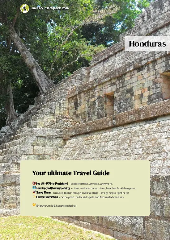
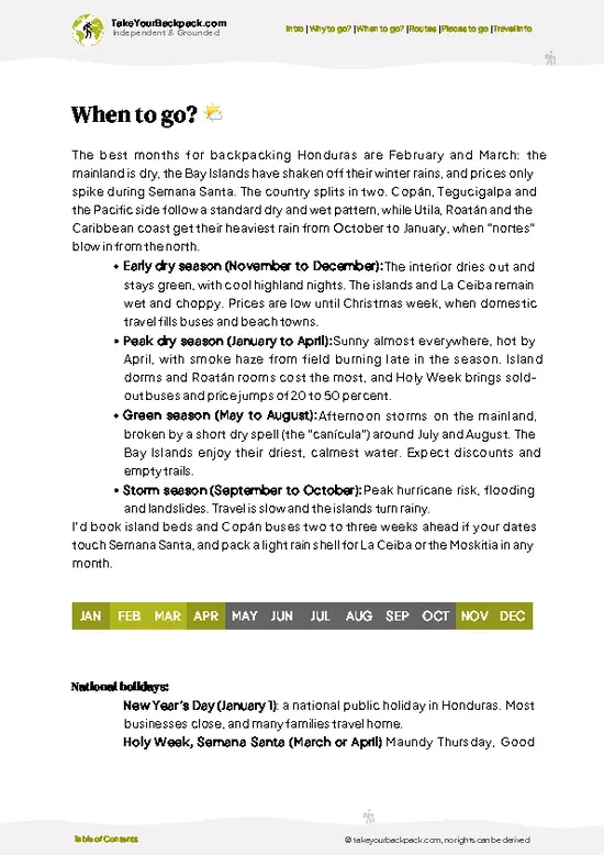
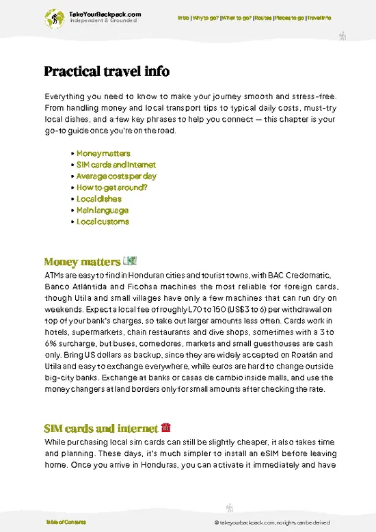
example page 0 from our offline Travel Guide for Honduras
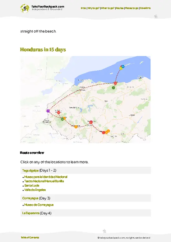
example page 1 from our offline Travel Guide for Honduras
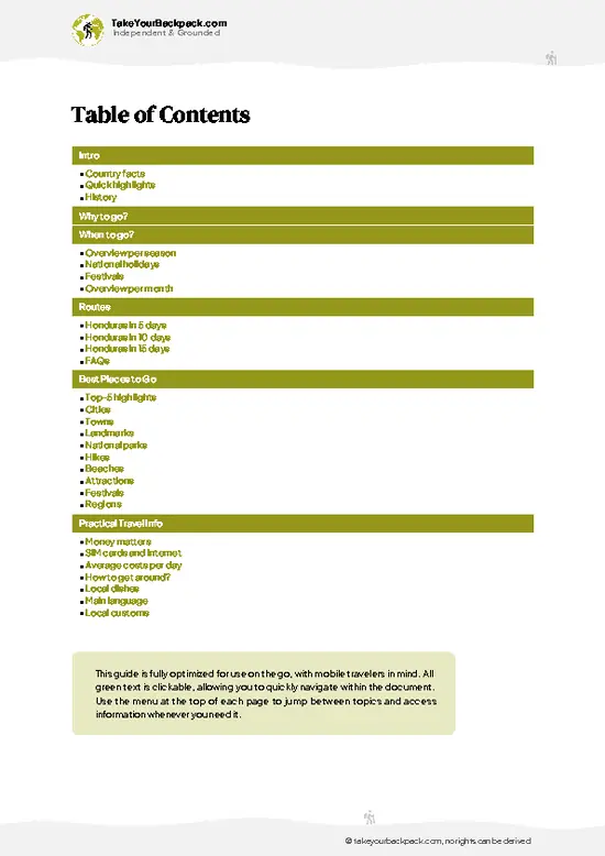
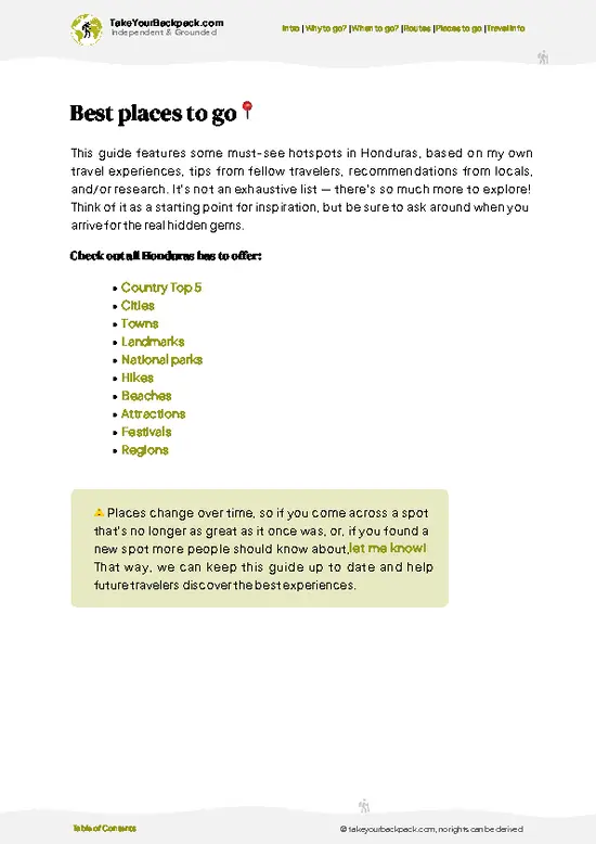
example page 2 from our offline Travel Guide for Honduras
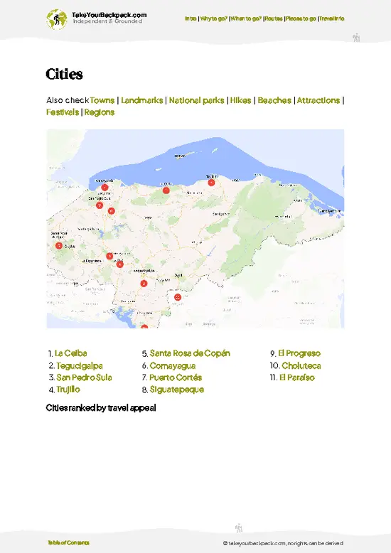
example page 3 from our offline Travel Guide for Honduras
example page 4 from our offline Travel Guide for Honduras
example page 5 from our offline Travel Guide for Honduras
example page 6 from our offline Travel Guide for Honduras
example page 7 from our offline Travel Guide for Honduras
Loading the map 🌍
CLICK TO FILTER
cities
towns
landmarks
national parks
hikes
beaches
attractions
festivals
regions
SHOW COUNTRY’S BESTSHOW ALL

✨ Why go?
Ranked #10 national park in Honduras
What makes this national park worth exploring

Sierra de Agalta National Park suits backpackers who want a mountain with no turnstiles. The main draw is the multi-day climb to the cloud forest summit from Gualaco, where you camp under tree ferns and moss-covered oaks rather than in a developed campground. Local guides and community groups run the logistics, so you pay people who live there and carry less planning stress. The second reason is wildlife density: resplendent quetzals and howler monkeys are realistic targets if you walk quietly at dawn, and the forest is large enough that tracks of tapir and peccary appear on muddy stretches. Tours do not dominate here. Self-guided travelers can organize everything in Gualaco, bring their own food and tent, and move at their own pace, but they should not attempt the high ridge without a local, because trails fork, fade and flood.

💡 HighlightsThe experiences that define the visit

  1. Cloud forest summit ridge: the highest section of the range, draped in moss, bromeliads and tree ferns, with views breaking through when the mist lifts.
  2. Gualaco: the starting point of the La Picucha trek, with guides who know the lower forest well.
  3. Quetzal territory: the upper forest is home to resplendent quetzals, best spotted at first light near fruiting wild avocado trees.
  4. Río Babilonia valley: clear streams with rock pools and small cascades on the lower slopes, good for a cooling stop.
  5. Howler and spider monkey forest: troops move through the mid-elevation canopy, announced by roars long before you see them.
  6. Tapir and jaguar habitat: the dense, remote interior shelters these animals. You are far more likely to see tracks and droppings than the animals themselves.
  7. Orchid and bromeliad zones:
… read more 👉
  1. Cloud forest summit ridge: the highest section of the range, draped in moss, bromeliads and tree ferns, with views breaking through when the mist lifts.
  2. Gualaco: the starting point of the La Picucha trek, with guides who know the lower forest well.
  3. Quetzal territory: the upper forest is home to resplendent quetzals, best spotted at first light near fruiting wild avocado trees.
  4. Río Babilonia valley: clear streams with rock pools and small cascades on the lower slopes, good for a cooling stop.
  5. Howler and spider monkey forest: troops move through the mid-elevation canopy, announced by roars long before you see them.
  6. Tapir and jaguar habitat: the dense, remote interior shelters these animals. You are far more likely to see tracks and droppings than the animals themselves.
  7. Orchid and bromeliad zones: the humid upper slopes hold dense epiphyte growth, with orchids flowering at different elevations through the year.
Sierra de Agalta National Park has no ticketed attractions, but guides for the summit trek should be arranged in Gualaco a day ahead.
Spotted a mistake or missing something? Contact us.

Things to do near Sierra de Agalta National Park

Ratings based on Tripadvisor reviews. When you book through this link, you support our work at no extra cost to you.

🌤️ When to go?Weather, crowds, and seasonal trade-offs

  • Dry Season (March to May): The easiest trail conditions in the park, with valley highs of 28 to 34°C (82 to 93°F) and cool nights near 12°C (54°F) on the ridge. Fires in the lowlands can haze the views by late April.
  • Rainy Season (June to October): Trails turn to mud and river crossings swell. Cloud forest at 1,500 m and above drops to 10 to 14°C (50 to 57°F), and guides are easier to book and sometimes cheaper.
  • Cool Wet Spell (November to February): Northern fronts bring drizzle and fog to the peaks, yet the forest is lush and bird activity is high. Days are shorter, around 11 hours of light.
  • Holidays: Semana Santa and Christmas fill transport and lodging in Catacamas and Gualaco, and prices edge up.
Book your guide a week ahead for March and April, and expect to hike in wet gear any other month.

source: climatestotravel.comJANJanuary: excellent for travelingFEBFebruary: excellent for travelingMARMarch: excellent for travelingAPRApril: highly recommended for travelingMAYMay: fair for travelingJUNJune: fair for travelingJULJuly: fair for travelingAUGAugust: fair for travelingSEPSeptember: fair for travelingOCTOctober: fair for travelingNOVNovember: highly recommended for travelingDECDecember: excellent for traveling
when-to-go

✈️ The backpacker research shortcutHonduras Travel Guide

An offline-friendly backpacking guide with optimized travel routes, ranked highlights, transport advice, and the best areas to stay.
example page 0 from our offline Travel Guide for Honduras
example page 1 from our offline Travel Guide for Honduras
example page 2 from our offline Travel Guide for Honduras
example page 3 from our offline Travel Guide for Honduras
example page 4 from our offline Travel Guide for Honduras
example page 5 from our offline Travel Guide for Honduras
example page 6 from our offline Travel Guide for Honduras
example page 7 from our offline Travel Guide for Honduras
The digital guide (255 pages) contains:
✅ 70 highlights, ranked by travel appeal
✅ Optimized 5, 10 & 15-day travel routes
✅ Cities, national parks, landmarks, beaches
✅ How to get around
✅ Offline-friendly for travel without Wi-Fi
👉 Click to see all 30+ guide features

📅 Plan smarter in minutes, not weeks
✅ Month by month travel advice
✅ Festivals & national holidays
✅ Budget expectations

🗺️ Go to the right places, skip the overrated ones
✅ Honest pros & cons of destinations
✅ Top hikes, parks & viewpoints
✅ Lesser-known places most travelers miss
✅ Clear “worth it vs skip it” guidance

🛏️ Travel smoothly without rookie mistakes
✅ Best areas to stay
✅ Transport systems explained simply
✅ Common scams & safety advice
✅ SIM cards, money & practical tips

🌍 Understand the country, not just visit it
✅ Culture & traditions
✅ 52 Essential phrases & customs
✅ Festivals worth planning around
✅ Traveler-friendly historical context
✅ Insights that make places more meaningful

📱 Built for real travel conditions
✅ Fully downloadable PDF
✅ Works completely offline
✅ Optimized for phone use
✅ Useful in remote areas & buses
✅ Everything in one place
Stop searching, start planning
Get instant access to your full guide. 30‑day money-back guarantee.
+ Add another guide for just

By proceeding you agree to our terms.
Sent to your inbox immediately after payment • 100% Secure Checkout
Best Backpacking Travel Advisor 2025 tourism awardBest Backpacking
Travel Advisor
2025
What others say about Take Your Backpack Guides:
⭐⭐⭐⭐⭐
Fantastic, amazing amount of information!
⭐⭐⭐⭐⭐
My goodness this is amazing, it's what I've been looking for hats off too you!
⭐⭐⭐⭐⭐
I think this is absolutely BRILLIANT
⭐⭐⭐⭐
Very complete and informative. It's still missing places, but I gotta to commend you
⭐⭐⭐⭐⭐
This is truly amazing, thank you, can't wait to explore it with my kids!
⭐⭐⭐⭐⭐
Awesome resource, thank you!
⭐⭐⭐⭐⭐
This is amazing! Can't wait to explore the ones I haven't seen
⭐⭐⭐⭐
I love this! Well done, great idea.
⭐⭐⭐⭐⭐
Thanks for taking the time to make this gem!
⭐⭐⭐⭐⭐
This might be the best website I've ever seen.
⭐⭐⭐⭐⭐
Congratulations, and thank you so much for your work; it's incredibly valuable.
⭐⭐⭐⭐
In all seriousness I think you did a great job pointing out the important spots
⭐⭐⭐⭐⭐
10/10 very good
⭐⭐⭐⭐⭐
As someone who's only just starting to visit regularly this is awesome, thank you.
⭐⭐⭐⭐
Thank you very much! I'm going to visit my dad, it's going to be very useful!
⭐⭐⭐⭐⭐
This is really cool! We'll be travelling for the first time and this definitely come in handy.
⭐⭐⭐⭐⭐
You are now our minister of culture, congratulations 👨‍💼
⭐⭐⭐⭐⭐
Just wanted to tell you that this is a pearl! Going to follow your recommendations.
⭐⭐⭐⭐⭐
This is so cool. I'll definitely be using the resource for my travels soon.
⭐⭐⭐⭐⭐
This is very impressive! Good work.
⭐⭐⭐⭐⭐
This is an amazing and informative site. Very well done!

🛏️ Where to stay?How to pick the right area

Catacamas is the best base for most backpackers, with several simple hotels and hostels at roughly US$10 to 25 a night, plus restaurants, ATMs and buses to Tegucigalpa and Juticalpa. It sits on the southwest edge of the park and has the most tour operators for guided treks to La Picucha and the cloud forest summits.

Inside the park, lodging is basic. Expect rustic cabins or shared shelters in Gualaco’s mountain villages, and camping at trail sites with a guide. Bring a sleeping bag, since nights above 1,500 m turn cold and damp.

Gualaco, on the north side, offers a handful of guesthouses and … read more 👉
Catacamas is the best base for most backpackers, with several simple hotels and hostels at roughly US$10 to 25 a night, plus restaurants, ATMs and buses to Tegucigalpa and Juticalpa. It sits on the southwest edge of the park and has the most tour operators for guided treks to La Picucha and the cloud forest summits.

Inside the park, lodging is basic. Expect rustic cabins or shared shelters in Gualaco’s mountain villages, and camping at trail sites with a guide. Bring a sleeping bag, since nights above 1,500 m turn cold and damp.

Gualaco, on the north side, offers a handful of guesthouses and is the usual start of the La Picucha trek. Dulce Nombre de Culmí is another small gateway with a few budget rooms. Booking ahead is rarely needed outside Semana Santa, but arrive before dark since services thin out quickly.

👛 Costs (as of 23 October 2026)Money, prices, and spending tips

A realistic budget for Sierra de Agalta National Park is about US$41 to 90 per day, driven mostly by guide fees and transport to the trailheads.
CategoryBudget RangeLocal Reality
Entrance and PermitUS$0 to 5Fees are small and often collected through community or guide arrangements, paid in lempiras.
GuideUS$20 to 35A local guide is the norm for overnight routes, with porters costing extra.
AccommodationUS$10 to 25Budget hotels in Catacamas or Gualaco; basic cabins or camping near trails cost less.
Local TransportUS$3 to 10Buses and pickup trucks (rapiditos) run to villages near the trailheads, and schedules thin out by afternoon.
Food and SuppliesUS$8 to 15Cheap comedores serve set meals; stock up on trail food in town as the mountain has no shops.
Total Daily BudgetUS$41 to 90Per person, per day, in high season.
⚠️ Prices can change and everyone travels differently, so take this as a rough guide. Hope it helps you plan your adventure!

🥾 TrailsWhere to hike in Sierra de Agalta: trails for every level

Sierra de Agalta National Park offers rugged, lightly marked hiking where local guides matter more than signage. Most routes start from Gualaco and climb through farmland, then pine, then humid broadleaf and cloud forest.
  • Summit trek: a demanding three to five day round trip climbing steeply to the cloud forest ridge, with overnight camping. Expect mud, roots and long uphill sections. Fit hikers only.
  • Lower forest day walks: half-day to full-day loops from the village through coffee farms and secondary forest, easy to moderate, good for birds and monkeys.
  • River walks: short, flat to moderate routes
… read more 👉
Sierra de Agalta National Park offers rugged, lightly marked hiking where local guides matter more than signage. Most routes start from Gualaco and climb through farmland, then pine, then humid broadleaf and cloud forest.
  • Summit trek: a demanding three to five day round trip climbing steeply to the cloud forest ridge, with overnight camping. Expect mud, roots and long uphill sections. Fit hikers only.
  • Lower forest day walks: half-day to full-day loops from the village through coffee farms and secondary forest, easy to moderate, good for birds and monkeys.
  • River walks: short, flat to moderate routes along streams with swimming spots, suitable for a relaxed morning.
  • Terrain: steep slopes, slippery clay, stream crossings and frequent fog above the mid-elevation. Waterproof gear is essential.
  • Wildlife: quetzals, toucans, howler monkeys, and signs of tapir and peccary. Jaguars exist but are rarely seen.
Getting to Sierra de Agalta National Park takes effort. Buses reach the Olancho towns near the range, and from there you take local transport to Gualaco. Services are basic, so carry cash in lempiras and buy supplies before heading up. The park is almost empty of visitors, and you may share the trail with no one. A guide is strongly recommended for any overnight route, and community guides collect fees directly.
⚠️ Hiking info can sometimes be outdated or inaccurate. Before you hit the trail, check the latest conditions with locals. If you do spot anything that's off, I'd love to hear from you, so I can update it for fellow travelers.

🛡️ SafetyStaying Safe: What Travelers Should Know

Sierra de Agalta is a remote, rugged park where the main risks are mud, fog and getting lost, so hiring a local guide is the sensible default. Trails to the cloud forest climb steeply, with slick roots and loose clay, and markings are sparse. Waterproof boots, a rain jacket and a dry layer for camp matter more than any other gear, since temperatures fall sharply above 1,500 m.

Rivers can rise quickly after rain, so cross early in the day and wait if the water is brown and fast. Carry more water treatment and food than you think you need, as multi-day routes have no shops.

Wildlife is mostly quiet. Watch your step for snakes, give any peccaries or big cats plenty of space, and store food securely at night. Check with the guide or community office on local conditions before you set off.

FAQFrequently asked questions about Sierra de Agalta

Plan on 2 to 4 days for Sierra de Agalta National Park. A fast overnight reaches the lower cloud forest, while the climb to La Picucha and back usually takes 3 to 4 days with a guide. Add a day for travel to Catacamas or Gualaco.
Yes, Sierra de Agalta National Park can be reached without a car, though not quickly. Buses run from Tegucigalpa to Catacamas in roughly 4 to 5 hours, and pickups or local buses continue to Gualaco near the trailhead. Rental vehicles are not needed, but you will want a guide for the trails themselves.
Sierra de Agalta National Park charges only a small fee, usually under US$5, often arranged through a local guide or community office. There is no complex permit process for most routes, but a guide costing about US$20 to 35 a day is strongly advised for overnight treks. Bring cash in lempiras since no card payments exist on the mountain.
⚠️ Things can change over time, so always validate details locally before you go.

Other Honduran national parks near Sierra de Agalta

Explore more nearby:


💡 Not sure where to go next?
Create a personalized itinerary for Honduras including Sierra de Agalta and the places that fit your trip.

Generate my itinerary

👉 Discover all national parks

Or checkout all Honduras has to offer (think cities, towns, villages, national parks, hikes, beaches, festivals)
Country photo of Honduras

We 💚 feedbackParting advice and final tips

Sierra de Agalta National Park rewards people who talk to the village before the trail. Many visitors overlook that guides and community members decide which routes are passable after rain, so I would spend an evening in Gualaco asking, then pack a real rain shell and dry socks for camp.

✈️ When did I visit Honduras?
Honduras I visited during my half year trip through South and Central America back in 2003

✍️ Help improve this page!
The information on this page is based on my own backpacking experience in Honduras, supplemented with up-to-date research and feedback from other travelers. Travel details can change, so if you notice anything outdated or incomplete, feel free to let me know.


🙋‍♂️ Give feedback

👋 Meet the founderWho’s Behind Take Your Backpack?

Johan, backpacker and founder of TakeYourBackpackHi, I’m Johan (Netherlands 🇳🇱), the creator of TakeYourBackpack. Over the past 3 decades, I’ve backpacked through 90+ countries across six continents, gaining extensive experience with independent travel, long-term trips, and overland routes.

This site is built on a combination of firsthand travel experience and carefully curated insights from other backpackers. Many guides are based on places I’ve personally visited, while others bring together tips, observations, and practical advice shared by trusted travelers I’ve met along the way.

The goal is to provide realistic, experience-driven guidance — not generic itineraries — so you can explore destinations with better context, clearer expectations, and more confidence.