×

Liechtenstein🇱🇮 | hikesFürstensteigCabled limestone ledge, Gaflei trailhead, Drei Schwestern views, sheer drops | things to do and best time to go

Explore Vaduz Wine FestivalExplore Drei-Schwestern-Steig

Backpacking in Fürstensteig
🏆 Top pickhike ranked #1
By Johan Kruseman 🇳🇱 | Updated November 6, 2026

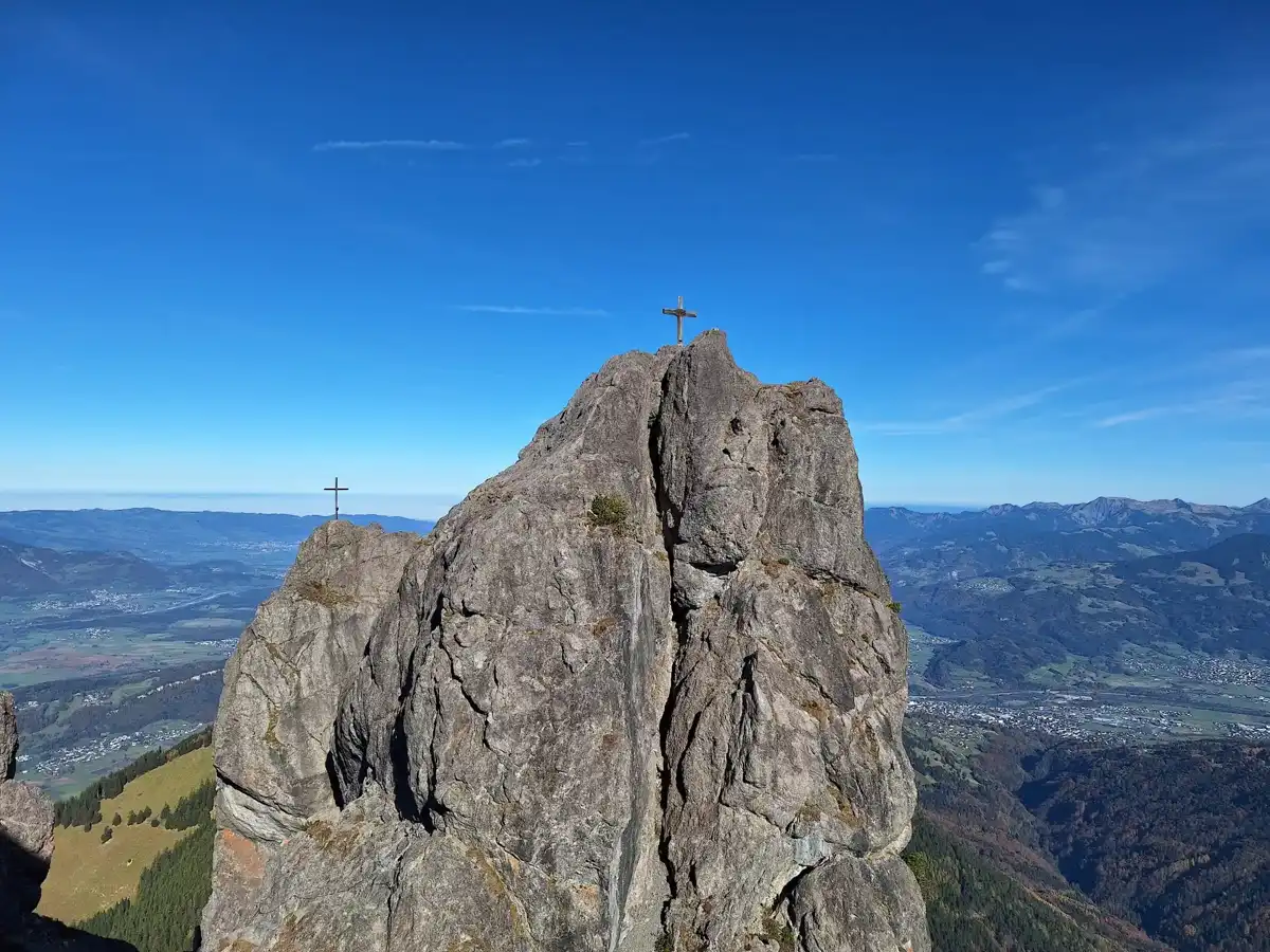
Fürstensteig is a ledge path cut into the cliff faces above the Rhine valley, with a steel cable on the exposed stretches and a sheer drop beside your boots. It sits in the Rätikon above Triesenberg in the south of Liechtenstein, and the trailhead is the hamlet of Gaflei. The view is the draw: the valley floor, the Swiss peaks across the river and the jagged Drei Schwestern. The route is a half-day outing with a few hundred meters of climbing, and it is rated demanding because of the exposure, so it is no stroll. Fog or wet rock ruins it, and the ledge is narrow enough that you wait for oncoming hikers at the wider spots. Getting to the start works by public bus from Vaduz toward Triesenberg, though the last stretch up to Gaflei is thinner, so check the timetable the evening before. For a first day, take a morning bus, eat a proper breakfast in Triesenberg, walk the ledge with a clear sky, and finish with coffee at the Gaflei terrace.

Part of Backpacking in Liechtenstein: all 25 places on one map, with routes and the best time to go.
Discover everything you want to know in the 📖 Liechtenstein Travel Guide.
Best time to go: May - October
Duration: 4 hours
Distance: 9 kilometers
Total ascent: 600 meters
Loading the map 🌍
CLICK TO FILTER
towns
villages
landmarks
hikes
attractions
festivals
regions
SHOW COUNTRY’S BESTSHOW ALL

✨ Why go?
Ranked #1 hike in Liechtenstein
The unique appeal for travelers

Fürstensteig gives you a serious alpine ledge walk in a country you can cross in a morning. The cable-secured rock ledge was cut into the cliffs for Prince Johann II, so you are walking a piece of royal-era engineering. It has real exposure without needing a rope or technical gear, which is rare so close to a European capital. The scenery per hour is high. Within a short stretch you get the Rhine valley laid out far below, the Drei Schwestern ridge staring back at you and, on clear days, the Swiss mountains beyond the river. Because the route is short and flexible, it slots into a longer Alpine trip as a single half-day, or you can stretch it into a full day by linking neighboring paths and huts. Liechtenstein is small enough that the trail pairs easily with a night in Vaduz or Triesenberg … read more 👉
Fürstensteig gives you a serious alpine ledge walk in a country you can cross in a morning. The cable-secured rock ledge was cut into the cliffs for Prince Johann II, so you are walking a piece of royal-era engineering. It has real exposure without needing a rope or technical gear, which is rare so close to a European capital. The scenery per hour is high. Within a short stretch you get the Rhine valley laid out far below, the Drei Schwestern ridge staring back at you and, on clear days, the Swiss mountains beyond the river. Because the route is short and flexible, it slots into a longer Alpine trip as a single half-day, or you can stretch it into a full day by linking neighboring paths and huts. Liechtenstein is small enough that the trail pairs easily with a night in Vaduz or Triesenberg before you move on to Switzerland or Austria by bus or train. If you have a good-weather window, this is the stretch to spend it on.

💡 HighlightsKey sights and experiences for travelers

  1. The Fürstensteig ledge: The path itself, blasted into near-vertical limestone with cables and short stepped sections. The drop is real, and so is the view down to the Rhine valley.
  2. Gaflei: The trailhead hamlet sits on a sunny terrace of meadows. It has a small inn and a lookout over Vaduz, and it makes a good place to check the sky before you commit to the ledge.
  3. Drei Schwestern: The three-peaked ridge that dominates the skyline from the path. Its pale, serrated rock catches the afternoon sun and gives the walk a focal point.
  4. Vaduz and Rhine valley panorama: From the more open sections you can pick out the castle above the capital, the river and the Swiss slopes beyond. Early in the day the haze is thinnest.
  5. Alpine meadows and woods around Gaflei: Before and after the ledge, the trail crosses
… read more 👉
  1. The Fürstensteig ledge: The path itself, blasted into near-vertical limestone with cables and short stepped sections. The drop is real, and so is the view down to the Rhine valley.
  2. Gaflei: The trailhead hamlet sits on a sunny terrace of meadows. It has a small inn and a lookout over Vaduz, and it makes a good place to check the sky before you commit to the ledge.
  3. Drei Schwestern: The three-peaked ridge that dominates the skyline from the path. Its pale, serrated rock catches the afternoon sun and gives the walk a focal point.
  4. Vaduz and Rhine valley panorama: From the more open sections you can pick out the castle above the capital, the river and the Swiss slopes beyond. Early in the day the haze is thinnest.
  5. Alpine meadows and woods around Gaflei: Before and after the ledge, the trail crosses spruce forest and flower-filled pasture where cowbells carry across the slope. It is a gentle contrast to the rock section.
Fürstensteig itself is the best choice for a first visit, so start with the ledge on a dry morning and treat the rest as a bonus.
Spotted a mistake or missing something? Contact us.

Things to do around Fürstensteig

Ratings based on Tripadvisor reviews. When you book through this link, you support our work at no extra cost to you.

🌤️ When to go?Weather, crowds, and seasonal trade-offs

  • Summer (July to August): The cables and ledge are reliably snow-free, with valley highs of 22 to 27°C (72 to 81°F) and cooler, breezier conditions on the ridge. Days run about 15 hours, but weekends bring queues at the cabled sections and full parking near the trailhead.
  • Early Autumn (September to mid-October): Crisp mornings of 5 to 10°C (41 to 50°F) and afternoons of 12 to 18°C (54 to 64°F) make for steady walking with clear air. Crowds thin, and lodging prices in the region ease slightly after the August peak.
  • Late Spring (May to June): Wildflowers are out, but north-facing gullies can hold old snow and the ledge may be damp or slippery. Highs of 14 to 20°C (57 to 68°F) feel pleasant, and rain showers are frequent.
  • Winter (November to April): Snow and ice cover the ledge and cables, and days
… read more 👉
  • Summer (July to August): The cables and ledge are reliably snow-free, with valley highs of 22 to 27°C (72 to 81°F) and cooler, breezier conditions on the ridge. Days run about 15 hours, but weekends bring queues at the cabled sections and full parking near the trailhead.
  • Early Autumn (September to mid-October): Crisp mornings of 5 to 10°C (41 to 50°F) and afternoons of 12 to 18°C (54 to 64°F) make for steady walking with clear air. Crowds thin, and lodging prices in the region ease slightly after the August peak.
  • Late Spring (May to June): Wildflowers are out, but north-facing gullies can hold old snow and the ledge may be damp or slippery. Highs of 14 to 20°C (57 to 68°F) feel pleasant, and rain showers are frequent.
  • Winter (November to April): Snow and ice cover the ledge and cables, and days shorten to roughly 8 to 9 hours. Temperatures hover from -5 to 5°C (23 to 41°F). This route is for experienced mountaineers only, and no seasonal price premium applies.
Aim for September on a weekday, when the route is dry, quiet and lit by long, clear light.


source: climatestotravel.comJANJanuary: below average for travelingFEBFebruary: below average for travelingMARMarch: fair for travelingAPRApril: fair for travelingMAYMay: highly recommended for travelingJUNJune: excellent for travelingJULJuly: excellent for travelingAUGAugust: excellent for travelingSEPSeptember: highly recommended for travelingOCTOctober: good for travelingNOVNovember: fair for travelingDECDecember: below average for traveling
liechtenstein-hike-furstensteig
© Google | Daniel Kuster

✈️ The backpacker research shortcutLiechtenstein Travel Guide

What the free pages can't give you: ready-made routes, every place ranked, and it works offline. All in 1 guide.
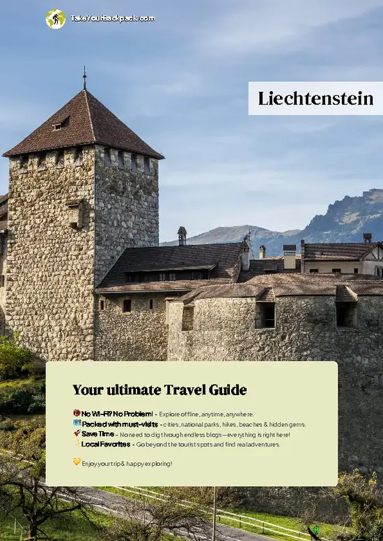
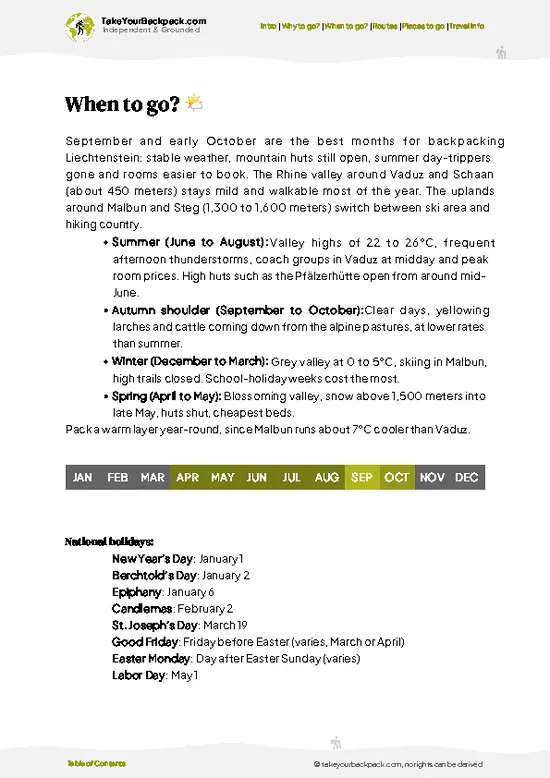
example page 0 from our offline Travel Guide for Liechtenstein
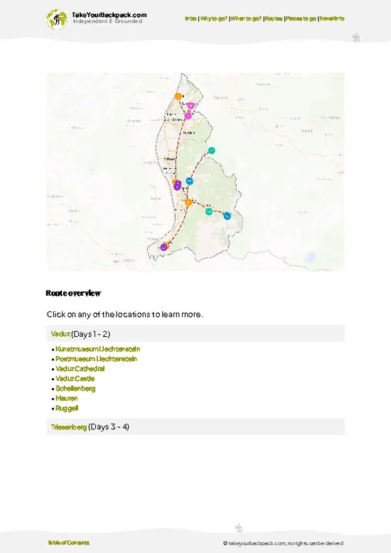
example page 1 from our offline Travel Guide for Liechtenstein
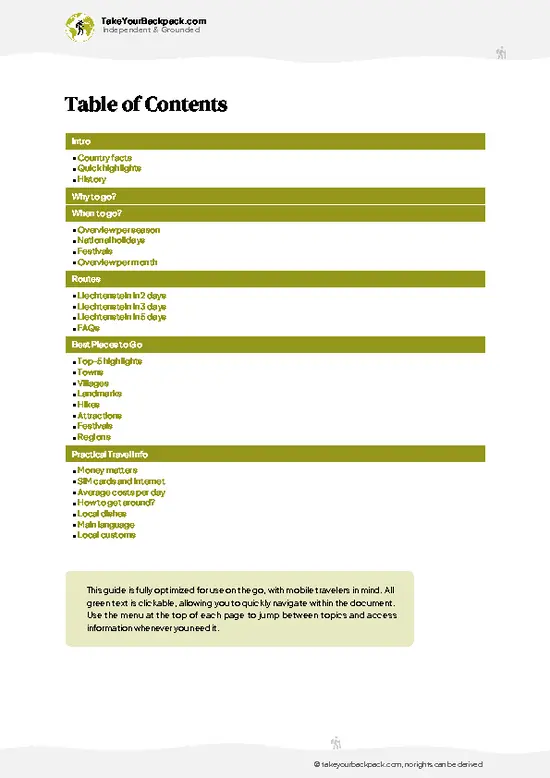
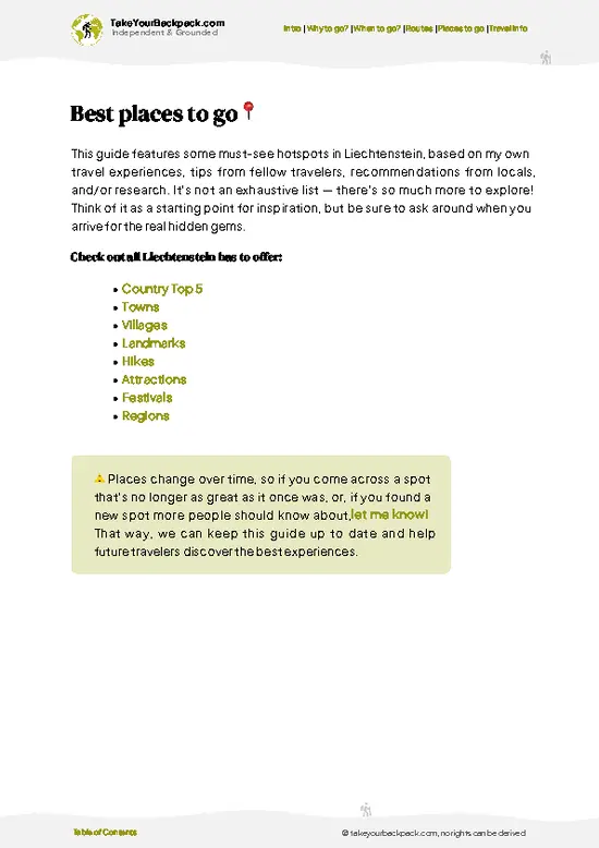
example page 2 from our offline Travel Guide for Liechtenstein
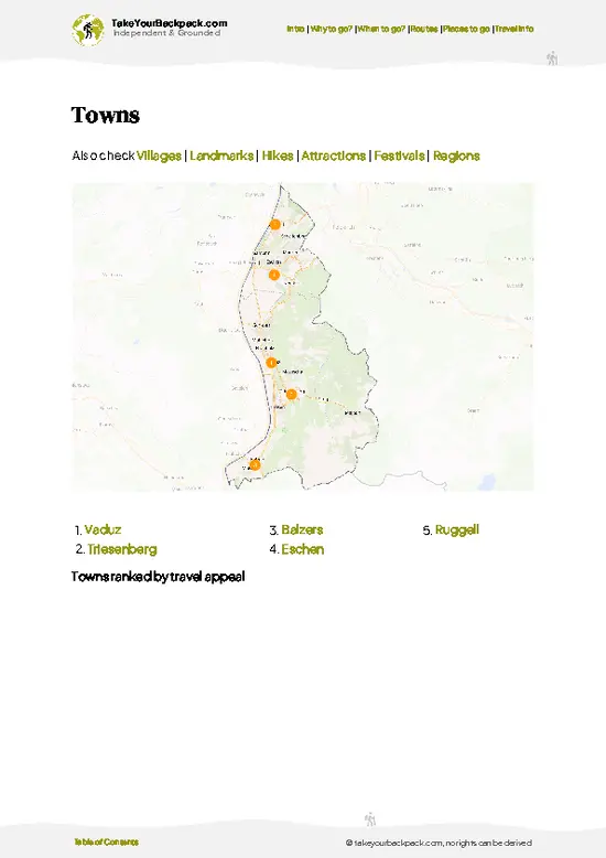
example page 3 from our offline Travel Guide for Liechtenstein
example page 4 from our offline Travel Guide for Liechtenstein
example page 5 from our offline Travel Guide for Liechtenstein
example page 6 from our offline Travel Guide for Liechtenstein
example page 7 from our offline Travel Guide for Liechtenstein
The digital guide (106 pages) contains:-page digital guide:
✅ Ready-made 2, 3 & 5-day routes
✅ All 25 places ranked, so you skip the overrated ones
✅ Works offline, all in 1 guide
✅ Cities, national parks, landmarks, beaches
✅ How to get around
👉 Click to see all 30+ guide features

📅 Plan smarter in minutes, not weeks
✅ Month by month travel advice
✅ Festivals & national holidays
✅ Budget expectations

🗺️ Go to the right places, skip the overrated ones
✅ Honest pros & cons of destinations
✅ Top hikes, parks & viewpoints
✅ Lesser-known places most travelers miss
✅ Clear “worth it vs skip it” guidance

🛏️ Travel smoothly without rookie mistakes
✅ Best areas to stay
✅ Transport systems explained simply
✅ Common scams & safety advice
✅ SIM cards, money & practical tips

🌍 Understand the country, not just visit it
✅ Culture & traditions
✅ 52 Essential phrases & customs
✅ Festivals worth planning around
✅ Traveler-friendly historical context
✅ Insights that make places more meaningful

📱 Built for real travel conditions
✅ Fully downloadable PDF
✅ Works completely offline
✅ Optimized for phone use
✅ Useful in remote areas & buses
✅ All in 1 guide
Stop searching, start planning
Get instant access to your full guide. 30‑day money-back guarantee.


By proceeding you agree to our terms.
Sent to your inbox immediately after payment • 100% Secure Checkout
Best Backpacking Travel Advisor 2025 tourism awardBest Backpacking
Travel Advisor
2025
What others say about Take Your Backpack Guides:
⭐⭐⭐⭐⭐
Fantastic, amazing amount of information!
⭐⭐⭐⭐⭐
My goodness this is amazing, it's what I've been looking for hats off too you!
⭐⭐⭐⭐⭐
I think this is absolutely BRILLIANT
⭐⭐⭐⭐
Very complete and informative. It's still missing places, but I gotta to commend you
⭐⭐⭐⭐⭐
This is truly amazing, thank you, can't wait to explore it with my kids!
⭐⭐⭐⭐⭐
Awesome resource, thank you!
⭐⭐⭐⭐⭐
This is amazing! Can't wait to explore the ones I haven't seen
⭐⭐⭐⭐
I love this! Well done, great idea.
⭐⭐⭐⭐⭐
Thanks for taking the time to make this gem!
⭐⭐⭐⭐⭐
This might be the best website I've ever seen.
⭐⭐⭐⭐⭐
Congratulations, and thank you so much for your work; it's incredibly valuable.
⭐⭐⭐⭐
In all seriousness I think you did a great job pointing out the important spots
⭐⭐⭐⭐⭐
10/10 very good
⭐⭐⭐⭐⭐
As someone who's only just starting to visit regularly this is awesome, thank you.
⭐⭐⭐⭐
Thank you very much! I'm going to visit my dad, it's going to be very useful!
⭐⭐⭐⭐⭐
This is really cool! We'll be travelling for the first time and this definitely come in handy.
⭐⭐⭐⭐⭐
You are now our minister of culture, congratulations 👨‍💼
⭐⭐⭐⭐⭐
Just wanted to tell you that this is a pearl! Going to follow your recommendations.
⭐⭐⭐⭐⭐
This is so cool. I'll definitely be using the resource for my travels soon.
⭐⭐⭐⭐⭐
This is very impressive! Good work.
⭐⭐⭐⭐⭐
This is an amazing and informative site. Very well done!

🛏️ Where to stay?Best areas to stay in Liechtenstein

If you enjoy meeting fellow travelers, consider choosing hostels with high ratings for atmosphere. On the other hand, if you prefer having your own space, a hotel might be a better option.

🥾 Hike detailsKey facts about the Fürstensteig hike

Total Distance: Fürstensteig is usually walked as a loop of roughly 8 to 10 kilometers from Gaflei, depending on the return route you choose.
Estimated Duration: Plan on 3.5 to 4.5 hours of walking, plus time for photos and a stop at a hut or inn.
Difficulty: Demanding alpine hiking. The ledge is exposed and partly cable-secured, so you need a steady head and sure footing. It is closed or dangerous in snow, ice or heavy rain.
Starting Point: The trailhead is Gaflei above Triesenberg. Buses run from Vaduz to Triesenberg, and a local connection continues toward Gaflei, though service is limited. Check
… read more 👉
Total Distance: Fürstensteig is usually walked as a loop of roughly 8 to 10 kilometers from Gaflei, depending on the return route you choose.
Estimated Duration: Plan on 3.5 to 4.5 hours of walking, plus time for photos and a stop at a hut or inn.
Difficulty: Demanding alpine hiking. The ledge is exposed and partly cable-secured, so you need a steady head and sure footing. It is closed or dangerous in snow, ice or heavy rain.
Starting Point: The trailhead is Gaflei above Triesenberg. Buses run from Vaduz to Triesenberg, and a local connection continues toward Gaflei, though service is limited. Check the schedule, or be ready to walk the last part uphill.
Major Landmarks:
  • Gaflei: The meadow hamlet with a small inn, where the path begins.
  • The rock ledge: The cable-protected section cut into the cliff wall.
  • Drei Schwestern: The jagged ridge in view for much of the route.
  • Lookouts over the Rhine valley: Open points where the valley, Vaduz and the Swiss side come into view.
Terrain and Scenery: Forest tracks lead to a narrow, rocky ledge with a steep drop on one side. Some steps are uneven and can be slick after rain. Beyond the cliff section the path returns to easier terrain with long valley views.
Vegetation: Spruce and beech forest at the start, then alpine meadows with gentian, orchids and other wildflowers in early summer. Rock faces carry mosses and hardy cushion plants.
Wildlife: Chamois are the animal you are most likely to see on the cliffs, and marmots live on higher meadows. Alpine choughs and other birds ride the updrafts. Cattle graze the lower pastures in summer.
Practical Notes: Wear boots with real grip, carry water and a rain layer, and start early so you are off the ledge before the afternoon weather turns. Hold the cable on exposed steps and let faster hikers pass at wide spots.
⚠️ Hiking info can sometimes be outdated or inaccurate. Before you hit the trail, check the latest conditions with locals. If you do spot anything that's off, I'd love to hear from you, so I can update it for fellow travelers.

🛡️ SafetySafety Tips and Common Scams in Fürstensteig

Fürstensteig is a short, exposed ledge route with fixed cables, and it is safe for sure-footed hikers who respect the drop. The path cuts across steep limestone cliffs, narrow in places, so a single slip on wet rock can have serious consequences. Skip it after rain, in thunderstorms, or when snow lingers, because the stone turns greasy fast. Wear boots with real grip, not trail runners with worn soles, and keep your pack slim so it doesn’t catch on overhangs. Anyone with a fear of heights should think twice, since there is no easy bail-out midway. Let faster walkers pass at wide spots, and wait at cable sections instead of stacking up on the ledge. Rockfall is possible, so avoid dislodging stones and consider a helmet on busy days. Chamois and marmots appear on the slopes, so keep your distance … read more 👉
Fürstensteig is a short, exposed ledge route with fixed cables, and it is safe for sure-footed hikers who respect the drop. The path cuts across steep limestone cliffs, narrow in places, so a single slip on wet rock can have serious consequences. Skip it after rain, in thunderstorms, or when snow lingers, because the stone turns greasy fast. Wear boots with real grip, not trail runners with worn soles, and keep your pack slim so it doesn’t catch on overhangs. Anyone with a fear of heights should think twice, since there is no easy bail-out midway. Let faster walkers pass at wide spots, and wait at cable sections instead of stacking up on the ledge. Rockfall is possible, so avoid dislodging stones and consider a helmet on busy days. Chamois and marmots appear on the slopes, so keep your distance and leave dogs at home. Carry at least 1.5 liters of water, since there is none on the ledge, and start early to finish well before dark.

FAQFrequently asked questions about Fürstensteig

Fürstensteig takes about 3 to 4 hours as a loop from Gaflei back to Gaflei, covering roughly 8 to 9 kilometers. If you continue over the Drei Schwestern to Planken, plan 4 to 5 hours on foot plus a bus ride back toward Vaduz. Gaflei sits above Vaduz and is reached by a local LIEmobil bus, for which a single ticket and a day ticket are available.
Fürstensteig is a demanding mountain hike rated moderate to difficult, with a narrow, exposed path blasted into steep limestone cliffs on the Alpilla side. Fixed cables protect the most airy stretches, but you need a steady head, sure footing and sturdy hiking boots with good grip. The total climb is around 600 to 700 meters, and the path is best skipped when wet or icy, since the rock turns slick.
Fürstensteig needs no guide and no permit, and walking it costs nothing. The route is signed from Gaflei, so most hikers go independently with a map or a hiking app. A guide only makes sense if you want company on the exposed sections; a local mountain guide in Liechtenstein typically charges around €250 to 450 for a day, and the trail is normally open from late spring to autumn.
⚠️ Things can change over time, so always validate details locally before you go.

Other Liechtensteiner hikes near Fürstensteig

Explore more nearby:

  • Rappenstein—2,222 m summit, narrow ridge, Valüna descent, 17 km loop| 5 km away
  • Gänglesee Trail—Mountain pond loop, cowbell pastures, larch and spruce, quiet Triesenberg uplands| 5 km away
  • Drei-Schwestern-Steig—Cliff-cut Fürstensteig, limestone peaks, one-way traverse, Planken bus| 5 km away

💡 Not sure where to go next?
Create a personalized itinerary for Liechtenstein including Fürstensteig and the places that fit your trip.

Generate my itinerary

👉 Discover all hikes

Or checkout all Liechtenstein has to offer (think cities, towns, villages, national parks, hikes, beaches, festivals)
Country photo of Liechtenstein

We 💚 feedbackSumming up the experience

Fürstensteig fits neatly into a single morning, so give it one dry day and no more. Stay the night before in Triesenberg or Vaduz so you can catch an early bus and reach the ledge while the rock is dry and the crowds are thin. I would add a second day only if you want to string together neighboring huts and ridges. Wear boots, not trainers, and skip it in fog.

✍️ Help improve this page!
The information on this page is based on in-depth research, insights shared by experienced travelers, and feedback from the local travel community in Liechtenstein. While every effort is made to keep the information accurate and current, conditions can change — so if you spot anything incorrect or outdated, please get in touch.


🙋‍♂️ Give feedback

👋 Meet the founderWho’s Behind Take Your Backpack?

Johan, backpacker and founder of TakeYourBackpackHi, I’m Johan (Netherlands 🇳🇱), the creator of TakeYourBackpack. Over the past 30 years, I’ve backpacked through 88 countries across six continents, gaining extensive experience with independent travel, long-term trips, and overland routes.

This site is built on a combination of firsthand travel experience and carefully curated insights from other backpackers. Many guides are based on places I’ve personally visited, while others bring together tips, observations, and practical advice shared by trusted travelers I’ve met along the way.

The goal is to provide realistic, experience-driven guidance — not generic itineraries — so you can explore destinations with better context, clearer expectations, and more confidence.