

×

Niger🇳🇪 | hikesAir Mountainsgranite peaks, rock art sites, seasonal oases | things to do and best time to go

Explore Festival de la Parole de NiameyExplore Termit Massif

Backpacking in Air Mountains
🏆 Top pickhike ranked #1
By Johan Kruseman 🇳🇱 | Updated September 3, 2026

Most travelers picture the Air Mountains as a mirage—just endless sand and sun-bleached rock, a blank spot on the map. That’s dead wrong. This massif, rising out of Niger’s northern Sahara, is a fortress of jagged granite, secret canyons, and ancient rock art. The hike itself is no gentle stroll; you’ll scramble over boulders, weave through acacia thickets, and feel the sun press down with every step. Scenery shifts from lunar plateaus to sudden bursts of green in hidden valleys, where Tuareg camps dot the horizon. The trek is long—think days, not hours—and the heat is real, but the payoff is standing atop a wind-blasted ridge with nothing but silence and sky. Getting there isn’t easy; public transport sputters out in Agadez, so you’ll need grit and a good fixer. Compared to the softer, shorter trails near the Niger River, the Air demands more, but it gives you the kind of wild, unfiltered Africa that sticks in your bones.

Discover everything you want to know in the 📖 Niger Travel Guide.
Best time to go: October - April
Duration: 10 to 12 days
Distance: 1,000 kilometers
Total ascent: 1,000 meters
Safety warning

The current risk level for Niger is high. Check the advice before going.


Get your Niger guide
67 ranked highlights, routes & tips, works offline (284 pages)
Loading the map 🌍
CLICK TO FILTER
cities
towns
villages
landmarks
national parks
hikes
attractions
festivals
regions
SHOW COUNTRY’S BESTSHOW ALL

✨ Why go?
Ranked #1 hike in Niger
Reasons people choose to hike the here

The Air Mountains in Niger are a magnet for backpackers craving a mix of challenge and reward. The scenery-to-effort ratio here is off the charts. You’ll trek through rugged terrain, where the jagged peaks rise dramatically against the endless blue sky. Each step brings you closer to breathtaking views that make the sweat worthwhile.

Accessing this slice of paradise is a breeze. Public transport options are available, making it easy to hop on a bus or share a ride to the trailhead. Once you’re on the trail, you can choose your distance—whether you want a quick day hike or a multi-day adventure, the flexibility is yours.

And let’s talk cost: this hike won’t break the bank. With affordable accommodations and local food options, you can stretch your budget while soaking in the raw beauty … read more 👉
The Air Mountains in Niger are a magnet for backpackers craving a mix of challenge and reward. The scenery-to-effort ratio here is off the charts. You’ll trek through rugged terrain, where the jagged peaks rise dramatically against the endless blue sky. Each step brings you closer to breathtaking views that make the sweat worthwhile.

Accessing this slice of paradise is a breeze. Public transport options are available, making it easy to hop on a bus or share a ride to the trailhead. Once you’re on the trail, you can choose your distance—whether you want a quick day hike or a multi-day adventure, the flexibility is yours.

And let’s talk cost: this hike won’t break the bank. With affordable accommodations and local food options, you can stretch your budget while soaking in the raw beauty around you.

The Air Mountains fit seamlessly into a longer backpacking route through Niger, allowing you to explore the rich culture and landscapes of the region. The moment you reach a summit and take in the vastness below, you’ll feel that sweet burn in your legs transform into pure exhilaration.
Want to include Air Mountains in your Niger route?
Create a personalized Niger itinerary that includes Air Mountains and the places that fit your trip — based on your travel style, budget, and available time. Get your route in seconds.

Generate my trip

💡 HighlightsTop highlights of Air Mountains

  • Timia Valley oasis and waterfall — A surprising green pocket in the middle of volcanic ridges: gardens, palm groves and a seasonal waterfall make for an unbeatable lunch/siesta spot. The contrast between lush pools and the surrounding red rock is something you won’t see on typical desert hikes, and the trail in and out is pleasant scrambling with good camping options.
  • Adrar Bous rock art and fossil outcrops — Scramble across weathered sandstone walls covered in ancient petroglyphs and spot fossil-bearing layers that tell a deep-time story. It’s a mix of light climbing, archaeology and paleontology that gives the hike a real “this place used to be different” vibe.
  • Bagzane ridge panorama — Hike up to the higher ridgelines for wide, uninterrupted views across the Aïr massif into the Ténéré
read more 👉
  • Timia Valley oasis and waterfall — A surprising green pocket in the middle of volcanic ridges: gardens, palm groves and a seasonal waterfall make for an unbeatable lunch/siesta spot. The contrast between lush pools and the surrounding red rock is something you won’t see on typical desert hikes, and the trail in and out is pleasant scrambling with good camping options.
  • Adrar Bous rock art and fossil outcrops — Scramble across weathered sandstone walls covered in ancient petroglyphs and spot fossil-bearing layers that tell a deep-time story. It’s a mix of light climbing, archaeology and paleontology that gives the hike a real “this place used to be different” vibe.
  • Bagzane ridge panorama — Hike up to the higher ridgelines for wide, uninterrupted views across the Aïr massif into the Ténéré sand sea. Sunrise or sunset from the ridge turns the whole desert into a palette of colors and makes the effort of the ascent feel worth every blister.
  • Jagged inselbergs and volcanic plugs — The trail threads among dramatic rock towers, narrow canyons and black volcanic cones that break the skyline—great for route-finding practice and photography. These sculpted rocks give each day’s hike a new silhouette and a satisfying sense of verticality uncommon on flat desert treks.
  • Tuareg camps and traditional life — The human side of the Aïr: tuareg camps, shepherds, and small oasis villages you pass through offer real cultural encounters and the chance to learn local navigation, salt trade history and food. Those conversations and a shared cup of tea often become the most memorable parts of the trek.
Spotted a mistake or missing something? Contact us.

🌤️ When to go?Weather, crowds, and seasonal trade-offs


  • Weather: The Air Mountains sit in the Sahara’s southern edge, so timing your hike around the dry season is crucial. From October to April, expect clear skies and almost no rain, making the trails safer and less slippery. Outside this window, sudden storms can turn the terrain into a mud trap.

  • Temperature: Daytime highs during the dry season hover between 25-30°C (77-86°F), perfect for long treks without overheating. Nights can drop sharply to 5-10°C (41-50°F), so pack layers. Avoid the scorching summer months when temps soar past 40°C (104°F), turning every step into a furnace crawl.

  • Daylight Hours: The dry season offers steady daylight from about 6 AM to 6 PM, giving you a solid 12 hours to cover ground. This balance lets you start early to beat the heat and still have time for breaks
read more 👉

  • Weather: The Air Mountains sit in the Sahara’s southern edge, so timing your hike around the dry season is crucial. From October to April, expect clear skies and almost no rain, making the trails safer and less slippery. Outside this window, sudden storms can turn the terrain into a mud trap.

  • Temperature: Daytime highs during the dry season hover between 25-30°C (77-86°F), perfect for long treks without overheating. Nights can drop sharply to 5-10°C (41-50°F), so pack layers. Avoid the scorching summer months when temps soar past 40°C (104°F), turning every step into a furnace crawl.

  • Daylight Hours: The dry season offers steady daylight from about 6 AM to 6 PM, giving you a solid 12 hours to cover ground. This balance lets you start early to beat the heat and still have time for breaks and exploration without rushing.

  • Crowds: The Air Mountains are remote, so expect solitude year-round. However, the dry season attracts more adventurous trekkers, so you’ll find a few others on the trails, which can be a welcome morale boost without feeling crowded.

  • Seasonal Activities: The cooler months coincide with local festivals and market days in nearby villages, adding cultural spice to your trek. Timing your hike to catch these events can deepen your experience beyond the landscape.

  • Price Fluctuations: Dry season is peak trekking time, so expect slightly higher costs for guides and accommodations. Off-season rates drop but come with the risk of harsh weather and limited services.


Pro-tip: Aim for late October to early December—cool temps, dry trails, and local life buzzing just enough to keep your journey lively without losing the wilderness edge.


source: climatestotravel.comJANJanuary: excellent for travelingFEBFebruary: excellent for travelingMARMarch: excellent for travelingAPRApril: highly recommended for travelingMAYMay: fair for travelingJUNJune: below average for travelingJULJuly: below average for travelingAUGAugust: below average for travelingSEPSeptember: fair for travelingOCTOctober: excellent for travelingNOVNovember: excellent for travelingDECDecember: excellent for traveling
when-to-go

✈️ The backpacker research shortcutNiger Travel Guide

An offline-friendly backpacking guide with optimized travel routes, ranked highlights, transport advice, and the best areas to stay.
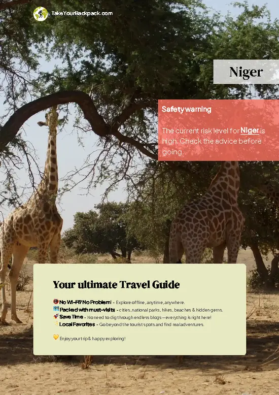
example page 0 from our offline Travel Guide for Niger
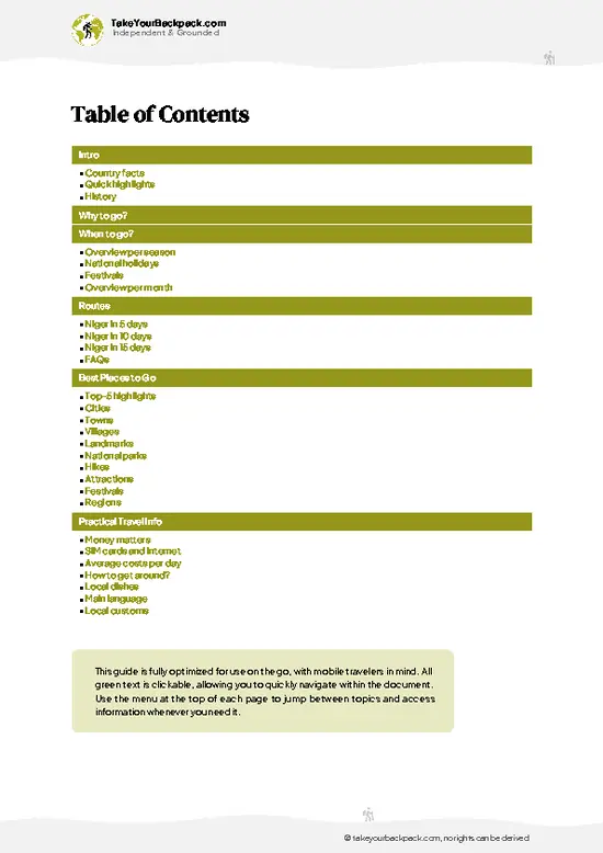
example page 1 from our offline Travel Guide for Niger
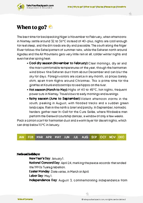
example page 2 from our offline Travel Guide for Niger
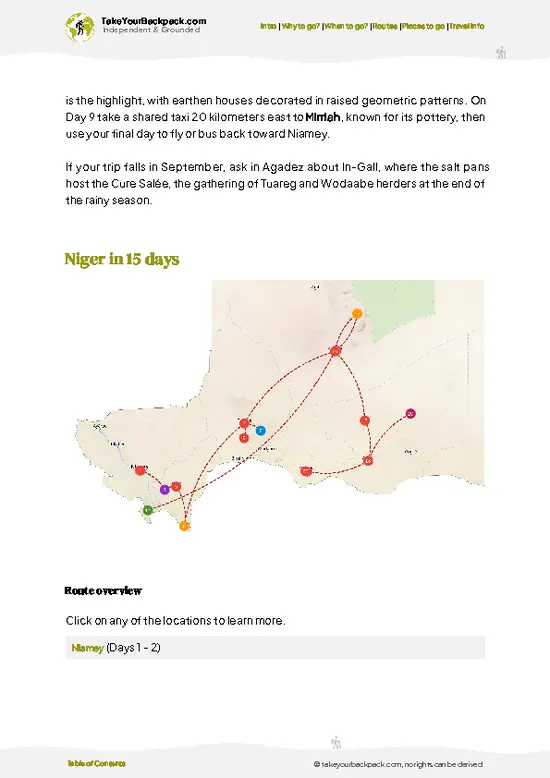
example page 3 from our offline Travel Guide for Niger
example page 4 from our offline Travel Guide for Niger
example page 5 from our offline Travel Guide for Niger
example page 6 from our offline Travel Guide for Niger
example page 7 from our offline Travel Guide for Niger
The digital guide (284 pages) contains:
67 highlights, ranked by travel appeal
Optimized 5, 10 & 15-day travel routes
Cities, national parks, landmarks, beaches
How to get around
Offline-friendly for travel without Wi-Fi
👉 Click to see all 30+ guide features

📅 Plan smarter in minutes, not weeks
Month by month travel advice
Festivals & national holidays
Budget expectations

🗺️ Go to the right places, skip the overrated ones
Honest pros & cons of destinations
Top hikes, parks & viewpoints
Lesser-known places most travelers miss
Clear “worth it vs skip it” guidance

🛏️ Travel smoothly without rookie mistakes
Best areas to stay
Transport systems explained simply
Common scams & safety advice
SIM cards, money & practical tips

🌍 Understand the country, not just visit it
Culture & traditions
52 Essential phrases & customs
Festivals worth planning around
Traveler-friendly historical context
Insights that make places more meaningful

📱 Built for real travel conditions
Fully downloadable PDF
Works completely offline
Optimized for phone use
Useful in remote areas & buses
Everything in one place
Save weeks of stressful planning
Get instant access to your full guide. 30‑day money-back guarantee.
+ Add another guide for just US$7.80

By proceeding you agree to our terms.
Sent to your inbox immediately after payment • 100% Secure Checkout
Best Backpacking Travel Advisor 2025 tourism awardBest Backpacking
Travel Advisor
2025
What others say about Take Your Backpack Guides:
⭐⭐⭐⭐⭐
Fantastic, amazing amount of information!
⭐⭐⭐⭐⭐
My goodness this is amazing, it's what I've been looking for hats off too you!
⭐⭐⭐⭐⭐
I think this is absolutely BRILLIANT
⭐⭐⭐⭐
Very complete and informative. It's still missing places, but I gotta to commend you
⭐⭐⭐⭐⭐
This is truly amazing, thank you, can't wait to explore it with my kids!
⭐⭐⭐⭐⭐
Awesome resource, thank you!
⭐⭐⭐⭐⭐
This is amazing! Can't wait to explore the ones I haven't seen
⭐⭐⭐⭐
I love this! Well done, great idea.
⭐⭐⭐⭐⭐
Thanks for taking the time to make this gem!
⭐⭐⭐⭐⭐
This might be the best website I've ever seen.
⭐⭐⭐⭐⭐
Congratulations, and thank you so much for your work; it's incredibly valuable.
⭐⭐⭐⭐
In all seriousness I think you did a great job pointing out the important spots
⭐⭐⭐⭐⭐
10/10 very good
⭐⭐⭐⭐⭐
As someone who's only just starting to visit regularly this is awesome, thank you.
⭐⭐⭐⭐
Thank you very much! I'm going to visit my dad, it's going to be very useful!
⭐⭐⭐⭐⭐
This is really cool! We'll be travelling for the first time and this definitely come in handy.
⭐⭐⭐⭐⭐
You are now our minister of culture, congratulations 👨‍💼
⭐⭐⭐⭐⭐
Just wanted to tell you that this is a pearl! Going to follow your recommendations.
⭐⭐⭐⭐⭐
This is so cool. I'll definitely be using the resource for my travels soon.
⭐⭐⭐⭐⭐
This is very impressive! Good work.
⭐⭐⭐⭐⭐
This is an amazing and informative site. Very well done!

🛏️ Where to stay?Best areas and accommodation options

If you enjoy meeting fellow travelers, consider choosing hostels with high ratings for atmosphere. On the other hand, if you prefer having your own space, a hotel might be a better option.

🥾 Hike detailsA practical overview of the hike

Total Distance: Approximately 120 kilometers, making it a multi-day trek that requires some planning.

Estimated Duration: Typically, hikers take about 5 to 7 days to complete the trail, depending on pace and rest stops.

Difficulty Level: This trail is considered challenging. It’s not for the faint of heart, as it involves navigating rocky terrain and steep ascents.

Starting Point: The trail usually begins in the town of Agadez. To get there by public transport, you can take a bus from Niamey, which takes around 12-14 hours. Buses are fairly frequent, but be prepared for a bumpy ride.

Major read more 👉
Total Distance: Approximately 120 kilometers, making it a multi-day trek that requires some planning.

Estimated Duration: Typically, hikers take about 5 to 7 days to complete the trail, depending on pace and rest stops.

Difficulty Level: This trail is considered challenging. It’s not for the faint of heart, as it involves navigating rocky terrain and steep ascents.

Starting Point: The trail usually begins in the town of Agadez. To get there by public transport, you can take a bus from Niamey, which takes around 12-14 hours. Buses are fairly frequent, but be prepared for a bumpy ride.

Major Landmarks Along the Route:
  • Aïr Mountains: The stunning mountain range itself is the main attraction, with breathtaking views at various points.
  • Ancient Rock Art: Look out for petroglyphs that date back thousands of years, adding a historical twist to your hike.
  • Oasis Towns: Several small villages along the way offer a glimpse into local life and a chance to refill water supplies.

Type of Terrain and Scenery: Expect a mix of rocky paths, sandy stretches, and steep climbs. The scenery varies from rugged mountains to expansive desert plains, with some incredible vistas that make the effort worthwhile.

Typical Vegetation and Wildlife:
  • Vegetation: You’ll find sparse desert flora, including acacia trees and hardy shrubs, which can provide some shade.
  • Wildlife: Keep an eye out for desert foxes, various bird species, and maybe even a gazelle if you’re lucky.

This trail is remote, so make sure to carry enough water and snacks. It’s also wise to have a good map or GPS, as trails can be less defined. Happy hiking!
⚠️ Hiking info can sometimes be outdated or inaccurate. Before you hit the trail, check the latest conditions with locals. If you do spot anything that's off, I'd love to hear from you, so I can update it for fellow travelers.

🛡️ SafetyTraveler Safety Guide

The Air Mountains in Niger offer a rugged beauty that demands respect but rewards effort. Expect weather shifts; the sun can scorch, then clouds roll in, bringing sudden rain. Dress in layers and pack a lightweight rain jacket.

The terrain is a mix of rocky paths and steep ascents. Footing can be tricky, so sturdy hiking boots are essential. Take your time on the climbs; the views at the top are worth every ounce of sweat. Navigation can be straightforward, but keep a map handy—landmarks can blend into the landscape.

Wildlife encounters are rare but possible. If you spot a gazelle or a bird of prey, observe quietly. Avoid approaching; respect their space.

First-timers often underestimate hydration. Carry enough water, especially on warmer days. Timing your hike is crucial; early mornings … read more 👉
The Air Mountains in Niger offer a rugged beauty that demands respect but rewards effort. Expect weather shifts; the sun can scorch, then clouds roll in, bringing sudden rain. Dress in layers and pack a lightweight rain jacket.

The terrain is a mix of rocky paths and steep ascents. Footing can be tricky, so sturdy hiking boots are essential. Take your time on the climbs; the views at the top are worth every ounce of sweat. Navigation can be straightforward, but keep a map handy—landmarks can blend into the landscape.

Wildlife encounters are rare but possible. If you spot a gazelle or a bird of prey, observe quietly. Avoid approaching; respect their space.

First-timers often underestimate hydration. Carry enough water, especially on warmer days. Timing your hike is crucial; early mornings are cooler and less crowded. Embrace the challenge, and you’ll find that every step brings you closer to the breathtaking vistas that define this wild terrain.

FAQTraveler FAQ

The Air Mountains hike typically takes 3 to 5 days depending on the route and pace. The main trekking routes cover around 60 to 80 kilometers through varied terrain. Plan for daily hikes of 15 to 20 kilometers to complete the trek comfortably.
The difficulty of the Air Mountains hike is moderate to challenging due to rocky terrain, steep ascents, and high temperatures. Hikers should be in good physical condition and prepared for uneven paths and occasional altitude changes up to 1,800 meters. Basic trekking experience is recommended.
Yes, you need a local guide for the Air Mountains hike as the area is remote and navigation can be difficult. A permit is also required, usually arranged through local tour operators or the Niger tourism office. Hiring a guide costs around 20 to 40 USD per day.
⚠️ Things can change over time, so always validate details locally before you go.

Other Nigerien hikes near Air Mountains

Explore more nearby:

  • Azawagh Valley—open desert plains, nomadic encampments, fossil beds| 719 km away
  • Termit Massif—limestone ridges, wildlife reserves, remote canyons| 1052 km away
  • Kaouar Cliffs—towering escarpments, palm-filled gueltas, ancient wells| 1351 km away

💡 Not sure where to go next?
Create a personalized itinerary for Niger including Air Mountains and the places that fit your trip.

Generate my itinerary

👉 Discover all hikes

Or checkout all Niger has to offer (think cities, towns, villages, national parks, hikes, beaches, festivals)
Country photo of Niger

We 💚 feedbackKey takeaways before you go

The Air Mountains are a raw, untamed playground. You’ll feel the grit underfoot as you scramble over rocky trails, but that struggle leads to breathtaking views that make your heart race. The best surprise? Stumbling upon a local market where the colors and scents explode in your senses. Just a heads-up: the heat can be relentless, so start early. Embrace the challenge; the reward is a cold drink under a starlit sky, sharing stories with fellow adventurers. It’s magic.

✍️ Help improve this page!
The information on this page is based on in-depth research, insights shared by experienced travelers, and feedback from the local travel community in Niger. While every effort is made to keep the information accurate and current, conditions can change — so if you spot anything incorrect or outdated, please get in touch.


🙋‍♂️ Give feedback

👋 Meet the founderWho’s Behind Take Your Backpack?

Johan, backpacker and founder of TakeYourBackpackHi, I’m Johan (Netherlands 🇳🇱), the creator of TakeYourBackpack. Over the past decade, I’ve backpacked through 80+ countries across six continents, gaining extensive experience with independent travel, long-term trips, and overland routes.

This site is built on a combination of firsthand travel experience and carefully curated insights from other backpackers. Many guides are based on places I’ve personally visited, while others bring together tips, observations, and practical advice shared by trusted travelers I’ve met along the way.

The goal is to provide realistic, experience-driven guidance — not generic itineraries — so you can explore destinations with better context, clearer expectations, and more confidence.

Get full Niger guide •
Instant download • 67 highlights • Full Offline guide