
×

Panama🇵🇦 | hikesLa India Dormida TrailSleeping-woman ridge, rope scrambles, crater valley, mossy cloud forest | things to do and best time to go

Explore Camino RealExplore Cerro Ancón Trail

Backpacking in La India Dormida Trail
🌟 Highlighthike ranked #4
By Johan Kruseman 🇳🇱 | Updated October 20, 2026

La India Dormida Trail gives you a summit view over the Caribbean-to-Pacific divide in a half day, with a trailhead you can reach by bus from a major town. It climbs the ridge above El Valle de Antón, in the crater of an extinct volcano in central Panama, west of Panama City. The hike runs about 3 to 4 kilometers round trip, steep and often muddy, and the profile makes sense: the ridge rises abruptly from the crater floor, so you gain height fast. The reward is a long profile of the sleeping maiden and views across the valley. I expected a quiet forest path, but the first thing I noticed was the sound of a roadside rooster chorus giving way to cool, dripping cloud forest within twenty minutes. Public transport is easy: buses run from the capital to El Valle, then a short taxi or walk reaches the start. Expect a small entry fee at the gate. It suits fit beginners and photographers; it is poor for anyone wanting solitude on weekends or a long trek.

Discover everything you want to know in the 📖 Panama Travel Guide.
Best time to go: December - April
Duration: 3 hours
Distance: 4 kilometers
Total ascent: 400 meters


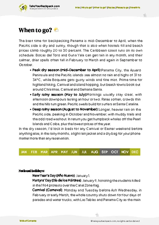
example page 0 from our offline Travel Guide for Panama
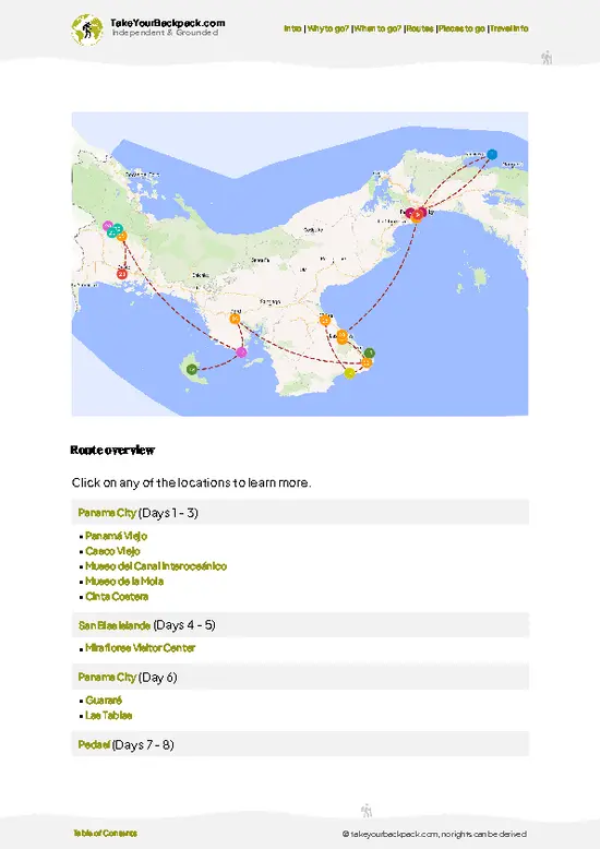
example page 1 from our offline Travel Guide for Panama
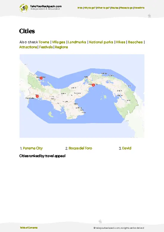
example page 2 from our offline Travel Guide for Panama
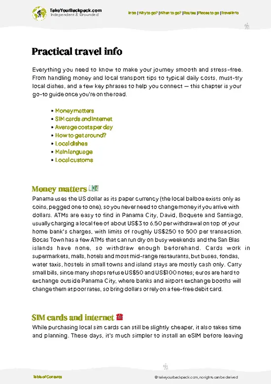
example page 3 from our offline Travel Guide for Panama
example page 4 from our offline Travel Guide for Panama
example page 5 from our offline Travel Guide for Panama
example page 6 from our offline Travel Guide for Panama
example page 7 from our offline Travel Guide for Panama
Loading the map 🌍
CLICK TO FILTER
cities
towns
villages
landmarks
national parks
hikes
beaches
attractions
festivals
regions
SHOW COUNTRY’S BESTSHOW ALL

✨ Why go?
Ranked #4 hike in Panama
The unique appeal for travelers

La India Dormida Trail packs a real summit into a morning, which is the main reason backpackers add it to a Panama route. The climb gains roughly 400 meters over a short distance, so you get the rim-of-the-crater panorama without committing a full day, and you can still move on to the coast or highlands by afternoon. Access is the second draw. El Valle sits on a direct bus line from the capital, so the trailhead needs no rental car and no guide, and the whole outing stays cheap. The third is the setting itself: the trail traces the ridge shaped like a reclining woman, a local legend tied to a princess who died of heartbreak, and the path passes cloud forest that feels far wetter than the valley floor. Pair it with the Sunday artisan market in town and you have a complete low-cost day that … read more 👉
La India Dormida Trail packs a real summit into a morning, which is the main reason backpackers add it to a Panama route. The climb gains roughly 400 meters over a short distance, so you get the rim-of-the-crater panorama without committing a full day, and you can still move on to the coast or highlands by afternoon. Access is the second draw. El Valle sits on a direct bus line from the capital, so the trailhead needs no rental car and no guide, and the whole outing stays cheap. The third is the setting itself: the trail traces the ridge shaped like a reclining woman, a local legend tied to a princess who died of heartbreak, and the path passes cloud forest that feels far wetter than the valley floor. Pair it with the Sunday artisan market in town and you have a complete low-cost day that fits between Panama City and the western highlands.

💡 HighlightsTop highlights of La India Dormida Trail

  1. La India Dormida Summit Viewpoint: The top of the ridge is what most people come for, with a wide view over the crater valley and the town far below. On clear mornings you can trace the outline of the sleeping woman from the surrounding peaks.
  2. Cloud Forest Section: Midway up, the air cools and the trees thicken with moss, ferns and bromeliads. Mist often lingers here, so the light turns soft and the trail gets slick.
  3. Rope-Assisted Steep Pitches: Several muddy, rooty scrambles have ropes fixed to help you up and down. They are short but give the climb its character.
  4. Birdlife Along the Ridge: Tanagers, hummingbirds and the occasional motmot show up in the forest edges, best heard in the early hours before groups arrive.
  5. Trailhead Entry Gate and Lookout: The start area has a ticket booth and a first
… read more 👉
  1. La India Dormida Summit Viewpoint: The top of the ridge is what most people come for, with a wide view over the crater valley and the town far below. On clear mornings you can trace the outline of the sleeping woman from the surrounding peaks.
  2. Cloud Forest Section: Midway up, the air cools and the trees thicken with moss, ferns and bromeliads. Mist often lingers here, so the light turns soft and the trail gets slick.
  3. Rope-Assisted Steep Pitches: Several muddy, rooty scrambles have ropes fixed to help you up and down. They are short but give the climb its character.
  4. Birdlife Along the Ridge: Tanagers, hummingbirds and the occasional motmot show up in the forest edges, best heard in the early hours before groups arrive.
  5. Trailhead Entry Gate and Lookout: The start area has a ticket booth and a first open view back across the valley, handy for judging weather before you commit to the climb.
The trailhead lookout is free to enjoy, while the summit climb costs only the small entry fee at the gate.
Spotted a mistake or missing something? Contact us.

Things to do around La India Dormida Trail

Ratings based on Tripadvisor reviews. When you book through this link, you support our work at no extra cost to you.

🌤️ When to go?Weather, crowds, and seasonal trade-offs

  • Dry Season (mid-December to April): La India Dormida Trail is firmest and clearest now, with morning summit views over El Valle de Antón and the Pacific coast. Highs run 27 to 31°C (81 to 88°F) in town and cooler on the ridge, with nights near 18°C (64°F). Weekends and Carnival and Easter weeks bring the biggest crowds, plus higher hotel rates in El Valle.
  • Early Wet Season (May to July): Mornings are usually dry, with cloud and rain building after midday. Rock and roots turn slick, but the hillsides go bright green and trail traffic thins.
  • Peak Rains (August to November): Expect near-daily downpours, muddy tracks and frequent summit cloud. Temperatures sit around 22 to 28°C (72 to 82°F). Lodging is cheapest, with room to bargain midweek.
  • Daylight: Year-round you get roughly 11.5 to 12.5 hours,
… read more 👉
  • Dry Season (mid-December to April): La India Dormida Trail is firmest and clearest now, with morning summit views over El Valle de Antón and the Pacific coast. Highs run 27 to 31°C (81 to 88°F) in town and cooler on the ridge, with nights near 18°C (64°F). Weekends and Carnival and Easter weeks bring the biggest crowds, plus higher hotel rates in El Valle.
  • Early Wet Season (May to July): Mornings are usually dry, with cloud and rain building after midday. Rock and roots turn slick, but the hillsides go bright green and trail traffic thins.
  • Peak Rains (August to November): Expect near-daily downpours, muddy tracks and frequent summit cloud. Temperatures sit around 22 to 28°C (72 to 82°F). Lodging is cheapest, with room to bargain midweek.
  • Daylight: Year-round you get roughly 11.5 to 12.5 hours, so start by 7 a.m. to finish before dark and before the rains.
Start at first light in any month; the trail is clearest and coolest before 10 a.m.


source: climatestotravel.comJANJanuary: excellent for travelingFEBFebruary: excellent for travelingMARMarch: excellent for travelingAPRApril: highly recommended for travelingMAYMay: fair for travelingJUNJune: fair for travelingJULJuly: fair for travelingAUGAugust: fair for travelingSEPSeptember: fair for travelingOCTOctober: fair for travelingNOVNovember: fair for travelingDECDecember: highly recommended for traveling
panama-hike-la-india-dormida-trail
© Google |

✈️ The backpacker research shortcutPanama Travel Guide

An offline-friendly backpacking guide with optimized travel routes, ranked highlights, transport advice, and the best areas to stay.
example page 0 from our offline Travel Guide for Panama
example page 1 from our offline Travel Guide for Panama
example page 2 from our offline Travel Guide for Panama
example page 3 from our offline Travel Guide for Panama
example page 4 from our offline Travel Guide for Panama
example page 5 from our offline Travel Guide for Panama
example page 6 from our offline Travel Guide for Panama
example page 7 from our offline Travel Guide for Panama
The digital guide (272 pages) contains:
✅ 89 highlights, ranked by travel appeal
✅ Optimized 5, 10 & 15-day travel routes
✅ Cities, national parks, landmarks, beaches
✅ How to get around
✅ Offline-friendly for travel without Wi-Fi
👉 Click to see all 30+ guide features

📅 Plan smarter in minutes, not weeks
✅ Month by month travel advice
✅ Festivals & national holidays
✅ Budget expectations

🗺️ Go to the right places, skip the overrated ones
✅ Honest pros & cons of destinations
✅ Top hikes, parks & viewpoints
✅ Lesser-known places most travelers miss
✅ Clear “worth it vs skip it” guidance

🛏️ Travel smoothly without rookie mistakes
✅ Best areas to stay
✅ Transport systems explained simply
✅ Common scams & safety advice
✅ SIM cards, money & practical tips

🌍 Understand the country, not just visit it
✅ Culture & traditions
✅ 52 Essential phrases & customs
✅ Festivals worth planning around
✅ Traveler-friendly historical context
✅ Insights that make places more meaningful

📱 Built for real travel conditions
✅ Fully downloadable PDF
✅ Works completely offline
✅ Optimized for phone use
✅ Useful in remote areas & buses
✅ Everything in one place
Stop searching, start planning
Get instant access to your full guide. 30‑day money-back guarantee.
+ Add another guide for just

By proceeding you agree to our terms.
Sent to your inbox immediately after payment • 100% Secure Checkout
Best Backpacking Travel Advisor 2025 tourism awardBest Backpacking
Travel Advisor
2025
What others say about Take Your Backpack Guides:
⭐⭐⭐⭐⭐
Fantastic, amazing amount of information!
⭐⭐⭐⭐⭐
My goodness this is amazing, it's what I've been looking for hats off too you!
⭐⭐⭐⭐⭐
I think this is absolutely BRILLIANT
⭐⭐⭐⭐
Very complete and informative. It's still missing places, but I gotta to commend you
⭐⭐⭐⭐⭐
This is truly amazing, thank you, can't wait to explore it with my kids!
⭐⭐⭐⭐⭐
Awesome resource, thank you!
⭐⭐⭐⭐⭐
This is amazing! Can't wait to explore the ones I haven't seen
⭐⭐⭐⭐
I love this! Well done, great idea.
⭐⭐⭐⭐⭐
Thanks for taking the time to make this gem!
⭐⭐⭐⭐⭐
This might be the best website I've ever seen.
⭐⭐⭐⭐⭐
Congratulations, and thank you so much for your work; it's incredibly valuable.
⭐⭐⭐⭐
In all seriousness I think you did a great job pointing out the important spots
⭐⭐⭐⭐⭐
10/10 very good
⭐⭐⭐⭐⭐
As someone who's only just starting to visit regularly this is awesome, thank you.
⭐⭐⭐⭐
Thank you very much! I'm going to visit my dad, it's going to be very useful!
⭐⭐⭐⭐⭐
This is really cool! We'll be travelling for the first time and this definitely come in handy.
⭐⭐⭐⭐⭐
You are now our minister of culture, congratulations 👨‍💼
⭐⭐⭐⭐⭐
Just wanted to tell you that this is a pearl! Going to follow your recommendations.
⭐⭐⭐⭐⭐
This is so cool. I'll definitely be using the resource for my travels soon.
⭐⭐⭐⭐⭐
This is very impressive! Good work.
⭐⭐⭐⭐⭐
This is an amazing and informative site. Very well done!

🛏️ Where to stay?Best areas and accommodation options

If you enjoy meeting fellow travelers, consider choosing hostels with high ratings for atmosphere. On the other hand, if you prefer having your own space, a hotel might be a better option.

🥾 Hike detailsRoute, distance, and difficulty explained

Total Distance: La India Dormida Trail runs roughly 3 to 4 kilometers round trip.
Duration: Plan 2.5 to 4 hours including time at the top.
Difficulty: Moderate to demanding for its length, because the grade is steep and muddy in places.
Starting Point: The trailhead sits on the edge of El Valle de Antón. Buses from the capital reach town, then a short taxi ride or walk covers the rest.
Major Landmarks:
  • Entry Gate: Pay the small fee and sign in here.
  • Fixed Ropes: Steeper stretches where you pull yourself up roots and mud.
  • Summit Lookout: Open rock with views across the volcanic crater.
Terrain and Scenery:
… read more 👉
Total Distance: La India Dormida Trail runs roughly 3 to 4 kilometers round trip.
Duration: Plan 2.5 to 4 hours including time at the top.
Difficulty: Moderate to demanding for its length, because the grade is steep and muddy in places.
Starting Point: The trailhead sits on the edge of El Valle de Antón. Buses from the capital reach town, then a short taxi ride or walk covers the rest.
Major Landmarks:
  • Entry Gate: Pay the small fee and sign in here.
  • Fixed Ropes: Steeper stretches where you pull yourself up roots and mud.
  • Summit Lookout: Open rock with views across the volcanic crater.
Terrain and Scenery: Packed earth turns to roots, rock steps and slippery clay. Views open on the valley floor and surrounding crater walls.
Vegetation: Premontane and cloud forest with ferns, orchids, bromeliads and moss-covered trunks.
Wildlife: Mainly birds, along with butterflies and the occasional monkey or lizard.
Practical Notes: Wear shoes with real grip, carry water and a light rain layer, and start early to beat afternoon cloud.
⚠️ Hiking info can sometimes be outdated or inaccurate. Before you hit the trail, check the latest conditions with locals. If you do spot anything that's off, I'd love to hear from you, so I can update it for fellow travelers.

🛡️ SafetyStaying Safe: What Travelers Should Know

La India Dormida Trail is a short, popular climb with no technical sections, and most problems come from footing and heat. The path is steep in places, with loose rock and exposed roots that turn greasy after rain, so wear shoes with real tread rather than sandals. Start early, since the sun is hard on the open upper slopes and afternoon storms arrive quickly in the wet months. Carry at least 1.5 liters of water per person, sun protection and a light rain layer. The route is easy enough to follow, but junctions near the top can confuse you in cloud, so keep to the main worn track. Snakes and insects exist, though encounters are uncommon; watch where you put hands and feet on scrambles and don’t feed or chase any animals. Pack out your trash, and tell your lodging when you expect to be back.

FAQFrequently asked questions about La India Dormida Trail

La India Dormida Trail takes about 2.5 to 4 hours round trip for most hikers, covering roughly 3 to 4 kilometers from the trailhead above El Valle de Antón. The climb up usually takes 1.5 to 2 hours, and the descent about 1 hour. Allow extra time if you linger at the summit viewpoint or the ground is wet.
La India Dormida Trail is moderate, mainly because it climbs steadily and steeply over roughly 400 to 500 meters of elevation gain. The upper section has loose rock and some light scrambling, and mud makes it slower in the rainy months. Reasonably fit first-timers manage it with good shoes, water and a morning start.
La India Dormida Trail does not require a guide, and the route is clear enough to hike independently from El Valle de Antón. There is a small entrance or access fee at the trailhead, typically a few dollars (around US$3 to 5), paid in cash. A local guide is optional and costs roughly US$20 to 40 if you want help with plants, birds and the history of the area.
⚠️ Things can change over time, so always validate details locally before you go.

Other Panamanian hikes near La India Dormida Trail

Explore more nearby:


💡 Not sure where to go next?
Create a personalized itinerary for Panama including La India Dormida Trail and the places that fit your trip.

Generate my itinerary

👉 Discover all hikes

Or checkout all Panama has to offer (think cities, towns, villages, national parks, hikes, beaches, festivals)
Country photo of Panama

We 💚 feedbackWhat to keep in mind

La India Dormida Trail is short, but travelers often treat it like a casual stroll, arrive late in flimsy sneakers and slide around in afternoon mud. Start early, wear shoes with tread and bring a light rain layer. You will enjoy the views far more, and the descent is much safer.

✈️ When did I visit Panama?
Panama I visited during my half year trip through South and Central America back in 2003

✍️ Help improve this page!
The information on this page is based on my own backpacking experience in Panama, supplemented with up-to-date research and feedback from other travelers. Travel details can change, so if you notice anything outdated or incomplete, feel free to let me know.


🙋‍♂️ Give feedback

👋 Meet the founderWho’s Behind Take Your Backpack?

Johan, backpacker and founder of TakeYourBackpackHi, I’m Johan (Netherlands 🇳🇱), the creator of TakeYourBackpack. Over the past 3 decades, I’ve backpacked through 90+ countries across six continents, gaining extensive experience with independent travel, long-term trips, and overland routes.

This site is built on a combination of firsthand travel experience and carefully curated insights from other backpackers. Many guides are based on places I’ve personally visited, while others bring together tips, observations, and practical advice shared by trusted travelers I’ve met along the way.

The goal is to provide realistic, experience-driven guidance — not generic itineraries — so you can explore destinations with better context, clearer expectations, and more confidence.