
×

St. Vincent & the Grenadines🇻🇨 | hikesLa Soufrière VolcanoActive crater rim, sulfur vents, cloud forest, half-day climb | things to do and best time to go

Explore Fort DuvernetteExplore Vermont Nature Trail

Backpacking in La Soufrière Volcano
🏆 Top pickhike ranked #1
By Johan Kruseman 🇳🇱 | Updated October 22, 2026

La Soufrière is an active volcano that erupted explosively in April 2021, and the summit crater trail has been closed or restricted at times since, so a full crater visit depends on current conditions rather than the old routine. The mountain fills the northern end of the island of Saint Vincent, in Saint Vincent and the Grenadines, and the classic route climbs from the Rabacca side on the windward coast, not from Kingstown's side. Expect a steep, muddy, sometimes windy walk of roughly 5 to 7 hours round trip, with clouds that often swallow the rim by late morning. Start at dawn. The upside is a rainforest climb, a ridge with views to both coasts and a crater that looks like another planet. The downside is a long, slippery slog and limited buses to the trailhead, so many people hire a driver from Georgetown or Kingstown. Local guides know the ground after the eruption and are worth having. The ash-covered upper slopes crunch underfoot like gravel on a driveway.

Discover everything you want to know in the 📖 St. Vincent & the Grenadines Travel Guide.
Best time to go: November - May
Duration: 7 hours
Distance: 13 kilometers
Total ascent: 900 meters


example page 0 from our offline Travel Guide for Saint Vincent and the Grenadines
example page 1 from our offline Travel Guide for Saint Vincent and the Grenadines
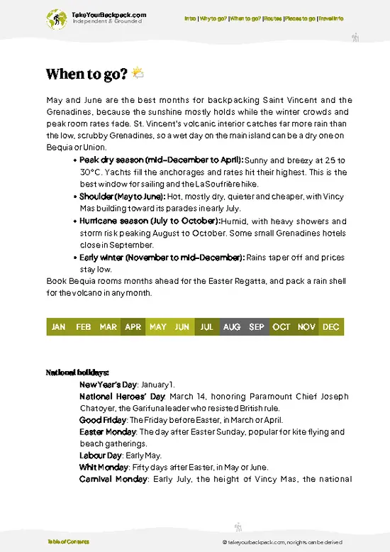
example page 2 from our offline Travel Guide for Saint Vincent and the Grenadines
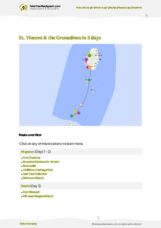
example page 3 from our offline Travel Guide for Saint Vincent and the Grenadines
example page 4 from our offline Travel Guide for Saint Vincent and the Grenadines
example page 5 from our offline Travel Guide for Saint Vincent and the Grenadines
example page 6 from our offline Travel Guide for Saint Vincent and the Grenadines
example page 7 from our offline Travel Guide for Saint Vincent and the Grenadines
Loading the map 🌍
CLICK TO FILTER
towns
villages
landmarks
national parks
hikes
beaches
attractions
festivals
regions
SHOW COUNTRY’S BESTSHOW ALL

✨ Why go?
Ranked #1 hike in St. Vincent & the Grenadines
What makes this hike worth hiking

La Soufrière Volcano gives you a genuine volcanic summit at sea level's doorstep, with the whole climb done in a single day. That is the main pull: you go from banana fields and rainforest to ash slopes and a crater rim, then back to a beach by dinner. The ridge walk along the Soufrière crest opens views over the Atlantic coast on one side and the Caribbean on the other, and few Caribbean hikes put both seas in a single frame. The effort is serious but short, so it suits a backpacker with one free day. You also meet local guides who grew up on these slopes and can explain what the 2021 eruption changed, from the ash-buried farms of the Orange Hill area to the reshaped crater. The cost stays low because there is no need for gear beyond boots and rain layers, and it fits neatly between the capital … read more 👉
La Soufrière Volcano gives you a genuine volcanic summit at sea level's doorstep, with the whole climb done in a single day. That is the main pull: you go from banana fields and rainforest to ash slopes and a crater rim, then back to a beach by dinner. The ridge walk along the Soufrière crest opens views over the Atlantic coast on one side and the Caribbean on the other, and few Caribbean hikes put both seas in a single frame. The effort is serious but short, so it suits a backpacker with one free day. You also meet local guides who grew up on these slopes and can explain what the 2021 eruption changed, from the ash-buried farms of the Orange Hill area to the reshaped crater. The cost stays low because there is no need for gear beyond boots and rain layers, and it fits neatly between the capital and the northern coast on a longer island loop.

💡 HighlightsMust-see experiences and standout moments

  1. The Summit Crater Rim: The signature sight is the huge crater, which was reshaped by the 2021 eruption and still has steaming vents. The scale is hard to take in, and the sulfur smell is sharp. Access depends on current conditions.
  2. The Leeward Trail Through Rainforest: The lower climb passes tall trees, ferns and heliconia, with a good chance of hearing the Saint Vincent parrot, the national bird, in the canopy.
  3. The Ridge Viewpoints: Along the upper ridge you can look down on both the Atlantic and Caribbean coasts. On a clear morning the Grenadines can show as faint shapes on the horizon.
  4. The Ash Slopes: Higher up, the vegetation thins into gray ash and stunted scrub. It looks stark, and the soft ground makes each step heavier than it should be.
  5. Rabacca Dry River: Near the base, this wide channel
… read more 👉
  1. The Summit Crater Rim: The signature sight is the huge crater, which was reshaped by the 2021 eruption and still has steaming vents. The scale is hard to take in, and the sulfur smell is sharp. Access depends on current conditions.
  2. The Leeward Trail Through Rainforest: The lower climb passes tall trees, ferns and heliconia, with a good chance of hearing the Saint Vincent parrot, the national bird, in the canopy.
  3. The Ridge Viewpoints: Along the upper ridge you can look down on both the Atlantic and Caribbean coasts. On a clear morning the Grenadines can show as faint shapes on the horizon.
  4. The Ash Slopes: Higher up, the vegetation thins into gray ash and stunted scrub. It looks stark, and the soft ground makes each step heavier than it should be.
  5. Rabacca Dry River: Near the base, this wide channel of old volcanic debris shows how far past eruptions pushed material toward the sea. It makes a short, striking stop before or after the climb.
La Soufrière Volcano needs no ticket for the walk itself, though arranging a guide ahead of time is smart, especially on days when access is limited.
Spotted a mistake or missing something? Contact us.

Things to do around La Soufrière Volcano

Ratings based on Tripadvisor reviews. When you book through this link, you support our work at no extra cost to you.

🌤️ When to go?Choosing the right time of year

The best window for La Soufrière Volcano is the dry season, roughly January through May, when summit views are most likely and the trail is firmest.
  • Dry Season (Jan to May): Days run 27 to 31°C (81 to 88°F) at the coast, and the crater rim is cooler at about 18 to 22°C (64 to 72°F). Rain is lighter and the clouds lift more often. Guides book up around Carnival time in late June to July, so early in the dry season is calmer.
  • Wet Season (Jun to Nov): Expect daily downpours, mud on the Soufrière Trail and cloud that can hide the crater. Hurricane risk peaks from August to October, and hikes get canceled. Rental cars and rooms are often cheaper.
  • Daylight: Days stay at 11 to 13 hours all year, so start early to finish before afternoon cloud builds.
  • Crowds and Prices: Cruise ship days bring groups to
… read more 👉
The best window for La Soufrière Volcano is the dry season, roughly January through May, when summit views are most likely and the trail is firmest.
  • Dry Season (Jan to May): Days run 27 to 31°C (81 to 88°F) at the coast, and the crater rim is cooler at about 18 to 22°C (64 to 72°F). Rain is lighter and the clouds lift more often. Guides book up around Carnival time in late June to July, so early in the dry season is calmer.
  • Wet Season (Jun to Nov): Expect daily downpours, mud on the Soufrière Trail and cloud that can hide the crater. Hurricane risk peaks from August to October, and hikes get canceled. Rental cars and rooms are often cheaper.
  • Daylight: Days stay at 11 to 13 hours all year, so start early to finish before afternoon cloud builds.
  • Crowds and Prices: Cruise ship days bring groups to the Rabacca side. Winter holiday weeks push up lodging rates in Kingstown and Georgetown.
Start at dawn on a weekday, since the summit clouds over by late morning.


source: climatestotravel.comJANJanuary: excellent for travelingFEBFebruary: excellent for travelingMARMarch: excellent for travelingAPRApril: excellent for travelingMAYMay: highly recommended for travelingJUNJune: fair for travelingJULJuly: fair for travelingAUGAugust: fair for travelingSEPSeptember: fair for travelingOCTOctober: fair for travelingNOVNovember: highly recommended for travelingDECDecember: excellent for traveling
saint-vincent-and-the-grenadines-hike-la-soufriere-volcano
© Google | Kascique Lowmans

✈️ The backpacker research shortcutSt. Vincent & the Grenadines Travel Guide

An offline-friendly backpacking guide with optimized travel routes, ranked highlights, transport advice, and the best areas to stay.
example page 0 from our offline Travel Guide for Saint Vincent and the Grenadines
example page 1 from our offline Travel Guide for Saint Vincent and the Grenadines
example page 2 from our offline Travel Guide for Saint Vincent and the Grenadines
example page 3 from our offline Travel Guide for Saint Vincent and the Grenadines
example page 4 from our offline Travel Guide for Saint Vincent and the Grenadines
example page 5 from our offline Travel Guide for Saint Vincent and the Grenadines
example page 6 from our offline Travel Guide for Saint Vincent and the Grenadines
example page 7 from our offline Travel Guide for Saint Vincent and the Grenadines
The digital guide (124 pages) contains:
✅ 26 highlights, ranked by travel appeal
✅ Optimized 2, 3 & 5-day travel routes
✅ Cities, national parks, landmarks, beaches
✅ How to get around
✅ Offline-friendly for travel without Wi-Fi
👉 Click to see all 30+ guide features

📅 Plan smarter in minutes, not weeks
✅ Month by month travel advice
✅ Festivals & national holidays
✅ Budget expectations

🗺️ Go to the right places, skip the overrated ones
✅ Honest pros & cons of destinations
✅ Top hikes, parks & viewpoints
✅ Lesser-known places most travelers miss
✅ Clear “worth it vs skip it” guidance

🛏️ Travel smoothly without rookie mistakes
✅ Best areas to stay
✅ Transport systems explained simply
✅ Common scams & safety advice
✅ SIM cards, money & practical tips

🌍 Understand the country, not just visit it
✅ Culture & traditions
✅ Local customs
✅ Festivals worth planning around
✅ Traveler-friendly historical context
✅ Insights that make places more meaningful

📱 Built for real travel conditions
✅ Fully downloadable PDF
✅ Works completely offline
✅ Optimized for phone use
✅ Useful in remote areas & buses
✅ Everything in one place
Stop searching, start planning
Get instant access to your full guide. 30‑day money-back guarantee.
+ Add another guide for just

By proceeding you agree to our terms.
Sent to your inbox immediately after payment • 100% Secure Checkout
Best Backpacking Travel Advisor 2025 tourism awardBest Backpacking
Travel Advisor
2025
What others say about Take Your Backpack Guides:
⭐⭐⭐⭐⭐
Fantastic, amazing amount of information!
⭐⭐⭐⭐⭐
My goodness this is amazing, it's what I've been looking for hats off too you!
⭐⭐⭐⭐⭐
I think this is absolutely BRILLIANT
⭐⭐⭐⭐
Very complete and informative. It's still missing places, but I gotta to commend you
⭐⭐⭐⭐⭐
This is truly amazing, thank you, can't wait to explore it with my kids!
⭐⭐⭐⭐⭐
Awesome resource, thank you!
⭐⭐⭐⭐⭐
This is amazing! Can't wait to explore the ones I haven't seen
⭐⭐⭐⭐
I love this! Well done, great idea.
⭐⭐⭐⭐⭐
Thanks for taking the time to make this gem!
⭐⭐⭐⭐⭐
This might be the best website I've ever seen.
⭐⭐⭐⭐⭐
Congratulations, and thank you so much for your work; it's incredibly valuable.
⭐⭐⭐⭐
In all seriousness I think you did a great job pointing out the important spots
⭐⭐⭐⭐⭐
10/10 very good
⭐⭐⭐⭐⭐
As someone who's only just starting to visit regularly this is awesome, thank you.
⭐⭐⭐⭐
Thank you very much! I'm going to visit my dad, it's going to be very useful!
⭐⭐⭐⭐⭐
This is really cool! We'll be travelling for the first time and this definitely come in handy.
⭐⭐⭐⭐⭐
You are now our minister of culture, congratulations 👨‍💼
⭐⭐⭐⭐⭐
Just wanted to tell you that this is a pearl! Going to follow your recommendations.
⭐⭐⭐⭐⭐
This is so cool. I'll definitely be using the resource for my travels soon.
⭐⭐⭐⭐⭐
This is very impressive! Good work.
⭐⭐⭐⭐⭐
This is an amazing and informative site. Very well done!

🛏️ Where to stay?Where staying makes the most sense

If you enjoy meeting fellow travelers, consider choosing hostels with high ratings for atmosphere. On the other hand, if you prefer having your own space, a hotel might be a better option.

🥾 Hike detailsEverything you need to know before hiking La Soufrière Volcano

Total Distance: La Soufrière Volcano is hiked as an out-and-back of roughly 12 to 14 kilometers from the Rabacca (leeward Chatoyer) or the Orange Hill side, depending on the route you pick. The popular leeward route from Chateaubelair side runs about 9 kilometers one way, while the windward route from Rabacca is shorter but steeper.
Estimated Duration: Plan 6 to 8 hours round trip, with a long pause at the summit rim.
Difficulty: Moderate to demanding. The climb is steady and steep in places, and the upper section is slippery after rain.
Starting Point: La Soufrière Volcano trails start from two
… read more 👉
Total Distance: La Soufrière Volcano is hiked as an out-and-back of roughly 12 to 14 kilometers from the Rabacca (leeward Chatoyer) or the Orange Hill side, depending on the route you pick. The popular leeward route from Chateaubelair side runs about 9 kilometers one way, while the windward route from Rabacca is shorter but steeper.
Estimated Duration: Plan 6 to 8 hours round trip, with a long pause at the summit rim.
Difficulty: Moderate to demanding. The climb is steady and steep in places, and the upper section is slippery after rain.
Starting Point: La Soufrière Volcano trails start from two sides of the island.
  • Windward Trailhead (Rabacca): Minibuses from Kingstown run up the Windward Highway toward Georgetown, and you walk or arrange a taxi from there to the trailhead.
  • Leeward Trailhead (Fancy or Richmond side): Vans from Kingstown run along the leeward coast to Chateaubelair, with a short taxi hop onward to the path.
Major Landmarks:
  • Lower Farmland: Small plots of root crops and banana give way to forest edges within the first hour.
  • Old Lava Flows: Dark ridges of cooled rock from past eruptions cut across the slopes.
  • Summit Rim: The crater rim opens onto a steep, ash-gray bowl with steaming vents. The 2020 to 2021 crater features are gone, so you see raw volcanic rock and bare slopes.
  • Coastal Views: On clear days you see the Caribbean Sea and, to the south, the rest of the island chain.
Terrain and Scenery: Expect packed earth, exposed roots, loose ash, and rocky steps. The upper ridge is narrow and windy. Mist often rolls in fast, so views can vanish, then reappear within minutes. Solid footwear with grip matters more than poles.
Vegetation: The path moves from cultivated gardens into dense rainforest with tree ferns, heliconia, and mossy trunks. Higher up, trees shrink into stunted elfin growth, then thin out to bare ash and scrub near the rim.
Wildlife: Listen for the St. Vincent parrot, the national bird, in the forest on the cooler flanks. Hummingbirds feed at flowering shrubs, and lizards sun on the rocks. Mongooses dart across lower tracks.
Practical Notes: Carry at least 2 liters of water, a rain layer, and snacks, since there is nowhere to buy anything on the mountain. Check current volcano-alert status with local authorities before you go. A local guide is a smart hire for the upper section where the trail fades in cloud.
⚠️ Hiking info can sometimes be outdated or inaccurate. Before you hit the trail, check the latest conditions with locals. If you do spot anything that's off, I'd love to hear from you, so I can update it for fellow travelers.

🛡️ SafetySafety Tips and Common Scams in La Soufrière Volcano

The hike to La Soufrière Volcano is steep but well used, and the main hazards are weather and fatigue rather than wildlife. The usual route climbs from Rabacca on the Windward side through rainforest, then up a slick, rooty ridge to a crater rim at about 1,234 meters (4,049 feet). Wind and cloud can arrive within minutes, so pack a rain shell and a warm layer even on a sunny morning. Wear boots with real grip, since mud and loose volcanic rock cause most twisted ankles. Carry at least 2 liters of water and keep to the marked path near the crater edge, where the drop is sheer. Check the volcano alert status with the national emergency agency before you go, because access closes when activity rises. The volcano erupted explosively in 2021, and the landscape remains altered. Hiring a local guide … read more 👉
The hike to La Soufrière Volcano is steep but well used, and the main hazards are weather and fatigue rather than wildlife. The usual route climbs from Rabacca on the Windward side through rainforest, then up a slick, rooty ridge to a crater rim at about 1,234 meters (4,049 feet). Wind and cloud can arrive within minutes, so pack a rain shell and a warm layer even on a sunny morning. Wear boots with real grip, since mud and loose volcanic rock cause most twisted ankles. Carry at least 2 liters of water and keep to the marked path near the crater edge, where the drop is sheer. Check the volcano alert status with the national emergency agency before you go, because access closes when activity rises. The volcano erupted explosively in 2021, and the landscape remains altered. Hiring a local guide helps with navigation in fog. Walk at a steady pace and leave extra time for the descent.

FAQCommon questions from travelers

Plan on 6 to 8 hours round trip for La Soufrière Volcano from the Rabacca trailhead on the windward side, or 5 to 7 hours of one-way hiking if you take the full northern route. The classic out-and-back from Fancy covers roughly 12 to 14 kilometers (7 to 9 miles) and climbs to the crater rim at about 1,234 meters (4,049 feet). The through-hike from Richmond Beach on the leeward side to Fancy takes a full day and needs a pre-arranged ride at the far end.
Moderate to strenuous is the fair rating for La Soufrière Volcano, mostly because of length, heat on the lower slopes and steep, muddy upper sections rather than technical climbing. The leeward route from Richmond Beach has several steep ridges, stream crossings and about 1,200 meters (3,900 feet) of elevation gain, while the windward Rabacca route is shorter but still takes about 3 to 4 hours up. Reasonably fit hikers manage it with sturdy shoes, 2 to 3 liters of water and an early start before clouds build around the summit.
A guide is strongly advised for La Soufrière Volcano, and the leeward trail from Richmond Beach in particular is easy to lose in forest and ridge sections. Local guides typically charge about US$40 to 80 per group depending on route and size, and can be arranged through Fancy, Chateaubelair or your accommodation. Access to the summit area depends on current volcanic alert status set by the national emergency authority, so check it before booking and bring cash in US$ or the local currency for fees and transport.
⚠️ Things can change over time, so always validate details locally before you go.

Other Vincentian hikes near La Soufrière Volcano

Explore more nearby:

  • Dark View Falls—Twin waterfalls, bamboo groves, river pools| 8 km away
  • Vermont Nature Trail—Parrot habitat, mossy canopy, stream crossings, estate stonework| 13 km away
  • Fort Duvernette—Islet staircase, boat access, cannon ruins, Young Island views| 22 km away

💡 Not sure where to go next?
Create a personalized itinerary for St. Vincent & the Grenadines including La Soufrière Volcano and the places that fit your trip.

Generate my itinerary

👉 Discover all hikes

Or checkout all St. Vincent & the Grenadines has to offer (think cities, towns, villages, national parks, hikes, beaches, festivals)
Country photo of St. Vincent & the Grenadines

We 💚 feedbackFinal thoughts on hiking the La Soufrière Volcano

Go in the dry months, roughly January to May, and be on the trail by first light, because cloud usually closes over the crater by late morning. La Soufrière Volcano rewards early starters with clear ridge views, so I would book a driver the day before and pack a rain shell anyway. Skip it on a wet afternoon.

✍️ Help improve this page!
The information on this page is based on in-depth research, insights shared by experienced travelers, and feedback from the local travel community in St. Vincent & the Grenadines. While every effort is made to keep the information accurate and current, conditions can change — so if you spot anything incorrect or outdated, please get in touch.


🙋‍♂️ Give feedback

👋 Meet the founderWho’s Behind Take Your Backpack?

Johan, backpacker and founder of TakeYourBackpackHi, I’m Johan (Netherlands 🇳🇱), the creator of TakeYourBackpack. Over the past 3 decades, I’ve backpacked through 90+ countries across six continents, gaining extensive experience with independent travel, long-term trips, and overland routes.

This site is built on a combination of firsthand travel experience and carefully curated insights from other backpackers. Many guides are based on places I’ve personally visited, while others bring together tips, observations, and practical advice shared by trusted travelers I’ve met along the way.

The goal is to provide realistic, experience-driven guidance — not generic itineraries — so you can explore destinations with better context, clearer expectations, and more confidence.