
×

Spain🇪🇸 | hikesLa Senda del Osorail trail, bear habitat, forested valleys | things to do and best time to go

Explore El Caminito de los FarosExplore Ruta de las Caras

Backpacking in La Senda del Oso
👍 Recommendedhike ranked #9
By Johan Kruseman 🇳🇱 | Updated September 4, 2026

Most people only realize after they go that La Senda del Oso is basically a mountain epic you can do with almost no planning: rent a bike, follow a single clear path, and you’re in business. Tucked in Asturias, in northern Spain’s green, damp corner, it runs along an old mining railway through tight limestone gorges, dripping tunnels, and sleepy stone villages. It’s long but not brutal—more about time in the saddle than gasping for air—so kids and non-hikers can actually enjoy it. Buses from Oviedo make the start surprisingly reachable, which you can’t say for many Spanish mountain routes. Compared to Picos de Europa, it’s tamer, busier, and less wild, but far more relaxed and logistically painless.

Discover everything you want to know in the 📖 Spain Travel Guide.
Best time to go: March - June, September - November
Duration: 2 days
Distance: 30 kilometers
Total ascent: 800 meters


Get your Spain guide
148 ranked highlights, routes & tips, works offline (542 pages)
Loading the map 🌍
CLICK TO FILTER
cities
towns
villages
landmarks
national parks
hikes
beaches
attractions
festivals
regions
SHOW COUNTRY’S BESTSHOW ALL

✨ Why go?
Ranked #9 hike in Spain
The unique appeal for travelers

La Senda del Oso is a magnet for backpackers craving a mix of scenery and effort. This trail delivers stunning views of lush valleys and rugged mountains without demanding a Herculean effort. You can hop on public transport to get there, making it accessible and budget-friendly.

The trail offers flexible distances—tackle a short segment or go for the full stretch, depending on your energy and time. Each step reveals something new: the sound of rustling leaves, the scent of pine, and the thrill of spotting wildlife.

It’s a perfect fit for those weaving through a longer backpacking route in northern Spain. After a day of hiking, reward yourself with a cold beer in a nearby village, soaking in the local vibe. The effort you put in pays off with every breathtaking view and every moment of connection to nature.
Want to include La Senda del Oso in your Spain route?
Create a personalized Spain itinerary that includes La Senda del Oso and the places that fit your trip — based on your travel style, budget, and available time. Get your route in seconds.

Generate my trip

💡 HighlightsMust-see experiences and standout moments

  • Brown bear observation centers and enclosures — The whole trail is named for them for a reason: small rescue and interpretation centres along the route let you see rescued Cantabrian brown bears from safe hides and learn about real conservation work. It’s the rare hike where wildlife education is part of the path, not an afterthought.
  • Railway viaducts and tunnels (personal favorite) — You walk an old narrow-gauge mining railway that threads the valley: stone viaducts arching over the river, short tunnels cut into rock and unexpectedly wide views where the track once ran. It’s photogenic, a little cinematic, and gives the trail a unique industrial-meets-wild feel.
  • Riverside gorges and waterfalls — The Trubia and its tributaries carve steep, rocky sections full of cascades, pools and cool,
read more 👉
  • Brown bear observation centers and enclosures — The whole trail is named for them for a reason: small rescue and interpretation centres along the route let you see rescued Cantabrian brown bears from safe hides and learn about real conservation work. It’s the rare hike where wildlife education is part of the path, not an afterthought.
  • Railway viaducts and tunnels (personal favorite) — You walk an old narrow-gauge mining railway that threads the valley: stone viaducts arching over the river, short tunnels cut into rock and unexpectedly wide views where the track once ran. It’s photogenic, a little cinematic, and gives the trail a unique industrial-meets-wild feel.
  • Riverside gorges and waterfalls — The Trubia and its tributaries carve steep, rocky sections full of cascades, pools and cool, ferny banks. Those intimate gorge moments break up the valley views and make the trail feel wilder than many other converted railways.
  • Traditional Asturian villages and hórreos — Small hamlets with stone houses, tiny churches and the ubiquitous raised wooden/granite hórreos (granaries) dot the route. Stops here give you real local flavor—pulled-pork-style cider houses, simple tapas and friendly people—so the hike isn’t just nature, it’s culture too.
  • Chestnut and beech forests — seasonal moods — Long stretches under chestnut and beech canopy change dramatically through the year: lush green and wildflowers in spring, deep shade and mushrooms in summer, brilliant oranges in autumn. The forest quiet and birdlife are what make long stretches feel restorative rather than just scenic.
Spotted a mistake or missing something? Contact us.

Things to do near La Senda del Oso

Ratings based on Tripadvisor reviews. When you book through this link, you support our work at no extra cost to you.

🌤️ When to go?Weather, crowds, and seasonal trade-offs


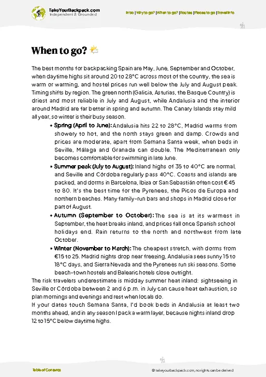
  • Weather: Spring and early autumn deliver the best trail conditions. Expect mild, stable weather—no scorchers or downpours. Summer can bake the path, pushing temps above 30°C (86°F), while winter chills dip below freezing, making some sections slippery.

  • Temperature: Ideal hiking temps hover between 15-22°C (59-72°F). This range keeps your pace steady without overheating or shivering, especially important on a trail that stretches through varied terrain.

  • Daylight Hours: Late spring to early autumn offers 10-14 hours of daylight. More light means more time to push your limits and savor the rugged landscape without rushing.

  • Crowds: Peak summer draws local families and tourists, cranking up foot traffic. Shoulder seasons keep the trail quieter, letting you own the path and soak in the raw nature.
read more 👉

  • Weather: Spring and early autumn deliver the best trail conditions. Expect mild, stable weather—no scorchers or downpours. Summer can bake the path, pushing temps above 30°C (86°F), while winter chills dip below freezing, making some sections slippery.

  • Temperature: Ideal hiking temps hover between 15-22°C (59-72°F). This range keeps your pace steady without overheating or shivering, especially important on a trail that stretches through varied terrain.

  • Daylight Hours: Late spring to early autumn offers 10-14 hours of daylight. More light means more time to push your limits and savor the rugged landscape without rushing.

  • Crowds: Peak summer draws local families and tourists, cranking up foot traffic. Shoulder seasons keep the trail quieter, letting you own the path and soak in the raw nature.

  • Seasonal Activities: Spring blooms and autumn foliage transform the scenery, adding a sensory punch to your trek. Plus, local festivals in nearby villages pop up mostly in these shoulder months, enriching your cultural pit stops.

  • Price Fluctuations: Accommodation and transport costs spike in summer. Booking in spring or autumn can save you cash and hassle, freeing up budget for a cold cerveza at the end of the day.


Pro-tip: Hit La Senda del Oso in early October—cool air, fewer hikers, and the trail dressed in fiery fall colors make every step feel earned and electric.


source: climatestotravel.comJANJanuary: below average for travelingFEBFebruary: below average for travelingMARMarch: good for travelingAPRApril: highly recommended for travelingMAYMay: excellent for travelingJUNJune: highly recommended for travelingJULJuly: fair for travelingAUGAugust: fair for travelingSEPSeptember: highly recommended for travelingOCTOctober: excellent for travelingNOVNovember: good for travelingDECDecember: below average for traveling
spain-hike-la-senda-del-oso
© Google |

✈️ The backpacker research shortcutSpain Travel Guide

An offline-friendly backpacking guide with optimized travel routes, ranked highlights, transport advice, and the best areas to stay.
example page 0 from our offline Travel Guide for Spain
example page 1 from our offline Travel Guide for Spain
example page 2 from our offline Travel Guide for Spain
example page 3 from our offline Travel Guide for Spain
example page 4 from our offline Travel Guide for Spain
example page 5 from our offline Travel Guide for Spain
example page 6 from our offline Travel Guide for Spain
example page 7 from our offline Travel Guide for Spain
The digital guide (542 pages) contains:
148 highlights, ranked by travel appeal
Optimized 7, 14 & 21-day travel routes
Cities, national parks, landmarks, beaches
How to get around
Offline-friendly for travel without Wi-Fi
👉 Click to see all 30+ guide features

📅 Plan smarter in minutes, not weeks
Month by month travel advice
Festivals & national holidays
Budget expectations

🗺️ Go to the right places, skip the overrated ones
Honest pros & cons of destinations
Top hikes, parks & viewpoints
Lesser-known places most travelers miss
Clear “worth it vs skip it” guidance

🛏️ Travel smoothly without rookie mistakes
Best areas to stay
Transport systems explained simply
Common scams & safety advice
SIM cards, money & practical tips

🌍 Understand the country, not just visit it
Culture & traditions
52 Essential phrases & customs
Festivals worth planning around
Traveler-friendly historical context
Insights that make places more meaningful

📱 Built for real travel conditions
Fully downloadable PDF
Works completely offline
Optimized for phone use
Useful in remote areas & buses
Everything in one place
Save weeks of stressful planning
Get instant access to your full guide. 30‑day money-back guarantee.
+ Add another guide for just €6.50

By proceeding you agree to our terms.
Sent to your inbox immediately after payment • 100% Secure Checkout
Best Backpacking Travel Advisor 2025 tourism awardBest Backpacking
Travel Advisor
2025
What others say about Take Your Backpack Guides:
⭐⭐⭐⭐⭐
Fantastic, amazing amount of information!
⭐⭐⭐⭐⭐
My goodness this is amazing, it's what I've been looking for hats off too you!
⭐⭐⭐⭐⭐
I think this is absolutely BRILLIANT
⭐⭐⭐⭐
Very complete and informative. It's still missing places, but I gotta to commend you
⭐⭐⭐⭐⭐
This is truly amazing, thank you, can't wait to explore it with my kids!
⭐⭐⭐⭐⭐
Awesome resource, thank you!
⭐⭐⭐⭐⭐
This is amazing! Can't wait to explore the ones I haven't seen
⭐⭐⭐⭐
I love this! Well done, great idea.
⭐⭐⭐⭐⭐
Thanks for taking the time to make this gem!
⭐⭐⭐⭐⭐
This might be the best website I've ever seen.
⭐⭐⭐⭐⭐
Congratulations, and thank you so much for your work; it's incredibly valuable.
⭐⭐⭐⭐
In all seriousness I think you did a great job pointing out the important spots
⭐⭐⭐⭐⭐
10/10 very good
⭐⭐⭐⭐⭐
As someone who's only just starting to visit regularly this is awesome, thank you.
⭐⭐⭐⭐
Thank you very much! I'm going to visit my dad, it's going to be very useful!
⭐⭐⭐⭐⭐
This is really cool! We'll be travelling for the first time and this definitely come in handy.
⭐⭐⭐⭐⭐
You are now our minister of culture, congratulations 👨‍💼
⭐⭐⭐⭐⭐
Just wanted to tell you that this is a pearl! Going to follow your recommendations.
⭐⭐⭐⭐⭐
This is so cool. I'll definitely be using the resource for my travels soon.
⭐⭐⭐⭐⭐
This is very impressive! Good work.
⭐⭐⭐⭐⭐
This is an amazing and informative site. Very well done!

🛏️ Where to stay?Choosing the right base

If you enjoy meeting fellow travelers, consider choosing hostels with high ratings for atmosphere. On the other hand, if you prefer having your own space, a hotel might be a better option.

🥾 Hike detailsRoute, distance, and difficulty explained

Total Distance: 22 kilometers (about 13.7 miles) round trip. The trail can be done as a loop or an out-and-back, depending on your preference.

Estimated Duration: Plan for around 6 to 8 hours, depending on your pace and how many breaks you take to soak in the views or snap photos.

Difficulty Level: Moderate. While it’s not a technical climb, there are some steep sections and uneven terrain that might challenge less experienced hikers.

Starting Point: The trailhead is located in the town of Tuñón. You can get there by taking a bus from Oviedo, which runs regularly. Just check the schedules ahead … read more 👉
Total Distance: 22 kilometers (about 13.7 miles) round trip. The trail can be done as a loop or an out-and-back, depending on your preference.

Estimated Duration: Plan for around 6 to 8 hours, depending on your pace and how many breaks you take to soak in the views or snap photos.

Difficulty Level: Moderate. While it’s not a technical climb, there are some steep sections and uneven terrain that might challenge less experienced hikers.

Starting Point: The trailhead is located in the town of Tuñón. You can get there by taking a bus from Oviedo, which runs regularly. Just check the schedules ahead of time, as they can vary.

Major Landmarks Along the Route:
  • La Casa del Oso: A visitor center dedicated to the brown bear, where you can learn about local wildlife.
  • Puente de los Siete Ojos: A charming old bridge with great views of the surrounding landscape.
  • Mirador de la Foz de los Tornos: A viewpoint that offers stunning panoramas of the valley below.

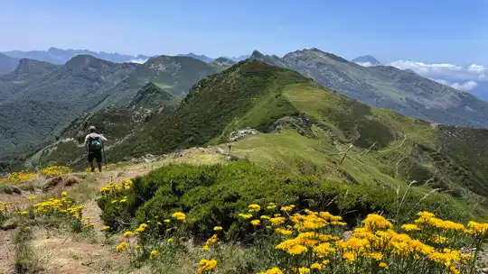
Type of Terrain and Scenery: Expect a mix of dirt paths and rocky trails, with some sections that may be muddy after rain. The scenery is breathtaking—think lush green forests, rolling hills, and the occasional river crossing.

Typical Vegetation and Wildlife:
  • Vegetation: You’ll find a mix of beech and oak trees, along with wildflowers in the spring and summer.
  • Wildlife: Keep your eyes peeled for birds, deer, and, if you’re lucky, the elusive brown bear. Just remember to make some noise so you don’t surprise any critters!

This trail is a gem for those who enjoy nature and want a bit of adventure without going overboard. Just pack enough water and snacks, and you’ll be set for a great day out!
⚠️ Hiking info can sometimes be outdated or inaccurate. Before you hit the trail, check the latest conditions with locals. If you do spot anything that's off, I'd love to hear from you, so I can update it for fellow travelers.

🛡️ SafetyTraveler Safety Guide

La Senda del Oso offers a rewarding trek through lush landscapes, but don’t underestimate the terrain. The trail is well-marked, yet sections can be steep and rocky, demanding solid footing and a steady pace. Weather can shift quickly; be ready for sun, rain, or even a chill, especially in the early mornings or late afternoons.

Wildlife encounters are a possibility, particularly with deer or the occasional bear. Keep your distance and make noise to avoid surprising them.

Pack layers and sturdy shoes, and don’t skimp on water. Timing is key; start early to beat the crowds and enjoy the tranquility. The effort pays off with breathtaking views and the satisfaction of conquering the trail.

FAQFrequently asked questions about La Senda del Oso

The La Senda del Oso hike typically takes about 4 to 6 hours to complete one way, covering approximately 22 kilometers. Most hikers do it as a day trip, but some split it over two days to explore more leisurely.
The hike is considered easy to moderate in difficulty, suitable for most fitness levels. The trail is mostly flat and follows an old railway line, making it accessible for families and casual hikers.
No guide or permit is required to hike La Senda del Oso. The trail is open to the public year-round, and you can explore it independently without any special permissions.
⚠️ Things can change over time, so always validate details locally before you go.

Other Spanish hikes near La Senda del Oso

Explore more nearby:


💡 Not sure where to go next?
Create a personalized itinerary for Spain including La Senda del Oso and the places that fit your trip.

Generate my itinerary

👉 Discover all hikes

Or checkout all Spain has to offer (think cities, towns, villages, national parks, hikes, beaches, festivals)
Country photo of Spain

We 💚 feedbackIs it worth it?

La Senda del Oso is a wild ride through Asturias’ lush landscapes, where the thrill of spotting a bear or a soaring eagle makes every step worthwhile. But be ready for some steep climbs that’ll leave your legs burning. The payoff? Those panoramic views at the top and the sweet taste of local cider afterward. It’s a challenge, but one that rewards you in spades.

✈️ When did I visit Spain?
With Spain having so much to offer, I have visited it many times. Best trip was a hiking tour in the Picos de Europa in the North of Spain in July 2023.

✍️ Help improve this page!
The information on this page is based on my own backpacking experience in Spain, supplemented with up-to-date research and feedback from other travelers. Travel details can change, so if you notice anything outdated or incomplete, feel free to let me know.


🙋‍♂️ Give feedback

👋 Meet the founderWho’s Behind Take Your Backpack?

Johan, backpacker and founder of TakeYourBackpackHi, I’m Johan (Netherlands 🇳🇱), the creator of TakeYourBackpack. Over the past decade, I’ve backpacked through 80+ countries across six continents, gaining extensive experience with independent travel, long-term trips, and overland routes.

This site is built on a combination of firsthand travel experience and carefully curated insights from other backpackers. Many guides are based on places I’ve personally visited, while others bring together tips, observations, and practical advice shared by trusted travelers I’ve met along the way.

The goal is to provide realistic, experience-driven guidance — not generic itineraries — so you can explore destinations with better context, clearer expectations, and more confidence.

Get full Spain guide •
Instant download • 148 highlights • Full Offline guide