×

Timor-Leste🇹🇱 | hikesMount Matebian2,370 m summit, mountain of souls, All Souls’ pilgrimage, Quelicai base | things to do and best time to go

Explore Timor-Leste Coffee FestivalExplore Mundo Perdido

Backpacking in Mount Matebian
🏆 Top pickhike ranked #1
By Johan Kruseman 🇳🇱 | Updated October 15, 2026

The decision that shapes a Matebian trip is whether you summit as a long day or sleep up high, and a cold, clear dawn tips it toward sleeping. Matebian is a massif in the east of Timor-Leste, south of Baucau, and Foho Matebian Mane is its high point at roughly 2,370 meters. Fog often swallows the top by mid-morning, so a day-trip start from the foot means arriving in a gray blank. Trails are unmarked and split among grazing paths, so hire a local guide in the nearest village rather than trusting a phone map. Bring cash, because there are no ATMs on the mountain. Pack a warm layer, since nights are cold, and carry all your water from the last village, as sources on the ridge are unreliable. Roads to the trailhead are rough, and landslides in the wet months can add hours, so leave slack before any onward bus. The scenery is wide open ridgeline, the effort is steep, and transport is slow. The grass at the top snaps with frost at first light.

Discover everything you want to know in the 📖 Timor-Leste Travel Guide.
Best time to go: April - November
Duration: 2 days
Distance: 12 kilometers
Total ascent: 1500 meters


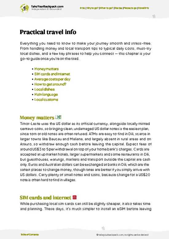
example page 0 from our offline Travel Guide for Timor-Leste
example page 1 from our offline Travel Guide for Timor-Leste
example page 2 from our offline Travel Guide for Timor-Leste
example page 3 from our offline Travel Guide for Timor-Leste
example page 4 from our offline Travel Guide for Timor-Leste
example page 5 from our offline Travel Guide for Timor-Leste
example page 6 from our offline Travel Guide for Timor-Leste
example page 7 from our offline Travel Guide for Timor-Leste
Loading the map 🌍
CLICK TO FILTER
cities
towns
villages
national parks
hikes
beaches
attractions
festivals
regions
SHOW COUNTRY’S BESTSHOW ALL

✨ Why go?
Ranked #1 hike in Timor-Leste
Reasons people choose to hike the here

Matebian is for people who want Timor-Leste’s spiritual heartland without a queue. Timorese tradition holds that the spirits of the dead gather on Matebian Mane, and that gives a night here a weight you do not get on a scenic summit elsewhere. Families still climb for pilgrimage, so you may share the ridge with locals carrying offerings rather than other foreign trekkers.

The second pull is the scale of the view for a short walk. Few places in the country let you stand above 2,000 meters and see the north coast, the sea and the eastern ranges in one sweep, and the nearby Matebian Feto peak adds a second objective if your legs allow. The mountain also holds history: it was a last refuge for civilians and fighters during the resistance, and guides from the foot villages tell that story from … read more 👉
Matebian is for people who want Timor-Leste’s spiritual heartland without a queue. Timorese tradition holds that the spirits of the dead gather on Matebian Mane, and that gives a night here a weight you do not get on a scenic summit elsewhere. Families still climb for pilgrimage, so you may share the ridge with locals carrying offerings rather than other foreign trekkers.

The second pull is the scale of the view for a short walk. Few places in the country let you stand above 2,000 meters and see the north coast, the sea and the eastern ranges in one sweep, and the nearby Matebian Feto peak adds a second objective if your legs allow. The mountain also holds history: it was a last refuge for civilians and fighters during the resistance, and guides from the foot villages tell that story from family memory.

It also fits a longer eastern loop. Combine it with Baucau’s old Portuguese quarter and the Quelicai area, and you get a mountain stretch that breaks up the coastal driving without needing weeks of trekking experience.

💡 HighlightsWhat this place is best known for

  1. Foho Matebian Mane summit: The high point of the massif, at roughly 2,370 meters, is a bare, windy crest with wide views north toward the coast and sea. It is the reason most walkers come, and it is a calm, quiet place at sunrise.
  2. Matebian Feto: The neighboring peak, traditionally the “female” counterpart to Mane. Its slightly lower, rounder profile makes a good side objective and a good vantage for looking back at the main summit.
  3. All Souls’ pilgrimage: Each year around early November, Catholic Timorese climb to the mountain to honor the dead. The tradition ties into the belief that souls travel to Matebian, and if your timing is right, you see a living ritual with candles and prayers rather than a viewpoint.
  4. The high ridgelines: The high slopes are open grass and rock with scattered stunted
… read more 👉
  1. Foho Matebian Mane summit: The high point of the massif, at roughly 2,370 meters, is a bare, windy crest with wide views north toward the coast and sea. It is the reason most walkers come, and it is a calm, quiet place at sunrise.
  2. Matebian Feto: The neighboring peak, traditionally the “female” counterpart to Mane. Its slightly lower, rounder profile makes a good side objective and a good vantage for looking back at the main summit.
  3. All Souls’ pilgrimage: Each year around early November, Catholic Timorese climb to the mountain to honor the dead. The tradition ties into the belief that souls travel to Matebian, and if your timing is right, you see a living ritual with candles and prayers rather than a viewpoint.
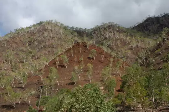
  4. The high ridgelines: The high slopes are open grass and rock with scattered stunted trees, quite unlike the lowland farmland below, and the cloud rolling through them is part of the walk.
  5. Quelicai and the foothill villages: The communities at the base serve as the gateway, where guides are found and households may offer a simple bed and a meal. The mountain’s wartime story comes through here in conversation more than in any monument.
For a first visit, the Foho Matebian Mane summit at dawn is the one to plan everything around.
Spotted a mistake or missing something? Contact us.

Things to do near Mount Matebian

Ratings based on Tripadvisor reviews. When you book through this link, you support our work at no extra cost to you.

🌤️ When to go?Seasonal considerations and timing

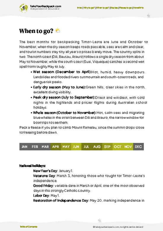
  • Dry Season (June to October): This is the window for Matebian, when trails are firm and the summit ridge is usually clear by sunrise. Lower slopes around Baucau and Quelicai run 24 to 32°C (75 to 90°F), while the high camps near 2,300 m (7,500 ft) drop to roughly 8 to 14°C (46 to 57°F) at night. Daylight lasts about 11.5 to 12 hours.
  • Transition Months (November and May): Showers start building in the afternoons and mornings stay hazy but workable. Expect 22 to 30°C (72 to 86°F) lower down, with mud on the steeper tracks. Villages are quiet, so homestay hosts have more time for you.
  • Wet Season (December to April): Heavy downpours turn dirt roads to Quelicai and Baguia into slick clay, and cloud often swallows the peaks. Highs sit near 25 to 30°C (77 to 86°F). Few visitors come, and prices barely
… read more 👉
  • Dry Season (June to October): This is the window for Matebian, when trails are firm and the summit ridge is usually clear by sunrise. Lower slopes around Baucau and Quelicai run 24 to 32°C (75 to 90°F), while the high camps near 2,300 m (7,500 ft) drop to roughly 8 to 14°C (46 to 57°F) at night. Daylight lasts about 11.5 to 12 hours.
  • Transition Months (November and May): Showers start building in the afternoons and mornings stay hazy but workable. Expect 22 to 30°C (72 to 86°F) lower down, with mud on the steeper tracks. Villages are quiet, so homestay hosts have more time for you.
  • Wet Season (December to April): Heavy downpours turn dirt roads to Quelicai and Baguia into slick clay, and cloud often swallows the peaks. Highs sit near 25 to 30°C (77 to 86°F). Few visitors come, and prices barely move because the area has no real tourist market.
  • Pilgrimage Dates: Locals climb for religious observances, especially around Catholic feast days, so the mountain can have more people than usual.
Start your climb in the dark so you reach the ridge before cloud rolls in, which usually happens by mid-morning.


source: climatestotravel.comJANJanuary: fair for travelingFEBFebruary: fair for travelingMARMarch: fair for travelingAPRApril: good for travelingMAYMay: highly recommended for travelingJUNJune: highly recommended for travelingJULJuly: highly recommended for travelingAUGAugust: highly recommended for travelingSEPSeptember: excellent for travelingOCTOctober: excellent for travelingNOVNovember: good for travelingDECDecember: fair for traveling
timor-leste-hike-mount-matebian
© Google | Pb Channel

✈️ The backpacker research shortcutTimor-Leste Travel Guide

An offline-friendly backpacking guide with optimized travel routes, ranked highlights, transport advice, and the best areas to stay.
example page 0 from our offline Travel Guide for Timor-Leste
example page 1 from our offline Travel Guide for Timor-Leste
example page 2 from our offline Travel Guide for Timor-Leste
example page 3 from our offline Travel Guide for Timor-Leste
example page 4 from our offline Travel Guide for Timor-Leste
example page 5 from our offline Travel Guide for Timor-Leste
example page 6 from our offline Travel Guide for Timor-Leste
example page 7 from our offline Travel Guide for Timor-Leste
The digital guide (171 pages) contains:
✅ 46 highlights, ranked by travel appeal
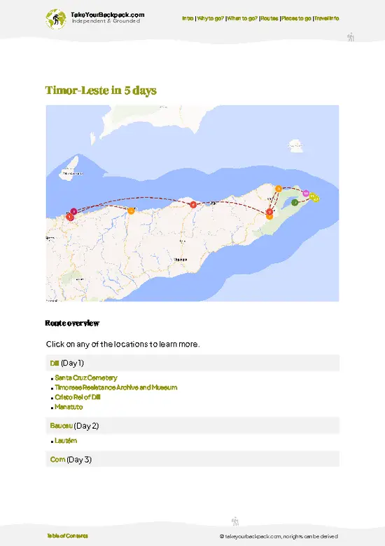
✅ Optimized 2, 3 & 5-day travel routes
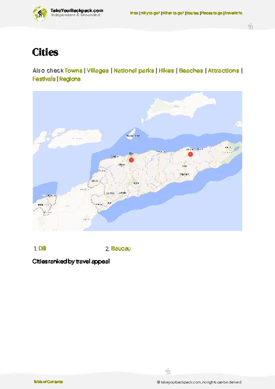
✅ Cities, national parks, landmarks, beaches
✅ How to get around
✅ Offline-friendly for travel without Wi-Fi
👉 Click to see all 30+ guide features

📅 Plan smarter in minutes, not weeks
✅ Month by month travel advice
✅ Festivals & national holidays
✅ Budget expectations

🗺️ Go to the right places, skip the overrated ones
✅ Honest pros & cons of destinations
✅ Top hikes, parks & viewpoints
✅ Lesser-known places most travelers miss
✅ Clear “worth it vs skip it” guidance

🛏️ Travel smoothly without rookie mistakes
✅ Best areas to stay
✅ Transport systems explained simply
✅ Common scams & safety advice
✅ SIM cards, money & practical tips

🌍 Understand the country, not just visit it
✅ Culture & traditions
✅ 52 Essential phrases & customs
✅ Festivals worth planning around
✅ Traveler-friendly historical context
✅ Insights that make places more meaningful

📱 Built for real travel conditions
✅ Fully downloadable PDF
✅ Works completely offline
✅ Optimized for phone use
✅ Useful in remote areas & buses
✅ Everything in one place
Stop searching, start planning
Get instant access to your full guide. 30‑day money-back guarantee.
+ Add another guide for just

By proceeding you agree to our terms.
Sent to your inbox immediately after payment • 100% Secure Checkout
Best Backpacking Travel Advisor 2025 tourism awardBest Backpacking
Travel Advisor
2025
What others say about Take Your Backpack Guides:
⭐⭐⭐⭐⭐
Fantastic, amazing amount of information!
⭐⭐⭐⭐⭐
My goodness this is amazing, it's what I've been looking for hats off too you!
⭐⭐⭐⭐⭐
I think this is absolutely BRILLIANT
⭐⭐⭐⭐
Very complete and informative. It's still missing places, but I gotta to commend you
⭐⭐⭐⭐⭐
This is truly amazing, thank you, can't wait to explore it with my kids!
⭐⭐⭐⭐⭐
Awesome resource, thank you!
⭐⭐⭐⭐⭐
This is amazing! Can't wait to explore the ones I haven't seen
⭐⭐⭐⭐
I love this! Well done, great idea.
⭐⭐⭐⭐⭐
Thanks for taking the time to make this gem!
⭐⭐⭐⭐⭐
This might be the best website I've ever seen.
⭐⭐⭐⭐⭐
Congratulations, and thank you so much for your work; it's incredibly valuable.
⭐⭐⭐⭐
In all seriousness I think you did a great job pointing out the important spots
⭐⭐⭐⭐⭐
10/10 very good
⭐⭐⭐⭐⭐
As someone who's only just starting to visit regularly this is awesome, thank you.
⭐⭐⭐⭐
Thank you very much! I'm going to visit my dad, it's going to be very useful!
⭐⭐⭐⭐⭐
This is really cool! We'll be travelling for the first time and this definitely come in handy.
⭐⭐⭐⭐⭐
You are now our minister of culture, congratulations 👨‍💼
⭐⭐⭐⭐⭐
Just wanted to tell you that this is a pearl! Going to follow your recommendations.
⭐⭐⭐⭐⭐
This is so cool. I'll definitely be using the resource for my travels soon.
⭐⭐⭐⭐⭐
This is very impressive! Good work.
⭐⭐⭐⭐⭐
This is an amazing and informative site. Very well done!

🛏️ Where to stay?How to pick the right area

If you enjoy meeting fellow travelers, consider choosing hostels with high ratings for atmosphere. On the other hand, if you prefer having your own space, a hotel might be a better option.

🥾 Hike detailsHike details: route, duration, and difficulty of Mount Matebian

Total Distance: Varies with the starting village and route, but expect a steep climb of several hours each way rather than a long traverse.
Estimated Duration: Two days is the practical plan, with a night near the top for sunrise. Fit hikers can try a long single day, though cloud often arrives before midday.
Difficulty: Moderate to demanding. The path is steep, unsigned in places and exposed to wind and cold at height.
Starting Point: The foothill villages around Quelicai, reached from Baucau.
  • Public Transport: Shared minibuses run from Baucau toward Quelicai on rough mountain roads and are slow,
… read more 👉
Total Distance: Varies with the starting village and route, but expect a steep climb of several hours each way rather than a long traverse.
Estimated Duration: Two days is the practical plan, with a night near the top for sunrise. Fit hikers can try a long single day, though cloud often arrives before midday.
Difficulty: Moderate to demanding. The path is steep, unsigned in places and exposed to wind and cold at height.
Starting Point: The foothill villages around Quelicai, reached from Baucau.
  • Public Transport: Shared minibuses run from Baucau toward Quelicai on rough mountain roads and are slow, with few departures after midday. From the road end, you walk or hire a local motorbike to the trailhead.
  • Guide: Arrange one in the village. Paths split among grazing tracks and fog can erase landmarks.
Major Landmarks:
  • Foho Matebian Mane: The main summit, roughly 2,370 meters, with long views toward the north coast.
  • Matebian Feto: The neighboring peak, a little lower.
  • Ridge shrines and offerings: Small sites used during pilgrimage season.
Terrain and Scenery: Farmed terraces and village paths give way to steep, rocky slopes, then open ridge. Expect loose stones, slick grass after rain and strong wind at the crest. Views open toward the sea on clear mornings.
Vegetation: Low-altitude gardens and scrub change to tussock grass and stunted, wind-bent trees higher up.
Wildlife: Birdlife is the main sighting, along with grazing livestock on the lower slopes. Large mammals are rare.
Practical Notes: Carry all water from the last village, a warm layer and a rain shell. Nights are cold at the top, and the wet season turns tracks and access roads treacherous.
⚠️ Hiking info can sometimes be outdated or inaccurate. Before you hit the trail, check the latest conditions with locals. If you do spot anything that's off, I'd love to hear from you, so I can update it for fellow travelers.

🛡️ SafetyTraveler Safety Guide

Matebian is a straightforward but remote mountain, and its main risks are weather, rough access roads and being far from help. Cloud and wind arrive fast on the exposed upper ridge, and nights at altitude are cold enough to need a fleece and a windproof layer, even in the dry season. Trails are steep, with loose rock and slippery clay after rain, so sturdy boots and trekking poles save your knees on the descent. Paths can split near villages, so hire a local guide or ask villagers to point you along, and download an offline map before leaving signal. Carry at least 3 liters of water per person, since refill points are scarce, and bring snacks and sun protection for open slopes. Phone coverage is patchy, and medical care is a long drive away in Baucau, so pack a basic first-aid kit. Wildlife … read more 👉
Matebian is a straightforward but remote mountain, and its main risks are weather, rough access roads and being far from help. Cloud and wind arrive fast on the exposed upper ridge, and nights at altitude are cold enough to need a fleece and a windproof layer, even in the dry season. Trails are steep, with loose rock and slippery clay after rain, so sturdy boots and trekking poles save your knees on the descent. Paths can split near villages, so hire a local guide or ask villagers to point you along, and download an offline map before leaving signal. Carry at least 3 liters of water per person, since refill points are scarce, and bring snacks and sun protection for open slopes. Phone coverage is patchy, and medical care is a long drive away in Baucau, so pack a basic first-aid kit. Wildlife is rarely an issue, though feral dogs near villages can bark at you; walk calmly and keep food sealed. Ask permission before photographing sacred sites or people.

FAQTraveler FAQ

Most hikers need one long day of 6 to 9 hours round trip for the summit push, with a longer overnight option if you start from a village homestay. The approach from Baucau by road takes about 2 to 3 hours to reach trailheads near Quelicai or Fatumaka. Many walkers sleep in a nearby village the night before to start at around 4 or 5 a.m. Allow extra time if rain has made the access tracks muddy.
Expect a moderate to hard hike, mainly because of steep climbs, altitude of about 2,370 m (7,780 ft) and rough footing. Fit walkers with some hill experience manage it fine, but the final ascent is relentless and the descent is hard on the knees. Navigation is the second challenge, since trails are lightly marked. Wet weather makes it noticeably tougher.
No national permit is required, but a local guide is strongly recommended and usually arranged through your homestay or a Dili or Baucau tour operator. Guides typically charge around US$20 to 40 per day, and hiring one also supports the village. Respect for sacred sites matters, so check with community leaders before entering ceremonial areas. Bring cash in US dollars, since Timor-Leste uses the dollar and there are no ATMs near the mountain.
⚠️ Things can change over time, so always validate details locally before you go.

Ideas for continuing your journey

Mount Matebian isn’t the only highlight in Timor-Leste. Explore all what Timor-Leste has to offer.
Country photo of Timor-Leste

We 💚 feedbackFinal thoughts on hiking the Mount Matebian

Go in the dry months and be on the ridge before first light, because the mist usually rolls in once the sun warms the slopes, and the clearest hour is the cold one. I would sleep near the top rather than rush up and down in a day, and I would bring a real jacket, since the wind up there cuts through a T-shirt fast.

✍️ Help improve this page!
The information on this page is based on in-depth research, insights shared by experienced travelers, and feedback from the local travel community in Timor-Leste. While every effort is made to keep the information accurate and current, conditions can change — so if you spot anything incorrect or outdated, please get in touch.


🙋‍♂️ Give feedback

👋 Meet the founderWho’s Behind Take Your Backpack?

Johan, backpacker and founder of TakeYourBackpackHi, I’m Johan (Netherlands 🇳🇱), the creator of TakeYourBackpack. Over the past 3 decades, I’ve backpacked through 90+ countries across six continents, gaining extensive experience with independent travel, long-term trips, and overland routes.

This site is built on a combination of firsthand travel experience and carefully curated insights from other backpackers. Many guides are based on places I’ve personally visited, while others bring together tips, observations, and practical advice shared by trusted travelers I’ve met along the way.

The goal is to provide realistic, experience-driven guidance — not generic itineraries — so you can explore destinations with better context, clearer expectations, and more confidence.