×

Uganda🇺🇬 | hikesMount Kadam Trailgranite outcrops, remote Karamoja, thorny bushland | things to do and best time to go

Explore Mount Moroto TrailExplore Mount Morungole Trail

Backpacking in Mount Kadam Trail
👌 Worth visitinghike ranked #7
By Johan Kruseman 🇳🇱 | Updated September 4, 2026

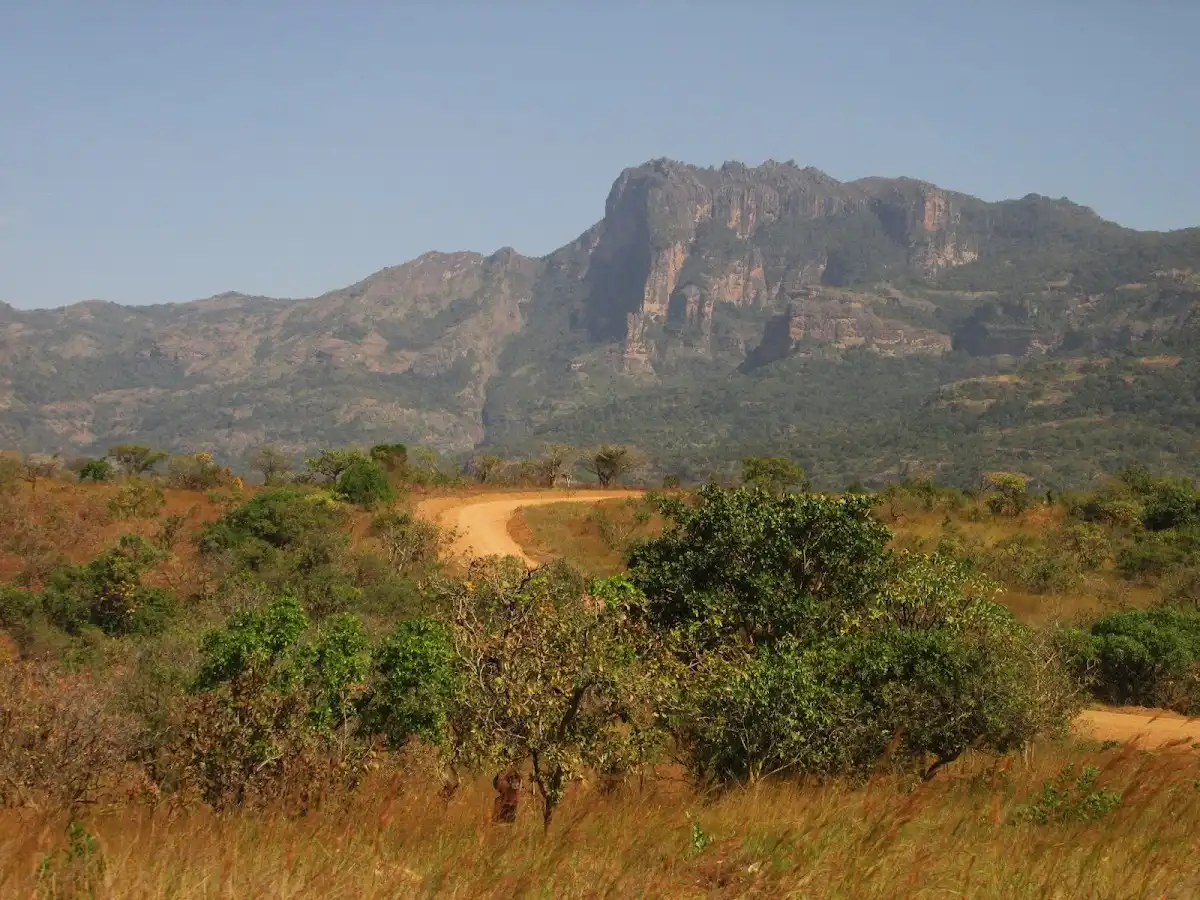
You’ll face a real fork in the road at Mount Kadam: do you commit to the full summit push, or settle for the lower slopes and call it a day? That choice matters—because Kadam isn’t a casual stroll. It’s tucked in Uganda’s remote Karamoja region, far from the tourist conveyor belt, and the trail is a raw, red-earth grind. Expect sweat, scratched shins, and the kind of silence that only comes when you’re miles from the nearest paved road. The payoff? Ridge views that swallow the horizon, villages perched like secrets, and—if you’re lucky—a cold soda in Nakapiripirit at the end. The hike is long, steep, and the path can vanish beneath your boots. Public transport is patchy at best; you’ll need patience or a sturdy boda-boda. Compared to the well-trodden Rwenzoris or Mount Elgon, Kadam is wilder, lonelier, and absolutely worth the effort if you want Uganda unfiltered.

Discover everything you want to know in the 📖 Uganda Travel Guide.
Best time to go: June - September, December - February
Duration: 3 days
Distance: 12 kilometers
Total ascent: 1,200 meters
Safety warning

The current risk level for Uganda is high. Check the advice before going.


Get your Uganda guide
106 ranked highlights, routes & tips, works offline (408 pages)
Loading the map 🌍
CLICK TO FILTER
cities
towns
landmarks
national parks
hikes
beaches
attractions
festivals
regions
SHOW COUNTRY’S BESTSHOW ALL

✨ Why go?
Ranked #7 hike in Uganda
What makes it a must-see hike

The Mount Kadam Trail in Uganda is a magnet for backpackers craving a mix of challenge and reward. The scenery-to-effort ratio is off the charts. You’ll trek through lush forests, where the air is thick with the scent of earth and greenery, and the sounds of wildlife surround you. Each step brings you closer to breathtaking views that make the sweat worth it.

Accessing the trail is a breeze with public transport options that drop you near the trailhead. It’s budget-friendly, too—perfect for those looking to stretch their dollars. The hike offers flexible distances, allowing you to tailor your adventure based on your energy levels or time constraints.

Plus, it fits seamlessly into a longer backpacking route through Uganda, making it an ideal pit stop. Whether you’re savoring a cold beer … read more 👉
The Mount Kadam Trail in Uganda is a magnet for backpackers craving a mix of challenge and reward. The scenery-to-effort ratio is off the charts. You’ll trek through lush forests, where the air is thick with the scent of earth and greenery, and the sounds of wildlife surround you. Each step brings you closer to breathtaking views that make the sweat worth it.

Accessing the trail is a breeze with public transport options that drop you near the trailhead. It’s budget-friendly, too—perfect for those looking to stretch their dollars. The hike offers flexible distances, allowing you to tailor your adventure based on your energy levels or time constraints.

Plus, it fits seamlessly into a longer backpacking route through Uganda, making it an ideal pit stop. Whether you’re savoring a cold beer at the end or simply soaking in the vistas, the Mount Kadam Trail delivers a visceral experience that lingers long after the hike is over.
Want to include Mount Kadam Trail in your Uganda route?
Create a personalized Uganda itinerary that includes Mount Kadam Trail and the places that fit your trip — based on your travel style, budget, and available time. Get your route in seconds.

Generate my trip

💡 HighlightsEssential experiences to have while hiking the Mount Kadam Trail

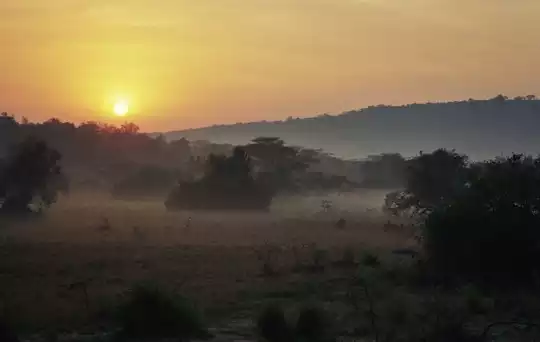
  • Summit sunrise panorama — Hike up early and you get a wide, empty sky spilling light across the Karamoja plains; the scale and silence up there (with distant ridgelines fading into haze) make it feel like you’re the only person in northeastern Uganda. Best time for photos and that spine-tingling “you made it” moment.
  • Pockets of Afromontane forest — Sporadic, cool patches of mossy trees and ferns tucked into gullies feel totally different from the dry lowlands below. The contrast—hot, dusty plains to shaded, green hollows—gives the trail a surprising variety of scenery on a relatively short route.
  • Ridge walk and rocky escarpments — The trail follows sharp ridgelines and steep cliffs in places, offering dramatic viewpoints and good scrambling; the geology and exposed rock faces are much
read more 👉
  • Summit sunrise panorama — Hike up early and you get a wide, empty sky spilling light across the Karamoja plains; the scale and silence up there (with distant ridgelines fading into haze) make it feel like you’re the only person in northeastern Uganda. Best time for photos and that spine-tingling “you made it” moment.
  • Pockets of Afromontane forest — Sporadic, cool patches of mossy trees and ferns tucked into gullies feel totally different from the dry lowlands below. The contrast—hot, dusty plains to shaded, green hollows—gives the trail a surprising variety of scenery on a relatively short route.
  • Ridge walk and rocky escarpments — The trail follows sharp ridgelines and steep cliffs in places, offering dramatic viewpoints and good scrambling; the geology and exposed rock faces are much more interesting than the average dirt track and make for dynamic hiking and photography.
  • Birdlife and mountain-specialist fauna — It’s a quiet hike, but the mix of habitats attracts montane bird species, colorful sunbirds and plenty of butterflies. If you like slow, attentive walking, the wildlife and small critter encounters reward patience.
  • Karamojong cultural encounters — The trail threads close to pastoral villages, so you’ll see day-to-day life—cattle kraals, local markets and friendly curiosity. Guides from the area add real context; the cultural contrast with the mountain scenery is what sticks with you afterward.
Personal favorite: the summit sunrise—nothing beats watching the plains wake up from that ridge.
Spotted a mistake or missing something? Contact us.

Things to do near Mount Kadam Trail

Ratings based on Tripadvisor reviews. When you book through this link, you support our work at no extra cost to you.

🌤️ When to go?When to go for the best experience


  • Weather: The best window is during Uganda’s dry seasons—December to February and June to August—when the trail is firm and the skies clear. Rain turns the path slick and treacherous, sapping energy and morale.

  • Temperature: Expect daytime highs around 20-25°C (68-77°F) on the trail, dropping sharply after sunset to 10-15°C (50-59°F). Layering is key; the mountain chill hits hard once you stop moving.

  • Daylight Hours: Near the equator, daylight is steady year-round, roughly 12 hours. Start early to maximize your summit time and avoid afternoon clouds that often roll in.

  • Crowds: Peak trekking months bring a handful of other hikers but nothing overwhelming. Off-season means solitude but prepare for muddy slogging and fewer support services.

  • Seasonal Activities: Dry months align with
read more 👉

  • Weather: The best window is during Uganda’s dry seasons—December to February and June to August—when the trail is firm and the skies clear. Rain turns the path slick and treacherous, sapping energy and morale.

  • Temperature: Expect daytime highs around 20-25°C (68-77°F) on the trail, dropping sharply after sunset to 10-15°C (50-59°F). Layering is key; the mountain chill hits hard once you stop moving.

  • Daylight Hours: Near the equator, daylight is steady year-round, roughly 12 hours. Start early to maximize your summit time and avoid afternoon clouds that often roll in.

  • Crowds: Peak trekking months bring a handful of other hikers but nothing overwhelming. Off-season means solitude but prepare for muddy slogging and fewer support services.

  • Seasonal Activities: Dry months align with local festivals and wildlife spotting, adding cultural and natural layers to your hike. Wet seasons dull the experience but boost the greenery.

  • Price Fluctuations: Expect higher guide and permit fees during peak dry seasons due to demand. Off-season offers bargains but at the cost of trail conditions and comfort.


Pro-tip: Aim for early dry season hikes—trail conditions are solid, crowds manageable, and the mountain’s raw beauty hits hardest when the air is crisp and clear.


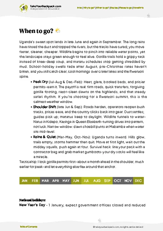
source: climatestotravel.comJANJanuary: excellent for travelingFEBFebruary: excellent for travelingMARMarch: fair for travelingAPRApril: below average for travelingMAYMay: fair for travelingJUNJune: excellent for travelingJULJuly: excellent for travelingAUGAugust: excellent for travelingSEPSeptember: good for travelingOCTOctober: fair for travelingNOVNovember: fair for travelingDECDecember: excellent for traveling
uganda-hike-mount-kadam-trail
© Google |

✈️ The backpacker research shortcutUganda Travel Guide

An offline-friendly backpacking guide with optimized travel routes, ranked highlights, transport advice, and the best areas to stay.
example page 0 from our offline Travel Guide for Uganda
example page 1 from our offline Travel Guide for Uganda
example page 2 from our offline Travel Guide for Uganda
example page 3 from our offline Travel Guide for Uganda
example page 4 from our offline Travel Guide for Uganda
example page 5 from our offline Travel Guide for Uganda
example page 6 from our offline Travel Guide for Uganda
example page 7 from our offline Travel Guide for Uganda
The digital guide (408 pages) contains:
106 highlights, ranked by travel appeal
Optimized 5, 10 & 15-day travel routes
Cities, national parks, landmarks, beaches
How to get around
Offline-friendly for travel without Wi-Fi
👉 Click to see all 30+ guide features

📅 Plan smarter in minutes, not weeks
Month by month travel advice
Festivals & national holidays
Budget expectations

🗺️ Go to the right places, skip the overrated ones
Honest pros & cons of destinations
Top hikes, parks & viewpoints
Lesser-known places most travelers miss
Clear “worth it vs skip it” guidance

🛏️ Travel smoothly without rookie mistakes
Best areas to stay
Transport systems explained simply
Common scams & safety advice
SIM cards, money & practical tips

🌍 Understand the country, not just visit it
Culture & traditions
52 Essential phrases & customs
Festivals worth planning around
Traveler-friendly historical context
Insights that make places more meaningful

📱 Built for real travel conditions
Fully downloadable PDF
Works completely offline
Optimized for phone use
Useful in remote areas & buses
Everything in one place
Save weeks of stressful planning
Get instant access to your full guide. 30‑day money-back guarantee.
+ Add another guide for just €6.50

By proceeding you agree to our terms.
Sent to your inbox immediately after payment • 100% Secure Checkout
Best Backpacking Travel Advisor 2025 tourism awardBest Backpacking
Travel Advisor
2025
What others say about Take Your Backpack Guides:
⭐⭐⭐⭐⭐
Fantastic, amazing amount of information!
⭐⭐⭐⭐⭐
My goodness this is amazing, it's what I've been looking for hats off too you!
⭐⭐⭐⭐⭐
I think this is absolutely BRILLIANT
⭐⭐⭐⭐
Very complete and informative. It's still missing places, but I gotta to commend you
⭐⭐⭐⭐⭐
This is truly amazing, thank you, can't wait to explore it with my kids!
⭐⭐⭐⭐⭐
Awesome resource, thank you!
⭐⭐⭐⭐⭐
This is amazing! Can't wait to explore the ones I haven't seen
⭐⭐⭐⭐
I love this! Well done, great idea.
⭐⭐⭐⭐⭐
Thanks for taking the time to make this gem!
⭐⭐⭐⭐⭐
This might be the best website I've ever seen.
⭐⭐⭐⭐⭐
Congratulations, and thank you so much for your work; it's incredibly valuable.
⭐⭐⭐⭐
In all seriousness I think you did a great job pointing out the important spots
⭐⭐⭐⭐⭐
10/10 very good
⭐⭐⭐⭐⭐
As someone who's only just starting to visit regularly this is awesome, thank you.
⭐⭐⭐⭐
Thank you very much! I'm going to visit my dad, it's going to be very useful!
⭐⭐⭐⭐⭐
This is really cool! We'll be travelling for the first time and this definitely come in handy.
⭐⭐⭐⭐⭐
You are now our minister of culture, congratulations 👨‍💼
⭐⭐⭐⭐⭐
Just wanted to tell you that this is a pearl! Going to follow your recommendations.
⭐⭐⭐⭐⭐
This is so cool. I'll definitely be using the resource for my travels soon.
⭐⭐⭐⭐⭐
This is very impressive! Good work.
⭐⭐⭐⭐⭐
This is an amazing and informative site. Very well done!

🛏️ Where to stay?Best areas and accommodation options

If you enjoy meeting fellow travelers, consider choosing hostels with high ratings for atmosphere. On the other hand, if you prefer having your own space, a hotel might be a better option.

🥾 Hike detailsEverything you need to know before hiking Mount Kadam Trail

Total Distance: The Mount Kadam Trail spans approximately 12 kilometers (about 7.5 miles) round trip.

Estimated Duration: Expect to spend around 4 to 6 hours on the trail, depending on your pace and how often you stop to take in the views or catch your breath.

Difficulty Level: This trail is considered moderate. While it’s not a technical climb, some sections can be steep and may require a bit of scrambling.

Starting Point: The trailhead is located near the village of Kachumbala. To get there by public transport, you can take a matatu (shared taxi) from Mbale to Kachumbala. The ride takes … read more 👉
Total Distance: The Mount Kadam Trail spans approximately 12 kilometers (about 7.5 miles) round trip.

Estimated Duration: Expect to spend around 4 to 6 hours on the trail, depending on your pace and how often you stop to take in the views or catch your breath.

Difficulty Level: This trail is considered moderate. While it’s not a technical climb, some sections can be steep and may require a bit of scrambling.

Starting Point: The trailhead is located near the village of Kachumbala. To get there by public transport, you can take a matatu (shared taxi) from Mbale to Kachumbala. The ride takes about 30 minutes. Once you arrive in Kachumbala, it’s a short walk to the trailhead.

Major Landmarks Along the Route:
  • Waterfalls: Midway through the hike, you’ll encounter a beautiful waterfall that’s a great spot for a break.
  • Viewpoints: There are several scenic viewpoints offering stunning vistas of the surrounding hills and valleys, especially as you near the summit.
  • Local Villages: You’ll pass through a couple of small villages where you can experience local culture and perhaps grab a snack.

Type of Terrain and Scenery: The trail features a mix of dirt paths, rocky sections, and some grassy areas. The scenery ranges from lush forests at the base to more open grasslands as you ascend. Expect panoramic views as you climb higher, with the landscape transforming into rolling hills and valleys.

Typical Vegetation and Wildlife:
  • Vegetation: The lower slopes are rich in tropical rainforest, with plenty of ferns and tall trees. As you go higher, you’ll see more grasslands and shrubs.
  • Wildlife: Keep an eye out for various bird species, monkeys, and maybe even some small antelope. The area is quite biodiverse, so you might spot some interesting critters along the way.

This trail is a fantastic option for those looking to experience Uganda’s natural beauty without the intense challenges of some other hikes. Just remember to pack enough water and snacks, and enjoy the journey!
⚠️ Hiking info can sometimes be outdated or inaccurate. Before you hit the trail, check the latest conditions with locals. If you do spot anything that's off, I'd love to hear from you, so I can update it for fellow travelers.

🛡️ SafetyScams, Hazards, and Annoyances

The Mount Kadam Trail in Uganda offers a thrilling mix of challenge and beauty. Weather can shift quickly; mornings may start cool, but the sun can blaze by midday. Dress in layers and pack a light rain jacket. The trail itself is steep in sections, with rocky footing that demands focus. Take your time; a steady pace will keep you steady and enjoying the scenery.

Wildlife encounters are a possibility, especially with monkeys and various bird species. Keep your distance and don’t feed them—respect their space.

First-timers often underestimate the altitude; hydration is key. Carry enough water and snacks to fuel your journey. The trail is well-marked, but a map can help you navigate confidently. Embrace the grind; the view from the summit, paired with that first cold beer, makes every step worthwhile.

FAQCommon questions from travelers

The Mount Kadam Trail hike typically takes 2 to 3 days to complete, covering approximately 40 kilometers round trip. The pace depends on fitness and weather conditions, with most hikers camping overnight on the mountain.
The difficulty of the Mount Kadam Trail hike is moderate to challenging due to steep ascents and variable terrain. Hikers should be prepared for altitude changes up to 3,063 meters and potentially slippery paths during the rainy season from April to June.
Yes, a guide and permit are required to hike Mount Kadam. Permits can be obtained through the Uganda Wildlife Authority or local tour operators, usually costing around $20 to $30 USD, and guides are mandatory for safety and navigation.
⚠️ Things can change over time, so always validate details locally before you go.

Other Ugandan hikes near Mount Kadam Trail

Explore more nearby:

  • Sipi Falls—triple waterfalls, coffee farms, basalt cliffs| 60 km away
  • Mount Elgon—crater rim, ancient caldera, moorland plateaus, caves| 71 km away
  • Mount Moroto Trail—rocky ridges, savanna edge, Tepeth villages| 86 km away

💡 Not sure where to go next?
Create a personalized itinerary for Uganda including Mount Kadam Trail and the places that fit your trip.

Generate my itinerary

👉 Discover all hikes

Or checkout all Uganda has to offer (think cities, towns, villages, national parks, hikes, beaches, festivals)
Country photo of Uganda

We 💚 feedbackSumming up the experience

The Mount Kadam Trail is a wild ride, where the lush green canopy gives way to breathtaking views that make every step worth it. You’ll feel the burn in your legs, but that first glimpse of the summit? Pure magic. Just know, the trail can be a bit rough and muddy, especially after rain. Pack your grit and embrace the challenge; the reward is a slice of Uganda that few get to see.

✈️ When did I visit Uganda?
In September 2019 I have done a backpacking trip through Uganda. Seeing gorilla’s in the wild from up close was a pure unexpected highlight!

✍️ Help improve this page!
The information on this page is based on my own backpacking experience in Uganda, supplemented with up-to-date research and feedback from other travelers. Travel details can change, so if you notice anything outdated or incomplete, feel free to let me know.


🙋‍♂️ Give feedback

👋 Meet the founderWho’s Behind Take Your Backpack?

Johan, backpacker and founder of TakeYourBackpackHi, I’m Johan (Netherlands 🇳🇱), the creator of TakeYourBackpack. Over the past decade, I’ve backpacked through 80+ countries across six continents, gaining extensive experience with independent travel, long-term trips, and overland routes.

This site is built on a combination of firsthand travel experience and carefully curated insights from other backpackers. Many guides are based on places I’ve personally visited, while others bring together tips, observations, and practical advice shared by trusted travelers I’ve met along the way.

The goal is to provide realistic, experience-driven guidance — not generic itineraries — so you can explore destinations with better context, clearer expectations, and more confidence.

Get full Uganda guide •
Instant download • 106 highlights • Full Offline guide