×

American Samoa🇦🇸 | beachesFagasa BayDark sand and coral rubble, Fagasa Pass viewpoint, Mt. Alava Trail, village road | things to do and best time to go

Explore Tauese P.F. Sunia Ocean CenterExplore Fagatele Bay Beach

Backpacking in Fagasa Bay
🌟 Highlightbeach ranked #3
By Johan Kruseman 🇳🇱 | Updated October 15, 2026

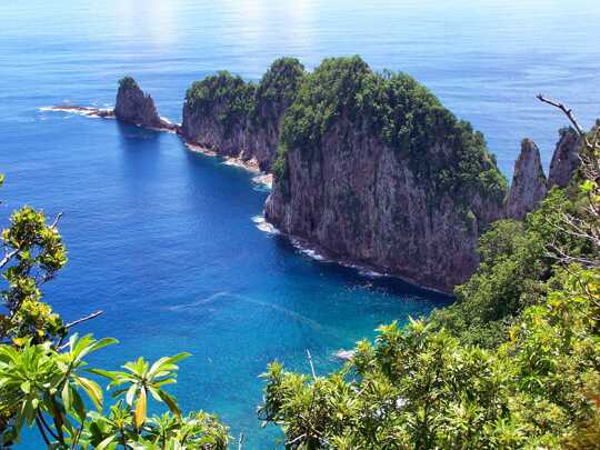
Fagasa Bay faces the open Pacific on the north coast of Tutuila, not the sheltered Pago Pago Harbor, so the water can be rough and the shore is more rock and coral rubble than resort sand. It sits in the north of American Samoa, over the ridge from the capital, and the road drops steeply from Fagasa Pass to reach it. Crowds are close to nonexistent, there are no rental huts or lounge chairs, and swimming only makes sense on calm mornings when the swell is low. Snorkeling is hit or miss. Food and beds are back in the harbor towns, so pack water and snacks. What you get is a quiet village bay with green ridges stacked behind it, and it costs nothing. Go early, before the afternoon cloud settles on the peaks, and watch the village kids fishing from the rocks near the water’s edge.

Discover everything you want to know in the 📖 American Samoa Travel Guide.


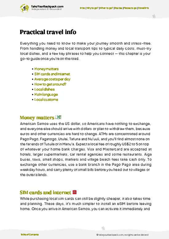
example page 0 from our offline Travel Guide for American Samoa
example page 1 from our offline Travel Guide for American Samoa
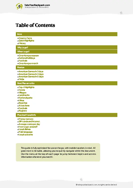
example page 2 from our offline Travel Guide for American Samoa
example page 3 from our offline Travel Guide for American Samoa
example page 4 from our offline Travel Guide for American Samoa
example page 5 from our offline Travel Guide for American Samoa
example page 6 from our offline Travel Guide for American Samoa
example page 7 from our offline Travel Guide for American Samoa
Loading the map 🌍
CLICK TO FILTER
towns
villages
landmarks
national parks
hikes
beaches
attractions
festivals
regions
SHOW COUNTRY’S BESTSHOW ALL

✨ Why go?
Ranked #3 beach in American Samoa
Why visitors keep coming back

Backpackers stop here because Fagasa Bay is the easiest place on Tutuila to see a working Samoan village on the water without a tour. There is no entrance gate, no operator, and no one selling anything. You park, walk, and nod at people sitting under open-sided fales. That gives you a real sense of fa’a Samoa in a way the harbor strip never does.
The second pull is the setting. The bay sits right under the ridge that carries the Mt. Alava Trail, so it pairs with a hike in the National Park of American Samoa. You can sweat on the ridge in the morning, then come down and cool off with a swim if the sea is flat, or just a sit on the shore.
It also works as a pause on a loop of the north side of the island. The road over Fagasa Pass is short but steep, and the contrast between the busy harbor and … read more 👉
Backpackers stop here because Fagasa Bay is the easiest place on Tutuila to see a working Samoan village on the water without a tour. There is no entrance gate, no operator, and no one selling anything. You park, walk, and nod at people sitting under open-sided fales. That gives you a real sense of fa’a Samoa in a way the harbor strip never does.
The second pull is the setting. The bay sits right under the ridge that carries the Mt. Alava Trail, so it pairs with a hike in the National Park of American Samoa. You can sweat on the ridge in the morning, then come down and cool off with a swim if the sea is flat, or just a sit on the shore.
It also works as a pause on a loop of the north side of the island. The road over Fagasa Pass is short but steep, and the contrast between the busy harbor and this quiet shoreline makes a good break in a day of island driving. Treat it as a stop, not a base.

💡 HighlightsWhat this place is best known for

  1. Fagasa Bay shoreline: The main draw is the bay itself, a curve of dark sand, coral rubble and rocks facing the open ocean. On flat days the water by the shore is clear enough to float in, and on rougher days the surf crashing on the reef is worth watching from the sand. Local fishers work the rocks, usually early.
  2. Fagasa Pass viewpoint: On the road down, the ridge opens up and you see the bay far below, framed by steep rainforest. Pull over where it is safe and look at it in morning light, when the water looks deepest blue against the green.
  3. Mt. Alava Trail: This ridge trail inside the National Park of American Samoa starts near the top of the pass and runs along the spine of the island toward Vatia. You do not need to do the whole thing. A couple of hours up and back gives views over the north
… read more 👉
  1. Fagasa Bay shoreline: The main draw is the bay itself, a curve of dark sand, coral rubble and rocks facing the open ocean. On flat days the water by the shore is clear enough to float in, and on rougher days the surf crashing on the reef is worth watching from the sand. Local fishers work the rocks, usually early.
  2. Fagasa Pass viewpoint: On the road down, the ridge opens up and you see the bay far below, framed by steep rainforest. Pull over where it is safe and look at it in morning light, when the water looks deepest blue against the green.
  3. Mt. Alava Trail: This ridge trail inside the National Park of American Samoa starts near the top of the pass and runs along the spine of the island toward Vatia. You do not need to do the whole thing. A couple of hours up and back gives views over the north coast and the harbor, plus a good look at the island’s forest and birds.
  4. Village walk: Fagasa is a living village, not a sight. Walk the road quietly, greet people, and look at the churches, the open fales and the neat lawns. Ask before photographing anyone, and keep clothing modest. Sunday brings church services and a hush over the village, and a daily evening prayer time when you should pause and keep voices low.
  5. Snorkel or surf watching: On calm mornings you can snorkel along the edges of the reef near the shore, but only if you are comfortable reading the swell. On bigger days the same reef produces waves that draw local surfers, and watching from the beach is the safer choice.
All five fit into roughly half a day, and the Mt. Alava hike is the only part that stretches longer if you go beyond the first viewpoints.
Spotted a mistake or missing something? Contact us.

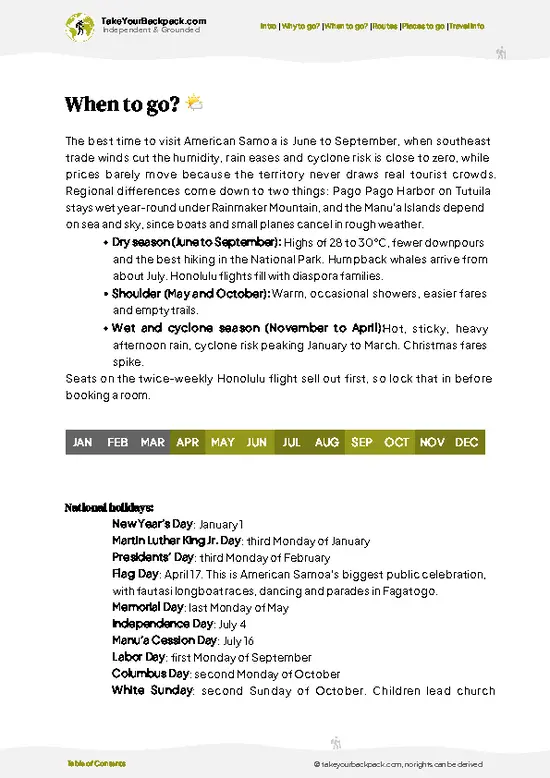
🌤️ When to go?When to go for the best experience

  • Dry Season (May to October): Fagasa Bay is at its calmest and clearest now, with days of 28 to 30°C (82 to 86°F), cooler nights near 24°C (75°F), and noticeably less rain. Visibility for snorkeling inside the bay is best. The trade winds can kick up chop in the afternoon.
  • Wet Season (November to April): Expect 29 to 32°C (84 to 90°F), thick humidity, and heavy downpours that turn the Fagasa Pass road slick and muddy the water near stream mouths. Cyclones are possible, mostly January to March. Rooms and car rentals are often cheaper.
  • Daylight: Sunrise and sunset shift by under an hour across the year, with roughly 11 to 13 hours of light. The bay sits under steep ridges, so the sun drops behind the hills earlier than the clock suggests.
  • Crowds and Prices: Visitor numbers stay low all year, and
… read more 👉
  • Dry Season (May to October): Fagasa Bay is at its calmest and clearest now, with days of 28 to 30°C (82 to 86°F), cooler nights near 24°C (75°F), and noticeably less rain. Visibility for snorkeling inside the bay is best. The trade winds can kick up chop in the afternoon.
  • Wet Season (November to April): Expect 29 to 32°C (84 to 90°F), thick humidity, and heavy downpours that turn the Fagasa Pass road slick and muddy the water near stream mouths. Cyclones are possible, mostly January to March. Rooms and car rentals are often cheaper.
  • Daylight: Sunrise and sunset shift by under an hour across the year, with roughly 11 to 13 hours of light. The bay sits under steep ridges, so the sun drops behind the hills earlier than the clock suggests.
  • Crowds and Prices: Visitor numbers stay low all year, and weekends bring local families. Prices barely move between seasons, apart from occasional airfare swings around July and December holidays.
Go on a weekday morning in June or July for flat water and an empty beach.


source: climatestotravel.comJANJanuary: fair for travelingFEBFebruary: fair for travelingMARMarch: fair for travelingAPRApril: fair for travelingMAYMay: excellent for travelingJUNJune: excellent for travelingJULJuly: excellent for travelingAUGAugust: excellent for travelingSEPSeptember: excellent for travelingOCTOctober: excellent for travelingNOVNovember: fair for travelingDECDecember: fair for traveling
american-samoa-beach-fagasa-bay
© Google | Lucinda Wiley

✈️ The backpacker research shortcutAmerican Samoa Travel Guide

An offline-friendly backpacking guide with optimized travel routes, ranked highlights, transport advice, and the best areas to stay.
example page 0 from our offline Travel Guide for American Samoa
example page 1 from our offline Travel Guide for American Samoa
example page 2 from our offline Travel Guide for American Samoa
example page 3 from our offline Travel Guide for American Samoa
example page 4 from our offline Travel Guide for American Samoa
example page 5 from our offline Travel Guide for American Samoa
example page 6 from our offline Travel Guide for American Samoa
example page 7 from our offline Travel Guide for American Samoa
The digital guide (141 pages) contains:
✅ 36 highlights, ranked by travel appeal
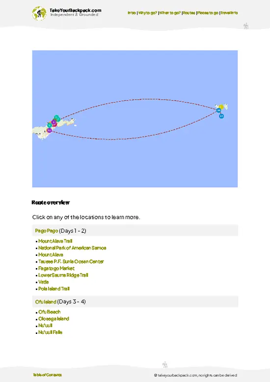
✅ Optimized 2, 3 & 5-day travel routes
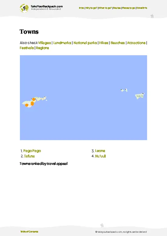
✅ Cities, national parks, landmarks, beaches
✅ How to get around
✅ Offline-friendly for travel without Wi-Fi
👉 Click to see all 30+ guide features

📅 Plan smarter in minutes, not weeks
✅ Month by month travel advice
✅ Festivals & national holidays
✅ Budget expectations

🗺️ Go to the right places, skip the overrated ones
✅ Honest pros & cons of destinations
✅ Top hikes, parks & viewpoints
✅ Lesser-known places most travelers miss
✅ Clear “worth it vs skip it” guidance

🛏️ Travel smoothly without rookie mistakes
✅ Best areas to stay
✅ Transport systems explained simply
✅ Common scams & safety advice
✅ SIM cards, money & practical tips

🌍 Understand the country, not just visit it
✅ Culture & traditions
✅ 52 Essential phrases & customs
✅ Festivals worth planning around
✅ Traveler-friendly historical context
✅ Insights that make places more meaningful

📱 Built for real travel conditions
✅ Fully downloadable PDF
✅ Works completely offline
✅ Optimized for phone use
✅ Useful in remote areas & buses
✅ Everything in one place
Stop searching, start planning
Get instant access to your full guide. 30‑day money-back guarantee.
+ Add another guide for just

By proceeding you agree to our terms.
Sent to your inbox immediately after payment • 100% Secure Checkout
Best Backpacking Travel Advisor 2025 tourism awardBest Backpacking
Travel Advisor
2025
What others say about Take Your Backpack Guides:
⭐⭐⭐⭐⭐
Fantastic, amazing amount of information!
⭐⭐⭐⭐⭐
My goodness this is amazing, it's what I've been looking for hats off too you!
⭐⭐⭐⭐⭐
I think this is absolutely BRILLIANT
⭐⭐⭐⭐
Very complete and informative. It's still missing places, but I gotta to commend you
⭐⭐⭐⭐⭐
This is truly amazing, thank you, can't wait to explore it with my kids!
⭐⭐⭐⭐⭐
Awesome resource, thank you!
⭐⭐⭐⭐⭐
This is amazing! Can't wait to explore the ones I haven't seen
⭐⭐⭐⭐
I love this! Well done, great idea.
⭐⭐⭐⭐⭐
Thanks for taking the time to make this gem!
⭐⭐⭐⭐⭐
This might be the best website I've ever seen.
⭐⭐⭐⭐⭐
Congratulations, and thank you so much for your work; it's incredibly valuable.
⭐⭐⭐⭐
In all seriousness I think you did a great job pointing out the important spots
⭐⭐⭐⭐⭐
10/10 very good
⭐⭐⭐⭐⭐
As someone who's only just starting to visit regularly this is awesome, thank you.
⭐⭐⭐⭐
Thank you very much! I'm going to visit my dad, it's going to be very useful!
⭐⭐⭐⭐⭐
This is really cool! We'll be travelling for the first time and this definitely come in handy.
⭐⭐⭐⭐⭐
You are now our minister of culture, congratulations 👨‍💼
⭐⭐⭐⭐⭐
Just wanted to tell you that this is a pearl! Going to follow your recommendations.
⭐⭐⭐⭐⭐
This is so cool. I'll definitely be using the resource for my travels soon.
⭐⭐⭐⭐⭐
This is very impressive! Good work.
⭐⭐⭐⭐⭐
This is an amazing and informative site. Very well done!

🛏️ Where to stay?Best areas to stay in American Samoa

Stay in the Pago Pago Harbor area, around Utulei, Fagatogo, and Pago Pago village, because Fagasa Bay has no hostels and almost no lodging of its own. This stretch is 15 to 25 minutes by car from the bay over the Fagasa Pass road, and it holds the few budget guesthouses, small motels, and family-run rooms on the island. Expect roughly US$80 to 130 a night for a basic double, since dorm-style beds barely exist here. Fagatogo is the most practical base. The market, the main bus stops, cheap lunch plates, and the Tafuna-bound aiga buses all gather there, and you will meet other travelers at the market … read more 👉
Stay in the Pago Pago Harbor area, around Utulei, Fagatogo, and Pago Pago village, because Fagasa Bay has no hostels and almost no lodging of its own. This stretch is 15 to 25 minutes by car from the bay over the Fagasa Pass road, and it holds the few budget guesthouses, small motels, and family-run rooms on the island. Expect roughly US$80 to 130 a night for a basic double, since dorm-style beds barely exist here. Fagatogo is the most practical base. The market, the main bus stops, cheap lunch plates, and the Tafuna-bound aiga buses all gather there, and you will meet other travelers at the market and harbor-side food spots. Utulei is quieter, with a small beach and a short walk to the visitor center area. Tafuna near the airport has more motel options and car rental offices, handy if you land late or leave early. Because public buses do not run reliably to Fagasa, many travelers rent a car for a day or arrange a ride with their host. Book ahead, as rooms are limited and fill during government events and holidays.

🛡️ SafetySafety Tips and Common Scams in Fagasa Bay

Fagasa Bay is a small, sheltered cove, and for most visitors it is calm and low-key. Swimming is easiest in the dry season, when the water is generally flat and clear inside the reef-fringed bay. Near the mouth, where the bay meets open ocean, currents can pull outward, and swells rise after storms or during the wet season, so stay inside the calmer inner part. Reef edges and coral heads are sharp, so wear reef shoes and look before stepping in. The sun is strong, and the steep hills offer little shade on the sand, so bring a hat and reapply sunscreen. Afternoon showers arrive fast. Locals use the beach, especially on weekends, and Sundays are quiet and respectful by custom, so swim modestly and skip loud music. Village land surrounds the shore, so ask before camping or crossing private property. … read more 👉
Fagasa Bay is a small, sheltered cove, and for most visitors it is calm and low-key. Swimming is easiest in the dry season, when the water is generally flat and clear inside the reef-fringed bay. Near the mouth, where the bay meets open ocean, currents can pull outward, and swells rise after storms or during the wet season, so stay inside the calmer inner part. Reef edges and coral heads are sharp, so wear reef shoes and look before stepping in. The sun is strong, and the steep hills offer little shade on the sand, so bring a hat and reapply sunscreen. Afternoon showers arrive fast. Locals use the beach, especially on weekends, and Sundays are quiet and respectful by custom, so swim modestly and skip loud music. Village land surrounds the shore, so ask before camping or crossing private property. Theft is uncommon, but keep valuables out of a parked rental car.

FAQFrequently asked questions about Fagasa Bay

Fagasa Bay is about 15 to 25 minutes by car from Pago Pago, reached via the winding Fagasa Pass road north of the harbor. Public aiga buses run irregularly to Fagasa, so most travelers rent a car (roughly US$60 to 100 a day) or take a taxi, which can cost US$20 to 40 each way depending on the pickup point. From Tafuna airport, allow around 45 minutes to an hour.
Swimming and snorkeling are decent inside the sheltered bay, mainly from May to October when the water is calmer and clearer. Expect small reef fish and coral patches near the edges rather than big marine action, and stay away from the open mouth of the bay, where currents and swell pick up. Surfing is not a draw here, as the bay is protected and the island's better breaks are elsewhere, such as the Tafuna and Aunuu side.
Yes, there is no entry fee to reach the bay, and parking is informal and free. The land is village-owned, so be respectful, ask before settling in near houses, and expect a modest charge only if a family offers a guided activity or use of a hut. Bring your own food and water, as there are essentially no shops or restaurants at the shore.
⚠️ Things can change over time, so always validate details locally before you go.

Other American Samoan beaches near Fagasa Bay

Explore more nearby:

  • Lauli’i Beach—Reef-break surf, low-tide flats, north-coast sunrise, village shoreline| 8 km away
  • Fagatele Bay Beach—Crater bowl, cliff overlook, sanctuary reef, rough rubble shore| 10 km away
  • Onenoa Beach—East-coast sunrise, palm-lined village sand, reef-edge snorkeling, coastal drive| 16 km away

💡 Not sure where to go next?
Create a personalized itinerary for American Samoa including Fagasa Bay and the places that fit your trip.

Generate my itinerary

👉 Discover all beaches

Or checkout all American Samoa has to offer (think cities, towns, villages, national parks, hikes, beaches, festivals)
Country photo of American Samoa

We 💚 feedbackIs it worth it?

Fagasa Bay suits travelers who like quiet shorelines, village life and a little hiking more than lounging in resort comfort. If that is you, I would come in the morning, bring water and snacks, and pair it with a short stretch of the Mt. Alava Trail. Skip Sundays unless you want to experience the church-day hush, and leave the swimsuit in the bag if the surf looks heavy.

✍️ Help improve this page!
The information on this page is based on in-depth research, insights shared by experienced travelers, and feedback from the local travel community in American Samoa. While every effort is made to keep the information accurate and current, conditions can change — so if you spot anything incorrect or outdated, please get in touch.


🙋‍♂️ Give feedback

👋 Meet the founderWho’s Behind Take Your Backpack?

Johan, backpacker and founder of TakeYourBackpackHi, I’m Johan (Netherlands 🇳🇱), the creator of TakeYourBackpack. Over the past 3 decades, I’ve backpacked through 90+ countries across six continents, gaining extensive experience with independent travel, long-term trips, and overland routes.

This site is built on a combination of firsthand travel experience and carefully curated insights from other backpackers. Many guides are based on places I’ve personally visited, while others bring together tips, observations, and practical advice shared by trusted travelers I’ve met along the way.

The goal is to provide realistic, experience-driven guidance — not generic itineraries — so you can explore destinations with better context, clearer expectations, and more confidence.