×

Angola🇦🇴 | hikesSerra da Leba PassHairpin lookout, roadside stalls, old tarmac, desert horizon | things to do and best time to go

Explore Tundavala GapExplore Pedras Negras de Pungo Andongo

Backpacking in Serra da Leba Pass
👍 Recommendedhike ranked #4
By Johan Kruseman 🇳🇱 | Updated October 5, 2026

Brake pads tick as they cool, and the air at the lookout smells of hot rubber, dust and woodsmoke from the plateau below. Then the cloud lifts and the road appears: a ribbon of tarmac folding back on itself down the Chela escarpment. Serra da Leba sits in Huíla Province, about 30 kilometers by road from Lubango, on the route toward Namibe. It is not a long-distance trek. You walk the hairpins, a few kilometers at most, in sun that bites by midmorning, with trucks grinding past and little shade. Public transport gets you to Lubango easily, but the pass itself needs a taxi or a negotiated lift, and there is no formal trail. Compared with the longer, rougher climbs elsewhere in Angola, this one is short and easy underfoot. The reward is the whole zigzag spread beneath you, desert glowing orange in the distance.

Discover everything you want to know in the 📖 Angola Travel Guide.
Best time to go: March - November
Duration: 1.5 to 3 hours
Distance: 5 kilometers
Total ascent: 300 meters


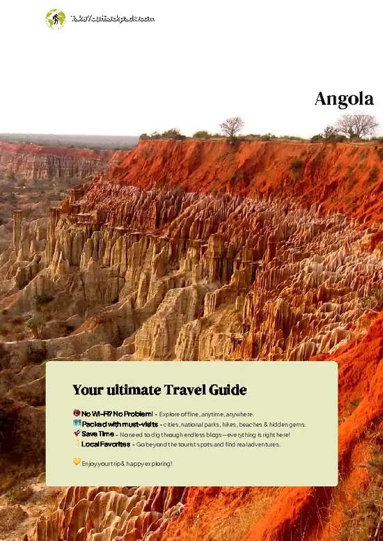
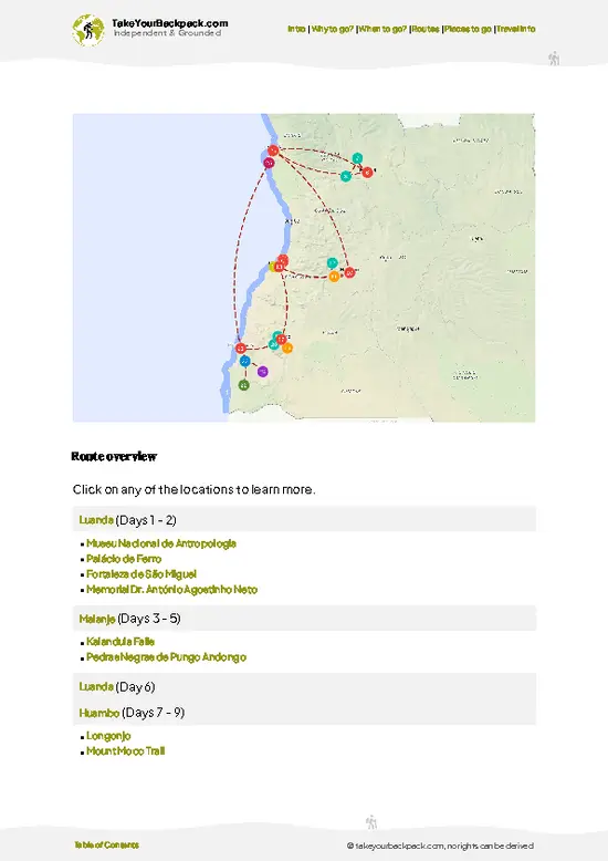
example page 0 from our offline Travel Guide for Angola
example page 1 from our offline Travel Guide for Angola
example page 2 from our offline Travel Guide for Angola
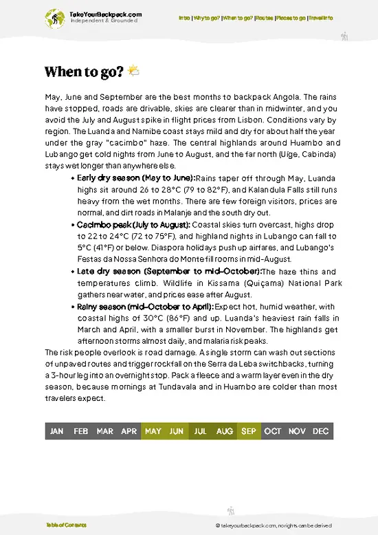
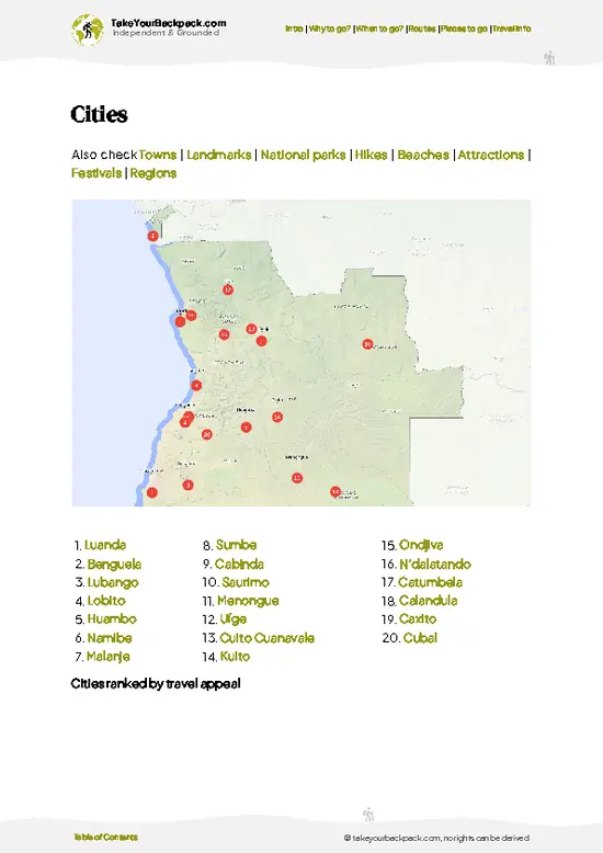
example page 3 from our offline Travel Guide for Angola
example page 4 from our offline Travel Guide for Angola
example page 5 from our offline Travel Guide for Angola
example page 6 from our offline Travel Guide for Angola
example page 7 from our offline Travel Guide for Angola
Loading the map 🌍
CLICK TO FILTER
cities
towns
landmarks
national parks
hikes
beaches
attractions
festivals
regions
SHOW COUNTRY’S BESTSHOW ALL

✨ Why go?
Ranked #4 hike in Angola
Why Serra da Leba Pass should be on your travel list

Backpackers come for one view: the Serra da Leba road, a string of tight hairpin bends dropping roughly 1,000 meters of escarpment toward the Namib coastal plain. Few places in Angola give you so much scenery for so little effort. You can stand at the viewpoint at the top of the pass, photograph the switchbacks, and be back in town by lunch.

It also fits neatly into a southern Angola loop. Lubango is the natural base, with its Cristo Rei statue and cooler highland air, and from there the road runs down to Namibe and the desert beyond. You can combine the pass with Tundavala Gap in a single day, hiring a driver for a modest fee. Distances are flexible: walk a single bend, or stroll several kilometers of road, depending on the heat and your patience with passing trucks.

💡 HighlightsPlaces and moments you shouldn't skip

  1. The hairpin viewpoint: The main lookout on the EN280 road shows the switchback sequence at once, with bends stacked on the cliff face. Come with a zoom lens; the road looks like a dropped piece of string.
  2. The Chela escarpment: This steep edge divides the cool Huíla highlands from the hot coastal lowlands. Rock walls, scrub and sudden drops change within minutes of walking.
  3. The desert horizon: On a clear morning the land below fades into the dry plains that lead toward Namibe and the Namib. The color shift from green plateau to ochre is abrupt.
  4. Roadside stalls and villagers: Local vendors often sell fruit and snacks near the viewpoint. Buying a few bananas here is the easiest way to start a conversation and see daily life on the pass.
  5. Passing trucks and old tarmac: The Portuguese colonial-era engineering
… read more 👉
  1. The hairpin viewpoint: The main lookout on the EN280 road shows the switchback sequence at once, with bends stacked on the cliff face. Come with a zoom lens; the road looks like a dropped piece of string.
  2. The Chela escarpment: This steep edge divides the cool Huíla highlands from the hot coastal lowlands. Rock walls, scrub and sudden drops change within minutes of walking.
  3. The desert horizon: On a clear morning the land below fades into the dry plains that lead toward Namibe and the Namib. The color shift from green plateau to ochre is abrupt.
  4. Roadside stalls and villagers: Local vendors often sell fruit and snacks near the viewpoint. Buying a few bananas here is the easiest way to start a conversation and see daily life on the pass.
  5. Passing trucks and old tarmac: The Portuguese colonial-era engineering is still in use, and heavy trucks crawl through the bends in low gear. Watching them take the tightest corners is surprisingly gripping.
Most visitors stop only at the main lookout, yet the quieter bends lower down give a closer look at the road wall stonework and far fewer people.
Spotted a mistake or missing something? Contact us.

🌤️ When to go?Seasonal considerations and timing

The best window for Serra da Leba Pass is the dry season, May to September, when skies are clear and the views over the Namibe plain are sharpest.
  • Dry Season (May to September): Days run 22 to 28°C (72 to 82°F) on the escarpment, and nights at around 1,800 meters drop to 10 to 14°C (50 to 57°F). Daylight lasts roughly 11.5 to 12 hours, with sunrise near 6:30 am. Haze and low cloud (the cacimbo) can hang over the top in June and July, so mornings may start gray.
  • Hot Season (October to December): Temperatures climb to 28 to 33°C (82 to 91°F) on the lower switchbacks. Heat builds fast by late morning, so start at dawn.
  • Rainy Season (January to April): Afternoon storms and cloud cover the upper slopes, with highs of 24 to 29°C (75 to 84°F). The paved road stays open, but views vanish for days.
  • Crowds
… read more 👉
The best window for Serra da Leba Pass is the dry season, May to September, when skies are clear and the views over the Namibe plain are sharpest.
  • Dry Season (May to September): Days run 22 to 28°C (72 to 82°F) on the escarpment, and nights at around 1,800 meters drop to 10 to 14°C (50 to 57°F). Daylight lasts roughly 11.5 to 12 hours, with sunrise near 6:30 am. Haze and low cloud (the cacimbo) can hang over the top in June and July, so mornings may start gray.
  • Hot Season (October to December): Temperatures climb to 28 to 33°C (82 to 91°F) on the lower switchbacks. Heat builds fast by late morning, so start at dawn.
  • Rainy Season (January to April): Afternoon storms and cloud cover the upper slopes, with highs of 24 to 29°C (75 to 84°F). The paved road stays open, but views vanish for days.
  • Crowds and Prices: Visitors are few year-round. Lubango lodging and car hire cost more in July and August and around Christmas.
Arrive at the viewpoint by 7 am, when light is soft and the road below is still quiet.


source: climatestotravel.comJANJanuary: fair for travelingFEBFebruary: fair for travelingMARMarch: good for travelingAPRApril: good for travelingMAYMay: excellent for travelingJUNJune: excellent for travelingJULJuly: excellent for travelingAUGAugust: excellent for travelingSEPSeptember: excellent for travelingOCTOctober: excellent for travelingNOVNovember: good for travelingDECDecember: fair for traveling
angola-hike-serra-da-leba-pass
© Google |

✈️ The backpacker research shortcutAngola Travel Guide

An offline-friendly backpacking guide with optimized travel routes, ranked highlights, transport advice, and the best areas to stay.
example page 0 from our offline Travel Guide for Angola
example page 1 from our offline Travel Guide for Angola
example page 2 from our offline Travel Guide for Angola
example page 3 from our offline Travel Guide for Angola
example page 4 from our offline Travel Guide for Angola
example page 5 from our offline Travel Guide for Angola
example page 6 from our offline Travel Guide for Angola
example page 7 from our offline Travel Guide for Angola
The digital guide (246 pages) contains:
✅ 71 highlights, ranked by travel appeal
✅ Optimized 7, 14 & 21-day travel routes
✅ Cities, national parks, landmarks, beaches
✅ How to get around
✅ Offline-friendly for travel without Wi-Fi
👉 Click to see all 30+ guide features

📅 Plan smarter in minutes, not weeks
✅ Month by month travel advice
✅ Festivals & national holidays
✅ Budget expectations

🗺️ Go to the right places, skip the overrated ones
✅ Honest pros & cons of destinations
✅ Top hikes, parks & viewpoints
✅ Lesser-known places most travelers miss
✅ Clear “worth it vs skip it” guidance

🛏️ Travel smoothly without rookie mistakes
✅ Best areas to stay
✅ Transport systems explained simply
✅ Common scams & safety advice
✅ SIM cards, money & practical tips

🌍 Understand the country, not just visit it
✅ Culture & traditions
✅ 52 Essential phrases & customs
✅ Festivals worth planning around
✅ Traveler-friendly historical context
✅ Insights that make places more meaningful

📱 Built for real travel conditions
✅ Fully downloadable PDF
✅ Works completely offline
✅ Optimized for phone use
✅ Useful in remote areas & buses
✅ Everything in one place
Stop searching, start planning
Get instant access to your full guide. 30‑day money-back guarantee.
+ Add another guide for just

By proceeding you agree to our terms.
Sent to your inbox immediately after payment • 100% Secure Checkout
Best Backpacking Travel Advisor 2025 tourism awardBest Backpacking
Travel Advisor
2025
What others say about Take Your Backpack Guides:
⭐⭐⭐⭐⭐
Fantastic, amazing amount of information!
⭐⭐⭐⭐⭐
My goodness this is amazing, it's what I've been looking for hats off too you!
⭐⭐⭐⭐⭐
I think this is absolutely BRILLIANT
⭐⭐⭐⭐
Very complete and informative. It's still missing places, but I gotta to commend you
⭐⭐⭐⭐⭐
This is truly amazing, thank you, can't wait to explore it with my kids!
⭐⭐⭐⭐⭐
Awesome resource, thank you!
⭐⭐⭐⭐⭐
This is amazing! Can't wait to explore the ones I haven't seen
⭐⭐⭐⭐
I love this! Well done, great idea.
⭐⭐⭐⭐⭐
Thanks for taking the time to make this gem!
⭐⭐⭐⭐⭐
This might be the best website I've ever seen.
⭐⭐⭐⭐⭐
Congratulations, and thank you so much for your work; it's incredibly valuable.
⭐⭐⭐⭐
In all seriousness I think you did a great job pointing out the important spots
⭐⭐⭐⭐⭐
10/10 very good
⭐⭐⭐⭐⭐
As someone who's only just starting to visit regularly this is awesome, thank you.
⭐⭐⭐⭐
Thank you very much! I'm going to visit my dad, it's going to be very useful!
⭐⭐⭐⭐⭐
This is really cool! We'll be travelling for the first time and this definitely come in handy.
⭐⭐⭐⭐⭐
You are now our minister of culture, congratulations 👨‍💼
⭐⭐⭐⭐⭐
Just wanted to tell you that this is a pearl! Going to follow your recommendations.
⭐⭐⭐⭐⭐
This is so cool. I'll definitely be using the resource for my travels soon.
⭐⭐⭐⭐⭐
This is very impressive! Good work.
⭐⭐⭐⭐⭐
This is an amazing and informative site. Very well done!

🛏️ Where to stay?Best areas to stay in Angola

If you enjoy meeting fellow travelers, consider choosing hostels with high ratings for atmosphere. On the other hand, if you prefer having your own space, a hotel might be a better option.

🥾 Hike detailsHike details: route, duration, and difficulty of Serra da Leba Pass

Total Distance: There is no marked trail. Walking the road bends is roughly 3 to 6 kilometers, depending on how far you go.
Estimated Duration: 1.5 to 3 hours on foot, plus time for photos.
Difficulty: Easy to moderate. The surface is paved, but heat, sun and traffic make it tiring.
Starting Point: The pass lies on the road between Lubango and Namibe, about 30 kilometers from Lubango.
  • Public transport: Shared minibuses (candongueiros) run between Lubango and Namibe and can drop you near the top; confirm the driver will stop. A private taxi from Lubango is easier for a return trip.
Major Landmarks:
  • Main
… read more 👉
Total Distance: There is no marked trail. Walking the road bends is roughly 3 to 6 kilometers, depending on how far you go.
Estimated Duration: 1.5 to 3 hours on foot, plus time for photos.
Difficulty: Easy to moderate. The surface is paved, but heat, sun and traffic make it tiring.
Starting Point: The pass lies on the road between Lubango and Namibe, about 30 kilometers from Lubango.
  • Public transport: Shared minibuses (candongueiros) run between Lubango and Namibe and can drop you near the top; confirm the driver will stop. A private taxi from Lubango is easier for a return trip.
Major Landmarks:
  • Main viewpoint: Overlooks the zigzag road.
  • Hairpin bends: Walkable in sections, with narrow shoulders.
  • Lubango: The base town, with Cristo Rei and Tundavala Gap nearby.
Terrain and Scenery: Steep escarpment, rocky outcrops and long views over the lowland plains toward the desert.
Vegetation: Dry highland scrub and grass at the top, thinning into arid shrubs and thorny plants lower down.
Wildlife: Mostly birds, lizards and baboons on the rocky slopes. Large animals are rare near the road.
⚠️ Hiking info can sometimes be outdated or inaccurate. Before you hit the trail, check the latest conditions with locals. If you do spot anything that's off, I'd love to hear from you, so I can update it for fellow travelers.

🛡️ SafetyTraveler Safety Guide

Serra da Leba Pass is a short, easy viewpoint visit with no technical terrain, and the main risks are traffic and weather.
The road is a paved mountain route of tight hairpins, and trucks take the bends slowly but wide. Walk on the viewpoint platform and avoid the narrow shoulders, especially in fog or after dusk. Cacimbo mist and rainy-season storms cut visibility quickly, so plan your photos for clear mornings. The escarpment is exposed, with strong wind and steep drops beyond the barriers, so keep to the marked areas and watch children.
Wildlife is not a concern, though baboons occasionally appear on rocky slopes, and you should never feed them. Carry water, sun protection and a warm layer, since it cools at around 1,800 meters. Bring cash in kwanza, as there are few services here. Keep cameras … read more 👉
Serra da Leba Pass is a short, easy viewpoint visit with no technical terrain, and the main risks are traffic and weather.
The road is a paved mountain route of tight hairpins, and trucks take the bends slowly but wide. Walk on the viewpoint platform and avoid the narrow shoulders, especially in fog or after dusk. Cacimbo mist and rainy-season storms cut visibility quickly, so plan your photos for clear mornings. The escarpment is exposed, with strong wind and steep drops beyond the barriers, so keep to the marked areas and watch children.
Wildlife is not a concern, though baboons occasionally appear on rocky slopes, and you should never feed them. Carry water, sun protection and a warm layer, since it cools at around 1,800 meters. Bring cash in kwanza, as there are few services here. Keep cameras and phones close at roadside stops, and consider going with a local driver from Lubango who knows the pull-offs.

FAQCommon questions from travelers

Walking the road bends of Serra da Leba takes about 1.5 to 3 hours, covering roughly 3 to 6 kilometers. Most people combine it with a half-day trip from Lubango, which is about 30 kilometers away. Add extra time if you also stop at Tundavala Gap.
Easy to moderate, because the surface is paved and the gradient is gentle, but heat and traffic add strain. Midday sun on the exposed escarpment is the main challenge, so start early. Carry at least 2 liters of water, as there is almost no shade.
No guide or permit is needed, since the pass is on a public road and the viewpoint is freely accessible. A hired driver from Lubango can help with transport and typically costs in the range of US$30 to 60 for a day trip. Check current road conditions locally before you go.
⚠️ Things can change over time, so always validate details locally before you go.

Other Angolan hikes near Serra da Leba Pass

Explore more nearby:

  • Serra da Binga Trail—remote highlands, rolling hills, scattered rural villages| 0 km away
  • Tundavala Gap—Sheer rim, Fenda cliffs, sunrise light, 18 km from Lubango| 32 km away
  • Serra da Chela Trail—DIY day walks, unmarked footpaths, Humpata Plateau, Namib views| 54 km away

💡 Not sure where to go next?
Create a personalized itinerary for Angola including Serra da Leba Pass and the places that fit your trip.

Generate my itinerary

👉 Discover all hikes

Or checkout all Angola has to offer (think cities, towns, villages, national parks, hikes, beaches, festivals)
Country photo of Angola

We 💚 feedbackFinal thoughts on hiking the Serra da Leba Pass

Go early, ideally just after sunrise, when the light rakes across the bends and the trucks are still few. The dry season, roughly May to September, gives the clearest views, while the rainy months often wrap the escarpment in cloud. Bring water and a hat, since shade is almost nonexistent, and keep well off the road edge when a truck rounds a corner.

✍️ Help improve this page!
The information on this page is based on in-depth research, insights shared by experienced travelers, and feedback from the local travel community in Angola. While every effort is made to keep the information accurate and current, conditions can change — so if you spot anything incorrect or outdated, please get in touch.


🙋‍♂️ Give feedback

👋 Meet the founderWho’s Behind Take Your Backpack?

Johan, backpacker and founder of TakeYourBackpackHi, I’m Johan (Netherlands 🇳🇱), the creator of TakeYourBackpack. Over the past 3 decades, I’ve backpacked through 90+ countries across six continents, gaining extensive experience with independent travel, long-term trips, and overland routes.

This site is built on a combination of firsthand travel experience and carefully curated insights from other backpackers. Many guides are based on places I’ve personally visited, while others bring together tips, observations, and practical advice shared by trusted travelers I’ve met along the way.

The goal is to provide realistic, experience-driven guidance — not generic itineraries — so you can explore destinations with better context, clearer expectations, and more confidence.