
×

Armenia🇦🇲 | hikesMount AragatsVolcanic summit, alpine meadows, glacial lakes | things to do and best time to go

Explore Lastiver Cave TrailExplore Dilijan National Park’s Parz Lake Trail

Backpacking in Mount Aragats
🏆 Top pickhike ranked #1
By Johan Kruseman 🇳🇱 | Updated June 5, 2026

Most people only realize on the way down that Aragats is four peaks for the price of one day trip—you can tag a single summit or chain a brutal ridge run, all from the same trailhead. Mount Aragats rises northwest of Yerevan in Armenia’s Aragatsotn region, a hulking extinct volcano that dominates the horizon on clear days. The hike hits you fast: a rough jeep track, then volcanic rubble, snow patches even in summer, and a crater that looks ripped from another planet. Views stretch to Ararat and deep into Turkey if the haze cooperates. It’s long and exposed, with loose rock that punishes weak ankles and weather that can flip from sunburn to sleet in an hour. Public transport gets you close (to Byurakan or Aparan), but you usually need a taxi for the last stretch, so it’s less plug-and-play than Dilijan’s forest trails yet more dramatic and committing than most day hikes in Armenia.

Discover everything you want to know in the 📖 Armenia Travel Guide.
Best time to go: April - October
Duration: 1 to 2 days
Distance: 12-14 kilometers
Total ascent: 1,200 meters


Get your Armenia guide
69 ranked highlights, routes & tips, works offline (271 pages)
Loading the map 🌍
CLICK TO FILTER
cities
towns
villages
landmarks
national parks
hikes
beaches
attractions
festivals
regions
SHOW COUNTRY’S BESTSHOW ALL

✨ Why go?
Ranked #1 hike in Armenia
Why visitors keep coming back

Mount Aragats is a magnet for backpackers, and it’s easy to see why. The scenery-to-effort ratio is off the charts. You’re not just hiking; you’re traversing a landscape that shifts from rugged terrain to breathtaking views of the surrounding valleys and peaks. The public transport access is a breeze, with marshrutkas whisking you from Yerevan to the trailhead, making it a seamless addition to your itinerary.

Cost? Minimal. You can tackle this adventure without breaking the bank. The flexible distances cater to all levels, whether you’re up for a grueling summit push or a leisurely stroll through wildflowers. Each step is a dance with nature, and the burn in your legs only heightens the thrill.

As you crest the summit, the reward is palpable: a panoramic vista that stretches for miles, … read more 👉
Mount Aragats is a magnet for backpackers, and it’s easy to see why. The scenery-to-effort ratio is off the charts. You’re not just hiking; you’re traversing a landscape that shifts from rugged terrain to breathtaking views of the surrounding valleys and peaks. The public transport access is a breeze, with marshrutkas whisking you from Yerevan to the trailhead, making it a seamless addition to your itinerary.

Cost? Minimal. You can tackle this adventure without breaking the bank. The flexible distances cater to all levels, whether you’re up for a grueling summit push or a leisurely stroll through wildflowers. Each step is a dance with nature, and the burn in your legs only heightens the thrill.

As you crest the summit, the reward is palpable: a panoramic vista that stretches for miles, a moment that makes every ounce of effort worth it. And when you finally crack open that first cold beer at the end of the day, you’ll realize this hike fits perfectly into a longer backpacking route, a highlight that lingers long after the trail dust settles.
Want to include Mount Aragats in your Armenia route?
Create a personalized Armenia itinerary that includes Mount Aragats and the places that fit your trip — based on your travel style, budget, and available time. Get your route in seconds.

Generate my trip

💡 HighlightsEssential experiences to have while hiking the Mount Aragats

  1. Lake Kari (Kari Lich) — A high-altitude, glassy tarn sitting above 3,100 m that makes an excellent basecamp and photo stop; reflections of the peaks, easy shoreline walks, and the nearby Soviet geophysical buildings give the place a slightly otherworldly vibe.
  2. The volcanic crater plateau — Aragats is a big, blunt volcano; the broad crater and its rim give a lunar, open feel you don’t get on narrow alpine ridgelines, with stark volcanic rock, scree slopes and sudden sweeps of sky that make the hike feel epic without technical climbing.
  3. Four summits and the North Summit view — The mountain’s four peaks (north is the highest at ~4,090 m) let you pick your exposure: the north summit offers wide, unobstructed panoramas — Ararat on clear days, the Armenian plain, and the Greater Caucasus — a
read more 👉
  1. Lake Kari (Kari Lich) — A high-altitude, glassy tarn sitting above 3,100 m that makes an excellent basecamp and photo stop; reflections of the peaks, easy shoreline walks, and the nearby Soviet geophysical buildings give the place a slightly otherworldly vibe.
  2. The volcanic crater plateau — Aragats is a big, blunt volcano; the broad crater and its rim give a lunar, open feel you don’t get on narrow alpine ridgelines, with stark volcanic rock, scree slopes and sudden sweeps of sky that make the hike feel epic without technical climbing.
  3. Four summits and the North Summit view — The mountain’s four peaks (north is the highest at ~4,090 m) let you pick your exposure: the north summit offers wide, unobstructed panoramas — Ararat on clear days, the Armenian plain, and the Greater Caucasus — a payoff that rivals many higher, more crowded peaks.
  4. Alpine meadows, wildflowers and wildlife — In summer the crater and lower slopes burst with colorful alpine blooms; marmots whistle from rocks, and raptors circle above — that contrast of delicate flowers against volcanic scree is one of Aragats’ signature scenes.
  5. Medieval Amberd and mountain culture — On Aragats’ southern flank sits Amberd fortress and the Vahramashen Church; pairing a hike up the mountain with a visit to this cliffside medieval site (or the rustic shepherd shelters and old research huts near Lake Kari) gives a mix of raw nature and Armenian history you don’t get on purely natural trails.
Spotted a mistake or missing something? Contact us.

Things to do near Mount Aragats

Ratings based on Tripadvisor reviews. When you book through this link, you support our work at no extra cost to you.

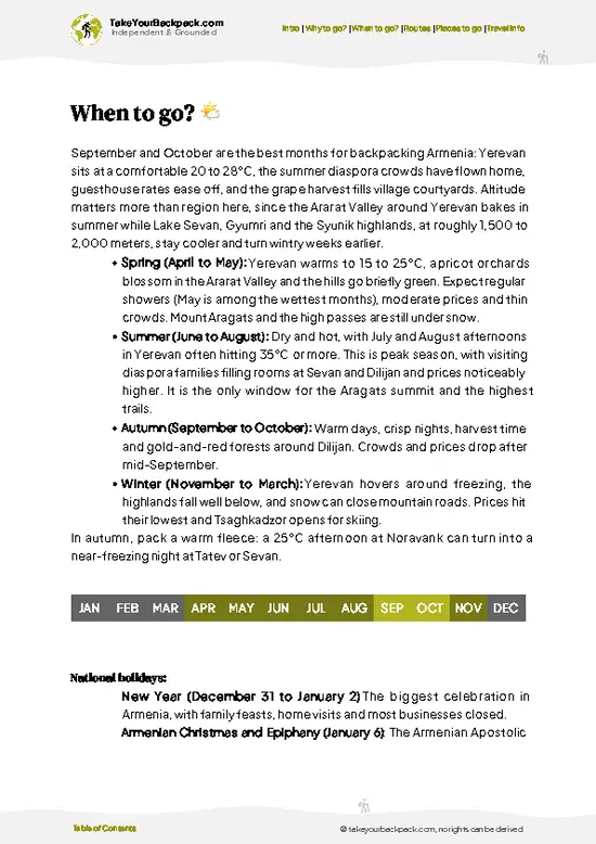
🌤️ When to go?When to go for the best experience


  • Weather: Spring and early autumn deliver the best balance—clear skies with manageable winds. Summer can scorch, pushing temps above 30°C (86°F), while winter slams the mountain with snow and ice, making trails treacherous.

  • Temperature: Late May to early October offers daytime highs between 15-25°C (59-77°F), perfect for sweating it out without overheating. Nights dip to 5-10°C (41-50°F), so pack layers.

  • Daylight Hours: Long summer days stretch up to 15 hours, giving you ample time to tackle the summit and soak in the views without rushing. Spring and fall days are shorter but still generous.

  • Crowds: Peak season in July and August draws local hikers and tourists, especially weekends. For solitude, aim for late May or September when the trails thin out but the weather stays friendly.
read more 👉

  • Weather: Spring and early autumn deliver the best balance—clear skies with manageable winds. Summer can scorch, pushing temps above 30°C (86°F), while winter slams the mountain with snow and ice, making trails treacherous.

  • Temperature: Late May to early October offers daytime highs between 15-25°C (59-77°F), perfect for sweating it out without overheating. Nights dip to 5-10°C (41-50°F), so pack layers.

  • Daylight Hours: Long summer days stretch up to 15 hours, giving you ample time to tackle the summit and soak in the views without rushing. Spring and fall days are shorter but still generous.

  • Crowds: Peak season in July and August draws local hikers and tourists, especially weekends. For solitude, aim for late May or September when the trails thin out but the weather stays friendly.

  • Seasonal Activities: Summer opens up alpine meadows bursting with wildflowers and mountain lakes thawed for a refreshing dip. Winter invites hardcore mountaineers with crampons and ice axes, but it’s not for the faint-hearted.

  • Price Fluctuations: Accommodation and guide fees spike in summer. Shoulder seasons offer better deals and more flexible bookings without sacrificing the experience.


Pro-tip: Time your hike for early September—cooler air, fewer crowds, and the mountain’s raw colors shifting into autumn make every step feel earned and every view sharper.


source: climatestotravel.comJANJanuary: below average for travelingFEBFebruary: below average for travelingMARMarch: fair for travelingAPRApril: highly recommended for travelingMAYMay: excellent for travelingJUNJune: highly recommended for travelingJULJuly: good for travelingAUGAugust: good for travelingSEPSeptember: excellent for travelingOCTOctober: highly recommended for travelingNOVNovember: fair for travelingDECDecember: below average for traveling
armenia-hike-mount-aragats v3
© Google |

✈️ The backpacker research shortcutArmenia Travel Guide

An offline-friendly backpacking guide with optimized travel routes, ranked highlights, transport advice, and the best areas to stay.
example page 0 from our offline Travel Guide for Armenia
example page 1 from our offline Travel Guide for Armenia
example page 2 from our offline Travel Guide for Armenia
example page 3 from our offline Travel Guide for Armenia
example page 4 from our offline Travel Guide for Armenia
example page 5 from our offline Travel Guide for Armenia
example page 6 from our offline Travel Guide for Armenia
example page 7 from our offline Travel Guide for Armenia
The digital guide (271 pages) contains:
69 highlights, ranked by travel appeal
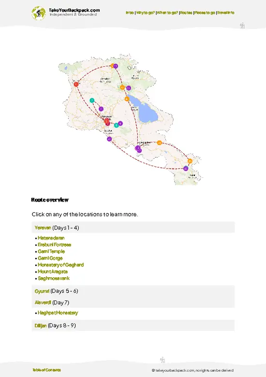
Optimized 5, 10 & 15-day travel routes
Cities, national parks, landmarks, beaches
How to get around
Offline-friendly for travel without Wi-Fi
👉 Click to see all 30+ guide features

📅 Plan smarter in minutes, not weeks
Month by month travel advice
Festivals & national holidays
Budget expectations

🗺️ Go to the right places, skip the overrated ones
Honest pros & cons of destinations
Top hikes, parks & viewpoints
Lesser-known places most travelers miss
Clear “worth it vs skip it” guidance

🛏️ Travel smoothly without rookie mistakes
Best areas to stay
Transport systems explained simply
Common scams & safety advice
SIM cards, money & practical tips

🌍 Understand the country, not just visit it
Culture & traditions
52 Essential phrases & customs
Festivals worth planning around
Traveler-friendly historical context
Insights that make places more meaningful

📱 Built for real travel conditions
Fully downloadable PDF
Works completely offline
Optimized for phone use
Useful in remote areas & buses
Everything in one place
Save weeks of stressful planning
Get instant access to your full guide. 30‑day money-back guarantee.


By proceeding you agree to our terms.
Sent to your inbox immediately after payment • 100% Secure Checkout
Best Backpacking Travel Advisor 2025 tourism awardBest Backpacking
Travel Advisor
2025
What others say about Take Your Backpack Guides:
⭐⭐⭐⭐⭐
Fantastic, amazing amount of information!
⭐⭐⭐⭐⭐
My goodness this is amazing, it's what I've been looking for hats off too you!
⭐⭐⭐⭐⭐
I think this is absolutely BRILLIANT
⭐⭐⭐⭐
Very complete and informative. It's still missing places, but I gotta to commend you
⭐⭐⭐⭐⭐
This is truly amazing, thank you, can't wait to explore it with my kids!
⭐⭐⭐⭐⭐
Awesome resource, thank you!
⭐⭐⭐⭐⭐
This is amazing! Can't wait to explore the ones I haven't seen
⭐⭐⭐⭐
I love this! Well done, great idea.
⭐⭐⭐⭐⭐
Thanks for taking the time to make this gem!
⭐⭐⭐⭐⭐
This might be the best website I've ever seen.
⭐⭐⭐⭐⭐
Congratulations, and thank you so much for your work; it's incredibly valuable.
⭐⭐⭐⭐
In all seriousness I think you did a great job pointing out the important spots
⭐⭐⭐⭐⭐
10/10 very good
⭐⭐⭐⭐⭐
As someone who's only just starting to visit regularly this is awesome, thank you.
⭐⭐⭐⭐
Thank you very much! I'm going to visit my dad, it's going to be very useful!
⭐⭐⭐⭐⭐
This is really cool! We'll be travelling for the first time and this definitely come in handy.
⭐⭐⭐⭐⭐
You are now our minister of culture, congratulations 👨‍💼
⭐⭐⭐⭐⭐
Just wanted to tell you that this is a pearl! Going to follow your recommendations.
⭐⭐⭐⭐⭐
This is so cool. I'll definitely be using the resource for my travels soon.
⭐⭐⭐⭐⭐
This is very impressive! Good work.
⭐⭐⭐⭐⭐
This is an amazing and informative site. Very well done!

🛏️ Where to stay?Best areas and accommodation options

If you enjoy meeting fellow travelers, consider choosing hostels with high ratings for atmosphere. On the other hand, if you prefer having your own space, a hotel might be a better option.

🥾 Hike detailsRoute, distance, and difficulty explained

Total Distance: The trail to Mount Aragats covers approximately 18 kilometers (11 miles) round trip, depending on the route you choose and how much you explore the summit area.

Estimated Duration: Plan for about 6 to 8 hours for the hike. This includes time for breaks, enjoying the views, and possibly some time at the summit.

Difficulty Level: This trail is generally rated as moderate to challenging. The ascent can be steep in parts, and the altitude (over 4,000 meters) can be tough for some hikers.

Starting Point: The hike typically starts from the village of Byurakan, which is accessible … read more 👉
Total Distance: The trail to Mount Aragats covers approximately 18 kilometers (11 miles) round trip, depending on the route you choose and how much you explore the summit area.

Estimated Duration: Plan for about 6 to 8 hours for the hike. This includes time for breaks, enjoying the views, and possibly some time at the summit.

Difficulty Level: This trail is generally rated as moderate to challenging. The ascent can be steep in parts, and the altitude (over 4,000 meters) can be tough for some hikers.

Starting Point: The hike typically starts from the village of Byurakan, which is accessible by public transport.
  • Getting There: Take a marshrutka (minibus) from Yerevan to Byurakan. They leave from the central bus station and the ride takes about an hour.

Major Landmarks Along the Route:
  • Amberd Fortress: A medieval fortress that offers stunning views and a glimpse into Armenia’s history.
  • Aragats Lake: A beautiful glacial lake that’s a great spot for a break and some photos.
  • The Summit: The highest point of Mount Aragats, with breathtaking panoramic views of the surrounding landscape.

Type of Terrain and Scenery: Expect a mix of rocky paths, grassy meadows, and some scree near the summit. The scenery varies from lush green hills to stark, rocky outcrops as you gain elevation.

Typical Vegetation and Wildlife:
  • Vegetation: You’ll find a variety of alpine flowers, shrubs, and some hardy trees at lower elevations. As you climb higher, the flora becomes sparser.
  • Wildlife: Keep an eye out for birds like the golden eagle and various small mammals. The higher altitudes might not have much wildlife, but you might spot some mountain goats if you’re lucky.

Pack plenty of water, snacks, and a camera—this trail is a gem for those who love nature and a bit of a challenge!
⚠️ Hiking info can sometimes be outdated or inaccurate. Before you hit the trail, check the latest conditions with locals. If you do spot anything that's off, I'd love to hear from you, so I can update it for fellow travelers.

🛡️ SafetyScams, Hazards, and Annoyances

Mount Aragats offers a thrilling challenge without the drama. The trails are well-marked, but don’t underestimate the altitude. At over 4,000 meters, you’ll feel the burn in your lungs, especially if you’re not acclimatized. Pace yourself; take breaks to soak in the sweeping views of the surrounding valleys.

Weather can shift quickly. Mornings might greet you with sunshine, but by afternoon, clouds can roll in, bringing rain or even snow. Layer your clothing and pack a lightweight waterproof jacket.

The terrain varies. Some sections are steep and rocky, demanding careful footing. Watch for loose stones, especially on descents. Navigation is straightforward, but a map or GPS can be your best friend if the fog rolls in.

Wildlife encounters are rare but possible. If you spot a chamois or … read more 👉
Mount Aragats offers a thrilling challenge without the drama. The trails are well-marked, but don’t underestimate the altitude. At over 4,000 meters, you’ll feel the burn in your lungs, especially if you’re not acclimatized. Pace yourself; take breaks to soak in the sweeping views of the surrounding valleys.

Weather can shift quickly. Mornings might greet you with sunshine, but by afternoon, clouds can roll in, bringing rain or even snow. Layer your clothing and pack a lightweight waterproof jacket.

The terrain varies. Some sections are steep and rocky, demanding careful footing. Watch for loose stones, especially on descents. Navigation is straightforward, but a map or GPS can be your best friend if the fog rolls in.

Wildlife encounters are rare but possible. If you spot a chamois or a golden eagle, keep your distance and enjoy the moment quietly. Respect the environment; leave no trace.

Prepare well, and the reward will be a cold beer at the finish, savoring the sense of accomplishment.

Other Armenian hikes near Mount Aragats

Explore more nearby:


💡 Not sure where to go next?
Create a personalized itinerary for Armenia including Mount Aragats and the places that fit your trip.

Generate my itinerary

👉 Discover all hikes

Or checkout all Armenia has to offer (think cities, towns, villages, national parks, hikes, beaches, festivals)
Country photo of Armenia

We 💚 feedbackSumming up the experience

Climbing Mount Aragats is like stepping into a raw, untamed world. The trails can be relentless, but that final push to the summit? It’s electric. You’ll find yourself surrounded by a breathtaking panorama that makes every drop of sweat worth it.

Don’t miss the crater lake; it’s a stunning surprise tucked away at the top. Just be ready for the altitude—take it slow. The vibe here is pure adventure, and the locals are some of the friendliest you’ll meet. Grab a cold beer afterward; you’ve earned it.

✍️ Help improve this page!
The information on this page is based on in-depth research, insights shared by experienced travelers, and feedback from the local travel community in Armenia. While every effort is made to keep the information accurate and current, conditions can change — so if you spot anything incorrect or outdated, please get in touch.


🙋‍♂️ Give feedback

👋 Meet the founderWho’s Behind Take Your Backpack?

Johan, backpacker and founder of TakeYourBackpackHi, I’m Johan (Netherlands 🇳🇱), the creator of TakeYourBackpack. Over the past decade, I’ve backpacked through 80+ countries across six continents, gaining extensive experience with independent travel, long-term trips, and overland routes.

This site is built on a combination of firsthand travel experience and carefully curated insights from other backpackers. Many guides are based on places I’ve personally visited, while others bring together tips, observations, and practical advice shared by trusted travelers I’ve met along the way.

The goal is to provide realistic, experience-driven guidance — not generic itineraries — so you can explore destinations with better context, clearer expectations, and more confidence.

Get full Armenia guide •
Instant download • 69 highlights • Full Offline guide