



×

Bosnia and Herzegovina🇧🇦 | hikesVia Dinaricalong-distance route, cross-border trails, diverse ecosystems | things to do and best time to go

Explore Lukomir Highland VillageExplore Vranica Mountain

Backpacking in Via Dinarica
🏆 Top pickhike ranked #1
By Johan Kruseman 🇳🇱 | Updated May 24, 2026

You have to choose early on: do you commit to a serious multi-day section of the Via Dinarica, or cherry-pick a single highlight day and keep it casual? That decision matters, because this trail, running along the spine of the Dinaric Alps through central and western Bosnia and Herzegovina (around Konjic, Jablanica, Prozor-Rama, and up toward the Bosnian Krajina), rewards commitment but punishes underestimation. The Bosnian stretch of the Via Dinarica throws you onto high karst ridges, over white limestone plateaus, past war-scarred villages, and above lakes like Jablanica and Rama that look painted on. It’s long, often remote, and tougher than nearby day hikes around Sarajevo or Mostar, with more navigation and more exposure to weather. Public transport gets you to gateway towns easily enough, but trailheads can sit a taxi ride away. When it clicks, though, the payoff is huge: big-mountain feel, Balkan hospitality, and the sense you’ve actually crossed something, not just sampled it.

Discover everything you want to know in the 📖 Bosnia and Herzegovina Travel Guide.
Best time to go: April - October
Duration: 15 to 20 days
Distance: 1,000 kilometers
Total ascent: 12,000 meters
Loading the map 🌍
CLICK TO FILTER
cities
towns
villages
landmarks
national parks
hikes
beaches
attractions
festivals
SHOW COUNTRY’S BESTSHOW ALL

✨ Why go?
Ranked #1 hike in Bosnia and Herzegovina
The unique appeal for travelers

The Via Dinarica in Bosnia and Herzegovina is a magnet for backpackers craving a mix of challenge and reward. Picture this: you’re trudging through lush green valleys, the scent of pine filling the air, and suddenly, you crest a ridge. Below, a tapestry of emerald hills unfolds, and the adrenaline rushes in. The scenery-to-effort ratio here is off the charts; you’ll sweat, but the views are worth every drop.

Getting to the trailhead is a breeze. Public transport is reliable and affordable, making it easy to hop from town to trail. You can choose your own adventure with flexible distances—tackle a day hike or stretch it into a multi-day trek. This adaptability means you can fit the Via Dinarica seamlessly into a longer backpacking route across the Balkans.

And let’s talk costs. This trail … read more 👉
The Via Dinarica in Bosnia and Herzegovina is a magnet for backpackers craving a mix of challenge and reward. Picture this: you’re trudging through lush green valleys, the scent of pine filling the air, and suddenly, you crest a ridge. Below, a tapestry of emerald hills unfolds, and the adrenaline rushes in. The scenery-to-effort ratio here is off the charts; you’ll sweat, but the views are worth every drop.

Getting to the trailhead is a breeze. Public transport is reliable and affordable, making it easy to hop from town to trail. You can choose your own adventure with flexible distances—tackle a day hike or stretch it into a multi-day trek. This adaptability means you can fit the Via Dinarica seamlessly into a longer backpacking route across the Balkans.

And let’s talk costs. This trail won’t break the bank. You can camp or find budget-friendly accommodations, leaving you with extra cash for that first cold beer at the end of a long day. The Via Dinarica isn’t just a hike; it’s a visceral experience that rewards your effort with breathtaking moments and a sense of accomplishment.
Want to include Via Dinarica in your Bosnia and Herzegovina route?
Create a personalized Bosnia and Herzegovina itinerary that includes Via Dinarica and the places that fit your trip — based on your travel style, budget, and available time. Get your route in seconds.

Generate my trip

💡 HighlightsKey sights and experiences for travelers

  • Mount Maglić — The highest peak in Bosnia and Herzegovina, Maglić delivers the classic Dinaric payoff: enormous ridgeline views, deep canyons dropping away toward the Drina, and dramatic stone faces. It feels remote even on busy days, and the summit panoramas (best at sunrise) make the long climb utterly worth it.
  • Perućica primeval forest (Sutjeska National Park) — One of Europe’s last old-growth beech forests, Perućica is a time capsule of mossy trunks, giant trees and quiet. The atmosphere is totally different from alpine ridges — you get shaded, primeval trails and a real chance to notice wildlife signs (bears, chamois, and deep birdsong) rather than only sweeping views.
  • Zelengora and its glacial lakes — Smooth, green ridges give way to a handful of mirror-like glacial lakes tucked
read more 👉
  • Mount Maglić — The highest peak in Bosnia and Herzegovina, Maglić delivers the classic Dinaric payoff: enormous ridgeline views, deep canyons dropping away toward the Drina, and dramatic stone faces. It feels remote even on busy days, and the summit panoramas (best at sunrise) make the long climb utterly worth it.
  • Perućica primeval forest (Sutjeska National Park) — One of Europe’s last old-growth beech forests, Perućica is a time capsule of mossy trunks, giant trees and quiet. The atmosphere is totally different from alpine ridges — you get shaded, primeval trails and a real chance to notice wildlife signs (bears, chamois, and deep birdsong) rather than only sweeping views.
  • Zelengora and its glacial lakes — Smooth, green ridges give way to a handful of mirror-like glacial lakes tucked into gentler bowls; the water here is astonishingly clear and oddly luminous. Zelengora’s combination of long, walkable ridge days and serene lakeshores is rare on the Dinarica — great for camping, mirror reflections at dawn, and quiet solitude.
  • Prenj massif — Nicknamed the ”Bosnian Himalayas” for good reason: jagged limestone spikes, narrow cols and serious scrambling give this range an alpine, high-mountain feel far south of the Alps. If you like exposed ridgelines, knife-edged couloirs and dramatic rock scenery, Prenj stands out from gentler Dinaric sections.
  • Lukomir village — The highest traditional mountain village in the country, Lukomir is a living slice of old mountain life: stone houses, hay-roofed outbuildings and shepherds’ katuns. It’s cultural contrast to the wilderness — expect steep approaches, seasonal access, cozy homestays and a glimpse at how people have eked out life on these slopes for centuries.
Spotted a mistake or missing something? Contact us.

Things to do near Via Dinarica

Ratings based on Tripadvisor reviews. When you book through this link, you support our work at no extra cost to you.

🌤️ When to go?Choosing the right time of year


  • Weather: Spring (late April to June) and early autumn (September to mid-October) deliver the best trail conditions. Snow melts by late April, leaving the paths clear but the air crisp. Summer can scorch with highs hitting 30-35°C (86-95°F), making midday hiking brutal.

  • Temperature: Expect cool mornings around 5-10°C (41-50°F) in spring and autumn, warming to a comfortable 15-20°C (59-68°F) by midday. Summer days push into the 30s Celsius, which drains energy fast on exposed ridges.

  • Daylight Hours: Long days in summer offer up to 15 hours of light, perfect for extended trekking. Spring and autumn provide 10-13 hours, enough to cover ground without rushing but requiring earlier starts.

  • Crowds: Peak summer months bring local and regional hikers, especially on weekends. Spring and autumn
read more 👉

  • Weather: Spring (late April to June) and early autumn (September to mid-October) deliver the best trail conditions. Snow melts by late April, leaving the paths clear but the air crisp. Summer can scorch with highs hitting 30-35°C (86-95°F), making midday hiking brutal.

  • Temperature: Expect cool mornings around 5-10°C (41-50°F) in spring and autumn, warming to a comfortable 15-20°C (59-68°F) by midday. Summer days push into the 30s Celsius, which drains energy fast on exposed ridges.

  • Daylight Hours: Long days in summer offer up to 15 hours of light, perfect for extended trekking. Spring and autumn provide 10-13 hours, enough to cover ground without rushing but requiring earlier starts.

  • Crowds: Peak summer months bring local and regional hikers, especially on weekends. Spring and autumn see fewer people, letting you claim the trail’s raw solitude and wild silence.

  • Seasonal Activities: Summer opens mountain huts and local festivals, adding cultural flavor. Spring and autumn are quieter but reward with blooming wildflowers or fiery fall foliage, respectively.

  • Price Fluctuations: Accommodation and transport costs spike in July and August. Shoulder seasons offer better deals, stretching your budget further without sacrificing experience.


Pro-tip: Aim for late May or early October to dodge crowds, enjoy mild weather, and catch the trail at its most alive—without the summer scorch or winter freeze.


source: climatestotravel.comJANJanuary: below average for travelingFEBFebruary: below average for travelingMARMarch: fair for travelingAPRApril: good for travelingMAYMay: excellent for travelingJUNJune: excellent for travelingJULJuly: good for travelingAUGAugust: good for travelingSEPSeptember: excellent for travelingOCTOctober: highly recommended for travelingNOVNovember: fair for travelingDECDecember: below average for traveling
when-to-go

✈️ The backpacker research shortcutBosnia and Herzegovina Travel Guide

An offline-friendly backpacking guide with optimized travel routes, ranked highlights, transport advice, and the best areas to stay.
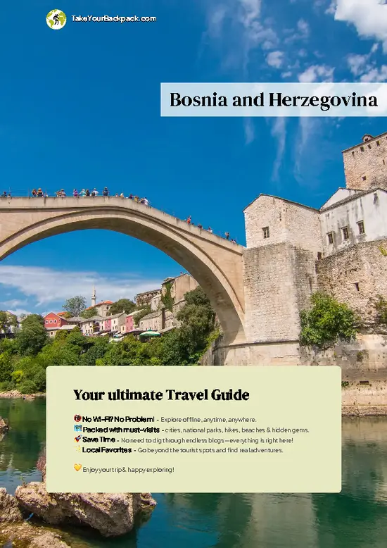
example page 0 from our offline Travel Guide for Bosnia and Herzegovina
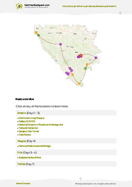
example page 1 from our offline Travel Guide for Bosnia and Herzegovina
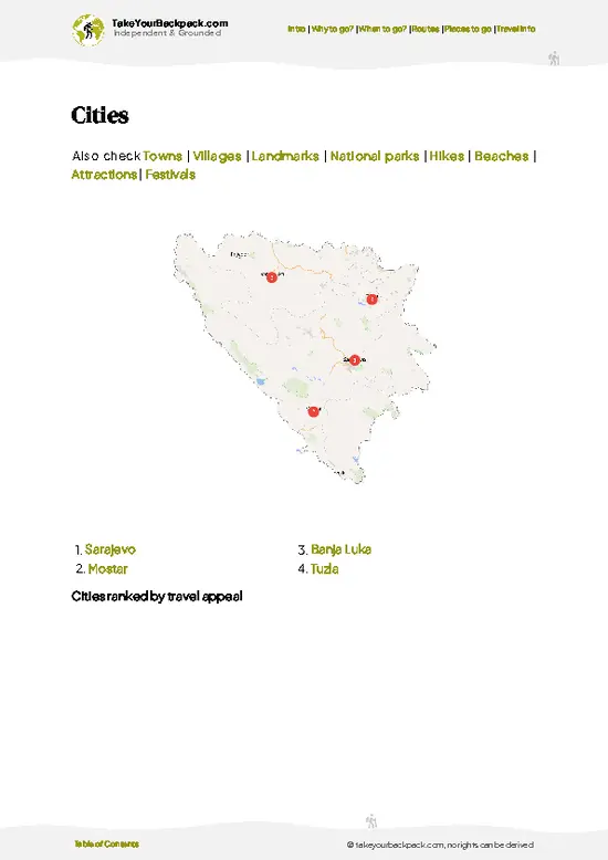
example page 2 from our offline Travel Guide for Bosnia and Herzegovina
example page 3 from our offline Travel Guide for Bosnia and Herzegovina
example page 4 from our offline Travel Guide for Bosnia and Herzegovina
example page 5 from our offline Travel Guide for Bosnia and Herzegovina
example page 6 from our offline Travel Guide for Bosnia and Herzegovina
example page 7 from our offline Travel Guide for Bosnia and Herzegovina
The digital guide (324 pages) contains:
86 highlights, ranked by travel appeal
Optimized 5, 10 & 15-day travel routes
Cities, national parks, landmarks, beaches
How to get around
Offline-friendly for travel without Wi-Fi
👉 Click to see all 30+ guide features

📅 Plan smarter in minutes, not weeks
Month by month travel advice
Festivals & national holidays
Budget expectations

🗺️ Go to the right places, skip the overrated ones
Honest pros & cons of destinations
Top hikes, parks & viewpoints
Lesser-known places most travelers miss
Clear “worth it vs skip it” guidance

🛏️ Travel smoothly without rookie mistakes
Best areas to stay
Transport systems explained simply
Common scams & safety advice
SIM cards, money & practical tips

🌍 Understand the country, not just visit it
Culture & traditions
52 Essential phrases & customs
Festivals worth planning around
Traveler-friendly historical context
Insights that make places more meaningful

📱 Built for real travel conditions
Fully downloadable PDF
Works completely offline
Optimized for phone use
Useful in remote areas & buses
Everything in one place
Save weeks of stressful planning
Get instant access to your full guide. 30‑day money-back guarantee.


By proceeding you agree to our terms.
Sent to your inbox immediately after payment • 100% Secure Checkout
Best Backpacking Travel Advisor 2025 tourism awardBest Backpacking
Travel Advisor
2025
What others say about Take Your Backpack Guides:
⭐⭐⭐⭐⭐
Fantastic, amazing amount of information!
⭐⭐⭐⭐⭐
My goodness this is amazing, it's what I've been looking for hats off too you!
⭐⭐⭐⭐⭐
I think this is absolutely BRILLIANT
⭐⭐⭐⭐
Very complete and informative. It's still missing places, but I gotta to commend you
⭐⭐⭐⭐⭐
This is truly amazing, thank you, can't wait to explore it with my kids!
⭐⭐⭐⭐⭐
Awesome resource, thank you!
⭐⭐⭐⭐⭐
This is amazing! Can't wait to explore the ones I haven't seen
⭐⭐⭐⭐
I love this! Well done, great idea.
⭐⭐⭐⭐⭐
Thanks for taking the time to make this gem!
⭐⭐⭐⭐⭐
This might be the best website I've ever seen.
⭐⭐⭐⭐⭐
Congratulations, and thank you so much for your work; it's incredibly valuable.
⭐⭐⭐⭐
In all seriousness I think you did a great job pointing out the important spots
⭐⭐⭐⭐⭐
10/10 very good
⭐⭐⭐⭐⭐
As someone who's only just starting to visit regularly this is awesome, thank you.
⭐⭐⭐⭐
Thank you very much! I'm going to visit my dad, it's going to be very useful!
⭐⭐⭐⭐⭐
This is really cool! We'll be travelling for the first time and this definitely come in handy.
⭐⭐⭐⭐⭐
You are now our minister of culture, congratulations 👨‍💼
⭐⭐⭐⭐⭐
Just wanted to tell you that this is a pearl! Going to follow your recommendations.
⭐⭐⭐⭐⭐
This is so cool. I'll definitely be using the resource for my travels soon.
⭐⭐⭐⭐⭐
This is very impressive! Good work.
⭐⭐⭐⭐⭐
This is an amazing and informative site. Very well done!

🛏️ Where to stay?Best areas and accommodation options

If you enjoy meeting fellow travelers, consider choosing hostels with high ratings for atmosphere. On the other hand, if you prefer having your own space, a hotel might be a better option.

🥾 Hike detailsHike details: route, duration, and difficulty of Via Dinarica

Total Distance: Approximately 1,200 kilometers, stretching from the northern part of Bosnia and Herzegovina down to the southern areas, connecting to the Via Dinarica trail that runs through several countries in the Dinaric Alps.

Estimated Duration: Depending on your pace and the sections you choose to tackle, it can take anywhere from two to four weeks to complete the entire route. Many hikers opt for shorter segments, which can be done in a week or even a few days.

Difficulty Level: Moderate to challenging. The trail includes steep ascents and descents, rocky paths, and occasional sections … read more 👉
Total Distance: Approximately 1,200 kilometers, stretching from the northern part of Bosnia and Herzegovina down to the southern areas, connecting to the Via Dinarica trail that runs through several countries in the Dinaric Alps.

Estimated Duration: Depending on your pace and the sections you choose to tackle, it can take anywhere from two to four weeks to complete the entire route. Many hikers opt for shorter segments, which can be done in a week or even a few days.

Difficulty Level: Moderate to challenging. The trail includes steep ascents and descents, rocky paths, and occasional sections that may require some scrambling. It’s not for the faint-hearted, but if you’re reasonably fit and have some hiking experience, you’ll manage just fine.

Starting Point: The trail often begins in the town of Bihać. To get there by public transport, take a bus from Sarajevo or Banja Luka. The bus ride from Sarajevo takes about 5-6 hours, while from Banja Luka it’s roughly 3-4 hours. Buses are generally frequent, but it’s a good idea to check schedules in advance.

Major Landmarks Along the Route:
  • Una National Park: Known for its stunning waterfalls and crystal-clear rivers, this park is a highlight of the trail.
  • Sutjeska National Park: Home to the highest peak in Bosnia, Maglić, and rich in biodiversity.
  • Drina River: The trail runs alongside this beautiful river, providing breathtaking views and spots for rest.
  • Historical Sites: You’ll encounter various medieval fortresses and remnants of Ottoman architecture, giving a glimpse into the region’s rich history.

Type of Terrain and Scenery: The terrain varies quite a bit, from rocky mountain paths to lush valleys and dense forests. Expect to traverse through alpine meadows, rocky ridges, and occasionally, some muddy sections after rainfall. The scenery is absolutely breathtaking, with panoramic views of the Dinaric Alps, cascading rivers, and charming villages dotting the landscape.

Typical Vegetation and Wildlife: The trail is rich in biodiversity. You’ll find a mix of coniferous and deciduous forests, wildflowers, and alpine plants. Wildlife includes deer, bears, and various bird species, so keep your eyes peeled—though, thankfully, bears tend to avoid humans. Just remember to make some noise while hiking to avoid surprising any wildlife!

Overall, the Via Dinarica is a gem for independent hikers looking for a mix of adventure, natural beauty, and cultural experiences. Just pack your gear, lace up those boots, and get ready for an unforgettable journey!
⚠️ Hiking info can sometimes be outdated or inaccurate. Before you hit the trail, check the latest conditions with locals. If you do spot anything that's off, I'd love to hear from you, so I can update it for fellow travelers.

🛡️ SafetyTraveler Safety Guide

The Via Dinarica in Bosnia and Herzegovina is a wild playground, but it’s not without its quirks. Weather can shift faster than you can say “raincoat,” so pack layers and a reliable waterproof jacket. Expect steep ascents that will get your heart racing, but the views from the top are worth every drop of sweat. Navigation can be tricky; trail markers are sometimes sparse, so a good map or GPS app is your best friend.

Footing varies—some paths are well-trodden, while others demand careful placement to avoid slips on rocky sections. River crossings can pop up, especially after rain, so be prepared to get your feet wet.

Wildlife is part of the charm here. You might spot deer or even a bear in the distance. Keep your distance and make noise to avoid surprising them.

First-timers often underestimate … read more 👉
The Via Dinarica in Bosnia and Herzegovina is a wild playground, but it’s not without its quirks. Weather can shift faster than you can say “raincoat,” so pack layers and a reliable waterproof jacket. Expect steep ascents that will get your heart racing, but the views from the top are worth every drop of sweat. Navigation can be tricky; trail markers are sometimes sparse, so a good map or GPS app is your best friend.

Footing varies—some paths are well-trodden, while others demand careful placement to avoid slips on rocky sections. River crossings can pop up, especially after rain, so be prepared to get your feet wet.

Wildlife is part of the charm here. You might spot deer or even a bear in the distance. Keep your distance and make noise to avoid surprising them.

First-timers often underestimate the need for sturdy boots and trekking poles. They’ll save your knees on the descents. Embrace the challenge; the reward is a cold beer at the end of the trail, shared with fellow adventurers.

Other Bosnian hikes near Via Dinarica

Explore more nearby:

  • Čvrsnica Mountain Trail—karst terrain, Hajdučka Vrata arch, steep canyons| 6 km away
  • Prenj—jagged peaks, remote wilderness, alpine passes| 24 km away
  • Vranica Mountain—glacial lakes, pine forests, rounded summits| 42 km away

💡 Not sure where to go next?
Create a personalized itinerary for Bosnia and Herzegovina including Via Dinarica and the places that fit your trip.

Generate my itinerary

👉 Discover all hikes

Or checkout all Bosnia and Herzegovina has to offer (think cities, towns, villages, national parks, hikes, beaches, festivals)
Country photo of Bosnia and Herzegovina

We 💚 feedbackWhat to keep in mind

The Via Dinarica is a wild ride. You’ll feel the pulse of the mountains in your legs and the thrill of discovery in your heart. Don’t miss the local konoba (tavern) in Žabljak; the homemade rakija will surprise you. Just be ready for the trails—some are steep and rocky, but the views from the peaks are worth every drop of sweat. Pack a sense of adventure and a good pair of boots, and you’ll find yourself craving the next challenge before you even finish the last.

✍️ Help improve this page!
The information on this page is based on in-depth research, insights shared by experienced travelers, and feedback from the local travel community in Bosnia and Herzegovina. While every effort is made to keep the information accurate and current, conditions can change — so if you spot anything incorrect or outdated, please get in touch.


🙋‍♂️ Give feedback

👋 Meet the founderWho’s Behind Take Your Backpack?

Johan, backpacker and founder of TakeYourBackpackHi, I’m Johan (Netherlands 🇳🇱), the creator of TakeYourBackpack. Over the past decade, I’ve backpacked through 80+ countries across six continents, gaining extensive experience with independent travel, long-term trips, and overland routes.

This site is built on a combination of firsthand travel experience and carefully curated insights from other backpackers. Many guides are based on places I’ve personally visited, while others bring together tips, observations, and practical advice shared by trusted travelers I’ve met along the way.

The goal is to provide realistic, experience-driven guidance — not generic itineraries — so you can explore destinations with better context, clearer expectations, and more confidence.

Get full country guide •
Instant download • 86 highlights • Full Offline guide