×

Canada🇨🇦 | hikesBruce TrailLimestone escarpment, Rattlesnake Point, cedar-clinging cliffs, Halton section walks | things to do and best time to go

Explore Berg Lake TrailExplore Fundy Footpath

Backpacking in Bruce Trail
👌 Worth visitinghike ranked #9
By Johan Kruseman 🇳🇱 | Updated October 23, 2026

The Bruce Trail is Canada’s oldest and longest marked footpath, and the main trail runs about 900 kilometers with roughly 400 kilometers of side trails, yet you can sleep in a bed most nights because towns sit close to the route. It runs through southern Ontario, in Canada, from the Niagara River to Tobermory, and this stretch near Milton and Halton Hills follows the Niagara Escarpment. I arrived at a gravel pullout, stepped through a wooden stile, and the first thing I noticed was the smell of cedar and damp limestone, with a hawk calling above a rock ledge. Underfoot you get roots, white-blazed trees and slabby rock steps, then sudden cliff-edge lookouts over farmland. Road crossings and transit gaps are a nuisance. Day hikers and section walkers will love it; anyone who wants remote wilderness or easy bus access will not.

Discover everything you want to know in the 📖 Canada Travel Guide.
Best time to go: April - November
Duration: 5 hours
Distance: 15 kilometers
Total ascent: 350 meters


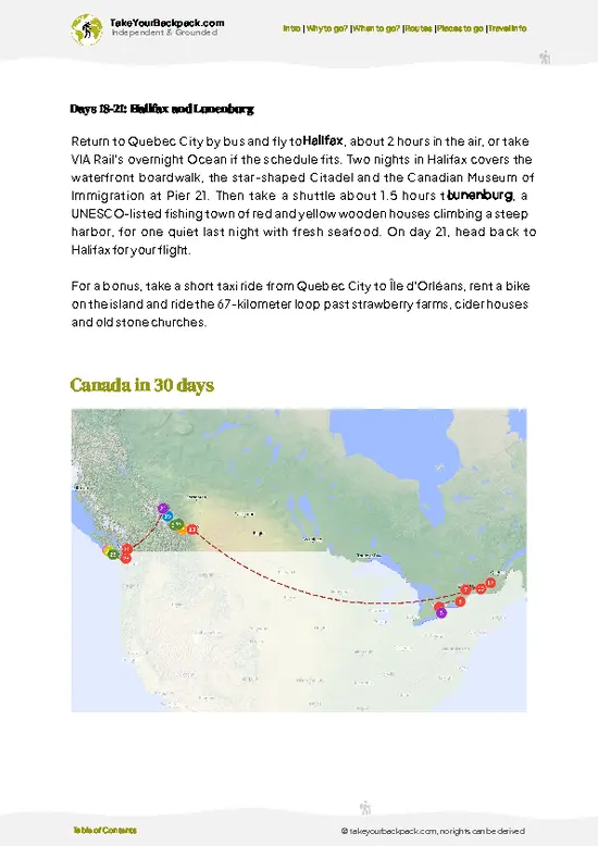
example page 0 from our offline Travel Guide for Canada
example page 1 from our offline Travel Guide for Canada
example page 2 from our offline Travel Guide for Canada
example page 3 from our offline Travel Guide for Canada
example page 4 from our offline Travel Guide for Canada
example page 5 from our offline Travel Guide for Canada
example page 6 from our offline Travel Guide for Canada
example page 7 from our offline Travel Guide for Canada
Loading the map 🌍
CLICK TO FILTER
cities
towns
villages
landmarks
national parks
hikes
beaches
attractions
festivals
regions
SHOW COUNTRY’S BESTSHOW ALL

✨ Why go?
Ranked #9 hike in Canada
What makes it a must-see hike

The Bruce Trail gives backpackers a long-distance path without the logistics of a remote expedition. The escarpment near Milton and Halton Hills packs in limestone cliffs, cedar-clinging ledges and deep forest within a short drive of Toronto, so a half day on foot delivers real Niagara Escarpment views. Distances are wonderfully flexible, because the trail is split into clubs and numbered sections with frequent road access, and you can chop it into day hikes of 5 to 20 kilometers or string them into multi-day trips. It also costs little, since walking is free and many club sections need no permit. That makes it a smart add-on to a longer Ontario trip, combined with Niagara Falls, Toronto or Georgian Bay. Hikers chasing the full end-to-end Niagara to Tobermory goal can chip away at it over several seasons.

💡 HighlightsMust-see experiences and standout moments

  1. Niagara Escarpment Cliff Lookouts: The trail’s signature sight is the limestone brink, where ledges drop sharply to farmland and the Ontario countryside spreads out below.
  2. Rattlesnake Point: Open limestone cliffs here draw climbers and walkers, with wide views over the Milton plain and hawks riding the updrafts. Fall color is excellent.
  3. Crawford Lake area: Nearby forest trails lead to a small, deep lake, and a reconstructed Iroquoian village stands beside it.
  4. Kelso and Hilton Falls Conservation Areas: Quarry cliffs, a reservoir and a waterfall make for varied short loops that connect with the main trail.
  5. Hemlock and cedar forest sections: Ancient, twisted cedars cling to the rock face, and the dim light and mossy boulders give the walking a quiet, cool atmosphere.
The Bruce Trail itself is free, … read more 👉
  1. Niagara Escarpment Cliff Lookouts: The trail’s signature sight is the limestone brink, where ledges drop sharply to farmland and the Ontario countryside spreads out below.
  2. Rattlesnake Point: Open limestone cliffs here draw climbers and walkers, with wide views over the Milton plain and hawks riding the updrafts. Fall color is excellent.
  3. Crawford Lake area: Nearby forest trails lead to a small, deep lake, and a reconstructed Iroquoian village stands beside it.
  4. Kelso and Hilton Falls Conservation Areas: Quarry cliffs, a reservoir and a waterfall make for varied short loops that connect with the main trail.
  5. Hemlock and cedar forest sections: Ancient, twisted cedars cling to the rock face, and the dim light and mossy boulders give the walking a quiet, cool atmosphere.
The Bruce Trail itself is free, but Rattlesnake Point, Crawford Lake, Kelso and Hilton Falls are conservation parks that charge an entry fee, and busy weekends call for booking a day pass ahead online.
Spotted a mistake or missing something? Contact us.

Things to do near Bruce Trail

Ratings based on Tripadvisor reviews. When you book through this link, you support our work at no extra cost to you.

🌤️ When to go?Choosing the right time of year

  • Spring (April to May): Daytime highs run 8 to 18°C (46 to 64°F), and mud lingers on the escarpment trails. Trilliums and other wildflowers carpet the forests in May, and crowds stay thin on weekdays.
  • Summer (June to August): Highs of 22 to 28°C (72 to 82°F) with humid afternoons, plus mosquitoes and ticks. Light lasts until well into the evening. Weekends at Rattlesnake Point and Kelso fill up.
  • Fall (September to October): Highs of 10 to 20°C (50 to 68°F) and crisp mornings. Maple color peaks in early to mid October, so trailheads get busy and nearby inns raise rates.
  • Winter (December to March): Lows of -10 to -3°C (14 to 27°F). Ice and snow call for microspikes or snowshoes, and daylight is short.
Weekday hikes in late September give you fall color without the weekend parking scramble.

source: climatestotravel.comJANJanuary: below average for travelingFEBFebruary: below average for travelingMARMarch: fair for travelingAPRApril: good for travelingMAYMay: highly recommended for travelingJUNJune: highly recommended for travelingJULJuly: good for travelingAUGAugust: good for travelingSEPSeptember: highly recommended for travelingOCTOctober: excellent for travelingNOVNovember: good for travelingDECDecember: below average for traveling
canada-hike-bruce-trail v1
© Google |

✈️ The backpacker research shortcutCanada Travel Guide

An offline-friendly backpacking guide with optimized travel routes, ranked highlights, transport advice, and the best areas to stay.
example page 0 from our offline Travel Guide for Canada
example page 1 from our offline Travel Guide for Canada
example page 2 from our offline Travel Guide for Canada
example page 3 from our offline Travel Guide for Canada
example page 4 from our offline Travel Guide for Canada
example page 5 from our offline Travel Guide for Canada
example page 6 from our offline Travel Guide for Canada
example page 7 from our offline Travel Guide for Canada
The digital guide (385 pages) contains:
✅ 125 highlights, ranked by travel appeal
✅ Optimized 14, 21 & 30-day travel routes
✅ Cities, national parks, landmarks, beaches
✅ How to get around
✅ Offline-friendly for travel without Wi-Fi
👉 Click to see all 30+ guide features

📅 Plan smarter in minutes, not weeks
✅ Month by month travel advice
✅ Festivals & national holidays
✅ Budget expectations

🗺️ Go to the right places, skip the overrated ones
✅ Honest pros & cons of destinations
✅ Top hikes, parks & viewpoints
✅ Lesser-known places most travelers miss
✅ Clear “worth it vs skip it” guidance

🛏️ Travel smoothly without rookie mistakes
✅ Best areas to stay
✅ Transport systems explained simply
✅ Common scams & safety advice
✅ SIM cards, money & practical tips

🌍 Understand the country, not just visit it
✅ Culture & traditions
✅ Local customs
✅ Festivals worth planning around
✅ Traveler-friendly historical context
✅ Insights that make places more meaningful

📱 Built for real travel conditions
✅ Fully downloadable PDF
✅ Works completely offline
✅ Optimized for phone use
✅ Useful in remote areas & buses
✅ Everything in one place
Stop searching, start planning
Get instant access to your full guide. 30‑day money-back guarantee.
+ Add another guide for just

By proceeding you agree to our terms.
Sent to your inbox immediately after payment • 100% Secure Checkout
Best Backpacking Travel Advisor 2025 tourism awardBest Backpacking
Travel Advisor
2025
What others say about Take Your Backpack Guides:
⭐⭐⭐⭐⭐
Fantastic, amazing amount of information!
⭐⭐⭐⭐⭐
My goodness this is amazing, it's what I've been looking for hats off too you!
⭐⭐⭐⭐⭐
I think this is absolutely BRILLIANT
⭐⭐⭐⭐
Very complete and informative. It's still missing places, but I gotta to commend you
⭐⭐⭐⭐⭐
This is truly amazing, thank you, can't wait to explore it with my kids!
⭐⭐⭐⭐⭐
Awesome resource, thank you!
⭐⭐⭐⭐⭐
This is amazing! Can't wait to explore the ones I haven't seen
⭐⭐⭐⭐
I love this! Well done, great idea.
⭐⭐⭐⭐⭐
Thanks for taking the time to make this gem!
⭐⭐⭐⭐⭐
This might be the best website I've ever seen.
⭐⭐⭐⭐⭐
Congratulations, and thank you so much for your work; it's incredibly valuable.
⭐⭐⭐⭐
In all seriousness I think you did a great job pointing out the important spots
⭐⭐⭐⭐⭐
10/10 very good
⭐⭐⭐⭐⭐
As someone who's only just starting to visit regularly this is awesome, thank you.
⭐⭐⭐⭐
Thank you very much! I'm going to visit my dad, it's going to be very useful!
⭐⭐⭐⭐⭐
This is really cool! We'll be travelling for the first time and this definitely come in handy.
⭐⭐⭐⭐⭐
You are now our minister of culture, congratulations 👨‍💼
⭐⭐⭐⭐⭐
Just wanted to tell you that this is a pearl! Going to follow your recommendations.
⭐⭐⭐⭐⭐
This is so cool. I'll definitely be using the resource for my travels soon.
⭐⭐⭐⭐⭐
This is very impressive! Good work.
⭐⭐⭐⭐⭐
This is an amazing and informative site. Very well done!

🛏️ Where to stay?Best areas and accommodation options

If you enjoy meeting fellow travelers, consider choosing hostels with high ratings for atmosphere. On the other hand, if you prefer having your own space, a hotel might be a better option.

🥾 Hike detailsTrail overview: what to expect on the hike

Total Distance: The Bruce Trail main route is about 900 kilometers, while a typical section near Milton runs 10 to 25 kilometers.
Estimated Duration: Allow 3 to 7 hours for a day section, or about 6 to 8 weeks for the whole trail in stages.
Difficulty: Moderate. Short steep climbs, rocky steps and slick roots slow the pace, though there is no technical scrambling.
Starting Point: Most hikers start at conservation area parking lots or road crossings. Public transit is limited, so Bruce Trail walkers often take GO Transit to Milton and then a taxi or rideshare to the trailhead.
Major Landmarks:
  • Rattlesnake
… read more 👉
Total Distance: The Bruce Trail main route is about 900 kilometers, while a typical section near Milton runs 10 to 25 kilometers.
Estimated Duration: Allow 3 to 7 hours for a day section, or about 6 to 8 weeks for the whole trail in stages.
Difficulty: Moderate. Short steep climbs, rocky steps and slick roots slow the pace, though there is no technical scrambling.
Starting Point: Most hikers start at conservation area parking lots or road crossings. Public transit is limited, so Bruce Trail walkers often take GO Transit to Milton and then a taxi or rideshare to the trailhead.
Major Landmarks:
  • Rattlesnake Point: Cliff lookouts over the plain.
  • Crawford Lake: A small lake with a reconstructed longhouse village.
  • Hilton Falls: A waterfall and old mill ruins.
Terrain and Scenery: The Bruce Trail crosses limestone ledges, rooty forest paths, boardwalks and old farm lanes. Open cliff edges alternate with shaded valleys.
Vegetation: Eastern white cedar, sugar maple, beech and hemlock dominate, with spring wildflowers such as trillium.
Wildlife: Expect white-tailed deer, chipmunks, turkey vultures and hawks, plus the occasional garter snake. Ticks are present, so check yourself afterward.
⚠️ Hiking info can sometimes be outdated or inaccurate. Before you hit the trail, check the latest conditions with locals. If you do spot anything that's off, I'd love to hear from you, so I can update it for fellow travelers.

🛡️ SafetyScams, Hazards, and Annoyances

Bruce Trail is well marked with white blazes and mostly low-risk, but the escarpment has its own quirks. Rock ledges, tree roots and limestone slabs get slick after rain, so wear shoes with real tread and take your time on descents. Ticks are common from spring through fall, so wear long pants, do a body check afterward and carry a map or offline app because side-trail blazes in blue can confuse. Poison ivy lines many paths. Black bears are rare near the Hamilton and Milton sections, but rattlesnakes are not a concern here. Deer and coyotes keep their distance. Carry more water than seems necessary, since few sections have taps, and stay on the marked trail to respect private land.

FAQCommon questions from travelers

The full Bruce Trail runs about 900 km (560 miles) from Niagara to Tobermory, and end-to-end hikers usually need 5 to 8 weeks. Most backpackers walk sections instead, such as a 2 to 4 hour loop near Rattlesnake Point or a 3 to 5 day stretch. Daily distances of 15 to 25 km (9 to 15 miles) are typical for trekkers.
Bruce Trail is easy to moderate on most day sections, with rolling terrain, stairs and rocky footing rather than serious climbs. Elevation gains are modest, often 100 to 300 meters per day, but roots, limestone and mud slow you down. A full end-to-end trek is demanding mainly because of its length and the 5 to 8 weeks of effort it takes.
Bruce Trail needs no guide, and navigation is simple thanks to white blazes and the Bruce Trail Conservancy guidebook and app. Membership with the Conservancy (roughly US$60 to 80 a year) is encouraged and unlocks maps. Some conservation areas such as Rattlesnake Point or Kelso charge US$7 to 11 per person, and Bruce Peninsula National Park near Tobermory requires reserved parking passes in season. Camping is only allowed at designated sites.
⚠️ Things can change over time, so always validate details locally before you go.

Other Canadian hikes near Bruce Trail

Explore more nearby:


💡 Not sure where to go next?
Create a personalized itinerary for Canada including Bruce Trail and the places that fit your trip.

Generate my itinerary

👉 Discover all hikes

Or checkout all Canada has to offer (think cities, towns, villages, national parks, hikes, beaches, festivals)
Country photo of Canada

We 💚 feedbackIs it worth it?

The Bruce Trail is easy to underrate because the white blazes are sometimes faint at road crossings, and a missed turn costs time. I would download the club section map before setting out and pick a weekday morning, when the cliff lookouts are quiet.

✈️ When did I visit Canada?
As part of my 1.5 year travel around the world trip, I visited Canada in 2016.

✍️ Help improve this page!
The information on this page is based on my own backpacking experience in Canada, supplemented with up-to-date research and feedback from other travelers. Travel details can change, so if you notice anything outdated or incomplete, feel free to let me know.


🙋‍♂️ Give feedback

👋 Meet the founderWho’s Behind Take Your Backpack?

Johan, backpacker and founder of TakeYourBackpackHi, I’m Johan (Netherlands 🇳🇱), the creator of TakeYourBackpack. Over the past 3 decades, I’ve backpacked through 90+ countries across six continents, gaining extensive experience with independent travel, long-term trips, and overland routes.

This site is built on a combination of firsthand travel experience and carefully curated insights from other backpackers. Many guides are based on places I’ve personally visited, while others bring together tips, observations, and practical advice shared by trusted travelers I’ve met along the way.

The goal is to provide realistic, experience-driven guidance — not generic itineraries — so you can explore destinations with better context, clearer expectations, and more confidence.