
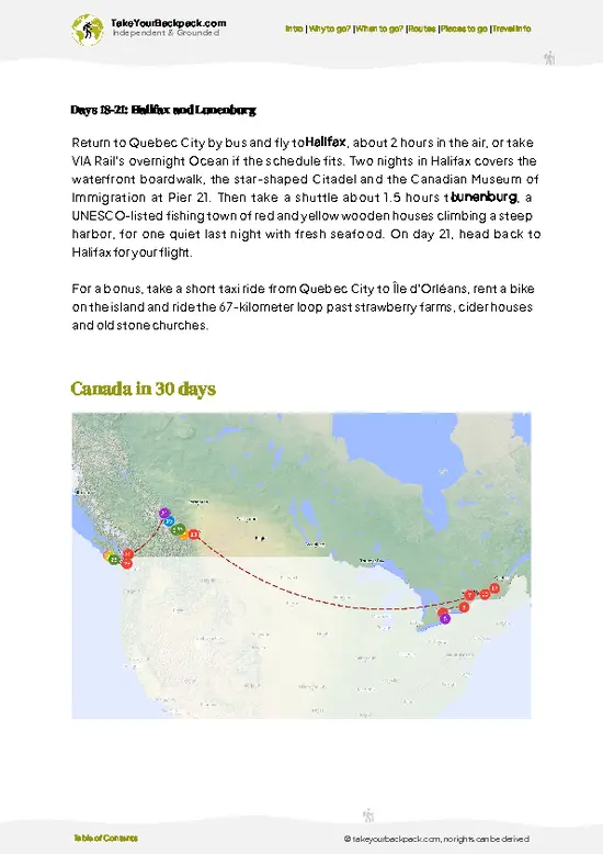
- The Notch: The highest point on the trail, about 2,510 meters, is a steep, rocky saddle with views back over the Maligne Valley and ahead to endless ridgelines. A side scramble up the nearby slope adds even more outlook.
- Curator Lake and Curator Campground area: Open alpine terrain and views of the Queen Elizabeth Ranges make this stretch feel remote. Marmots and pikas are common in the boulders.
- Little Shovel Pass: A wide alpine pass with wildflowers in midsummer and the trail threading between rolling ridges. It is the place to slow down and look around.
- Big Shovel Pass: Broad open slopes and wide views of the Athabasca Valley. Caribou and bighorn sheep are sometimes spotted on distant slopes.
- Signal Mountain Viewpoint: Near the end of the route, the descent offers a panorama over the Athabasca
- The Notch: The highest point on the trail, about 2,510 meters, is a steep, rocky saddle with views back over the Maligne Valley and ahead to endless ridgelines. A side scramble up the nearby slope adds even more outlook.
- Curator Lake and Curator Campground area: Open alpine terrain and views of the Queen Elizabeth Ranges make this stretch feel remote. Marmots and pikas are common in the boulders.
- Little Shovel Pass: A wide alpine pass with wildflowers in midsummer and the trail threading between rolling ridges. It is the place to slow down and look around.
- Big Shovel Pass: Broad open slopes and wide views of the Athabasca Valley. Caribou and bighorn sheep are sometimes spotted on distant slopes.
- Signal Mountain Viewpoint: Near the end of the route, the descent offers a panorama over the Athabasca Valley and Jasper townsite. It is a good spot for a final break before the knees-down finish.
Spotted a mistake or missing something? Contact us.

Maligne Lake Cruise

Jasper Wildlife & Maligne Lake Tour with Spirit Island Cruise

Jasper Evening Wildlife Tour

Athabasca Falls Run

Athabasca River Mile 5

Half-Day Jasper Culture Food Tour

Jasper National Park Tour: Maligne Valley, Medicine Lake and Spirit Island

Athabasca River Easy Scenic Raft Trip

Jasper Wildlife and Sightseeing Tour with Maligne Lake Hike


 Best Backpacking

 Hi, I’m Johan (Netherlands 🇳🇱), the creator of TakeYourBackpack. Over the past 3 decades, I’ve backpacked through 90+ countries across six continents, gaining extensive experience with independent travel, long-term trips, and overland routes.