×

Central African Republic🇨🇫 | hikesMount Ngaoui Trail1,410 m summit, Yadé Massif, granite ridge, Cameroon border | things to do and best time to go

Explore Boali Waterfalls TrailExplore Bamingui-Bangoran National Park

Backpacking in Mount Ngaoui Trail
👌 Worth visitinghike ranked #3
By Johan Kruseman 🇳🇱 | Updated October 22, 2026

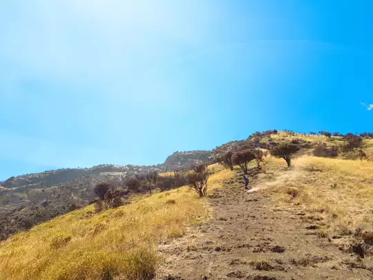
Mount Ngaoui is the highest point in the Central African Republic, at roughly 1,410 meters, and the trail up it is the reason anyone comes. It sits in the Yadé Massif on the western border with Cameroon, a long way from Bangui. Expect a rugged ridge climb through savanna woodland, with open granite and wide views over the plateau. The effort is moderate, a steep day or an easy overnight, but nothing here is set up for walkers. There are no marked trails worth the name, no public transport to the foot of the massif, and no maps you can trust. Three things catch people out. Arranging a local guide late means delays, so line one up in the nearest town before you go. Carrying too little cash is the usual budget killer, because nothing takes cards. Skipping current security checks in the northwest is the worst mistake, so ask locally before committing. This suits self-reliant, patient hikers with French and flexible plans. It will frustrate anyone who wants signposts, huts or a schedule.

Discover everything you want to know in the 📖 Central African Republic Travel Guide.
Best time to go: November - February
Duration: 2 days
Distance: 20 kilometers
Total ascent: 800 meters
Safety warning

The current risk level for Central African Republic is high. Check the advice before going.


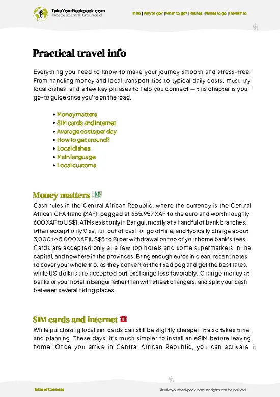
example page 0 from our offline Travel Guide for Central African Republic
example page 1 from our offline Travel Guide for Central African Republic
example page 2 from our offline Travel Guide for Central African Republic
example page 3 from our offline Travel Guide for Central African Republic
example page 4 from our offline Travel Guide for Central African Republic
example page 5 from our offline Travel Guide for Central African Republic
example page 6 from our offline Travel Guide for Central African Republic
example page 7 from our offline Travel Guide for Central African Republic
Loading the map 🌍
CLICK TO FILTER
cities
towns
landmarks
national parks
hikes
attractions
regions
SHOW COUNTRY’S BESTSHOW ALL

✨ Why go?
Ranked #3 hike in Central African Republic
Why visitors keep coming back

Mount Ngaoui Trail gives you something almost nobody can claim: a walk to the highest summit in the Central African Republic, close to the Cameroon frontier. Peak-baggers and border-collectors treat that as the entire pitch, and it holds up. The Yadé Massif rises out of rolling savanna, so even a modest climb of a few hundred meters opens a big, empty horizon with no other trekkers in it. The second draw is how little the hike is polished. You deal with village chiefs and local guides rather than ticket booths, and that brings a real chance to meet the Gbaya and Mbum communities who farm the lower slopes on their own terms. It is also cheap in the sense that there is almost nothing to pay for beyond guide fees, food and small gifts to hosts. The flexible length helps: you can summit in a hard … read more 👉
Mount Ngaoui Trail gives you something almost nobody can claim: a walk to the highest summit in the Central African Republic, close to the Cameroon frontier. Peak-baggers and border-collectors treat that as the entire pitch, and it holds up. The Yadé Massif rises out of rolling savanna, so even a modest climb of a few hundred meters opens a big, empty horizon with no other trekkers in it. The second draw is how little the hike is polished. You deal with village chiefs and local guides rather than ticket booths, and that brings a real chance to meet the Gbaya and Mbum communities who farm the lower slopes on their own terms. It is also cheap in the sense that there is almost nothing to pay for beyond guide fees, food and small gifts to hosts. The flexible length helps: you can summit in a hard day or stretch it into two with a night near the base. It belongs on a long, slow overland route through the west, not a quick trip.

💡 HighlightsKey sights and experiences for travelers

  1. Summit of Mount Ngaoui: The top of the country, about 1,410 meters, with a broad outlook across the plateau and toward Cameroon. It is a rocky, exposed finish rather than a pointed peak, so the view opens gradually as the trees thin.
  2. Yadé Massif ridgeline: The granite-based highland that Ngaoui belongs to. Along the upper ridge you walk across bare rock slabs and boulder fields, with a clear sense of how abruptly the massif lifts out of the lowland.
  3. Savanna woodland on the lower slopes: The approach passes through grass and scattered trees, with birdlife most active in the cool early hours. It is a gentle warm-up before the steeper pitches begin.
  4. Farming hamlets at the foot of the massif: Small settlements of cassava and maize growers, where your guide will usually make introductions. Greeting
… read more 👉
  1. Summit of Mount Ngaoui: The top of the country, about 1,410 meters, with a broad outlook across the plateau and toward Cameroon. It is a rocky, exposed finish rather than a pointed peak, so the view opens gradually as the trees thin.
  2. Yadé Massif ridgeline: The granite-based highland that Ngaoui belongs to. Along the upper ridge you walk across bare rock slabs and boulder fields, with a clear sense of how abruptly the massif lifts out of the lowland.
  3. Savanna woodland on the lower slopes: The approach passes through grass and scattered trees, with birdlife most active in the cool early hours. It is a gentle warm-up before the steeper pitches begin.
  4. Farming hamlets at the foot of the massif: Small settlements of cassava and maize growers, where your guide will usually make introductions. Greeting the village head before you walk is the proper custom, and it often brings useful local route advice.
  5. Views toward the Cameroon border: From the higher ground the land falls away to the west, giving a sense of how remote this frontier is. Haze is common, so a clear morning matters.
Start with the summit of Mount Ngaoui Trail itself, early in the day, because the view is the whole point and the haze that builds later softens it.
Spotted a mistake or missing something? Contact us.

🌤️ When to go?Weather, crowds, and seasonal trade-offs

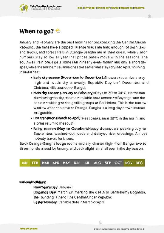
December to February gives the clearest, most stable hiking weather on Mount Ngaoui Trail.
  • Dry Season (November to March): Days reach 26 to 30°C (79 to 86°F) on the lower slopes, and nights near the summit drop to 14 to 17°C (57 to 63°F). Skies are clearest in November and early December. Harmattan haze can dull views from January.
  • Early Rains (April to May): Afternoon storms build, grass grows tall and paths turn slick. Temperatures sit around 22 to 28°C (72 to 82°F).
  • Peak Rains (June to October): Cloud often caps the summit, tracks to the trailhead turn to mud, and rivers swell. Local drivers and guides charge more, and some days nobody will go.
  • Crowds and Daylight: You will likely meet no other hikers in any month. Daylight runs about 11.5 to 12.5 hours, so start early.
Book your guide and vehicle … read more 👉
December to February gives the clearest, most stable hiking weather on Mount Ngaoui Trail.
  • Dry Season (November to March): Days reach 26 to 30°C (79 to 86°F) on the lower slopes, and nights near the summit drop to 14 to 17°C (57 to 63°F). Skies are clearest in November and early December. Harmattan haze can dull views from January.
  • Early Rains (April to May): Afternoon storms build, grass grows tall and paths turn slick. Temperatures sit around 22 to 28°C (72 to 82°F).
  • Peak Rains (June to October): Cloud often caps the summit, tracks to the trailhead turn to mud, and rivers swell. Local drivers and guides charge more, and some days nobody will go.
  • Crowds and Daylight: You will likely meet no other hikers in any month. Daylight runs about 11.5 to 12.5 hours, so start early.
Book your guide and vehicle in the first half of the dry season, before roads dry out and demand rises.


source: climatestotravel.comJANJanuary: excellent for travelingFEBFebruary: excellent for travelingMARMarch: fair for travelingAPRApril: below average for travelingMAYMay: below average for travelingJUNJune: below average for travelingJULJuly: below average for travelingAUGAugust: below average for travelingSEPSeptember: below average for travelingOCTOctober: fair for travelingNOVNovember: excellent for travelingDECDecember: excellent for traveling
central-african-republic-hike-mount-ngaoui-trail
© Google |

✈️ The backpacker research shortcutCentral African Republic Travel Guide

An offline-friendly backpacking guide with optimized travel routes, ranked highlights, transport advice, and the best areas to stay.
example page 0 from our offline Travel Guide for Central African Republic
example page 1 from our offline Travel Guide for Central African Republic
example page 2 from our offline Travel Guide for Central African Republic
example page 3 from our offline Travel Guide for Central African Republic
example page 4 from our offline Travel Guide for Central African Republic
example page 5 from our offline Travel Guide for Central African Republic
example page 6 from our offline Travel Guide for Central African Republic
example page 7 from our offline Travel Guide for Central African Republic
The digital guide (210 pages) contains:
✅ 42 highlights, ranked by travel appeal
✅ Optimized 5, 10 & 15-day travel routes
✅ Cities, national parks, landmarks, beaches
✅ How to get around
✅ Offline-friendly for travel without Wi-Fi
👉 Click to see all 30+ guide features

📅 Plan smarter in minutes, not weeks
✅ Month by month travel advice
✅ Festivals & national holidays
✅ Budget expectations

🗺️ Go to the right places, skip the overrated ones
✅ Honest pros & cons of destinations
✅ Top hikes, parks & viewpoints
✅ Lesser-known places most travelers miss
✅ Clear “worth it vs skip it” guidance

🛏️ Travel smoothly without rookie mistakes
✅ Best areas to stay
✅ Transport systems explained simply
✅ Common scams & safety advice
✅ SIM cards, money & practical tips

🌍 Understand the country, not just visit it
✅ Culture & traditions
✅ 52 Essential phrases & customs
✅ Festivals worth planning around
✅ Traveler-friendly historical context
✅ Insights that make places more meaningful

📱 Built for real travel conditions
✅ Fully downloadable PDF
✅ Works completely offline
✅ Optimized for phone use
✅ Useful in remote areas & buses
✅ Everything in one place
Stop searching, start planning
Get instant access to your full guide. 30‑day money-back guarantee.
+ Add another guide for just

By proceeding you agree to our terms.
Sent to your inbox immediately after payment • 100% Secure Checkout
Best Backpacking Travel Advisor 2025 tourism awardBest Backpacking
Travel Advisor
2025
What others say about Take Your Backpack Guides:
⭐⭐⭐⭐⭐
Fantastic, amazing amount of information!
⭐⭐⭐⭐⭐
My goodness this is amazing, it's what I've been looking for hats off too you!
⭐⭐⭐⭐⭐
I think this is absolutely BRILLIANT
⭐⭐⭐⭐
Very complete and informative. It's still missing places, but I gotta to commend you
⭐⭐⭐⭐⭐
This is truly amazing, thank you, can't wait to explore it with my kids!
⭐⭐⭐⭐⭐
Awesome resource, thank you!
⭐⭐⭐⭐⭐
This is amazing! Can't wait to explore the ones I haven't seen
⭐⭐⭐⭐
I love this! Well done, great idea.
⭐⭐⭐⭐⭐
Thanks for taking the time to make this gem!
⭐⭐⭐⭐⭐
This might be the best website I've ever seen.
⭐⭐⭐⭐⭐
Congratulations, and thank you so much for your work; it's incredibly valuable.
⭐⭐⭐⭐
In all seriousness I think you did a great job pointing out the important spots
⭐⭐⭐⭐⭐
10/10 very good
⭐⭐⭐⭐⭐
As someone who's only just starting to visit regularly this is awesome, thank you.
⭐⭐⭐⭐
Thank you very much! I'm going to visit my dad, it's going to be very useful!
⭐⭐⭐⭐⭐
This is really cool! We'll be travelling for the first time and this definitely come in handy.
⭐⭐⭐⭐⭐
You are now our minister of culture, congratulations 👨‍💼
⭐⭐⭐⭐⭐
Just wanted to tell you that this is a pearl! Going to follow your recommendations.
⭐⭐⭐⭐⭐
This is so cool. I'll definitely be using the resource for my travels soon.
⭐⭐⭐⭐⭐
This is very impressive! Good work.
⭐⭐⭐⭐⭐
This is an amazing and informative site. Very well done!

🛏️ Where to stay?Best areas and accommodation options

If you enjoy meeting fellow travelers, consider choosing hostels with high ratings for atmosphere. On the other hand, if you prefer having your own space, a hotel might be a better option.

🥾 Hike detailsTrail overview: what to expect on the hike

Total Distance: Mount Ngaoui Trail is roughly 20 kilometers as a round trip from the lower villages, depending on where your guide starts and which line up the massif you take.
Estimated Duration: One long day for fit hikers, or two days with a night in a village near the base.
Difficulty: Moderate. The climb is sustained rather than technical, but there is no marked path, heat builds fast, and the rock can be slippery after rain.
Starting Point: The trail begins in farming settlements on the Cameroon side of the western highlands. No scheduled public transport reaches the base, so independent hikers
… read more 👉
Total Distance: Mount Ngaoui Trail is roughly 20 kilometers as a round trip from the lower villages, depending on where your guide starts and which line up the massif you take.
Estimated Duration: One long day for fit hikers, or two days with a night in a village near the base.
Difficulty: Moderate. The climb is sustained rather than technical, but there is no marked path, heat builds fast, and the rock can be slippery after rain.
Starting Point: The trail begins in farming settlements on the Cameroon side of the western highlands. No scheduled public transport reaches the base, so independent hikers usually get to the nearest town by shared road transport and then arrange a local ride or walk the final stretch. A guide from the area is strongly advised.
Major Landmarks:
  • Foothill villages: Where you introduce yourself, sort out the guide and refill water.
  • Woodland belt: The shaded middle section, useful for a rest before the open slopes.
  • Upper rock slabs: Bare granite with exposure and the first wide views.
  • Summit: About 1,410 meters, the highest point in the country.
Terrain and Scenery: Dirt tracks and farm paths give way to steep grassy slopes, then boulders and smooth rock. The views widen steadily over the savanna plateau.
Vegetation: Grassland and open woodland on the lower slopes, with denser trees in folds and drainages, and sparse grass and shrubs near the top.
Wildlife: Expect birds, lizards and insects. Larger animals are scarce near settled areas, so do not count on seeing any.
Practical Notes: Carry all your water or purification, sun protection, sturdy shoes and cash in small notes. Check current security conditions locally before you go.
⚠️ Hiking info can sometimes be outdated or inaccurate. Before you hit the trail, check the latest conditions with locals. If you do spot anything that's off, I'd love to hear from you, so I can update it for fellow travelers.

🛡️ SafetySafety Tips and Common Scams in Mount Ngaoui Trail

The biggest variable on Mount Ngaoui Trail is the security situation in the northwest, so check current conditions with your embassy, humanitarian contacts and local authorities before you travel, and go only with a guide the community knows. On the mountain itself the hazards are ordinary. Grassy slopes and rocky sections have no waymarks, and the footing turns greasy after rain, so wear boots with real grip and use a guide for navigation. Start at first light to be down well before afternoon storms. Lower slopes get hot and shade is patchy, so carry at least 3 liters of water per person plus a way to treat stream water. Snakes favor tall grass and rocky ledges, so watch your step and stay on worn paths. Malaria is a constant here, so take prophylaxis and cover up at dusk. Bring a first-aid kit, because help is far away.

FAQCommon questions from travelers

Plan on a full day for Mount Ngaoui Trail, roughly 6 to 9 hours round trip from the nearest village at the foot of the mountain. Most travelers reach the area from Bocaranga, about 450 km from Bangui, which takes one to two days by road in the dry season. Adding a night in the area makes an early start easier.
Mount Ngaoui Trail is a moderate hike, rated more by its remoteness than by technical difficulty. The summit stands at about 1,410 m, the highest point in the country, with steady climbing over grass and rock and no scrambling. Rain makes the slopes slippery, and the lack of marked paths adds to the effort.
Yes, hire a local guide for Mount Ngaoui Trail, typically about €5 to 15 per day depending on negotiation. There is no formal park permit, but you should report to local authorities in Bocaranga and carry your passport and visa for checkpoints. Given the unsettled security situation in the northwest, seek current local advice before setting out.
⚠️ Things can change over time, so always validate details locally before you go.

Other Central African hikes near Mount Ngaoui Trail

Explore more nearby:

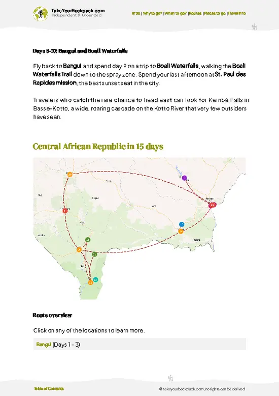
  • Boali Waterfalls Trail—cascading falls, basalt cliffs, misty viewpoints, picnic spots| 400 km away
  • Lobaye River Trail—riverbank villages, canoe access, tropical vegetation, local markets| 436 km away
  • Dzanga Bai Trail—forest clearing, wildlife observation, elephant gatherings, sandy terrain| 450 km away

💡 Not sure where to go next?
Create a personalized itinerary for Central African Republic including Mount Ngaoui Trail and the places that fit your trip.

Generate my itinerary

👉 Discover all hikes

Or checkout all Central African Republic has to offer (think cities, towns, villages, national parks, hikes, beaches, festivals)
Country photo of Central African Republic

We 💚 feedbackKey takeaways before you go

Mount Ngaoui Trail is at its best on a clear morning in the cooler weeks after the rains have fully faded, when the haze lifts and the border country opens up. I would start before first light, reach the rock slabs while the air is still crisp, and be back down before the afternoon heat. Bring more water than seems reasonable.

✍️ Help improve this page!
The information on this page is based on in-depth research, insights shared by experienced travelers, and feedback from the local travel community in Central African Republic. While every effort is made to keep the information accurate and current, conditions can change — so if you spot anything incorrect or outdated, please get in touch.


🙋‍♂️ Give feedback

👋 Meet the founderWho’s Behind Take Your Backpack?

Johan, backpacker and founder of TakeYourBackpackHi, I’m Johan (Netherlands 🇳🇱), the creator of TakeYourBackpack. Over the past 3 decades, I’ve backpacked through 90+ countries across six continents, gaining extensive experience with independent travel, long-term trips, and overland routes.

This site is built on a combination of firsthand travel experience and carefully curated insights from other backpackers. Many guides are based on places I’ve personally visited, while others bring together tips, observations, and practical advice shared by trusted travelers I’ve met along the way.

The goal is to provide realistic, experience-driven guidance — not generic itineraries — so you can explore destinations with better context, clearer expectations, and more confidence.