
×
Torres del Paine Circuit

Chile🇨🇱 | hikesTorres del Paine CircuitFull circuit, John Gardner Pass, booked campsites, backside solitude | things to do and best time to go

Explore Lake District trailsExplore W Trek

Backpacking in Torres del Paine Circuit
🏆 Top pickhike ranked #1
By Johan Kruseman 🇳🇱 | Updated October 19, 2026

Every campsite and refugio on the Torres del Paine Circuit must be booked in advance, and the park’s rangers check your reservations, so you cannot simply turn up and pitch a tent. The loop runs through Torres del Paine National Park in Chilean Patagonia, north of Puerto Natales. The scenery is the draw: granite towers, the Grey Glacier, turquoise lakes and the high John Gardner Pass. It is roughly 110 kilometers, demanding, with wind and steep passes, and the access is easy only as far as Puerto Natales, where buses reach the Laguna Amarga entrance. Costs catch people out, since park fees are paid in advance and camping slots sell out months ahead, so book first and flights second. Buses fill in high season, so reserve them as well. The surprise for me was the water: I filled my bottle straight from a glacial stream and it tasted cleaner than any bottled brand, so I carried less. Hikers with a week and a tolerance for wind will love it. Anyone wanting a casual stroll or a flexible, spontaneous trip will not.

Discover everything you want to know in the 📖 Chile Travel Guide.
Best time to go: October - March
Duration: 8 days
Distance: 110 kilometers
Total ascent: 3500 meters


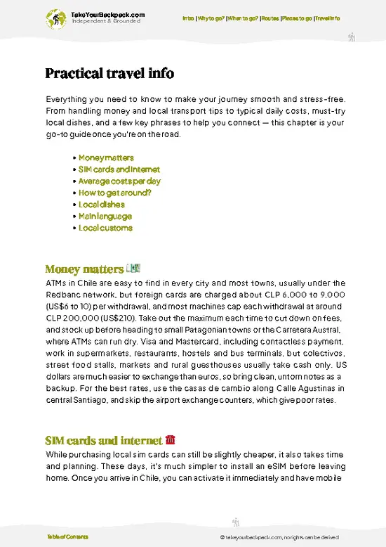
example page 0 from our offline Travel Guide for Chile
example page 1 from our offline Travel Guide for Chile
example page 2 from our offline Travel Guide for Chile
example page 3 from our offline Travel Guide for Chile
example page 4 from our offline Travel Guide for Chile
example page 5 from our offline Travel Guide for Chile
example page 6 from our offline Travel Guide for Chile
example page 7 from our offline Travel Guide for Chile
Loading the map 🌍
CLICK TO FILTER
cities
towns
villages
landmarks
national parks
hikes
beaches
attractions
festivals
regions
SHOW COUNTRY’S BESTSHOW ALL

✨ Why go?
Ranked #1 hike in Chile
What makes it a must-see hike

Torres del Paine Circuit gives you the full park on foot, which the shorter W trek cannot. Two reasons stand out. First, the John Gardner Pass, at about 1,200 meters, opens onto the Southern Patagonian Ice Field, a view of an enormous sheet of ice that day hikers never see. The back side of the loop is also far quieter, so you walk long stretches with few people, in a park that gets crowded on the front sections. Second, the circuit gets you Grey Glacier and the Torres base viewpoint in a single route, so one permit and one itinerary cover the greatest hits plus the wild northern valleys around Dickson and Los Perros. It also fits well into a longer Patagonia trip: Puerto Natales is a natural hub, with gear rental, supplies and onward buses toward El Calafate in Argentina. Expect to pay for … read more 👉
Torres del Paine Circuit gives you the full park on foot, which the shorter W trek cannot. Two reasons stand out. First, the John Gardner Pass, at about 1,200 meters, opens onto the Southern Patagonian Ice Field, a view of an enormous sheet of ice that day hikers never see. The back side of the loop is also far quieter, so you walk long stretches with few people, in a park that gets crowded on the front sections. Second, the circuit gets you Grey Glacier and the Torres base viewpoint in a single route, so one permit and one itinerary cover the greatest hits plus the wild northern valleys around Dickson and Los Perros. It also fits well into a longer Patagonia trip: Puerto Natales is a natural hub, with gear rental, supplies and onward buses toward El Calafate in Argentina. Expect to pay for the privilege, but the camps are well run and water is drinkable from streams, which keeps food weight down.

💡 HighlightsPlaces and moments you shouldn't skip

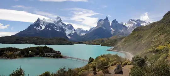
  1. Base of the Towers (Mirador Las Torres): The park’s signature sight, three granite spires rising above a glacial lake after a steep final scramble over boulders. It is a full-day side trip from the valley, and the early hours give the best light on the rock.
  2. Grey Glacier: A wide blue ice face calving into Lago Grey, visible from the shore and from a suspension bridge viewpoint near the refugio. Icebergs drift across the lake and wash up on the beach.
  3. John Gardner Pass: The highest point of the loop, reached by a long climb through wind and loose rock. At the top, the Southern Patagonian Ice Field spreads out below you, a view many trekkers rate as the best of the whole trip.
  4. Los Cuernos: Dark, striped granite horns above Lago Nordenskjöld. The trail skirts the lakeshore under them, with waterfalls
… read more 👉
  1. Base of the Towers (Mirador Las Torres): The park’s signature sight, three granite spires rising above a glacial lake after a steep final scramble over boulders. It is a full-day side trip from the valley, and the early hours give the best light on the rock.
  2. Grey Glacier: A wide blue ice face calving into Lago Grey, visible from the shore and from a suspension bridge viewpoint near the refugio. Icebergs drift across the lake and wash up on the beach.
  3. John Gardner Pass: The highest point of the loop, reached by a long climb through wind and loose rock. At the top, the Southern Patagonian Ice Field spreads out below you, a view many trekkers rate as the best of the whole trip.
  4. Los Cuernos: Dark, striped granite horns above Lago Nordenskjöld. The trail skirts the lakeshore under them, with waterfalls and steady views of the peaks in changing light.
  5. Dickson Glacier and Lake: Near the start of the backside trail, a small lake fed by a hanging glacier, with a camp on a grassy shore. Pioneers’ old cabins and open pampa give this section a remote feel.
Base of the Towers pairs well with a night at a nearby camp, so you can reach the viewpoint before the day crowds arrive.
Spotted a mistake or missing something? Contact us.

Things to do near Torres del Paine Circuit

Ratings based on Tripadvisor reviews. When you book through this link, you support our work at no extra cost to you.

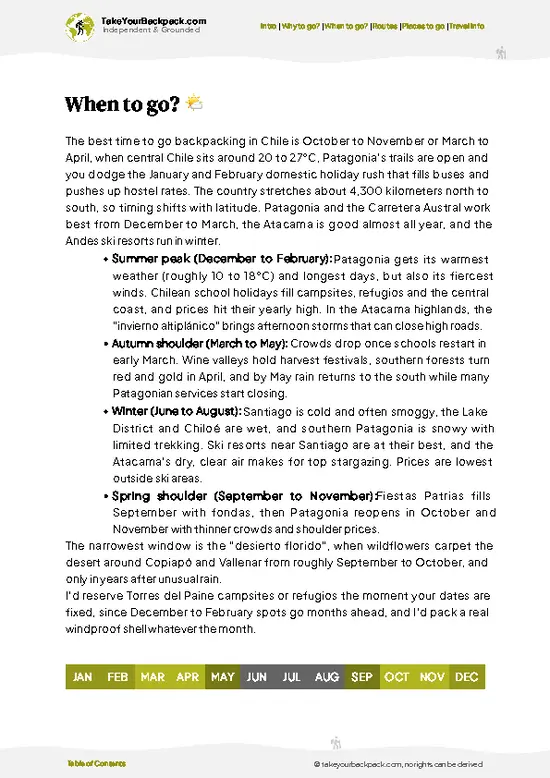
🌤️ When to go?Seasonal considerations and timing

  • Peak Summer (December to February): Torres del Paine Circuit is at its busiest and most reliable, with highs of 12 to 18°C (54 to 64°F), lows of 3 to 7°C (37 to 45°F), and about 16 to 17 hours of daylight. Wind is strongest and gusts can top 100 km/h. Campsites and refugios sell out months ahead, and prices peak.
  • Shoulder Months (October to November, March to April): Expect 6 to 14°C (43 to 57°F), changeable skies and thinner crowds. March brings red and gold lenga forest, calmer wind and 12 to 13 hours of light. Snow can still block John Gardner Pass in October and early November.
  • Winter (May to September): Highs sit at 2 to 6°C (36 to 43°F) with 7 to 8 hours of daylight. Most refugios close, the full circuit is not practical, and snow covers the high pass. Rates fall, but services are minimal.
… read more 👉
  • Peak Summer (December to February): Torres del Paine Circuit is at its busiest and most reliable, with highs of 12 to 18°C (54 to 64°F), lows of 3 to 7°C (37 to 45°F), and about 16 to 17 hours of daylight. Wind is strongest and gusts can top 100 km/h. Campsites and refugios sell out months ahead, and prices peak.
  • Shoulder Months (October to November, March to April): Expect 6 to 14°C (43 to 57°F), changeable skies and thinner crowds. March brings red and gold lenga forest, calmer wind and 12 to 13 hours of light. Snow can still block John Gardner Pass in October and early November.
  • Winter (May to September): Highs sit at 2 to 6°C (36 to 43°F) with 7 to 8 hours of daylight. Most refugios close, the full circuit is not practical, and snow covers the high pass. Rates fall, but services are minimal.
I would book the W or Circuit campsites as soon as reservations open, and aim for early March if you want fewer people and still-open refugios.


source: climatestotravel.comJANJanuary: excellent for travelingFEBFebruary: highly recommended for travelingMARMarch: highly recommended for travelingAPRApril: fair for travelingMAYMay: below average for travelingJUNJune: below average for travelingJULJuly: below average for travelingAUGAugust: below average for travelingSEPSeptember: fair for travelingOCTOctober: good for travelingNOVNovember: highly recommended for travelingDECDecember: excellent for traveling
Chile - the Torres del Paine Circuit

✈️ The backpacker research shortcutChile Travel Guide

An offline-friendly backpacking guide with optimized travel routes, ranked highlights, transport advice, and the best areas to stay.
example page 0 from our offline Travel Guide for Chile
example page 1 from our offline Travel Guide for Chile
example page 2 from our offline Travel Guide for Chile
example page 3 from our offline Travel Guide for Chile
example page 4 from our offline Travel Guide for Chile
example page 5 from our offline Travel Guide for Chile
example page 6 from our offline Travel Guide for Chile
example page 7 from our offline Travel Guide for Chile
The digital guide (333 pages) contains:
✅ 107 highlights, ranked by travel appeal
✅ Optimized 7, 14 & 21-day travel routes
✅ Cities, national parks, landmarks, beaches
✅ How to get around
✅ Offline-friendly for travel without Wi-Fi
👉 Click to see all 30+ guide features

📅 Plan smarter in minutes, not weeks
✅ Month by month travel advice
✅ Festivals & national holidays
✅ Budget expectations

🗺️ Go to the right places, skip the overrated ones
✅ Honest pros & cons of destinations
✅ Top hikes, parks & viewpoints
✅ Lesser-known places most travelers miss
✅ Clear “worth it vs skip it” guidance

🛏️ Travel smoothly without rookie mistakes
✅ Best areas to stay
✅ Transport systems explained simply
✅ Common scams & safety advice
✅ SIM cards, money & practical tips

🌍 Understand the country, not just visit it
✅ Culture & traditions
✅ 52 Essential phrases & customs
✅ Festivals worth planning around
✅ Traveler-friendly historical context
✅ Insights that make places more meaningful

📱 Built for real travel conditions
✅ Fully downloadable PDF
✅ Works completely offline
✅ Optimized for phone use
✅ Useful in remote areas & buses
✅ Everything in one place
Stop searching, start planning
Get instant access to your full guide. 30‑day money-back guarantee.
+ Add another guide for just

By proceeding you agree to our terms.
Sent to your inbox immediately after payment • 100% Secure Checkout
Best Backpacking Travel Advisor 2025 tourism awardBest Backpacking
Travel Advisor
2025
What others say about Take Your Backpack Guides:
⭐⭐⭐⭐⭐
Fantastic, amazing amount of information!
⭐⭐⭐⭐⭐
My goodness this is amazing, it's what I've been looking for hats off too you!
⭐⭐⭐⭐⭐
I think this is absolutely BRILLIANT
⭐⭐⭐⭐
Very complete and informative. It's still missing places, but I gotta to commend you
⭐⭐⭐⭐⭐
This is truly amazing, thank you, can't wait to explore it with my kids!
⭐⭐⭐⭐⭐
Awesome resource, thank you!
⭐⭐⭐⭐⭐
This is amazing! Can't wait to explore the ones I haven't seen
⭐⭐⭐⭐
I love this! Well done, great idea.
⭐⭐⭐⭐⭐
Thanks for taking the time to make this gem!
⭐⭐⭐⭐⭐
This might be the best website I've ever seen.
⭐⭐⭐⭐⭐
Congratulations, and thank you so much for your work; it's incredibly valuable.
⭐⭐⭐⭐
In all seriousness I think you did a great job pointing out the important spots
⭐⭐⭐⭐⭐
10/10 very good
⭐⭐⭐⭐⭐
As someone who's only just starting to visit regularly this is awesome, thank you.
⭐⭐⭐⭐
Thank you very much! I'm going to visit my dad, it's going to be very useful!
⭐⭐⭐⭐⭐
This is really cool! We'll be travelling for the first time and this definitely come in handy.
⭐⭐⭐⭐⭐
You are now our minister of culture, congratulations 👨‍💼
⭐⭐⭐⭐⭐
Just wanted to tell you that this is a pearl! Going to follow your recommendations.
⭐⭐⭐⭐⭐
This is so cool. I'll definitely be using the resource for my travels soon.
⭐⭐⭐⭐⭐
This is very impressive! Good work.
⭐⭐⭐⭐⭐
This is an amazing and informative site. Very well done!

🛏️ Where to stay?Choosing the right base

If you enjoy meeting fellow travelers, consider choosing hostels with high ratings for atmosphere. On the other hand, if you prefer having your own space, a hotel might be a better option.

🥾 Hike detailsA practical overview of the hike

Total Distance: Torres del Paine Circuit covers about 110 kilometers when walked as a full loop, plus the Towers side trip.
Estimated Duration: Seven to nine days at a steady pace.
Difficulty: Demanding. Long days, steep passes, strong wind and changeable weather. Good boots and layers are necessary.
Starting Point: Most hikers start at Laguna Amarga or Las Torres. Buses run from Puerto Natales to the park entrance, so book a seat in season, then pay the entry fee at the gate.
Major Landmarks:
  • Seron and Dickson: Open pampa and river valleys on the northern side.
  • Los Perros Glacier: Forest camp below
… read more 👉
Total Distance: Torres del Paine Circuit covers about 110 kilometers when walked as a full loop, plus the Towers side trip.
Estimated Duration: Seven to nine days at a steady pace.
Difficulty: Demanding. Long days, steep passes, strong wind and changeable weather. Good boots and layers are necessary.
Starting Point: Most hikers start at Laguna Amarga or Las Torres. Buses run from Puerto Natales to the park entrance, so book a seat in season, then pay the entry fee at the gate.
Major Landmarks:
  • Seron and Dickson: Open pampa and river valleys on the northern side.
  • Los Perros Glacier: Forest camp below an ice-choked lagoon, the staging point for the pass.
  • John Gardner Pass: High point with views over the ice field.
  • Grey Glacier: Lakeside ice face and suspension bridges.
  • Los Cuernos and Base of the Towers: Closing sights on the eastern side.
Terrain and Scenery: Gravel paths, boulder fields, wooden bridges, muddy forest and exposed ridges. The views switch between lakes, glaciers and granite peaks.
Vegetation: Lenga and ñire beech forests, Patagonian steppe grass, and low shrubs such as calafate near the lakes.
Wildlife: Guanacos are common in the open valleys. Andean condors circle above the cliffs, and foxes visit camps. Pumas live in the park but are rarely seen.
⚠️ Hiking info can sometimes be outdated or inaccurate. Before you hit the trail, check the latest conditions with locals. If you do spot anything that's off, I'd love to hear from you, so I can update it for fellow travelers.

🛡️ SafetyStaying Safe: What Travelers Should Know

Torres del Paine Circuit is well marked and heavily used, and the main hazard is weather, not terrain. Wind is the constant. It can knock you sideways on exposed stretches and above Lago Grey, and it makes tents fail, so pitch low, use all guylines and choose sheltered spots. Storms arrive fast, and rain, sleet and sun can all show up in one day. Carry a proper waterproof shell, warm layers and gloves even in summer. John Gardner Pass, around 1,200 meters, is the highest and most exposed point, and the day you cross it should start early, with a check of the forecast at the ranger station first. Trails are rocky and muddy in places, with a few suspension bridges and small stream crossings that rise after rain. Pumas and guanacos live here, and pumas are rarely seen. Keep your distance and … read more 👉
Torres del Paine Circuit is well marked and heavily used, and the main hazard is weather, not terrain. Wind is the constant. It can knock you sideways on exposed stretches and above Lago Grey, and it makes tents fail, so pitch low, use all guylines and choose sheltered spots. Storms arrive fast, and rain, sleet and sun can all show up in one day. Carry a proper waterproof shell, warm layers and gloves even in summer. John Gardner Pass, around 1,200 meters, is the highest and most exposed point, and the day you cross it should start early, with a check of the forecast at the ranger station first. Trails are rocky and muddy in places, with a few suspension bridges and small stream crossings that rise after rain. Pumas and guanacos live here, and pumas are rarely seen. Keep your distance and do not feed any animals. Fires are strictly banned, and stoves are only allowed in designated areas. Water from streams is generally drinkable. Many first-timers underestimate the circuit’s length and leave late. Pace yourself and book every night in advance, because camping outside designated sites is not permitted.

FAQFrequently asked questions about Torres del Paine Circuit

Torres del Paine Circuit takes 7 to 10 days for most hikers, covering roughly 130 km (80 miles) from the start at Laguna Amarga or Paine Grande. The usual route runs counterclockwise or clockwise around the massif, with stops at Seron, Los Perros, Paso and Grey. Allow an extra day or two for weather delays and side trips to the Torres base viewpoint.
Torres del Paine Circuit is moderately hard to demanding, with daily stages of 12 to 25 km (7 to 15 miles) and total ascent well over 3,000 meters. The toughest day crosses John Gardner Pass at about 1,200 meters, with steep, windy, sometimes snowy sections and a long descent toward Glaciar Grey. You need good fitness and experience carrying a pack of 12 to 18 kg, though no technical climbing skills are required.
No guide is required on Torres del Paine Circuit, but you must reserve every campsite or refugio in advance and register at the park entrance. Park entry for foreign visitors costs about US$35 to 50 depending on the season, and it is valid for several days. Camping runs about US$15 to 30 a night in the concession sites, while refugio beds cost around US$70 to 130, and reservations are made online through the park operators Vértice Patagonia and Las Torres Patagonia (formerly Fantástico Sur), plus the CONAF-run sites.
⚠️ Things can change over time, so always validate details locally before you go.

Other Chilean hikes near Torres del Paine Circuit

Explore more nearby:

  • W Trek—Three valleys, refugio stages, Francés amphitheater, Grey ice face
  • Cerro Castillo—Lenga forest traverse, turquoise lagoon, serrated volcanic ridge, Paso Peñón| 558 km away
  • Dientes de Navarino—Southernmost circuit, jagged dark teeth, scree passes, no huts| 569 km away

💡 Not sure where to go next?
Create a personalized itinerary for Chile including Torres del Paine Circuit and the places that fit your trip.

Generate my itinerary

👉 Discover all hikes

Or checkout all Chile has to offer (think cities, towns, villages, national parks, hikes, beaches, festivals)
Country photo of Chile

We 💚 feedbackParting advice and final tips

Torres del Paine Circuit is best in the long daylight of summer, when the wind is strong but the passes are open and the camps are running. I would go in the quieter weeks at either end of that window, carry a good windproof shell, and start every day early, since afternoon gusts can turn the exposed sections tiring.

✈️ When did I visit Chile?
I have visited Chile, together with Argentina, in September 2012.

✍️ Help improve this page!
The information on this page is based on my own backpacking experience in Chile, supplemented with up-to-date research and feedback from other travelers. Travel details can change, so if you notice anything outdated or incomplete, feel free to let me know.


🙋‍♂️ Give feedback

👋 Meet the founderWho’s Behind Take Your Backpack?

Johan, backpacker and founder of TakeYourBackpackHi, I’m Johan (Netherlands 🇳🇱), the creator of TakeYourBackpack. Over the past 3 decades, I’ve backpacked through 90+ countries across six continents, gaining extensive experience with independent travel, long-term trips, and overland routes.

This site is built on a combination of firsthand travel experience and carefully curated insights from other backpackers. Many guides are based on places I’ve personally visited, while others bring together tips, observations, and practical advice shared by trusted travelers I’ve met along the way.

The goal is to provide realistic, experience-driven guidance — not generic itineraries — so you can explore destinations with better context, clearer expectations, and more confidence.