

×

Chile🇨🇱 | hikesVillarrica Volcano AscentActive crater, crampons and ice axe, dawn start, snow-chute descent | things to do and best time to go

Explore Queulat Hanging Glacier TrailExplore Pampa Linda Trail

Backpacking in Villarrica Volcano Ascent
👌 Worth visitinghike ranked #6
By Johan Kruseman 🇳🇱 | Updated October 18, 2026

Guided groups leave from Pucón town at dawn, so you can summit an active volcano without a car, a tent or any climbing experience. Villarrica Volcano Ascent is in Chile’s Araucanía region, south-east of Temuco, and the trail starts inside Villarrica National Park, a short transfer from Pucón. The cone is 2,847 meters high, and the climb is steep, with ash and scree on the lower slopes and ice higher up, which is why crampons and an ice axe are part of the rental kit. Chairlift rides skip the first stretch. I once left my goggles in the hostel, and the crater’s sulfur gas stung my eyes until the guide lent me a spare pair, so I now check the gear bag twice. The reward is a glowing crater and a view over lakes and forests. Unlike Llaima, a longer and more remote climb, this one is packaged and easy to reach.

Discover everything you want to know in the 📖 Chile Travel Guide.
Best time to go: October - March
Duration: 9 hours
Distance: 13 kilometers
Total ascent: 1200 meters


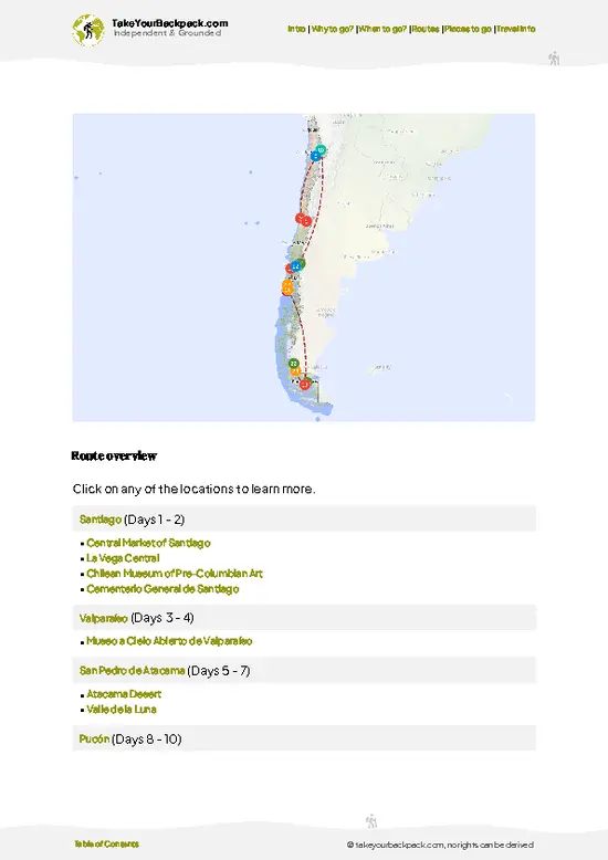
example page 0 from our offline Travel Guide for Chile
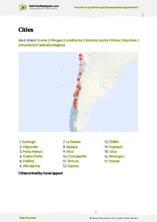
example page 1 from our offline Travel Guide for Chile
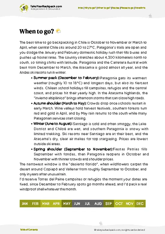
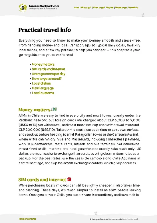
example page 2 from our offline Travel Guide for Chile
example page 3 from our offline Travel Guide for Chile
example page 4 from our offline Travel Guide for Chile
example page 5 from our offline Travel Guide for Chile
example page 6 from our offline Travel Guide for Chile
example page 7 from our offline Travel Guide for Chile
Loading the map 🌍
CLICK TO FILTER
cities
towns
villages
landmarks
national parks
hikes
beaches
attractions
festivals
regions
SHOW COUNTRY’S BESTSHOW ALL

✨ Why go?
Ranked #6 hike in Chile
What sets this place apart

Villarrica Volcano Ascent attracts backpackers because a smoking, active crater sits just a short ride from a town packed with hostels. You need no gear of your own, since agencies in Pucón supply boots, crampons, helmet, jacket and ice axe, and the ascent fits into a single day. That convenience matters on a long Chile route, where most big summits need multi-day planning. The second draw is the view. From the top you look down into the Villarrica crater and out across Lake Villarrica and the snow-streaked volcanoes Quetrupillán and Lanín along the Argentine border. Few climbs of this height give such a payoff in only 5 to 6 hours of walking. The third draw is the finish. Many groups slide down the upper snow on a plastic seat in the descent chutes, cutting the way back dramatically and ending the day with a laugh.

💡 HighlightsMust-see experiences and standout moments

  1. The Active Crater: The summit rim looks into a lava-lit vent that vents steam and sulfur. When the gas is calm, you can peer down at the glow; when it isn’t, guides turn the group around.
  2. Summit Views: On clear days you see Lake Villarrica, Lake Calafquén, and the cones of Lanín, Quetrupillán and Llaima in a single sweep.
  3. The Glacier Zone: Above the ash slopes, the route crosses snow and ice where you strap on crampons and use the ice axe. It is the most technical part and the part that feels like real mountaineering.
  4. The Descent Slides: Guides lead groups down marked snow chutes that you glide down on your backside. It cuts much of the descent time and is the best fun of the day.
  5. Villarrica National Park Forest: Near the base, the trail passes lava fields and stands of araucaria, the monkey puzzle
… read more 👉
  1. The Active Crater: The summit rim looks into a lava-lit vent that vents steam and sulfur. When the gas is calm, you can peer down at the glow; when it isn’t, guides turn the group around.
  2. Summit Views: On clear days you see Lake Villarrica, Lake Calafquén, and the cones of Lanín, Quetrupillán and Llaima in a single sweep.
  3. The Glacier Zone: Above the ash slopes, the route crosses snow and ice where you strap on crampons and use the ice axe. It is the most technical part and the part that feels like real mountaineering.
  4. The Descent Slides: Guides lead groups down marked snow chutes that you glide down on your backside. It cuts much of the descent time and is the best fun of the day.
  5. Villarrica National Park Forest: Near the base, the trail passes lava fields and stands of araucaria, the monkey puzzle trees that grow on these volcanic slopes. They are a good reason to arrive early at the start and walk the lower section slowly.
The crater views and the descent slides combine well in one day, because the slide only comes after you have stood on the rim.
Spotted a mistake or missing something? Contact us.

Things to do around Villarrica Volcano Ascent

Ratings based on Tripadvisor reviews. When you book through this link, you support our work at no extra cost to you.

🌤️ When to go?Choosing the right time of year

  • Summer (December to March): Most climbs go in this window, with stable skies and the best odds of reaching the crater rim. Town highs run 22 to 28°C (72 to 82°F), while the summit sits around -5 to 2°C (23 to 36°F) with wind. Days are long, crowds peak in January and February, and tour prices are at their highest.
  • Autumn (April to May): Cooler, with town highs of 14 to 19°C (57 to 66°F), thinner crowds and quieter trails. Rain and cloud turn up more often, so cancellations rise.
  • Winter (June to August): Heavy snow, short days and frequent storms. Town highs are 8 to 12°C (46 to 54°F). Climbs run only on clear days, and skiing on the slopes replaces much of the hiking.
  • Spring (September to November): Snow still holds high up, which suits crampons and ice axes. Temperatures climb from 12 to 20°C
… read more 👉
  • Summer (December to March): Most climbs go in this window, with stable skies and the best odds of reaching the crater rim. Town highs run 22 to 28°C (72 to 82°F), while the summit sits around -5 to 2°C (23 to 36°F) with wind. Days are long, crowds peak in January and February, and tour prices are at their highest.
  • Autumn (April to May): Cooler, with town highs of 14 to 19°C (57 to 66°F), thinner crowds and quieter trails. Rain and cloud turn up more often, so cancellations rise.
  • Winter (June to August): Heavy snow, short days and frequent storms. Town highs are 8 to 12°C (46 to 54°F). Climbs run only on clear days, and skiing on the slopes replaces much of the hiking.
  • Spring (September to November): Snow still holds high up, which suits crampons and ice axes. Temperatures climb from 12 to 20°C (54 to 68°F), and prices stay below summer levels.
Book your climb for a flexible window of two or three days, since wind decides everything.


source: climatestotravel.comJANJanuary: excellent for travelingFEBFebruary: excellent for travelingMARMarch: excellent for travelingAPRApril: fair for travelingMAYMay: below average for travelingJUNJune: below average for travelingJULJuly: below average for travelingAUGAugust: below average for travelingSEPSeptember: fair for travelingOCTOctober: good for travelingNOVNovember: highly recommended for travelingDECDecember: excellent for traveling
when-to-go

✈️ The backpacker research shortcutChile Travel Guide

An offline-friendly backpacking guide with optimized travel routes, ranked highlights, transport advice, and the best areas to stay.
example page 0 from our offline Travel Guide for Chile
example page 1 from our offline Travel Guide for Chile
example page 2 from our offline Travel Guide for Chile
example page 3 from our offline Travel Guide for Chile
example page 4 from our offline Travel Guide for Chile
example page 5 from our offline Travel Guide for Chile
example page 6 from our offline Travel Guide for Chile
example page 7 from our offline Travel Guide for Chile
The digital guide (333 pages) contains:
✅ 107 highlights, ranked by travel appeal
✅ Optimized 7, 14 & 21-day travel routes
✅ Cities, national parks, landmarks, beaches
✅ How to get around
✅ Offline-friendly for travel without Wi-Fi
👉 Click to see all 30+ guide features

📅 Plan smarter in minutes, not weeks
✅ Month by month travel advice
✅ Festivals & national holidays
✅ Budget expectations

🗺️ Go to the right places, skip the overrated ones
✅ Honest pros & cons of destinations
✅ Top hikes, parks & viewpoints
✅ Lesser-known places most travelers miss
✅ Clear “worth it vs skip it” guidance

🛏️ Travel smoothly without rookie mistakes
✅ Best areas to stay
✅ Transport systems explained simply
✅ Common scams & safety advice
✅ SIM cards, money & practical tips

🌍 Understand the country, not just visit it
✅ Culture & traditions
✅ 52 Essential phrases & customs
✅ Festivals worth planning around
✅ Traveler-friendly historical context
✅ Insights that make places more meaningful

📱 Built for real travel conditions
✅ Fully downloadable PDF
✅ Works completely offline
✅ Optimized for phone use
✅ Useful in remote areas & buses
✅ Everything in one place
Stop searching, start planning
Get instant access to your full guide. 30‑day money-back guarantee.
+ Add another guide for just

By proceeding you agree to our terms.
Sent to your inbox immediately after payment • 100% Secure Checkout
Best Backpacking Travel Advisor 2025 tourism awardBest Backpacking
Travel Advisor
2025
What others say about Take Your Backpack Guides:
⭐⭐⭐⭐⭐
Fantastic, amazing amount of information!
⭐⭐⭐⭐⭐
My goodness this is amazing, it's what I've been looking for hats off too you!
⭐⭐⭐⭐⭐
I think this is absolutely BRILLIANT
⭐⭐⭐⭐
Very complete and informative. It's still missing places, but I gotta to commend you
⭐⭐⭐⭐⭐
This is truly amazing, thank you, can't wait to explore it with my kids!
⭐⭐⭐⭐⭐
Awesome resource, thank you!
⭐⭐⭐⭐⭐
This is amazing! Can't wait to explore the ones I haven't seen
⭐⭐⭐⭐
I love this! Well done, great idea.
⭐⭐⭐⭐⭐
Thanks for taking the time to make this gem!
⭐⭐⭐⭐⭐
This might be the best website I've ever seen.
⭐⭐⭐⭐⭐
Congratulations, and thank you so much for your work; it's incredibly valuable.
⭐⭐⭐⭐
In all seriousness I think you did a great job pointing out the important spots
⭐⭐⭐⭐⭐
10/10 very good
⭐⭐⭐⭐⭐
As someone who's only just starting to visit regularly this is awesome, thank you.
⭐⭐⭐⭐
Thank you very much! I'm going to visit my dad, it's going to be very useful!
⭐⭐⭐⭐⭐
This is really cool! We'll be travelling for the first time and this definitely come in handy.
⭐⭐⭐⭐⭐
You are now our minister of culture, congratulations 👨‍💼
⭐⭐⭐⭐⭐
Just wanted to tell you that this is a pearl! Going to follow your recommendations.
⭐⭐⭐⭐⭐
This is so cool. I'll definitely be using the resource for my travels soon.
⭐⭐⭐⭐⭐
This is very impressive! Good work.
⭐⭐⭐⭐⭐
This is an amazing and informative site. Very well done!

🛏️ Where to stay?Where staying makes the most sense

If you enjoy meeting fellow travelers, consider choosing hostels with high ratings for atmosphere. On the other hand, if you prefer having your own space, a hotel might be a better option.

🥾 Hike detailsRoute, distance, and difficulty explained

Total Distance: Villarrica Volcano Ascent covers roughly 12 to 14 kilometers round trip, depending on whether the chairlift is running.
Duration: Plan 8 to 10 hours door to door, including about 4 to 5 hours of climbing, time at the rim, and a faster descent.
Difficulty: Demanding. The slope is steep and sustained, and you need decent fitness plus a steady head on ice. Mountaineering experience is not required with a guide.
Starting Point: The trailhead sits at the ski area on the volcano’s flank, reached by agency minibus from Pucón. Pucón has bus links from Santiago and Temuco.
Major Landmarks:
  • Chairlift
… read more 👉
Total Distance: Villarrica Volcano Ascent covers roughly 12 to 14 kilometers round trip, depending on whether the chairlift is running.
Duration: Plan 8 to 10 hours door to door, including about 4 to 5 hours of climbing, time at the rim, and a faster descent.
Difficulty: Demanding. The slope is steep and sustained, and you need decent fitness plus a steady head on ice. Mountaineering experience is not required with a guide.
Starting Point: The trailhead sits at the ski area on the volcano’s flank, reached by agency minibus from Pucón. Pucón has bus links from Santiago and Temuco.
Major Landmarks:
  • Chairlift top: Skips the lowest stretch of loose ash.
  • Snowfield: The main climb, where crampons go on.
  • Crater rim: The summit, with gas and a glowing vent.
Terrain and Scenery: Black volcanic sand and scree give way to snow and ice, with views opening over lakes and forest as you rise.
Vegetation: Native lenga and araucaria forest near the base, then bare volcanic ground with almost nothing growing higher up.
Wildlife: Little on the upper slopes. Birds such as Andean condors can sometimes be seen soaring on the thermals lower down.
Closures: The climb is regularly closed for wind, poor visibility or volcanic activity, so keep a spare day.
⚠️ Hiking info can sometimes be outdated or inaccurate. Before you hit the trail, check the latest conditions with locals. If you do spot anything that's off, I'd love to hear from you, so I can update it for fellow travelers.

🛡️ SafetyTraveler Safety Guide

Villarrica is an active volcano, so the main risks are weather and snow conditions rather than the trail itself. Guides cancel when wind, cloud or crater gas make the summit unsafe, and that call is worth respecting. The route crosses steep snow and ice for much of the year, which is why helmets, crampons, ice axes and gas masks are supplied with the guided climb. Go at a steady pace, keep your layers handy, and bring a windproof shell, gloves, sunglasses and sunscreen, because sun on snow burns quickly. First-timers often underestimate the cold near the rim and arrive in cotton or without enough water. Sulfur fumes can irritate your throat near the crater, so keep the mask close. Stay behind your guide on the ascent and descent, and follow instructions about turning around.

FAQFrequently asked questions about Villarrica Volcano Ascent

Villarrica Volcano Ascent takes 7 to 9 hours round trip, including breaks and the descent. Most groups leave Pucón around 7 to 8 a.m. and start climbing from the ski area at about 1,400 meters. The ascent to the 2,847 meter summit takes roughly 4 to 5 hours, and the descent about 2 hours, often partly by sliding on snow.
Villarrica Volcano Ascent is a demanding but non-technical climb, suited to anyone with decent fitness. You gain about 1,200 to 1,400 meters over steep snow and volcanic scree, with some sections of ice that need crampons. The pace is slow and steady, and most healthy first-timers with guides reach the top when weather allows.
Villarrica Volcano Ascent requires a certified guide, and climbing independently is not permitted. Tours from Pucón cost roughly US$100 to 160 and include gear, transport to the trailhead and park entry. Operators handle the CONAF permit, and pay in cash or card at the agency, so your passport and booking are all you need.
⚠️ Things can change over time, so always validate details locally before you go.

Other Chilean hikes near Villarrica Volcano Ascent

Explore more nearby:


💡 Not sure where to go next?
Create a personalized itinerary for Chile including Villarrica Volcano Ascent and the places that fit your trip.

Generate my itinerary

👉 Discover all hikes

Or checkout all Chile has to offer (think cities, towns, villages, national parks, hikes, beaches, festivals)
Country photo of Chile

We 💚 feedbackSumming up the experience

Villarrica Volcano Ascent suits fit first-timers who want a real summit without technical climbing skills, and anyone who enjoys a steep, loose-ash grind rewarded by a glowing crater. If you hate early alarms or crowds on a single track, skip it. I would book with a guide company that has a flexible weather window, and bring your own gloves.

✈️ When did I visit Chile?
I have visited Chile, together with Argentina, in September 2012.

✍️ Help improve this page!
The information on this page is based on my own backpacking experience in Chile, supplemented with up-to-date research and feedback from other travelers. Travel details can change, so if you notice anything outdated or incomplete, feel free to let me know.


🙋‍♂️ Give feedback

👋 Meet the founderWho’s Behind Take Your Backpack?

Johan, backpacker and founder of TakeYourBackpackHi, I’m Johan (Netherlands 🇳🇱), the creator of TakeYourBackpack. Over the past 3 decades, I’ve backpacked through 90+ countries across six continents, gaining extensive experience with independent travel, long-term trips, and overland routes.

This site is built on a combination of firsthand travel experience and carefully curated insights from other backpackers. Many guides are based on places I’ve personally visited, while others bring together tips, observations, and practical advice shared by trusted travelers I’ve met along the way.

The goal is to provide realistic, experience-driven guidance — not generic itineraries — so you can explore destinations with better context, clearer expectations, and more confidence.