×

Comoros🇰🇲 | national parksMount Ntringui National ParkAnjouan's highest peak, cloud forest, clove terraces, dawn summit hike | things to do and best time to go

Explore Mohéli National ParkExplore Old Friday Mosque

Backpacking in Mount Ntringui
👍 Recommendednational park ranked #2
By Johan Kruseman 🇳🇱 | Updated October 22, 2026

The big decision at Mount Ntringui National Park is whether to hike it with a local guide from a village or try to go alone, and the unmarked, muddy forest paths tip it firmly toward a guide. The park sits on Anjouan (Ndzuwani) in the south of the Comoros, above the hill towns around Mutsamudu and the Domoni road, and it protects the island’s highest peak, at roughly 1,575 meters. Expect damp, cool air that smells of wet earth and clove, the whistle of birds you rarely see, and Livingstone’s fruit bats overhead if you are lucky. The scenery is thick montane forest, then bare ridge, with views over Anjouan’s coast when the cloud lifts. That is the catch: clouds often swallow the summit by late morning, so start before dawn and bring a rain layer. Slippery clay slows everyone, so allow a full day and wear shoes with grip. Crowds are almost nonexistent, but so are signs, cafes and shops, so carry your own water and food. Compared with Mount Karthala on Grande Comore, Ntringui is greener, wetter and far less volcanic, with no crater to cross.

Discover everything you want to know in the 📖 Comoros Travel Guide.


example page 0 from our offline Travel Guide for Comoros
example page 1 from our offline Travel Guide for Comoros
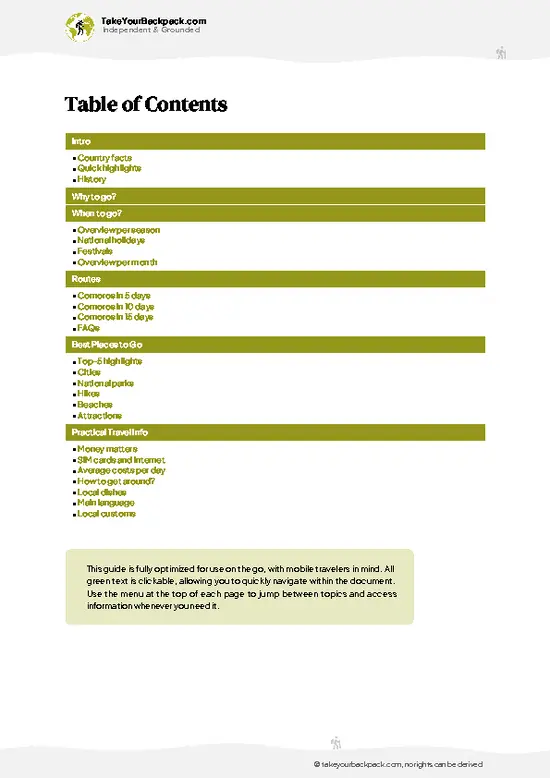
example page 2 from our offline Travel Guide for Comoros
example page 3 from our offline Travel Guide for Comoros
example page 4 from our offline Travel Guide for Comoros
example page 5 from our offline Travel Guide for Comoros
example page 6 from our offline Travel Guide for Comoros
example page 7 from our offline Travel Guide for Comoros
Loading the map 🌍
CLICK TO FILTER
cities
national parks
hikes
beaches
attractions
SHOW COUNTRY’S BESTSHOW ALL

✨ Why go?
Ranked #2 national park in Comoros
The unique appeal for travelers

Mount Ntringui National Park suits backpackers who like to arrange things themselves, because the climb starts almost at the edge of Mutsamudu and needs no tour operator, just a local guide you can find through your guesthouse. That keeps the cost low and the money in village hands. The second reason is the forest itself. Within a few hours you pass from farmed slopes of banana and clove into dense, damp montane forest, where tree ferns, lianas and orchids crowd the path and the air cools noticeably. The park is also one of the better places in the archipelago to see the endemic wildlife, including Livingstone’s fruit bats, the world’s largest fruit bats in this group, and the island’s forest birds calling from the canopy. Finally, the scale is friendly. A day is enough, so you can pair it … read more 👉
Mount Ntringui National Park suits backpackers who like to arrange things themselves, because the climb starts almost at the edge of Mutsamudu and needs no tour operator, just a local guide you can find through your guesthouse. That keeps the cost low and the money in village hands. The second reason is the forest itself. Within a few hours you pass from farmed slopes of banana and clove into dense, damp montane forest, where tree ferns, lianas and orchids crowd the path and the air cools noticeably. The park is also one of the better places in the archipelago to see the endemic wildlife, including Livingstone’s fruit bats, the world’s largest fruit bats in this group, and the island’s forest birds calling from the canopy. Finally, the scale is friendly. A day is enough, so you can pair it with the old medina of Mutsamudu and the coast, rather than committing to the multi-day effort that bigger volcanoes demand. If you want a first Comorian summit without expedition logistics, this is it. Expect mud, sweat and quiet.

💡 HighlightsEssential experiences to have while exploring Mount Ntringui

  1. Summit of Mount Ntringui: The reason people come. On a clear morning the ridge opens onto the whole of Anjouan, with the coast, the island’s sharp interior ridges and sometimes the outline of neighboring Mohéli.
  2. Montane rainforest belt: Above the farmland the trail enters thick forest with tree ferns, moss-draped trunks and a damp, earthy smell. Light comes down in thin green shafts.
  3. Livingstone’s fruit bats: A rare, endangered species that lives on the island’s forested slopes. Look in the early morning or late afternoon, when they glide between fruiting trees on wings spanning well over a meter.
  4. Clove and ylang-ylang terraces: The lower slopes are working farms. The sharp, sweet smell of drying cloves and flowering ylang-ylang tells you how much the island’s economy depends on these crops.
  5. Forest
… read more 👉
  1. Summit of Mount Ntringui: The reason people come. On a clear morning the ridge opens onto the whole of Anjouan, with the coast, the island’s sharp interior ridges and sometimes the outline of neighboring Mohéli.
  2. Montane rainforest belt: Above the farmland the trail enters thick forest with tree ferns, moss-draped trunks and a damp, earthy smell. Light comes down in thin green shafts.
  3. Livingstone’s fruit bats: A rare, endangered species that lives on the island’s forested slopes. Look in the early morning or late afternoon, when they glide between fruiting trees on wings spanning well over a meter.
  4. Clove and ylang-ylang terraces: The lower slopes are working farms. The sharp, sweet smell of drying cloves and flowering ylang-ylang tells you how much the island’s economy depends on these crops.
  5. Forest birdlife: Listen for Comoros endemics calling from the canopy, including the Anjouan scops owl’s habitat zone, and carry binoculars for the open ridge sections.
  6. Views over Mutsamudu: From switchback gaps in the trees you look straight down on the port’s tin roofs, the old harbor and the fort, a good reminder of how fast the island climbs from sea level.
  7. Village approach paths: The start of the walk passes homes, small plots and children who will shout greetings. A short chat with farmers often gives you better route advice than any map.
Do the summit first, starting before dawn, because the view is the one thing that cloud can take away and everything else on the list stays good in any weather.
Spotted a mistake or missing something? Contact us.

🌤️ When to go?When to go for the best experience

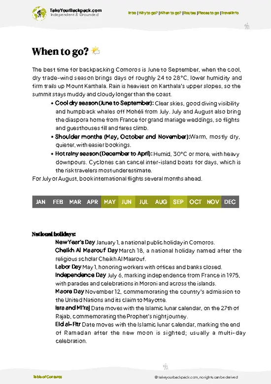
The best window for Mount Ntringui is the dry season from May to October, when trails are firmer and skies over Anjouan are clearest.
  • Dry Season (May to October): Days run 24 to 28°C (75 to 82°F) at the coast and noticeably cooler on the upper slopes, often 15 to 20°C (59 to 68°F). Rain is lighter, footing is better, and summit views are more likely. Daylight is about 11.5 hours. Expect the most visitors, though numbers stay small.
  • Wet Season (November to April): Hot and humid, 28 to 32°C (82 to 90°F) at sea level, with heavy showers and cloud sitting on the summit. Trails turn slick and muddy, and cyclone-season storms can hit between January and March. Daylight stretches to roughly 12.5 hours.
  • Shoulder Months (May and October to November): Mixed weather, fewer people, and the forest at its
… read more 👉
The best window for Mount Ntringui is the dry season from May to October, when trails are firmer and skies over Anjouan are clearest.
  • Dry Season (May to October): Days run 24 to 28°C (75 to 82°F) at the coast and noticeably cooler on the upper slopes, often 15 to 20°C (59 to 68°F). Rain is lighter, footing is better, and summit views are more likely. Daylight is about 11.5 hours. Expect the most visitors, though numbers stay small.
  • Wet Season (November to April): Hot and humid, 28 to 32°C (82 to 90°F) at sea level, with heavy showers and cloud sitting on the summit. Trails turn slick and muddy, and cyclone-season storms can hit between January and March. Daylight stretches to roughly 12.5 hours.
  • Shoulder Months (May and October to November): Mixed weather, fewer people, and the forest at its greenest.
  • Prices: Guides and local transport are fixed locally and barely change by season, but flights and ferries fill up around July and August and during Eid.
Start your climb at first light, since cloud usually builds on the summit by late morning.


source: climatestotravel.comJANJanuary: below average for travelingFEBFebruary: below average for travelingMARMarch: fair for travelingAPRApril: fair for travelingMAYMay: excellent for travelingJUNJune: excellent for travelingJULJuly: highly recommended for travelingAUGAugust: highly recommended for travelingSEPSeptember: excellent for travelingOCTOctober: excellent for travelingNOVNovember: good for travelingDECDecember: fair for traveling
when-to-go

✈️ The backpacker research shortcutComoros Travel Guide

An offline-friendly backpacking guide with optimized travel routes, ranked highlights, transport advice, and the best areas to stay.
example page 0 from our offline Travel Guide for Comoros
example page 1 from our offline Travel Guide for Comoros
example page 2 from our offline Travel Guide for Comoros
example page 3 from our offline Travel Guide for Comoros
example page 4 from our offline Travel Guide for Comoros
example page 5 from our offline Travel Guide for Comoros
example page 6 from our offline Travel Guide for Comoros
example page 7 from our offline Travel Guide for Comoros
The digital guide (84 pages) contains:
✅ 15 highlights, ranked by travel appeal
✅ Optimized 5, 10 & 15-day travel routes
✅ Cities, national parks, landmarks, beaches
✅ How to get around
✅ Offline-friendly for travel without Wi-Fi
👉 Click to see all 30+ guide features

📅 Plan smarter in minutes, not weeks
✅ Month by month travel advice
✅ Festivals & national holidays
✅ Budget expectations

🗺️ Go to the right places, skip the overrated ones
✅ Honest pros & cons of destinations
✅ Top hikes, parks & viewpoints
✅ Lesser-known places most travelers miss
✅ Clear “worth it vs skip it” guidance

🛏️ Travel smoothly without rookie mistakes
✅ Best areas to stay
✅ Transport systems explained simply
✅ Common scams & safety advice
✅ SIM cards, money & practical tips

🌍 Understand the country, not just visit it
✅ Culture & traditions
✅ 52 Essential phrases & customs
✅ Festivals worth planning around
✅ Traveler-friendly historical context
✅ Insights that make places more meaningful

📱 Built for real travel conditions
✅ Fully downloadable PDF
✅ Works completely offline
✅ Optimized for phone use
✅ Useful in remote areas & buses
✅ Everything in one place
Stop searching, start planning
Get instant access to your full guide. 30‑day money-back guarantee.
+ Add another guide for just

By proceeding you agree to our terms.
Sent to your inbox immediately after payment • 100% Secure Checkout
Best Backpacking Travel Advisor 2025 tourism awardBest Backpacking
Travel Advisor
2025
What others say about Take Your Backpack Guides:
⭐⭐⭐⭐⭐
Fantastic, amazing amount of information!
⭐⭐⭐⭐⭐
My goodness this is amazing, it's what I've been looking for hats off too you!
⭐⭐⭐⭐⭐
I think this is absolutely BRILLIANT
⭐⭐⭐⭐
Very complete and informative. It's still missing places, but I gotta to commend you
⭐⭐⭐⭐⭐
This is truly amazing, thank you, can't wait to explore it with my kids!
⭐⭐⭐⭐⭐
Awesome resource, thank you!
⭐⭐⭐⭐⭐
This is amazing! Can't wait to explore the ones I haven't seen
⭐⭐⭐⭐
I love this! Well done, great idea.
⭐⭐⭐⭐⭐
Thanks for taking the time to make this gem!
⭐⭐⭐⭐⭐
This might be the best website I've ever seen.
⭐⭐⭐⭐⭐
Congratulations, and thank you so much for your work; it's incredibly valuable.
⭐⭐⭐⭐
In all seriousness I think you did a great job pointing out the important spots
⭐⭐⭐⭐⭐
10/10 very good
⭐⭐⭐⭐⭐
As someone who's only just starting to visit regularly this is awesome, thank you.
⭐⭐⭐⭐
Thank you very much! I'm going to visit my dad, it's going to be very useful!
⭐⭐⭐⭐⭐
This is really cool! We'll be travelling for the first time and this definitely come in handy.
⭐⭐⭐⭐⭐
You are now our minister of culture, congratulations 👨‍💼
⭐⭐⭐⭐⭐
Just wanted to tell you that this is a pearl! Going to follow your recommendations.
⭐⭐⭐⭐⭐
This is so cool. I'll definitely be using the resource for my travels soon.
⭐⭐⭐⭐⭐
This is very impressive! Good work.
⭐⭐⭐⭐⭐
This is an amazing and informative site. Very well done!

🛏️ Where to stay?Best areas and accommodation options

The best base for Mount Ntringui is Mutsamudu or the smaller towns nearby, because there are no lodgings inside the national park itself.
Mutsamudu, the capital of Anjouan, sits on the coast roughly 30 to 45 minutes by road from the usual trailheads, and it has the widest choice: a handful of small hotels and guesthouses, usually €20 to 45 a night for a simple double, with fan or air conditioning and breakfast sometimes included. Its old medina, port and cafés make it an easy place to arrange a guide and shared taxis.
Domoni, on the southeast coast, is quieter, with a historic harbor and a few basic … read more 👉
The best base for Mount Ntringui is Mutsamudu or the smaller towns nearby, because there are no lodgings inside the national park itself.
Mutsamudu, the capital of Anjouan, sits on the coast roughly 30 to 45 minutes by road from the usual trailheads, and it has the widest choice: a handful of small hotels and guesthouses, usually €20 to 45 a night for a simple double, with fan or air conditioning and breakfast sometimes included. Its old medina, port and cafés make it an easy place to arrange a guide and shared taxis.
Domoni, on the southeast coast, is quieter, with a historic harbor and a few basic guesthouses at about €15 to 35. It suits you if you want sea access and fewer people, though getting to the mountain takes longer.
Sima and the coastal villages in the west offer a handful of beach-side bungalows and homestays, typically €20 to 40, and give a slower pace.
Camping in the highlands is possible only with local agreement and a guide, and there are no facilities, so carry water and a tent.
Book ahead from July to August, and ask your host about a guide, since the better lodgings can usually arrange one the same day.

👛 Costs (as of 22 October 2026)Typical daily expenses

Expect to spend about €50 a day for Mount Ntringui when staying in Mutsamudu with a guide, with a lower range possible if you choose basic guesthouses and share rides.
CategoryBudget RangeLocal Reality
Entrance and permit€0 to 5Fees, where charged, are small and usually handled through your guide or the local community; carry cash.
Guide€10 to 20A local guide is strongly advised for the summit route and is paid in cash, usually per group.
Accommodation (high season)€15 to 25Simple guesthouse rooms in Mutsamudu or Domoni; hotels with air conditioning cost closer to €40 or more.
Local transport€3 to 8Shared taxis and minibuses link towns and trailheads; a private taxi to the start costs more, around €10 to 20 per trip.
Food and supplies€8 to 15Local meals of rice, fish, cassava and coconut sauces
… read more 👉
Expect to spend about €50 a day for Mount Ntringui when staying in Mutsamudu with a guide, with a lower range possible if you choose basic guesthouses and share rides.
CategoryBudget RangeLocal Reality
Entrance and permit€0 to 5Fees, where charged, are small and usually handled through your guide or the local community; carry cash.
Guide€10 to 20A local guide is strongly advised for the summit route and is paid in cash, usually per group.
Accommodation (high season)€15 to 25Simple guesthouse rooms in Mutsamudu or Domoni; hotels with air conditioning cost closer to €40 or more.
Local transport€3 to 8Shared taxis and minibuses link towns and trailheads; a private taxi to the start costs more, around €10 to 20 per trip.
Food and supplies€8 to 15Local meals of rice, fish, cassava and coconut sauces are inexpensive; bring snacks and water for the hike.
Total Daily Budget€36 to 73About €50 on a typical mid-range day for one traveler.
Prices are paid in Comorian francs, so withdraw cash in town, since card acceptance is limited outside a few hotels.
⚠️ Prices can change and everyone travels differently, so take this as a rough guide. Hope it helps you plan your adventure!

🥾 TrailsPlan your hike in Mount Ntringui: routes, terrain, and sights

Mount Ntringui National Park is walked mainly as a single long day hike from the edge of Mutsamudu to the ridge and back, and a guide is strongly recommended because junctions are unmarked and the mud hides footprints.
  • Mutsamudu to the summit ridge: Roughly 5 to 7 hours round trip, depending on pace and weather. Difficulty is moderate to hard. The path climbs steeply through farmland, then forest, with roots, loose red soil and a few scrambles.
  • Terrain: Steep, often slippery clay, exposed roots and stretches of dense undergrowth. Trekking poles help on the descent, and shoes with real tread matter
… read more 👉
Mount Ntringui National Park is walked mainly as a single long day hike from the edge of Mutsamudu to the ridge and back, and a guide is strongly recommended because junctions are unmarked and the mud hides footprints.
  • Mutsamudu to the summit ridge: Roughly 5 to 7 hours round trip, depending on pace and weather. Difficulty is moderate to hard. The path climbs steeply through farmland, then forest, with roots, loose red soil and a few scrambles.
  • Terrain: Steep, often slippery clay, exposed roots and stretches of dense undergrowth. Trekking poles help on the descent, and shoes with real tread matter more than anything else you pack.
  • Wildlife: Fruit bats, forest birds, chameleons and geckos are the likeliest sightings. Early starts give the best chance of seeing animals before the heat and cloud arrive.
  • Scenery: The tree line gives way to open ridge sections with sweeping views of the island and the Indian Ocean when the weather is clear.
  • Variations: Guides can sometimes suggest slower loops or shorter turnarounds at forest viewpoints if you do not want to reach the top.
Weather changes quickly. Mornings are usually clearest, while afternoons often bring cloud or rain, so carry a light waterproof, at least two liters of water and snacks. Leeches and biting insects are not a major issue, but long trousers help against scratchy vegetation.
Getting there is simple. Mutsamudu is the island’s main town, and shared taxis and local transport connect it with other parts of Anjouan, with the trail starting a short walk or ride from town. Crowds are minimal, and you may meet only farmers and the occasional other hiker. Entry arrangements are informal and small, and guides charge a modest fee, usually about €10 to 20 for the day, paid in Comorian francs. Ask your guesthouse to arrange one the evening before.
⚠️ Hiking info can sometimes be outdated or inaccurate. Before you hit the trail, check the latest conditions with locals. If you do spot anything that's off, I'd love to hear from you, so I can update it for fellow travelers.

🛡️ SafetyScams, Hazards, and Annoyances

Mount Ntringui is a straightforward climb for anyone with basic fitness, but the humid heat and slippery forest trails catch people out. The summit sits near 1,595 meters (5,233 feet), so altitude is not a concern, though the ascent is steep and sustained. Paths over roots, red mud and loose rock turn slick after rain, so wear shoes with real grip and carry a trekking pole if you have one. Trails are not always clearly marked, and forks in the forest are easy to miss, which is why hiring a local guide is sensible and supports the village economy. Start early, since cloud and afternoon showers build quickly and the descent is harder on wet ground. Bring at least 2 to 3 liters of water per person, a rain layer and sun protection, because shops are not found along the route. Wildlife is mostly … read more 👉
Mount Ntringui is a straightforward climb for anyone with basic fitness, but the humid heat and slippery forest trails catch people out. The summit sits near 1,595 meters (5,233 feet), so altitude is not a concern, though the ascent is steep and sustained. Paths over roots, red mud and loose rock turn slick after rain, so wear shoes with real grip and carry a trekking pole if you have one. Trails are not always clearly marked, and forks in the forest are easy to miss, which is why hiring a local guide is sensible and supports the village economy. Start early, since cloud and afternoon showers build quickly and the descent is harder on wet ground. Bring at least 2 to 3 liters of water per person, a rain layer and sun protection, because shops are not found along the route. Wildlife is mostly harmless: Livingstone’s fruit bats, lemurs and birds are the main sights, so keep your distance and carry out all litter. Tell your guesthouse your plan before leaving.

FAQFrequently asked questions about Mount Ntringui

Plan on one full day for Mount Ntringui, since the summit hike takes roughly 5 to 8 hours round trip depending on your trailhead and fitness. Adding a second day lets you explore Mutsamudu’s medina and the surrounding villages on Anjouan. Stay a third day if you want to combine the climb with Domoni or a beach stop.
Yes, you can reach Mount Ntringui without a car, using shared taxis and minibuses from Mutsamudu toward the trailhead villages, usually a 30 to 45 minute ride for about €1 to 5. A private taxi to the start costs around €10 to 20 each way. Hiring a local guide makes the logistics easier, as they often arrange the ride and know the trail.
Mount Ntringui National Park has a small fee or community contribution, typically €0 to 5, often collected through your guide or local contact. A guide, costing roughly €10 to 20 per day, is strongly recommended since trails are not always clearly marked. Carry cash in euros or Comorian francs, because there are no card facilities at the trailheads.
⚠️ Things can change over time, so always validate details locally before you go.

Other destinations worth considering

Mount Ntringui isn’t the only highlight in Comoros. Explore all what Comoros has to offer.
Country photo of Comoros

We 💚 feedbackKey takeaways before you go

Pair Mount Ntringui National Park with a slow day in Mutsamudu’s old medina and a coastal drive toward Domoni, then flip to Mohéli’s marine reserve or Grande Comore’s Karthala for a different volcanic feel. I would go up at first light and keep the afternoon free for a swim. Bring spare socks, because the mud wins.

✍️ Help improve this page!
The information on this page is based on in-depth research, insights shared by experienced travelers, and feedback from the local travel community in Comoros. While every effort is made to keep the information accurate and current, conditions can change — so if you spot anything incorrect or outdated, please get in touch.


🙋‍♂️ Give feedback

👋 Meet the founderWho’s Behind Take Your Backpack?

Johan, backpacker and founder of TakeYourBackpackHi, I’m Johan (Netherlands 🇳🇱), the creator of TakeYourBackpack. Over the past 3 decades, I’ve backpacked through 90+ countries across six continents, gaining extensive experience with independent travel, long-term trips, and overland routes.

This site is built on a combination of firsthand travel experience and carefully curated insights from other backpackers. Many guides are based on places I’ve personally visited, while others bring together tips, observations, and practical advice shared by trusted travelers I’ve met along the way.

The goal is to provide realistic, experience-driven guidance — not generic itineraries — so you can explore destinations with better context, clearer expectations, and more confidence.