×

Costa Rica🇨🇷 | hikesRío Celeste TrailTurquoise waterfall, Teñidero confluence, sulfur vents, Tenorio forest | things to do and best time to go

Explore Místico Hanging BridgesExplore Rincón de la Vieja Volcano

Backpacking in Río Celeste Trail
🏆 Top pickhike ranked #2
By Johan Kruseman 🇳🇱 | Updated October 23, 2026

The river is not blue all the way along; the color shows up only at the Teñidero, where two clear streams meet, and the stretch above and below can look plain gray-green after rain. Río Celeste Trail runs through Tenorio Volcano National Park in the north of Costa Rica, roughly 6 to 7 kilometers out and back on a well-built path with steps and some muddy slopes. Expect about 3 hours. The scenery is excellent, but the start is awkward without a car, since buses stop in Bijagua and you still need a taxi or shuttle for the last stretch. I walked in past the ranger hut and the first thing I met was the smell of wet leaf litter and a distant hiss of water, then a flash of milky turquoise through the trunks that looked fake. The last thing you hear at the hanging bridge is the stream clattering over pale, chalky rocks.

Discover everything you want to know in the 📖 Costa Rica Travel Guide.
Best time to go: November - May
Duration: 3 hours
Distance: 7 kilometers
Total ascent: 250 meters


example page 0 from our offline Travel Guide for Costa Rica
example page 1 from our offline Travel Guide for Costa Rica
example page 2 from our offline Travel Guide for Costa Rica
example page 3 from our offline Travel Guide for Costa Rica
example page 4 from our offline Travel Guide for Costa Rica
example page 5 from our offline Travel Guide for Costa Rica
example page 6 from our offline Travel Guide for Costa Rica
example page 7 from our offline Travel Guide for Costa Rica
Loading the map 🌍
CLICK TO FILTER
cities
towns
villages
landmarks
national parks
hikes
beaches
attractions
festivals
regions
SHOW COUNTRY’S BESTSHOW ALL

✨ Why go?
Ranked #2 hike in Costa Rica
Why Río Celeste Trail should be on your travel list

Río Celeste Trail gives backpackers a color-shifting river that photographs can't really prepare you for, and you get it on a single morning's walk. The route is short and graded, so you can fit it between a night in La Fortuna and the next move toward Guanacaste without losing a full day. The payoff arrives early: the Catarata Río Celeste waterfall, a staircase descent of about 250 steps to a pool of opaque blue, is only about 45 minutes from the entrance. Then the trail keeps giving, with the Teñidero, where the water changes color before your eyes, and boiling mud pots at Los Borbollones. That density of sights per kilometer is rare in Costa Rica, where headline attractions often demand a long drive or a hard climb. Flexible too: turn around at the waterfall for a quick visit, or carry … read more 👉
Río Celeste Trail gives backpackers a color-shifting river that photographs can't really prepare you for, and you get it on a single morning's walk. The route is short and graded, so you can fit it between a night in La Fortuna and the next move toward Guanacaste without losing a full day. The payoff arrives early: the Catarata Río Celeste waterfall, a staircase descent of about 250 steps to a pool of opaque blue, is only about 45 minutes from the entrance. Then the trail keeps giving, with the Teñidero, where the water changes color before your eyes, and boiling mud pots at Los Borbollones. That density of sights per kilometer is rare in Costa Rica, where headline attractions often demand a long drive or a hard climb. Flexible too: turn around at the waterfall for a quick visit, or carry on to the blue lagoon and the thermal vents for the full loop.

💡 HighlightsPlaces and moments you shouldn't skip

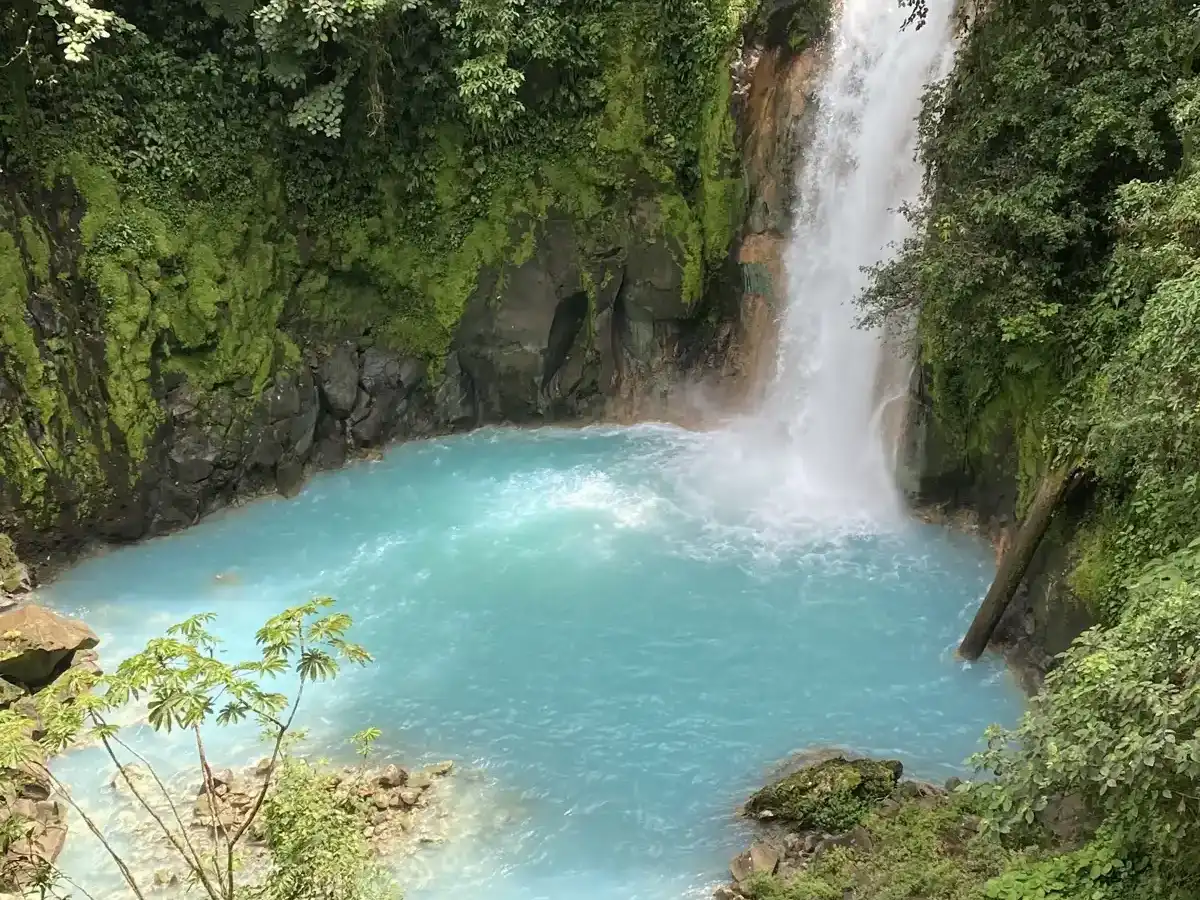
  1. Catarata Río Celeste: The waterfall everyone searches for. A steep staircase drops to a viewpoint where the water plunges into a pool of milky turquoise, ringed by dark forest.
  2. El Teñidero: The spot where two clear streams merge and the water turns blue. Minerals, mainly aluminum silicates, scatter the light, which is why the effect looks like a switch being flipped.
  3. Laguna Azul: A calm, deep blue lagoon fed by the river. The color is strongest in clear weather, and the pool sits quietly under overhanging trees.
  4. Los Borbollones: Bubbling, steaming patches along the riverbank where volcanic gas rises through the water. You smell the sulfur before you see it.
  5. Hanging bridge over the river: A short suspension bridge where you stand above the stream with clear views of the blue-tinted water and the
… read more 👉
  1. Catarata Río Celeste: The waterfall everyone searches for. A steep staircase drops to a viewpoint where the water plunges into a pool of milky turquoise, ringed by dark forest.
  2. El Teñidero: The spot where two clear streams merge and the water turns blue. Minerals, mainly aluminum silicates, scatter the light, which is why the effect looks like a switch being flipped.
  3. Laguna Azul: A calm, deep blue lagoon fed by the river. The color is strongest in clear weather, and the pool sits quietly under overhanging trees.
  4. Los Borbollones: Bubbling, steaming patches along the riverbank where volcanic gas rises through the water. You smell the sulfur before you see it.
  5. Hanging bridge over the river: A short suspension bridge where you stand above the stream with clear views of the blue-tinted water and the forested canyon walls.
Start with the waterfall, since it is the reason the trail exists and the light there is best before the midday crowds arrive.
Spotted a mistake or missing something? Contact us.

Things to do around Río Celeste Trail

Ratings based on Tripadvisor reviews. When you book through this link, you support our work at no extra cost to you.

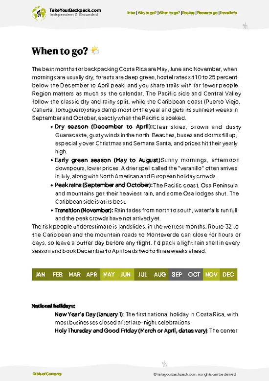
🌤️ When to go?Best time to hike the Río Celeste Trail

  • Late Dec to April: Driest stretch in Tenorio Volcano National Park, with trails firmest and the river at its brightest turquoise. Mornings run 18-22°C (64-72°F), afternoons 26-30°C (79-86°F). Crowds peak around New Year and Easter week, and nearby lodges charge their highest rates.
  • May to August: Rain arrives mostly in the afternoon. Start at opening time and you often finish dry. Expect 22-28°C (72-82°F), muddier steps, and noticeably thinner crowds and lower room prices.
  • September to November: The wettest months, with rain that can last all day. Heavy runoff can turn the river milky gray-green instead of blue, so the main payoff dims. Rates are at their lowest.
  • Daylight: The park opens at 8 am and the last entry is around 2 pm. Daylight is about 11 to 12 hours year round, so late starts leave
… read more 👉
  • Late Dec to April: Driest stretch in Tenorio Volcano National Park, with trails firmest and the river at its brightest turquoise. Mornings run 18-22°C (64-72°F), afternoons 26-30°C (79-86°F). Crowds peak around New Year and Easter week, and nearby lodges charge their highest rates.
  • May to August: Rain arrives mostly in the afternoon. Start at opening time and you often finish dry. Expect 22-28°C (72-82°F), muddier steps, and noticeably thinner crowds and lower room prices.
  • September to November: The wettest months, with rain that can last all day. Heavy runoff can turn the river milky gray-green instead of blue, so the main payoff dims. Rates are at their lowest.
  • Daylight: The park opens at 8 am and the last entry is around 2 pm. Daylight is about 11 to 12 hours year round, so late starts leave little margin.
Book a weekday morning in February or March for the bluest water, or go in June for fewer people.


source: climatestotravel.comJANJanuary: excellent for travelingFEBFebruary: excellent for travelingMARMarch: excellent for travelingAPRApril: highly recommended for travelingMAYMay: good for travelingJUNJune: fair for travelingJULJuly: fair for travelingAUGAugust: fair for travelingSEPSeptember: fair for travelingOCTOctober: fair for travelingNOVNovember: good for travelingDECDecember: excellent for traveling
costa-rica-hike-rio-celeste-trail
© Google | Paulo Souza

✈️ The backpacker research shortcutCosta Rica Travel Guide

An offline-friendly backpacking guide with optimized travel routes, ranked highlights, transport advice, and the best areas to stay.
example page 0 from our offline Travel Guide for Costa Rica
example page 1 from our offline Travel Guide for Costa Rica
example page 2 from our offline Travel Guide for Costa Rica
example page 3 from our offline Travel Guide for Costa Rica
example page 4 from our offline Travel Guide for Costa Rica
example page 5 from our offline Travel Guide for Costa Rica
example page 6 from our offline Travel Guide for Costa Rica
example page 7 from our offline Travel Guide for Costa Rica
The digital guide (287 pages) contains:
✅ 90 highlights, ranked by travel appeal
✅ Optimized 5, 10 & 15-day travel routes
✅ Cities, national parks, landmarks, beaches
✅ How to get around
✅ Offline-friendly for travel without Wi-Fi
👉 Click to see all 30+ guide features

📅 Plan smarter in minutes, not weeks
✅ Month by month travel advice
✅ Festivals & national holidays
✅ Budget expectations

🗺️ Go to the right places, skip the overrated ones
✅ Honest pros & cons of destinations
✅ Top hikes, parks & viewpoints
✅ Lesser-known places most travelers miss
✅ Clear “worth it vs skip it” guidance

🛏️ Travel smoothly without rookie mistakes
✅ Best areas to stay
✅ Transport systems explained simply
✅ Common scams & safety advice
✅ SIM cards, money & practical tips

🌍 Understand the country, not just visit it
✅ Culture & traditions
✅ 52 Essential phrases & customs
✅ Festivals worth planning around
✅ Traveler-friendly historical context
✅ Insights that make places more meaningful

📱 Built for real travel conditions
✅ Fully downloadable PDF
✅ Works completely offline
✅ Optimized for phone use
✅ Useful in remote areas & buses
✅ Everything in one place
Stop searching, start planning
Get instant access to your full guide. 30‑day money-back guarantee.
+ Add another guide for just

By proceeding you agree to our terms.
Sent to your inbox immediately after payment • 100% Secure Checkout
Best Backpacking Travel Advisor 2025 tourism awardBest Backpacking
Travel Advisor
2025
What others say about Take Your Backpack Guides:
⭐⭐⭐⭐⭐
Fantastic, amazing amount of information!
⭐⭐⭐⭐⭐
My goodness this is amazing, it's what I've been looking for hats off too you!
⭐⭐⭐⭐⭐
I think this is absolutely BRILLIANT
⭐⭐⭐⭐
Very complete and informative. It's still missing places, but I gotta to commend you
⭐⭐⭐⭐⭐
This is truly amazing, thank you, can't wait to explore it with my kids!
⭐⭐⭐⭐⭐
Awesome resource, thank you!
⭐⭐⭐⭐⭐
This is amazing! Can't wait to explore the ones I haven't seen
⭐⭐⭐⭐
I love this! Well done, great idea.
⭐⭐⭐⭐⭐
Thanks for taking the time to make this gem!
⭐⭐⭐⭐⭐
This might be the best website I've ever seen.
⭐⭐⭐⭐⭐
Congratulations, and thank you so much for your work; it's incredibly valuable.
⭐⭐⭐⭐
In all seriousness I think you did a great job pointing out the important spots
⭐⭐⭐⭐⭐
10/10 very good
⭐⭐⭐⭐⭐
As someone who's only just starting to visit regularly this is awesome, thank you.
⭐⭐⭐⭐
Thank you very much! I'm going to visit my dad, it's going to be very useful!
⭐⭐⭐⭐⭐
This is really cool! We'll be travelling for the first time and this definitely come in handy.
⭐⭐⭐⭐⭐
You are now our minister of culture, congratulations 👨‍💼
⭐⭐⭐⭐⭐
Just wanted to tell you that this is a pearl! Going to follow your recommendations.
⭐⭐⭐⭐⭐
This is so cool. I'll definitely be using the resource for my travels soon.
⭐⭐⭐⭐⭐
This is very impressive! Good work.
⭐⭐⭐⭐⭐
This is an amazing and informative site. Very well done!

🛏️ Where to stay?Where staying makes the most sense

If you enjoy meeting fellow travelers, consider choosing hostels with high ratings for atmosphere. On the other hand, if you prefer having your own space, a hotel might be a better option.

🥾 Hike detailsA practical overview of the hike

Total Distance: Río Celeste Trail covers about 6 to 7 kilometers out and back inside Tenorio Volcano National Park.
Estimated Duration: 3 to 4 hours at a relaxed pace with photo stops.
Difficulty: Easy to moderate. The path is well maintained, but the staircase to the waterfall is steep and the surface is slick after rain.
Starting Point: The park entrance and ranger station near Bijagua de Upala. Public buses reach Bijagua, and from there you continue by taxi or shuttle for the final stretch.
Major Landmarks:
  • Catarata Río Celeste: Waterfall reached by roughly 250 steps.
  • Laguna Azul: Blue lagoon along
… read more 👉
Total Distance: Río Celeste Trail covers about 6 to 7 kilometers out and back inside Tenorio Volcano National Park.
Estimated Duration: 3 to 4 hours at a relaxed pace with photo stops.
Difficulty: Easy to moderate. The path is well maintained, but the staircase to the waterfall is steep and the surface is slick after rain.
Starting Point: The park entrance and ranger station near Bijagua de Upala. Public buses reach Bijagua, and from there you continue by taxi or shuttle for the final stretch.
Major Landmarks:
  • Catarata Río Celeste: Waterfall reached by roughly 250 steps.
  • Laguna Azul: Blue lagoon along the river.
  • El Teñidero: Confluence where the water changes color.
  • Los Borbollones: Thermal vents and boiling mud.
  • Hanging bridge: Suspension crossing above the river.
Terrain and Scenery: Packed dirt, stone steps and wooden walkways climb gently through humid forest, with a few muddy dips. The river glows pale blue and turquoise along the lower section.
Vegetation: Dense rainforest with tall trees, palms, ferns, bromeliads and moss-covered trunks.
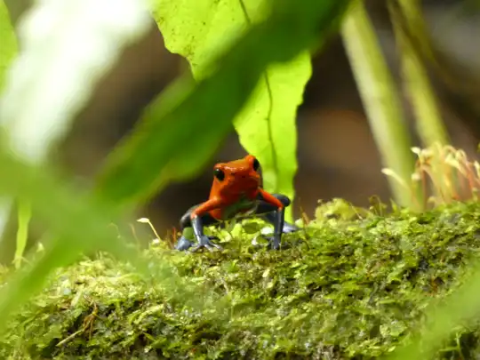
Wildlife: Toucans, motmots and other birds are common. Poison dart frogs, howler monkeys and leaf-cutter ant columns appear along the trail, and a tapir is possible but rare.
⚠️ Hiking info can sometimes be outdated or inaccurate. Before you hit the trail, check the latest conditions with locals. If you do spot anything that's off, I'd love to hear from you, so I can update it for fellow travelers.

🛡️ SafetyScams, Hazards, and Annoyances

Río Celeste Trail is a well-maintained, ranger-managed path, and most problems come from slick surfaces and rain rather than danger. The route is about 7 km (4.3 miles) round trip, with a long stairway down to the waterfall and steady mud elsewhere. Wear shoes with real tread, since wet wooden steps and clay slope sections get slippery. Rubber boots can be rented near the entrance in the wet months and are worth it. Rain upstream can raise the river quickly, so pay attention to ranger closures and never wade past barriers. The thermal springs section is for looking only, as the water is hot and bubbling. Wildlife is mostly birds, frogs and the occasional snake. Keep to the path, watch where you place hands on rails, and give animals space. Carry water, insect repellent and a light rain jacket, … read more 👉
Río Celeste Trail is a well-maintained, ranger-managed path, and most problems come from slick surfaces and rain rather than danger. The route is about 7 km (4.3 miles) round trip, with a long stairway down to the waterfall and steady mud elsewhere. Wear shoes with real tread, since wet wooden steps and clay slope sections get slippery. Rubber boots can be rented near the entrance in the wet months and are worth it. Rain upstream can raise the river quickly, so pay attention to ranger closures and never wade past barriers. The thermal springs section is for looking only, as the water is hot and bubbling. Wildlife is mostly birds, frogs and the occasional snake. Keep to the path, watch where you place hands on rails, and give animals space. Carry water, insect repellent and a light rain jacket, and pay the entry fee by card or cash before you arrive.

FAQTraveler FAQ

Río Celeste Trail takes roughly 3 to 4 hours for the 7 km (4.3 mile) round trip at an unhurried pace. The waterfall lies about 1.5 km from the entrance, and the walk to the Teñidero at the far end takes about 1.5 hours each way, with extra time for photos at the Teñidero, where the river turns blue, and at the viewpoints. Last entry is around 2 pm, so arrive by 8 or 9 am to finish comfortably before dark.
Río Celeste Trail is easy to moderate, suitable for most people with basic fitness. The main effort is the staircase of roughly 250 steps down to the waterfall and back up, plus muddy, uneven stretches along the route. Families with older children do it regularly, and there are rest areas and restrooms along the way.
Río Celeste Trail needs no guide, since the path is clearly marked and rangers staff the route, though guides are available for around US$40 to 70 per group if you want wildlife spotting and explanations. Entry to Tenorio Volcano National Park costs about US$12 for foreign adults, and you pay at the ranger station. Swimming in the river is not allowed, and daily visitor numbers are capped, so arriving early in busy months is wise.
⚠️ Things can change over time, so always validate details locally before you go.

Other Costa Rican hikes near Río Celeste Trail

Explore more nearby:


💡 Not sure where to go next?
Create a personalized itinerary for Costa Rica including Río Celeste Trail and the places that fit your trip.

Generate my itinerary

👉 Discover all hikes

Or checkout all Costa Rica has to offer (think cities, towns, villages, national parks, hikes, beaches, festivals)
Country photo of Costa Rica

We 💚 feedbackParting advice and final tips

Río Celeste Trail is short, but the color depends on recent rain, so a sunny spell beforehand matters more than an early start. Many first-timers skip the boiling vents at Los Borbollones, and I would stop there and just stand a minute upwind. Bring boots with grip, not sandals.

✈️ When did I visit Costa Rica?
Costa Rica I visited during my half year trip through South and Central America back in 2003

✍️ Help improve this page!
The information on this page is based on my own backpacking experience in Costa Rica, supplemented with up-to-date research and feedback from other travelers. Travel details can change, so if you notice anything outdated or incomplete, feel free to let me know.


🙋‍♂️ Give feedback

👋 Meet the founderWho’s Behind Take Your Backpack?

Johan, backpacker and founder of TakeYourBackpackHi, I’m Johan (Netherlands 🇳🇱), the creator of TakeYourBackpack. Over the past 3 decades, I’ve backpacked through 90+ countries across six continents, gaining extensive experience with independent travel, long-term trips, and overland routes.

This site is built on a combination of firsthand travel experience and carefully curated insights from other backpackers. Many guides are based on places I’ve personally visited, while others bring together tips, observations, and practical advice shared by trusted travelers I’ve met along the way.

The goal is to provide realistic, experience-driven guidance — not generic itineraries — so you can explore destinations with better context, clearer expectations, and more confidence.