×

Greenland🇬🇱 | hikesArctic Circle Trail160 km traverse, cairns and paint dots, reindeer tundra, hut-to-hut lakes | things to do and best time to go

Explore Arctic Circle RaceExplore Sermermiut Valley

Backpacking in Arctic Circle Trail
🏆 Top pickhike ranked #1
By Johan Kruseman 🇳🇱 | Updated October 22, 2026

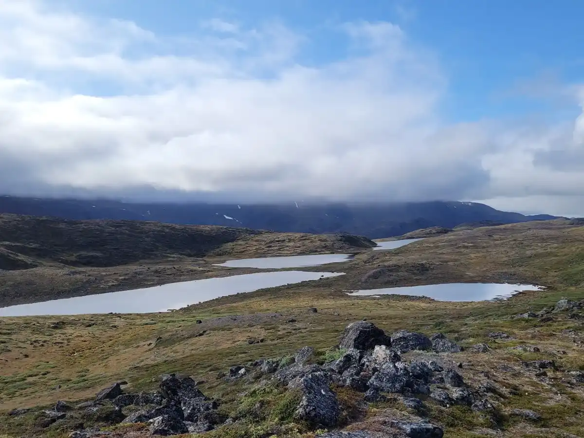
The Arctic Circle Trail does not cross the Arctic Circle; it runs entirely just north of it, as a roughly 160 kilometer route in western Greenland between the Kangerlussuaq area and the coastal town of Sisimiut. It usually takes 7 to 10 days, and nobody maintains it, so the path is a series of cairns, red paint dots and boot-worn peat. You get reindeer on open tundra, musk oxen in the valleys, glacial lakes, and a silence broken by wind and your own zipper. Mosquitoes in July are thick and relentless, rivers can run knee to thigh deep, and the wet ground soaks boots by day two. The terrain is rolling rather than steep, so fitness matters more than technical skill. Kangerlussuaq has the airport, which is the only practical way in, and Sisimiut has a ferry connection along the coast. Carry a stove and fuel, because there are no shops en route, and book your flight and return transport before you set off.

Discover everything you want to know in the 📖 Greenland Travel Guide.
Best time to go: May - September
Duration: 8 days
Distance: 160 kilometers
Total ascent: 1500 meters


example page 0 from our offline Travel Guide for Greenland
example page 1 from our offline Travel Guide for Greenland
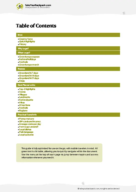
example page 2 from our offline Travel Guide for Greenland
example page 3 from our offline Travel Guide for Greenland
example page 4 from our offline Travel Guide for Greenland
example page 5 from our offline Travel Guide for Greenland
example page 6 from our offline Travel Guide for Greenland
example page 7 from our offline Travel Guide for Greenland
Loading the map 🌍
CLICK TO FILTER
towns
villages
landmarks
national parks
hikes
attractions
festivals
regions
SHOW COUNTRY’S BESTSHOW ALL

✨ Why go?
Ranked #1 hike in Greenland
Reasons people choose to hike the here

The Arctic Circle Trail gives you a full week or more of empty tundra without a guide, a permit or a booking system. That is rare, and it is the main pull. You sleep in basic Katiffik, Innajuattoq and Ikkattoq huts or pitch a tent wherever the ground is flat, and you cook beside lakes so clear you can drink straight from them. Distance is flexible too. Start at Kangerlussuaq and you walk the whole 160 kilometers; hop on a boat from Sisimiut and you can do shorter sections. It also fits a longer trip neatly, because both ends have airport or ferry links to the rest of the country, so you can fold it between Nuuk and Ilulissat. Musk oxen, reindeer and the sight of the Greenland ice sheet edge near the start give it far more wildlife and drama than its modest altitude suggests. You never climb … read more 👉
The Arctic Circle Trail gives you a full week or more of empty tundra without a guide, a permit or a booking system. That is rare, and it is the main pull. You sleep in basic Katiffik, Innajuattoq and Ikkattoq huts or pitch a tent wherever the ground is flat, and you cook beside lakes so clear you can drink straight from them. Distance is flexible too. Start at Kangerlussuaq and you walk the whole 160 kilometers; hop on a boat from Sisimiut and you can do shorter sections. It also fits a longer trip neatly, because both ends have airport or ferry links to the rest of the country, so you can fold it between Nuuk and Ilulissat. Musk oxen, reindeer and the sight of the Greenland ice sheet edge near the start give it far more wildlife and drama than its modest altitude suggests. You never climb above roughly 450 meters, so the effort stays manageable for a fit first-timer.

💡 HighlightsKey sights and experiences for travelers

  1. Kangerlussuaq Start and Sandflats: The trailhead lies at the head of a long fjord with silty braided flats and dry, dusty hills. It looks nothing like the green country ahead, and the contrast is part of the opening day.
  2. Katiffik Hut and Ice Sheet Views: Early on, the hut area gives a long outlook toward the ice sheet margin, a pale line under a huge sky.
  3. Hundeso Lake Region: The lakes near the start sit among rocky ridges, with glassy water and good campsites. Reindeer and musk ox often graze within sight.
  4. Ikkattoq Hut: A small overnight hut for six on a lakeshore, with a cooking bench and a view across the water. It makes a sensible place to rest tired legs before the harder middle sections.
  5. Approach to Sisimiut: The final stretch drops into coastal rock and low heath, and the first glimpse
… read more 👉
  1. Kangerlussuaq Start and Sandflats: The trailhead lies at the head of a long fjord with silty braided flats and dry, dusty hills. It looks nothing like the green country ahead, and the contrast is part of the opening day.
  2. Katiffik Hut and Ice Sheet Views: Early on, the hut area gives a long outlook toward the ice sheet margin, a pale line under a huge sky.
  3. Hundeso Lake Region: The lakes near the start sit among rocky ridges, with glassy water and good campsites. Reindeer and musk ox often graze within sight.
  4. Ikkattoq Hut: A small overnight hut for six on a lakeshore, with a cooking bench and a view across the water. It makes a sensible place to rest tired legs before the harder middle sections.
  5. Approach to Sisimiut: The final stretch drops into coastal rock and low heath, and the first glimpse of Sisimiut’s colored houses and harbor feels earned after a week in the interior.
The Arctic Circle Trail needs no ticket and no booking, since the huts are free and first come, first served.
Spotted a mistake or missing something? Contact us.
🌤️ When to go?Seasonal considerations and timing

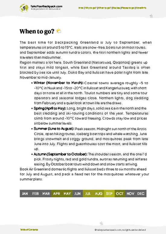
  • Late June to mid-July: Daytime highs of 8 to 15°C (46 to 59°F) arrive with snow patches still lingering on the high passes. The sun barely dips, so you can walk whenever you like. Mosquitoes hatch hard and peak here.
  • Late July to August: This is the warmest stretch, with highs of 10 to 18°C (50 to 64°F) and occasional days above 20°C (68°F). Most hikers start now, so huts fill and Kangerlussuaq flights and hostel beds cost the most. Bugs ease by mid-August.
  • Late August to mid-September: Highs of 3 to 10°C (37 to 50°F), few bugs, red tundra and the first dark nights. Crowds thin, though nights can touch freezing, and daylight shrinks fast to roughly 12 to 14 hours.
  • October to May: Temperatures fall well below freezing, to -20°C (-4°F) or lower. The route turns into a ski or snowshoe expedition
… read more 👉
  • Late June to mid-July: Daytime highs of 8 to 15°C (46 to 59°F) arrive with snow patches still lingering on the high passes. The sun barely dips, so you can walk whenever you like. Mosquitoes hatch hard and peak here.
  • Late July to August: This is the warmest stretch, with highs of 10 to 18°C (50 to 64°F) and occasional days above 20°C (68°F). Most hikers start now, so huts fill and Kangerlussuaq flights and hostel beds cost the most. Bugs ease by mid-August.
  • Late August to mid-September: Highs of 3 to 10°C (37 to 50°F), few bugs, red tundra and the first dark nights. Crowds thin, though nights can touch freezing, and daylight shrinks fast to roughly 12 to 14 hours.
  • October to May: Temperatures fall well below freezing, to -20°C (-4°F) or lower. The route turns into a ski or snowshoe expedition with short daylight in midwinter, and huts are not a safe plan.
Book Kangerlussuaq flights months ahead for early August, or go in the first week of September for lower prices and no mosquitoes.


source: climatestotravel.comJANJanuary: below average for travelingFEBFebruary: below average for travelingMARMarch: below average for travelingAPRApril: fair for travelingMAYMay: good for travelingJUNJune: highly recommended for travelingJULJuly: excellent for travelingAUGAugust: highly recommended for travelingSEPSeptember: good for travelingOCTOctober: fair for travelingNOVNovember: below average for travelingDECDecember: below average for traveling
greenland-hike-arctic-circle-trail
© Google | Martin Walter

✈️ The backpacker research shortcutGreenland Travel Guide

An offline-friendly backpacking guide with optimized travel routes, ranked highlights, transport advice, and the best areas to stay.
example page 0 from our offline Travel Guide for Greenland
example page 1 from our offline Travel Guide for Greenland
example page 2 from our offline Travel Guide for Greenland
example page 3 from our offline Travel Guide for Greenland
example page 4 from our offline Travel Guide for Greenland
example page 5 from our offline Travel Guide for Greenland
example page 6 from our offline Travel Guide for Greenland
example page 7 from our offline Travel Guide for Greenland
The digital guide (154 pages) contains:
✅ 33 highlights, ranked by travel appeal
✅ Optimized 7, 14 & 21-day travel routes
✅ Cities, national parks, landmarks, beaches
✅ How to get around
✅ Offline-friendly for travel without Wi-Fi
👉 Click to see all 30+ guide features

📅 Plan smarter in minutes, not weeks
✅ Month by month travel advice
✅ Festivals & national holidays
✅ Budget expectations

🗺️ Go to the right places, skip the overrated ones
✅ Honest pros & cons of destinations
✅ Top hikes, parks & viewpoints
✅ Lesser-known places most travelers miss
✅ Clear “worth it vs skip it” guidance

🛏️ Travel smoothly without rookie mistakes
✅ Best areas to stay
✅ Transport systems explained simply
✅ Common scams & safety advice
✅ SIM cards, money & practical tips

🌍 Understand the country, not just visit it
✅ Culture & traditions
✅ 52 Essential phrases & customs
✅ Festivals worth planning around
✅ Traveler-friendly historical context
✅ Insights that make places more meaningful

📱 Built for real travel conditions
✅ Fully downloadable PDF
✅ Works completely offline
✅ Optimized for phone use
✅ Useful in remote areas & buses
✅ Everything in one place
Stop searching, start planning
Get instant access to your full guide. 30‑day money-back guarantee.
+ Add another guide for just

By proceeding you agree to our terms.
Sent to your inbox immediately after payment • 100% Secure Checkout
Best Backpacking Travel Advisor 2025 tourism awardBest Backpacking
Travel Advisor
2025
What others say about Take Your Backpack Guides:
⭐⭐⭐⭐⭐
Fantastic, amazing amount of information!
⭐⭐⭐⭐⭐
My goodness this is amazing, it's what I've been looking for hats off too you!
⭐⭐⭐⭐⭐
I think this is absolutely BRILLIANT
⭐⭐⭐⭐
Very complete and informative. It's still missing places, but I gotta to commend you
⭐⭐⭐⭐⭐
This is truly amazing, thank you, can't wait to explore it with my kids!
⭐⭐⭐⭐⭐
Awesome resource, thank you!
⭐⭐⭐⭐⭐
This is amazing! Can't wait to explore the ones I haven't seen
⭐⭐⭐⭐
I love this! Well done, great idea.
⭐⭐⭐⭐⭐
Thanks for taking the time to make this gem!
⭐⭐⭐⭐⭐
This might be the best website I've ever seen.
⭐⭐⭐⭐⭐
Congratulations, and thank you so much for your work; it's incredibly valuable.
⭐⭐⭐⭐
In all seriousness I think you did a great job pointing out the important spots
⭐⭐⭐⭐⭐
10/10 very good
⭐⭐⭐⭐⭐
As someone who's only just starting to visit regularly this is awesome, thank you.
⭐⭐⭐⭐
Thank you very much! I'm going to visit my dad, it's going to be very useful!
⭐⭐⭐⭐⭐
This is really cool! We'll be travelling for the first time and this definitely come in handy.
⭐⭐⭐⭐⭐
You are now our minister of culture, congratulations 👨‍💼
⭐⭐⭐⭐⭐
Just wanted to tell you that this is a pearl! Going to follow your recommendations.
⭐⭐⭐⭐⭐
This is so cool. I'll definitely be using the resource for my travels soon.
⭐⭐⭐⭐⭐
This is very impressive! Good work.
⭐⭐⭐⭐⭐
This is an amazing and informative site. Very well done!

🛏️ Where to stay?Where staying makes the most sense

If you enjoy meeting fellow travelers, consider choosing hostels with high ratings for atmosphere. On the other hand, if you prefer having your own space, a hotel might be a better option.

🥾 Hike detailsEverything you need to know before hiking Arctic Circle Trail

Total Distance: The Arctic Circle Trail covers about 160 kilometers one way, usually walked east to west.
Duration: Most hikers need 7 to 10 days, and fast walkers can finish in 5 or 6.
Difficulty: Moderate to demanding. The trail is not technical, but river crossings, bog, wind and long days with a heavy pack make it tiring.
Starting Point: Kangerlussuaq, the settlement around the airport. Most people arrive by air, and the finish at Sisimiut connects onward by ferry or domestic flight.
Major Landmarks:
  • Katiffik Hut: An early shelter with ice sheet views.
  • Innajuattoq Hut: A shelter set around the middle
… read more 👉
Total Distance: The Arctic Circle Trail covers about 160 kilometers one way, usually walked east to west.
Duration: Most hikers need 7 to 10 days, and fast walkers can finish in 5 or 6.
Difficulty: Moderate to demanding. The trail is not technical, but river crossings, bog, wind and long days with a heavy pack make it tiring.
Starting Point: Kangerlussuaq, the settlement around the airport. Most people arrive by air, and the finish at Sisimiut connects onward by ferry or domestic flight.
Major Landmarks:
  • Katiffik Hut: An early shelter with ice sheet views.
  • Innajuattoq Hut: A shelter set around the middle of the route.
  • Ikkattoq Hut: A lakeside hut and popular stop.
  • Sisimiut: The coastal finish, with shops, a harbor and guesthouses.
Terrain and Scenery: Gravel and sand at the start give way to rocky ridges, boggy valleys, wide lake basins and open tundra. Route markers are cairns and red paint dots, which help in poor visibility.
Vegetation: Dwarf birch, willow and heather cover much of the land, with mosses and lichens on rock. There are no real trees.
Wildlife: Reindeer and musk ox are common. Arctic hare, ptarmigan and raptors also appear. Mosquitoes and biting flies are heavy in July.
Practical Notes: Carry fuel, since canisters are not sold on the trail. River fords can be thigh-deep after rain, so carry sandals or camp shoes.
⚠️ Hiking info can sometimes be outdated or inaccurate. Before you hit the trail, check the latest conditions with locals. If you do spot anything that's off, I'd love to hear from you, so I can update it for fellow travelers.

🛡️ SafetySafety Tips and Common Scams in Arctic Circle Trail

Arctic Circle Trail is a well-marked 160 km route with no serious technical sections, but it is remote and self-reliant. Weather changes quickly: a warm afternoon can turn into cold rain and wind within an hour, so carry a proper shell, warm layers and a tent rated for gusts, even if you plan to use the huts. Wet feet cause most problems. The river crossings are usually shin to knee deep, but the Ikkattoq and Kangerluarsuk outlets can run higher after rain, so unclip your hip belt, wear camp shoes and cross in the morning when meltwater is lower. Navigation is easy with cairns and red paint marks, though fog hides them, so carry a map and GPS. Musk oxen roam the area; keep at least 50 meters away and never walk between a bull and the herd. Reindeer are harmless. Mosquitoes in July are the … read more 👉
Arctic Circle Trail is a well-marked 160 km route with no serious technical sections, but it is remote and self-reliant. Weather changes quickly: a warm afternoon can turn into cold rain and wind within an hour, so carry a proper shell, warm layers and a tent rated for gusts, even if you plan to use the huts. Wet feet cause most problems. The river crossings are usually shin to knee deep, but the Ikkattoq and Kangerluarsuk outlets can run higher after rain, so unclip your hip belt, wear camp shoes and cross in the morning when meltwater is lower. Navigation is easy with cairns and red paint marks, though fog hides them, so carry a map and GPS. Musk oxen roam the area; keep at least 50 meters away and never walk between a bull and the herd. Reindeer are harmless. Mosquitoes in July are the real nuisance, so bring a head net and repellent. Mobile coverage is patchy, so leave your plans with your lodging.

FAQFrequently asked questions about Arctic Circle Trail

Most hikers take 7 to 10 days to cover the 160 km between Kangerlussuaq and Sisimiut on the Arctic Circle Trail. Fit walkers who skip rest days can finish in 5 to 6 days, covering 25 to 30 km daily. Allow an extra day or two for storms or high rivers, and add a day for the trip back from Sisimiut.
Arctic Circle Trail is moderate rather than technical, but it is long and demanding in stamina. You carry a pack of 15 to 20 kg over rolling tundra, rocky ground and boggy stretches, with daily distances of 20 to 30 km. River crossings and wind add effort, and there are no resupply points between Kangerlussuaq and Sisimiut. Most reasonably fit hikers with some multi-day experience manage it.
No permit or guide is required for Arctic Circle Trail, and the route is free to walk. The path is waymarked with cairns and red dots, and the 160 km can be hiked independently with a map and GPS. Basic huts along the way are free to use, with around 10 along the route, and a tent is still wise. Guided groups exist if you prefer, usually costing several thousand US dollars including flights.
⚠️ Things can change over time, so always validate details locally before you go.

Other destinations worth considering

Arctic Circle Trail isn’t the only highlight in Greenland. Explore all what Greenland has to offer.
Country photo of Greenland

We 💚 feedbackFinal thoughts on hiking the Arctic Circle Trail

The Arctic Circle Trail is best in late August into early September. The mosquitoes fade, the tundra turns red and gold, and the huts are quieter. I would bring a head net anyway and keep spare dry socks for the fords. Skip July unless you enjoy being eaten.

✍️ Help improve this page!
The information on this page is based on in-depth research, insights shared by experienced travelers, and feedback from the local travel community in Greenland. While every effort is made to keep the information accurate and current, conditions can change — so if you spot anything incorrect or outdated, please get in touch.


🙋‍♂️ Give feedback

👋 Meet the founderWho’s Behind Take Your Backpack?

Johan, backpacker and founder of TakeYourBackpackHi, I’m Johan (Netherlands 🇳🇱), the creator of TakeYourBackpack. Over the past 3 decades, I’ve backpacked through 90+ countries across six continents, gaining extensive experience with independent travel, long-term trips, and overland routes.

This site is built on a combination of firsthand travel experience and carefully curated insights from other backpackers. Many guides are based on places I’ve personally visited, while others bring together tips, observations, and practical advice shared by trusted travelers I’ve met along the way.

The goal is to provide realistic, experience-driven guidance — not generic itineraries — so you can explore destinations with better context, clearer expectations, and more confidence.