×

Guam🇬🇺 | landmarksSella BayRoadside overlook, turquoise shallows, reef edge, no town | things to do and best time to go

Explore YonaExplore Umatac Bay

Backpacking in Sella Bay
👍 Recommendedunique site ranked #2
By Johan Kruseman 🇳🇱 | Updated October 15, 2026

Sella Bay has no town, no hostel and no shop, which surprises people who expect a beach resort. It is a quiet cove on the southwest coast of Guam, near the village of Umatac, and you see it best from a roadside overlook on the coast highway. The good side is easy to list: green ridges dropping into blue water, almost no crowds, and a coastline that still feels lived in by locals rather than staged for visitors. The bad side is just as plain. You need your own wheels or a lot of patience, and shade is scarce. Bring water and a hat. Nearby Umatac adds Spanish-era forts, a Magellan monument and cheap roadside barbecue on weekends. For a first day, rent a car, reach the overlook before 9 a.m. while the light is soft and the pullout is empty, then roll south for lunch in Umatac.

Discover everything you want to know in the 📖 Guam Travel Guide.


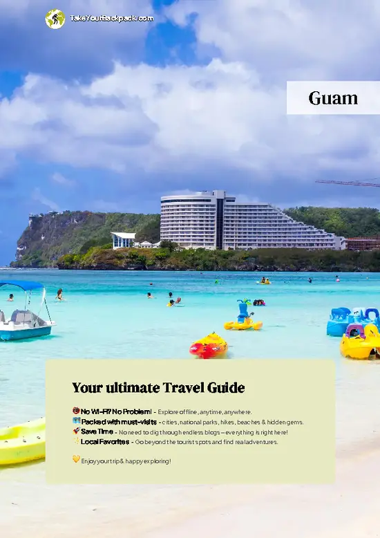
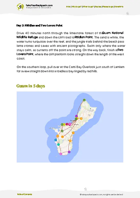
example page 0 from our offline Travel Guide for Guam
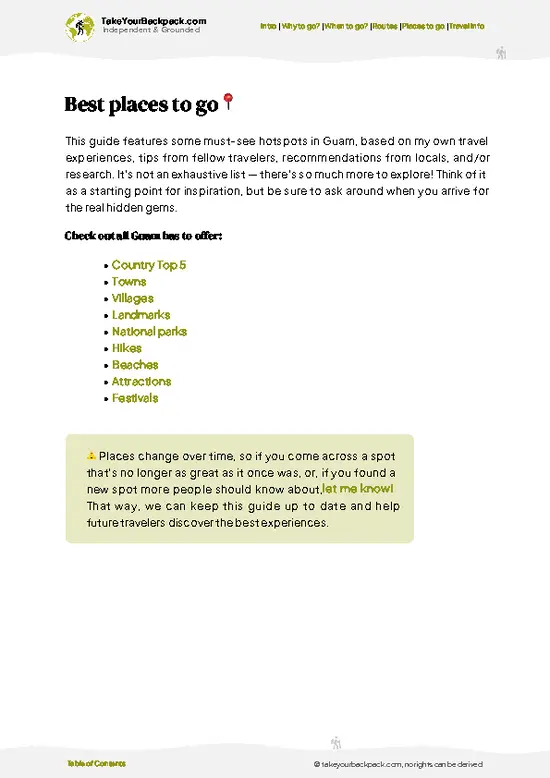
example page 1 from our offline Travel Guide for Guam
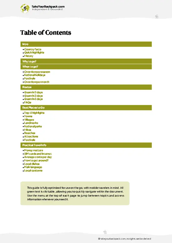
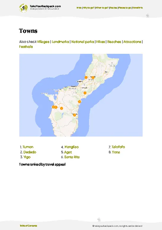
example page 2 from our offline Travel Guide for Guam
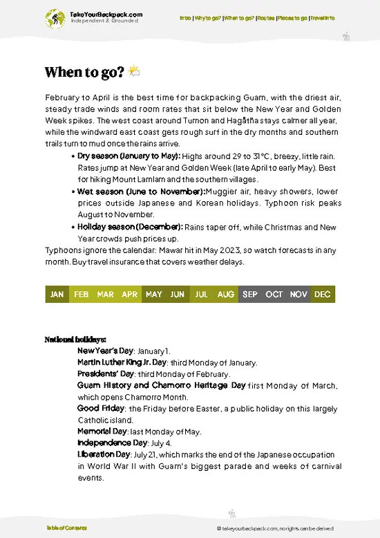
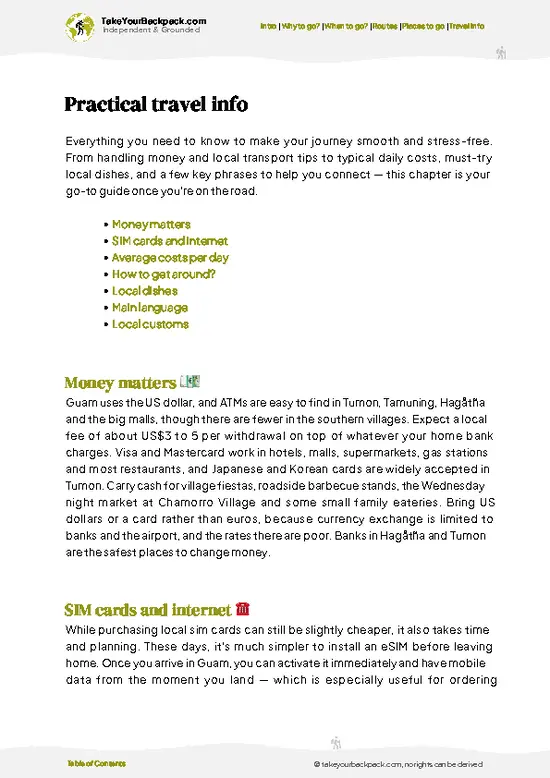
example page 3 from our offline Travel Guide for Guam
example page 4 from our offline Travel Guide for Guam
example page 5 from our offline Travel Guide for Guam
example page 6 from our offline Travel Guide for Guam
example page 7 from our offline Travel Guide for Guam
Loading the map 🌍
CLICK TO FILTER
towns
villages
landmarks
national parks
hikes
beaches
attractions
festivals
SHOW COUNTRY’S BESTSHOW ALL

✨ Why go?
Ranked #2 unique site in Guam
The unique appeal for travelers

Backpackers come to this stretch of southwest Guam because the island’s history and its wildest coast sit within a few minutes of each other. The road hugging the shoreline links Sella Bay Overlook, Fort Nuestra Señora de la Soledad and the Magellan monument at Umatac Bay, so a single loop covers lookouts, a Spanish colonial outpost and a swim without packing up a base. Few places on the island let you stack that much without a long drive between stops.

The second draw is the contrast with Tumon. Down here the villages are small, the churches are the biggest buildings, and fiesta tables and roadside stands replace tour-bus restaurants. You meet Chamorro families rather than package groups, and a plate of red rice and barbecue costs a fraction of what resort menus charge.

Then there is the … read more 👉
Backpackers come to this stretch of southwest Guam because the island’s history and its wildest coast sit within a few minutes of each other. The road hugging the shoreline links Sella Bay Overlook, Fort Nuestra Señora de la Soledad and the Magellan monument at Umatac Bay, so a single loop covers lookouts, a Spanish colonial outpost and a swim without packing up a base. Few places on the island let you stack that much without a long drive between stops.

The second draw is the contrast with Tumon. Down here the villages are small, the churches are the biggest buildings, and fiesta tables and roadside stands replace tour-bus restaurants. You meet Chamorro families rather than package groups, and a plate of red rice and barbecue costs a fraction of what resort menus charge.

Then there is the climb. Mount Lamlam, whose trail starts a short drive south at the Cetti Bay Overlook, is billed as the world’s tallest mountain when measured from the Mariana Trench floor. The trail is steep, muddy after rain and short enough to finish before lunch, which makes it an easy add-on for anyone who wants a proper hike without a full expedition.

💡 HighlightsMust-see experiences and standout moments

  1. Sella Bay Overlook: a roadside pullout above the cove, where the ridge falls to turquoise shallows and a dark reef edge. It is free, takes ten minutes, and is quietest early in the morning.
  2. Cetti Bay Overlook: a short drive south, a deeper bay framed by jungle ridges, with a clear view of the reef line and the road winding along the cliffs.
  3. Fort Nuestra Señora de la Soledad: a small hilltop Spanish fort above Umatac with stone walls, old cannon positions and a wide view over the bay, good for a short stop.
  4. Magellan Monument at Umatac Bay: a memorial to the 1521 landing of Ferdinand Magellan’s fleet, set beside the bay with a small plaza and benches.
  5. Umatac Outdoor Museum: a modest open-air display of village history, with Spanish-era markers and a restored plaza that explain why Spanish governors
… read more 👉
  1. Sella Bay Overlook: a roadside pullout above the cove, where the ridge falls to turquoise shallows and a dark reef edge. It is free, takes ten minutes, and is quietest early in the morning.
  2. Cetti Bay Overlook: a short drive south, a deeper bay framed by jungle ridges, with a clear view of the reef line and the road winding along the cliffs.
  3. Fort Nuestra Señora de la Soledad: a small hilltop Spanish fort above Umatac with stone walls, old cannon positions and a wide view over the bay, good for a short stop.
  4. Magellan Monument at Umatac Bay: a memorial to the 1521 landing of Ferdinand Magellan’s fleet, set beside the bay with a small plaza and benches.
  5. Umatac Outdoor Museum: a modest open-air display of village history, with Spanish-era markers and a restored plaza that explain why Spanish governors moved here each galleon season.
  6. Fouha Bay and Fouha Rock: a rocky formation just offshore, tied to the creation story of Guam. Locals fish the shallows, and the rocks make a good photo stop.
  7. Mount Lamlam: a steep, short hike with a view across Guam’s southwest, best when the ground is dry. Wear shoes with grip.
  8. Merizo Pier: the working pier for boats to Cocos Island, where fishermen gather early and the village church sits a few steps from the water.
  9. Cocos Island: a sandy islet inside a lagoon, reached by a short boat ride from Merizo, with clear water for snorkeling and few visitors on weekdays.
  10. Mount Jumullong Manglo: a small hill above Umatac topped by a large cross, with a view over the bay and the red-roofed village. Few visitors stop here.
Most people drive past Mount Jumullong Manglo, yet its cross-topped summit gives the best single view of Umatac’s bay and village.
Spotted a mistake or missing something? Contact us.

Things to do near Sella Bay

Ratings based on Tripadvisor reviews. When you book through this link, you support our work at no extra cost to you.

⌛️ 1 day1-day itinerary for Sella Bay

Plan on a rental car and a slow, stop-start pace, with the midday heat spent in the water or under a roof rather than on the road. The coast highway has few services, so fuel up and carry water before you start.

Day 1: Sella Bay Overlook: Start early, when the light on the cove is softest and the pullout is empty. Cetti Bay Overlook comes next, a short drive south, because the two bays are best compared back to back. Finish the morning with a swim or lunch in Umatac.

Day 2: Umatac: Spend the day on foot between Fort Soledad, the Magellan monument and the outdoor museum. Everything is close, so you can go slowly. Use the afternoon heat for a long lunch, then climb Mount Jumullong Manglo for the late view over the bay.

Day 3: Mount Lamlam: Hike in the morning while the trail is firmer and … read more 👉
Plan on a rental car and a slow, stop-start pace, with the midday heat spent in the water or under a roof rather than on the road. The coast highway has few services, so fuel up and carry water before you start.

Day 1: Sella Bay Overlook: Start early, when the light on the cove is softest and the pullout is empty. Cetti Bay Overlook comes next, a short drive south, because the two bays are best compared back to back. Finish the morning with a swim or lunch in Umatac.

Day 2: Umatac: Spend the day on foot between Fort Soledad, the Magellan monument and the outdoor museum. Everything is close, so you can go slowly. Use the afternoon heat for a long lunch, then climb Mount Jumullong Manglo for the late view over the bay.

Day 3: Mount Lamlam: Hike in the morning while the trail is firmer and cooler, then rinse off in the sea at Fouha Bay. The rest of the day stays loose, so you are not rushing a steep climb.

Day 4: Merizo and Cocos Island: Drive south to Merizo Pier and take a boat to Cocos Island for snorkeling and a quiet beach afternoon. Go on a weekday if you can, when the island is emptier. Return to Merizo for dinner near the church.

Day 5: Inarajan detour: Detour east to the Inarajan side of the island, where the village has historic Spanish-era buildings, the Gef Pa’go cultural village and a rock-walled natural pool. It adds a different coast without forcing you to change bases, since you can loop back along the south road.

If you only have one day to spend, make it Day 4. The boat ride, the clear lagoon and the unhurried afternoon on Cocos Island justify the whole trip.

🌤️ When to go?Weather, crowds, and seasonal trade-offs

  • Dry Season (December to May): Rain drops off, trade winds keep the coast breezy, and the trail down toward the bay is firmest. Highs run 28 to 31°C (82 to 88°F), with lows near 24°C (75°F). Sunrise comes about 6:15 a.m. and sunset about 6:00 p.m. in winter.
  • Wet Season (July to November): Afternoon downpours turn the red clay slick and the humid air hangs heavy, around 27 to 32°C (81 to 90°F). Typhoons peak here, so check forecasts before driving south. Visitor numbers are lowest, and the lush slopes above the bay are at their greenest.
  • Holidays and Fiestas: Village fiestas in Umatac and Merizo (the weeks around Easter and the patron saint days) bring crowds to the south and crowd the roads. Flights and rooms across Guam cost more around Golden Week and Christmas.
Go on a weekday morning in March … read more 👉
  • Dry Season (December to May): Rain drops off, trade winds keep the coast breezy, and the trail down toward the bay is firmest. Highs run 28 to 31°C (82 to 88°F), with lows near 24°C (75°F). Sunrise comes about 6:15 a.m. and sunset about 6:00 p.m. in winter.
  • Wet Season (July to November): Afternoon downpours turn the red clay slick and the humid air hangs heavy, around 27 to 32°C (81 to 90°F). Typhoons peak here, so check forecasts before driving south. Visitor numbers are lowest, and the lush slopes above the bay are at their greenest.
  • Holidays and Fiestas: Village fiestas in Umatac and Merizo (the weeks around Easter and the patron saint days) bring crowds to the south and crowd the roads. Flights and rooms across Guam cost more around Golden Week and Christmas.
Go on a weekday morning in March or April, when the overlook is quiet and the water below is clear.


source: climatestotravel.comJANJanuary: highly recommended for travelingFEBFebruary: highly recommended for travelingMARMarch: excellent for travelingAPRApril: excellent for travelingMAYMay: highly recommended for travelingJUNJune: fair for travelingJULJuly: fair for travelingAUGAugust: fair for travelingSEPSeptember: fair for travelingOCTOctober: fair for travelingNOVNovember: good for travelingDECDecember: good for traveling
when-to-go

✈️ The backpacker research shortcutGuam Travel Guide

An offline-friendly backpacking guide with optimized travel routes, ranked highlights, transport advice, and the best areas to stay.
example page 0 from our offline Travel Guide for Guam
example page 1 from our offline Travel Guide for Guam
example page 2 from our offline Travel Guide for Guam
example page 3 from our offline Travel Guide for Guam
example page 4 from our offline Travel Guide for Guam
example page 5 from our offline Travel Guide for Guam
example page 6 from our offline Travel Guide for Guam
example page 7 from our offline Travel Guide for Guam
The digital guide (135 pages) contains:
✅ 36 highlights, ranked by travel appeal
✅ Optimized 2, 3 & 5-day travel routes
✅ Cities, national parks, landmarks, beaches
✅ How to get around
✅ Offline-friendly for travel without Wi-Fi
👉 Click to see all 30+ guide features

📅 Plan smarter in minutes, not weeks
✅ Month by month travel advice
✅ Festivals & national holidays
✅ Budget expectations

🗺️ Go to the right places, skip the overrated ones
✅ Honest pros & cons of destinations
✅ Top hikes, parks & viewpoints
✅ Lesser-known places most travelers miss
✅ Clear “worth it vs skip it” guidance

🛏️ Travel smoothly without rookie mistakes
✅ Best areas to stay
✅ Transport systems explained simply
✅ Common scams & safety advice
✅ SIM cards, money & practical tips

🌍 Understand the country, not just visit it
✅ Culture & traditions
✅ Local customs
✅ Festivals worth planning around
✅ Traveler-friendly historical context
✅ Insights that make places more meaningful

📱 Built for real travel conditions
✅ Fully downloadable PDF
✅ Works completely offline
✅ Optimized for phone use
✅ Useful in remote areas & buses
✅ Everything in one place
Stop searching, start planning
Get instant access to your full guide. 30‑day money-back guarantee.
+ Add another guide for just

By proceeding you agree to our terms.
Sent to your inbox immediately after payment • 100% Secure Checkout
Best Backpacking Travel Advisor 2025 tourism awardBest Backpacking
Travel Advisor
2025
What others say about Take Your Backpack Guides:
⭐⭐⭐⭐⭐
Fantastic, amazing amount of information!
⭐⭐⭐⭐⭐
My goodness this is amazing, it's what I've been looking for hats off too you!
⭐⭐⭐⭐⭐
I think this is absolutely BRILLIANT
⭐⭐⭐⭐
Very complete and informative. It's still missing places, but I gotta to commend you
⭐⭐⭐⭐⭐
This is truly amazing, thank you, can't wait to explore it with my kids!
⭐⭐⭐⭐⭐
Awesome resource, thank you!
⭐⭐⭐⭐⭐
This is amazing! Can't wait to explore the ones I haven't seen
⭐⭐⭐⭐
I love this! Well done, great idea.
⭐⭐⭐⭐⭐
Thanks for taking the time to make this gem!
⭐⭐⭐⭐⭐
This might be the best website I've ever seen.
⭐⭐⭐⭐⭐
Congratulations, and thank you so much for your work; it's incredibly valuable.
⭐⭐⭐⭐
In all seriousness I think you did a great job pointing out the important spots
⭐⭐⭐⭐⭐
10/10 very good
⭐⭐⭐⭐⭐
As someone who's only just starting to visit regularly this is awesome, thank you.
⭐⭐⭐⭐
Thank you very much! I'm going to visit my dad, it's going to be very useful!
⭐⭐⭐⭐⭐
This is really cool! We'll be travelling for the first time and this definitely come in handy.
⭐⭐⭐⭐⭐
You are now our minister of culture, congratulations 👨‍💼
⭐⭐⭐⭐⭐
Just wanted to tell you that this is a pearl! Going to follow your recommendations.
⭐⭐⭐⭐⭐
This is so cool. I'll definitely be using the resource for my travels soon.
⭐⭐⭐⭐⭐
This is very impressive! Good work.
⭐⭐⭐⭐⭐
This is an amazing and informative site. Very well done!

🛏️ Where to stay?Best areas and accommodation options

Tumon is the best base for backpackers, because it has Guam’s widest range of budget beds, the only real concentration of hostels and cheap dorms, and a safe, well-lit strip where solo travelers meet easily. Expect roughly US$30 to 60 for a dorm bed or basic private room. It sits about 40 minutes to an hour by road from the southwest coast around Sella Bay, so you drive south for the day and return for dinner and company.

Around Sella Bay itself there is almost nothing to rent, just jungle ridges and a roadside overlook. The nearest villages are Agat to the north and Umatac to the south. Agat … read more 👉
Tumon is the best base for backpackers, because it has Guam’s widest range of budget beds, the only real concentration of hostels and cheap dorms, and a safe, well-lit strip where solo travelers meet easily. Expect roughly US$30 to 60 for a dorm bed or basic private room. It sits about 40 minutes to an hour by road from the southwest coast around Sella Bay, so you drive south for the day and return for dinner and company.

Around Sella Bay itself there is almost nothing to rent, just jungle ridges and a roadside overlook. The nearest villages are Agat to the north and Umatac to the south. Agat has a handful of small guesthouses and rooms, a long beach, and local shops, and it suits you if you want quiet mornings and a short drive to the trailheads and lookouts. Umatac is tiny, with a historic waterfront and very few beds, so book ahead or treat it as a stop rather than a base.

Hagåtña is the other sensible option. It is quieter than Tumon and central for reaching both coasts, and it comes alive on Wednesday evenings with the Chamorro Village night market. Rooms there are fewer and cost a little less. I would split a trip between Tumon for the social side and Agat for the south, if you have the days and a rental car.

🚌 Getting aroundGetting around like a local

Sella Bay has no bus station or town center. The nearest transit hub is Hagåtña, roughly 35 to 40 km north, and from there you follow Route 2 south through Agat and Umatac to the Sella Bay Overlook, just south of Agat. Public service to the southern villages is thin, so most backpackers rent wheels or share them. It works well once you have a plan.
  • Rental car: US$40 to 70 a day, and the easiest way to reach the overlook and stop at every pullout. Route 2 hugs the coast, so you get open ocean on one side and jungle ridges on the other, and you can stop whenever the light is good.
  • Split with other travelers: Tumon hostels are the best place to find people to share a car. A quarter of the daily rate each makes the south cheap, and you get company on the drive.
  • Taxi or ride-hail: A one-way fare from
… read more 👉
Sella Bay has no bus station or town center. The nearest transit hub is Hagåtña, roughly 35 to 40 km north, and from there you follow Route 2 south through Agat and Umatac to the Sella Bay Overlook, just south of Agat. Public service to the southern villages is thin, so most backpackers rent wheels or share them. It works well once you have a plan.
  • Rental car: US$40 to 70 a day, and the easiest way to reach the overlook and stop at every pullout. Route 2 hugs the coast, so you get open ocean on one side and jungle ridges on the other, and you can stop whenever the light is good.
  • Split with other travelers: Tumon hostels are the best place to find people to share a car. A quarter of the daily rate each makes the south cheap, and you get company on the drive.
  • Taxi or ride-hail: A one-way fare from Tumon runs US$60 to 90, and pickups in the south are scarce. Use it only if you arrange the return ahead of time, then enjoy a lazy afternoon at the lookout without watching the clock.
  • GRTA bus: Fares are a few dollars, but runs to the far south are sparse and slow. It suits patient travelers who start early and want the villages at street level, with plenty of time for the Umatac waterfront.
  • Bicycle: Only for strong riders. Route 2 has steep climbs and little shoulder, but the downhill glide toward the bay is wonderful in the cool of early morning.
Leave Tumon by 7:30 a.m. to beat traffic and heat, fill the tank in Agat (stations thin out after), and finish with lunch in Merizo before heading back with the sunset on your left.

👛 Costs (as of 15 October 2026)What things cost and how to budget

A day at Sella Bay costs roughly US$78 for a backpacker who rents a car and splits it with others, and most of that goes to wheels and a bed rather than the site itself.
CategoryBudget RangeLocal Reality
Entry feeUS$0The trail from the overlook down to the bay, the Spanish stone bridge and the ruins has no ticket booth.
Accommodation (high season)US$35 to 45Dorm beds are scarce on Guam, so expect a shared or budget room in Tumon or Agat. Prices climb in the dry months and during holiday weeks. Low season runs about US$25 to 35.
TransportUS$20 to 30Sharing a rental car split between two or three people works out to about this per head, plus fuel. Public buses run along the main road but do not reach the overlook, so you walk or drive the last stretch.
FoodUS$12 to 20Plates at local Chamorro lunch
… read more 👉
A day at Sella Bay costs roughly US$78 for a backpacker who rents a car and splits it with others, and most of that goes to wheels and a bed rather than the site itself.
CategoryBudget RangeLocal Reality
Entry feeUS$0The trail from the overlook down to the bay, the Spanish stone bridge and the ruins has no ticket booth.
Accommodation (high season)US$35 to 45Dorm beds are scarce on Guam, so expect a shared or budget room in Tumon or Agat. Prices climb in the dry months and during holiday weeks. Low season runs about US$25 to 35.
TransportUS$20 to 30Sharing a rental car split between two or three people works out to about this per head, plus fuel. Public buses run along the main road but do not reach the overlook, so you walk or drive the last stretch.
FoodUS$12 to 20Plates at local Chamorro lunch spots and Agat takeout counters run US$8 to 12. Dinner at a casual restaurant costs more, and groceries from a supermarket in the area keep it lower.
Water and snacks for the trailUS$2 to 4Buy before you go, since nothing is sold at the overlook or along the 1 mile trail down to the bay.
Optional extrasUS$0 to 10Parking at the overlook is free. Snorkel gear rental in nearby towns costs more, so many people bring their own.
Total Daily BudgetUS$69 to 99Midpoint of about US$78 using the high season bed price, shared car and modest food spending.
⚠️ Prices can change and everyone travels differently, so take this as a rough guide. Hope it helps you plan your adventure!

🍲 FoodLocal Flavors for Backpackers

Southern Guam eats Chamorro, and the signature is kelaguen: chicken, shrimp, or fish cured in lemon juice with grated coconut, scallions, and fiery local peppers, scooped up with a warm tortilla-like titiyas or spooned over rice. Always add finadene, the dark sauce of soy, lemon, onion, and hot pepper that sits on every table. The smoky side comes from BBQ ribs and chicken, glazed and charred over coconut husk or charcoal, served with orange-tinted red rice that gets its color from achiote seeds. For something sweet, look for buñelos aga’, banana fritters, and latiya, a custardy sponge cake dusted with cinnamon. The traditional drink is tuba, fermented coconut sap, sharp and faintly sour, found less often than cold local beer.

For a backpacker, the best meals come from roadside BBQ stands, … read more 👉
Southern Guam eats Chamorro, and the signature is kelaguen: chicken, shrimp, or fish cured in lemon juice with grated coconut, scallions, and fiery local peppers, scooped up with a warm tortilla-like titiyas or spooned over rice. Always add finadene, the dark sauce of soy, lemon, onion, and hot pepper that sits on every table. The smoky side comes from BBQ ribs and chicken, glazed and charred over coconut husk or charcoal, served with orange-tinted red rice that gets its color from achiote seeds. For something sweet, look for buñelos aga’, banana fritters, and latiya, a custardy sponge cake dusted with cinnamon. The traditional drink is tuba, fermented coconut sap, sharp and faintly sour, found less often than cold local beer.

For a backpacker, the best meals come from roadside BBQ stands, small local-run plate lunch counters in Agat and Umatac, and the Wednesday night market in Hagåtña, where stalls sell grilled skewers, fried snacks, and plates heaped with rice for around US$8 to 15. Shops near the south coast are few, so buy water and a packed lunch before driving out to the overlook.

If a family invites you to a fiesta, accept. Guests are fed generously and often sent home with a take-away plate, and refusing food is taken as a snub. Wash hands first, take a little of everything, and expect a lot of rice.

FAQTraveler FAQ

Half a day is enough for Sella Bay itself, since the main draw is the overlook on the southwest coast and the views over the bay and surrounding ridges take 30 to 60 minutes. Add a full day if you want to combine it with Cetti Bay Overlook, the historic waterfront at Umatac, and a swim or lunch in Agat. Two days of southern Guam is plenty for slower hikes and beaches.
Without a car, you will rely on taxis, ride-hailing, or tours, because Guam’s public bus network is thin and rarely reaches the southwest overlooks on a useful schedule. A taxi from Tumon to the southwest coast usually costs US$60 to 100 each way, so splitting it between travelers helps. Many backpackers rent a car for one day (roughly US$40 to 70) and drive Route 2 south, which takes about 45 to 60 minutes from Tumon.
Sella Bay is known for its roadside overlook above a deep, jungle-lined inlet on Guam’s southwest coast, where steep green ridges drop to blue water. It sits on the scenic southern route that also passes Cetti Bay Overlook and the old Spanish-era village of Umatac. Visitors usually stop for photos, a short walk, and picnic views, and the area is quiet because there are no resorts or crowds nearby.
⚠️ Things can change over time, so always validate details locally before you go.

Other Guamanian landmarks near Sella Bay

Explore more nearby:

  • Umatac Bay—Magellan Monument, Fort Soledad ruins, southwest coast cove, Cetti Bay overlook| 3 km away
  • Inarajan Natural Pool—Lava-rock basins, tide-fed pools, reef-break spray, calm-day snorkeling| 12 km away
  • Two Lovers Point—120-meter cliff, Chamorro legend, love locks, Tumon Bay panorama| 29 km away

💡 Not sure where to go next?
Create a personalized itinerary for Guam including Sella Bay and the places that fit your trip.

Generate my itinerary

👉 Discover all landmarks

Or checkout all Guam has to offer (think cities, towns, villages, national parks, hikes, beaches, festivals)
Country photo of Guam

We 💚 feedbackIs it worth it?

Most visitors stop at the overlook, take one photo and leave, missing the quiet village roads just beyond it. I would walk Umatac’s waterfront plaza near sunset, when local families come out and the bay turns copper. Bring cash for roadside barbecue stands, since many do not take cards, and skip midday driving if you can.

✍️ Help improve this page!
The information on this page is based on in-depth research, insights shared by experienced travelers, and feedback from the local travel community in Guam. While every effort is made to keep the information accurate and current, conditions can change — so if you spot anything incorrect or outdated, please get in touch.


🙋‍♂️ Give feedback

👋 Meet the founderWho’s Behind Take Your Backpack?

Johan, backpacker and founder of TakeYourBackpackHi, I’m Johan (Netherlands 🇳🇱), the creator of TakeYourBackpack. Over the past 3 decades, I’ve backpacked through 90+ countries across six continents, gaining extensive experience with independent travel, long-term trips, and overland routes.

This site is built on a combination of firsthand travel experience and carefully curated insights from other backpackers. Many guides are based on places I’ve personally visited, while others bring together tips, observations, and practical advice shared by trusted travelers I’ve met along the way.

The goal is to provide realistic, experience-driven guidance — not generic itineraries — so you can explore destinations with better context, clearer expectations, and more confidence.