×

Guatemala🇬🇹 | hikesLake AtitlánIndian Nose sunrise, village trails, San Pedro climb, boat hops | things to do and best time to go

Explore Fuego VolcanoExplore Santa María Volcano

Backpacking in Lake Atitlán
👌 Worth visitinghike ranked #7
By Johan Kruseman 🇳🇱 | Updated October 22, 2026

Lake Atitlán has a public boat network, so you can hop between villages for a few dollars without renting a car or booking a tour. The lake sits in the southwestern highlands of Guatemala, ringed by three volcanoes. The hike along its shore and ridges runs from a few hours to several days, with steep, dusty climbs that leave your thighs burning and then hand you a view of blue water far below. Panajachel is the easy gateway by shuttle or chicken bus. My mistake was setting off on a village trail at midday with one small bottle, and by the first ridge I was rationing sips while coffee-pickers passed me with machetes and ease. Carry a full liter and a half per person, and start before 9 a.m. so you finish before afternoon clouds and wind roll in.

Discover everything you want to know in the 📖 Guatemala Travel Guide.
Best time to go: November - April
Duration: 2 days
Distance: 18 kilometers
Total ascent: 700 meters


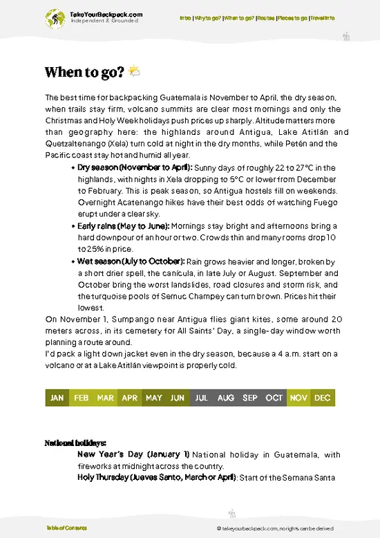
example page 0 from our offline Travel Guide for Guatemala
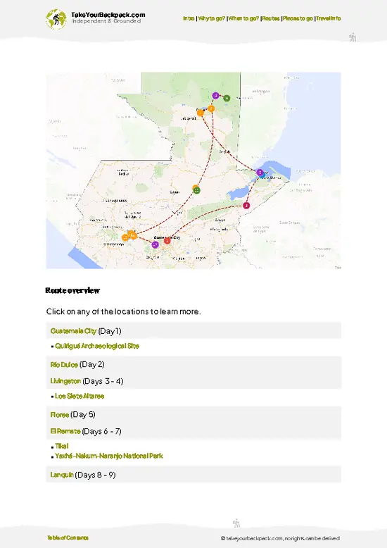
example page 1 from our offline Travel Guide for Guatemala
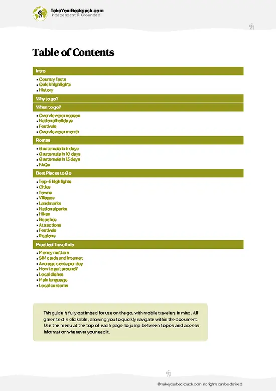
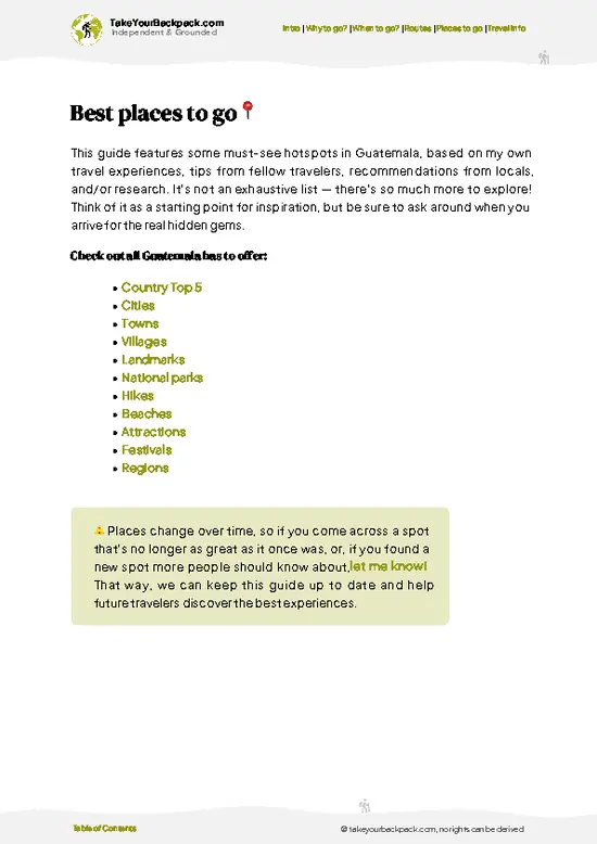
example page 2 from our offline Travel Guide for Guatemala
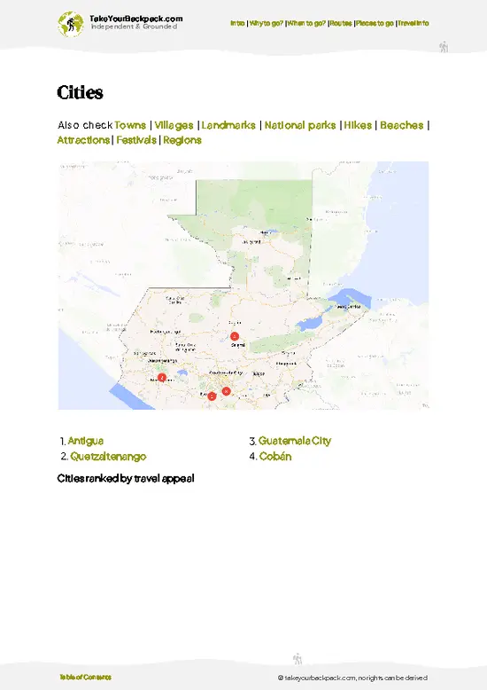
example page 3 from our offline Travel Guide for Guatemala
example page 4 from our offline Travel Guide for Guatemala
example page 5 from our offline Travel Guide for Guatemala
example page 6 from our offline Travel Guide for Guatemala
example page 7 from our offline Travel Guide for Guatemala
Loading the map 🌍
CLICK TO FILTER
cities
towns
villages
landmarks
national parks
hikes
beaches
attractions
festivals
regions
SHOW COUNTRY’S BESTSHOW ALL

✨ Why go?
Ranked #7 hike in Guatemala
What makes it a must-see hike

Lake Atitlán rewards backpackers because the distances are yours to choose. A stroll from San Pedro La Laguna to San Juan takes an hour or two, while a full day can link Santa Cruz La Laguna to Jaibalito and on to San Marcos by lakeside paths. You never commit to a long loop, since a launch is nearly always waiting at the next dock to carry you home, and tired legs are no problem.

The second pull is the density of villages. Each one has its own Maya identity, from Tz’utujil weaving cooperatives to coffee farms where you can watch beans being dried on patios. You walk through working life, not a reserve. Add the pre-dawn climb to Indian Nose above Santa Clara, and you get a volcano-framed sunrise for a short, manageable effort. It all fits easily into a longer route between Antigua and the highlands of Quetzaltenango.

💡 HighlightsThe experiences that define the visit

  1. Indian Nose (La Nariz del Indio): The lake’s signature viewpoint, reached by a steep 1 to 2 hour climb from San Juan La Laguna side trails or by road from Santa Clara. From the ridge you see all three volcanoes, Atitlán, Tolimán and San Pedro, with the lake spread below at sunrise.
  2. San Pedro Volcano: A hard, steep ascent of about 5 to 6 hours round trip through coffee farms and cloud forest. The top gives a panorama over the whole lake, and a guide is strongly advised.
  3. Santa Cruz to Jaibalito trail: A narrow path along the cliffs above the water linking two villages with no road access. It gives quiet views, small cafes and a boat ride out.
  4. San Juan La Laguna murals and weaving cooperatives: Painted walls line the village lanes, and women’s cooperatives demonstrate natural dyeing with plants
… read more 👉
  1. Indian Nose (La Nariz del Indio): The lake’s signature viewpoint, reached by a steep 1 to 2 hour climb from San Juan La Laguna side trails or by road from Santa Clara. From the ridge you see all three volcanoes, Atitlán, Tolimán and San Pedro, with the lake spread below at sunrise.
  2. San Pedro Volcano: A hard, steep ascent of about 5 to 6 hours round trip through coffee farms and cloud forest. The top gives a panorama over the whole lake, and a guide is strongly advised.
  3. Santa Cruz to Jaibalito trail: A narrow path along the cliffs above the water linking two villages with no road access. It gives quiet views, small cafes and a boat ride out.
  4. San Juan La Laguna murals and weaving cooperatives: Painted walls line the village lanes, and women’s cooperatives demonstrate natural dyeing with plants and cochineal. Walk the hill streets and buy directly from the weavers.
  5. Cerro de Oro viewpoint, near Santiago Atitlán: A short, manageable climb to a small hill between two volcanoes, with open views over the lake’s southern bay. It sees far fewer hikers than the better-known lookouts.
Indian Nose at sunrise and the San Juan murals and cooperatives work well together in one day, because you descend in time for a late breakfast and a gentle village stroll.
Spotted a mistake or missing something? Contact us.

Things to do around Lake Atitlán

Ratings based on Tripadvisor reviews. When you book through this link, you support our work at no extra cost to you.

🌤️ When to go?Choosing the right time of year

  • Dry Season (November to April): Mornings are crisp and clear, with volcano views from San Pedro and Panajachel at their sharpest. Lake-level highs run 22 to 26°C (72 to 79°F), and nights drop to 8 to 12°C (46 to 54°F). Daylight lasts about 11 to 12 hours, so start early.
  • Christmas to Semana Santa: Guatemalan families fill the lakeside villages, and dorm beds and boat seats cost more, often 20 to 40 percent above normal.
  • Rainy Season (May to October): Storms roll in after midday, trails turn to slick mud, and clouds hide the cones. Highs stay similar at 20 to 24°C (68 to 75°F). Prices dip and trails empty, and the hills turn deep green.
  • Late October and early November: Skies often clear again, and crowds are still thin.
Hike from November to February for the best views, and be off the ridge by early afternoon in any month.

source: climatestotravel.comJANJanuary: highly recommended for travelingFEBFebruary: highly recommended for travelingMARMarch: highly recommended for travelingAPRApril: highly recommended for travelingMAYMay: fair for travelingJUNJune: fair for travelingJULJuly: fair for travelingAUGAugust: fair for travelingSEPSeptember: fair for travelingOCTOctober: fair for travelingNOVNovember: highly recommended for travelingDECDecember: highly recommended for traveling
guatemala-hike-lake-atitlan
© Google | Martin Vidlička

✈️ The backpacker research shortcutGuatemala Travel Guide

An offline-friendly backpacking guide with optimized travel routes, ranked highlights, transport advice, and the best areas to stay.
example page 0 from our offline Travel Guide for Guatemala
example page 1 from our offline Travel Guide for Guatemala
example page 2 from our offline Travel Guide for Guatemala
example page 3 from our offline Travel Guide for Guatemala
example page 4 from our offline Travel Guide for Guatemala
example page 5 from our offline Travel Guide for Guatemala
example page 6 from our offline Travel Guide for Guatemala
example page 7 from our offline Travel Guide for Guatemala
The digital guide (272 pages) contains:
✅ 85 highlights, ranked by travel appeal
✅ Optimized 5, 10 & 15-day travel routes
✅ Cities, national parks, landmarks, beaches
✅ How to get around
✅ Offline-friendly for travel without Wi-Fi
👉 Click to see all 30+ guide features

📅 Plan smarter in minutes, not weeks
✅ Month by month travel advice
✅ Festivals & national holidays
✅ Budget expectations

🗺️ Go to the right places, skip the overrated ones
✅ Honest pros & cons of destinations
✅ Top hikes, parks & viewpoints
✅ Lesser-known places most travelers miss
✅ Clear “worth it vs skip it” guidance

🛏️ Travel smoothly without rookie mistakes
✅ Best areas to stay
✅ Transport systems explained simply
✅ Common scams & safety advice
✅ SIM cards, money & practical tips

🌍 Understand the country, not just visit it
✅ Culture & traditions
✅ 52 Essential phrases & customs
✅ Festivals worth planning around
✅ Traveler-friendly historical context
✅ Insights that make places more meaningful

📱 Built for real travel conditions
✅ Fully downloadable PDF
✅ Works completely offline
✅ Optimized for phone use
✅ Useful in remote areas & buses
✅ Everything in one place
Stop searching, start planning
Get instant access to your full guide. 30‑day money-back guarantee.
+ Add another guide for just

By proceeding you agree to our terms.
Sent to your inbox immediately after payment • 100% Secure Checkout
Best Backpacking Travel Advisor 2025 tourism awardBest Backpacking
Travel Advisor
2025
What others say about Take Your Backpack Guides:
⭐⭐⭐⭐⭐
Fantastic, amazing amount of information!
⭐⭐⭐⭐⭐
My goodness this is amazing, it's what I've been looking for hats off too you!
⭐⭐⭐⭐⭐
I think this is absolutely BRILLIANT
⭐⭐⭐⭐
Very complete and informative. It's still missing places, but I gotta to commend you
⭐⭐⭐⭐⭐
This is truly amazing, thank you, can't wait to explore it with my kids!
⭐⭐⭐⭐⭐
Awesome resource, thank you!
⭐⭐⭐⭐⭐
This is amazing! Can't wait to explore the ones I haven't seen
⭐⭐⭐⭐
I love this! Well done, great idea.
⭐⭐⭐⭐⭐
Thanks for taking the time to make this gem!
⭐⭐⭐⭐⭐
This might be the best website I've ever seen.
⭐⭐⭐⭐⭐
Congratulations, and thank you so much for your work; it's incredibly valuable.
⭐⭐⭐⭐
In all seriousness I think you did a great job pointing out the important spots
⭐⭐⭐⭐⭐
10/10 very good
⭐⭐⭐⭐⭐
As someone who's only just starting to visit regularly this is awesome, thank you.
⭐⭐⭐⭐
Thank you very much! I'm going to visit my dad, it's going to be very useful!
⭐⭐⭐⭐⭐
This is really cool! We'll be travelling for the first time and this definitely come in handy.
⭐⭐⭐⭐⭐
You are now our minister of culture, congratulations 👨‍💼
⭐⭐⭐⭐⭐
Just wanted to tell you that this is a pearl! Going to follow your recommendations.
⭐⭐⭐⭐⭐
This is so cool. I'll definitely be using the resource for my travels soon.
⭐⭐⭐⭐⭐
This is very impressive! Good work.
⭐⭐⭐⭐⭐
This is an amazing and informative site. Very well done!

🛏️ Where to stay?How to pick the right area

If you enjoy meeting fellow travelers, consider choosing hostels with high ratings for atmosphere. On the other hand, if you prefer having your own space, a hotel might be a better option.

🥾 Hike detailsRoute, distance, and difficulty explained

Total Distance: Lake Atitlán has no single set route; a typical multi-village traverse covers about 15 to 20 kilometers, while individual stretches run 3 to 8 kilometers.
Estimated Duration: One to two days at an easy pace, with boats for returns.
Difficulty: Easy to moderate on village paths; the volcano and Indian Nose climbs are steep and strenuous.
Starting Point: Panajachel is the main hub, reached by shuttle or chicken bus from Guatemala City, Antigua or Quetzaltenango. From there, public boats run to the villages along the shore.
Major Landmarks:
  • Santa Cruz La Laguna: Cliff-top village with
… read more 👉
Total Distance: Lake Atitlán has no single set route; a typical multi-village traverse covers about 15 to 20 kilometers, while individual stretches run 3 to 8 kilometers.
Estimated Duration: One to two days at an easy pace, with boats for returns.
Difficulty: Easy to moderate on village paths; the volcano and Indian Nose climbs are steep and strenuous.
Starting Point: Panajachel is the main hub, reached by shuttle or chicken bus from Guatemala City, Antigua or Quetzaltenango. From there, public boats run to the villages along the shore.
Major Landmarks:
  • Santa Cruz La Laguna: Cliff-top village with a trail dropping to the shore.
  • Jaibalito: Tiny roadless hamlet with lakeside paths.
  • San Pedro and San Juan: Twin Tz’utujil towns joined by a footpath.
  • Indian Nose: Summit lookout above Santa Clara.
Terrain and Scenery: Rocky footpaths, stone steps, cliff edges and steep farm terraces, with constant views of the water and volcanoes.
Vegetation: Coffee plantations, avocado trees, corn plots, pine and oak forest, and cloud forest higher on San Pedro.
Wildlife: Birds are the main draw, including hummingbirds and motmots. Coyotes and small mammals are rarely seen.
⚠️ Hiking info can sometimes be outdated or inaccurate. Before you hit the trail, check the latest conditions with locals. If you do spot anything that's off, I'd love to hear from you, so I can update it for fellow travelers.

🛡️ SafetyTraveler Safety Guide

Lake Atitlán hiking is mostly straightforward, but two things catch people out: afternoon storms and robbery on remote trails. Walk the popular routes, such as the Indian Nose sunrise climb above San Juan La Laguna or the lakeside paths between villages, in daylight and in a group, or hire a local guide, since isolated stretches have seen muggings in the past. Ask your hostel or the local guide association about current conditions before setting out. Volcano climbs on San Pedro and Atitlán are steep, loose and dusty, so bring grippy shoes, 2 liters of water and a headlamp for predawn starts. Cloud and rain arrive by early afternoon in the wet months, so finish early. Lake winds, called the Xocomil, build around midday, which makes boats choppy. Take the morning crossing.

FAQTraveler FAQ

Most Lake Atitlán hikes take 2 to 6 hours, depending on the route. The Indian Nose sunrise climb above San Juan La Laguna needs about 1 to 1.5 hours up, while the San Pedro Volcano summit takes 4 to 5 hours up and about 3 down. Walking the lakeside trail between villages such as Santa Cruz and Jaibalito takes roughly 1.5 to 2 hours.
Lake Atitlán hikes range from easy to demanding. The village-to-village trails and Indian Nose (about 2,200 meters) are moderate, with steady climbs and some loose footing. San Pedro Volcano, at 3,020 meters, is steep and tiring, with a climb of around 1,300 meters from the lake, so it suits fit hikers who start before dawn. Tolimán and Atitlán volcanoes are tougher still.
Lake Atitlán has no general permit for most hikes, but guides are strongly advised on the volcanoes and Indian Nose. Entry fees are small, usually US$3 to 7, and a guided sunrise hike runs about US$8 to 20 per person. Book through your hostel in Panajachel, San Pedro La Laguna or San Juan La Laguna, since guides add safety on isolated trails.
⚠️ Things can change over time, so always validate details locally before you go.

Other Guatemalan hikes near Lake Atitlán

Explore more nearby:

  • Santa María Volcano—Santiaguito dome, Llano del Pinal, steep roots, Xela sunrise| 38 km away
  • Acatenango Volcano—Fuego eruptions, ridge camp, ash scramble, pre-dawn summit| 41 km away
  • Mirador de la Cruz—Wooden cross, milpa slopes, Santa María view, short half day| 41 km away

💡 Not sure where to go next?
Create a personalized itinerary for Guatemala including Lake Atitlán and the places that fit your trip.

Generate my itinerary

👉 Discover all hikes

Or checkout all Guatemala has to offer (think cities, towns, villages, national parks, hikes, beaches, festivals)
Country photo of Guatemala

We 💚 feedbackKey takeaways before you go

Lake Atitlán deserves four or five days, not a rushed overnight. That gives you time for one sunrise climb, one lakeside traverse and a lazy day in a village to rest your legs. I would skip the dark solo hikes, hire a guide when in doubt, and base yourself across two villages.

✈️ When did I visit Guatemala?
Guatemala I visited during my half year trip through South and Central America back in 2003

✍️ Help improve this page!
The information on this page is based on my own backpacking experience in Guatemala, supplemented with up-to-date research and feedback from other travelers. Travel details can change, so if you notice anything outdated or incomplete, feel free to let me know.


🙋‍♂️ Give feedback

👋 Meet the founderWho’s Behind Take Your Backpack?

Johan, backpacker and founder of TakeYourBackpackHi, I’m Johan (Netherlands 🇳🇱), the creator of TakeYourBackpack. Over the past 3 decades, I’ve backpacked through 90+ countries across six continents, gaining extensive experience with independent travel, long-term trips, and overland routes.

This site is built on a combination of firsthand travel experience and carefully curated insights from other backpackers. Many guides are based on places I’ve personally visited, while others bring together tips, observations, and practical advice shared by trusted travelers I’ve met along the way.

The goal is to provide realistic, experience-driven guidance — not generic itineraries — so you can explore destinations with better context, clearer expectations, and more confidence.