×

Guatemala🇬🇹 | best hikesExplore the 8 Best hikes in Guatemala

Hiking in Guatemala means climbing through cloud forest that smells of wet moss and woodsmoke, or scrambling over loose volcanic cinders while sulfur stings your nose. Most routes sit on a chain of volcanoes and highlands, so effort is steep and short rather than long. The western highlands around Lake Atitlán and Quetzaltenango give cool air, Maya villages and cheap, easy access by chicken bus. Around Antigua, trails are busy and often guided. The northern lowlands trade altitude for steamy jungle and long, hot approaches. Independent travelers can do most of it on a modest budget.

By Johan Kruseman 🇳🇱 | Updated October 23, 2026
Explore the best beaches in Guatemala

Why go?What Makes Them Special

Guatemala packs an unusual amount of volcanic terrain into a country about the size of Tennessee. More than 30 volcanoes line the Pacific side, and a few erupt in plumes or glowing flows you can watch at night from a ridge. That means summit hikes with real drama: black ash underfoot, steam vents, and cold wind at dawn above a sea of cloud.

The second reason is culture. Highland trails often cross working Maya farmland, where K’iche’, Kaqchikel and Mam communities grow corn on slopes steep enough to look vertical. Paths double as village routes, so you meet people carrying firewood or produce, and the air carries the smell of cooking fires and pine.

The third is infrastructure, which is uneven. Hostels, agencies and shuttles in Antigua, Panajachel and Quetzaltenango make logistics simple … read more 👉
Guatemala packs an unusual amount of volcanic terrain into a country about the size of Tennessee. More than 30 volcanoes line the Pacific side, and a few erupt in plumes or glowing flows you can watch at night from a ridge. That means summit hikes with real drama: black ash underfoot, steam vents, and cold wind at dawn above a sea of cloud.

The second reason is culture. Highland trails often cross working Maya farmland, where K’iche’, Kaqchikel and Mam communities grow corn on slopes steep enough to look vertical. Paths double as village routes, so you meet people carrying firewood or produce, and the air carries the smell of cooking fires and pine.

The third is infrastructure, which is uneven. Hostels, agencies and shuttles in Antigua, Panajachel and Quetzaltenango make logistics simple and cheap. Beyond them, signage is thin, trails can be muddy and eroded, and many routes require a local guide or are strongly advised with one for security reasons.

Before choosing Guatemala, know that altitude matters: summits reach roughly 3,500 to 4,200 meters, and nights are cold. Expect rain, fog, and thin tracks. In return you get compact, high-impact days that cost little and end with a hot meal in a village market.
Behind the Scenes of Selection
The list of best hikes in Guatemala is created based on scenery, challenge, trail quality, landmarks, and overall enjoyment. If you feel a hike is missing in this list, please let us know.

When to go?Seasonal Guide to Visiting

Best months: The best months for hiking in Guatemala are November to March, when the dry season brings clear mornings and the best chance of open volcano views. Days in the highlands run roughly 18 to 24°C, but summit and ridge nights can drop to near or below freezing, with frost on grass around Quetzaltenango and the high volcanoes. December and January are the coldest, with sharp, crisp light and wind that bites at dawn.
Shoulder and wet season: April and May are the hottest and dustiest, with haze from burning fields that can flatten views, though temperatures climb to 28 to 32°C on lower slopes. The rainy season runs May to October. Expect afternoon downpours, slick clay trails and cloud that closes in by midday. Starting at first light usually gets you a dry window, and September and … read more 👉
Best months: The best months for hiking in Guatemala are November to March, when the dry season brings clear mornings and the best chance of open volcano views. Days in the highlands run roughly 18 to 24°C, but summit and ridge nights can drop to near or below freezing, with frost on grass around Quetzaltenango and the high volcanoes. December and January are the coldest, with sharp, crisp light and wind that bites at dawn.
Shoulder and wet season: April and May are the hottest and dustiest, with haze from burning fields that can flatten views, though temperatures climb to 28 to 32°C on lower slopes. The rainy season runs May to October. Expect afternoon downpours, slick clay trails and cloud that closes in by midday. Starting at first light usually gets you a dry window, and September and October are typically the wettest, with annual rainfall in the highlands often exceeding 1,500 mm. Trails can be muddy and rivers may rise.
Crowds and prices: Peak periods are Christmas to New Year and Semana Santa (the week before Easter), when Antigua fills, guided groups sell out and accommodation prices rise noticeably. Low season brings quieter trails and easy bargaining. In the northern lowlands, around Petén, it is hot and humid year-round (often 30°C or more), and the dry months are the easier time for walking jungle paths.

hike hoppingHow to Combine hikes Into One Trip

How many days: A trip combining several hikes in Guatemala needs 10 to 14 days, which allows for rest days and weather slips. The country is small, but roads wind, and distances look short on a map while taking hours on a bus.
Direction and grouping: Start in Antigua, which sits about 1 to 1.5 hours from Guatemala City airport by shuttle and gets you used to altitude gently. From there, go west to Lake Atitlán (around 2.5 to 3.5 hours by shuttle), then on to Quetzaltenango (roughly 2 to 3 hours from Panajachel with a change at Los Encuentros). The three form a natural line through the highlands. The north, around Flores and Petén, sits far away: a night bus or roughly 8 to 10 hours of daytime driving from the capital, or a short flight. Treat it as a separate leg at the start or end.
Time per … read more 👉
How many days: A trip combining several hikes in Guatemala needs 10 to 14 days, which allows for rest days and weather slips. The country is small, but roads wind, and distances look short on a map while taking hours on a bus.
Direction and grouping: Start in Antigua, which sits about 1 to 1.5 hours from Guatemala City airport by shuttle and gets you used to altitude gently. From there, go west to Lake Atitlán (around 2.5 to 3.5 hours by shuttle), then on to Quetzaltenango (roughly 2 to 3 hours from Panajachel with a change at Los Encuentros). The three form a natural line through the highlands. The north, around Flores and Petén, sits far away: a night bus or roughly 8 to 10 hours of daytime driving from the capital, or a short flight. Treat it as a separate leg at the start or end.
Time per stop: Allow 2 to 4 days in each highland base: one for the hike, one to recover or for a second route, plus arrival time. Add a spare day for rain.
Common mistakes: Travelers stack summit dawn starts back to back, then arrive exhausted with sore knees. Space hard days apart. Another mistake is booking tight onward buses after a night hike. Leave slack, since chicken buses fill and roads close for landslides in the wet months. Do not cram the north into a short trip; either commit two to three days or skip it.

The ListHighly Recommended hikes of Guatemala

1 Acatenango Volcano

Fuego eruptions, ridge camp, ash scramble, pre-dawn summit

Climb through pine forest to a ridge camp facing Fuego, then scramble loose ash before dawn to the crater rim.

guatemala-hike-acatenango-volcano
© Google | Backpackingpeanuts

2 Tajumulco Volcano

Central America’s highest point, bunchgrass camp, twin craters, Tuichán start

Camp on a windy meadow below the final slope, then reach the 4,220-meter rim at first light above a floor of cloud.

3 El Mirador Trek

Petén jungle, La Danta, mule trail, howler monkeys

Trek about 60 kilometers from Carmelita through mud and rainforest to reach pyramids rising above an unbroken canopy.

guatemala-hike-el-mirador-trek
© Google |

4 Santa María Volcano

Santiaguito dome, Llano del Pinal, steep roots, Xela sunrise

Grind 1,200 meters up from the pine village of Llano del Pinal to look down on a lava dome erupting.

5 Semuc Champey to Lanquín Trail

Turquoise terraces, limestone bridge, jungle stairs, Lanquín market

Cross wet roots and plank sections to a platform above the pools, then swim and end among Lanquín’s grill stalls.

guatemala-hike-semuc-champey-to-lanquin-trail
© Google |

6 Lake Atitlán

Indian Nose sunrise, village trails, San Pedro climb, boat hops

Link lakeside villages on foot, climb to lookouts over three volcanoes, and take a public boat back when your legs give out.

guatemala-hike-lake-atitlan
© Google | Martin Vidlička

7 Todos Santos Cuchumatán

La Torre 3,837 m, Mam ridgelines, pine moorland, thin air

Ride 30 minutes out of town, then climb about two hours on foot to open moorland at the highest point of the Cuchumatanes.

8 El Cimarrón

Sinkhole rim, 170 to 200 m drop, guided abseil, gravel climb

Climb a 2.5 km gravel track through forest to rim viewpoints over a flat, green sinkhole floor that only a guided rope descent reaches.

Loading the map 🌍

Expert viewInsights from Locals and Experts

How many hikes: I advise three to five hikes for a typical backpacker. Guatemala’s climbs are steep, often start at 2 a.m., and leave your legs wrecked for a day. Fewer than three wastes the effort of getting here; more than five and the days blur into mud, ash and bus seats. Spacing them with rest days keeps you sharp at altitude, and you finish each one with a hot corn tortilla breakfast and a view that earns it.
Which kind to prioritize: First-timers and those short of time do best with one active volcano and one gentler highland route, since the glowing night view and the cool misty ridge are very different experiences. Travelers who like culture should favor village-to-village trails around the lake and Quetzaltenango, where you pass milpa fields, weaving women and the smell of woodsmoke. … read more 👉
How many hikes: I advise three to five hikes for a typical backpacker. Guatemala’s climbs are steep, often start at 2 a.m., and leave your legs wrecked for a day. Fewer than three wastes the effort of getting here; more than five and the days blur into mud, ash and bus seats. Spacing them with rest days keeps you sharp at altitude, and you finish each one with a hot corn tortilla breakfast and a view that earns it.
Which kind to prioritize: First-timers and those short of time do best with one active volcano and one gentler highland route, since the glowing night view and the cool misty ridge are very different experiences. Travelers who like culture should favor village-to-village trails around the lake and Quetzaltenango, where you pass milpa fields, weaving women and the smell of woodsmoke. Serious trekkers can add a multi-day route in the Cuchumatanes or the north, where you sleep in simple shelters and walk mostly alone. Those on a tight budget should choose the self-guided or small-group trails near towns, since transport costs stay low.
What it costs: Budget US$25 to 45 a day including food, a dorm bed and local buses. Park and volcano entry fees are usually about US$4 to 15 (roughly Q30 to 120). Guides cost around US$10 to 30 per person in a group, or US$40 to 80 for a private day. Shuttles to trailheads run US$5 to 15. Sunrise tours from Antigua often bundle transport, a guide and breakfast for US$35 to 60. Carry quetzales in small bills, since village shops rarely change large notes.
Safety and culture: Hike with a local guide on popular volcano routes. Robberies on trails have happened, and a guide who knows the community and the police patrols is your best protection. Avoid walking after dark outside organized groups, and leave valuables at your hostel. Check volcano activity with INSIVUMEH, the national agency, before you go. Eruptions can close routes at short notice, so stay flexible.

Pack layers: it is cold at dawn, hot by noon, and soaked by the afternoon rain. Ask before photographing people, especially children and women in traditional dress, and greet villagers with a quiet “buenos días.” Many highland communities own the land you cross, so pay trail fees to them directly. Your fee supports a family, and in return you get a safe passage, a friendly welcome and often a cup of sweet coffee on the way down.

✈️ The backpacker research shortcutGuatemala Travel Guide

An offline-friendly backpacking guide with optimized travel routes, ranked highlights, transport advice, and the best areas to stay.
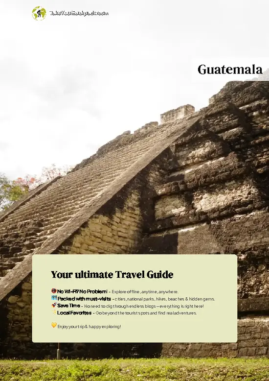
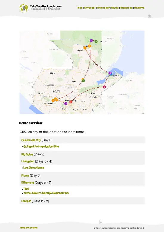
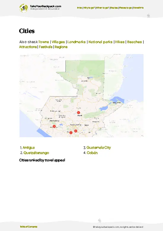
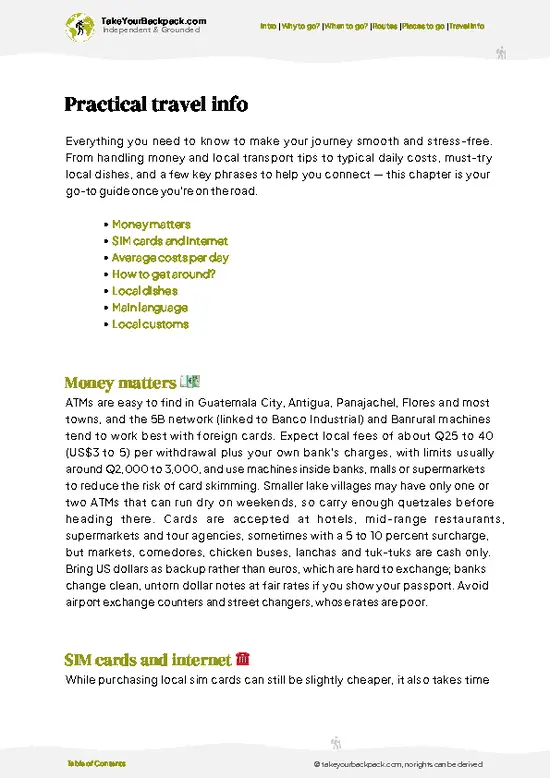
example page 0 from our offline Travel Guide for Guatemala
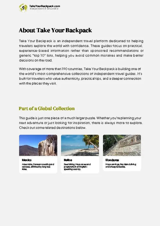
example page 1 from our offline Travel Guide for Guatemala
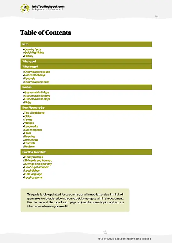
example page 2 from our offline Travel Guide for Guatemala
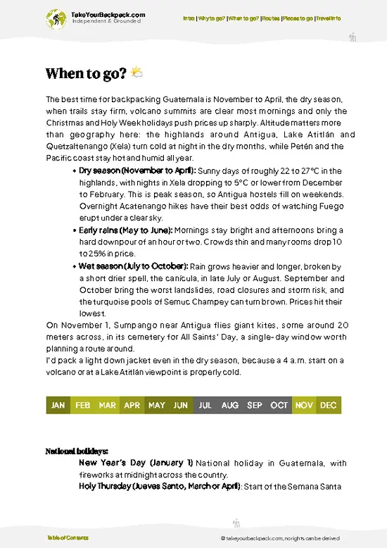
example page 3 from our offline Travel Guide for Guatemala
example page 4 from our offline Travel Guide for Guatemala
example page 5 from our offline Travel Guide for Guatemala
example page 6 from our offline Travel Guide for Guatemala
example page 7 from our offline Travel Guide for Guatemala
The digital guide (272 pages) contains:
✅ 85 highlights, ranked by travel appeal
✅ Optimized 5, 10 & 15-day travel routes
✅ Cities, national parks, landmarks, beaches
✅ How to get around
✅ Offline-friendly for travel without Wi-Fi
👉 Click to see all 30+ guide features

📅 Plan smarter in minutes, not weeks
✅ Month by month travel advice
✅ Festivals & national holidays
✅ Budget expectations

🗺️ Go to the right places, skip the overrated ones
✅ Honest pros & cons of destinations
✅ Top hikes, parks & viewpoints
✅ Lesser-known places most travelers miss
✅ Clear “worth it vs skip it” guidance

🛏️ Travel smoothly without rookie mistakes
✅ Best areas to stay
✅ Transport systems explained simply
✅ Common scams & safety advice
✅ SIM cards, money & practical tips

🌍 Understand the country, not just visit it
✅ Culture & traditions
✅ 52 Essential phrases & customs
✅ Festivals worth planning around
✅ Traveler-friendly historical context
✅ Insights that make places more meaningful

📱 Built for real travel conditions
✅ Fully downloadable PDF
✅ Works completely offline
✅ Optimized for phone use
✅ Useful in remote areas & buses
✅ Everything in one place
Stop searching, start planning
Get instant access to your full guide. 30‑day money-back guarantee.
+ Add another guide for just

By proceeding you agree to our terms.
Sent to your inbox immediately after payment • 100% Secure Checkout
Best Backpacking Travel Advisor 2025 tourism awardBest Backpacking
Travel Advisor
2025
What others say about Take Your Backpack Guides:
⭐⭐⭐⭐⭐
Fantastic, amazing amount of information!
⭐⭐⭐⭐⭐
My goodness this is amazing, it's what I've been looking for hats off too you!
⭐⭐⭐⭐⭐
I think this is absolutely BRILLIANT
⭐⭐⭐⭐
Very complete and informative. It's still missing places, but I gotta to commend you
⭐⭐⭐⭐⭐
This is truly amazing, thank you, can't wait to explore it with my kids!
⭐⭐⭐⭐⭐
Awesome resource, thank you!
⭐⭐⭐⭐⭐
This is amazing! Can't wait to explore the ones I haven't seen
⭐⭐⭐⭐
I love this! Well done, great idea.
⭐⭐⭐⭐⭐
Thanks for taking the time to make this gem!
⭐⭐⭐⭐⭐
This might be the best website I've ever seen.
⭐⭐⭐⭐⭐
Congratulations, and thank you so much for your work; it's incredibly valuable.
⭐⭐⭐⭐
In all seriousness I think you did a great job pointing out the important spots
⭐⭐⭐⭐⭐
10/10 very good
⭐⭐⭐⭐⭐
As someone who's only just starting to visit regularly this is awesome, thank you.
⭐⭐⭐⭐
Thank you very much! I'm going to visit my dad, it's going to be very useful!
⭐⭐⭐⭐⭐
This is really cool! We'll be travelling for the first time and this definitely come in handy.
⭐⭐⭐⭐⭐
You are now our minister of culture, congratulations 👨‍💼
⭐⭐⭐⭐⭐
Just wanted to tell you that this is a pearl! Going to follow your recommendations.
⭐⭐⭐⭐⭐
This is so cool. I'll definitely be using the resource for my travels soon.
⭐⭐⭐⭐⭐
This is very impressive! Good work.
⭐⭐⭐⭐⭐
This is an amazing and informative site. Very well done!

🛏️ Where to stay?Accommodation Highlights

Hostels and budget beds are easy to find in Guatemala, with dorms typically running Q80 to 150 (US$10 to 20) and simple private rooms from about Q200 (US$26), clustered in a handful of traveler hubs. Antigua has the widest choice within walking distance of its cobbled center, bars and volcano-tour operators, though prices run highest here and some hostels near the central streets stay loud late into the night. At Lake Atitlán, San Pedro La Laguna is the cheap, social base with plenty of nightlife, San Marcos La Laguna is quieter and leans toward yoga retreats, while Flores works as the compact island gateway to Tikal and Guatemala City’s Zona 10 and Zona 13 are the safer picks for an airport … read more 👉
Hostels and budget beds are easy to find in Guatemala, with dorms typically running Q80 to 150 (US$10 to 20) and simple private rooms from about Q200 (US$26), clustered in a handful of traveler hubs. Antigua has the widest choice within walking distance of its cobbled center, bars and volcano-tour operators, though prices run highest here and some hostels near the central streets stay loud late into the night. At Lake Atitlán, San Pedro La Laguna is the cheap, social base with plenty of nightlife, San Marcos La Laguna is quieter and leans toward yoga retreats, while Flores works as the compact island gateway to Tikal and Guatemala City’s Zona 10 and Zona 13 are the safer picks for an airport night compared with the grittier Zona 1.

If you enjoy meeting fellow travelers, consider choosing hostels with high ratings for atmosphere. On the other hand, if you prefer having your own space, a hotel might be a better option.

GuatemalaSee More of Guatemala

👋 Meet the founderWho’s Behind Take Your Backpack?

Johan, backpacker and founder of TakeYourBackpackHi, I’m Johan (Netherlands 🇳🇱), the creator of TakeYourBackpack. Over the past 3 decades, I’ve backpacked through 90+ countries across six continents, gaining extensive experience with independent travel, long-term trips, and overland routes.

This site is built on a combination of firsthand travel experience and carefully curated insights from other backpackers. Many guides are based on places I’ve personally visited, while others bring together tips, observations, and practical advice shared by trusted travelers I’ve met along the way.

The goal is to provide realistic, experience-driven guidance — not generic itineraries — so you can explore destinations with better context, clearer expectations, and more confidence.