×

Honduras🇭🇳 | national parksCelaque National ParkCerro las Minas summit, overnight climb, cold river pools, Don Tomás camp | things to do and best time to go

Explore El Bejuco Waterfall TrailExplore Cerro Azul Meámbar National Park

Backpacking in Celaque
🏆 Top picknational park ranked #3
By Johan Kruseman 🇳🇱 | Updated October 23, 2026

The cloud forest dripped on my hood, and the loud crashing ahead turned out to be a small bird scratching through the leaf litter, not the large animal I braced for. Celaque National Park sits in western Honduras, in the Lempira highlands above the town of Gracias, with peaks above 2,800 meters. Expect steep, muddy, rooty hiking, thick fog, and mossy forest with real chances at quetzals, toucanets and monkeys. Crowds are almost nil. Costly mistakes: arriving without cash for the village shops, setting out late on the summit route, and skipping a rain shell. Carry small bills, start at dawn, pack waterproofs. Skip the lower ridges if you want views. Fit hikers who like solitude will love it. Anyone wanting easy, signed, paved paths should go elsewhere.

Discover everything you want to know in the 📖 Honduras Travel Guide.


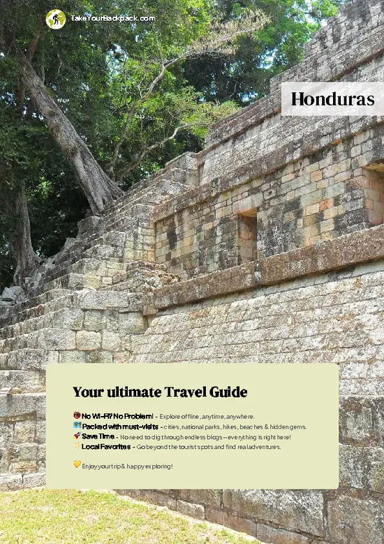
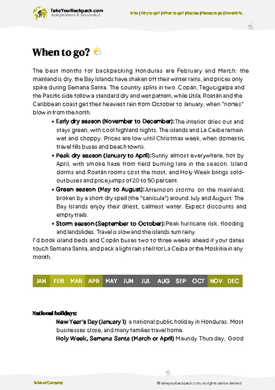
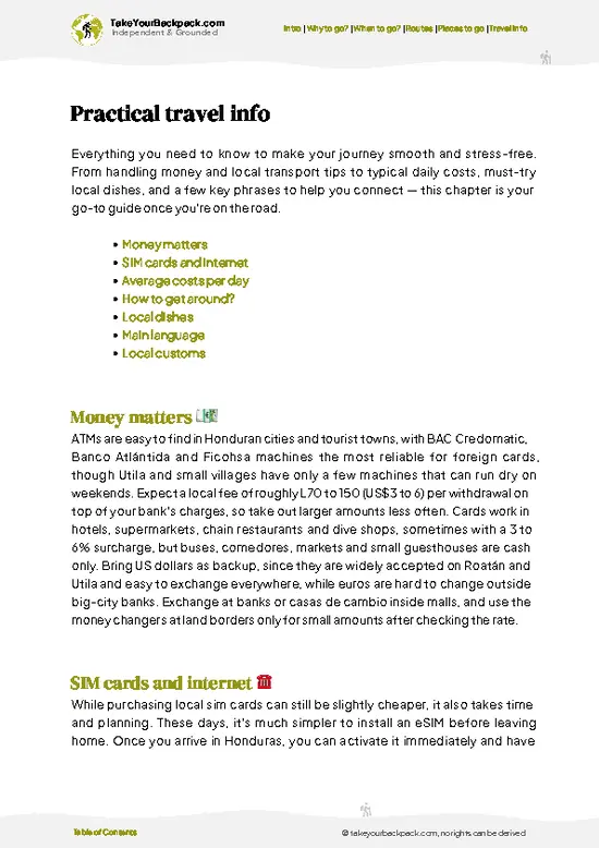
example page 0 from our offline Travel Guide for Honduras
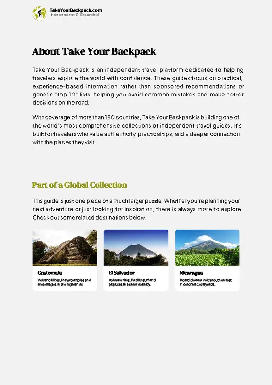
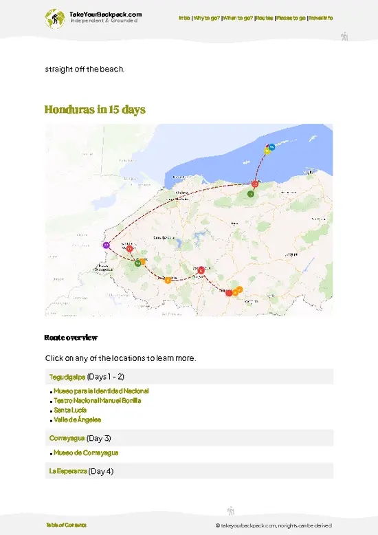
example page 1 from our offline Travel Guide for Honduras
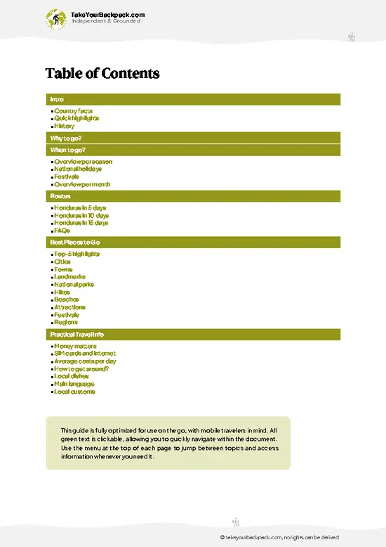
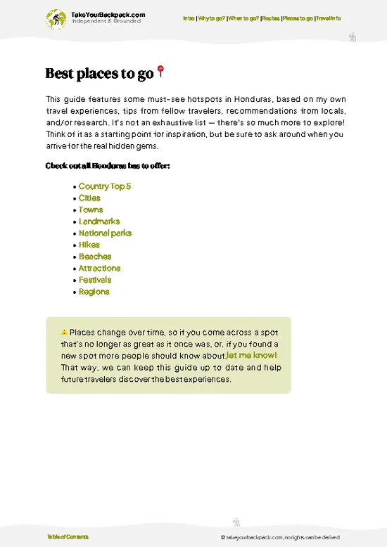
example page 2 from our offline Travel Guide for Honduras
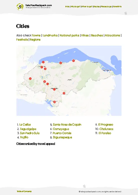
example page 3 from our offline Travel Guide for Honduras
example page 4 from our offline Travel Guide for Honduras
example page 5 from our offline Travel Guide for Honduras
example page 6 from our offline Travel Guide for Honduras
example page 7 from our offline Travel Guide for Honduras
Loading the map 🌍
CLICK TO FILTER
cities
towns
landmarks
national parks
hikes
beaches
attractions
festivals
regions
SHOW COUNTRY’S BESTSHOW ALL

✨ Why go?
Ranked #3 national park in Honduras
Why Celaque should be on your travel list

Celaque National Park suits people who like earning their scenery without a tour group in sight. The big draw is Cerro las Minas, the highest point in Honduras at roughly 2,870 meters, reached on a hard overnight hike through cloud forest that you can organize yourself at the visitor center. Nobody herds you along. You carry your own food, sleep in a basic camp, and set your pace.

The second reason is the water. Celaque means “box of water” in the local Lenca tongue, and more than a dozen rivers start on these slopes, so streams, pools and waterfalls keep appearing on the lower trails. The day walk to the Quebrada Los Naranjos area gives you that without committing to the summit.

The park is also a better fit than most Honduran reserves for independent travelers: the base town of Gracias … read more 👉
Celaque National Park suits people who like earning their scenery without a tour group in sight. The big draw is Cerro las Minas, the highest point in Honduras at roughly 2,870 meters, reached on a hard overnight hike through cloud forest that you can organize yourself at the visitor center. Nobody herds you along. You carry your own food, sleep in a basic camp, and set your pace.

The second reason is the water. Celaque means “box of water” in the local Lenca tongue, and more than a dozen rivers start on these slopes, so streams, pools and waterfalls keep appearing on the lower trails. The day walk to the Quebrada Los Naranjos area gives you that without committing to the summit.

The park is also a better fit than most Honduran reserves for independent travelers: the base town of Gracias is walkable, trailheads sit close, and guides are optional on the lower routes but worth hiring for the summit.

💡 HighlightsDon't-miss highlights and experiences

  1. Cerro las Minas summit: The highest point in Honduras, around 2,870 meters, reached on a long overnight climb through oak, pine and dripping cloud forest. Views open only when the fog lifts.
  2. Cloud forest at Los Naranjos: Moss-draped trees, giant ferns and orchids line the trail from the main visitor center. It is the easiest place to sense why the park exists.
  3. Resplendent quetzal territory: The upper forest shelters quetzals, most reliably seen early in the morning near fruiting trees. Patience and binoculars help more than speed.
  4. River crossings: Streams pour down from the slopes all year. Cold pools and small cascades along the lower route make good rest stops.
  5. Visitor center and interpretive trail: A short, well-marked walk near the entrance, useful for spotting birds and learning the park’s
… read more 👉
  1. Cerro las Minas summit: The highest point in Honduras, around 2,870 meters, reached on a long overnight climb through oak, pine and dripping cloud forest. Views open only when the fog lifts.
  2. Cloud forest at Los Naranjos: Moss-draped trees, giant ferns and orchids line the trail from the main visitor center. It is the easiest place to sense why the park exists.
  3. Resplendent quetzal territory: The upper forest shelters quetzals, most reliably seen early in the morning near fruiting trees. Patience and binoculars help more than speed.
  4. River crossings: Streams pour down from the slopes all year. Cold pools and small cascades along the lower route make good rest stops.
  5. Visitor center and interpretive trail: A short, well-marked walk near the entrance, useful for spotting birds and learning the park’s water-catching role for nearby communities.
  6. Monkeys: Troops move through the canopy and often announce themselves by sound long before you see them. Listen at dawn.
  7. Upper camp at Campamento Don Tomás: A rustic overnight halt on the way to the summit, where the forest sounds change completely after dark.
The visitor center walk and the Los Naranjos forest trail fit easily into one morning, leaving the afternoon for returning to Gracias.
Spotted a mistake or missing something? Contact us.

Things to do near Celaque National Park

Ratings based on Tripadvisor reviews. When you book through this link, you support our work at no extra cost to you.

🌤️ When to go?Weather, crowds, and seasonal trade-offs

  • Dry Season (November to April): Trails are firmest and the summit views from the cloud forest are most likely to open up. Days reach 20 to 25°C (68 to 77°F) in the lower park, while nights near the high camps drop to 3 to 8°C (37 to 46°F). Sunrise comes around 6 a.m. and light fades by early evening, so start hiking early.
  • Holy Week and Christmas: Honduran families travel, so Gracias guesthouses fill and prices climb 10 to 20 percent. The trails themselves stay quiet.
  • Wet Season (May to October): Afternoon downpours turn the steep paths to Las Minas into mud and swell the streams. Expect 15 to 22°C (59 to 72°F) in the forest, with cloud covering the peaks for days. Lodging is cheapest and you will often have the park to yourself.
  • Hurricane Window (September to November): Tropical systems can
… read more 👉
  • Dry Season (November to April): Trails are firmest and the summit views from the cloud forest are most likely to open up. Days reach 20 to 25°C (68 to 77°F) in the lower park, while nights near the high camps drop to 3 to 8°C (37 to 46°F). Sunrise comes around 6 a.m. and light fades by early evening, so start hiking early.
  • Holy Week and Christmas: Honduran families travel, so Gracias guesthouses fill and prices climb 10 to 20 percent. The trails themselves stay quiet.
  • Wet Season (May to October): Afternoon downpours turn the steep paths to Las Minas into mud and swell the streams. Expect 15 to 22°C (59 to 72°F) in the forest, with cloud covering the peaks for days. Lodging is cheapest and you will often have the park to yourself.
  • Hurricane Window (September to November): Tropical systems can bring multi-day rain and landslides on access roads.
For the best balance of dry trails and green forest, aim for late November through February, and book Gracias beds ahead for Holy Week.


source: climatestotravel.comJANJanuary: highly recommended for travelingFEBFebruary: excellent for travelingMARMarch: excellent for travelingAPRApril: excellent for travelingMAYMay: fair for travelingJUNJune: fair for travelingJULJuly: fair for travelingAUGAugust: fair for travelingSEPSeptember: fair for travelingOCTOctober: fair for travelingNOVNovember: highly recommended for travelingDECDecember: highly recommended for traveling
when-to-go

✈️ The backpacker research shortcutHonduras Travel Guide

An offline-friendly backpacking guide with optimized travel routes, ranked highlights, transport advice, and the best areas to stay.
example page 0 from our offline Travel Guide for Honduras
example page 1 from our offline Travel Guide for Honduras
example page 2 from our offline Travel Guide for Honduras
example page 3 from our offline Travel Guide for Honduras
example page 4 from our offline Travel Guide for Honduras
example page 5 from our offline Travel Guide for Honduras
example page 6 from our offline Travel Guide for Honduras
example page 7 from our offline Travel Guide for Honduras
The digital guide (250 pages) contains:
✅ 70 highlights, ranked by travel appeal
✅ Optimized 5, 10 & 15-day travel routes
✅ Cities, national parks, landmarks, beaches
✅ How to get around
✅ Offline-friendly for travel without Wi-Fi
👉 Click to see all 30+ guide features

📅 Plan smarter in minutes, not weeks
✅ Month by month travel advice
✅ Festivals & national holidays
✅ Budget expectations

🗺️ Go to the right places, skip the overrated ones
✅ Honest pros & cons of destinations
✅ Top hikes, parks & viewpoints
✅ Lesser-known places most travelers miss
✅ Clear “worth it vs skip it” guidance

🛏️ Travel smoothly without rookie mistakes
✅ Best areas to stay
✅ Transport systems explained simply
✅ Common scams & safety advice
✅ SIM cards, money & practical tips

🌍 Understand the country, not just visit it
✅ Culture & traditions
✅ 52 Essential phrases & customs
✅ Festivals worth planning around
✅ Traveler-friendly historical context
✅ Insights that make places more meaningful

📱 Built for real travel conditions
✅ Fully downloadable PDF
✅ Works completely offline
✅ Optimized for phone use
✅ Useful in remote areas & buses
✅ Everything in one place
Stop searching, start planning
Get instant access to your full guide. 30‑day money-back guarantee.
+ Add another guide for just

By proceeding you agree to our terms.
Sent to your inbox immediately after payment • 100% Secure Checkout
Best Backpacking Travel Advisor 2025 tourism awardBest Backpacking
Travel Advisor
2025
What others say about Take Your Backpack Guides:
⭐⭐⭐⭐⭐
Fantastic, amazing amount of information!
⭐⭐⭐⭐⭐
My goodness this is amazing, it's what I've been looking for hats off too you!
⭐⭐⭐⭐⭐
I think this is absolutely BRILLIANT
⭐⭐⭐⭐
Very complete and informative. It's still missing places, but I gotta to commend you
⭐⭐⭐⭐⭐
This is truly amazing, thank you, can't wait to explore it with my kids!
⭐⭐⭐⭐⭐
Awesome resource, thank you!
⭐⭐⭐⭐⭐
This is amazing! Can't wait to explore the ones I haven't seen
⭐⭐⭐⭐
I love this! Well done, great idea.
⭐⭐⭐⭐⭐
Thanks for taking the time to make this gem!
⭐⭐⭐⭐⭐
This might be the best website I've ever seen.
⭐⭐⭐⭐⭐
Congratulations, and thank you so much for your work; it's incredibly valuable.
⭐⭐⭐⭐
In all seriousness I think you did a great job pointing out the important spots
⭐⭐⭐⭐⭐
10/10 very good
⭐⭐⭐⭐⭐
As someone who's only just starting to visit regularly this is awesome, thank you.
⭐⭐⭐⭐
Thank you very much! I'm going to visit my dad, it's going to be very useful!
⭐⭐⭐⭐⭐
This is really cool! We'll be travelling for the first time and this definitely come in handy.
⭐⭐⭐⭐⭐
You are now our minister of culture, congratulations 👨‍💼
⭐⭐⭐⭐⭐
Just wanted to tell you that this is a pearl! Going to follow your recommendations.
⭐⭐⭐⭐⭐
This is so cool. I'll definitely be using the resource for my travels soon.
⭐⭐⭐⭐⭐
This is very impressive! Good work.
⭐⭐⭐⭐⭐
This is an amazing and informative site. Very well done!

🛏️ Where to stay?How to pick the right area

Gracias, a colonial town about 8 km from the Las Minas visitor center, is the best base for most backpackers. Budget guesthouses and small hostels near the central plaza charge about US$8 to 15 for a dorm bed or basic private room, and mid-range hotels with a pool run US$30 to 60. Gracias also has the supplies, restaurants, and the Aguas Termales hot springs (a short taxi ride south of town) that make a good recovery soak after a hike. Colectivos and pickup trucks run from town toward the park entrance, so you can sleep comfortably and still start early.

Inside the park, the Las Minas visitor … read more 👉
Gracias, a colonial town about 8 km from the Las Minas visitor center, is the best base for most backpackers. Budget guesthouses and small hostels near the central plaza charge about US$8 to 15 for a dorm bed or basic private room, and mid-range hotels with a pool run US$30 to 60. Gracias also has the supplies, restaurants, and the Aguas Termales hot springs (a short taxi ride south of town) that make a good recovery soak after a hike. Colectivos and pickup trucks run from town toward the park entrance, so you can sleep comfortably and still start early.

Inside the park, the Las Minas visitor center offers simple cabins and a camping area, with bunks costing roughly US$10 to 15 and tent sites a few dollars less. Higher up, the Naranjo camp and the Campamento Don Tomás area are the usual overnight stops for the multi-day summit route. Facilities there are basic: flat tent pads, a water source that you should treat, and no shops. Bring a warm sleeping bag, because nights are cold.

If Gracias is full, the town of La Esperanza and the larger city of Santa Rosa de Copán are alternatives but sit far from the trailheads. Staying in Gracias is simpler and cheaper.

👛 Costs (as of 23 October 2026)What things cost and how to budget

Celaque National Park costs a backpacker roughly US$36 to 78 per day, including park entry, a bed, and simple meals. Prices below are approximate and paid in the local currency, so carry small bills because there are no ATMs near the park.
CategoryBudget RangeLocal Reality
Entrance feeUS$6 to 10Charged at the Las Minas visitor center; foreigners pay more than Hondurans, and an extra camping or cabin fee may apply.
Accommodation (high season)US$10 to 20Dorm bed or basic room in Gracias, or a bunk or tent site inside the park. Wet season is a little cheaper.
Local transportUS$2 to 8Taxi or pickup from Gracias to the Las Minas entrance; colectivos cost less when running. Plan on a round trip.
Food and suppliesUS$8 to 15Set lunches (baleadas, plato típico) in Gracias cost US$3 to 5. Camping food must
… read more 👉
Celaque National Park costs a backpacker roughly US$36 to 78 per day, including park entry, a bed, and simple meals. Prices below are approximate and paid in the local currency, so carry small bills because there are no ATMs near the park.
CategoryBudget RangeLocal Reality
Entrance feeUS$6 to 10Charged at the Las Minas visitor center; foreigners pay more than Hondurans, and an extra camping or cabin fee may apply.
Accommodation (high season)US$10 to 20Dorm bed or basic room in Gracias, or a bunk or tent site inside the park. Wet season is a little cheaper.
Local transportUS$2 to 8Taxi or pickup from Gracias to the Las Minas entrance; colectivos cost less when running. Plan on a round trip.
Food and suppliesUS$8 to 15Set lunches (baleadas, plato típico) in Gracias cost US$3 to 5. Camping food must be bought in town beforehand.
Guide (optional)US$10 to 25A day guide from the visitor center is useful on the summit route; the cost splits across a group.
Total Daily BudgetUS$36 to 78Lower end without a guide; the upper end includes a guide.
⚠️ Prices can change and everyone travels differently, so take this as a rough guide. Hope it helps you plan your adventure!

🥾 TrailsBest hikes in Celaque national park

Celaque National Park offers a handful of walks, from short forest strolls to a punishing summit climb, all starting from the visitor center above Gracias.
  • Cerro las Minas: A two-day round trip, roughly 18 to 20 kilometers total, with about 1,500 meters of climbing. Difficulty is hard. Terrain is steep, rooty and muddy, with repeated stream crossings, thick cloud forest and a basic camp partway up. Views depend entirely on the fog.
  • Los Naranjos Trail: A moderate day hike of around 4 to 6 hours return, climbing steadily through cloud forest beside streams. Good for birds, orchids and ferns. Expect
… read more 👉
Celaque National Park offers a handful of walks, from short forest strolls to a punishing summit climb, all starting from the visitor center above Gracias.
  • Cerro las Minas: A two-day round trip, roughly 18 to 20 kilometers total, with about 1,500 meters of climbing. Difficulty is hard. Terrain is steep, rooty and muddy, with repeated stream crossings, thick cloud forest and a basic camp partway up. Views depend entirely on the fog.
  • Los Naranjos Trail: A moderate day hike of around 4 to 6 hours return, climbing steadily through cloud forest beside streams. Good for birds, orchids and ferns. Expect slippery roots.
  • Interpretive nature trail: An easy loop of about 1 to 2 hours near the visitor center. Flat to gently rolling, suited to families and to a first look at the forest.
  • Wildlife: Quetzals, toucanets, monkeys, pumas (rarely seen) and many amphibians live here. Dawn is best.
Getting to the park is straightforward by local transport from Gracias: pickups and taxis run toward the entrance community, and walking is possible if you are fit. The park is very quiet, with a handful of visitors on most days and more on weekends and holidays. An entrance fee applies and is paid at the visitor center, in local currency, so bring cash. Guides are available there and are sensible for the summit climb. Bring a rain shell, warm layers for the cold nights, food for the whole trip, and water treatment, since camps are simple.
⚠️ Hiking info can sometimes be outdated or inaccurate. Before you hit the trail, check the latest conditions with locals. If you do spot anything that's off, I'd love to hear from you, so I can update it for fellow travelers.

🛡️ SafetyScams, Hazards, and Annoyances

Celaque is a straightforward park for prepared hikers, and the main hazards are weather and steep, slippery terrain rather than people or animals. Trails from Las Minas climb steeply through cloud forest, and in the wet months the clay and roots get slick, so trekking poles and shoes with real tread help a lot. Cloud can drop visibility at the top within minutes, and temperatures fall sharply after dark, so pack a warm layer and a rain shell even on a sunny morning. Streams are crossed on stones or logs and rise after heavy rain, so wait rather than force a crossing. Start early, carry plenty of water or a filter, and tell the visitor center your route. Wildlife is shy. Pumas and snakes exist but are rarely seen. Keep your voice up on the trail, never feed animals, and store food securely … read more 👉
Celaque is a straightforward park for prepared hikers, and the main hazards are weather and steep, slippery terrain rather than people or animals. Trails from Las Minas climb steeply through cloud forest, and in the wet months the clay and roots get slick, so trekking poles and shoes with real tread help a lot. Cloud can drop visibility at the top within minutes, and temperatures fall sharply after dark, so pack a warm layer and a rain shell even on a sunny morning. Streams are crossed on stones or logs and rise after heavy rain, so wait rather than force a crossing. Start early, carry plenty of water or a filter, and tell the visitor center your route. Wildlife is shy. Pumas and snakes exist but are rarely seen. Keep your voice up on the trail, never feed animals, and store food securely at camp. Guides are available at Las Minas and are worth hiring for the summit route.

FAQCommon questions from travelers

Two to three days works well for Celaque National Park. A day hike to the Las Minas waterfalls takes 4 to 6 hours round trip, while the full summit trek to Naranjo and Cerro las Minas takes two days with a night at camp. Add a day in nearby Gracias for hot springs and the colonial center.
Yes, you can reach Celaque National Park without a car. From Gracias, take a taxi or a pickup truck for the roughly 8 km, 20 to 30 minute ride to the Las Minas visitor center, costing about US$3 to 8 each way. Buses from Santa Rosa de Copán reach Gracias in about 1.5 hours, and the trails start right at the visitor center.
Yes, Celaque National Park charges an entrance fee, roughly US$6 to 10 for foreign visitors, payable at the Las Minas visitor center. Camping or cabin stays cost a few dollars extra, and a guide runs about US$10 to 25 if you want one. No separate advance permit is generally needed for day hikes, but register on arrival for overnight trips.
⚠️ Things can change over time, so always validate details locally before you go.

Other Honduran national parks near Celaque

Explore more nearby:


💡 Not sure where to go next?
Create a personalized itinerary for Honduras including Celaque and the places that fit your trip.

Generate my itinerary

👉 Discover all national parks

Or checkout all Honduras has to offer (think cities, towns, villages, national parks, hikes, beaches, festivals)
Country photo of Honduras

We 💚 feedbackParting advice and final tips

Celaque National Park rewards strong legs and low expectations of comfort. Hikers who love fog, mud and birdsong will be happy here, as will anyone chasing the highest point in Honduras. Casual sightseers will find the effort steep. I would hire a local guide for the summit, pack a rain shell, and give the cloud forest two full days.

✈️ When did I visit Honduras?
Honduras I visited during my half year trip through South and Central America back in 2003

✍️ Help improve this page!
The information on this page is based on my own backpacking experience in Honduras, supplemented with up-to-date research and feedback from other travelers. Travel details can change, so if you notice anything outdated or incomplete, feel free to let me know.


🙋‍♂️ Give feedback

👋 Meet the founderWho’s Behind Take Your Backpack?

Johan, backpacker and founder of TakeYourBackpackHi, I’m Johan (Netherlands 🇳🇱), the creator of TakeYourBackpack. Over the past 3 decades, I’ve backpacked through 90+ countries across six continents, gaining extensive experience with independent travel, long-term trips, and overland routes.

This site is built on a combination of firsthand travel experience and carefully curated insights from other backpackers. Many guides are based on places I’ve personally visited, while others bring together tips, observations, and practical advice shared by trusted travelers I’ve met along the way.

The goal is to provide realistic, experience-driven guidance — not generic itineraries — so you can explore destinations with better context, clearer expectations, and more confidence.