×

Honduras🇭🇳 | national parksCerro Azul Meámbar National ParkYojoa-view lookouts, Meámbar cascades, shaded coffee plots, toucanet trails | things to do and best time to go

Explore Celaque National ParkExplore Cusuco National Park

Backpacking in Cerro Azul Meámbar
👍 Recommendednational park ranked #6
By Johan Kruseman 🇳🇱 | Updated October 22, 2026

The pickup truck stopped where the road ran out of pavement, and the first thing I noticed was the smell of wet leaves and woodsmoke drifting from a farmhouse, with a cloud forest rising green and quiet behind it. Cerro Azul Meámbar National Park sits in west-central Honduras, on the eastern side of Lake Yojoa. The forest is the draw: orchids, quetzal territory, and trails with almost nobody on them. Access is the weak spot. Buses drop you at junctions, so start early and arrange a ride onward before dark, or you will pay for a late taxi. Services are thin, so carry cash and food. Skip it if you want signed, polished trails. Go if you like muddy boots and self-reliance.

Discover everything you want to know in the 📖 Honduras Travel Guide.


example page 0 from our offline Travel Guide for Honduras
example page 1 from our offline Travel Guide for Honduras
example page 2 from our offline Travel Guide for Honduras
example page 3 from our offline Travel Guide for Honduras
example page 4 from our offline Travel Guide for Honduras
example page 5 from our offline Travel Guide for Honduras
example page 6 from our offline Travel Guide for Honduras
example page 7 from our offline Travel Guide for Honduras
Loading the map 🌍
CLICK TO FILTER
cities
towns
landmarks
national parks
hikes
beaches
attractions
festivals
regions
SHOW COUNTRY’S BESTSHOW ALL

✨ Why go?
Ranked #6 national park in Honduras
What makes it a must-see national park

Cerro Azul Meámbar National Park suits backpackers who prefer working things out themselves. The park protects cloud forest above the town of Meámbar, with ridges that climb past 2,000 meters, and the base communities around it run small community tourism projects rather than packaged tours. That means you can show up, talk to the local committee, and arrange a guide for a modest sum instead of buying a seat on a bus group. The trail variety is the second draw. Short walks lead to waterfalls such as the falls near the Los Pinos area, while long, steep routes push into dense forest where quetzals and howler monkeys live. The third reason is the setting beside Lake Yojoa, where you can pair muddy days with lakeside coffee, cheap hostels and bird-watching in the same trip. Few Honduran parks let you do all that without a rental car.

💡 HighlightsTop highlights of Cerro Azul Meámbar

  1. Cloud forest ridge walks: Moss-draped oaks, tree ferns and orchids line the higher trails, and mist often closes in by midday, so start early.
  2. Resplendent quetzal territory: The upper forest shelters this bird, with the best chances in the drier months when males carry long tail streamers.
  3. Waterfalls of the Meámbar side: Short forest paths lead to cascades and cold pools, good for a quick dip after sweaty climbing.
  4. Howler monkeys: Troops move through the canopy, and you often hear the roar before you spot anything.
  5. Mountain toucans and other birds: Emerald toucanets, trogons and hummingbirds feed along trail edges, which makes slow walking rewarding for birders.
  6. Community-run viewpoints: When the clouds lift, the lookouts give wide views over Lake Yojoa and the surrounding valleys.
  7. Coffee farms
… read more 👉
  1. Cloud forest ridge walks: Moss-draped oaks, tree ferns and orchids line the higher trails, and mist often closes in by midday, so start early.
  2. Resplendent quetzal territory: The upper forest shelters this bird, with the best chances in the drier months when males carry long tail streamers.
  3. Waterfalls of the Meámbar side: Short forest paths lead to cascades and cold pools, good for a quick dip after sweaty climbing.
  4. Howler monkeys: Troops move through the canopy, and you often hear the roar before you spot anything.
  5. Mountain toucans and other birds: Emerald toucanets, trogons and hummingbirds feed along trail edges, which makes slow walking rewarding for birders.
  6. Community-run viewpoints: When the clouds lift, the lookouts give wide views over Lake Yojoa and the surrounding valleys.
  7. Coffee farms on the park edge: Small growers sell fresh roasted beans and sometimes let you walk their shaded plots, a calm contrast to the steeper park trails.
Cerro Azul Meámbar National Park has no ticketed sight, though guides are best arranged a day ahead through the local community committee.
Spotted a mistake or missing something? Contact us.

Things to do near Cerro Azul Meámbar National Park

Ratings based on Tripadvisor reviews. When you book through this link, you support our work at no extra cost to you.

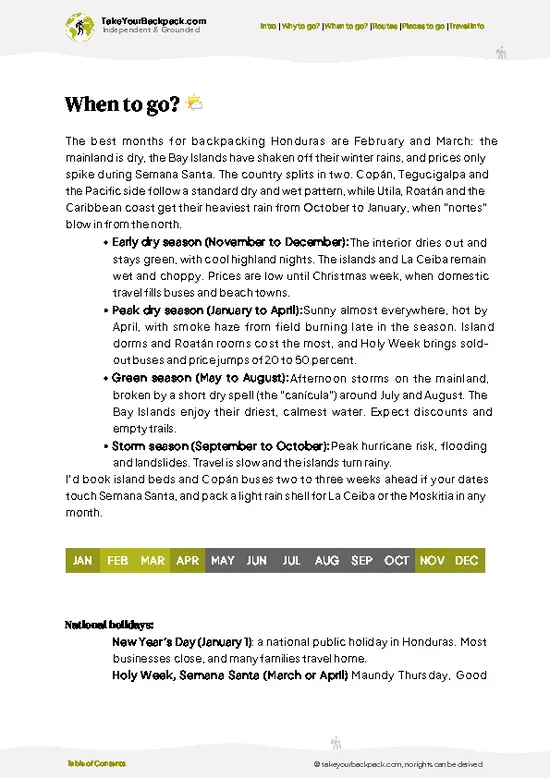
🌤️ When to go?Weather, crowds, and seasonal trade-offs

  • Dry Season (February to May): Trails are firmest and cloud forest views are clearest. Valley days run 28 to 34°C (82 to 93°F), while the highlands above 1,500 m (4,900 ft) sit near 12 to 20°C (54 to 68°F). Expect roughly 11 to 12 hours of light. Easter week brings Honduran families to Lake Yojoa.
  • Rainy Season (June to October): Downpours turn paths to mud, streams swell, and leeches and slick roots slow you down. Temperatures stay 20 to 30°C (68 to 86°F). Lodges are quiet and sometimes discount rooms.
  • Cool, Showery Months (November to January): Northern fronts bring drizzle and mist, with nights near 10 to 14°C (50 to 57°F) up high. Birding is good, with migrants arriving, and crowds are thin apart from the Christmas holidays.
Aim for late February or March, before the heat and smoke of April burning season build.

source: climatestotravel.comJANJanuary: excellent for travelingFEBFebruary: excellent for travelingMARMarch: highly recommended for travelingAPRApril: good for travelingMAYMay: fair for travelingJUNJune: fair for travelingJULJuly: fair for travelingAUGAugust: fair for travelingSEPSeptember: fair for travelingOCTOctober: fair for travelingNOVNovember: highly recommended for travelingDECDecember: excellent for traveling
when-to-go

✈️ The backpacker research shortcutHonduras Travel Guide

An offline-friendly backpacking guide with optimized travel routes, ranked highlights, transport advice, and the best areas to stay.
example page 0 from our offline Travel Guide for Honduras
example page 1 from our offline Travel Guide for Honduras
example page 2 from our offline Travel Guide for Honduras
example page 3 from our offline Travel Guide for Honduras
example page 4 from our offline Travel Guide for Honduras
example page 5 from our offline Travel Guide for Honduras
example page 6 from our offline Travel Guide for Honduras
example page 7 from our offline Travel Guide for Honduras
The digital guide (255 pages) contains:
✅ 70 highlights, ranked by travel appeal
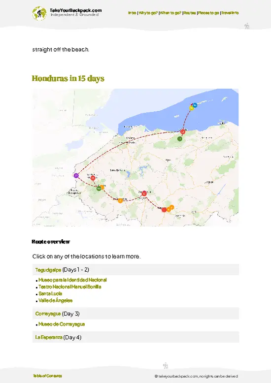
✅ Optimized 5, 10 & 15-day travel routes
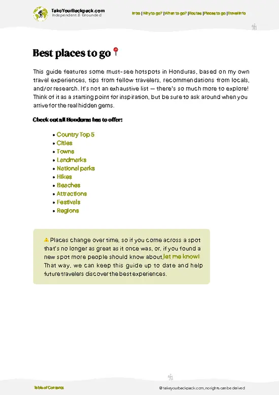
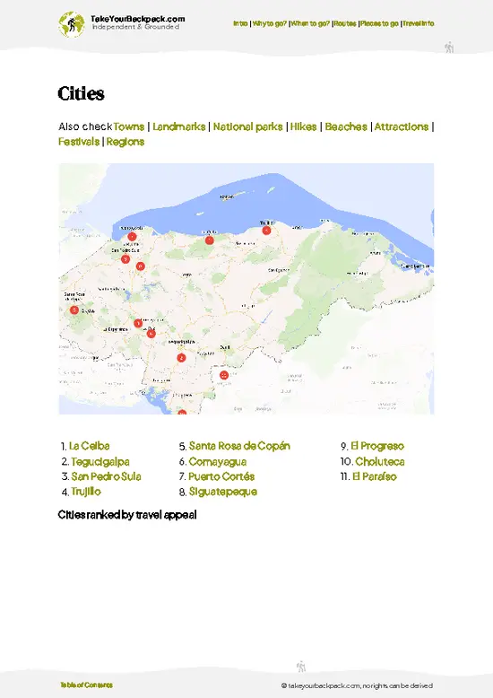
✅ Cities, national parks, landmarks, beaches
✅ How to get around
✅ Offline-friendly for travel without Wi-Fi
👉 Click to see all 30+ guide features

📅 Plan smarter in minutes, not weeks
✅ Month by month travel advice
✅ Festivals & national holidays
✅ Budget expectations

🗺️ Go to the right places, skip the overrated ones
✅ Honest pros & cons of destinations
✅ Top hikes, parks & viewpoints
✅ Lesser-known places most travelers miss
✅ Clear “worth it vs skip it” guidance

🛏️ Travel smoothly without rookie mistakes
✅ Best areas to stay
✅ Transport systems explained simply
✅ Common scams & safety advice
✅ SIM cards, money & practical tips

🌍 Understand the country, not just visit it
✅ Culture & traditions
✅ 52 Essential phrases & customs
✅ Festivals worth planning around
✅ Traveler-friendly historical context
✅ Insights that make places more meaningful

📱 Built for real travel conditions
✅ Fully downloadable PDF
✅ Works completely offline
✅ Optimized for phone use
✅ Useful in remote areas & buses
✅ Everything in one place
Stop searching, start planning
Get instant access to your full guide. 30‑day money-back guarantee.
+ Add another guide for just

By proceeding you agree to our terms.
Sent to your inbox immediately after payment • 100% Secure Checkout
Best Backpacking Travel Advisor 2025 tourism awardBest Backpacking
Travel Advisor
2025
What others say about Take Your Backpack Guides:
⭐⭐⭐⭐⭐
Fantastic, amazing amount of information!
⭐⭐⭐⭐⭐
My goodness this is amazing, it's what I've been looking for hats off too you!
⭐⭐⭐⭐⭐
I think this is absolutely BRILLIANT
⭐⭐⭐⭐
Very complete and informative. It's still missing places, but I gotta to commend you
⭐⭐⭐⭐⭐
This is truly amazing, thank you, can't wait to explore it with my kids!
⭐⭐⭐⭐⭐
Awesome resource, thank you!
⭐⭐⭐⭐⭐
This is amazing! Can't wait to explore the ones I haven't seen
⭐⭐⭐⭐
I love this! Well done, great idea.
⭐⭐⭐⭐⭐
Thanks for taking the time to make this gem!
⭐⭐⭐⭐⭐
This might be the best website I've ever seen.
⭐⭐⭐⭐⭐
Congratulations, and thank you so much for your work; it's incredibly valuable.
⭐⭐⭐⭐
In all seriousness I think you did a great job pointing out the important spots
⭐⭐⭐⭐⭐
10/10 very good
⭐⭐⭐⭐⭐
As someone who's only just starting to visit regularly this is awesome, thank you.
⭐⭐⭐⭐
Thank you very much! I'm going to visit my dad, it's going to be very useful!
⭐⭐⭐⭐⭐
This is really cool! We'll be travelling for the first time and this definitely come in handy.
⭐⭐⭐⭐⭐
You are now our minister of culture, congratulations 👨‍💼
⭐⭐⭐⭐⭐
Just wanted to tell you that this is a pearl! Going to follow your recommendations.
⭐⭐⭐⭐⭐
This is so cool. I'll definitely be using the resource for my travels soon.
⭐⭐⭐⭐⭐
This is very impressive! Good work.
⭐⭐⭐⭐⭐
This is an amazing and informative site. Very well done!

🛏️ Where to stay?Where staying makes the most sense

Most backpackers sleep outside Cerro Azul Meámbar National Park, in the lake area, because lodging inside the boundaries is limited to basic ranger posts and community-run cabins that need advance arrangement through the park’s management foundation or local guides.

The usual base is the north end of Lake Yojoa, near Los Naranjos and Peña Blanca. Hostels and guesthouses here have dorm beds at US$8 to 14 and private rooms at US$20 to 45. Several have gardens full of birds, kitchens, and kayaks for rent. Pulhapanzak waterfall is close by, and guides can arrange park hikes from the lakeside.

On … read more 👉
Most backpackers sleep outside Cerro Azul Meámbar National Park, in the lake area, because lodging inside the boundaries is limited to basic ranger posts and community-run cabins that need advance arrangement through the park’s management foundation or local guides.

The usual base is the north end of Lake Yojoa, near Los Naranjos and Peña Blanca. Hostels and guesthouses here have dorm beds at US$8 to 14 and private rooms at US$20 to 45. Several have gardens full of birds, kitchens, and kayaks for rent. Pulhapanzak waterfall is close by, and guides can arrange park hikes from the lakeside.

On the park’s east side, the small town of Meámbar has simple hospedajes at roughly US$10 to 20 a night and little else, so bring cash. Siguatepeque, in the highlands to the south, offers cheap hotels at US$15 to 35, plus supermarkets and ATMs for stocking up. San Pedro Sula is the bigger hub if you arrive by air or long-distance bus, though most people continue straight to the lake. Book ahead for Easter and Christmas.

👛 Costs (as of 22 October 2026)How expensive it really is

Cerro Azul Meámbar National Park costs roughly US$45 to 60 a day for a backpacker who stays at the lake and hires a guide, with the total of US$52 in high season used below.
CategoryBudget RangeLocal Reality
Entrance and guideUS$8 to 25A small park fee plus a local guide, with the guide making up most of the cost. Pay in cash.
AccommodationUS$8 to 20Dorm beds around Lake Yojoa cost US$8 to 14. Private rooms start near US$20, and prices rise at Easter and Christmas.
Local transportUS$3 to 8Buses and shared minibuses along the highway cost a few dollars. Taxis or moto-taxis to trailheads cost more.
Food and suppliesUS$8 to 15Baleadas and comedor set meals (almuerzo) cost US$2 to 5. Lakeside restaurants with fried fish cost more.
Total Daily BudgetUS$52Per person, per day, in high season.
⚠️ Prices can change and everyone travels differently, so take this as a rough guide. Hope it helps you plan your adventure!

🥾 TrailsScenic routes and wildlife spotting in Cerro Azul Meámbar

Cerro Azul Meámbar National Park offers rugged hiking through cloud forest, with muddy, steep terrain and little formal signage, so most walkers go with a local guide. Named trails are not consistently marked, so the walks below describe the routes people actually do.
  • Waterfall walks: Short hikes of roughly 1 to 3 hours return start from community entry points and follow forest paths to cascades. Easy to moderate, with slippery roots and stream crossings.
  • Ridge and summit routes: Full-day climbs of about 5 to 8 hours climb through oak and pine into cloud forest. Hard, with steep, wet ground and
… read more 👉
Cerro Azul Meámbar National Park offers rugged hiking through cloud forest, with muddy, steep terrain and little formal signage, so most walkers go with a local guide. Named trails are not consistently marked, so the walks below describe the routes people actually do.
  • Waterfall walks: Short hikes of roughly 1 to 3 hours return start from community entry points and follow forest paths to cascades. Easy to moderate, with slippery roots and stream crossings.
  • Ridge and summit routes: Full-day climbs of about 5 to 8 hours climb through oak and pine into cloud forest. Hard, with steep, wet ground and cool mist at the top.
  • Bird and wildlife walks: Slow dawn outings of 2 to 4 hours focus on quetzals, toucanets and monkeys. Easy to moderate, mostly on forest tracks.
  • Scenery: Expect orchids, tree ferns, mossy trunks and occasional views toward Lake Yojoa when the clouds clear.
  • Wildlife: Howler monkeys, many bird species and, rarely, larger mammals such as pumas hide deeper in the forest.
Public buses run along the main highway near Lake Yojoa, and from there you reach the park entrances by local pickup or taxi, so allow extra time. Crowds are minimal, and you may share the trail with only a few other people. A small entrance or guide fee is usually collected locally in cash, so carry lempiras and small bills. Bring waterproof boots, a rain jacket and plenty of water.
⚠️ Hiking info can sometimes be outdated or inaccurate. Before you hit the trail, check the latest conditions with locals. If you do spot anything that's off, I'd love to hear from you, so I can update it for fellow travelers.

🛡️ SafetyTraveler Safety Guide

Cerro Azul Meámbar National Park is a manageable cloud forest hike if you go with a local guide, which is the sensible way to visit. Trails are poorly signed and fork often, and mist can wipe out visibility in minutes. Steep, muddy sections and wet roots are the main cause of sprains, so wear boots with real tread and use a trekking pole. Streams can rise quickly after rain, so cross early in the day. Mornings are cool at altitude even when the valley is hot, so carry a light rain layer.

Wildlife is mostly birds, monkeys, and the occasional snake, so watch where you step and put your hands only on what you can see. Keep distance and never feed animals. Carry more water than you expect, tell your lodge your route, and arrange a ride back before dusk. Phone signal is patchy.

FAQCommon questions from travelers

Plan on one full day for a guided hike, or two days if you want to reach higher cloud forest and watch birds at dawn. Cerro Azul Meámbar National Park is easy to combine with Lake Yojoa and Pulhapanzak waterfall, so many travelers spend three days in the area in total. Starting at first light gives you the clearest views before mist builds.
Yes, though with some effort. Buses on the highway between San Pedro Sula and Tegucigalpa stop near Lake Yojoa and Siguatepeque, and from there you can take a taxi or shared pickup to trailheads for roughly US$5 to 20. Cerro Azul Meámbar National Park has few signs and little public transport, so a guide arranged through your lodge makes access far simpler.
Yes, a small fee applies, typically a few US dollars, and it is paid in cash at the entrance or through the managing foundation. Cerro Azul Meámbar National Park does not require a formal permit for most day hikes, but you should arrange access in advance for overnight stays. A local guide costs about US$10 to 25 and is strongly advised.
⚠️ Things can change over time, so always validate details locally before you go.

Other Honduran national parks near Cerro Azul Meámbar

Explore more nearby:


💡 Not sure where to go next?
Create a personalized itinerary for Honduras including Cerro Azul Meámbar and the places that fit your trip.

Generate my itinerary

👉 Discover all national parks

Or checkout all Honduras has to offer (think cities, towns, villages, national parks, hikes, beaches, festivals)
Country photo of Honduras

We 💚 feedbackWhat to keep in mind

Cerro Azul Meámbar National Park works best as one stop on a western Honduras loop, paired with Lake Yojoa for birding and coffee, then onward to Copán Ruínas or the Caribbean coast. I would give it two nights, hire a guide for the summit, and pack real rain gear.

✈️ When did I visit Honduras?
Honduras I visited during my half year trip through South and Central America back in 2003

✍️ Help improve this page!
The information on this page is based on my own backpacking experience in Honduras, supplemented with up-to-date research and feedback from other travelers. Travel details can change, so if you notice anything outdated or incomplete, feel free to let me know.


🙋‍♂️ Give feedback

👋 Meet the founderWho’s Behind Take Your Backpack?

Johan, backpacker and founder of TakeYourBackpackHi, I’m Johan (Netherlands 🇳🇱), the creator of TakeYourBackpack. Over the past 3 decades, I’ve backpacked through 90+ countries across six continents, gaining extensive experience with independent travel, long-term trips, and overland routes.

This site is built on a combination of firsthand travel experience and carefully curated insights from other backpackers. Many guides are based on places I’ve personally visited, while others bring together tips, observations, and practical advice shared by trusted travelers I’ve met along the way.

The goal is to provide realistic, experience-driven guidance — not generic itineraries — so you can explore destinations with better context, clearer expectations, and more confidence.