
×

Italy🇮🇹 | hikesAlta Via dei Monti Liguriridge walks, maritime Alps, panoramic horizons | things to do and best time to go

Explore Selvaggio BluExplore Val d’Orcia Trail

Backpacking in Alta Via dei Monti Liguri
👀 For curious travelershike ranked #11
By Johan Kruseman 🇳🇱 | Updated May 29, 2026

Most people only realize on day three that the Alta Via dei Monti Liguri lets you sleep high in the hills yet drop to the coast for espresso or a train in under an hour. This long-distance route runs along the spine of Liguria in northwest Italy, roughly parallel to the Riviera between Ventimiglia and La Spezia. It’s a patchwork of chestnut woods, airy ridgelines, and old mule tracks, with sea on one side and the Alps or Apennines on the other. Stages are moderate rather than brutal, but the length and summer heat grind you down. Access is easy by train and bus from Genoa, and compared with the Cinque Terre trails it’s wilder, cheaper, and far less choreographed—more real sweat, bigger horizons, fewer gelato stands.

Discover everything you want to know in the 📖 Italy Travel Guide.
Best time to go: April - June, September - October
Duration: 12 days
Distance: 440 kilometers
Total ascent: 18,000 meters


Get your Italy guide
149 ranked highlights, routes & tips, works offline (542 pages)
Loading the map 🌍
CLICK TO FILTER
cities
towns
villages
landmarks
national parks
hikes
beaches
attractions
festivals
regions
SHOW COUNTRY’S BESTSHOW ALL

✨ Why go?
Ranked #11 hike in Italy
What makes it a must-see hike

The Alta Via dei Monti Liguri is a backpacker’s playground, where every step rewards you with breathtaking views and a sense of accomplishment. The scenery-to-effort ratio is off the charts; you’ll traverse lush forests, rugged ridges, and charming villages without feeling like you’ve run a marathon. Public transport makes access a breeze, so you can hop on a train and dive into the adventure without breaking the bank. With flexible distances, you can tailor your trek to fit your pace, whether you want a leisurely stroll or a challenging push. Plus, it seamlessly integrates into a longer backpacking route, making it a perfect pit stop on your Italian odyssey. The first cold beer at the end? That’s just the cherry on top.
Want to include Alta Via dei Monti Liguri in your Italy route?
Create a personalized Italy itinerary that includes Alta Via dei Monti Liguri and the places that fit your trip — based on your travel style, budget, and available time. Get your route in seconds.

Generate my trip

💡 HighlightsPlaces and moments you shouldn't skip

  • Monte Saccarello (2201 m) — the summit that looks both ways: The highest point on the route, so you get that rare “sea and high peaks” panorama — French Alps one way, Ligurian Sea the other. The ridge here feels Alpine but with Mediterranean plants at your feet; I’ve seen chamois and late-season alpine flowers on the same day. It’s a proper “you’re nowhere and everywhere” moment that a lot of other trails don’t deliver.
  • Monte Beigua & the Beigua Geopark — geology and wild panoramas: A UNESCO Global Geopark with weird, ancient rocks and fossil-rich outcrops, plus viewpoints that stretch from rocky headlands to distant mountains. The mix of maquis shrubs, rocky summits and interpretive panels makes it interesting for more than just the photos — you can actually read the landscape’s history
read more 👉
  • Monte Saccarello (2201 m) — the summit that looks both ways: The highest point on the route, so you get that rare “sea and high peaks” panorama — French Alps one way, Ligurian Sea the other. The ridge here feels Alpine but with Mediterranean plants at your feet; I’ve seen chamois and late-season alpine flowers on the same day. It’s a proper “you’re nowhere and everywhere” moment that a lot of other trails don’t deliver.
  • Monte Beigua & the Beigua Geopark — geology and wild panoramas: A UNESCO Global Geopark with weird, ancient rocks and fossil-rich outcrops, plus viewpoints that stretch from rocky headlands to distant mountains. The mix of maquis shrubs, rocky summits and interpretive panels makes it interesting for more than just the photos — you can actually read the landscape’s history as you walk.
  • Monte Antola and its rifugio — beech woods and simple comforts: Classic ridge walking through towering beech forests, ending at a small mountain refuge where you can get a hot meal and a bunk. The views are wide but gentle — perfect for slow evenings, local mountain food, and chatting with shepherds or other hikers. It’s a calm counterpoint to the higher, bleaker summits.
  • Ridge-line sea panoramas (Passo del Melogno, Capo Mele viewpoints): Parts of the Alta Via run so close to the coast that you’ll watch the Mediterranean change color for hours. That constant juxtaposition — craggy ridge one minute, glittering sea the next — is the trail’s signature and what makes it spectacularly different from inland long-distance routes.
  • Ancient mule tracks, alpeggi and mountain villages — the human layer: The trail threads old shepherd paths, dry-stone terraces and tiny villages where life still follows seasonal rhythms. You’ll pass simple chapels, WWII relics and rustic pastures; those cultural touches (and the chance to buy a slice of local cheese from a farmer) make the hike feel lived-in rather than just scenic.
Personal favorite: Monte Saccarello — that summit view of Alps to sea is my go-to memory from the Alta Via.
Spotted a mistake or missing something? Contact us.

Things to do near Alta Via dei Monti Liguri

Ratings based on Tripadvisor reviews. When you book through this link, you support our work at no extra cost to you.

🌤️ When to go?Choosing the right time of year


  • Weather: Spring and early autumn deliver the best conditions—expect mild, stable weather with less chance of rain than summer’s unpredictable storms. Winter brings snow and ice, shutting down many sections.

  • Temperature: Daytime highs hover around 15-22°C (59-72°F) in spring and fall, perfect for long days on the trail without overheating. Summer spikes can push 28-32°C (82-90°F), turning the hike into a sweat fest.

  • Daylight Hours: Late spring and early autumn offer 10-14 hours of daylight, enough to cover long distances without rushing. Winter’s short days limit your window, while summer’s long light can tempt you to push harder.

  • Crowds: Peak summer draws locals and tourists alike, cranking up trail traffic and accommodation prices. Shoulder seasons keep the path quieter, letting
read more 👉

  • Weather: Spring and early autumn deliver the best conditions—expect mild, stable weather with less chance of rain than summer’s unpredictable storms. Winter brings snow and ice, shutting down many sections.

  • Temperature: Daytime highs hover around 15-22°C (59-72°F) in spring and fall, perfect for long days on the trail without overheating. Summer spikes can push 28-32°C (82-90°F), turning the hike into a sweat fest.

  • Daylight Hours: Late spring and early autumn offer 10-14 hours of daylight, enough to cover long distances without rushing. Winter’s short days limit your window, while summer’s long light can tempt you to push harder.

  • Crowds: Peak summer draws locals and tourists alike, cranking up trail traffic and accommodation prices. Shoulder seasons keep the path quieter, letting you savor the rugged solitude.

  • Seasonal Activities: Spring blooms and autumn foliage add color and texture to the landscape, while summer festivals in nearby villages offer cultural pit stops if you time it right.

  • Price Fluctuations: Summer’s high season inflates lodging and transport costs. Booking in shoulder seasons often nets better deals and more flexible options.


Pro-tip: Aim for late May or early October—when the trail is alive with color, the air is crisp but not cold, and you’ll have the space to move at your own pace without the crush of crowds.


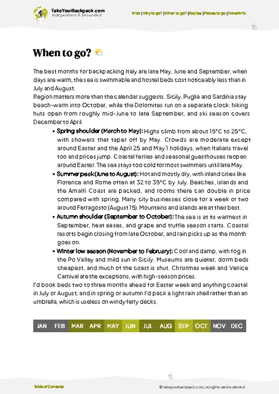
source: climatestotravel.comJANJanuary: below average for travelingFEBFebruary: below average for travelingMARMarch: fair for travelingAPRApril: highly recommended for travelingMAYMay: excellent for travelingJUNJune: good for travelingJULJuly: fair for travelingAUGAugust: fair for travelingSEPSeptember: highly recommended for travelingOCTOctober: excellent for travelingNOVNovember: fair for travelingDECDecember: below average for traveling
when-to-go

✈️ The backpacker research shortcutItaly Travel Guide

An offline-friendly backpacking guide with optimized travel routes, ranked highlights, transport advice, and the best areas to stay.
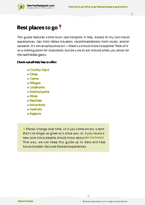
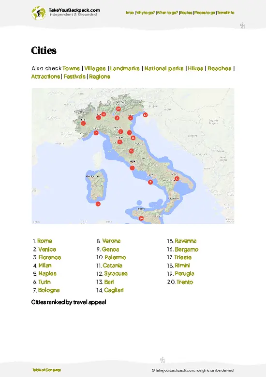
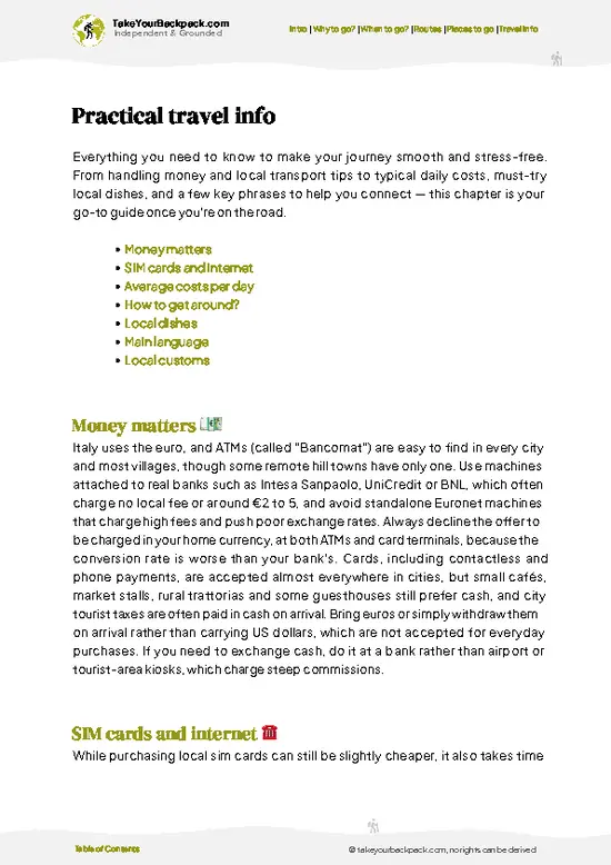
example page 0 from our offline Travel Guide for Italy
example page 1 from our offline Travel Guide for Italy
example page 2 from our offline Travel Guide for Italy
example page 3 from our offline Travel Guide for Italy
example page 4 from our offline Travel Guide for Italy
example page 5 from our offline Travel Guide for Italy
example page 6 from our offline Travel Guide for Italy
example page 7 from our offline Travel Guide for Italy
The digital guide (542 pages) contains:
149 highlights, ranked by travel appeal
Optimized 7, 14 & 21-day travel routes
Cities, national parks, landmarks, beaches
How to get around
Offline-friendly for travel without Wi-Fi
👉 Click to see all 30+ guide features

📅 Plan smarter in minutes, not weeks
Month by month travel advice
Festivals & national holidays
Budget expectations

🗺️ Go to the right places, skip the overrated ones
Honest pros & cons of destinations
Top hikes, parks & viewpoints
Lesser-known places most travelers miss
Clear “worth it vs skip it” guidance

🛏️ Travel smoothly without rookie mistakes
Best areas to stay
Transport systems explained simply
Common scams & safety advice
SIM cards, money & practical tips

🌍 Understand the country, not just visit it
Culture & traditions
52 Essential phrases & customs
Festivals worth planning around
Traveler-friendly historical context
Insights that make places more meaningful

📱 Built for real travel conditions
Fully downloadable PDF
Works completely offline
Optimized for phone use
Useful in remote areas & buses
Everything in one place
Save weeks of stressful planning
Get instant access to your full guide. 30‑day money-back guarantee.


By proceeding you agree to our terms.
Sent to your inbox immediately after payment • 100% Secure Checkout
Best Backpacking Travel Advisor 2025 tourism awardBest Backpacking
Travel Advisor
2025
What others say about Take Your Backpack Guides:
⭐⭐⭐⭐⭐
Fantastic, amazing amount of information!
⭐⭐⭐⭐⭐
My goodness this is amazing, it's what I've been looking for hats off too you!
⭐⭐⭐⭐⭐
I think this is absolutely BRILLIANT
⭐⭐⭐⭐
Very complete and informative. It's still missing places, but I gotta to commend you
⭐⭐⭐⭐⭐
This is truly amazing, thank you, can't wait to explore it with my kids!
⭐⭐⭐⭐⭐
Awesome resource, thank you!
⭐⭐⭐⭐⭐
This is amazing! Can't wait to explore the ones I haven't seen
⭐⭐⭐⭐
I love this! Well done, great idea.
⭐⭐⭐⭐⭐
Thanks for taking the time to make this gem!
⭐⭐⭐⭐⭐
This might be the best website I've ever seen.
⭐⭐⭐⭐⭐
Congratulations, and thank you so much for your work; it's incredibly valuable.
⭐⭐⭐⭐
In all seriousness I think you did a great job pointing out the important spots
⭐⭐⭐⭐⭐
10/10 very good
⭐⭐⭐⭐⭐
As someone who's only just starting to visit regularly this is awesome, thank you.
⭐⭐⭐⭐
Thank you very much! I'm going to visit my dad, it's going to be very useful!
⭐⭐⭐⭐⭐
This is really cool! We'll be travelling for the first time and this definitely come in handy.
⭐⭐⭐⭐⭐
You are now our minister of culture, congratulations 👨‍💼
⭐⭐⭐⭐⭐
Just wanted to tell you that this is a pearl! Going to follow your recommendations.
⭐⭐⭐⭐⭐
This is so cool. I'll definitely be using the resource for my travels soon.
⭐⭐⭐⭐⭐
This is very impressive! Good work.
⭐⭐⭐⭐⭐
This is an amazing and informative site. Very well done!

🛏️ Where to stay?Best areas to stay in Italy

If you enjoy meeting fellow travelers, consider choosing hostels with high ratings for atmosphere. On the other hand, if you prefer having your own space, a hotel might be a better option.

🥾 Hike detailsHike details: route, duration, and difficulty of Alta Via dei Monti Liguri

Total Distance: Approximately 440 kilometers (around 273 miles), stretching from the French border to the Cinque Terre.

Estimated Duration: Typically takes about 15 to 20 days to hike the entire trail, depending on your pace and how much time you spend exploring the villages along the way.

Difficulty Level: Moderate to challenging. While some sections are relatively easy, others can be steep and rocky, requiring a good level of fitness.

Starting Point: The trail begins in the town of Ventimiglia.
How to Get There by Public Transport: You can take a train from major cities like Genoa or Nice … read more 👉
Total Distance: Approximately 440 kilometers (around 273 miles), stretching from the French border to the Cinque Terre.

Estimated Duration: Typically takes about 15 to 20 days to hike the entire trail, depending on your pace and how much time you spend exploring the villages along the way.

Difficulty Level: Moderate to challenging. While some sections are relatively easy, others can be steep and rocky, requiring a good level of fitness.

Starting Point: The trail begins in the town of Ventimiglia.
How to Get There by Public Transport: You can take a train from major cities like Genoa or Nice to Ventimiglia. The train station is a short walk from the trailhead.

Major Landmarks Along the Route:
  • Monte Grai: Offers stunning panoramic views of the surrounding mountains and valleys.
  • Borzonasca: A charming village with traditional Ligurian architecture.
  • Cinque Terre: The famous coastal villages known for their colorful houses and breathtaking sea views.

Type of Terrain and Scenery: Expect a mix of rugged mountain paths, forest trails, and coastal views. The trail winds through the Apennines, offering a variety of landscapes, from lush forests to rocky cliffs overlooking the Mediterranean.

Typical Vegetation: You’ll find a mix of Mediterranean scrub, chestnut forests, and wildflowers. Olive groves and vineyards are common, especially near the coast.

Wildlife: Keep an eye out for deer, foxes, and various bird species. The area is also home to some reptiles and a variety of insects, especially in warmer months.
⚠️ Hiking info can sometimes be outdated or inaccurate. Before you hit the trail, check the latest conditions with locals. If you do spot anything that's off, I'd love to hear from you, so I can update it for fellow travelers.

🛡️ SafetyTraveler Safety Guide

The Alta Via dei Monti Liguri offers a mix of manageable trails and stunning views, but don’t underestimate the terrain. Expect steep sections that demand focus, especially after rain when footing can get slippery. Weather can shift quickly; pack layers and a reliable rain jacket.

Wildlife is generally shy, but keep your distance from any larger animals. A calm approach is best—don’t surprise them.

Timing is key; early starts help you avoid afternoon storms. Stay hydrated and pace yourself; the reward of a cold beer at a mountain hut is worth the effort. Embrace the journey, and let the trail guide you.

Other Italian hikes near Alta Via dei Monti Liguri

Explore more nearby:


💡 Not sure where to go next?
Create a personalized itinerary for Italy including Alta Via dei Monti Liguri and the places that fit your trip.

Generate my itinerary

👉 Discover all hikes

Or checkout all Italy has to offer (think cities, towns, villages, national parks, hikes, beaches, festivals)
Country photo of Italy

We 💚 feedbackIs it worth it?

The Alta Via dei Monti Liguri is a feast for the senses. Picture this: rugged trails leading to sweeping views of the Mediterranean, where every step feels like a victory. But be ready for the reality check—some sections are steep and can test your legs. Embrace the burn; the payoff is a cold beer in a charming village, savoring the journey.

✈️ When did I visit Italy?
Italy I have vistited a couple of times: Rome already when I was still in high school, and I did a 7 day hike in the Dolomites in 2021.

✍️ Help improve this page!
The information on this page is based on my own backpacking experience in Italy, supplemented with up-to-date research and feedback from other travelers. Travel details can change, so if you notice anything outdated or incomplete, feel free to let me know.


🙋‍♂️ Give feedback

👋 Meet the founderWho’s Behind Take Your Backpack?

Johan, backpacker and founder of TakeYourBackpackHi, I’m Johan (Netherlands 🇳🇱), the creator of TakeYourBackpack. Over the past decade, I’ve backpacked through 80+ countries across six continents, gaining extensive experience with independent travel, long-term trips, and overland routes.

This site is built on a combination of firsthand travel experience and carefully curated insights from other backpackers. Many guides are based on places I’ve personally visited, while others bring together tips, observations, and practical advice shared by trusted travelers I’ve met along the way.

The goal is to provide realistic, experience-driven guidance — not generic itineraries — so you can explore destinations with better context, clearer expectations, and more confidence.

Get full Italy guide •
Instant download • 149 highlights • Full Offline guide