×

Kosovo🇽🇰 | hikesHajla trailsborder ridge, karst formations, wildflower slopes | things to do and best time to go

Explore Dreljsko LakeExplore Waterfall Trail Shtegu i Ujëvarës

Backpacking in Hajla trails
🌟 Highlighthike ranked #4
By Johan Kruseman 🇳🇱 | Updated June 8, 2026

Most hikers expect the Hajla trails to be a quiet, easy ramble—just another borderland stroll—but the reality is a muscular, calf-burning climb that feels more Balkan than brochure. Hajla sits in Kosovo’s far west, brushing up against Montenegro, where the Accursed Mountains earn their name with every switchback. The trail throws you into a raw, unfiltered landscape: pine forests that smell like resin and rain, meadows that explode with wildflowers in June, and ridgelines where the wind will slap the sleep out of your eyes. It’s not a walk in the park—expect 7 to 9 hours on the main route, with steep, rocky sections that demand respect and decent boots. Public transport to the trailhead is patchy at best; you’ll likely need a taxi from Peja, which adds a layer of logistical grit. Compared to the more manicured Rugova Gorge hikes nearby, Hajla is wilder, lonelier, and—when you finally crest the summit and see the whole of Kosovo spill out below—absolutely worth the sweat.

Discover everything you want to know in the 📖 Kosovo Travel Guide.
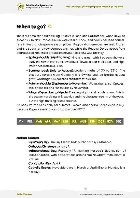
Best time to go: April - October
Duration: 2 days
Total ascent: 1200 meters


Get your Kosovo guide
71 ranked highlights, routes & tips, works offline (279 pages)
Loading the map 🌍
CLICK TO FILTER
cities
towns
villages
landmarks
national parks
hikes
attractions
festivals
regions
SHOW COUNTRY’S BESTSHOW ALL

✨ Why go?
Ranked #4 hike in Kosovo
Reasons people choose to hike the here

Backpackers chase the Hajla trails in Kosovo because they deliver a raw, unfiltered punch of nature without demanding a full expedition. The scenery-to-effort ratio here is a rare find—rugged peaks and wildflower-strewn meadows unfold with every step, but the climbs don’t drag you into exhaustion. You get the burn in your legs and lungs, sure, but the payoff is a panorama that feels like you’ve stumbled into a secret world.

Public transport access is surprisingly solid for a trail this wild. Buses and minibuses from Peja or Pristina drop you close enough to start walking without the hassle of private transfers or expensive taxis. That means you can slot the Hajla trails into a longer Kosovo or Balkan route without breaking your rhythm or your budget. Speaking of budget, the low cost of everything—from … read more 👉
Backpackers chase the Hajla trails in Kosovo because they deliver a raw, unfiltered punch of nature without demanding a full expedition. The scenery-to-effort ratio here is a rare find—rugged peaks and wildflower-strewn meadows unfold with every step, but the climbs don’t drag you into exhaustion. You get the burn in your legs and lungs, sure, but the payoff is a panorama that feels like you’ve stumbled into a secret world.

Public transport access is surprisingly solid for a trail this wild. Buses and minibuses from Peja or Pristina drop you close enough to start walking without the hassle of private transfers or expensive taxis. That means you can slot the Hajla trails into a longer Kosovo or Balkan route without breaking your rhythm or your budget. Speaking of budget, the low cost of everything—from transport to local food—keeps your wallet happy while you chase those mountain views.

The trails themselves offer flexible distances. You can push for a full-day summit or opt for shorter loops that still pack a punch. This flexibility makes Hajla a perfect pit stop or a highlight on a multi-day trek through the Balkans. It’s the kind of hike where the grit of the trail matches the thrill of the view, and the journey feels as good as the destination.
Want to include Hajla trails in your Kosovo route?
Create a personalized Kosovo itinerary that includes Hajla trails and the places that fit your trip — based on your travel style, budget, and available time. Get your route in seconds.

Generate my trip

💡 HighlightsWhat this place is best known for

1. Hajla Summit (2403m)
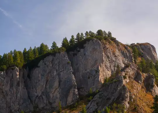
The final push to Hajla’s summit is a test of lungs and legs—loose scree, switchbacks, and the wind that never seems to let up. But cresting that last ridge, you get a 360-degree panorama that slaps you awake. Montenegro sprawls to the west, Kosovo’s valleys unfurl to the east, and the Dinaric Alps stack up in blue layers. There’s no fence, no selfie platform, just raw rock and the kind of silence that makes you grin like a fool. The sense of scale is humbling; you see the world as a map, not a postcard. This is my personal favorite—nothing beats the summit’s wild, unfiltered reward.


2. Rugova Canyon Views
Early in the hike, the trail skirts the upper rim of Rugova Canyon. The drop is dizzying—sheer limestone walls plunge hundreds of meters, and the river below looks … read more 👉
1. Hajla Summit (2403m)
The final push to Hajla’s summit is a test of lungs and legs—loose scree, switchbacks, and the wind that never seems to let up. But cresting that last ridge, you get a 360-degree panorama that slaps you awake. Montenegro sprawls to the west, Kosovo’s valleys unfurl to the east, and the Dinaric Alps stack up in blue layers. There’s no fence, no selfie platform, just raw rock and the kind of silence that makes you grin like a fool. The sense of scale is humbling; you see the world as a map, not a postcard. This is my personal favorite—nothing beats the summit’s wild, unfiltered reward.


2. Rugova Canyon Views
Early in the hike, the trail skirts the upper rim of Rugova Canyon. The drop is dizzying—sheer limestone walls plunge hundreds of meters, and the river below looks like a thread of turquoise. You’ll feel the exposure in your knees. Ravens ride the thermals, and if you’re lucky, you’ll spot a golden eagle tracing lazy circles overhead. The canyon’s scale is a gut-check, but the views are pure adrenaline. It’s the kind of landscape that makes you slow down, not for a photo, but just to let your heart rate settle.


3. Alpine Meadows and Wildflowers
Midway up, the forest breaks open into meadows that feel almost Alpine—grassy, rolling, and in June and July, absolutely riotous with wildflowers. Think purple gentians, yellow buttercups, and the occasional wild orchid. Shepherds’ huts dot the hills, and you might hear the clatter of bells from sheep grazing nearby. The air smells of thyme and damp earth. It’s a sensory reset after the grind of the forest, and a reminder that the Balkans can do “idyllic” just as well as the Alps, but with fewer crowds and more character.


4. Hajla’s Border Marker
Near the summit, you’ll cross a weathered concrete pillar marking the Kosovo-Montenegro border. There’s something quietly thrilling about straddling two countries with one muddy boot in each. The marker is battered by storms and graffiti, but it’s a tangible reminder of the region’s tangled history. Pause here—eat a snack, swap stories, and feel the wind whip past. It’s a checkpoint for the soul as much as the body.


5. The Descent to Pepaj Village
The descent toward Pepaj is a quad-burner—steep, rocky, and relentless. But as you drop, the landscape softens. Pine forests give way to orchards, and the first glimpse of Pepaj’s red roofs signals the endgame. There’s usually a local offering homemade raki or a cold beer for a few euros. Sitting on a rough wooden bench, boots off, drink in hand, you taste the dust and effort of the trail. The reward isn’t just the view—it’s the welcome, the relief, and the sense that you’ve earned every step.
Spotted a mistake or missing something? Contact us.

Things to do near Hajla trails

Ratings based on Tripadvisor reviews. When you book through this link, you support our work at no extra cost to you.

🌤️ When to go?Best time to hike the Hajla trails


  • Weather: The Hajla trails demand respect for the seasons. From May to September, the weather settles into a reliable rhythm—warm days hover around 20-25°C (68-77°F), perfect for sweating it out without frying. Outside this window, expect unpredictable rain and snow, especially from November through March, which can turn trails into slick, muddy messes or icy hazards.

  • Temperature: Summer highs hit 25°C (77°F), but mornings and evenings dip to a refreshing 10-15°C (50-59°F), so layering is your friend. Spring and fall bring cooler temps, often flirting with 5-15°C (41-59°F), which means brisk starts but comfortable hiking if you dress smart.

  • Daylight Hours: Peak summer stretches daylight to nearly 16 hours, giving you plenty of time to push deeper into the wild without rushing. By late
read more 👉

  • Weather: The Hajla trails demand respect for the seasons. From May to September, the weather settles into a reliable rhythm—warm days hover around 20-25°C (68-77°F), perfect for sweating it out without frying. Outside this window, expect unpredictable rain and snow, especially from November through March, which can turn trails into slick, muddy messes or icy hazards.

  • Temperature: Summer highs hit 25°C (77°F), but mornings and evenings dip to a refreshing 10-15°C (50-59°F), so layering is your friend. Spring and fall bring cooler temps, often flirting with 5-15°C (41-59°F), which means brisk starts but comfortable hiking if you dress smart.

  • Daylight Hours: Peak summer stretches daylight to nearly 16 hours, giving you plenty of time to push deeper into the wild without rushing. By late fall and early spring, daylight shrinks to around 10 hours, forcing earlier starts and quicker finishes.

  • Crowds: Hajla’s trails are off the beaten path, but summer weekends see a modest bump in local hikers. If you crave solitude, aim for weekdays in late spring or early fall when the trails are quieter and the air feels more personal.

  • Seasonal Activities: Summer opens up wildflower blooms and alpine meadows, while autumn paints the landscape in fiery reds and golds—both prime for photography and wildlife spotting. Winter transforms the area into a frozen playground but requires serious gear and experience.

  • Price Fluctuations: Accommodation and local services peak in summer, especially July and August, nudging prices up by 20-30%. Shoulder seasons like May, June, and September offer better deals and still-solid weather.


Pro-tip: Hit the Hajla trails in late May or early September to dodge crowds, catch crisp air, and snag the best value on lodging—plus, the trail conditions are usually just right for pushing your limits without battling mud or heatstroke.


source: climatestotravel.comJANJanuary: below average for travelingFEBFebruary: below average for travelingMARMarch: fair for travelingAPRApril: good for travelingMAYMay: excellent for travelingJUNJune: highly recommended for travelingJULJuly: highly recommended for travelingAUGAugust: highly recommended for travelingSEPSeptember: excellent for travelingOCTOctober: good for travelingNOVNovember: fair for travelingDECDecember: below average for traveling
when-to-go

✈️ The backpacker research shortcutKosovo Travel Guide

An offline-friendly backpacking guide with optimized travel routes, ranked highlights, transport advice, and the best areas to stay.
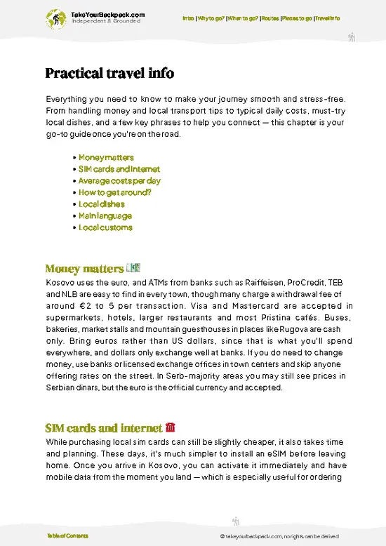
example page 0 from our offline Travel Guide for Kosovo
example page 1 from our offline Travel Guide for Kosovo
example page 2 from our offline Travel Guide for Kosovo
example page 3 from our offline Travel Guide for Kosovo
example page 4 from our offline Travel Guide for Kosovo
example page 5 from our offline Travel Guide for Kosovo
example page 6 from our offline Travel Guide for Kosovo
example page 7 from our offline Travel Guide for Kosovo
The digital guide (279 pages) contains:
71 highlights, ranked by travel appeal
Optimized 2, 3 & 5-day travel routes
Cities, national parks, landmarks, beaches
How to get around
Offline-friendly for travel without Wi-Fi
👉 Click to see all 30+ guide features

📅 Plan smarter in minutes, not weeks
Month by month travel advice
Festivals & national holidays
Budget expectations

🗺️ Go to the right places, skip the overrated ones
Honest pros & cons of destinations
Top hikes, parks & viewpoints
Lesser-known places most travelers miss
Clear “worth it vs skip it” guidance

🛏️ Travel smoothly without rookie mistakes
Best areas to stay
Transport systems explained simply
Common scams & safety advice
SIM cards, money & practical tips

🌍 Understand the country, not just visit it
Culture & traditions
52 Essential phrases & customs
Festivals worth planning around
Traveler-friendly historical context
Insights that make places more meaningful

📱 Built for real travel conditions
Fully downloadable PDF
Works completely offline
Optimized for phone use
Useful in remote areas & buses
Everything in one place
Save weeks of stressful planning
Get instant access to your full guide. 30‑day money-back guarantee.


By proceeding you agree to our terms.
Sent to your inbox immediately after payment • 100% Secure Checkout
Best Backpacking Travel Advisor 2025 tourism awardBest Backpacking
Travel Advisor
2025
What others say about Take Your Backpack Guides:
⭐⭐⭐⭐⭐
Fantastic, amazing amount of information!
⭐⭐⭐⭐⭐
My goodness this is amazing, it's what I've been looking for hats off too you!
⭐⭐⭐⭐⭐
I think this is absolutely BRILLIANT
⭐⭐⭐⭐
Very complete and informative. It's still missing places, but I gotta to commend you
⭐⭐⭐⭐⭐
This is truly amazing, thank you, can't wait to explore it with my kids!
⭐⭐⭐⭐⭐
Awesome resource, thank you!
⭐⭐⭐⭐⭐
This is amazing! Can't wait to explore the ones I haven't seen
⭐⭐⭐⭐
I love this! Well done, great idea.
⭐⭐⭐⭐⭐
Thanks for taking the time to make this gem!
⭐⭐⭐⭐⭐
This might be the best website I've ever seen.
⭐⭐⭐⭐⭐
Congratulations, and thank you so much for your work; it's incredibly valuable.
⭐⭐⭐⭐
In all seriousness I think you did a great job pointing out the important spots
⭐⭐⭐⭐⭐
10/10 very good
⭐⭐⭐⭐⭐
As someone who's only just starting to visit regularly this is awesome, thank you.
⭐⭐⭐⭐
Thank you very much! I'm going to visit my dad, it's going to be very useful!
⭐⭐⭐⭐⭐
This is really cool! We'll be travelling for the first time and this definitely come in handy.
⭐⭐⭐⭐⭐
You are now our minister of culture, congratulations 👨‍💼
⭐⭐⭐⭐⭐
Just wanted to tell you that this is a pearl! Going to follow your recommendations.
⭐⭐⭐⭐⭐
This is so cool. I'll definitely be using the resource for my travels soon.
⭐⭐⭐⭐⭐
This is very impressive! Good work.
⭐⭐⭐⭐⭐
This is an amazing and informative site. Very well done!

🛏️ Where to stay?How to pick the right area

If you enjoy meeting fellow travelers, consider choosing hostels with high ratings for atmosphere. On the other hand, if you prefer having your own space, a hotel might be a better option.

🥾 Hike detailsA practical overview of the hike

Total Distance: The main Hajla trail stretches roughly 18 kilometers, a solid day hike that demands stamina but rewards with raw mountain character.

Estimated Duration: Expect to spend 6 to 8 hours on the trail, depending on your pace and how often you stop to drink in the views or catch your breath.

Difficulty: This is a moderate to challenging hike. The elevation gain is steady and sometimes steep, with rocky patches that test your footing. Not for beginners, but manageable for anyone with decent fitness and some trail experience.

Starting Point: The trail kicks off near the village of Gjeravica, … read more 👉
Total Distance: The main Hajla trail stretches roughly 18 kilometers, a solid day hike that demands stamina but rewards with raw mountain character.

Estimated Duration: Expect to spend 6 to 8 hours on the trail, depending on your pace and how often you stop to drink in the views or catch your breath.

Difficulty: This is a moderate to challenging hike. The elevation gain is steady and sometimes steep, with rocky patches that test your footing. Not for beginners, but manageable for anyone with decent fitness and some trail experience.

Starting Point: The trail kicks off near the village of Gjeravica, accessible by public transport from Peja. Buses run regularly to Peja, and from there, local minibuses or taxis can get you to Gjeravica. The village sits at about 1,600 meters, so you start already in the highlands.

Major Landmarks: The Hajla summit itself is the crown jewel, sitting at 2,403 meters. Along the way, you’ll pass the Hajla Lake, a small alpine tarn that mirrors the sky on calm days. The trail also skirts the edge of the Rugova Canyon, offering dramatic cliffside views that make the climb feel worthwhile.

Terrain and Scenery: The trail cuts through a rugged mix of rocky outcrops and grassy slopes. Early sections wind through dense pine forests that thin out as you climb, giving way to open meadows dotted with wildflowers in summer. The final ascent is a scramble over loose scree and limestone ridges, exposing you to sweeping panoramas of the Accursed Mountains.

Vegetation: Expect thick conifers—spruce and pine dominate the lower elevations. Higher up, the forest gives way to alpine shrubs and hardy grasses. In spring and summer, patches of edelweiss and mountain gentians add bursts of color.

Wildlife: Keep your eyes peeled for chamois darting across rocky ledges and the occasional golden eagle circling overhead. Smaller critters like marmots whistle warnings from their burrows, and if you’re lucky, you might spot a red fox slipping through the underbrush.

This trail demands grit. The burn in your legs is real, but so is the payoff: a summit that feels like the roof of the world, a silence broken only by wind and birdcalls, and the kind of views that make every step worth it. Lace up, pack smart, and get ready to earn every breathtaking moment.
⚠️ Hiking info can sometimes be outdated or inaccurate. Before you hit the trail, check the latest conditions with locals. If you do spot anything that's off, I'd love to hear from you, so I can update it for fellow travelers.

🛡️ SafetyStaying Safe: What Travelers Should Know

Hajla trails in Kosovo demand respect but don’t intimidate. The terrain shifts from gentle forest paths to rocky ascents that test your footing—expect loose stones and occasional scree, especially near the summit. Navigation is mostly straightforward; trail markers are sparse but visible if you keep your eyes sharp. Weather can flip fast, especially in spring and autumn—layers are your best friend. A sudden chill or wind gust will catch you if you’re not ready, so pack a windbreaker and waterproof shell.

Altitude here isn’t extreme, but the climb still burns your legs and lungs, rewarding you with sharp mountain air and wide-open views that make every step worth it. Wildlife is shy—deer and birds are common, but you’re unlikely to meet anything threatening. Still, keep food sealed and respect … read more 👉
Hajla trails in Kosovo demand respect but don’t intimidate. The terrain shifts from gentle forest paths to rocky ascents that test your footing—expect loose stones and occasional scree, especially near the summit. Navigation is mostly straightforward; trail markers are sparse but visible if you keep your eyes sharp. Weather can flip fast, especially in spring and autumn—layers are your best friend. A sudden chill or wind gust will catch you if you’re not ready, so pack a windbreaker and waterproof shell.

Altitude here isn’t extreme, but the climb still burns your legs and lungs, rewarding you with sharp mountain air and wide-open views that make every step worth it. Wildlife is shy—deer and birds are common, but you’re unlikely to meet anything threatening. Still, keep food sealed and respect their space; no need to play the hero.

First-timers often underestimate the trail’s ruggedness and overpack, slowing their pace. Move steady, travel light, and start early to avoid afternoon weather swings. The payoff? That moment you reach the ridge, sweat drying, with Kosovo’s wild heart spread beneath you.

Other Kosovar hikes near Hajla trails

Explore more nearby:


💡 Not sure where to go next?
Create a personalized itinerary for Kosovo including Hajla trails and the places that fit your trip.

Generate my itinerary

👉 Discover all hikes

Or checkout all Kosovo has to offer (think cities, towns, villages, national parks, hikes, beaches, festivals)
Country photo of Kosovo

We 💚 feedbackWhat to keep in mind

The Hajla trails punch well above their weight with raw, unfiltered mountain terrain that tests your legs and rewards you with sweeping views of Kosovo’s rugged spine—no crowds, just you and the wind. But don’t expect polished paths or clear signage; this is real wilderness. If you crave convenience, this might frustrate you. Still, the grit makes the summit’s silence and cold mountain air hit harder—pure, earned freedom.

✈️ When did I visit Kosovo?
In October 2025 I have walked the Peaks of the Balcan, crossing Albania, Kosovo and Montenegro.

✍️ Help improve this page!
The information on this page is based on my own backpacking experience in Kosovo, supplemented with up-to-date research and feedback from other travelers. Travel details can change, so if you notice anything outdated or incomplete, feel free to let me know.


🙋‍♂️ Give feedback

👋 Meet the founderWho’s Behind Take Your Backpack?

Johan, backpacker and founder of TakeYourBackpackHi, I’m Johan (Netherlands 🇳🇱), the creator of TakeYourBackpack. Over the past decade, I’ve backpacked through 80+ countries across six continents, gaining extensive experience with independent travel, long-term trips, and overland routes.

This site is built on a combination of firsthand travel experience and carefully curated insights from other backpackers. Many guides are based on places I’ve personally visited, while others bring together tips, observations, and practical advice shared by trusted travelers I’ve met along the way.

The goal is to provide realistic, experience-driven guidance — not generic itineraries — so you can explore destinations with better context, clearer expectations, and more confidence.

Get full Kosovo guide •
Instant download • 71 highlights • Full Offline guide