×

Kyrgyzstan🇰🇬 | landmarksToo-Ashuu PassHigh mountain road, 3,200 meters, Ala-Too ridgeline, shepherd camps | things to do and best time to go

Explore Skazka CanyonExplore Tash Rabat

Backpacking in Too-Ashuu Pass
👍 Recommendedunique site ranked #4
By Johan Kruseman 🇳🇱 | Updated October 15, 2026

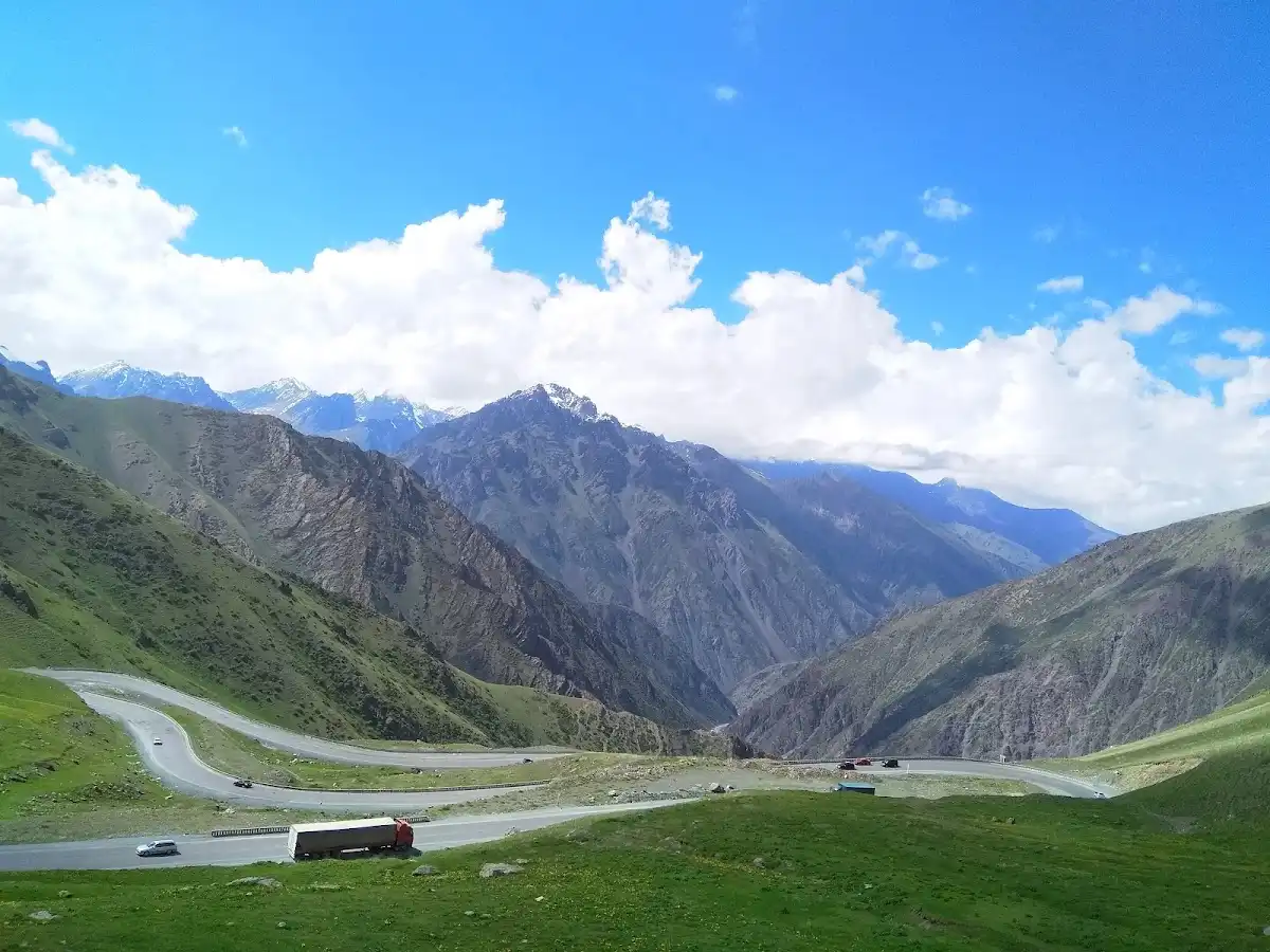
Most online summaries treat Too-Ashuu Pass as a tunnel you drive through, but the tunnel sits below the summit, so a shared taxi can carry you under the 3,586-meter crest without a glimpse of it. Get out and take the switchbacks. The pass lies in the central Tien Shan highlands of Kyrgyzstan and links the north with the south. Crowds are nonexistent, there is no ticket and no café, and the only cost is the fuel or seat fare you were paying anyway. The catch is that this is a transit point, not a destination, so expect no facilities and fast-changing weather. I stood at the top once with a thermos of tea going lukewarm in the wind, my fingers aching, while the road below zigzagged like dropped shoelaces. Photo potential is excellent, and the thin air keeps you honest.

Discover everything you want to know in the 📖 Kyrgyzstan Travel Guide.


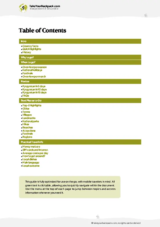
example page 0 from our offline Travel Guide for Kyrgyzstan
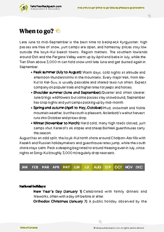
example page 1 from our offline Travel Guide for Kyrgyzstan
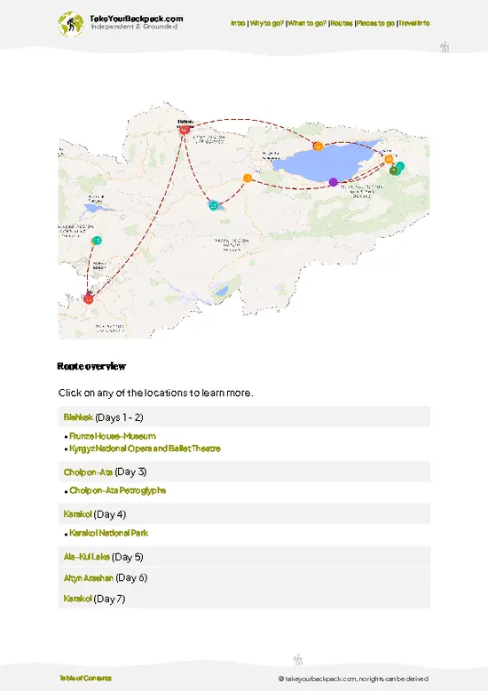
example page 2 from our offline Travel Guide for Kyrgyzstan
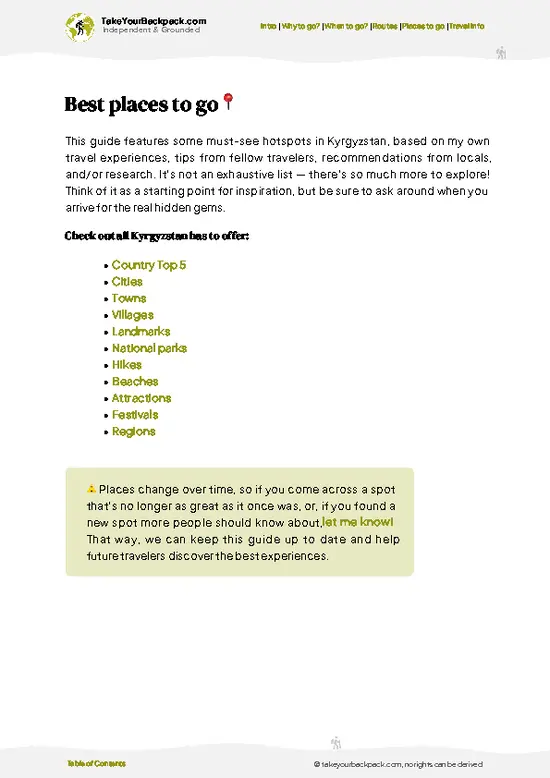
example page 3 from our offline Travel Guide for Kyrgyzstan
example page 4 from our offline Travel Guide for Kyrgyzstan
example page 5 from our offline Travel Guide for Kyrgyzstan
example page 6 from our offline Travel Guide for Kyrgyzstan
example page 7 from our offline Travel Guide for Kyrgyzstan
Loading the map 🌍
CLICK TO FILTER
cities
towns
villages
landmarks
national parks
hikes
beaches
attractions
festivals
regions
SHOW COUNTRY’S BESTSHOW ALL

✨ Why go?
Ranked #4 unique site in Kyrgyzstan
What makes it a must-see unique site

Backpackers make time for Too-Ashuu Pass because it is the kind of place you reach on the way to somewhere else and end up remembering longer than the somewhere else. Getting there costs nothing extra, since the road is the same one used by shared taxis and minibuses traveling between north and south Kyrgyzstan. Ask your driver to take the old switchback road instead of the tunnel, or hitch a ride and get dropped at the summit. It fits neatly into a north-south loop, linking lake regions, high-altitude villages and southern cities without a flight. At 3,586 meters, you also get a free taste of altitude before tackling higher passes and trekking routes. The effort is small: a detour of an hour or two, a warm layer in your daypack, and some patience. Few sights on a Kyrgyz itinerary are this cheap and this open.

💡 HighlightsWhat this place is best known for

  1. The switchback ascent: The road climbs the mountainside in tight hairpins, and each bend widens your view of the valley below. It is the best reason to choose the old road over the tunnel.
  2. The 3,586-meter summit: Standing at the crest gives you a clear sense of the north-south divide. The air is thin and cold even in summer, so a windbreaker is worth carrying.
  3. The tunnel route: The tunnel runs below the summit and shortens the crossing considerably. Driving through it is worth doing once, just to understand how much it changes the journey, especially in bad weather.
  4. Valley views from the top: On a clear day the slopes fall away in broad folds of grass and rock. Early morning gives the sharpest light and the least haze.
  5. Roadside stops and photo bends: Wide shoulders on several hairpins let a driver
… read more 👉
  1. The switchback ascent: The road climbs the mountainside in tight hairpins, and each bend widens your view of the valley below. It is the best reason to choose the old road over the tunnel.
  2. The 3,586-meter summit: Standing at the crest gives you a clear sense of the north-south divide. The air is thin and cold even in summer, so a windbreaker is worth carrying.
  3. The tunnel route: The tunnel runs below the summit and shortens the crossing considerably. Driving through it is worth doing once, just to understand how much it changes the journey, especially in bad weather.
  4. Valley views from the top: On a clear day the slopes fall away in broad folds of grass and rock. Early morning gives the sharpest light and the least haze.
  5. Roadside stops and photo bends: Wide shoulders on several hairpins let a driver pull over safely. These are the spots to photograph the zigzag road from above.
  6. High-altitude weather shifts: Sun, wind and cloud can swap places within the hour. Watching a front roll over the pass is a small show of its own.
I would pick the switchback ascent first, because it is the part the tunnel erases. Seeing the road wind upward lets you feel the climb the way travelers on this route always have, and it sets up every view that follows.
Spotted a mistake or missing something? Contact us.

Things to do near Too-Ashuu Pass

Ratings based on Tripadvisor reviews. When you book through this link, you support our work at no extra cost to you.

🌤️ When to go?When to go for the best experience

The best time to cross Too-Ashuu Pass is June to September, when the road is clear of snow and daytime temperatures at the summit sit around 5 to 15°C (41 to 59°F).
  • Summer (June to September): Reliable conditions, long daylight (about 14 hours in June), and cool air at 3,586 meters. Afternoon thunderstorms are common in July. This is also when shared taxis and marshrutkas run most often, and prices for rides stay flat.
  • Autumn (October to November): Crisp and quiet, with summit temperatures of about -5 to 5°C (23 to 41°F). Early snow can close the upper road for a day or two. Daylight drops to roughly 10 hours by November.
  • Winter (December to March): Temperatures fall to -20°C (-4°F) or lower, with ice and drifting snow on the switchbacks. Most traffic uses the tunnel below the summit, and you
… read more 👉
The best time to cross Too-Ashuu Pass is June to September, when the road is clear of snow and daytime temperatures at the summit sit around 5 to 15°C (41 to 59°F).
  • Summer (June to September): Reliable conditions, long daylight (about 14 hours in June), and cool air at 3,586 meters. Afternoon thunderstorms are common in July. This is also when shared taxis and marshrutkas run most often, and prices for rides stay flat.
  • Autumn (October to November): Crisp and quiet, with summit temperatures of about -5 to 5°C (23 to 41°F). Early snow can close the upper road for a day or two. Daylight drops to roughly 10 hours by November.
  • Winter (December to March): Temperatures fall to -20°C (-4°F) or lower, with ice and drifting snow on the switchbacks. Most traffic uses the tunnel below the summit, and you will see few other travelers.
  • Spring (April to May): Snowmelt, mud, and unpredictable storms. Roads can reopen and close within days.
Start before 10 a.m. so you cross the pass ahead of the afternoon clouds and weather.


source: climatestotravel.comJANJanuary: below average for travelingFEBFebruary: below average for travelingMARMarch: fair for travelingAPRApril: fair for travelingMAYMay: good for travelingJUNJune: highly recommended for travelingJULJuly: highly recommended for travelingAUGAugust: highly recommended for travelingSEPSeptember: good for travelingOCTOctober: fair for travelingNOVNovember: below average for travelingDECDecember: below average for traveling
kyrgyzstan-unique-site-too-ashuu-pass
© Google |

✈️ The backpacker research shortcutKyrgyzstan Travel Guide

An offline-friendly backpacking guide with optimized travel routes, ranked highlights, transport advice, and the best areas to stay.
example page 0 from our offline Travel Guide for Kyrgyzstan
example page 1 from our offline Travel Guide for Kyrgyzstan
example page 2 from our offline Travel Guide for Kyrgyzstan
example page 3 from our offline Travel Guide for Kyrgyzstan
example page 4 from our offline Travel Guide for Kyrgyzstan
example page 5 from our offline Travel Guide for Kyrgyzstan
example page 6 from our offline Travel Guide for Kyrgyzstan
example page 7 from our offline Travel Guide for Kyrgyzstan
The digital guide (242 pages) contains:
✅ 73 highlights, ranked by travel appeal
✅ Optimized 5, 10 & 15-day travel routes
✅ Cities, national parks, landmarks, beaches
✅ How to get around
✅ Offline-friendly for travel without Wi-Fi
👉 Click to see all 30+ guide features

📅 Plan smarter in minutes, not weeks
✅ Month by month travel advice
✅ Festivals & national holidays
✅ Budget expectations

🗺️ Go to the right places, skip the overrated ones
✅ Honest pros & cons of destinations
✅ Top hikes, parks & viewpoints
✅ Lesser-known places most travelers miss
✅ Clear “worth it vs skip it” guidance

🛏️ Travel smoothly without rookie mistakes
✅ Best areas to stay
✅ Transport systems explained simply
✅ Common scams & safety advice
✅ SIM cards, money & practical tips

🌍 Understand the country, not just visit it
✅ Culture & traditions
✅ 52 Essential phrases & customs
✅ Festivals worth planning around
✅ Traveler-friendly historical context
✅ Insights that make places more meaningful

📱 Built for real travel conditions
✅ Fully downloadable PDF
✅ Works completely offline
✅ Optimized for phone use
✅ Useful in remote areas & buses
✅ Everything in one place
Stop searching, start planning
Get instant access to your full guide. 30‑day money-back guarantee.
+ Add another guide for just

By proceeding you agree to our terms.
Sent to your inbox immediately after payment • 100% Secure Checkout
Best Backpacking Travel Advisor 2025 tourism awardBest Backpacking
Travel Advisor
2025
What others say about Take Your Backpack Guides:
⭐⭐⭐⭐⭐
Fantastic, amazing amount of information!
⭐⭐⭐⭐⭐
My goodness this is amazing, it's what I've been looking for hats off too you!
⭐⭐⭐⭐⭐
I think this is absolutely BRILLIANT
⭐⭐⭐⭐
Very complete and informative. It's still missing places, but I gotta to commend you
⭐⭐⭐⭐⭐
This is truly amazing, thank you, can't wait to explore it with my kids!
⭐⭐⭐⭐⭐
Awesome resource, thank you!
⭐⭐⭐⭐⭐
This is amazing! Can't wait to explore the ones I haven't seen
⭐⭐⭐⭐
I love this! Well done, great idea.
⭐⭐⭐⭐⭐
Thanks for taking the time to make this gem!
⭐⭐⭐⭐⭐
This might be the best website I've ever seen.
⭐⭐⭐⭐⭐
Congratulations, and thank you so much for your work; it's incredibly valuable.
⭐⭐⭐⭐
In all seriousness I think you did a great job pointing out the important spots
⭐⭐⭐⭐⭐
10/10 very good
⭐⭐⭐⭐⭐
As someone who's only just starting to visit regularly this is awesome, thank you.
⭐⭐⭐⭐
Thank you very much! I'm going to visit my dad, it's going to be very useful!
⭐⭐⭐⭐⭐
This is really cool! We'll be travelling for the first time and this definitely come in handy.
⭐⭐⭐⭐⭐
You are now our minister of culture, congratulations 👨‍💼
⭐⭐⭐⭐⭐
Just wanted to tell you that this is a pearl! Going to follow your recommendations.
⭐⭐⭐⭐⭐
This is so cool. I'll definitely be using the resource for my travels soon.
⭐⭐⭐⭐⭐
This is very impressive! Good work.
⭐⭐⭐⭐⭐
This is an amazing and informative site. Very well done!

🛏️ Where to stay?Choosing the right base

The best base for the pass is Naryn, the regional town on the southern side, with Kochkor and Bishkek as alternatives to the north. Naryn has the most budget beds close to the road, a few guesthouses run by families who arrange shared taxis, and a quiet, safe center where solo travelers meet others heading to Tash Rabat, Song Kol, or the Torugart route. Expect home-style dinners at long shared tables, which makes it easy to find travel partners and split taxi fares.
Kochkor is the better pick if you want village life. Its homestays and guesthouses are used to backpackers, the owners can organize … read more 👉
The best base for the pass is Naryn, the regional town on the southern side, with Kochkor and Bishkek as alternatives to the north. Naryn has the most budget beds close to the road, a few guesthouses run by families who arrange shared taxis, and a quiet, safe center where solo travelers meet others heading to Tash Rabat, Song Kol, or the Torugart route. Expect home-style dinners at long shared tables, which makes it easy to find travel partners and split taxi fares.
Kochkor is the better pick if you want village life. Its homestays and guesthouses are used to backpackers, the owners can organize horse treks and Song Kol transfers, and the town sits on the main route between Bishkek, Issyk-Kul, and Naryn. It is calm, walkable, and well suited to solo travelers.
Bishkek works if you want to leave early with the widest choice of hostels and the easiest onward connections, though you will spend several hours on the road before reaching the pass. Staying near the summit itself is rarely practical, since services are limited to roadside cafes and a few basic yurt camps in summer. Plan to sleep in a town and cross the pass as a day leg.

👛 Costs (as of 15 October 2026)Typical daily expenses

Crossing Too-Ashuu Pass costs very little, since there is no entrance fee and the expense is the transport and the meals along the way. Most backpackers spend roughly USD 25 to 45 a day while traveling this route.
CategoryBudget RangeLocal Reality
Pass accessUSD 0The road is public and free. Any tunnel toll, if charged, is small and paid in cash.
Shared taxi or marshrutkaUSD 5 to 15 per seatBishkek to Naryn is around 5 to 7 hours depending on stops and weather. Taxis leave when full, usually in the morning.
Private car with driverUSD 60 to 120Useful for photo stops on the switchbacks. Prices are negotiable and split easily among travelers.
Guesthouse or homestayUSD 10 to 25Dorm beds or family rooms in Naryn and Kochkor, often with breakfast included.
MealsUSD 3 to 8Roadside cafes serve lagman, plov,
… read more 👉
Crossing Too-Ashuu Pass costs very little, since there is no entrance fee and the expense is the transport and the meals along the way. Most backpackers spend roughly USD 25 to 45 a day while traveling this route.
CategoryBudget RangeLocal Reality
Pass accessUSD 0The road is public and free. Any tunnel toll, if charged, is small and paid in cash.
Shared taxi or marshrutkaUSD 5 to 15 per seatBishkek to Naryn is around 5 to 7 hours depending on stops and weather. Taxis leave when full, usually in the morning.
Private car with driverUSD 60 to 120Useful for photo stops on the switchbacks. Prices are negotiable and split easily among travelers.
Guesthouse or homestayUSD 10 to 25Dorm beds or family rooms in Naryn and Kochkor, often with breakfast included.
MealsUSD 3 to 8Roadside cafes serve lagman, plov, and samsa. A full homestay dinner costs a little more.
Snacks and waterUSD 1 to 3Stock up in town, as prices rise at roadside stalls near the summit.
Yurt camp stayUSD 15 to 30Available in summer near the route, with dinner and breakfast often included.
Carry small bills in Kyrgyzstani som, since drivers and cafes rarely give change for large notes and card payments are unreliable outside towns.
⚠️ Prices can change and everyone travels differently, so take this as a rough guide. Hope it helps you plan your adventure!

FAQCommon questions from travelers

Too-Ashuu Pass is a high mountain pass in Kyrgyzstan at 3,586 meters, linking the north and south of the country. The old road climbs in switchbacks to the summit, while a tunnel below the crest offers a faster crossing. It is a working road with no entry fee and few services.
Plan one to two hours if you are already traveling this road and want to stop at the summit and take photos. If you walk parts of the switchbacks or wait for a ride back down, allow half a day. Since the pass is a transit point rather than an attraction, most travelers add it to a longer north-south journey instead of giving it a full day.
Most travelers reach it by shared taxi or minibus on the road between northern and southern Kyrgyzstan, with fares usually in the range of a few hundred to over a thousand Kyrgyz som depending on distance. Ask the driver to use the old summit road instead of the tunnel, or arrange a private car for a short stop. Hitchhiking is common, but carry warm layers and water, since the summit is cold and exposed.
⚠️ Things can change over time, so always validate details locally before you go.

Other Kyrgyz landmarks near Too-Ashuu Pass

Explore more nearby:

  • Osh Bazaar—Produce stalls, bread ovens, dried fruit, Sunday crowds| 86 km away
  • Ala-Too Square—Ceremonial guard changes, Manas statue, Soviet-era façades, fountains| 88 km away
  • Tash Rabat—Stone caravanserai, At-Bashy valley, Silk Road stop, yurt stays| 209 km away

💡 Not sure where to go next?
Create a personalized itinerary for Kyrgyzstan including Too-Ashuu Pass and the places that fit your trip.

Generate my itinerary

👉 Discover all landmarks

Or checkout all Kyrgyzstan has to offer (think cities, towns, villages, national parks, hikes, beaches, festivals)
Country photo of Kyrgyzstan

We 💚 feedbackParting advice and final tips

Tuz Ashu is worth it for the switchbacks alone. Climbing the old road to the summit gives you the geography of Kyrgyzstan in about an hour, with no fee and no crowd. But it won’t suit everyone. There is nothing to do once you arrive, no shelter, and the cold wind bites. Treat it as a stop, not a destination.

✈️ When did I visit Kyrgyzstan?
I started my 1.5 year travel around the world trip in June 2015 in Kyrgyzstan.

✍️ Help improve this page!
The information on this page is based on my own backpacking experience in Kyrgyzstan, supplemented with up-to-date research and feedback from other travelers. Travel details can change, so if you notice anything outdated or incomplete, feel free to let me know.


🙋‍♂️ Give feedback

👋 Meet the founderWho’s Behind Take Your Backpack?

Johan, backpacker and founder of TakeYourBackpackHi, I’m Johan (Netherlands 🇳🇱), the creator of TakeYourBackpack. Over the past 3 decades, I’ve backpacked through 90+ countries across six continents, gaining extensive experience with independent travel, long-term trips, and overland routes.

This site is built on a combination of firsthand travel experience and carefully curated insights from other backpackers. Many guides are based on places I’ve personally visited, while others bring together tips, observations, and practical advice shared by trusted travelers I’ve met along the way.

The goal is to provide realistic, experience-driven guidance — not generic itineraries — so you can explore destinations with better context, clearer expectations, and more confidence.