×

Mali🇲🇱 | hikesTellem Caves TrailTellem granaries, Ireli cliff face, baobab groves, burial caves | things to do and best time to go

Explore Hombori TondoExplore Niger River Trek

Backpacking in Tellem Caves Trail
👌 Worth visitinghike ranked #3
By Johan Kruseman 🇳🇱 | Updated October 22, 2026

From the path, the Tellem granaries look like dark squares of mud brick glued to the rock, and the cliff face above Ireli is the easiest place to pick out a whole row of them. Tellem Caves Trail follows the Bandiagara Escarpment in the Dogon country of central Mali, southeast of Mopti. The cliff runs up to roughly 500 meters high. You walk sandy tracks across the plateau, drop down boulder-choked gullies, then cross flat plain below the wall, usually over about three days. Difficulty is moderate: the heat and the descents wear you out more than the distances do. Shared taxis and buses run from Mopti and Sévaré to Bandiagara, and from there you arrange a final lift to the trailhead. Skip the souvenir stalls and spend the time on the granaries. Unlike the popular Sangha circuit, which stays mostly on the plateau, this route keeps you at the foot of the cliff, where the burial caves are close enough to study.

Discover everything you want to know in the 📖 Mali Travel Guide.
Best time to go: October - March
Duration: 3 days
Distance: 40 kilometers
Total ascent: 800 meters
Safety warning

The current risk level for Mali is high. Check the advice before going.


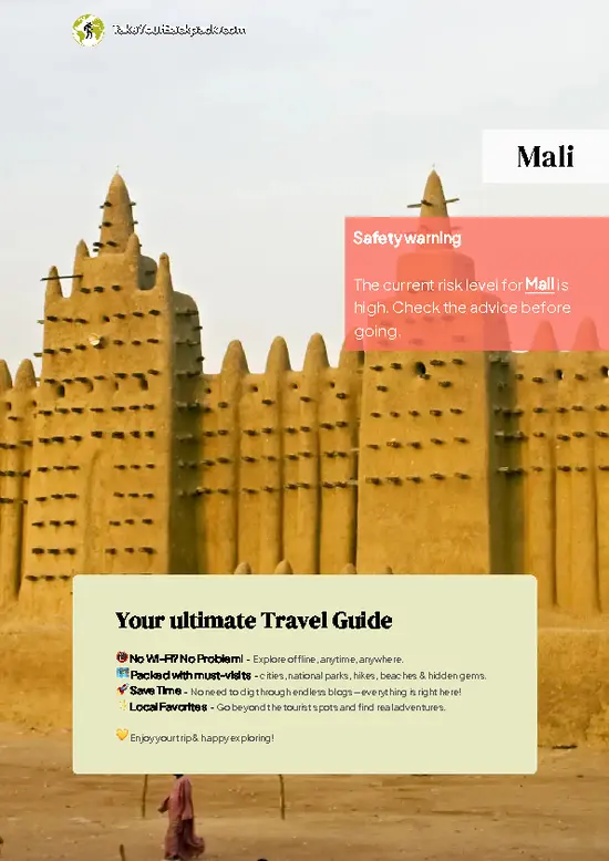
example page 0 from our offline Travel Guide for Mali
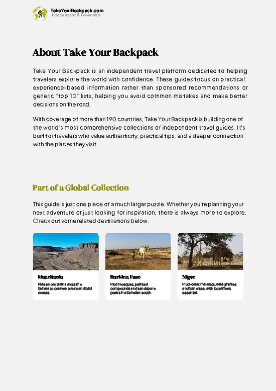
example page 1 from our offline Travel Guide for Mali
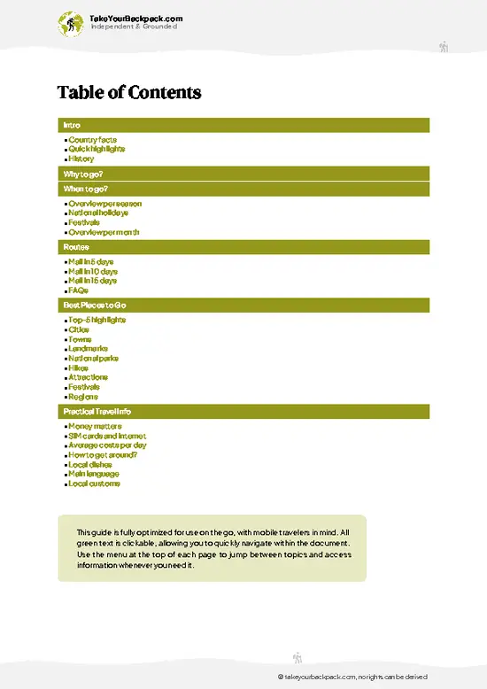
example page 2 from our offline Travel Guide for Mali
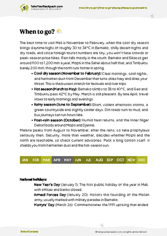
example page 3 from our offline Travel Guide for Mali
example page 4 from our offline Travel Guide for Mali
example page 5 from our offline Travel Guide for Mali
example page 6 from our offline Travel Guide for Mali
example page 7 from our offline Travel Guide for Mali
Loading the map 🌍
CLICK TO FILTER
cities
towns
landmarks
national parks
hikes
attractions
festivals
regions
SHOW COUNTRY’S BESTSHOW ALL

✨ Why go?
Ranked #3 hike in Mali
Why Tellem Caves Trail should be on your travel list

Tellem Caves Trail gives you an archaeological site you walk through, not a fenced exhibit. The Tellem granaries and burial caves were built into the escarpment before the Dogon arrived, and you see them from the same footpaths villagers use every day. That access is the main draw. You can stop under a cliff, spot the tiny doorways far above, and ask your guide which are Tellem work and which are later Dogon additions.
The second reason is flexibility. Villages such as Teli, Ende and Begnimato sit roughly a day apart, so you can cut the route to two days or stretch it to four. Guesthouses and rooftop sleeping platforms in the villages mean you carry little more than water and a sleeping sheet.
It also fits easily into a longer Mali itinerary. Riverside Mopti and the Friday market at Bandiagara … read more 👉
Tellem Caves Trail gives you an archaeological site you walk through, not a fenced exhibit. The Tellem granaries and burial caves were built into the escarpment before the Dogon arrived, and you see them from the same footpaths villagers use every day. That access is the main draw. You can stop under a cliff, spot the tiny doorways far above, and ask your guide which are Tellem work and which are later Dogon additions.
The second reason is flexibility. Villages such as Teli, Ende and Begnimato sit roughly a day apart, so you can cut the route to two days or stretch it to four. Guesthouses and rooftop sleeping platforms in the villages mean you carry little more than water and a sleeping sheet.
It also fits easily into a longer Mali itinerary. Riverside Mopti and the Friday market at Bandiagara make natural stops before or after the cliffs, and the walking gives you a slower look at Dogon farming, masks and granary architecture than any road trip could.

💡 HighlightsTop highlights of Tellem Caves Trail

  1. Tellem Granaries above Ireli: This is the sight most people come for. Rows of small mud-plastered storerooms and burial chambers cling to ledges high in the cliff, in places that look unreachable without ropes. The Tellem lived here before the Dogon, and the height is part of the story.
  2. Teli Cliff Village: Teli has old Tellem structures in the rock above and Dogon houses below. The village also shows the neat conical granary roofs, thatched like small hats, that you will learn to recognize.
  3. Banani Escarpment Views: The cliff walk near Banani opens out over the flat Seno plain, with the wall dropping sharply beneath you. The surrounding rock holds more cave openings, so bring binoculars to pick out details.
  4. Ende and Begnimato Cliff Paths: These stretches follow the foot of the wall through boulder
… read more 👉
  1. Tellem Granaries above Ireli: This is the sight most people come for. Rows of small mud-plastered storerooms and burial chambers cling to ledges high in the cliff, in places that look unreachable without ropes. The Tellem lived here before the Dogon, and the height is part of the story.
  2. Teli Cliff Village: Teli has old Tellem structures in the rock above and Dogon houses below. The village also shows the neat conical granary roofs, thatched like small hats, that you will learn to recognize.
  3. Banani Escarpment Views: The cliff walk near Banani opens out over the flat Seno plain, with the wall dropping sharply beneath you. The surrounding rock holds more cave openings, so bring binoculars to pick out details.
  4. Ende and Begnimato Cliff Paths: These stretches follow the foot of the wall through boulder fields and shaded baobab groves. They are a quieter section where you can walk for long periods without seeing anyone but farmers heading to their fields.
  5. Toguna Meeting Shelters: Each village has a low-roofed toguna, where elders sit to debate. The ceiling is built low on purpose, so people cannot stand up in anger. Sit under one with your guide and you will hear how village decisions are made.
Tellem Caves Trail is best started at Ireli's granaries, because seeing them first teaches you what to look for on the cliffs in every village afterward.
Spotted a mistake or missing something? Contact us.

🌤️ When to go?Seasonal considerations and timing

  • Cool Dry Season (November to February): This is the window for walking the Bandiagara Escarpment. Days reach 30 to 35°C (86 to 95°F) and nights drop to 14 to 20°C (57 to 68°F), cool enough for a sleeping bag layer. Harmattan dust can haze the views and photos. Crowds and guide demand peak around Christmas, and prices rise a little.
  • Hot Season (March to May): Afternoons reach 40 to 44°C (104 to 111°F). Cliff rock holds heat, so walks start at dawn and stop by late morning. Villages are quiet and guides are easy to book.
  • Rainy Season (June to September): Expect 28 to 35°C (82 to 95°F), humid air and sudden storms. Sandy tracks turn slick, gullies flood and the greenery is lovely, but the cliff paths get risky. Few visitors come and rates soften.
  • Shoulder Weeks (October): Fields are green, the heat
… read more 👉
  • Cool Dry Season (November to February): This is the window for walking the Bandiagara Escarpment. Days reach 30 to 35°C (86 to 95°F) and nights drop to 14 to 20°C (57 to 68°F), cool enough for a sleeping bag layer. Harmattan dust can haze the views and photos. Crowds and guide demand peak around Christmas, and prices rise a little.
  • Hot Season (March to May): Afternoons reach 40 to 44°C (104 to 111°F). Cliff rock holds heat, so walks start at dawn and stop by late morning. Villages are quiet and guides are easy to book.
  • Rainy Season (June to September): Expect 28 to 35°C (82 to 95°F), humid air and sudden storms. Sandy tracks turn slick, gullies flood and the greenery is lovely, but the cliff paths get risky. Few visitors come and rates soften.
  • Shoulder Weeks (October): Fields are green, the heat eases and the trail is nearly empty.
Daylight stays close to 11 to 13 hours, so plan to be off the cliff before dark. Book your guide a few days ahead at Christmas.


source: climatestotravel.comJANJanuary: excellent for travelingFEBFebruary: excellent for travelingMARMarch: good for travelingAPRApril: fair for travelingMAYMay: below average for travelingJUNJune: below average for travelingJULJuly: below average for travelingAUGAugust: below average for travelingSEPSeptember: fair for travelingOCTOctober: good for travelingNOVNovember: excellent for travelingDECDecember: excellent for traveling
when-to-go

✈️ The backpacker research shortcutMali Travel Guide

An offline-friendly backpacking guide with optimized travel routes, ranked highlights, transport advice, and the best areas to stay.
example page 0 from our offline Travel Guide for Mali
example page 1 from our offline Travel Guide for Mali
example page 2 from our offline Travel Guide for Mali
example page 3 from our offline Travel Guide for Mali
example page 4 from our offline Travel Guide for Mali
example page 5 from our offline Travel Guide for Mali
example page 6 from our offline Travel Guide for Mali
example page 7 from our offline Travel Guide for Mali
The digital guide (266 pages) contains:
✅ 61 highlights, ranked by travel appeal
✅ Optimized 5, 10 & 15-day travel routes
✅ Cities, national parks, landmarks, beaches
✅ How to get around
✅ Offline-friendly for travel without Wi-Fi
👉 Click to see all 30+ guide features

📅 Plan smarter in minutes, not weeks
✅ Month by month travel advice
✅ Festivals & national holidays
✅ Budget expectations

🗺️ Go to the right places, skip the overrated ones
✅ Honest pros & cons of destinations
✅ Top hikes, parks & viewpoints
✅ Lesser-known places most travelers miss
✅ Clear “worth it vs skip it” guidance

🛏️ Travel smoothly without rookie mistakes
✅ Best areas to stay
✅ Transport systems explained simply
✅ Common scams & safety advice
✅ SIM cards, money & practical tips

🌍 Understand the country, not just visit it
✅ Culture & traditions
✅ 52 Essential phrases & customs
✅ Festivals worth planning around
✅ Traveler-friendly historical context
✅ Insights that make places more meaningful

📱 Built for real travel conditions
✅ Fully downloadable PDF
✅ Works completely offline
✅ Optimized for phone use
✅ Useful in remote areas & buses
✅ Everything in one place
Stop searching, start planning
Get instant access to your full guide. 30‑day money-back guarantee.
+ Add another guide for just

By proceeding you agree to our terms.
Sent to your inbox immediately after payment • 100% Secure Checkout
Best Backpacking Travel Advisor 2025 tourism awardBest Backpacking
Travel Advisor
2025
What others say about Take Your Backpack Guides:
⭐⭐⭐⭐⭐
Fantastic, amazing amount of information!
⭐⭐⭐⭐⭐
My goodness this is amazing, it's what I've been looking for hats off too you!
⭐⭐⭐⭐⭐
I think this is absolutely BRILLIANT
⭐⭐⭐⭐
Very complete and informative. It's still missing places, but I gotta to commend you
⭐⭐⭐⭐⭐
This is truly amazing, thank you, can't wait to explore it with my kids!
⭐⭐⭐⭐⭐
Awesome resource, thank you!
⭐⭐⭐⭐⭐
This is amazing! Can't wait to explore the ones I haven't seen
⭐⭐⭐⭐
I love this! Well done, great idea.
⭐⭐⭐⭐⭐
Thanks for taking the time to make this gem!
⭐⭐⭐⭐⭐
This might be the best website I've ever seen.
⭐⭐⭐⭐⭐
Congratulations, and thank you so much for your work; it's incredibly valuable.
⭐⭐⭐⭐
In all seriousness I think you did a great job pointing out the important spots
⭐⭐⭐⭐⭐
10/10 very good
⭐⭐⭐⭐⭐
As someone who's only just starting to visit regularly this is awesome, thank you.
⭐⭐⭐⭐
Thank you very much! I'm going to visit my dad, it's going to be very useful!
⭐⭐⭐⭐⭐
This is really cool! We'll be travelling for the first time and this definitely come in handy.
⭐⭐⭐⭐⭐
You are now our minister of culture, congratulations 👨‍💼
⭐⭐⭐⭐⭐
Just wanted to tell you that this is a pearl! Going to follow your recommendations.
⭐⭐⭐⭐⭐
This is so cool. I'll definitely be using the resource for my travels soon.
⭐⭐⭐⭐⭐
This is very impressive! Good work.
⭐⭐⭐⭐⭐
This is an amazing and informative site. Very well done!

🛏️ Where to stay?Choosing the right base

If you enjoy meeting fellow travelers, consider choosing hostels with high ratings for atmosphere. On the other hand, if you prefer having your own space, a hotel might be a better option.

🥾 Hike detailsHike details: route, duration, and difficulty of Tellem Caves Trail

Total Distance: Roughly 40 kilometers on the typical three-day version, adjustable by choosing where to start and finish.
Duration: Two to four days, with three the usual choice.
Difficulty: Moderate. The paths are mostly simple, but sand, heat and rocky descents slow you down.
Starting Point: Bandiagara town, reached by shared taxi or bus from Mopti and Sévaré. Local drivers then take you to the trailhead villages.
Major Landmarks:
  • Ireli: Tellem granaries in a long row on the cliff.
  • Teli: Cliff village with Tellem and Dogon buildings side by side.
  • Ende and Begnimato: Villages along the foot of the escarpment
… read more 👉
Total Distance: Roughly 40 kilometers on the typical three-day version, adjustable by choosing where to start and finish.
Duration: Two to four days, with three the usual choice.
Difficulty: Moderate. The paths are mostly simple, but sand, heat and rocky descents slow you down.
Starting Point: Bandiagara town, reached by shared taxi or bus from Mopti and Sévaré. Local drivers then take you to the trailhead villages.
Major Landmarks:
  • Ireli: Tellem granaries in a long row on the cliff.
  • Teli: Cliff village with Tellem and Dogon buildings side by side.
  • Ende and Begnimato: Villages along the foot of the escarpment with guesthouses.
  • Banani: Viewpoints over the plain and more cave openings.
Terrain and Scenery: Sandy plateau tracks, stone staircases, boulder gullies and flat plain below a wall of sandstone that reaches up to roughly 500 meters. Some descents use rough steps worn into the rock.
Vegetation: Baobabs, acacia, shea trees and small onion gardens irrigated by hand near the villages. The plain is dry scrub and millet fields.
Wildlife: Mostly birds, lizards and baboons on the cliff. Large mammals are rare, and swifts and kestrels circle the rock faces.
Practical Notes: Local guides are standard and handle village permissions. Carry plenty of water and a sleeping sheet, since beds are simple and the afternoon heat is strong.
⚠️ Hiking info can sometimes be outdated or inaccurate. Before you hit the trail, check the latest conditions with locals. If you do spot anything that's off, I'd love to hear from you, so I can update it for fellow travelers.

🛡️ SafetyScams, Hazards, and Annoyances

Tellem Caves Trail is a manageable walk for anyone with normal fitness, and the main hazard is heat. Temperatures climb fast on the exposed escarpment, so start at first light, carry at least 3 liters of water per person and wear a hat. Footing is the next concern. The descent from the plateau uses steep, loose, sandy steps and boulder scrambles, and the old Tellem granaries sit on cliff ledges. Move slowly, use handholds and never climb the ancient structures, which are fragile and often sacred. In the rainy season the rock gets slick and gullies run quickly, so postpone if a storm is building. Local guides handle navigation between villages, and their rules on sacred sites matter, so ask before photographing people, shrines or ceremonies. Cobras and scorpions exist but are rarely met on … read more 👉
Tellem Caves Trail is a manageable walk for anyone with normal fitness, and the main hazard is heat. Temperatures climb fast on the exposed escarpment, so start at first light, carry at least 3 liters of water per person and wear a hat. Footing is the next concern. The descent from the plateau uses steep, loose, sandy steps and boulder scrambles, and the old Tellem granaries sit on cliff ledges. Move slowly, use handholds and never climb the ancient structures, which are fragile and often sacred. In the rainy season the rock gets slick and gullies run quickly, so postpone if a storm is building. Local guides handle navigation between villages, and their rules on sacred sites matter, so ask before photographing people, shrines or ceremonies. Cobras and scorpions exist but are rarely met on a daytime walk. Bring a headlamp, basic first aid and rehydration salts.

FAQTraveler FAQ

Tellem Caves Trail takes 1 day for a single cliff visit near Sangha or Dourou, or 3 to 5 days for the full Bandiagara Escarpment trek. Most multi-day routes cover 10 to 20 km a day, linking Dogon villages such as Ireli, Tireli, Banani and Begnimato. Most hikers start from Bandiagara or Sévaré, roughly 1 to 2 hours by road.
Tellem Caves Trail is moderate overall. Daily distances are short, but steep sandy descents, boulder scrambles and heat of 30 to 40°C (86 to 104°F) make it tiring. A day walk suits average fitness, while multi-day treks need decent stamina and good ankle support. Rainy season (June to September) adds slippery footing.
Yes, you need a local guide for Tellem Caves Trail, and Dogon communities require it for access to villages and sacred sites. Guides usually cost about €15 to 30 a day, and village or visitor fees of about €3 to 8 per person are common. Book through a hotel in Sévaré or Bandiagara, and check the current security situation first, as travel advice for central Mali is restrictive.
⚠️ Things can change over time, so always validate details locally before you go.

Other Malian hikes near Tellem Caves Trail

Explore more nearby:

  • Dogon Country Trek—Escarpment villages, cliff descents, masked dances, rooftop mattresses
  • Hombori Tondo—Hand of Fatima, granite-free sandstone spires, boulder fields, climbing walls
  • Niger River Trek—floodplain villages, seasonal wetlands, ferry crossings, riverside markets

💡 Not sure where to go next?
Create a personalized itinerary for Mali including Tellem Caves Trail and the places that fit your trip.

Generate my itinerary

👉 Discover all hikes

Or checkout all Mali has to offer (think cities, towns, villages, national parks, hikes, beaches, festivals)
Country photo of Mali

We 💚 feedbackWhat to keep in mind

Give Tellem Caves Trail three days, not two. The first day gets you used to the heat, the second is when the granaries finally make sense, and the third lets you slow down at a village toguna. I would hire a guide from Bandiagara who is from the area, and I would check current security conditions in central Mali with them before committing.

✍️ Help improve this page!
The information on this page is based on in-depth research, insights shared by experienced travelers, and feedback from the local travel community in Mali. While every effort is made to keep the information accurate and current, conditions can change — so if you spot anything incorrect or outdated, please get in touch.


🙋‍♂️ Give feedback

👋 Meet the founderWho’s Behind Take Your Backpack?

Johan, backpacker and founder of TakeYourBackpackHi, I’m Johan (Netherlands 🇳🇱), the creator of TakeYourBackpack. Over the past 3 decades, I’ve backpacked through 90+ countries across six continents, gaining extensive experience with independent travel, long-term trips, and overland routes.

This site is built on a combination of firsthand travel experience and carefully curated insights from other backpackers. Many guides are based on places I’ve personally visited, while others bring together tips, observations, and practical advice shared by trusted travelers I’ve met along the way.

The goal is to provide realistic, experience-driven guidance — not generic itineraries — so you can explore destinations with better context, clearer expectations, and more confidence.