
×

Marshall Islands🇲🇭 | hikesBokak Atoll TrailUninhabited ring, nesting seabirds, turtle tracks, charter-only access | things to do and best time to go

Explore Nitijela DayExplore Majuro Island Walk

Backpacking in Bokak Atoll Trail
By Johan Kruseman 🇳🇱 | Updated October 15, 2026

Bokak Atoll Trail gives you an entire atoll with no other hikers, no fences and no footprints but your own. It lies at the far north of Marshall Islands, an uninhabited ring of low islets around a pale lagoon, with coral rubble crunching underfoot and terns screaming overhead. The walk is flat and the difficulty comes from heat, glare and logistics. No public transport reaches it. You need a chartered boat or a yacht, landowner and government permission, and plenty of spare days. Arrange permits before you book anything, or the trip can stall in port. Carry all your drinking water, since the islets have no reliable source, and wear closed reef shoes because the sharp coral shreds sandals. Pack food for extra days in case seas delay your pickup. Unlike Bikar Atoll, a smaller seabird and turtle refuge, Bokak offers longer shoreline walking and a much larger lagoon.

Discover everything you want to know in the 📖 Marshall Islands Travel Guide.
Best time to go: December - April
Duration: 2 days
Distance: 25 kilometers
Total ascent: 10 meters


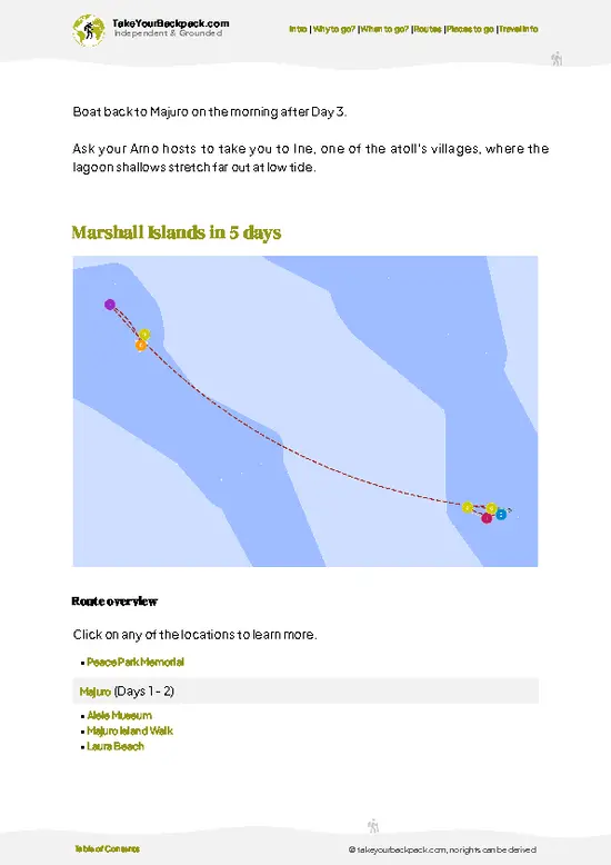
example page 0 from our offline Travel Guide for Marshall Islands
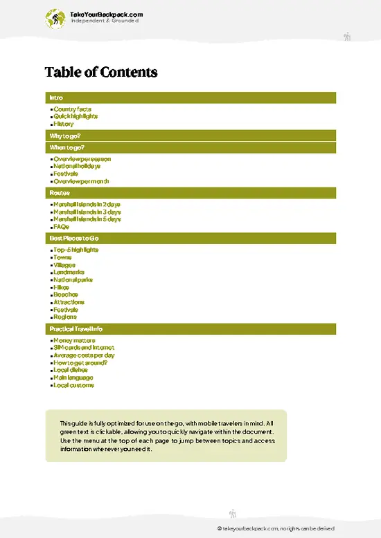
example page 1 from our offline Travel Guide for Marshall Islands
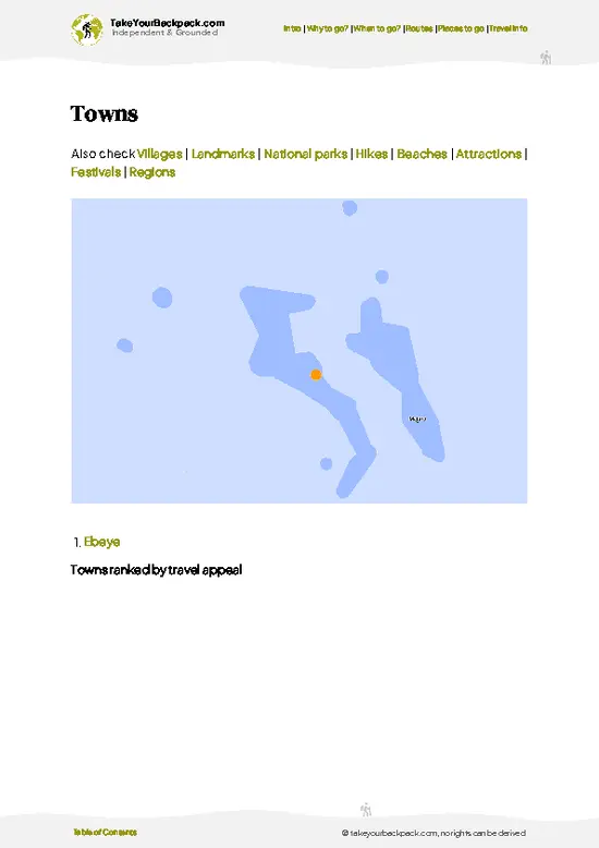
example page 2 from our offline Travel Guide for Marshall Islands
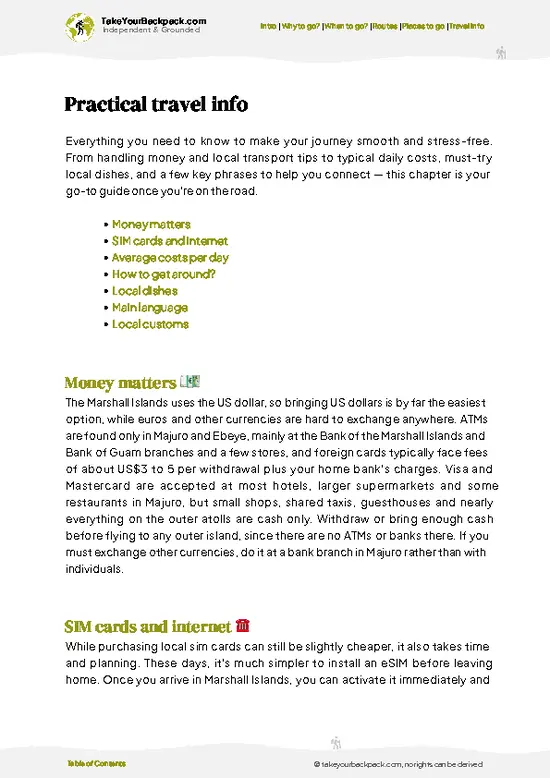
example page 3 from our offline Travel Guide for Marshall Islands
example page 4 from our offline Travel Guide for Marshall Islands
example page 5 from our offline Travel Guide for Marshall Islands
example page 6 from our offline Travel Guide for Marshall Islands
example page 7 from our offline Travel Guide for Marshall Islands
Loading the map 🌍
CLICK TO FILTER
towns
villages
landmarks
national parks
hikes
beaches
attractions
festivals
regions
SHOW COUNTRY’S BESTSHOW ALL

✨ Why go?
Ranked #99 hike in Marshall Islands
What makes this hike worth hiking

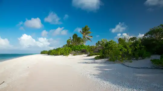
Backpackers chase Bokak for the sheer emptiness of the northernmost atoll in the country. Almost everywhere else in the Pacific you share a beach with someone, and here you can walk a shoreline for hours and see only birds, crabs and the occasional turtle track. The scenery earns the hassle: a wide lagoon that shifts from milky turquoise to deep blue, with ocean-facing reef flats that thunder when the swell rolls in.

It also suits people who like their route flexible. You walk the islets as far as tide, heat and water supplies allow, then turn around, so the distance is yours to set. The Taongi conservation area status means the point is observing nesting seabirds and green turtle beaches without disturbing them, not ticking off sights. For travelers already crossing the Marshalls, it is … read more 👉
Backpackers chase Bokak for the sheer emptiness of the northernmost atoll in the country. Almost everywhere else in the Pacific you share a beach with someone, and here you can walk a shoreline for hours and see only birds, crabs and the occasional turtle track. The scenery earns the hassle: a wide lagoon that shifts from milky turquoise to deep blue, with ocean-facing reef flats that thunder when the swell rolls in.

It also suits people who like their route flexible. You walk the islets as far as tide, heat and water supplies allow, then turn around, so the distance is yours to set. The Taongi conservation area status means the point is observing nesting seabirds and green turtle beaches without disturbing them, not ticking off sights. For travelers already crossing the Marshalls, it is the extreme add-on, the one story from the trip that nobody else on the hostel terrace in Majuro can match.

💡 HighlightsThe experiences that define the visit

  1. Bokak Lagoon: The reason to come. The shallow, wind-ruffled lagoon changes color with the depth and light, from near-white over sand to inky blue at the coral heads. Walk its inner shore at low tide when the flats are firm and clear.
  2. Seabird Colonies on the Northern Islets: Terns, noddies and tropicbirds nest on the ground and in the shrubs. The noise and the ammonia smell hit you before you see the birds. Keep your distance and your steps careful, because eggs sit directly on the sand.
  3. Green Turtle Beaches: The sandy stretches on the quieter islets are used by green turtles, and you can read their tracks in the morning as wide, dragged furrows up the beach. Sightings of the animals themselves come mostly at dusk and in the lagoon shallows.
  4. Ocean-Side Reef Flats: The outer edge of the atoll is
… read more 👉
  1. Bokak Lagoon: The reason to come. The shallow, wind-ruffled lagoon changes color with the depth and light, from near-white over sand to inky blue at the coral heads. Walk its inner shore at low tide when the flats are firm and clear.
  2. Seabird Colonies on the Northern Islets: Terns, noddies and tropicbirds nest on the ground and in the shrubs. The noise and the ammonia smell hit you before you see the birds. Keep your distance and your steps careful, because eggs sit directly on the sand.
  3. Green Turtle Beaches: The sandy stretches on the quieter islets are used by green turtles, and you can read their tracks in the morning as wide, dragged furrows up the beach. Sightings of the animals themselves come mostly at dusk and in the lagoon shallows.
  4. Ocean-Side Reef Flats: The outer edge of the atoll is a pale platform of coral rock, with surf booming against the reef edge. Tide pools hold small fish and hermit crabs. Check the tide before you go out, as the flats flood quickly.
  5. Pisonia and Scaevola Groves: The islets’ interior vegetation is low, tangled and surprisingly cool. Pisonia trees host nesting birds in their canopy, and the shade makes these groves the best place for midday rests.
Allow a full day to see the lagoon edge and one or two islets, and two to three days if you want to cover several islets at an unhurried pace.
Spotted a mistake or missing something? Contact us.

🌤️ When to go?Weather, crowds, and seasonal trade-offs

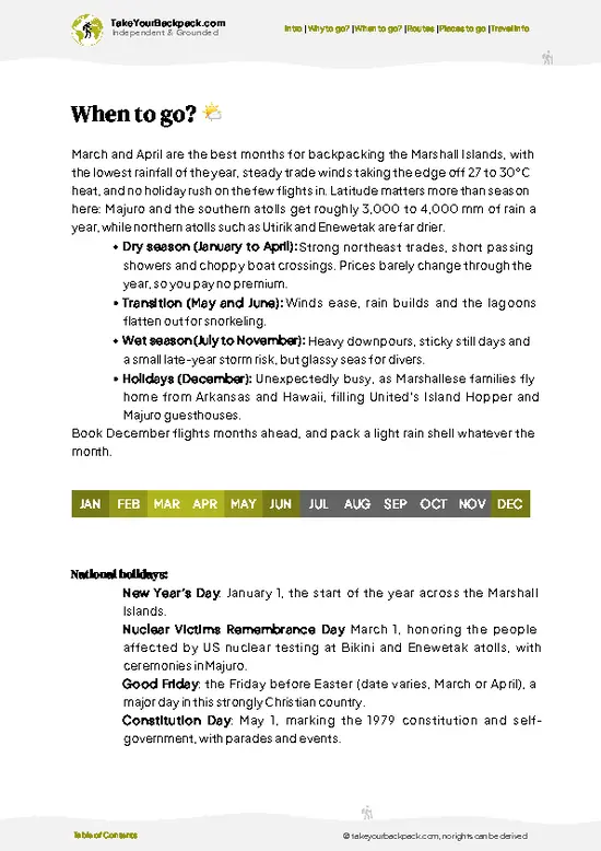
  • Dry Season (December to April): Calmer, sunnier weeks with northeast trade winds, and the best window for a boat crossing and landing in the lagoon. Days run 27 to 30°C (81 to 86°F), nights around 25°C (77°F), with roughly 11 to 12 hours of daylight.
  • Wet Season (May to November): Squalls and rougher open water make the passage slower and landings harder. Highs sit at 28 to 31°C (82 to 88°F) with heavy humidity, and daylight stretches to nearly 13 hours around June.
  • Typhoon Risk (July to November): Storms track through the region and can cancel a voyage with little notice. Bokak is farther north and drier than the southern atolls, but it has no shelter ashore.
  • Wildlife Season: Seabird colonies and green turtle nesting are active through much of the year, so timing matters less than weather.
  • Crowds
… read more 👉
  • Dry Season (December to April): Calmer, sunnier weeks with northeast trade winds, and the best window for a boat crossing and landing in the lagoon. Days run 27 to 30°C (81 to 86°F), nights around 25°C (77°F), with roughly 11 to 12 hours of daylight.
  • Wet Season (May to November): Squalls and rougher open water make the passage slower and landings harder. Highs sit at 28 to 31°C (82 to 88°F) with heavy humidity, and daylight stretches to nearly 13 hours around June.
  • Typhoon Risk (July to November): Storms track through the region and can cancel a voyage with little notice. Bokak is farther north and drier than the southern atolls, but it has no shelter ashore.
  • Wildlife Season: Seabird colonies and green turtle nesting are active through much of the year, so timing matters less than weather.
  • Crowds and Prices: Visitors are almost nonexistent in every season. Costs depend on the charter vessel and fuel, not on the calendar.
Plan the trip for February or March and leave a few spare days for weather delays at sea.


source: climatestotravel.comJANJanuary: excellent for travelingFEBFebruary: excellent for travelingMARMarch: excellent for travelingAPRApril: excellent for travelingMAYMay: fair for travelingJUNJune: fair for travelingJULJuly: fair for travelingAUGAugust: fair for travelingSEPSeptember: fair for travelingOCTOctober: fair for travelingNOVNovember: fair for travelingDECDecember: excellent for traveling
when-to-go

✈️ The backpacker research shortcutMarshall Islands Travel Guide

An offline-friendly backpacking guide with optimized travel routes, ranked highlights, transport advice, and the best areas to stay.
example page 0 from our offline Travel Guide for Marshall Islands
example page 1 from our offline Travel Guide for Marshall Islands
example page 2 from our offline Travel Guide for Marshall Islands
example page 3 from our offline Travel Guide for Marshall Islands
example page 4 from our offline Travel Guide for Marshall Islands
example page 5 from our offline Travel Guide for Marshall Islands
example page 6 from our offline Travel Guide for Marshall Islands
example page 7 from our offline Travel Guide for Marshall Islands
The digital guide (125 pages) contains:
✅ 27 highlights, ranked by travel appeal
✅ Optimized 2, 3 & 5-day travel routes
✅ Cities, national parks, landmarks, beaches
✅ How to get around
✅ Offline-friendly for travel without Wi-Fi
👉 Click to see all 30+ guide features

📅 Plan smarter in minutes, not weeks
✅ Month by month travel advice
✅ Festivals & national holidays
✅ Budget expectations

🗺️ Go to the right places, skip the overrated ones
✅ Honest pros & cons of destinations
✅ Top hikes, parks & viewpoints
✅ Lesser-known places most travelers miss
✅ Clear “worth it vs skip it” guidance

🛏️ Travel smoothly without rookie mistakes
✅ Best areas to stay
✅ Transport systems explained simply
✅ Common scams & safety advice
✅ SIM cards, money & practical tips

🌍 Understand the country, not just visit it
✅ Culture & traditions
✅ 52 Essential phrases & customs
✅ Festivals worth planning around
✅ Traveler-friendly historical context
✅ Insights that make places more meaningful

📱 Built for real travel conditions
✅ Fully downloadable PDF
✅ Works completely offline
✅ Optimized for phone use
✅ Useful in remote areas & buses
✅ Everything in one place
Stop searching, start planning
Get instant access to your full guide. 30‑day money-back guarantee.
+ Add another guide for just

By proceeding you agree to our terms.
Sent to your inbox immediately after payment • 100% Secure Checkout
Best Backpacking Travel Advisor 2025 tourism awardBest Backpacking
Travel Advisor
2025
What others say about Take Your Backpack Guides:
⭐⭐⭐⭐⭐
Fantastic, amazing amount of information!
⭐⭐⭐⭐⭐
My goodness this is amazing, it's what I've been looking for hats off too you!
⭐⭐⭐⭐⭐
I think this is absolutely BRILLIANT
⭐⭐⭐⭐
Very complete and informative. It's still missing places, but I gotta to commend you
⭐⭐⭐⭐⭐
This is truly amazing, thank you, can't wait to explore it with my kids!
⭐⭐⭐⭐⭐
Awesome resource, thank you!
⭐⭐⭐⭐⭐
This is amazing! Can't wait to explore the ones I haven't seen
⭐⭐⭐⭐
I love this! Well done, great idea.
⭐⭐⭐⭐⭐
Thanks for taking the time to make this gem!
⭐⭐⭐⭐⭐
This might be the best website I've ever seen.
⭐⭐⭐⭐⭐
Congratulations, and thank you so much for your work; it's incredibly valuable.
⭐⭐⭐⭐
In all seriousness I think you did a great job pointing out the important spots
⭐⭐⭐⭐⭐
10/10 very good
⭐⭐⭐⭐⭐
As someone who's only just starting to visit regularly this is awesome, thank you.
⭐⭐⭐⭐
Thank you very much! I'm going to visit my dad, it's going to be very useful!
⭐⭐⭐⭐⭐
This is really cool! We'll be travelling for the first time and this definitely come in handy.
⭐⭐⭐⭐⭐
You are now our minister of culture, congratulations 👨‍💼
⭐⭐⭐⭐⭐
Just wanted to tell you that this is a pearl! Going to follow your recommendations.
⭐⭐⭐⭐⭐
This is so cool. I'll definitely be using the resource for my travels soon.
⭐⭐⭐⭐⭐
This is very impressive! Good work.
⭐⭐⭐⭐⭐
This is an amazing and informative site. Very well done!

🛏️ Where to stay?Best areas and accommodation options

If you enjoy meeting fellow travelers, consider choosing hostels with high ratings for atmosphere. On the other hand, if you prefer having your own space, a hotel might be a better option.

🥾 Hike detailsEverything you need to know before hiking Bokak Atoll Trail

Total Distance: There is no marked trail. You walk along beaches and reef flats between islets, so distance is whatever you choose, usually a few kilometers per day.
Estimated Duration: One day covers the nearest islets; two to four days lets you reach more of the atoll, depending on tides and boat schedule.
Difficulty: Physically easy and flat. Mentally and logistically demanding because of heat, glare, remoteness and self-sufficiency.
Starting Point: You are landed by boat on the atoll. No public transport serves it. Access is by chartered vessel or private yacht, and permission from the landowners
… read more 👉
Total Distance: There is no marked trail. You walk along beaches and reef flats between islets, so distance is whatever you choose, usually a few kilometers per day.
Estimated Duration: One day covers the nearest islets; two to four days lets you reach more of the atoll, depending on tides and boat schedule.
Difficulty: Physically easy and flat. Mentally and logistically demanding because of heat, glare, remoteness and self-sufficiency.
Starting Point: You are landed by boat on the atoll. No public transport serves it. Access is by chartered vessel or private yacht, and permission from the landowners and national authorities is needed in advance.
Major Landmarks:
  • Lagoon Shoreline: The main walking line, with clear views across the water.
  • Seabird Nesting Areas: Concentrated on the shrubby islets.
  • Turtle Nesting Beaches: Sandy sections on the quieter islets.
  • Outer Reef Flats: Exposed at low tide on the ocean side.
Terrain and Scenery: Coral sand, rubble and flat reef rock, with water on both sides and almost no elevation. Expect sharp footing, hot glare and open horizons.
Vegetation: Low scrub including Scaevola and Tournefortia, Pisonia groves, some pandanus and coconut palms on the larger islets.
Wildlife: Nesting seabirds, green turtles, hermit crabs, coconut crabs, reef sharks in the lagoon, and abundant reef fish.
Practical Notes: Carry all water, shade, reef shoes, a first-aid kit and a satellite communicator. Camp away from nesting colonies and pack out all waste.
⚠️ Hiking info can sometimes be outdated or inaccurate. Before you hit the trail, check the latest conditions with locals. If you do spot anything that's off, I'd love to hear from you, so I can update it for fellow travelers.

🛡️ SafetyTraveler Safety Guide

Bokak is uninhabited, so every hazard here comes down to distance from help. There is no clinic, no freshwater source, no shop and no reliable phone coverage, so you carry all your drinking water, food, a full medical kit and a satellite messenger or VHF radio. The islets are flat coral and sand, with no real trail. Walking is easy, but sharp coral rock and loose footing cut feet quickly, so wear closed reef shoes. Sun and heat are the biggest daily problem. Cover up, rest at midday, and drink steadily. The lagoon passes have strong tidal currents, and sharks are common, so snorkel with a boat spotter and keep out of the channels. Coconut crabs and nesting seabirds are best left alone, and you should step around turtle nests and bird colonies. Land only with an experienced captain who knows … read more 👉
Bokak is uninhabited, so every hazard here comes down to distance from help. There is no clinic, no freshwater source, no shop and no reliable phone coverage, so you carry all your drinking water, food, a full medical kit and a satellite messenger or VHF radio. The islets are flat coral and sand, with no real trail. Walking is easy, but sharp coral rock and loose footing cut feet quickly, so wear closed reef shoes. Sun and heat are the biggest daily problem. Cover up, rest at midday, and drink steadily. The lagoon passes have strong tidal currents, and sharks are common, so snorkel with a boat spotter and keep out of the channels. Coconut crabs and nesting seabirds are best left alone, and you should step around turtle nests and bird colonies. Land only with an experienced captain who knows the reef entrances, and agree on a weather-delay plan before you leave.

FAQFrequently asked questions about Bokak Atoll Trail

Expect two to three weeks for the full trip, because the sea passage from Majuro takes several days each way. Once you are anchored at the atoll, walking the main islets and snorkeling the lagoon fills three to five days. There is no marked trail, and the islets are small, so most of your time goes to travel and weather.
The walking is easy, since the islets are flat coral and sand with no climbs, but the expedition as a whole is demanding. The challenges are a multi-day boat voyage, strong sun, no fresh water, and a long distance from medical care. Fitness matters less than self-sufficiency and comfort at sea.
Yes, you need permission and local support. Bokak (Taongi) is a protected conservation area, so you should arrange access through the Marshall Islands authorities, in Majuro, before leaving. No regular boat goes there, so you also need a chartered vessel with an experienced captain, who acts as your guide. Make these arrangements months ahead.
⚠️ Things can change over time, so always validate details locally before you go.

Other destinations worth considering

Bokak Atoll Trail isn’t the only highlight in Marshall Islands. Explore all what Marshall Islands has to offer.
Country photo of Marshall Islands

We 💚 feedbackKey takeaways before you go

Treat Bokak as the finale of a Marshall Islands trip, not the start. Spend your first weeks in Majuro and Arno or on the Ailinglaplap and Jaluit side, where you can settle in and adjust to boat time and island rhythm, then use that experience to plan the long northern charter. I would bring double the water and a book for weather delays.

✍️ Help improve this page!
The information on this page is based on in-depth research, insights shared by experienced travelers, and feedback from the local travel community in Marshall Islands. While every effort is made to keep the information accurate and current, conditions can change — so if you spot anything incorrect or outdated, please get in touch.


🙋‍♂️ Give feedback

👋 Meet the founderWho’s Behind Take Your Backpack?

Johan, backpacker and founder of TakeYourBackpackHi, I’m Johan (Netherlands 🇳🇱), the creator of TakeYourBackpack. Over the past 3 decades, I’ve backpacked through 90+ countries across six continents, gaining extensive experience with independent travel, long-term trips, and overland routes.

This site is built on a combination of firsthand travel experience and carefully curated insights from other backpackers. Many guides are based on places I’ve personally visited, while others bring together tips, observations, and practical advice shared by trusted travelers I’ve met along the way.

The goal is to provide realistic, experience-driven guidance — not generic itineraries — so you can explore destinations with better context, clearer expectations, and more confidence.