
×

Marshall Islands🇲🇭 | hikesMajuro Island WalkSingle-road walk, taxi flagging, Delap to Laura, roadside villages | things to do and best time to go

Explore Bokak Atoll TrailExplore Ailinginae Atoll

Backpacking in Majuro Island Walk
🏆 Top pickhike ranked #1
By Johan Kruseman 🇳🇱 | Updated October 15, 2026

Taxis run the entire length of the single road, so you can walk until your feet quit and flag a ride back for a dollar or so. Majuro Island Walk follows that road along the narrow atoll that holds Marshall Islands’s capital, from the crowded Delap-Uliga-Djarrit end out toward the quiet western villages. The ground is flat, which makes the difficulty about heat and sun, not climbing. Lagoon water glows pale turquoise on one side, and the Pacific booms against coral rubble on the other, sometimes only a few steps apart. Breadfruit and coconut shade the western stretches, pigs root in yards, kids shout hello from basketball courts, and diesel and frying doughnuts hang in the air near town. Traffic and dust are the hard part, plus almost no shoulder in places. You get a real look at daily island life and swimming spots whenever you want one. Carry more water than seems sensible, because shops thin out the farther west you go.

Discover everything you want to know in the 📖 Marshall Islands Travel Guide.
Best time to go: December - April
Duration: 1 to 2 days
Distance: 48 kilometers
Total ascent: 10 meters


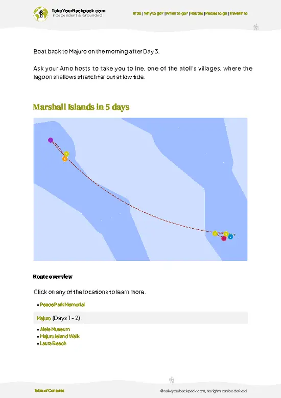
example page 0 from our offline Travel Guide for Marshall Islands
example page 1 from our offline Travel Guide for Marshall Islands
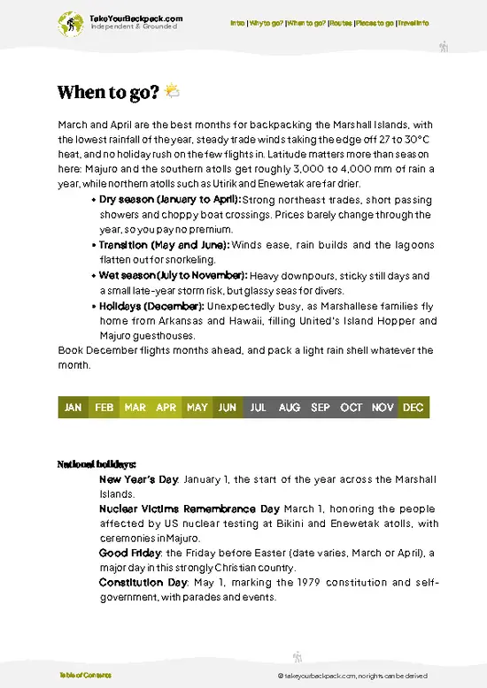
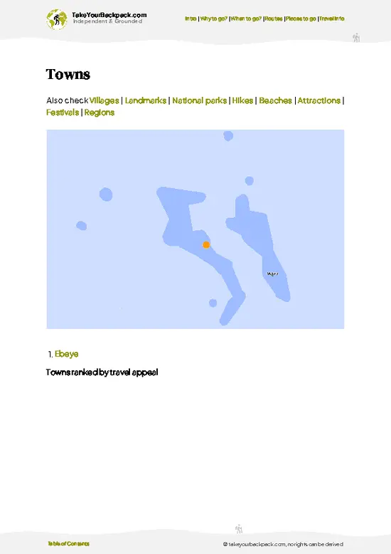
example page 2 from our offline Travel Guide for Marshall Islands
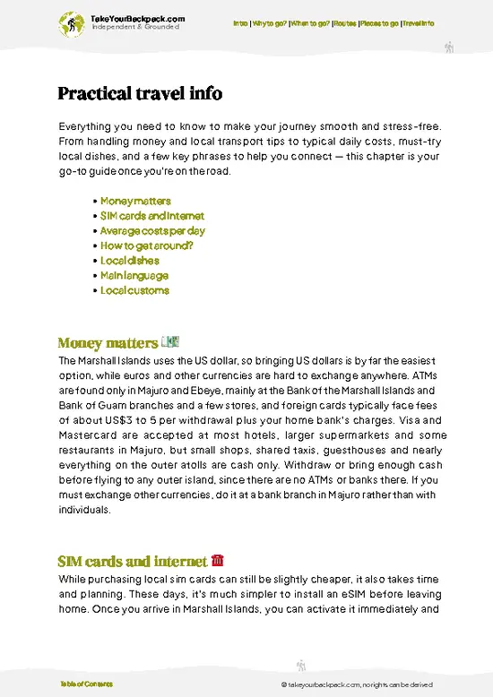
example page 3 from our offline Travel Guide for Marshall Islands
example page 4 from our offline Travel Guide for Marshall Islands
example page 5 from our offline Travel Guide for Marshall Islands
example page 6 from our offline Travel Guide for Marshall Islands
example page 7 from our offline Travel Guide for Marshall Islands
Loading the map 🌍
CLICK TO FILTER
towns
villages
landmarks
national parks
hikes
beaches
attractions
festivals
regions
SHOW COUNTRY’S BESTSHOW ALL

✨ Why go?
Ranked #1 hike in Marshall Islands
Why visitors keep coming back

Backpackers come for the chance to cover an entire capital atoll on foot, which almost nowhere else allows. The road is the only spine, so there is nothing to plan, no permit and no guide to hire. You can walk the full length from Delap to Laura over a long day or two, or just a slice, then wave down a shared taxi when the sun wins. That flexibility is the real draw.

It also fits a longer route through the Pacific neatly. Majuro is where flights arrive and depart, so a walk here fills a layover or a spare day without leaving the transport hub. The reward is variety on a strip a few hundred meters wide: Laura Beach with its white sand and clear water, the pandanus and coconut villages, church choirs drifting from open doors on Sunday, and the shifting color of the lagoon. Few places let you … read more 👉
Backpackers come for the chance to cover an entire capital atoll on foot, which almost nowhere else allows. The road is the only spine, so there is nothing to plan, no permit and no guide to hire. You can walk the full length from Delap to Laura over a long day or two, or just a slice, then wave down a shared taxi when the sun wins. That flexibility is the real draw.

It also fits a longer route through the Pacific neatly. Majuro is where flights arrive and depart, so a walk here fills a layover or a spare day without leaving the transport hub. The reward is variety on a strip a few hundred meters wide: Laura Beach with its white sand and clear water, the pandanus and coconut villages, church choirs drifting from open doors on Sunday, and the shifting color of the lagoon. Few places let you swim, eat local fish and watch daily life unfold in one afternoon without ever needing a ride beyond the next taxi.

💡 HighlightsPlaces and moments you shouldn't skip

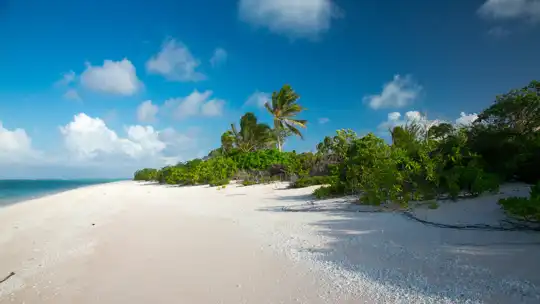
  1. Laura Beach: The best-known sight on the island, at the far western end where the road runs out. Fine white sand, clear lagoon water and shade from coconut palms make it the place locals head for weekend picnics. It is the natural finish line if you walk west.
  2. Alele Museum: The national museum, library and public records office sits in the Delap area. Exhibits cover traditional navigation, weaving and the story of the nuclear testing era, and it gives the rest of the walk context. Allow about an hour.
  3. Marshall Islands Capitol: The seat of the Nitijela, the national parliament, stands near the Delap end. It is a modern building and an easy stop when you start from town, and it shows how a nation spread over scattered atolls runs itself.
  4. Uliga Dock and the lagoon edge: Fishing boats, ferries and
… read more 👉
  1. Laura Beach: The best-known sight on the island, at the far western end where the road runs out. Fine white sand, clear lagoon water and shade from coconut palms make it the place locals head for weekend picnics. It is the natural finish line if you walk west.
  2. Alele Museum: The national museum, library and public records office sits in the Delap area. Exhibits cover traditional navigation, weaving and the story of the nuclear testing era, and it gives the rest of the walk context. Allow about an hour.
  3. Marshall Islands Capitol: The seat of the Nitijela, the national parliament, stands near the Delap end. It is a modern building and an easy stop when you start from town, and it shows how a nation spread over scattered atolls runs itself.
  4. Uliga Dock and the lagoon edge: Fishing boats, ferries and small cargo vessels tie up here, and the shoreline smells of salt, fuel and fish. Watching local boats load is a good way to see how the outer islands connect to the capital. The light is best in the early morning.
  5. Village stretches west of town: Walking past Ajeltake and the quieter settlements, you pass churches, small shops, breadfruit trees and cookhouses. There is no single landmark, yet this is the part where the atoll feels most lived in. Stop for a cold drink at a roadside store and chat with whoever is sitting outside.
If time is short, skip the Capitol and spend that hour on the beach at the western end.
Spotted a mistake or missing something? Contact us.

🌤️ When to go?Choosing the right time of year

  • Dry Season (December to April): Majuro’s best walking window, with steady trade winds and less rain. Highs run 29 to 31°C (84 to 88°F), nights 25 to 26°C (77 to 79°F). Seas on the lagoon side are calmer for swimming breaks.
  • Wet Season (May to November): Expect daily downpours, often short and heavy, and humidity that makes a long walk along the single road sticky. Temperatures barely change, but the winds drop and midday feels heavier. September and October are typically the wettest.
  • Daylight and Crowds: Sunrise is around 6:15 to 6:45 a.m. and sunset around 6:00 to 6:50 p.m. all year, so plan to finish by late afternoon. Visitor numbers stay low in every month, with small bumps around Christmas and Constitution Day (May 1).
  • Prices: Hotel rates and flights do not swing much by season. Lodging
… read more 👉
  • Dry Season (December to April): Majuro’s best walking window, with steady trade winds and less rain. Highs run 29 to 31°C (84 to 88°F), nights 25 to 26°C (77 to 79°F). Seas on the lagoon side are calmer for swimming breaks.
  • Wet Season (May to November): Expect daily downpours, often short and heavy, and humidity that makes a long walk along the single road sticky. Temperatures barely change, but the winds drop and midday feels heavier. September and October are typically the wettest.
  • Daylight and Crowds: Sunrise is around 6:15 to 6:45 a.m. and sunset around 6:00 to 6:50 p.m. all year, so plan to finish by late afternoon. Visitor numbers stay low in every month, with small bumps around Christmas and Constitution Day (May 1).
  • Prices: Hotel rates and flights do not swing much by season. Lodging is limited, so book ahead for late December.
Start walking at first light in any season, before the heat builds and the afternoon squalls roll in.


source: climatestotravel.comJANJanuary: excellent for travelingFEBFebruary: excellent for travelingMARMarch: highly recommended for travelingAPRApril: highly recommended for travelingMAYMay: fair for travelingJUNJune: fair for travelingJULJuly: fair for travelingAUGAugust: fair for travelingSEPSeptember: fair for travelingOCTOctober: fair for travelingNOVNovember: fair for travelingDECDecember: excellent for traveling
marshall-islands-hike-majuro-island-walk
© Google | Yang Xiao

✈️ The backpacker research shortcutMarshall Islands Travel Guide

An offline-friendly backpacking guide with optimized travel routes, ranked highlights, transport advice, and the best areas to stay.
example page 0 from our offline Travel Guide for Marshall Islands
example page 1 from our offline Travel Guide for Marshall Islands
example page 2 from our offline Travel Guide for Marshall Islands
example page 3 from our offline Travel Guide for Marshall Islands
example page 4 from our offline Travel Guide for Marshall Islands
example page 5 from our offline Travel Guide for Marshall Islands
example page 6 from our offline Travel Guide for Marshall Islands
example page 7 from our offline Travel Guide for Marshall Islands
The digital guide (125 pages) contains:
✅ 27 highlights, ranked by travel appeal
✅ Optimized 2, 3 & 5-day travel routes
✅ Cities, national parks, landmarks, beaches
✅ How to get around
✅ Offline-friendly for travel without Wi-Fi
👉 Click to see all 30+ guide features

📅 Plan smarter in minutes, not weeks
✅ Month by month travel advice
✅ Festivals & national holidays
✅ Budget expectations

🗺️ Go to the right places, skip the overrated ones
✅ Honest pros & cons of destinations
✅ Top hikes, parks & viewpoints
✅ Lesser-known places most travelers miss
✅ Clear “worth it vs skip it” guidance

🛏️ Travel smoothly without rookie mistakes
✅ Best areas to stay
✅ Transport systems explained simply
✅ Common scams & safety advice
✅ SIM cards, money & practical tips

🌍 Understand the country, not just visit it
✅ Culture & traditions
✅ 52 Essential phrases & customs
✅ Festivals worth planning around
✅ Traveler-friendly historical context
✅ Insights that make places more meaningful

📱 Built for real travel conditions
✅ Fully downloadable PDF
✅ Works completely offline
✅ Optimized for phone use
✅ Useful in remote areas & buses
✅ Everything in one place
Stop searching, start planning
Get instant access to your full guide. 30‑day money-back guarantee.
+ Add another guide for just

By proceeding you agree to our terms.
Sent to your inbox immediately after payment • 100% Secure Checkout
Best Backpacking Travel Advisor 2025 tourism awardBest Backpacking
Travel Advisor
2025
What others say about Take Your Backpack Guides:
⭐⭐⭐⭐⭐
Fantastic, amazing amount of information!
⭐⭐⭐⭐⭐
My goodness this is amazing, it's what I've been looking for hats off too you!
⭐⭐⭐⭐⭐
I think this is absolutely BRILLIANT
⭐⭐⭐⭐
Very complete and informative. It's still missing places, but I gotta to commend you
⭐⭐⭐⭐⭐
This is truly amazing, thank you, can't wait to explore it with my kids!
⭐⭐⭐⭐⭐
Awesome resource, thank you!
⭐⭐⭐⭐⭐
This is amazing! Can't wait to explore the ones I haven't seen
⭐⭐⭐⭐
I love this! Well done, great idea.
⭐⭐⭐⭐⭐
Thanks for taking the time to make this gem!
⭐⭐⭐⭐⭐
This might be the best website I've ever seen.
⭐⭐⭐⭐⭐
Congratulations, and thank you so much for your work; it's incredibly valuable.
⭐⭐⭐⭐
In all seriousness I think you did a great job pointing out the important spots
⭐⭐⭐⭐⭐
10/10 very good
⭐⭐⭐⭐⭐
As someone who's only just starting to visit regularly this is awesome, thank you.
⭐⭐⭐⭐
Thank you very much! I'm going to visit my dad, it's going to be very useful!
⭐⭐⭐⭐⭐
This is really cool! We'll be travelling for the first time and this definitely come in handy.
⭐⭐⭐⭐⭐
You are now our minister of culture, congratulations 👨‍💼
⭐⭐⭐⭐⭐
Just wanted to tell you that this is a pearl! Going to follow your recommendations.
⭐⭐⭐⭐⭐
This is so cool. I'll definitely be using the resource for my travels soon.
⭐⭐⭐⭐⭐
This is very impressive! Good work.
⭐⭐⭐⭐⭐
This is an amazing and informative site. Very well done!

🛏️ Where to stay?Where staying makes the most sense

If you enjoy meeting fellow travelers, consider choosing hostels with high ratings for atmosphere. On the other hand, if you prefer having your own space, a hotel might be a better option.

🥾 Hike detailsA practical overview of the hike

Total Distance: About 48 kilometers one way if you walk the whole road from the town end to Laura. Shorter sections work well.
Estimated Duration: Roughly 10 to 12 hours of steady walking, so most people split it over two days or do half and ride back.
Difficulty: Easy in terms of terrain, since the atoll is flat. Heat, humidity, strong sun and passing traffic make it harder than the numbers suggest.
Starting Point: The Delap-Uliga-Djarrit area, where most hotels and shops sit. Shared taxis and small buses run along the single road and stop wherever you wave, so you can start or finish at any point.
… read more 👉
Total Distance: About 48 kilometers one way if you walk the whole road from the town end to Laura. Shorter sections work well.
Estimated Duration: Roughly 10 to 12 hours of steady walking, so most people split it over two days or do half and ride back.
Difficulty: Easy in terms of terrain, since the atoll is flat. Heat, humidity, strong sun and passing traffic make it harder than the numbers suggest.
Starting Point: The Delap-Uliga-Djarrit area, where most hotels and shops sit. Shared taxis and small buses run along the single road and stop wherever you wave, so you can start or finish at any point.
Major Landmarks:
  • Alele Museum: The national museum and library, a few steps from the start.
  • Marshall Islands Capitol: The parliament building near the town end.
  • Uliga Dock: The working harbor on the lagoon side.
  • Laura Beach: The sandy finish at the western end.
Terrain and Scenery: A paved road runs between the lagoon and the ocean, often with only a few hundred meters of land between them. Shoulders are narrow and sometimes absent. Lagoon views are turquoise and calm, while the ocean side has rough coral and surf. Swimming is easiest on the lagoon side, away from the harbor.
Vegetation: Coconut palms, breadfruit, pandanus and low scrub along the shore. Villages are shaded and green, while the town end is mostly concrete and open sun.
Wildlife: Seabirds, frigatebirds and terns over the lagoon, plus reef fish in clear shallow water. On land you meet pigs, chickens and dogs more than anything wild.
Practical Notes: Start at first light to avoid the midday glare, wear a hat and reef-safe sunscreen, and carry plenty of water. Stores are frequent near town and sparse in the west. Dress modestly in villages, especially near churches on Sunday.
⚠️ Hiking info can sometimes be outdated or inaccurate. Before you hit the trail, check the latest conditions with locals. If you do spot anything that's off, I'd love to hear from you, so I can update it for fellow travelers.

🛡️ SafetySafety Tips and Common Scams in Majuro Island Walk

The Majuro walk is a flat, paved route along the main road, and the biggest risks are sun, heat and traffic. Heat and humidity are constant, so carry at least 2 liters of water, wear a hat and reef-safe sunscreen, and shelter during midday. Fill up before you set out, since shops thin out toward the far ends of the atoll. The road is narrow with no real shoulder in many stretches. Walk facing traffic, step off for buses and shared taxis, and avoid walking after dark, when lighting is poor. Showers arrive fast, so a light rain shell and a dry bag for your phone help. Loose dogs roam some villages. Stay calm, keep walking and do not feed them. Ocean and lagoon currents can be strong near channels, so swim only where locals do. Ask permission before photographing people or entering private land … read more 👉
The Majuro walk is a flat, paved route along the main road, and the biggest risks are sun, heat and traffic. Heat and humidity are constant, so carry at least 2 liters of water, wear a hat and reef-safe sunscreen, and shelter during midday. Fill up before you set out, since shops thin out toward the far ends of the atoll. The road is narrow with no real shoulder in many stretches. Walk facing traffic, step off for buses and shared taxis, and avoid walking after dark, when lighting is poor. Showers arrive fast, so a light rain shell and a dry bag for your phone help. Loose dogs roam some villages. Stay calm, keep walking and do not feed them. Ocean and lagoon currents can be strong near channels, so swim only where locals do. Ask permission before photographing people or entering private land and churchyards. Dress modestly in villages, with shoulders and knees covered.

FAQTraveler FAQ

Most people walk the length of Majuro Island in a full day of 8 to 10 hours, covering roughly 30 to 50 kilometers (19 to 31 miles) between Laura at the western end and Rita at the eastern end, if done end to end. Splitting it across two days with a night in Delap-Uliga-Djarrit town is easier on the feet. Many travelers simply walk shorter sections, such as downtown to the airport, in 2 to 3 hours, and catch a shared taxi back.
The walk is easy in terms of terrain, since the route is flat and paved, but the heat makes it harder than it looks. Daytime highs reach 29 to 31°C (84 to 88°F) with high humidity, so an end-to-end trek feels tiring on a long day. Beginners do well with short sections of 5 to 10 kilometers (3 to 6 miles), while fit walkers can manage longer stretches with regular water and shade stops.
No guide or permit is needed, as the route follows the public road and there is no entry fee. Hiring a guide is unnecessary, though a local driver or taxi (a short ride typically costs about US$1 to 3 within town) is handy for getting back from the far ends. Ask permission before stepping onto private land or beaches near villages, and check ahead if you want to visit Laura’s beaches or church grounds.
⚠️ Things can change over time, so always validate details locally before you go.

Other destinations worth considering

Majuro Island Walk isn’t the only highlight in Marshall Islands. Explore all what Marshall Islands has to offer.
Country photo of Marshall Islands

We 💚 feedbackFinal thoughts on hiking the Majuro Island Walk

This walk suits curious, easygoing travelers who like seeing a place at four kilometers an hour, and anyone stuck on Majuro for a few days with time to fill. I would start at dawn, walk the town end, then hop a taxi west and finish at Laura Beach with a swim. Skip it if you hate heat or traffic noise.

✍️ Help improve this page!
The information on this page is based on in-depth research, insights shared by experienced travelers, and feedback from the local travel community in Marshall Islands. While every effort is made to keep the information accurate and current, conditions can change — so if you spot anything incorrect or outdated, please get in touch.


🙋‍♂️ Give feedback

👋 Meet the founderWho’s Behind Take Your Backpack?

Johan, backpacker and founder of TakeYourBackpackHi, I’m Johan (Netherlands 🇳🇱), the creator of TakeYourBackpack. Over the past 3 decades, I’ve backpacked through 90+ countries across six continents, gaining extensive experience with independent travel, long-term trips, and overland routes.

This site is built on a combination of firsthand travel experience and carefully curated insights from other backpackers. Many guides are based on places I’ve personally visited, while others bring together tips, observations, and practical advice shared by trusted travelers I’ve met along the way.

The goal is to provide realistic, experience-driven guidance — not generic itineraries — so you can explore destinations with better context, clearer expectations, and more confidence.