×

Mauritania🇲🇷 | hikesAmogjar PassTarmac hairpins, sandstone escarpment, plateau viewpoint, dry wadis | things to do and best time to go

Explore Tiris TrailExplore Guelb er Richat Trail

Backpacking in Amogjar Pass
👍 Recommendedhike ranked #3
By Johan Kruseman 🇳🇱 | Updated October 22, 2026

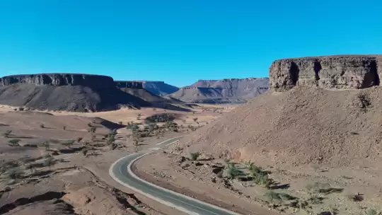
Amogjar Pass costs almost nothing to reach, because the main road east from Atar climbs straight through it and any shared vehicle heading that way passes the foot of the climb. The pass sits in the Adrar region in the north of Mauritania, east of Atar, where the plateau edge breaks into a tangle of cliffs. On foot you work through hairpins of hot tarmac and loose scree, with sandstone radiating heat at your shoulder and the wind carrying a dry mineral smell. The scenery is the draw: red-brown walls, pale sand pooled in the gullies, and a wide plateau view that makes the sweat feel earned. It is short and moderate, but there is almost no shade, no marked trail and no water supply. Cell signal drops out in the folds. At the top, the silence is broken only by wind and the occasional goat bell.

Discover everything you want to know in the 📖 Mauritania Travel Guide.
Best time to go: October - March
Duration: 3 hours
Distance: 8 kilometers
Total ascent: 250 meters
Safety warning

The current risk level for Mauritania is high. Check the advice before going.


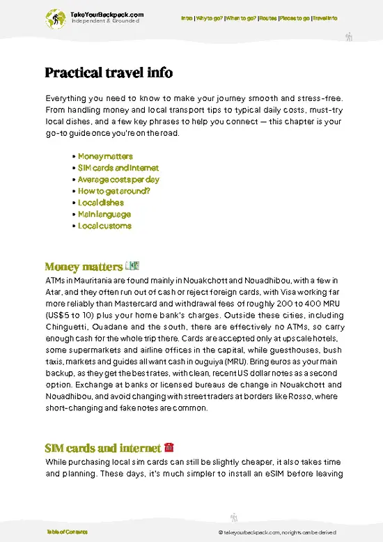
example page 0 from our offline Travel Guide for Mauritania
example page 1 from our offline Travel Guide for Mauritania
example page 2 from our offline Travel Guide for Mauritania
example page 3 from our offline Travel Guide for Mauritania
example page 4 from our offline Travel Guide for Mauritania
example page 5 from our offline Travel Guide for Mauritania
example page 6 from our offline Travel Guide for Mauritania
example page 7 from our offline Travel Guide for Mauritania
Loading the map 🌍
CLICK TO FILTER
cities
towns
villages
landmarks
national parks
hikes
beaches
attractions
festivals
regions
SHOW COUNTRY’S BESTSHOW ALL

✨ Why go?
Ranked #3 hike in Mauritania
What makes this hike worth hiking

Amogjar Pass gives you a full Adrar escarpment experience in a single morning, which is rare in a country where most good terrain demands a 4x4 and a guide. The main reasons backpackers come:

The first is the Atar to Chinguetti road. It runs right through the pass, so you can start walking at the base, finish at the top and flag down a passing vehicle onward without any pre-booked transfer. That makes it an easy add-on to an Adrar loop rather than a separate expedition.

The second is flexibility. There is no fixed trail, so you choose your own length. Walk the hairpin section of the tarmac if you want a gentle two-hour outing, or scramble up the dry gullies beside it for steeper, rockier ground and views that open sooner. Either way the climb is modest and the reward is a long look over the plateau.

💡 HighlightsKey sights and experiences for travelers

  1. The Amogjar Pass Hairpins: The tarmac road climbs the Adrar escarpment in tight switchbacks, and walking them lets you see how the road was cut into the cliff. Each bend shifts the view across the valley below.
  2. The Summit Viewpoint: At the top, the plateau spreads out in all directions, flat and stony, with layers of ridgeline fading into haze. It is the best spot for photographs because you can see both the climb behind you and the open land ahead.
  3. Sandstone Cliffs and Boulder Fields: The walls beside the road are layered in rust, ochre and dark brown, and many boulders have been wind-polished into rounded shapes. Touch the rock in the afternoon and it is too hot to hold for long.
  4. Dry Wadi Floors with Acacia: Sandy channels run between the slopes, and scattered acacia trees mark where rare rain
… read more 👉
  1. The Amogjar Pass Hairpins: The tarmac road climbs the Adrar escarpment in tight switchbacks, and walking them lets you see how the road was cut into the cliff. Each bend shifts the view across the valley below.
  2. The Summit Viewpoint: At the top, the plateau spreads out in all directions, flat and stony, with layers of ridgeline fading into haze. It is the best spot for photographs because you can see both the climb behind you and the open land ahead.
  3. Sandstone Cliffs and Boulder Fields: The walls beside the road are layered in rust, ochre and dark brown, and many boulders have been wind-polished into rounded shapes. Touch the rock in the afternoon and it is too hot to hold for long.
  4. Dry Wadi Floors with Acacia: Sandy channels run between the slopes, and scattered acacia trees mark where rare rain collects. Look for camel and goat tracks in the sand, and listen for birds in the thorn branches.
  5. The Night Sky from the Plateau: With no town nearby, the sky above the pass is dense with stars once the light fades. If you camp near the top, the cold that arrives after sunset is sharp, and the silence is complete.
For a first visit, the summit viewpoint at Amogjar Pass is the one stop to prioritize, since it pays you back for the climb in one wide look.
Spotted a mistake or missing something? Contact us.

🌤️ When to go?Seasonal considerations and timing

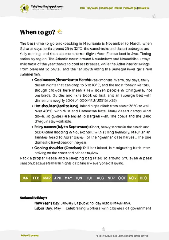
November to February is the window for hiking Amogjar Pass, with daytime highs of 25 to 32°C (77 to 90°F) and nights that can drop to 10 to 15°C (50 to 59°F) on the Adrar plateau.
  • Cool Season (November to February): Clear skies, comfortable walking temperatures and daylight of roughly 11 hours. This is peak time, so the few guesthouses in Atar and 4x4 drivers charge their highest rates, roughly 10 to 20 percent above shoulder months.
  • Warm Shoulder (March to April): Afternoons climb to 35 to 40°C (95 to 104°F). Doable if you start at first light and rest through midday. Sandstorms and haze start to flatten the views.
  • Hot Season (May to September): Highs of 40 to 46°C (104 to 115°F) on the rock make walking dangerous and rarely worthwhile. Prices drop and you will have the place to yourself, but
… read more 👉
November to February is the window for hiking Amogjar Pass, with daytime highs of 25 to 32°C (77 to 90°F) and nights that can drop to 10 to 15°C (50 to 59°F) on the Adrar plateau.
  • Cool Season (November to February): Clear skies, comfortable walking temperatures and daylight of roughly 11 hours. This is peak time, so the few guesthouses in Atar and 4x4 drivers charge their highest rates, roughly 10 to 20 percent above shoulder months.
  • Warm Shoulder (March to April): Afternoons climb to 35 to 40°C (95 to 104°F). Doable if you start at first light and rest through midday. Sandstorms and haze start to flatten the views.
  • Hot Season (May to September): Highs of 40 to 46°C (104 to 115°F) on the rock make walking dangerous and rarely worthwhile. Prices drop and you will have the place to yourself, but there is little shade.
  • Rare Rains (July to September): Short storms can fill wadis briefly and make tracks unusable for vehicles.
Book a driver in Atar a few days ahead for December and January, when demand is highest.


source: climatestotravel.comJANJanuary: excellent for travelingFEBFebruary: excellent for travelingMARMarch: good for travelingAPRApril: fair for travelingMAYMay: below average for travelingJUNJune: below average for travelingJULJuly: below average for travelingAUGAugust: below average for travelingSEPSeptember: fair for travelingOCTOctober: good for travelingNOVNovember: excellent for travelingDECDecember: excellent for traveling
when-to-go

✈️ The backpacker research shortcutMauritania Travel Guide

An offline-friendly backpacking guide with optimized travel routes, ranked highlights, transport advice, and the best areas to stay.
example page 0 from our offline Travel Guide for Mauritania
example page 1 from our offline Travel Guide for Mauritania
example page 2 from our offline Travel Guide for Mauritania
example page 3 from our offline Travel Guide for Mauritania
example page 4 from our offline Travel Guide for Mauritania
example page 5 from our offline Travel Guide for Mauritania
example page 6 from our offline Travel Guide for Mauritania
example page 7 from our offline Travel Guide for Mauritania
The digital guide (228 pages) contains:
✅ 47 highlights, ranked by travel appeal
✅ Optimized 5, 10 & 15-day travel routes
✅ Cities, national parks, landmarks, beaches
✅ How to get around
✅ Offline-friendly for travel without Wi-Fi
👉 Click to see all 30+ guide features

📅 Plan smarter in minutes, not weeks
✅ Month by month travel advice
✅ Festivals & national holidays
✅ Budget expectations

🗺️ Go to the right places, skip the overrated ones
✅ Honest pros & cons of destinations
✅ Top hikes, parks & viewpoints
✅ Lesser-known places most travelers miss
✅ Clear “worth it vs skip it” guidance

🛏️ Travel smoothly without rookie mistakes
✅ Best areas to stay
✅ Transport systems explained simply
✅ Common scams & safety advice
✅ SIM cards, money & practical tips

🌍 Understand the country, not just visit it
✅ Culture & traditions
✅ 52 Essential phrases & customs
✅ Festivals worth planning around
✅ Traveler-friendly historical context
✅ Insights that make places more meaningful

📱 Built for real travel conditions
✅ Fully downloadable PDF
✅ Works completely offline
✅ Optimized for phone use
✅ Useful in remote areas & buses
✅ Everything in one place
Stop searching, start planning
Get instant access to your full guide. 30‑day money-back guarantee.
+ Add another guide for just

By proceeding you agree to our terms.
Sent to your inbox immediately after payment • 100% Secure Checkout
Best Backpacking Travel Advisor 2025 tourism awardBest Backpacking
Travel Advisor
2025
What others say about Take Your Backpack Guides:
⭐⭐⭐⭐⭐
Fantastic, amazing amount of information!
⭐⭐⭐⭐⭐
My goodness this is amazing, it's what I've been looking for hats off too you!
⭐⭐⭐⭐⭐
I think this is absolutely BRILLIANT
⭐⭐⭐⭐
Very complete and informative. It's still missing places, but I gotta to commend you
⭐⭐⭐⭐⭐
This is truly amazing, thank you, can't wait to explore it with my kids!
⭐⭐⭐⭐⭐
Awesome resource, thank you!
⭐⭐⭐⭐⭐
This is amazing! Can't wait to explore the ones I haven't seen
⭐⭐⭐⭐
I love this! Well done, great idea.
⭐⭐⭐⭐⭐
Thanks for taking the time to make this gem!
⭐⭐⭐⭐⭐
This might be the best website I've ever seen.
⭐⭐⭐⭐⭐
Congratulations, and thank you so much for your work; it's incredibly valuable.
⭐⭐⭐⭐
In all seriousness I think you did a great job pointing out the important spots
⭐⭐⭐⭐⭐
10/10 very good
⭐⭐⭐⭐⭐
As someone who's only just starting to visit regularly this is awesome, thank you.
⭐⭐⭐⭐
Thank you very much! I'm going to visit my dad, it's going to be very useful!
⭐⭐⭐⭐⭐
This is really cool! We'll be travelling for the first time and this definitely come in handy.
⭐⭐⭐⭐⭐
You are now our minister of culture, congratulations 👨‍💼
⭐⭐⭐⭐⭐
Just wanted to tell you that this is a pearl! Going to follow your recommendations.
⭐⭐⭐⭐⭐
This is so cool. I'll definitely be using the resource for my travels soon.
⭐⭐⭐⭐⭐
This is very impressive! Good work.
⭐⭐⭐⭐⭐
This is an amazing and informative site. Very well done!

🛏️ Where to stay?Best areas and accommodation options

If you enjoy meeting fellow travelers, consider choosing hostels with high ratings for atmosphere. On the other hand, if you prefer having your own space, a hotel might be a better option.

🥾 Hike detailsTrail overview: what to expect on the hike

Total Distance: Amogjar Pass can be walked as a roughly 8 kilometer out-and-back, following the road and the gullies beside it. You can shorten it by only doing the upper hairpins.
Estimated Duration: About 3 hours at an easy pace, with stops for photographs.
Difficulty: Moderate. The slope is steady rather than technical, but heat, sun exposure and loose rock make it tiring.
Starting Point: The foot of the climb on the road east of Atar. Shared taxis and buses heading toward Chinguetti pass through, so ask the driver to drop you at the base of the pass.
Major Landmarks:
  • Lower Hairpins: The first tight
… read more 👉
Total Distance: Amogjar Pass can be walked as a roughly 8 kilometer out-and-back, following the road and the gullies beside it. You can shorten it by only doing the upper hairpins.
Estimated Duration: About 3 hours at an easy pace, with stops for photographs.
Difficulty: Moderate. The slope is steady rather than technical, but heat, sun exposure and loose rock make it tiring.
Starting Point: The foot of the climb on the road east of Atar. Shared taxis and buses heading toward Chinguetti pass through, so ask the driver to drop you at the base of the pass.
Major Landmarks:
  • Lower Hairpins: The first tight bends where the road leaves the valley floor.
  • Mid-Slope Gullies: Sandy dry channels you can use for a rougher route off the tarmac.
  • Summit Viewpoint: The top edge, with the broad plateau view.
Terrain and Scenery: Tarmac, loose stones and packed sand, with cliffs of red-brown sandstone on both sides. The upper section opens to a flat plateau and long views.
Vegetation: Sparse. Acacia and low thorny shrubs grow in the wadis, and the slopes are mostly bare rock.
Wildlife: Mostly livestock such as goats and camels, plus birds and small lizards. Expect tracks more than sightings.
Practical Notes: Carry all your water, wear a hat and cover up, as there is almost no shade. Start early, because rock surfaces hold heat into the evening.
⚠️ Hiking info can sometimes be outdated or inaccurate. Before you hit the trail, check the latest conditions with locals. If you do spot anything that's off, I'd love to hear from you, so I can update it for fellow travelers.

🛡️ SafetyScams, Hazards, and Annoyances

Heat and distance are the real hazards at Amogjar Pass, not the terrain. The route follows rocky tracks and dry wadis where footing is loose gravel and sand, so sturdy shoes matter more than poles. Shade is scarce, so start at dawn, stop for the hottest hours under a rock overhang, and carry at least 4 to 5 liters of water per person, since reliable sources are few. Tracks branch and fade in sand, which makes navigation tricky; download an offline map and hire a local driver or guide from Atar who knows the Adrar plateau. Tell your guesthouse your plan and expected return. Mobile coverage drops out quickly beyond the main road. Wildlife is minimal, though scorpions and snakes shelter under stones, so shake out boots and watch where you put your hands. Pack a hat, sun cover, electrolytes and … read more 👉
Heat and distance are the real hazards at Amogjar Pass, not the terrain. The route follows rocky tracks and dry wadis where footing is loose gravel and sand, so sturdy shoes matter more than poles. Shade is scarce, so start at dawn, stop for the hottest hours under a rock overhang, and carry at least 4 to 5 liters of water per person, since reliable sources are few. Tracks branch and fade in sand, which makes navigation tricky; download an offline map and hire a local driver or guide from Atar who knows the Adrar plateau. Tell your guesthouse your plan and expected return. Mobile coverage drops out quickly beyond the main road. Wildlife is minimal, though scorpions and snakes shelter under stones, so shake out boots and watch where you put your hands. Pack a hat, sun cover, electrolytes and a basic first-aid kit. Mauritanian travel advisories change, so check current guidance for the Adrar region before you go.

FAQCommon questions from travelers

Most hikers need half a day to a full day at Amogjar Pass, usually 3 to 6 hours of walking plus stops. Add roughly 1 to 2 hours each way if you drive from Atar, the nearest town with lodging. Starting at dawn keeps you off the rock before the midday heat.
Amogjar Pass is moderate, mainly because of heat rather than technical climbing. Expect rocky, uneven tracks, an ascent of a few hundred meters and sandy stretches that slow your pace. In winter, daytime highs of 25 to 32°C make it manageable for reasonably fit walkers, while summer temperatures above 40°C make it a hard route.
Amogjar Pass has no formal permit system for walkers, but a local guide or driver is strongly advised because tracks are unmarked and phone signal is patchy. Arrange one in Atar for roughly US$40 to 80 per day, depending on vehicle and group size. Carry your passport and visa, as checkpoints on the roads around Atar are common.
⚠️ Things can change over time, so always validate details locally before you go.

Other Mauritanian hikes near Amogjar Pass

Explore more nearby:


💡 Not sure where to go next?
Create a personalized itinerary for Mauritania including Amogjar Pass and the places that fit your trip.

Generate my itinerary

👉 Discover all hikes

Or checkout all Mauritania has to offer (think cities, towns, villages, national parks, hikes, beaches, festivals)
Country photo of Mauritania

We 💚 feedbackSumming up the experience

Amogjar Pass looks like a road you simply drive over, and that is what most people do, so the slow side of it goes unseen. Walk the gullies beside the tarmac rather than the tarmac itself. The sand holds animal tracks, the rock is more colorful close up, and you will see it at a pace the road never allows. Bring a scarf for the wind.

✍️ Help improve this page!
The information on this page is based on in-depth research, insights shared by experienced travelers, and feedback from the local travel community in Mauritania. While every effort is made to keep the information accurate and current, conditions can change — so if you spot anything incorrect or outdated, please get in touch.


🙋‍♂️ Give feedback

👋 Meet the founderWho’s Behind Take Your Backpack?

Johan, backpacker and founder of TakeYourBackpackHi, I’m Johan (Netherlands 🇳🇱), the creator of TakeYourBackpack. Over the past 3 decades, I’ve backpacked through 90+ countries across six continents, gaining extensive experience with independent travel, long-term trips, and overland routes.

This site is built on a combination of firsthand travel experience and carefully curated insights from other backpackers. Many guides are based on places I’ve personally visited, while others bring together tips, observations, and practical advice shared by trusted travelers I’ve met along the way.

The goal is to provide realistic, experience-driven guidance — not generic itineraries — so you can explore destinations with better context, clearer expectations, and more confidence.