v2.webp)
- Black River Peak (Piton de la Rivière Noire) — The island’s highest point (about 828 m). The hike up rewards you with sweeping views over the west coast, deep gorges and, on a clear day, Réunion on the horizon. Good morning hike for crisp air and panoramas.
- Macchabée Trail and Lookout — A popular loop through native forest that finishes at a dramatic viewpoint over the gorge. Short enough for a half-day outing but rich in birdlife and native plants—great if you want a proper walk without committing to a full day.
- Endemic Birds (pink pigeon, Mauritius kestrel, echo parakeet) — The park is the best mainland spot to see conservation success stories. Keep your ears open for calls and your binoculars ready; early morning is prime time for sightings.
- Indigenous Forests and Rare Plants — Pockets
- Black River Peak (Piton de la Rivière Noire) — The island’s highest point (about 828 m). The hike up rewards you with sweeping views over the west coast, deep gorges and, on a clear day, Réunion on the horizon. Good morning hike for crisp air and panoramas.
- Macchabée Trail and Lookout — A popular loop through native forest that finishes at a dramatic viewpoint over the gorge. Short enough for a half-day outing but rich in birdlife and native plants—great if you want a proper walk without committing to a full day.
- Endemic Birds (pink pigeon, Mauritius kestrel, echo parakeet) — The park is the best mainland spot to see conservation success stories. Keep your ears open for calls and your binoculars ready; early morning is prime time for sightings.
- Indigenous Forests and Rare Plants — Pockets of native ebony forest, orchids and the island’s rare flora (including the national flower, Trochetia) survive here. It’s a peaceful, green world—notice the different tree layers and understory plants that you won’t see elsewhere on the island.
- Deep Gorges and River Valleys — The park’s name says it: steep ravines, river cuts and shaded valleys create dramatic scenery. After rains these valleys feed impressive waterfalls and shady pools—perfect for photos and a cooler microclimate on hot days.
- Hiking Network (from short loops to summit routes) — Trails range from easy picnic loops to tougher ridgeline and summit hikes. Trails are well marked but bring water, a map from the visitor centre and decent shoes—some sections can be steep or slippery.
- Visitor Centre & Conservation Projects — Stop at the park centre for maps, trail advice and updates on reintroduction projects. It’s useful for planning (and for learning why the place looks a little different—ongoing work to restore native species).
Spotted a mistake or missing something? Contact us.
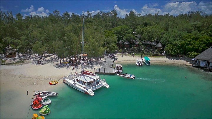
Full-Day Catamaran Cruise to Île aux Cerfs with BBQ Lunch

Mauritius full day tour : Private south west with lunch

Mauritius Full day tour of the South west

Mauritius Chamarel 7 Coloured Earth Private Holiday Tours

Ebony Forest Reserve Chamarel - Take a Hike Tour

Entrance Ticket To Curious Mauritius

Discovery Tour 35km
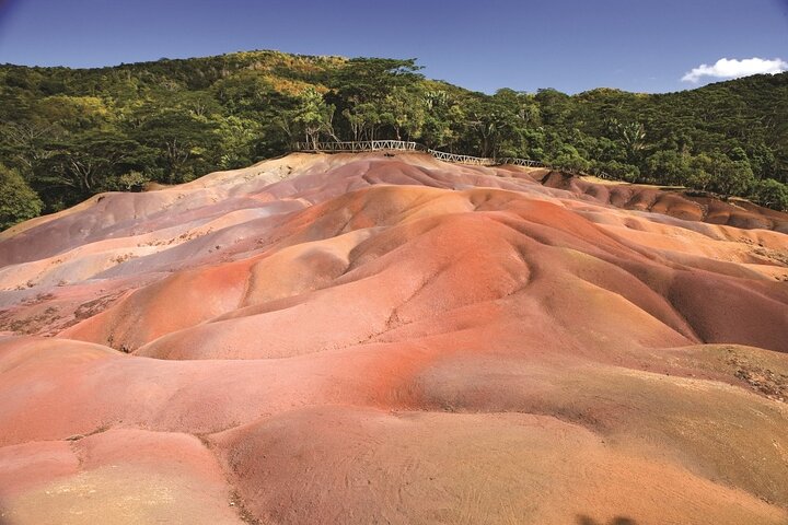
Trou-aux-Cerfs - Grand Bassin - 7 Coloured Earth - Wild South Guided Tour

Wild South Tour Mauritius | Hidden Gems, Rockpool & Waterfalls



 Best Backpacking
.jpg) Hi, I’m Johan (Netherlands 🇳🇱), the creator of TakeYourBackpack. Over the past 3 decades, I’ve backpacked through 90+ countries across six continents, gaining extensive experience with independent travel, long-term trips, and overland routes.
Hi, I’m Johan (Netherlands 🇳🇱), the creator of TakeYourBackpack. Over the past 3 decades, I’ve backpacked through 90+ countries across six continents, gaining extensive experience with independent travel, long-term trips, and overland routes.