
×

Mexico🇲🇽 | hikesLaguna de Bacalar Traillimestone lakeshore, blue water, subtropical woodland | things to do and best time to go

Explore El Cielo Biosphere ReserveExplore Copper Canyon

Backpacking in Laguna de Bacalar Trail
👀 For curious travelershike ranked #13
By Johan Kruseman 🇳🇱 | Updated May 24, 2026

Your shoes crunch on white limestone dust while the lagoon beside you glows that impossible electric blue, hot wind pushing the smell of wet mangroves and sunscreen into your face. This is the Laguna de Bacalar Trail, skirting the “Lake of Seven Colors” down in southern Quintana Roo, near the Belize border. It’s more of a long, sun‑blasted coastal ramble than a mountain hike: mostly flat, a few scruffy jungle sections, big payoff views, and brutal midday heat. Easy to reach by colectivo or bus from Chetumal or Tulum, but it can feel repetitive compared with Mexico’s highland routes; still, when you drop into the water at the end, every sweaty step feels justified.

Discover everything you want to know in the 📖 Mexico Travel Guide.
Best time to go: November - April
Duration: 2 days
Distance: 10 kilometers
Total ascent: 200 meters


Get your Mexico guide
147 ranked highlights, routes & tips, works offline (532 pages)
Loading the map 🌍
CLICK TO FILTER
cities
towns
villages
landmarks
national parks
hikes
beaches
attractions
festivals
regions
SHOW COUNTRY’S BESTSHOW ALL

✨ Why go?
Ranked #13 hike in Mexico
Reasons people choose to hike the here

The Laguna de Bacalar Trail is a must for backpackers craving both challenge and reward. The scenery-to-effort ratio is off the charts; you’ll sweat through lush jungles only to be greeted by the mesmerizing blues of the lagoon. It’s a feast for the eyes after a solid trek.

Getting there is a breeze with public transport access from nearby towns, making it easy to fit into your travel plans. Plus, it’s low cost—perfect for budget-conscious adventurers. You can tailor your hike to your energy levels, choosing flexible distances that suit your pace.

This trail seamlessly integrates into a longer backpacking route through the Yucatán, allowing you to soak in the beauty without feeling rushed. The moment you dip your toes in that cool water after the hike? Pure bliss.
Want to include Laguna de Bacalar Trail in your Mexico route?
Create a personalized Mexico itinerary that includes Laguna de Bacalar Trail and the places that fit your trip — based on your travel style, budget, and available time. Get your route in seconds.

Generate my trip

💡 HighlightsKey sights and experiences for travelers

  • Seven Colors lookout — The reason Bacalar gets all the hype: dramatic bands of blue that shift with depth and sun angle. From the trail’s high points you get sweeping views of the lagoon’s layered colors in one glance — a simple, unforgettable “wow” moment that photocams never quite capture the same way.
  • Cocalitos and the stromatolites — A rare, fragile carpet of living rock formations (stromatolites) that look prehistoric. They’re not a typical “waterfall” highlight — they’re ancient microbial mats you can usually see from shallow shores, and they make the lagoon scientifically special in a way most hikes don’t offer.
  • Mangrove channels and birdlife — The trail threads close to dense mangroves and narrow canals where herons, kingfishers and dozens of other water birds frequent. Quiet stretches
read more 👉
  • Seven Colors lookout — The reason Bacalar gets all the hype: dramatic bands of blue that shift with depth and sun angle. From the trail’s high points you get sweeping views of the lagoon’s layered colors in one glance — a simple, unforgettable “wow” moment that photocams never quite capture the same way.
  • Cocalitos and the stromatolites — A rare, fragile carpet of living rock formations (stromatolites) that look prehistoric. They’re not a typical “waterfall” highlight — they’re ancient microbial mats you can usually see from shallow shores, and they make the lagoon scientifically special in a way most hikes don’t offer.
  • Mangrove channels and birdlife — The trail threads close to dense mangroves and narrow canals where herons, kingfishers and dozens of other water birds frequent. Quiet stretches feel more like a nature hide than a tourist trail: great for binoculars, slow photography, and spotting small critters most casual visitors miss.
  • Cenote Azul and freshwater swim spots — Big, clear sinkholes and shallow sandy bays appear along the route — perfect for a cool, buoyant dip. The mix of fresh cenote water and lagoon edges makes for unusually clear swimming and quick, refreshing breaks between hiking sections.
  • Los Rápidos and sandbars — Where currents narrow and create playful little rapids and easily walkable sandbanks. It’s a fun, shallow area to wade, float, or picnic; the vibe is relaxed and very local compared with the busier boat stops.
Personal favorite: Cocalitos and the stromatolites — it’s rare to find living geological history right beside a hiking trail.
Spotted a mistake or missing something? Contact us.

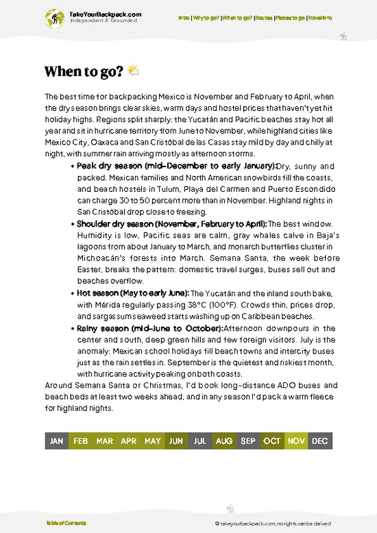
🌤️ When to go?Seasonal considerations and timing


  • Weather: Dry season from November to April slashes humidity and rain, making the trail less slippery and more enjoyable. The wet season (May to October) dumps heavy showers, turning paths into mud pits and sometimes flooding low areas.

  • Temperature: Daytime highs hover around 28-32°C (82-90°F) in dry months, perfect for sweating it out without frying. Wet season spikes humidity, pushing the heat into the uncomfortable 33-35°C (91-95°F) range.

  • Daylight Hours: Roughly 11 to 12 hours of daylight year-round, but the dry season offers clearer skies, so you get more usable light for early starts and late finishes.

  • Crowds: Peak tourist influx hits December through March, especially around holidays. Trails get busy, and prices climb. Shoulder months like November and April balance solitude
read more 👉

  • Weather: Dry season from November to April slashes humidity and rain, making the trail less slippery and more enjoyable. The wet season (May to October) dumps heavy showers, turning paths into mud pits and sometimes flooding low areas.

  • Temperature: Daytime highs hover around 28-32°C (82-90°F) in dry months, perfect for sweating it out without frying. Wet season spikes humidity, pushing the heat into the uncomfortable 33-35°C (91-95°F) range.

  • Daylight Hours: Roughly 11 to 12 hours of daylight year-round, but the dry season offers clearer skies, so you get more usable light for early starts and late finishes.

  • Crowds: Peak tourist influx hits December through March, especially around holidays. Trails get busy, and prices climb. Shoulder months like November and April balance solitude and decent weather.

  • Seasonal Activities: Dry season aligns with local festivals and water sports on Bacalar’s lagoon, adding cultural spice and post-hike cool-down options. Wet season quiets down the scene but brings lush greenery.

  • Price Fluctuations: Accommodation and tours spike in the dry season’s high months. Booking ahead is crucial. The wet season offers bargains but at the cost of trail conditions and fewer amenities.


Pro-tip: Aim for late November or early April—trail conditions are solid, crowds thin, and you’ll snag better deals while still catching the dry season’s tail end.


source: climatestotravel.comJANJanuary: highly recommended for travelingFEBFebruary: highly recommended for travelingMARMarch: highly recommended for travelingAPRApril: highly recommended for travelingMAYMay: fair for travelingJUNJune: fair for travelingJULJuly: fair for travelingAUGAugust: fair for travelingSEPSeptember: fair for travelingOCTOctober: fair for travelingNOVNovember: highly recommended for travelingDECDecember: highly recommended for traveling
when-to-go

✈️ The backpacker research shortcutMexico Travel Guide

An offline-friendly backpacking guide with optimized travel routes, ranked highlights, transport advice, and the best areas to stay.
example page 0 from our offline Travel Guide for Mexico
example page 1 from our offline Travel Guide for Mexico
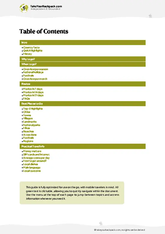
example page 2 from our offline Travel Guide for Mexico
example page 3 from our offline Travel Guide for Mexico
example page 4 from our offline Travel Guide for Mexico
example page 5 from our offline Travel Guide for Mexico
example page 6 from our offline Travel Guide for Mexico
example page 7 from our offline Travel Guide for Mexico
The digital guide (532 pages) contains:
147 highlights, ranked by travel appeal
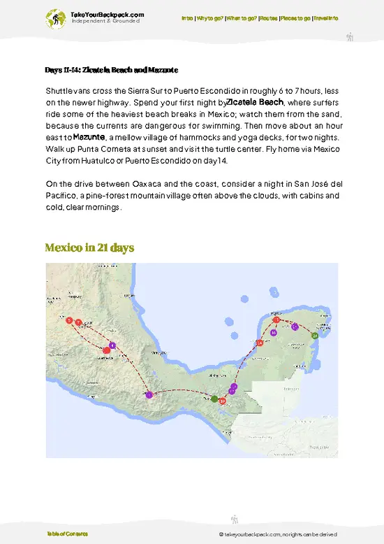
Optimized 7, 14 & 21-day travel routes
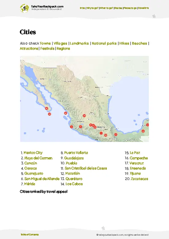
Cities, national parks, landmarks, beaches
How to get around
Offline-friendly for travel without Wi-Fi
👉 Click to see all 30+ guide features

📅 Plan smarter in minutes, not weeks
Month by month travel advice
Festivals & national holidays
Budget expectations

🗺️ Go to the right places, skip the overrated ones
Honest pros & cons of destinations
Top hikes, parks & viewpoints
Lesser-known places most travelers miss
Clear “worth it vs skip it” guidance

🛏️ Travel smoothly without rookie mistakes
Best areas to stay
Transport systems explained simply
Common scams & safety advice
SIM cards, money & practical tips

🌍 Understand the country, not just visit it
Culture & traditions
52 Essential phrases & customs
Festivals worth planning around
Traveler-friendly historical context
Insights that make places more meaningful

📱 Built for real travel conditions
Fully downloadable PDF
Works completely offline
Optimized for phone use
Useful in remote areas & buses
Everything in one place
Save weeks of stressful planning
Get instant access to your full guide. 30‑day money-back guarantee.


By proceeding you agree to our terms.
Sent to your inbox immediately after payment • 100% Secure Checkout
Best Backpacking Travel Advisor 2025 tourism awardBest Backpacking
Travel Advisor
2025
What others say about Take Your Backpack Guides:
⭐⭐⭐⭐⭐
Fantastic, amazing amount of information!
⭐⭐⭐⭐⭐
My goodness this is amazing, it's what I've been looking for hats off too you!
⭐⭐⭐⭐⭐
I think this is absolutely BRILLIANT
⭐⭐⭐⭐
Very complete and informative. It's still missing places, but I gotta to commend you
⭐⭐⭐⭐⭐
This is truly amazing, thank you, can't wait to explore it with my kids!
⭐⭐⭐⭐⭐
Awesome resource, thank you!
⭐⭐⭐⭐⭐
This is amazing! Can't wait to explore the ones I haven't seen
⭐⭐⭐⭐
I love this! Well done, great idea.
⭐⭐⭐⭐⭐
Thanks for taking the time to make this gem!
⭐⭐⭐⭐⭐
This might be the best website I've ever seen.
⭐⭐⭐⭐⭐
Congratulations, and thank you so much for your work; it's incredibly valuable.
⭐⭐⭐⭐
In all seriousness I think you did a great job pointing out the important spots
⭐⭐⭐⭐⭐
10/10 very good
⭐⭐⭐⭐⭐
As someone who's only just starting to visit regularly this is awesome, thank you.
⭐⭐⭐⭐
Thank you very much! I'm going to visit my dad, it's going to be very useful!
⭐⭐⭐⭐⭐
This is really cool! We'll be travelling for the first time and this definitely come in handy.
⭐⭐⭐⭐⭐
You are now our minister of culture, congratulations 👨‍💼
⭐⭐⭐⭐⭐
Just wanted to tell you that this is a pearl! Going to follow your recommendations.
⭐⭐⭐⭐⭐
This is so cool. I'll definitely be using the resource for my travels soon.
⭐⭐⭐⭐⭐
This is very impressive! Good work.
⭐⭐⭐⭐⭐
This is an amazing and informative site. Very well done!

🛏️ Where to stay?How to pick the right area

If you enjoy meeting fellow travelers, consider choosing hostels with high ratings for atmosphere. On the other hand, if you prefer having your own space, a hotel might be a better option.

🥾 Hike detailsTrail overview: what to expect on the hike

Total Distance: The Laguna de Bacalar Trail stretches about 8 kilometers (5 miles) round trip. It’s a nice little hike that won’t have you gasping for air, but it’s long enough to enjoy the scenery.

Estimated Duration: Plan for around 2 to 4 hours, depending on your pace and how often you stop to take in the views or snap photos.

Difficulty Level: This trail is generally rated as easy to moderate. Most folks should find it manageable, but there are some uneven sections that might trip up the less coordinated.

Starting Point: The trailhead is located near the town of Bacalar. To get there by … read more 👉
Total Distance: The Laguna de Bacalar Trail stretches about 8 kilometers (5 miles) round trip. It’s a nice little hike that won’t have you gasping for air, but it’s long enough to enjoy the scenery.

Estimated Duration: Plan for around 2 to 4 hours, depending on your pace and how often you stop to take in the views or snap photos.

Difficulty Level: This trail is generally rated as easy to moderate. Most folks should find it manageable, but there are some uneven sections that might trip up the less coordinated.

Starting Point: The trailhead is located near the town of Bacalar. To get there by public transport, catch a bus from Chetumal or Tulum to Bacalar. Once you arrive in Bacalar, you can take a short taxi ride or even walk to the trailhead, which is about 2 kilometers from the town center.

Major Landmarks Along the Route:
  • Laguna de Bacalar: The stunning lagoon itself is the main attraction, known for its striking blue waters.
  • Cenotes: You’ll pass by a couple of cenotes, natural sinkholes that are perfect for a refreshing dip.
  • Birdwatching Platforms: There are spots along the trail where you can stop and observe local birdlife.

Type of Terrain and Scenery: Expect a mix of sandy paths and some rocky areas. The trail meanders along the edge of the lagoon, offering breathtaking views of the water. You’ll also trek through patches of forest, giving you a nice variety of scenery.

Typical Vegetation and Wildlife: The area is lush with tropical vegetation. You’ll see mangroves, palm trees, and various shrubs. Keep an eye out for wildlife like iguanas, colorful birds, and maybe even a few butterflies flitting about. If you’re lucky, you might spot a heron or two hunting along the water’s edge.

This trail is a perfect day hike for budget travelers looking to enjoy nature without breaking the bank. Just remember to bring plenty of water and maybe a snack or two!
⚠️ Hiking info can sometimes be outdated or inaccurate. Before you hit the trail, check the latest conditions with locals. If you do spot anything that's off, I'd love to hear from you, so I can update it for fellow travelers.

🛡️ SafetyStaying Safe: What Travelers Should Know

The Laguna de Bacalar Trail offers a straightforward yet invigorating hike, but don’t let that lull you into complacency. The weather can shift quickly; be ready for sudden rain or heat. Dress in layers and pack a light poncho.

The terrain is mostly flat, but watch your footing near the water’s edge—slippery rocks can catch you off guard. Keep an eye out for local wildlife. You might spot a curious iguana or colorful birds; respect their space and avoid feeding them.

Timing is key. Early mornings are cooler and less crowded, giving you a chance to soak in the tranquility before the day heats up. Stay hydrated, pace yourself, and enjoy the vibrant blues of the lagoon as your reward.

Other Mexican hikes near Laguna de Bacalar Trail

Explore more nearby:


💡 Not sure where to go next?
Create a personalized itinerary for Mexico including Laguna de Bacalar Trail and the places that fit your trip.

Generate my itinerary

👉 Discover all hikes

Or checkout all Mexico has to offer (think cities, towns, villages, national parks, hikes, beaches, festivals)
Country photo of Mexico

We 💚 feedbackSumming up the experience

The Laguna de Bacalar Trail is a feast for the senses. Picture this: the vibrant blues of the lagoon, a refreshing dip after a sweaty trek, and the thrill of spotting wildlife along the way. But be ready for the heat; it can be relentless. Hydration is key. Embrace the challenge, and the reward will be that first sip of cold beer as you soak it all in.

✈️ When did I visit Mexico?
As part of my 1.5 year travel around the world trip, I visited Mexico in February and March 2016. Had to hurry a bit as I didn’t want to miss the free performance of the Rolling Stones in Cuba.

✍️ Help improve this page!
The information on this page is based on my own backpacking experience in Mexico, supplemented with up-to-date research and feedback from other travelers. Travel details can change, so if you notice anything outdated or incomplete, feel free to let me know.


🙋‍♂️ Give feedback

👋 Meet the founderWho’s Behind Take Your Backpack?

Johan, backpacker and founder of TakeYourBackpackHi, I’m Johan (Netherlands 🇳🇱), the creator of TakeYourBackpack. Over the past decade, I’ve backpacked through 80+ countries across six continents, gaining extensive experience with independent travel, long-term trips, and overland routes.

This site is built on a combination of firsthand travel experience and carefully curated insights from other backpackers. Many guides are based on places I’ve personally visited, while others bring together tips, observations, and practical advice shared by trusted travelers I’ve met along the way.

The goal is to provide realistic, experience-driven guidance — not generic itineraries — so you can explore destinations with better context, clearer expectations, and more confidence.

Get full Mexico guide •
Instant download • 147 highlights • Full Offline guide