×

Mozambique🇲🇿 | hikesInhaca IslandDune ridges, reef flats, mangrove creeks, lighthouse point | things to do and best time to go

Explore Festival de VilankuloExplore Mount Namuli

Backpacking in Inhaca Island
👀 For curious travelershike ranked #5
By Johan Kruseman 🇳🇱 | Updated October 22, 2026

The Inhaca Island circuit runs on sand tracks, tidal flats and forest paths, and you can walk the lot in a day. The island is best known for its mangrove-fringed shores and the coral reefs of Ponta Torres, and it sits in Maputo Bay in southern Mozambique, east of the capital. Scenery is the big win: dune ridges, empty Indian Ocean beaches, rock pools at low tide and a marine biology station with a small museum. Difficulty is easy, roughly 20 to 25 kilometers if you loop the south and east, with soft sand slowing every step and almost no shade on the open beaches. Getting to the start is simple: ferries and speedboats leave Maputo, and you walk from the landing at the village. Bring water, because shops are few. Along the way, you will pass fishers sorting catch beside wooden dhows.

Discover everything you want to know in the 📖 Mozambique Travel Guide.
Best time to go: April - October
Duration: 7 hours
Distance: 22 kilometers
Total ascent: 150 meters


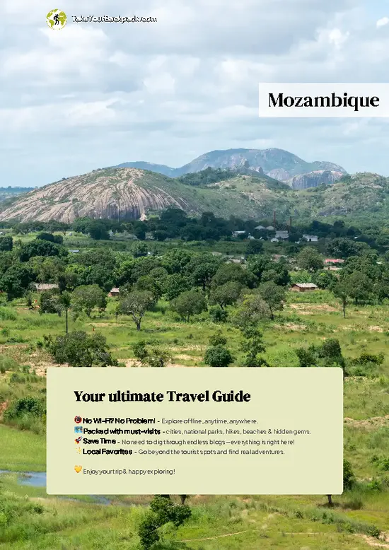
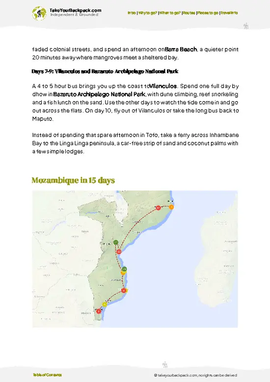
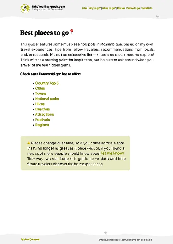
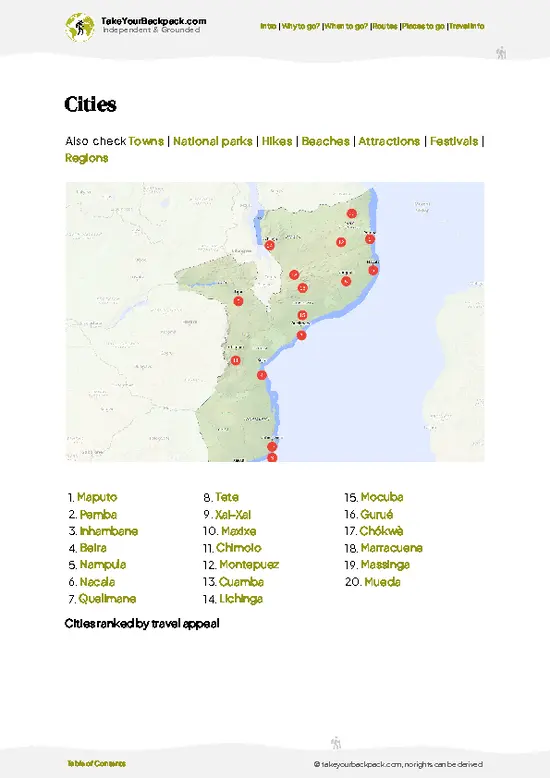
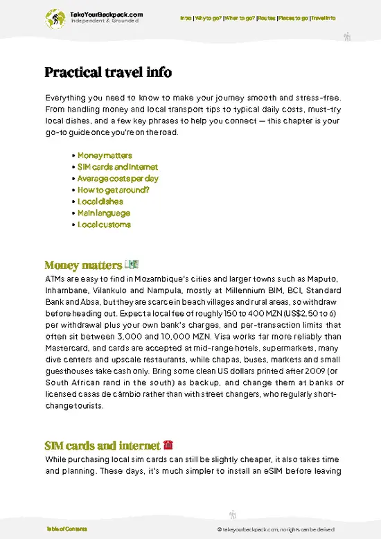
example page 0 from our offline Travel Guide for Mozambique
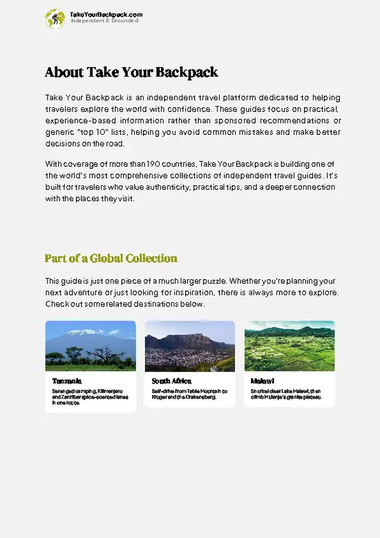
example page 1 from our offline Travel Guide for Mozambique
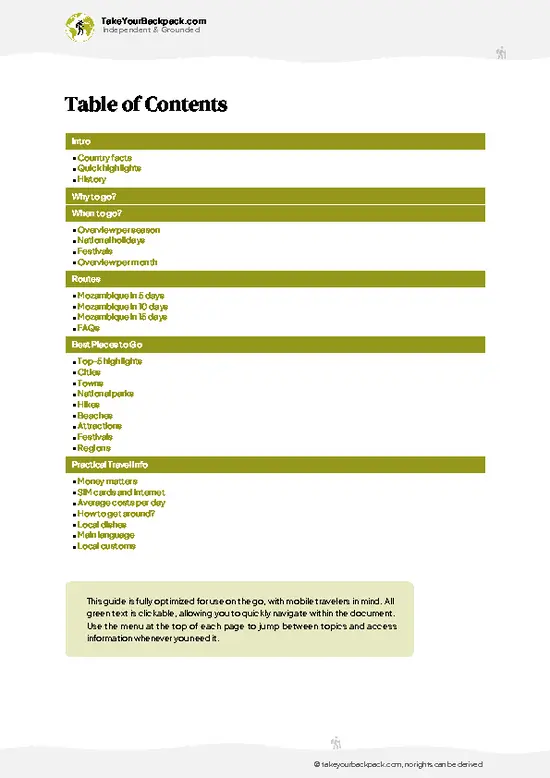
example page 2 from our offline Travel Guide for Mozambique
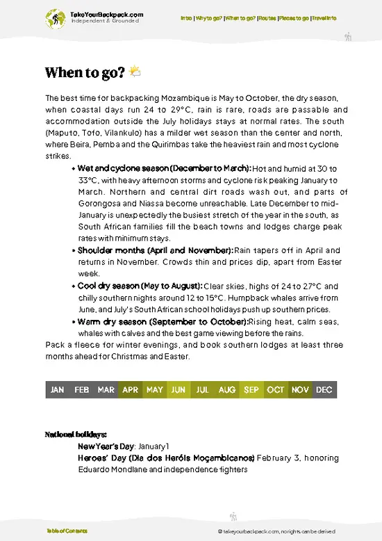
example page 3 from our offline Travel Guide for Mozambique
example page 4 from our offline Travel Guide for Mozambique
example page 5 from our offline Travel Guide for Mozambique
example page 6 from our offline Travel Guide for Mozambique
example page 7 from our offline Travel Guide for Mozambique
Loading the map 🌍
CLICK TO FILTER
cities
towns
national parks
hikes
beaches
attractions
festivals
regions
SHOW COUNTRY’S BESTSHOW ALL

✨ Why go?
Ranked #5 hike in Mozambique
Why Inhaca Island should be on your travel list

Inhaca Island gives you a full coastal wilderness walk without the logistics of a multi-day trek. Backpackers go for the Ponta Torres lighthouse side, where dunes drop to a reef-lined shore and you can wade across tide pools at low water. The Marine Biology Museum adds a rainy-day stop that most beach hikes lack, with preserved reef species and a local natural history focus. The walk is flexible too. You can do a short loop to the beaches near the village, or stretch it into a long day around the southern and eastern shore, and nothing is fixed, so you set the pace by the tide. It also fits neatly into a longer southern Mozambique route, sitting a short hop from Maputo before you head up the coast toward Tofo or south toward Ponta do Ouro. Expect sand, salt and sun, and very few other hikers once you leave the village.

💡 HighlightsWhat this place is best known for

  1. Ponta Torres and its lighthouse area: The southern tip is the classic walk, with dunes, open ocean and reef flats exposed at low tide. Wind is steady and the horizon is wide.
  2. Inhaca Marine Biology Museum: Run by the university research station, it displays shells, corals and fish from Maputo Bay. It is small, quick and informative.
  3. Mangrove shoreline of the western bay: Tidal creeks and thick root systems line the bay side. Look for fiddler crabs and wading birds on the mud at low water.
  4. Cabo Santa Maria beaches: Long, quiet stretches of pale sand on the ocean side give the best swimming and shell hunting. You can often walk for an hour and see only fishers.
  5. Coral reefs off the island: Snorkeling spots such as Barreira Vermelha and the Portuguese Island area show reef fish and hard corals. Boats
… read more 👉
  1. Ponta Torres and its lighthouse area: The southern tip is the classic walk, with dunes, open ocean and reef flats exposed at low tide. Wind is steady and the horizon is wide.
  2. Inhaca Marine Biology Museum: Run by the university research station, it displays shells, corals and fish from Maputo Bay. It is small, quick and informative.
  3. Mangrove shoreline of the western bay: Tidal creeks and thick root systems line the bay side. Look for fiddler crabs and wading birds on the mud at low water.
  4. Cabo Santa Maria beaches: Long, quiet stretches of pale sand on the ocean side give the best swimming and shell hunting. You can often walk for an hour and see only fishers.
  5. Coral reefs off the island: Snorkeling spots such as Barreira Vermelha and the Portuguese Island area show reef fish and hard corals. Boats go out from the village, and the water is clearest at high slack tide.
Inhaca Island’s cheapest highlight is the beach and mangrove walking, which costs nothing, while the museum charges a small entry fee and reef trips cost the most.
Spotted a mistake or missing something? Contact us.

Things to do near Inhaca Island

Ratings based on Tripadvisor reviews. When you book through this link, you support our work at no extra cost to you.

🌤️ When to go?When to go for the best experience

  • Cool dry season (May to September): Days run 20 to 26°C (68 to 79°F) and nights dip to 14 to 17°C (57 to 63°F), with little rain and clear water for snorkeling and diving. Daylight lasts roughly 11 hours in June and July. Whale season peaks from July to October, when humpbacks pass close to shore.
  • Hot wet season (November to March): Expect 28 to 33°C (82 to 91°F), heavy humidity and afternoon downpours. Daylight stretches to about 13.5 hours, turtles nest on the beaches, and rooms are cheaper outside the holidays, but boat crossings from Maputo can be rough.
  • Shoulder months (April and October): Temperatures sit at 24 to 29°C (75 to 84°F) with fewer visitors and easy walking on the island’s trails.
  • Holidays and weekends: South African school breaks, Christmas and Easter fill the lodges and push
… read more 👉
  • Cool dry season (May to September): Days run 20 to 26°C (68 to 79°F) and nights dip to 14 to 17°C (57 to 63°F), with little rain and clear water for snorkeling and diving. Daylight lasts roughly 11 hours in June and July. Whale season peaks from July to October, when humpbacks pass close to shore.
  • Hot wet season (November to March): Expect 28 to 33°C (82 to 91°F), heavy humidity and afternoon downpours. Daylight stretches to about 13.5 hours, turtles nest on the beaches, and rooms are cheaper outside the holidays, but boat crossings from Maputo can be rough.
  • Shoulder months (April and October): Temperatures sit at 24 to 29°C (75 to 84°F) with fewer visitors and easy walking on the island’s trails.
  • Holidays and weekends: South African school breaks, Christmas and Easter fill the lodges and push prices up by 20 to 40 percent.
Book your ferry or boat seat a few days ahead for any weekend, since sailings fill first.


source: climatestotravel.comJANJanuary: fair for travelingFEBFebruary: fair for travelingMARMarch: fair for travelingAPRApril: good for travelingMAYMay: highly recommended for travelingJUNJune: excellent for travelingJULJuly: excellent for travelingAUGAugust: excellent for travelingSEPSeptember: highly recommended for travelingOCTOctober: highly recommended for travelingNOVNovember: fair for travelingDECDecember: fair for traveling
mozambique-hike-inhaca-island v1
© Google |

✈️ The backpacker research shortcutMozambique Travel Guide

An offline-friendly backpacking guide with optimized travel routes, ranked highlights, transport advice, and the best areas to stay.
example page 0 from our offline Travel Guide for Mozambique
example page 1 from our offline Travel Guide for Mozambique
example page 2 from our offline Travel Guide for Mozambique
example page 3 from our offline Travel Guide for Mozambique
example page 4 from our offline Travel Guide for Mozambique
example page 5 from our offline Travel Guide for Mozambique
example page 6 from our offline Travel Guide for Mozambique
example page 7 from our offline Travel Guide for Mozambique
The digital guide (324 pages) contains:
✅ 78 highlights, ranked by travel appeal
✅ Optimized 5, 10 & 15-day travel routes
✅ Cities, national parks, landmarks, beaches
✅ How to get around
✅ Offline-friendly for travel without Wi-Fi
👉 Click to see all 30+ guide features

📅 Plan smarter in minutes, not weeks
✅ Month by month travel advice
✅ Festivals & national holidays
✅ Budget expectations

🗺️ Go to the right places, skip the overrated ones
✅ Honest pros & cons of destinations
✅ Top hikes, parks & viewpoints
✅ Lesser-known places most travelers miss
✅ Clear “worth it vs skip it” guidance

🛏️ Travel smoothly without rookie mistakes
✅ Best areas to stay
✅ Transport systems explained simply
✅ Common scams & safety advice
✅ SIM cards, money & practical tips

🌍 Understand the country, not just visit it
✅ Culture & traditions
✅ 52 Essential phrases & customs
✅ Festivals worth planning around
✅ Traveler-friendly historical context
✅ Insights that make places more meaningful

📱 Built for real travel conditions
✅ Fully downloadable PDF
✅ Works completely offline
✅ Optimized for phone use
✅ Useful in remote areas & buses
✅ Everything in one place
Stop searching, start planning
Get instant access to your full guide. 30‑day money-back guarantee.
+ Add another guide for just

By proceeding you agree to our terms.
Sent to your inbox immediately after payment • 100% Secure Checkout
Best Backpacking Travel Advisor 2025 tourism awardBest Backpacking
Travel Advisor
2025
What others say about Take Your Backpack Guides:
⭐⭐⭐⭐⭐
Fantastic, amazing amount of information!
⭐⭐⭐⭐⭐
My goodness this is amazing, it's what I've been looking for hats off too you!
⭐⭐⭐⭐⭐
I think this is absolutely BRILLIANT
⭐⭐⭐⭐
Very complete and informative. It's still missing places, but I gotta to commend you
⭐⭐⭐⭐⭐
This is truly amazing, thank you, can't wait to explore it with my kids!
⭐⭐⭐⭐⭐
Awesome resource, thank you!
⭐⭐⭐⭐⭐
This is amazing! Can't wait to explore the ones I haven't seen
⭐⭐⭐⭐
I love this! Well done, great idea.
⭐⭐⭐⭐⭐
Thanks for taking the time to make this gem!
⭐⭐⭐⭐⭐
This might be the best website I've ever seen.
⭐⭐⭐⭐⭐
Congratulations, and thank you so much for your work; it's incredibly valuable.
⭐⭐⭐⭐
In all seriousness I think you did a great job pointing out the important spots
⭐⭐⭐⭐⭐
10/10 very good
⭐⭐⭐⭐⭐
As someone who's only just starting to visit regularly this is awesome, thank you.
⭐⭐⭐⭐
Thank you very much! I'm going to visit my dad, it's going to be very useful!
⭐⭐⭐⭐⭐
This is really cool! We'll be travelling for the first time and this definitely come in handy.
⭐⭐⭐⭐⭐
You are now our minister of culture, congratulations 👨‍💼
⭐⭐⭐⭐⭐
Just wanted to tell you that this is a pearl! Going to follow your recommendations.
⭐⭐⭐⭐⭐
This is so cool. I'll definitely be using the resource for my travels soon.
⭐⭐⭐⭐⭐
This is very impressive! Good work.
⭐⭐⭐⭐⭐
This is an amazing and informative site. Very well done!

🛏️ Where to stay?Best areas to stay in Mozambique

If you enjoy meeting fellow travelers, consider choosing hostels with high ratings for atmosphere. On the other hand, if you prefer having your own space, a hotel might be a better option.

🥾 Hike detailsEverything you need to know before hiking Inhaca Island

Total Distance: Inhaca Island offers a loop of about 20 to 25 kilometers around the south and east, with shorter options of 6 to 12 kilometers near the village.
Estimated Duration: 6 to 8 hours for the long loop, including breaks and tide-pool stops.
Difficulty: Easy in gradient, moderate in effort because soft sand and sun exposure slow you down.
Starting Point: The ferry or boat landing near the main village, reached from Maputo by public boat. Walk from the landing along the track toward the southern beaches.
Major Landmarks:
  • Marine Biology Museum: A compact collection near the research station.
… read more 👉
Total Distance: Inhaca Island offers a loop of about 20 to 25 kilometers around the south and east, with shorter options of 6 to 12 kilometers near the village.
Estimated Duration: 6 to 8 hours for the long loop, including breaks and tide-pool stops.
Difficulty: Easy in gradient, moderate in effort because soft sand and sun exposure slow you down.
Starting Point: The ferry or boat landing near the main village, reached from Maputo by public boat. Walk from the landing along the track toward the southern beaches.
Major Landmarks:
  • Marine Biology Museum: A compact collection near the research station.
  • Ponta Torres: The southern point with dunes and reef flats.
  • Cabo Santa Maria: Long ocean beaches on the east side.
Terrain and Scenery: Sand tracks, firm wet sand at low tide, wooded dune ridges and rocky shelves. Views alternate between the calm bay and open surf. Check tide times before setting out, since the best walking is on hard sand at low tide.
Vegetation: Coastal forest, dune scrub, casuarina trees and dense mangrove stands along creeks and the bay side.
Wildlife: Wading birds, fiddler crabs, mudskippers, reef fish in tide pools and the occasional monkey in the forest. Offshore, humpback whales pass in the cooler months.
⚠️ Hiking info can sometimes be outdated or inaccurate. Before you hit the trail, check the latest conditions with locals. If you do spot anything that's off, I'd love to hear from you, so I can update it for fellow travelers.

🛡️ SafetyStaying Safe: What Travelers Should Know

Inhaca Island is a low-risk hike, with gentle sandy tracks and no real elevation, so the main hazards are sun, heat and tides. Carry at least 2 liters of water per person, a hat and reef-safe sunscreen, because shade is patchy along the dunes and the shoreline. Walk the beach and the mangrove boardwalks at low tide, check tide times before heading to the sandbanks, and avoid wading far from shore as currents shift quickly. Wear closed shoes in the mangroves, where mud is sticky and crab holes hide underfoot. Trails are not always signed, so hiring a local guide for longer routes saves wrong turns. Keep a respectful distance from nesting turtles and do not touch coral or starfish. Carry cash, since card machines are rare, and plan to be back at your lodge before dark, when lighting is limited.

FAQTraveler FAQ

Most hikes on Inhaca Island take 2 to 4 hours, such as the walk from the village to the lighthouse and the beaches on the east side. A full circuit of the island is about 12 to 15 kilometers and fits into a long day of 5 to 6 hours with breaks. Many visitors do it in stages over 2 to 3 days while staying in the village, which is a short boat ride from Maputo.
Inhaca Island is an easy hike, with flat sandy terrain and boardwalks through the mangroves. The main challenge is the heat and soft sand, which slow your pace on the longer beach stretches. Most people of average fitness manage 10 kilometers comfortably, as long as they start early and carry about 2 liters of water.
On Inhaca Island you do not need a permit for walking the trails, but a local guide is helpful for the mangroves and the marine reserve sections. Guides typically cost US$10 to 25 for a half day, and you can arrange one through your lodge or at the village. Some areas around the marine biology station and the reserve may charge a small entry fee of a few US dollars.
⚠️ Things can change over time, so always validate details locally before you go.

Other Mozambican hikes near Inhaca Island

Explore more nearby:

  • Mount Gorongosa—Park-guided climb, waterfall pool, Rift Valley outlook, mountain camp| 850 km away
  • Mount Chiperone—Trackless ascent, dripping montane forest, guide required, Malawi border views| 1095 km away
  • Mount Mabu—Medium-altitude rainforest, leeches and mud, rare chameleons, Gurué approach| 1136 km away

💡 Not sure where to go next?
Create a personalized itinerary for Mozambique including Inhaca Island and the places that fit your trip.

Generate my itinerary

👉 Discover all hikes

Or checkout all Mozambique has to offer (think cities, towns, villages, national parks, hikes, beaches, festivals)
Country photo of Mozambique

We 💚 feedbackParting advice and final tips

On Inhaca Island, most first-timers head straight for the beaches and forget the tide table, yet it controls everything: reef flats, easy sand and mangrove creeks. I would plan the walk around low water, start early and carry far more water than seems necessary.

✍️ Help improve this page!
The information on this page is based on in-depth research, insights shared by experienced travelers, and feedback from the local travel community in Mozambique. While every effort is made to keep the information accurate and current, conditions can change — so if you spot anything incorrect or outdated, please get in touch.


🙋‍♂️ Give feedback

👋 Meet the founderWho’s Behind Take Your Backpack?

Johan, backpacker and founder of TakeYourBackpackHi, I’m Johan (Netherlands 🇳🇱), the creator of TakeYourBackpack. Over the past 3 decades, I’ve backpacked through 90+ countries across six continents, gaining extensive experience with independent travel, long-term trips, and overland routes.

This site is built on a combination of firsthand travel experience and carefully curated insights from other backpackers. Many guides are based on places I’ve personally visited, while others bring together tips, observations, and practical advice shared by trusted travelers I’ve met along the way.

The goal is to provide realistic, experience-driven guidance — not generic itineraries — so you can explore destinations with better context, clearer expectations, and more confidence.