×
Fish River Canyon

Namibia🇳🇦 | hikesFish River CanyonPermit-only canyon trek, sandbank camps, scree descent, Ai-Ais hot springs | things to do and best time to go

Explore Caprivi Arts FestivalExplore Namib Naukluft Trail

Backpacking in Fish River Canyon
🏆 Top pickhike ranked #1
By Johan Kruseman 🇳🇱 | Updated October 22, 2026

Hikers on the Fish River Canyon trail sign a register at Hobas before starting, and permits are checked there, because the route is only open in the cooler months and numbers are capped at 30 starters a day. The canyon cuts through the south of Namibia, roughly 90 kilometers by road from Ai-Ais at the far end of the trail. It drops about 550 meters at its deepest, with a floor of sand, boulders and green pools, and the 80 to 90 kilometer one-way hike ends at hot springs. The upside is sheer scale, silence broken only by rock doves and your own boots, and nights under a hard sky of stars. The downside is the lack of any marked path, a steep first descent on loose scree, and no exit once you are down. Public transport to Hobas is poor, so most walkers arrange a shuttle. A first day usually means a dawn descent before the rock turns hot, then a long, slow walk over cobbles to a sandbank camp.

Discover everything you want to know in the 📖 Namibia Travel Guide.
Best time to go: May - September
Duration: 5 days
Distance: 85 kilometers
Total ascent: 600 meters


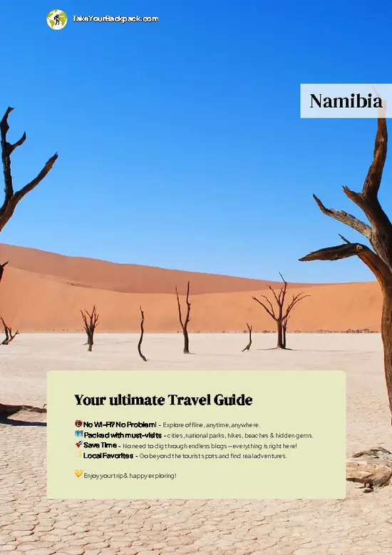
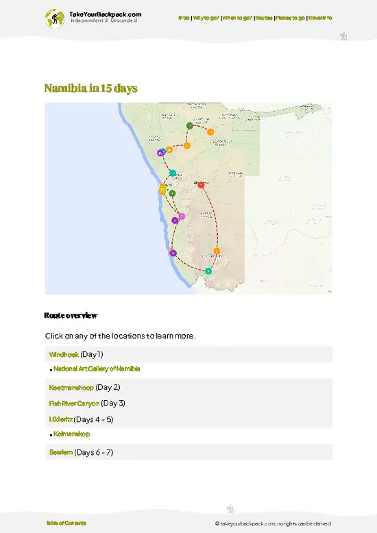
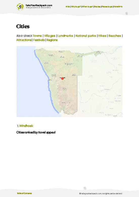
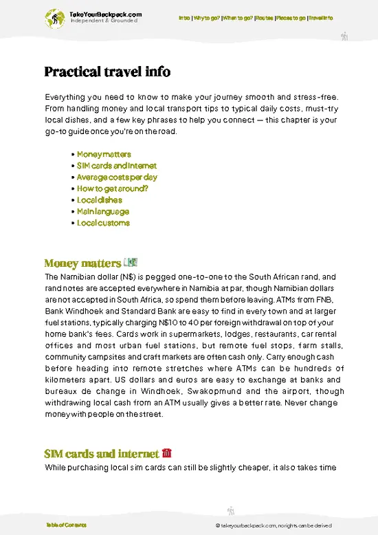
example page 0 from our offline Travel Guide for Namibia
example page 1 from our offline Travel Guide for Namibia
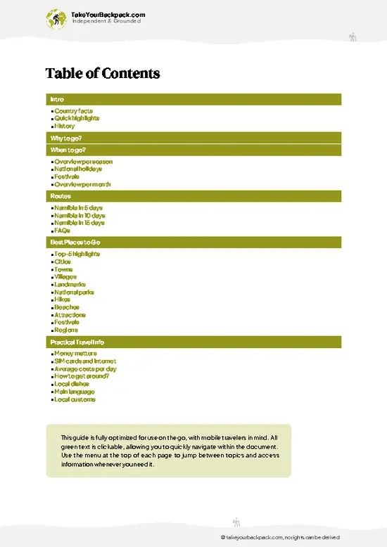
example page 2 from our offline Travel Guide for Namibia
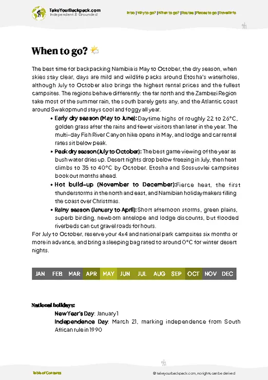
example page 3 from our offline Travel Guide for Namibia
example page 4 from our offline Travel Guide for Namibia
example page 5 from our offline Travel Guide for Namibia
example page 6 from our offline Travel Guide for Namibia
example page 7 from our offline Travel Guide for Namibia
Loading the map 🌍
CLICK TO FILTER
cities
towns
villages
landmarks
national parks
hikes
beaches
attractions
festivals
regions
SHOW COUNTRY’S BESTSHOW ALL

✨ Why go?
Ranked #1 hike in Namibia
Why visitors keep coming back

Fish River Canyon is the reason many backpackers add southern Namibia to a route. The draw is the five-day, 80 to 90 kilometer through-hike, one of the few real multi-day wilderness treks in southern Africa where you carry everything and follow no waymarks. You sleep on river sand beside pools, wash in water cooled by shaded rock walls, and finish at the Ai-Ais hot springs, where you soak aching feet at the end of the walk. Hikers who want less commitment can look down from the rim at Hobas and walk the short canyon-edge paths. The permit cap of 30 hikers per day means camps stay quiet, and you rarely see other groups apart from the odd pair passing at a bend. It also fits easily into a longer overland trip, since the route sits between the Kalahari and the Namib and the Cape Town corridor, … read more 👉
Fish River Canyon is the reason many backpackers add southern Namibia to a route. The draw is the five-day, 80 to 90 kilometer through-hike, one of the few real multi-day wilderness treks in southern Africa where you carry everything and follow no waymarks. You sleep on river sand beside pools, wash in water cooled by shaded rock walls, and finish at the Ai-Ais hot springs, where you soak aching feet at the end of the walk. Hikers who want less commitment can look down from the rim at Hobas and walk the short canyon-edge paths. The permit cap of 30 hikers per day means camps stay quiet, and you rarely see other groups apart from the odd pair passing at a bend. It also fits easily into a longer overland trip, since the route sits between the Kalahari and the Namib and the Cape Town corridor, and the walk makes a natural centerpiece for a few weeks in the south.

💡 HighlightsDon't-miss highlights and experiences

  1. Main Viewpoint at Hobas: The rim lookout shows the canyon’s big horseshoe bend, where the river has cut a switchback far below. The cliffs fall away in layered grey and rust bands, and the drop feels bigger than the numbers suggest.
  2. Hiker’s Descent Point: A steep trail drops from the rim into the canyon bed using chains and loose scree. It takes about one to two hours and is where the trek truly starts, with every step opening more of the walls.
  3. Riverbed Pools: In the cooler months the river shrinks into long green pools between sandbanks. They are where you swim, filter water and rest in shade during the heat of the afternoon.
  4. Sandbank Camps: Overnight stops are on sand beside the river, with no facilities and a ceiling of stars. Fires from driftwood are common, and the quiet at night is complete
… read more 👉
  1. Main Viewpoint at Hobas: The rim lookout shows the canyon’s big horseshoe bend, where the river has cut a switchback far below. The cliffs fall away in layered grey and rust bands, and the drop feels bigger than the numbers suggest.
  2. Hiker’s Descent Point: A steep trail drops from the rim into the canyon bed using chains and loose scree. It takes about one to two hours and is where the trek truly starts, with every step opening more of the walls.
  3. Riverbed Pools: In the cooler months the river shrinks into long green pools between sandbanks. They are where you swim, filter water and rest in shade during the heat of the afternoon.
  4. Sandbank Camps: Overnight stops are on sand beside the river, with no facilities and a ceiling of stars. Fires from driftwood are common, and the quiet at night is complete apart from the occasional bird call.
  5. Ai-Ais Hot Springs: The trail finishes at a resort where mineral-rich spring water, around 60 degrees Celsius at the source, is cooled for pools. After several days on cobbles, the soak is the best way to end it.
For a first visit, the Main Viewpoint at Hobas is the best choice, since it gives you the full scale of the canyon without a permit or any hiking.
Spotted a mistake or missing something? Contact us.

Things to do around Fish River Canyon

Ratings based on Tripadvisor reviews. When you book through this link, you support our work at no extra cost to you.

🌤️ When to go?When to go for the best experience

The Fish River Canyon hiking trail is only open from May 1 to mid-September, and that window is also the right one because the canyon floor turns dangerously hot the rest of the year.
  • Winter (May to August): Days reach 20 to 25°C (68 to 77°F) in the canyon, with dry air and cold nights that can fall to 0 to 5°C (32 to 41°F). Daylight runs roughly 11 hours, so you need an early start. June to August is busiest, and permits sell out.
  • Early Spring (September): Daytime highs climb toward 30°C (86°F) and the trail closes in mid-September. Crowds thin, but heat builds fast on the sandy stretches.
  • Summer (October to April): Canyon temperatures often pass 40°C (104°F), with flash storms from January to March. The trail is closed, and rim viewpoints are best at dawn.
  • Prices: Rest camp and lodge rates around
… read more 👉
The Fish River Canyon hiking trail is only open from May 1 to mid-September, and that window is also the right one because the canyon floor turns dangerously hot the rest of the year.
  • Winter (May to August): Days reach 20 to 25°C (68 to 77°F) in the canyon, with dry air and cold nights that can fall to 0 to 5°C (32 to 41°F). Daylight runs roughly 11 hours, so you need an early start. June to August is busiest, and permits sell out.
  • Early Spring (September): Daytime highs climb toward 30°C (86°F) and the trail closes in mid-September. Crowds thin, but heat builds fast on the sandy stretches.
  • Summer (October to April): Canyon temperatures often pass 40°C (104°F), with flash storms from January to March. The trail is closed, and rim viewpoints are best at dawn.
  • Prices: Rest camp and lodge rates around the rim rise in July and August. Shoulder weeks in May or early September are easier to book and slightly cheaper.
Book your permit months ahead for May, since the group quota fills quickly.


source: climatestotravel.comJANJanuary: below average for travelingFEBFebruary: below average for travelingMARMarch: below average for travelingAPRApril: fair for travelingMAYMay: highly recommended for travelingJUNJune: excellent for travelingJULJuly: excellent for travelingAUGAugust: excellent for travelingSEPSeptember: highly recommended for travelingOCTOctober: fair for travelingNOVNovember: below average for travelingDECDecember: below average for traveling
Namibia - Fish River Canyon

✈️ The backpacker research shortcutNamibia Travel Guide

An offline-friendly backpacking guide with optimized travel routes, ranked highlights, transport advice, and the best areas to stay.
example page 0 from our offline Travel Guide for Namibia
example page 1 from our offline Travel Guide for Namibia
example page 2 from our offline Travel Guide for Namibia
example page 3 from our offline Travel Guide for Namibia
example page 4 from our offline Travel Guide for Namibia
example page 5 from our offline Travel Guide for Namibia
example page 6 from our offline Travel Guide for Namibia
example page 7 from our offline Travel Guide for Namibia
The digital guide (294 pages) contains:
✅ 71 highlights, ranked by travel appeal
✅ Optimized 5, 10 & 15-day travel routes
✅ Cities, national parks, landmarks, beaches
✅ How to get around
✅ Offline-friendly for travel without Wi-Fi
👉 Click to see all 30+ guide features

📅 Plan smarter in minutes, not weeks
✅ Month by month travel advice
✅ Festivals & national holidays
✅ Budget expectations

🗺️ Go to the right places, skip the overrated ones
✅ Honest pros & cons of destinations
✅ Top hikes, parks & viewpoints
✅ Lesser-known places most travelers miss
✅ Clear “worth it vs skip it” guidance

🛏️ Travel smoothly without rookie mistakes
✅ Best areas to stay
✅ Transport systems explained simply
✅ Common scams & safety advice
✅ SIM cards, money & practical tips

🌍 Understand the country, not just visit it
✅ Culture & traditions
✅ 52 Essential phrases & customs
✅ Festivals worth planning around
✅ Traveler-friendly historical context
✅ Insights that make places more meaningful

📱 Built for real travel conditions
✅ Fully downloadable PDF
✅ Works completely offline
✅ Optimized for phone use
✅ Useful in remote areas & buses
✅ Everything in one place
Stop searching, start planning
Get instant access to your full guide. 30‑day money-back guarantee.
+ Add another guide for just

By proceeding you agree to our terms.
Sent to your inbox immediately after payment • 100% Secure Checkout
Best Backpacking Travel Advisor 2025 tourism awardBest Backpacking
Travel Advisor
2025
What others say about Take Your Backpack Guides:
⭐⭐⭐⭐⭐
Fantastic, amazing amount of information!
⭐⭐⭐⭐⭐
My goodness this is amazing, it's what I've been looking for hats off too you!
⭐⭐⭐⭐⭐
I think this is absolutely BRILLIANT
⭐⭐⭐⭐
Very complete and informative. It's still missing places, but I gotta to commend you
⭐⭐⭐⭐⭐
This is truly amazing, thank you, can't wait to explore it with my kids!
⭐⭐⭐⭐⭐
Awesome resource, thank you!
⭐⭐⭐⭐⭐
This is amazing! Can't wait to explore the ones I haven't seen
⭐⭐⭐⭐
I love this! Well done, great idea.
⭐⭐⭐⭐⭐
Thanks for taking the time to make this gem!
⭐⭐⭐⭐⭐
This might be the best website I've ever seen.
⭐⭐⭐⭐⭐
Congratulations, and thank you so much for your work; it's incredibly valuable.
⭐⭐⭐⭐
In all seriousness I think you did a great job pointing out the important spots
⭐⭐⭐⭐⭐
10/10 very good
⭐⭐⭐⭐⭐
As someone who's only just starting to visit regularly this is awesome, thank you.
⭐⭐⭐⭐
Thank you very much! I'm going to visit my dad, it's going to be very useful!
⭐⭐⭐⭐⭐
This is really cool! We'll be travelling for the first time and this definitely come in handy.
⭐⭐⭐⭐⭐
You are now our minister of culture, congratulations 👨‍💼
⭐⭐⭐⭐⭐
Just wanted to tell you that this is a pearl! Going to follow your recommendations.
⭐⭐⭐⭐⭐
This is so cool. I'll definitely be using the resource for my travels soon.
⭐⭐⭐⭐⭐
This is very impressive! Good work.
⭐⭐⭐⭐⭐
This is an amazing and informative site. Very well done!

🛏️ Where to stay?Best areas and accommodation options

If you enjoy meeting fellow travelers, consider choosing hostels with high ratings for atmosphere. On the other hand, if you prefer having your own space, a hotel might be a better option.

🥾 Hike detailsTrail overview: what to expect on the hike

Total Distance: Fish River Canyon is walked as a one-way trek of about 80 to 90 kilometers from the rim at Hobas to Ai-Ais.
Estimated Duration: Most groups take four to five days, with some taking up to six if they move slowly.
Difficulty: Hard. There is no marked trail, the sand and cobbles are tiring, and temperatures in the canyon get high even in the cooler months. Hikers must carry all food and be self-sufficient.
Starting Point: The Hobas viewpoint and trailhead on the rim.
  • Access: Public transport to Hobas is very limited, so most hikers take a shuttle or rental car from the nearby towns.
  • End
… read more 👉
Total Distance: Fish River Canyon is walked as a one-way trek of about 80 to 90 kilometers from the rim at Hobas to Ai-Ais.
Estimated Duration: Most groups take four to five days, with some taking up to six if they move slowly.
Difficulty: Hard. There is no marked trail, the sand and cobbles are tiring, and temperatures in the canyon get high even in the cooler months. Hikers must carry all food and be self-sufficient.
Starting Point: The Hobas viewpoint and trailhead on the rim.
  • Access: Public transport to Hobas is very limited, so most hikers take a shuttle or rental car from the nearby towns.
  • End Point: The trek finishes at Ai-Ais, where transfers can be arranged to collect you.
Major Landmarks:
  • Hobas Rim: The registration point and a long drop to the canyon floor.
  • Descent Route: A steep scree path with chains in places.
  • Riverbed Pools: Deep pools along the route, useful for water and swimming.
  • Ai-Ais: Hot springs and a resort at the end of the trail.
Terrain and Scenery: The route follows the river bed over sand, boulders and gravel, crossing the water repeatedly. Walls of rock rise on both sides, with the canyon widening in places into broad bends.
Vegetation: Sparse desert plants cover the floor and slopes, including quiver trees at the rim, acacia thorn and reeds near the pools.
Wildlife: Baboons, klipspringer, rock hyrax, mountain zebra and a range of birds including fish eagles. Snakes and scorpions live in the rocks, so shake out your boots in the morning.
⚠️ Hiking info can sometimes be outdated or inaccurate. Before you hit the trail, check the latest conditions with locals. If you do spot anything that's off, I'd love to hear from you, so I can update it for fellow travelers.

🛡️ SafetyScams, Hazards, and Annoyances

The main risks at Fish River Canyon are heat, dehydration and the sheer remoteness of the 5 day, 80 km trail, and all of them are manageable with preparation. There are no marked trails or rescue stations, so you follow the riverbed and the cairns, and a doctor’s certificate is required before you start. Carry at least 3 to 5 liters of water at the start of each day and refill only at the pools along the river, treating it every time, since the water is stagnant. Daytime sun is fierce even in winter, while nights drop near freezing, so pack a warm sleeping bag and sun protection. The deep sand and boulder fields slow your pace and are hard on ankles and knees, and there is no exit once you start, other than Ai-Ais at the end. Baboons, snakes and scorpions are present, so shake out shoes, keep … read more 👉
The main risks at Fish River Canyon are heat, dehydration and the sheer remoteness of the 5 day, 80 km trail, and all of them are manageable with preparation. There are no marked trails or rescue stations, so you follow the riverbed and the cairns, and a doctor’s certificate is required before you start. Carry at least 3 to 5 liters of water at the start of each day and refill only at the pools along the river, treating it every time, since the water is stagnant. Daytime sun is fierce even in winter, while nights drop near freezing, so pack a warm sleeping bag and sun protection. The deep sand and boulder fields slow your pace and are hard on ankles and knees, and there is no exit once you start, other than Ai-Ais at the end. Baboons, snakes and scorpions are present, so shake out shoes, keep food sealed, and give any animal space. Never hike alone, and leave your itinerary with the park office.

FAQTraveler FAQ

Fish River Canyon takes 4 to 5 days to hike on the full 80 km trail from the main viewpoint to Ai-Ais, with most groups covering 15 to 20 km a day. The route follows the riverbed, and you sleep on sandbars along the way. If you only want to see the rim, the viewpoint and short walks take 1 to 3 hours, and many visitors spend a night nearby for sunrise or sunset views.
Fish River Canyon is a hard hike, mainly because it is remote, unmarked and unsupported, with long days in deep sand and over boulders. You carry all your food and gear for 5 days, and your pack typically weighs 15 to 20 kg. Fit hikers with some multi-day experience manage well, but the rim walks near the main viewpoint are easy and flat.
Fish River Canyon requires a permit and a medical certificate for the full hike, but not a guide. Permits are issued by Namibia Wildlife Resorts at about US$ 45 to 60 per person plus a small fee for camping, and groups must have at least 3 people and a maximum of 40. The trail is open only from May 1 to mid-September, and permits are best booked months ahead, while viewing the canyon from the rim needs only a park entry fee.
⚠️ Things can change over time, so always validate details locally before you go.

Other Namibian hikes near Fish River Canyon

Explore more nearby:

  • Tok Tokkie Trail—Guided three-day walk, fog beetles, fairy circles, Nubib views| 322 km away
  • Namib Naukluft Trail—Eight-day hut circuit, dolomite plateau, tufa pools, chain sections| 412 km away
  • Naukluft 4x4 Trail—off-road route, rugged terrain, vehicle-based, remote campsites| 412 km away

💡 Not sure where to go next?
Create a personalized itinerary for Namibia including Fish River Canyon and the places that fit your trip.

Generate my itinerary

👉 Discover all hikes

Or checkout all Namibia has to offer (think cities, towns, villages, national parks, hikes, beaches, festivals)
Country photo of Namibia

We 💚 feedbackSumming up the experience

Fish River Canyon suits experienced walkers who like quiet, self-sufficiency and big empty landscapes, and who are happy to carry their own food for days. I would book the permit well ahead, pack a light sleeping bag and a lot of electrolytes, and plan a night at the Ai-Ais springs afterward. If the full trek is too much, the rim viewpoint alone is worth the detour.

✍️ Help improve this page!
The information on this page is based on in-depth research, insights shared by experienced travelers, and feedback from the local travel community in Namibia. While every effort is made to keep the information accurate and current, conditions can change — so if you spot anything incorrect or outdated, please get in touch.


🙋‍♂️ Give feedback

👋 Meet the founderWho’s Behind Take Your Backpack?

Johan, backpacker and founder of TakeYourBackpackHi, I’m Johan (Netherlands 🇳🇱), the creator of TakeYourBackpack. Over the past 3 decades, I’ve backpacked through 90+ countries across six continents, gaining extensive experience with independent travel, long-term trips, and overland routes.

This site is built on a combination of firsthand travel experience and carefully curated insights from other backpackers. Many guides are based on places I’ve personally visited, while others bring together tips, observations, and practical advice shared by trusted travelers I’ve met along the way.

The goal is to provide realistic, experience-driven guidance — not generic itineraries — so you can explore destinations with better context, clearer expectations, and more confidence.