


×
Kepler Track

New Zealand🇳🇿 | hikesKepler Track60 km loop, limestone caves, alpine ridge, lakeshore finish | things to do and best time to go

Explore Hooker Valley TrackExplore Milford Track

Backpacking in Kepler Track
👍 Recommendedhike ranked #5
By Johan Kruseman 🇳🇱 | Updated October 15, 2026

Kepler Track starts a short walk from Te Anau township, so you can reach the trailhead without a car or shuttle. It sits in Fiordland National Park in the south-west of New Zealand, one of the Great Walks, a 60 kilometer loop over lakeshore, beech forest and an exposed alpine ridge. The upside is huge views for a moderate climb and well-kept huts. The downside is that huts and campsites must be booked ahead in the main season, and Fiordland weather can close the ridge. My mistake was leaving my rain layer at the bottom of my pack on the first descent toward Lake Te Anau. I ended up stopping in a downpour, and now I keep it on top. Walk the first stretch from the control gates along the lake to Brod Bay, where the flat track gives you easy views.

Discover everything you want to know in the 📖 New Zealand Travel Guide.
Best time to go: September - May
Duration: 3 days
Distance: 60 kilometers
Total ascent: 1000 meters


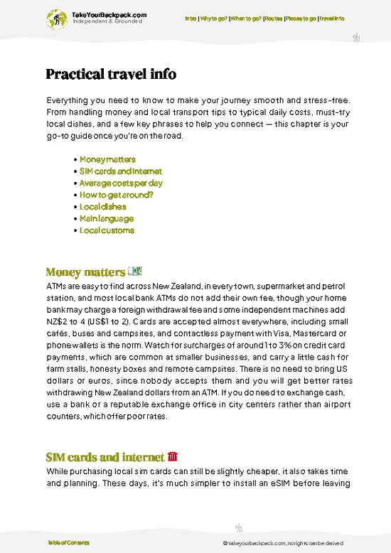
example page 0 from our offline Travel Guide for New Zealand
example page 1 from our offline Travel Guide for New Zealand
example page 2 from our offline Travel Guide for New Zealand
example page 3 from our offline Travel Guide for New Zealand
example page 4 from our offline Travel Guide for New Zealand
example page 5 from our offline Travel Guide for New Zealand
example page 6 from our offline Travel Guide for New Zealand
example page 7 from our offline Travel Guide for New Zealand
Loading the map 🌍
CLICK TO FILTER
cities
towns
villages
landmarks
national parks
hikes
beaches
attractions
festivals
regions
SHOW COUNTRY’S BESTSHOW ALL

✨ Why go?
Ranked #5 hike in New Zealand
Reasons people choose to hike the here

Backpackers pick Kepler Track because it packs the best of Fiordland into a 60 kilometer loop that begins and ends near Te Anau, with no backtracking and no vehicle needed to reach the start. You cross three distinct landscapes: lake edge, moss-draped beech forest and a high ridgeline above the bushline, where glacier-carved valleys open on both sides. The Luxmore Hut day, with its views over the South Fiord of Lake Te Anau, is the one people talk about afterward. The track is well graded and marked, so first-time multi-day hikers can manage it, while experienced walkers can run it in fewer days or add the Luxmore Caves detour. Because it is a loop, it also fits easily into a longer South Island route between Queenstown and Milford Sound.

💡 HighlightsThe experiences that define the visit

  1. Luxmore Hut and the alpine ridge: The high point of the loop. Above the bushline the track follows a ridge with wide views of Lake Te Anau, the Murchison Mountains and the Takitimu range, and the hut sits just below the tops.
  2. Luxmore Caves: A short side track from the hut leads to a limestone cave with stalactites and stalagmites. Bring a headlamp, because the passages are dark and it is a fun scramble.
  3. Iris Burn Falls: A short side walk from Iris Burn Hut brings you to a waterfall plunging through mossy beech forest. It is best after rain, when the flow is strongest.
  4. Iris Burn Valley: A broad glacial valley with a landslide scar and thick forest, where bird song in the morning is loud and the track descends gently for long stretches.
  5. Lake Manapouri and Moturau Hut: The final stretch follows the
… read more 👉
  1. Luxmore Hut and the alpine ridge: The high point of the loop. Above the bushline the track follows a ridge with wide views of Lake Te Anau, the Murchison Mountains and the Takitimu range, and the hut sits just below the tops.
  2. Luxmore Caves: A short side track from the hut leads to a limestone cave with stalactites and stalagmites. Bring a headlamp, because the passages are dark and it is a fun scramble.
  3. Iris Burn Falls: A short side walk from Iris Burn Hut brings you to a waterfall plunging through mossy beech forest. It is best after rain, when the flow is strongest.
  4. Iris Burn Valley: A broad glacial valley with a landslide scar and thick forest, where bird song in the morning is loud and the track descends gently for long stretches.
  5. Lake Manapouri and Moturau Hut: The final stretch follows the lake shore with beach spots and calm water for a swim in warm weather. Sandflies are thick here, so the hut verandah is a good place for a rest.
Allow three to four days to see everything on the loop, with the caves adding an hour or two.
Spotted a mistake or missing something? Contact us.

Things to do around Kepler Track

Ratings based on Tripadvisor reviews. When you book through this link, you support our work at no extra cost to you.

🌤️ When to go?Seasonal considerations and timing

  • Great Walk season (late October to April): Huts and campsites are staffed by wardens, bookings are required, and the track is at its easiest. Overnight lows run 6 to 10°C and highs reach about 20°C (43 to 68°F), with up to 16 hours of daylight in December and January.
  • Peak summer (Christmas to February): Hut beds sell out months ahead, fees are at their highest, and the Luxmore Hut crowds are at their thickest. Fiordland rain still arrives with little warning.
  • Autumn (March to April): Steadier skies, fewer people, and daylight shrinking to about 11 to 12 hours. Nights drop to 3 to 5°C (37 to 41°F).
  • Winter (May to September): Wardens leave, hut fees drop, and snow and avalanche risk on the tops make it a mountaineering trip with highs of 2 to 8°C (36 to 46°F) and only 8 to 9 hours of light.
Book … read more 👉
  • Great Walk season (late October to April): Huts and campsites are staffed by wardens, bookings are required, and the track is at its easiest. Overnight lows run 6 to 10°C and highs reach about 20°C (43 to 68°F), with up to 16 hours of daylight in December and January.
  • Peak summer (Christmas to February): Hut beds sell out months ahead, fees are at their highest, and the Luxmore Hut crowds are at their thickest. Fiordland rain still arrives with little warning.
  • Autumn (March to April): Steadier skies, fewer people, and daylight shrinking to about 11 to 12 hours. Nights drop to 3 to 5°C (37 to 41°F).
  • Winter (May to September): Wardens leave, hut fees drop, and snow and avalanche risk on the tops make it a mountaineering trip with highs of 2 to 8°C (36 to 46°F) and only 8 to 9 hours of light.
Book as soon as the Department of Conservation opens sales in the middle of the year, and aim for a weekday start in March.


source: climatestotravel.comJANJanuary: excellent for travelingFEBFebruary: excellent for travelingMARMarch: highly recommended for travelingAPRApril: highly recommended for travelingMAYMay: good for travelingJUNJune: fair for travelingJULJuly: below average for travelingAUGAugust: below average for travelingSEPSeptember: good for travelingOCTOctober: highly recommended for travelingNOVNovember: highly recommended for travelingDECDecember: excellent for traveling
New Zealand - the Kepler Track

✈️ The backpacker research shortcutNew Zealand Travel Guide

An offline-friendly backpacking guide with optimized travel routes, ranked highlights, transport advice, and the best areas to stay.
example page 0 from our offline Travel Guide for New Zealand
example page 1 from our offline Travel Guide for New Zealand
example page 2 from our offline Travel Guide for New Zealand
example page 3 from our offline Travel Guide for New Zealand
example page 4 from our offline Travel Guide for New Zealand
example page 5 from our offline Travel Guide for New Zealand
example page 6 from our offline Travel Guide for New Zealand
example page 7 from our offline Travel Guide for New Zealand
The digital guide (327 pages) contains:
✅ 110 highlights, ranked by travel appeal
✅ Optimized 7, 14 & 21-day travel routes
✅ Cities, national parks, landmarks, beaches
✅ How to get around
✅ Offline-friendly for travel without Wi-Fi
👉 Click to see all 30+ guide features

📅 Plan smarter in minutes, not weeks
✅ Month by month travel advice
✅ Festivals & national holidays
✅ Budget expectations

🗺️ Go to the right places, skip the overrated ones
✅ Honest pros & cons of destinations
✅ Top hikes, parks & viewpoints
✅ Lesser-known places most travelers miss
✅ Clear “worth it vs skip it” guidance

🛏️ Travel smoothly without rookie mistakes
✅ Best areas to stay
✅ Transport systems explained simply
✅ Common scams & safety advice
✅ SIM cards, money & practical tips

🌍 Understand the country, not just visit it
✅ Culture & traditions
✅ Local customs
✅ Festivals worth planning around
✅ Traveler-friendly historical context
✅ Insights that make places more meaningful

📱 Built for real travel conditions
✅ Fully downloadable PDF
✅ Works completely offline
✅ Optimized for phone use
✅ Useful in remote areas & buses
✅ Everything in one place
Stop searching, start planning
Get instant access to your full guide. 30‑day money-back guarantee.
+ Add another guide for just

By proceeding you agree to our terms.
Sent to your inbox immediately after payment • 100% Secure Checkout
Best Backpacking Travel Advisor 2025 tourism awardBest Backpacking
Travel Advisor
2025
What others say about Take Your Backpack Guides:
⭐⭐⭐⭐⭐
Fantastic, amazing amount of information!
⭐⭐⭐⭐⭐
My goodness this is amazing, it's what I've been looking for hats off too you!
⭐⭐⭐⭐⭐
I think this is absolutely BRILLIANT
⭐⭐⭐⭐
Very complete and informative. It's still missing places, but I gotta to commend you
⭐⭐⭐⭐⭐
This is truly amazing, thank you, can't wait to explore it with my kids!
⭐⭐⭐⭐⭐
Awesome resource, thank you!
⭐⭐⭐⭐⭐
This is amazing! Can't wait to explore the ones I haven't seen
⭐⭐⭐⭐
I love this! Well done, great idea.
⭐⭐⭐⭐⭐
Thanks for taking the time to make this gem!
⭐⭐⭐⭐⭐
This might be the best website I've ever seen.
⭐⭐⭐⭐⭐
Congratulations, and thank you so much for your work; it's incredibly valuable.
⭐⭐⭐⭐
In all seriousness I think you did a great job pointing out the important spots
⭐⭐⭐⭐⭐
10/10 very good
⭐⭐⭐⭐⭐
As someone who's only just starting to visit regularly this is awesome, thank you.
⭐⭐⭐⭐
Thank you very much! I'm going to visit my dad, it's going to be very useful!
⭐⭐⭐⭐⭐
This is really cool! We'll be travelling for the first time and this definitely come in handy.
⭐⭐⭐⭐⭐
You are now our minister of culture, congratulations 👨‍💼
⭐⭐⭐⭐⭐
Just wanted to tell you that this is a pearl! Going to follow your recommendations.
⭐⭐⭐⭐⭐
This is so cool. I'll definitely be using the resource for my travels soon.
⭐⭐⭐⭐⭐
This is very impressive! Good work.
⭐⭐⭐⭐⭐
This is an amazing and informative site. Very well done!

🛏️ Where to stay?Choosing the right base

If you enjoy meeting fellow travelers, consider choosing hostels with high ratings for atmosphere. On the other hand, if you prefer having your own space, a hotel might be a better option.

🥾 Hike detailsKey facts about the Kepler Track hike

Total Distance: About 60 kilometers as a loop.
Duration: Three to four days, with huts at Luxmore, Iris Burn and Moturau and campsites at Brod Bay and Iris Burn.
Difficulty: Moderate. The track is well formed, but the first day has a long climb and the ridge is exposed to wind and sudden weather.
Starting Point: The control gates near Te Anau, reached on foot from town along the lakeshore. Some people start at the Rainbow Reach end, which is reached by shuttle.
Major Landmarks:
  • Luxmore Hut: Alpine hut with ridge views and the caves nearby.
  • Iris Burn Hut: Valley hut close to the waterfall.
  • Moturau Hut:
… read more 👉
Total Distance: About 60 kilometers as a loop.
Duration: Three to four days, with huts at Luxmore, Iris Burn and Moturau and campsites at Brod Bay and Iris Burn.
Difficulty: Moderate. The track is well formed, but the first day has a long climb and the ridge is exposed to wind and sudden weather.
Starting Point: The control gates near Te Anau, reached on foot from town along the lakeshore. Some people start at the Rainbow Reach end, which is reached by shuttle.
Major Landmarks:
  • Luxmore Hut: Alpine hut with ridge views and the caves nearby.
  • Iris Burn Hut: Valley hut close to the waterfall.
  • Moturau Hut: Lakeside hut on Lake Manapouri.
Terrain and Scenery: Lake shore, forested climbs, an open ridge above the bushline, a glacial valley and a flat finish beside the lake.
Vegetation: Beech forest thick with moss and ferns, then tussock and alpine plants on the tops.
Wildlife: Forest birds such as the South Island robin, tui, bellbird and the cheeky kea, plus sandflies near the water.
⚠️ Hiking info can sometimes be outdated or inaccurate. Before you hit the trail, check the latest conditions with locals. If you do spot anything that's off, I'd love to hear from you, so I can update it for fellow travelers.

🛡️ SafetyTraveler Safety Guide

Weather is the main hazard on the Kepler Track, because Fiordland receives several meters of rain a year and the exposed ridge above Luxmore Hut can turn from clear to gale-force within an hour. Pack waterproofs, a warm layer, and gloves even in January, and carry enough food to sit out a delayed day. Snow can linger into November. The ridge section between Luxmore and Hanging Valley Shelter has steep drops on one side, so keep to the marked track and turn back if cloud takes the poles from view. Rivers rise quickly after heavy rain, though the main track is bridged. Kea at the huts will pick at boots, packs, and rubbish, so keep gear inside. Sandflies are relentless near the lakeshore, so carry repellent. Start early on the long Iris Burn day to avoid finishing in the dark.

FAQCommon questions from travelers

Most walkers take 3 to 4 days to complete the 60 km loop, usually staying at Luxmore, Iris Burn, and Moturau huts. Fit trail runners and some groups manage it in two days, and the Great Walk is walked in either direction. The loop starts and finishes near the Fiordland National Park Visitor Centre outside Te Anau.
Moderate to challenging, because the loop covers 60 km with a climb of roughly 900 m from the lake to the Luxmore ridge and a long day of about 16 km from Luxmore to Iris Burn. The track is well graded and formed, so no technical skills are needed, but the exposed tops require good fitness and weatherproof gear. Most people with decent fitness cope fine in summer.
No guide is needed, but you do need a booking in the Great Walks season (late October to April), with hut beds costing NZ$132 per night for international adults (NZ$88 for New Zealanders) and campsites NZ$42. Book through the Department of Conservation website, often months ahead for summer. Outside the season, you can walk with a backcountry hut pass or tickets, but should be prepared for snow and avalanche conditions.
⚠️ Things can change over time, so always validate details locally before you go.

Other New Zealander hikes near Kepler Track

Explore more nearby:

  • Milford Track—Mackinnon Pass, Sutherland Falls, one-way permits, rainforest valleys| 73 km away
  • Routeburn Track—Harris Saddle, Key Summit, glacial lakes, Routeburn Falls| 90 km away
  • Hooker Valley Track—Village trailheads, swing bridges, iceberg lake, glacier views| 276 km away

💡 Not sure where to go next?
Create a personalized itinerary for New Zealand including Kepler Track and the places that fit your trip.

Generate my itinerary

👉 Discover all hikes

Or checkout all New Zealand has to offer (think cities, towns, villages, national parks, hikes, beaches, festivals)
Country photo of New Zealand

We 💚 feedbackSumming up the experience

Kepler Track suits walkers who want a first Great Walk with big views and reliable huts, and anyone who likes a loop that ends where it began. It is not a wilderness experience, since the hut system is busy in season. I would book early and carry a good rain layer.

✈️ When did I visit New Zealand?
All the way back in high school I have been visiting the North Island of New Zealand (1993).

✍️ Help improve this page!
The information on this page is based on my own backpacking experience in New Zealand, supplemented with up-to-date research and feedback from other travelers. Travel details can change, so if you notice anything outdated or incomplete, feel free to let me know.


🙋‍♂️ Give feedback

👋 Meet the founderWho’s Behind Take Your Backpack?

Johan, backpacker and founder of TakeYourBackpackHi, I’m Johan (Netherlands 🇳🇱), the creator of TakeYourBackpack. Over the past 3 decades, I’ve backpacked through 90+ countries across six continents, gaining extensive experience with independent travel, long-term trips, and overland routes.

This site is built on a combination of firsthand travel experience and carefully curated insights from other backpackers. Many guides are based on places I’ve personally visited, while others bring together tips, observations, and practical advice shared by trusted travelers I’ve met along the way.

The goal is to provide realistic, experience-driven guidance — not generic itineraries — so you can explore destinations with better context, clearer expectations, and more confidence.