
×
Routeburn Track

New Zealand🇳🇿 | hikesRouteburn TrackHarris Saddle, Key Summit, glacial lakes, Routeburn Falls | things to do and best time to go

Explore Milford TrackExplore Te Araroa Trail

Backpacking in Routeburn Track
🌟 Highlighthike ranked #3
By Johan Kruseman 🇳🇱 | Updated October 15, 2026

The decision that catches most people out is whether to walk the Routeburn as a three-day hut or camp trip or to settle for a day walk to Key Summit or Routeburn Flats, and it tips on one fact: huts and campsites are booked through the Department of Conservation and sell out months ahead for the summer Great Walk season. The track runs through Fiordland and Mount Aspiring national parks in the south of New Zealand, between the Routeburn Shelter near Glenorchy and The Divide on the Milford Road. The other trap is logistics, because the two ends are far apart by road, so book a shuttle before you book anything else. A driver once told me, “Leave the car at Glenorchy, mate, the shuttle costs less than the shuffle.” He was right. Walk the direction your bookings dictate, and carry the hut ticket and a printed shuttle confirmation.

Discover everything you want to know in the 📖 New Zealand Travel Guide.
Best time to go: October - April
Duration: 3 days
Distance: 32 kilometers
Total ascent: 1000 meters


example page 0 from our offline Travel Guide for New Zealand
example page 1 from our offline Travel Guide for New Zealand
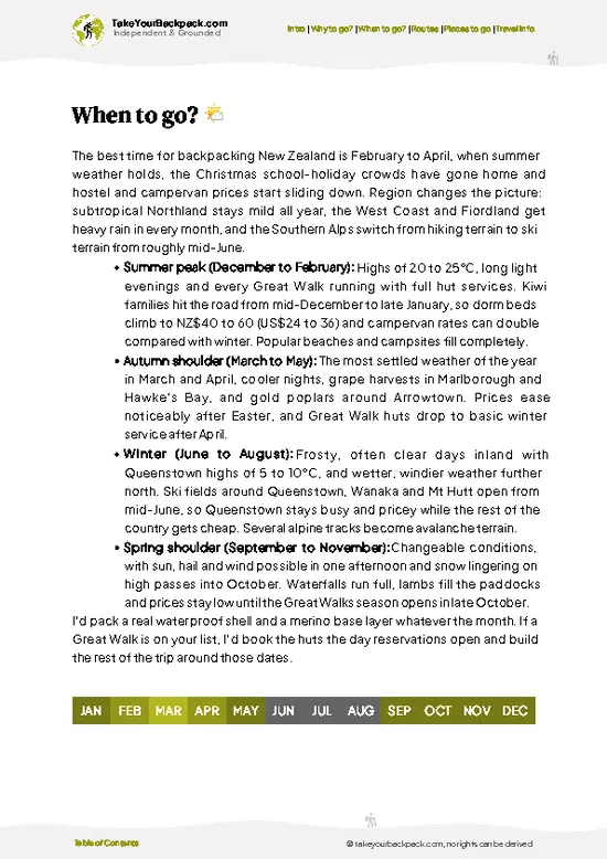
example page 2 from our offline Travel Guide for New Zealand
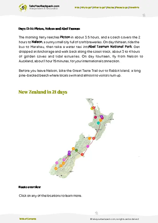
example page 3 from our offline Travel Guide for New Zealand
example page 4 from our offline Travel Guide for New Zealand
example page 5 from our offline Travel Guide for New Zealand
example page 6 from our offline Travel Guide for New Zealand
example page 7 from our offline Travel Guide for New Zealand
Loading the map 🌍
CLICK TO FILTER
cities
towns
villages
landmarks
national parks
hikes
beaches
attractions
festivals
regions
SHOW COUNTRY’S BESTSHOW ALL

✨ Why go?
Ranked #3 hike in New Zealand
Why Routeburn Track should be on your travel list

Backpackers chase the Routeburn because it packs the Harris Saddle crossing at 1,255 meters and wide alpine tops into just three days, one day less than the better-known Milford Track asks. The track climbs from beech forest to open tussock basins where the horizon is all jagged ridgeline and tarns, and the Lake Mackenzie area gives you a proper alpine hut stay without a multi-week commitment. Distances are flexible too. The side trip up Key Summit adds a few hours and a 360-degree view over three valleys, and stronger walkers can squeeze the whole track into two long days. It also fits a South Island loop neatly, since the trailheads sit on the Queenstown to Milford Sound corridor, so you can pair it with a cruise or a Routeburn-Greenstone-Caples extension. Plan early, because the hut system … read more 👉
Backpackers chase the Routeburn because it packs the Harris Saddle crossing at 1,255 meters and wide alpine tops into just three days, one day less than the better-known Milford Track asks. The track climbs from beech forest to open tussock basins where the horizon is all jagged ridgeline and tarns, and the Lake Mackenzie area gives you a proper alpine hut stay without a multi-week commitment. Distances are flexible too. The side trip up Key Summit adds a few hours and a 360-degree view over three valleys, and stronger walkers can squeeze the whole track into two long days. It also fits a South Island loop neatly, since the trailheads sit on the Queenstown to Milford Sound corridor, so you can pair it with a cruise or a Routeburn-Greenstone-Caples extension. Plan early, because the hut system is regulated and the summer slots disappear fast.

💡 HighlightsEssential experiences to have while hiking the Routeburn Track

  1. Harris Saddle: The high point of the track at about 1,255 meters, with sweeping views down the Hollyford Valley and a shelter where most walkers stop for lunch.
  2. Key Summit: A signed side trail from the saddle-bound path near The Divide climbs to an alpine wetland and views of the Hollyford, Greenstone and Eglinton valleys. Allow about an hour and a half return.
  3. Routeburn Falls: A long series of cascades beside Routeburn Falls Hut, with the hut deck looking over the Routeburn Valley. Good for sunset when the rock turns amber.
  4. Lake Mackenzie: A deep green glacial lake below steep bluffs, with a hut and campsite on its shore. Early morning light here is hard to beat.
  5. Routeburn Flats: An open river flat with braided channels and tussock, reached after roughly an hour and a half of easy walking from
… read more 👉
  1. Harris Saddle: The high point of the track at about 1,255 meters, with sweeping views down the Hollyford Valley and a shelter where most walkers stop for lunch.
  2. Key Summit: A signed side trail from the saddle-bound path near The Divide climbs to an alpine wetland and views of the Hollyford, Greenstone and Eglinton valleys. Allow about an hour and a half return.
  3. Routeburn Falls: A long series of cascades beside Routeburn Falls Hut, with the hut deck looking over the Routeburn Valley. Good for sunset when the rock turns amber.
  4. Lake Mackenzie: A deep green glacial lake below steep bluffs, with a hut and campsite on its shore. Early morning light here is hard to beat.
  5. Routeburn Flats: An open river flat with braided channels and tussock, reached after roughly an hour and a half of easy walking from the Routeburn Shelter. A rewarding short day walk with views of the surrounding peaks.
Key Summit and Harris Saddle combine well in one day if you are crossing the track from the Divide end.
Spotted a mistake or missing something? Contact us.

Things to do around Routeburn Track

Ratings based on Tripadvisor reviews. When you book through this link, you support our work at no extra cost to you.

🌤️ When to go?Best time to hike the Routeburn Track

  • Great Walk Season (late October to late April): Huts and campsites are staffed by DOC wardens and bookable only in this window, with the best odds of clear weather from December to March. Valley temperatures run 10 to 22°C (50 to 72°F), colder up on Harris Saddle (1,255 m).
  • Peak Summer (Christmas to February): Daylight lasts until about 9:30 pm, which is handy for long days. Huts sell out months ahead when the booking window opens, usually in the middle of the year, and hut fees are at their highest.
  • Autumn (March to April): Crowds thin, sandflies ease and mornings turn crisp at 3 to 15°C (37 to 59°F). Days shorten, with sunset before 6 pm by late April.
  • Winter (May to September): Snow and avalanche risk close the high section to ordinary hikers. Temperatures hover near -5 to 5°C (23 to 41°F),
… read more 👉
  • Great Walk Season (late October to late April): Huts and campsites are staffed by DOC wardens and bookable only in this window, with the best odds of clear weather from December to March. Valley temperatures run 10 to 22°C (50 to 72°F), colder up on Harris Saddle (1,255 m).
  • Peak Summer (Christmas to February): Daylight lasts until about 9:30 pm, which is handy for long days. Huts sell out months ahead when the booking window opens, usually in the middle of the year, and hut fees are at their highest.
  • Autumn (March to April): Crowds thin, sandflies ease and mornings turn crisp at 3 to 15°C (37 to 59°F). Days shorten, with sunset before 6 pm by late April.
  • Winter (May to September): Snow and avalanche risk close the high section to ordinary hikers. Temperatures hover near -5 to 5°C (23 to 41°F), with only about 9 hours of light. Huts are unstaffed and cheaper, but only experienced alpine travelers should go.
Midweek starts in March often leave a spare bunk when weekends are full.


source: climatestotravel.comJANJanuary: excellent for travelingFEBFebruary: excellent for travelingMARMarch: highly recommended for travelingAPRApril: highly recommended for travelingMAYMay: fair for travelingJUNJune: below average for travelingJULJuly: below average for travelingAUGAugust: below average for travelingSEPSeptember: fair for travelingOCTOctober: good for travelingNOVNovember: highly recommended for travelingDECDecember: excellent for traveling
New Zealand - Routeburn Track

✈️ The backpacker research shortcutNew Zealand Travel Guide

An offline-friendly backpacking guide with optimized travel routes, ranked highlights, transport advice, and the best areas to stay.
example page 0 from our offline Travel Guide for New Zealand
example page 1 from our offline Travel Guide for New Zealand
example page 2 from our offline Travel Guide for New Zealand
example page 3 from our offline Travel Guide for New Zealand
example page 4 from our offline Travel Guide for New Zealand
example page 5 from our offline Travel Guide for New Zealand
example page 6 from our offline Travel Guide for New Zealand
example page 7 from our offline Travel Guide for New Zealand
The digital guide (327 pages) contains:
✅ 110 highlights, ranked by travel appeal
✅ Optimized 7, 14 & 21-day travel routes
✅ Cities, national parks, landmarks, beaches
✅ How to get around
✅ Offline-friendly for travel without Wi-Fi
👉 Click to see all 30+ guide features

📅 Plan smarter in minutes, not weeks
✅ Month by month travel advice
✅ Festivals & national holidays
✅ Budget expectations

🗺️ Go to the right places, skip the overrated ones
✅ Honest pros & cons of destinations
✅ Top hikes, parks & viewpoints
✅ Lesser-known places most travelers miss
✅ Clear “worth it vs skip it” guidance

🛏️ Travel smoothly without rookie mistakes
✅ Best areas to stay
✅ Transport systems explained simply
✅ Common scams & safety advice
✅ SIM cards, money & practical tips

🌍 Understand the country, not just visit it
✅ Culture & traditions
✅ Local customs
✅ Festivals worth planning around
✅ Traveler-friendly historical context
✅ Insights that make places more meaningful

📱 Built for real travel conditions
✅ Fully downloadable PDF
✅ Works completely offline
✅ Optimized for phone use
✅ Useful in remote areas & buses
✅ Everything in one place
Stop searching, start planning
Get instant access to your full guide. 30‑day money-back guarantee.
+ Add another guide for just

By proceeding you agree to our terms.
Sent to your inbox immediately after payment • 100% Secure Checkout
Best Backpacking Travel Advisor 2025 tourism awardBest Backpacking
Travel Advisor
2025
What others say about Take Your Backpack Guides:
⭐⭐⭐⭐⭐
Fantastic, amazing amount of information!
⭐⭐⭐⭐⭐
My goodness this is amazing, it's what I've been looking for hats off too you!
⭐⭐⭐⭐⭐
I think this is absolutely BRILLIANT
⭐⭐⭐⭐
Very complete and informative. It's still missing places, but I gotta to commend you
⭐⭐⭐⭐⭐
This is truly amazing, thank you, can't wait to explore it with my kids!
⭐⭐⭐⭐⭐
Awesome resource, thank you!
⭐⭐⭐⭐⭐
This is amazing! Can't wait to explore the ones I haven't seen
⭐⭐⭐⭐
I love this! Well done, great idea.
⭐⭐⭐⭐⭐
Thanks for taking the time to make this gem!
⭐⭐⭐⭐⭐
This might be the best website I've ever seen.
⭐⭐⭐⭐⭐
Congratulations, and thank you so much for your work; it's incredibly valuable.
⭐⭐⭐⭐
In all seriousness I think you did a great job pointing out the important spots
⭐⭐⭐⭐⭐
10/10 very good
⭐⭐⭐⭐⭐
As someone who's only just starting to visit regularly this is awesome, thank you.
⭐⭐⭐⭐
Thank you very much! I'm going to visit my dad, it's going to be very useful!
⭐⭐⭐⭐⭐
This is really cool! We'll be travelling for the first time and this definitely come in handy.
⭐⭐⭐⭐⭐
You are now our minister of culture, congratulations 👨‍💼
⭐⭐⭐⭐⭐
Just wanted to tell you that this is a pearl! Going to follow your recommendations.
⭐⭐⭐⭐⭐
This is so cool. I'll definitely be using the resource for my travels soon.
⭐⭐⭐⭐⭐
This is very impressive! Good work.
⭐⭐⭐⭐⭐
This is an amazing and informative site. Very well done!

🛏️ Where to stay?Choosing the right base

If you enjoy meeting fellow travelers, consider choosing hostels with high ratings for atmosphere. On the other hand, if you prefer having your own space, a hotel might be a better option.

🥾 Hike detailsEverything you need to know before hiking Routeburn Track

Total Distance: About 32 kilometers one way, between the Routeburn Shelter and The Divide.
Estimated Duration: Usually 2 to 3 days, with huts or campsites needed on a Great Walk booking.
Difficulty: Moderate. The track is well graded and maintained, but the climb to the saddle is steady and weather can turn quickly.
Starting Point: Either end works.
  • Routeburn Shelter: Near Glenorchy, reached by road from Queenstown. Shuttles serve both trailheads in the season.
  • The Divide: On the Milford Road, served by buses and shuttles running between Queenstown, Te Anau and Milford Sound.
Major Landmarks:
  • Routeburn
… read more 👉
Total Distance: About 32 kilometers one way, between the Routeburn Shelter and The Divide.
Estimated Duration: Usually 2 to 3 days, with huts or campsites needed on a Great Walk booking.
Difficulty: Moderate. The track is well graded and maintained, but the climb to the saddle is steady and weather can turn quickly.
Starting Point: Either end works.
  • Routeburn Shelter: Near Glenorchy, reached by road from Queenstown. Shuttles serve both trailheads in the season.
  • The Divide: On the Milford Road, served by buses and shuttles running between Queenstown, Te Anau and Milford Sound.
Major Landmarks:
  • Routeburn Flats: Open flats and a small hut.
  • Routeburn Falls Hut: Above the bush line with cascades below.
  • Harris Saddle: The highest point and a shelter.
  • Lake Mackenzie: A hut and campsite on the shore.
  • Key Summit: A side trip near The Divide.
Terrain and Scenery: Forest benches give way to alpine basins, rocky cirques and a high traverse along a bluff with long drops. Stretches are exposed to wind.
Vegetation: Mountain beech forest at lower levels, then tussock, alpine herbs and wetlands with seasonal flowers at higher elevations.
Wildlife: Keep an eye out for kea, the mountain parrot, as well as robins, riflemen and rock wrens. Bats and long-tailed cuckoos live in the forest. Sandflies are an annoyance near water, so carry repellent.
⚠️ Hiking info can sometimes be outdated or inaccurate. Before you hit the trail, check the latest conditions with locals. If you do spot anything that's off, I'd love to hear from you, so I can update it for fellow travelers.

🛡️ SafetyStaying Safe: What Travelers Should Know

The main hazard on the Routeburn is weather, not terrain. The track is well formed and signposted, but the open stretch over Harris Saddle and around Lake Mackenzie sits above the bushline, where cold rain, wind and sudden snow can arrive in any month. Pack a waterproof jacket, warm layers, a hat and gloves even in January, and check the DOC track report each morning. Heavy rain swells side streams and can close slips or bridges, so be ready to wait a day rather than push through. Avalanche paths cross the track early and late in the season, and DOC will advise if they are active. Footing is rocky and steep on the Harris Saddle climb, so a steady pace beats a fast one. Sandflies are relentless at rest stops, so carry repellent. Keas, the local alpine parrots, shred boots and packs left outside, … read more 👉
The main hazard on the Routeburn is weather, not terrain. The track is well formed and signposted, but the open stretch over Harris Saddle and around Lake Mackenzie sits above the bushline, where cold rain, wind and sudden snow can arrive in any month. Pack a waterproof jacket, warm layers, a hat and gloves even in January, and check the DOC track report each morning. Heavy rain swells side streams and can close slips or bridges, so be ready to wait a day rather than push through. Avalanche paths cross the track early and late in the season, and DOC will advise if they are active. Footing is rocky and steep on the Harris Saddle climb, so a steady pace beats a fast one. Sandflies are relentless at rest stops, so carry repellent. Keas, the local alpine parrots, shred boots and packs left outside, so keep gear inside the hut and never feed them. Cell coverage is patchy, so carry a personal locator beacon if you plan to travel alone.

FAQFrequently asked questions about Routeburn Track

Most hikers take 3 days and 2 nights to walk the 32 km from The Divide to the Routeburn Shelter, or in reverse. Typical stops are Routeburn Falls Hut and Lake Mackenzie Hut, with Routeburn Flats as an alternative. Fit trampers can do the full traverse in 2 days, but 3 allows time for side trips like Conical Hill.
Moderate, with a graded Great Walk surface, but the day-two climb to Harris Saddle (1,255 m) and the 4 to 6 hour stages demand reasonable fitness. Expect about 800 m of total ascent on the longer days and rocky, uneven sections near Routeburn Falls. Anyone who walks regularly with a 10 to 12 kg pack will manage it, and the track is well signposted.
No guide is required, since the track is well marked and walked independently. In the Great Walk season (late October to late April) you must book huts or campsites through DOC in advance. From November to April huts cost NZ$132 per night for international adults (NZ$88 for New Zealanders), and campsites NZ$42 (NZ$28). Guided options exist through operators such as Ultimate Hikes, at several times the independent cost.
⚠️ Things can change over time, so always validate details locally before you go.

Other New Zealander hikes near Routeburn Track

Explore more nearby:

  • Milford Track—Mackinnon Pass, Sutherland Falls, one-way permits, rainforest valleys| 31 km away
  • Kepler Track—60 km loop, limestone caves, alpine ridge, lakeshore finish| 90 km away
  • Hooker Valley Track—Village trailheads, swing bridges, iceberg lake, glacier views| 191 km away

💡 Not sure where to go next?
Create a personalized itinerary for New Zealand including Routeburn Track and the places that fit your trip.

Generate my itinerary

👉 Discover all hikes

Or checkout all New Zealand has to offer (think cities, towns, villages, national parks, hikes, beaches, festivals)
Country photo of New Zealand

We 💚 feedbackIs it worth it?

The Routeburn suits first-time multi-day walkers who want a big alpine payoff without a week of commitment, and photographers who will happily stop every ten minutes. If you hate booking ahead or crowds, look elsewhere. I would walk it in good weather only and carry a proper rain shell.

✈️ When did I visit New Zealand?
All the way back in high school I have been visiting the North Island of New Zealand (1993).

✍️ Help improve this page!
The information on this page is based on my own backpacking experience in New Zealand, supplemented with up-to-date research and feedback from other travelers. Travel details can change, so if you notice anything outdated or incomplete, feel free to let me know.


🙋‍♂️ Give feedback

👋 Meet the founderWho’s Behind Take Your Backpack?

Johan, backpacker and founder of TakeYourBackpackHi, I’m Johan (Netherlands 🇳🇱), the creator of TakeYourBackpack. Over the past 3 decades, I’ve backpacked through 90+ countries across six continents, gaining extensive experience with independent travel, long-term trips, and overland routes.

This site is built on a combination of firsthand travel experience and carefully curated insights from other backpackers. Many guides are based on places I’ve personally visited, while others bring together tips, observations, and practical advice shared by trusted travelers I’ve met along the way.

The goal is to provide realistic, experience-driven guidance — not generic itineraries — so you can explore destinations with better context, clearer expectations, and more confidence.