×

Palau🇵🇼 | hikesMount NgerchelchuusPalau's highest point, savanna summit, Ngardmau combo | things to do and best time to go

Explore Palau International Coral Reef FestivalExplore Ngardmau Waterfall Trail

Backpacking in Mount Ngerchelchuus
👍 Recommendedhike ranked #2
By Johan Kruseman 🇳🇱 | Updated October 15, 2026

The choice that matters is whether you hike Mount Ngerchelchuus on its own or fold it into a Ngardmau day with the waterfall, and the answer is almost always to combine them, because getting here costs most of your day anyway. The mountain is on the west coast of Babeldaob, in Ngardmau State in Palau, and at roughly 240 meters it is the country’s highest point. The hike is short and moderate, with a steady climb on red clay that turns slick after rain. No scheduled bus runs out here, so you need a rental car or a driver from Koror. Start early to beat the heat on the open slopes, and pack a liter of water more than you think you need. The big gain is a wide view over the island’s interior and the lagoon, and the small surprise is how quiet it is, with little more than birdsong and the wind in the grass at the summit.

Discover everything you want to know in the 📖 Palau Travel Guide.
Best time to go: November - May
Duration: 2 hours
Distance: 3 kilometers
Total ascent: 200 meters


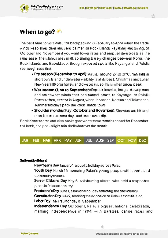
example page 0 from our offline Travel Guide for Palau
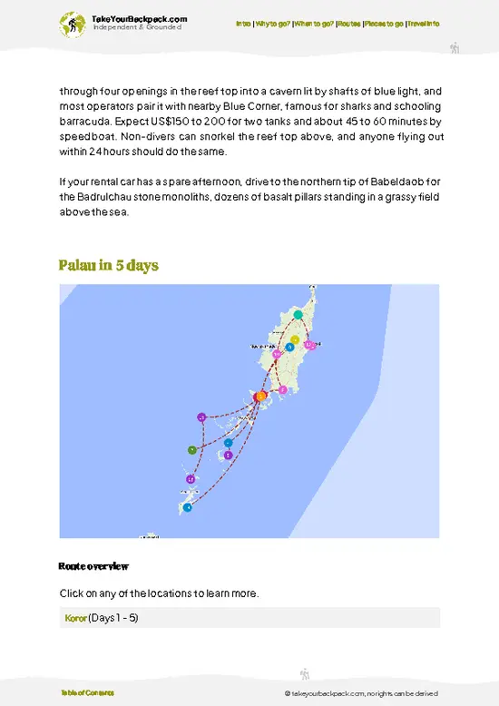
example page 1 from our offline Travel Guide for Palau
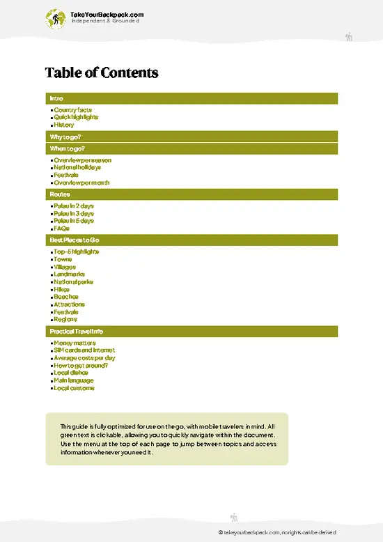
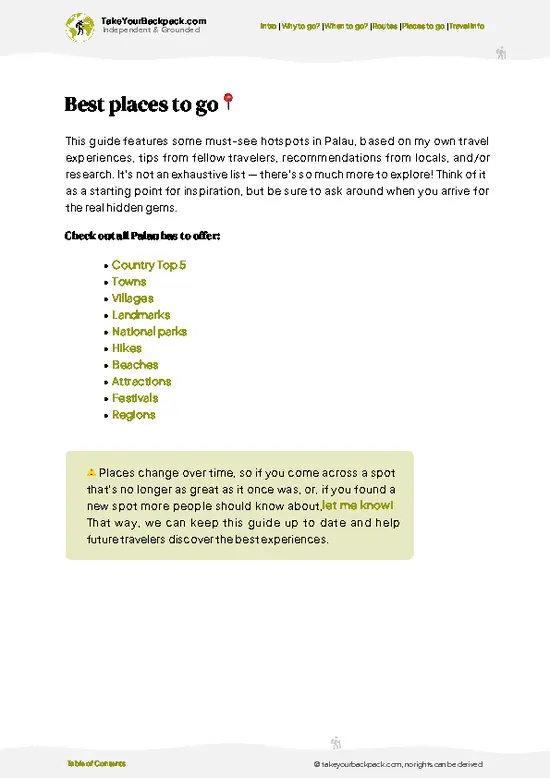
example page 2 from our offline Travel Guide for Palau
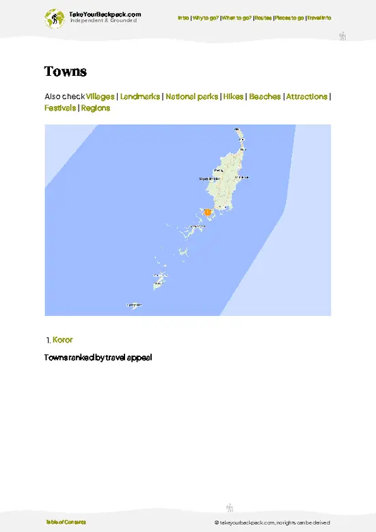
example page 3 from our offline Travel Guide for Palau
example page 4 from our offline Travel Guide for Palau
example page 5 from our offline Travel Guide for Palau
example page 6 from our offline Travel Guide for Palau
example page 7 from our offline Travel Guide for Palau
Loading the map 🌍
CLICK TO FILTER
towns
villages
landmarks
national parks
hikes
beaches
attractions
festivals
regions
SHOW COUNTRY’S BESTSHOW ALL

✨ Why go?
Ranked #2 hike in Palau
What makes this hike worth hiking

Most backpackers in Palau spend their days on boats and in the water, so Ngerchelchuus appeals as the one land-based highest point in Palau you can tick off in a morning. The effort is small, around two hours round trip, and the payoff is a look at the island’s green interior that you simply don’t get from a dive boat. It also shows you a different Palau: open savanna and red clay on the upper slopes instead of reef and limestone. Because the trail sits in Ngardmau, you can pair it with the Ngardmau Waterfall and the old Japanese-era remains nearby, which turns a lone summit into a full day out of Koror. It costs little beyond transport and a modest local fee, and it needs no camping gear, so it slots easily between dive days.

💡 HighlightsThe experiences that define the visit

  1. Summit Viewpoint: The top of Palau’s highest peak gives you a broad look across Babeldaob’s forested ridges toward the west coast and out to the lagoon on a clear morning. Few other places in Palau give you this much elevation.
  2. Upper Savanna Slopes: The final stretch climbs through open grassland and bare red clay, a landscape far from the tropical image of the islands. Ferns and pandanus dot the edges, and the footing gets slippery after rain.
  3. Ngardmau Waterfall: Known locally as Taki Falls, this is among the largest waterfalls in Micronesia, dropping over a rock face into a forested gorge. A forest trail leads to it, and a small entry fee applies at the site, usually a few US dollars. It is the natural companion to the summit hike.
  4. Japanese-Era Hydro and Tramway Remains: Near the waterfall
… read more 👉
  1. Summit Viewpoint: The top of Palau’s highest peak gives you a broad look across Babeldaob’s forested ridges toward the west coast and out to the lagoon on a clear morning. Few other places in Palau give you this much elevation.
  2. Upper Savanna Slopes: The final stretch climbs through open grassland and bare red clay, a landscape far from the tropical image of the islands. Ferns and pandanus dot the edges, and the footing gets slippery after rain.
  3. Ngardmau Waterfall: Known locally as Taki Falls, this is among the largest waterfalls in Micronesia, dropping over a rock face into a forested gorge. A forest trail leads to it, and a small entry fee applies at the site, usually a few US dollars. It is the natural companion to the summit hike.
  4. Japanese-Era Hydro and Tramway Remains: Near the waterfall trail you pass rusting relics from the Japanese administration of the islands, including the remains of an old power installation. They give the walk a historical layer that most visitors skip.
  5. Ngardmau Bay Coastline: On the descent and on the drive, you get views of the bay and the shoreline that frame the west coast, with mangroves and reef edges visible from higher ground. It is a good spot for a slow pause before heading back.
Do the summit first, early in the morning, while the slopes are cooler and the haze is still low, and save the shaded waterfall trail for the hotter part of the day.
Spotted a mistake or missing something? Contact us.

Things to do near Mount Ngerchelchuus

Ratings based on Tripadvisor reviews. When you book through this link, you support our work at no extra cost to you.

🌤️ When to go?Seasonal considerations and timing

  • Dry season (December to April): The most reliable window for the red-dirt trail, with highs of 29 to 31°C (84 to 88°F) and fewer afternoon downpours. Footing stays firmer, and views over Babeldaob’s forested interior are clearest.
  • Wet season (June to October): Expect near-daily squalls, humidity above 80 percent and temperatures of 26 to 31°C (79 to 88°F). The clay turns to slick grease and leeches and mud slow you down. Waterfalls look better, though.
  • Shoulder months (May and November): Showers are patchy and the trail is often workable by mid-morning. Lodging in Koror and Airai tends to cost less than in peak winter, roughly 10 to 20 percent.
  • Daylight: Sunrise comes near 6:00 and sunset near 18:00 all year, so start by 8:00 for a comfortable finish before dusk.
  • Crowds: This trail sees few hikers
… read more 👉
  • Dry season (December to April): The most reliable window for the red-dirt trail, with highs of 29 to 31°C (84 to 88°F) and fewer afternoon downpours. Footing stays firmer, and views over Babeldaob’s forested interior are clearest.
  • Wet season (June to October): Expect near-daily squalls, humidity above 80 percent and temperatures of 26 to 31°C (79 to 88°F). The clay turns to slick grease and leeches and mud slow you down. Waterfalls look better, though.
  • Shoulder months (May and November): Showers are patchy and the trail is often workable by mid-morning. Lodging in Koror and Airai tends to cost less than in peak winter, roughly 10 to 20 percent.
  • Daylight: Sunrise comes near 6:00 and sunset near 18:00 all year, so start by 8:00 for a comfortable finish before dusk.
  • Crowds: This trail sees few hikers in any month, so busy periods around Christmas and Lunar New Year affect prices more than trail traffic.
Start early in the morning, since showers usually build after midday.


source: climatestotravel.comJANJanuary: excellent for travelingFEBFebruary: excellent for travelingMARMarch: excellent for travelingAPRApril: excellent for travelingMAYMay: good for travelingJUNJune: fair for travelingJULJuly: fair for travelingAUGAugust: fair for travelingSEPSeptember: fair for travelingOCTOctober: fair for travelingNOVNovember: highly recommended for travelingDECDecember: excellent for traveling
when-to-go

✈️ The backpacker research shortcutPalau Travel Guide

An offline-friendly backpacking guide with optimized travel routes, ranked highlights, transport advice, and the best areas to stay.
example page 0 from our offline Travel Guide for Palau
example page 1 from our offline Travel Guide for Palau
example page 2 from our offline Travel Guide for Palau
example page 3 from our offline Travel Guide for Palau
example page 4 from our offline Travel Guide for Palau
example page 5 from our offline Travel Guide for Palau
example page 6 from our offline Travel Guide for Palau
example page 7 from our offline Travel Guide for Palau
The digital guide (99 pages) contains:
✅ 22 highlights, ranked by travel appeal
✅ Optimized 2, 3 & 5-day travel routes
✅ Cities, national parks, landmarks, beaches
✅ How to get around
✅ Offline-friendly for travel without Wi-Fi
👉 Click to see all 30+ guide features

📅 Plan smarter in minutes, not weeks
✅ Month by month travel advice
✅ Festivals & national holidays
✅ Budget expectations

🗺️ Go to the right places, skip the overrated ones
✅ Honest pros & cons of destinations
✅ Top hikes, parks & viewpoints
✅ Lesser-known places most travelers miss
✅ Clear “worth it vs skip it” guidance

🛏️ Travel smoothly without rookie mistakes
✅ Best areas to stay
✅ Transport systems explained simply
✅ Common scams & safety advice
✅ SIM cards, money & practical tips

🌍 Understand the country, not just visit it
✅ Culture & traditions
✅ 52 Essential phrases & customs
✅ Festivals worth planning around
✅ Traveler-friendly historical context
✅ Insights that make places more meaningful

📱 Built for real travel conditions
✅ Fully downloadable PDF
✅ Works completely offline
✅ Optimized for phone use
✅ Useful in remote areas & buses
✅ Everything in one place
Stop searching, start planning
Get instant access to your full guide. 30‑day money-back guarantee.
+ Add another guide for just

By proceeding you agree to our terms.
Sent to your inbox immediately after payment • 100% Secure Checkout
Best Backpacking Travel Advisor 2025 tourism awardBest Backpacking
Travel Advisor
2025
What others say about Take Your Backpack Guides:
⭐⭐⭐⭐⭐
Fantastic, amazing amount of information!
⭐⭐⭐⭐⭐
My goodness this is amazing, it's what I've been looking for hats off too you!
⭐⭐⭐⭐⭐
I think this is absolutely BRILLIANT
⭐⭐⭐⭐
Very complete and informative. It's still missing places, but I gotta to commend you
⭐⭐⭐⭐⭐
This is truly amazing, thank you, can't wait to explore it with my kids!
⭐⭐⭐⭐⭐
Awesome resource, thank you!
⭐⭐⭐⭐⭐
This is amazing! Can't wait to explore the ones I haven't seen
⭐⭐⭐⭐
I love this! Well done, great idea.
⭐⭐⭐⭐⭐
Thanks for taking the time to make this gem!
⭐⭐⭐⭐⭐
This might be the best website I've ever seen.
⭐⭐⭐⭐⭐
Congratulations, and thank you so much for your work; it's incredibly valuable.
⭐⭐⭐⭐
In all seriousness I think you did a great job pointing out the important spots
⭐⭐⭐⭐⭐
10/10 very good
⭐⭐⭐⭐⭐
As someone who's only just starting to visit regularly this is awesome, thank you.
⭐⭐⭐⭐
Thank you very much! I'm going to visit my dad, it's going to be very useful!
⭐⭐⭐⭐⭐
This is really cool! We'll be travelling for the first time and this definitely come in handy.
⭐⭐⭐⭐⭐
You are now our minister of culture, congratulations 👨‍💼
⭐⭐⭐⭐⭐
Just wanted to tell you that this is a pearl! Going to follow your recommendations.
⭐⭐⭐⭐⭐
This is so cool. I'll definitely be using the resource for my travels soon.
⭐⭐⭐⭐⭐
This is very impressive! Good work.
⭐⭐⭐⭐⭐
This is an amazing and informative site. Very well done!

🛏️ Where to stay?Best areas to stay in Palau

If you enjoy meeting fellow travelers, consider choosing hostels with high ratings for atmosphere. On the other hand, if you prefer having your own space, a hotel might be a better option.

🥾 Hike detailsHike details: route, duration, and difficulty of Mount Ngerchelchuus

Total Distance: Roughly 3 kilometers round trip on the summit trail.
Estimated Duration: About 1.5 to 2 hours return at a relaxed pace, with time for photos at the top.
Difficulty: Moderate. The gradient is steady rather than technical, but the red clay becomes slick after rain and the upper slopes have almost no shade.
Starting Point: The trail begins in Ngardmau State on the west side of Babeldaob. No scheduled public bus serves it, so independent travelers reach it by rental car or a hired driver or taxi from Koror, using the main road around the island.
Major Landmarks:
  • Lower forest section: Shaded
… read more 👉
Total Distance: Roughly 3 kilometers round trip on the summit trail.
Estimated Duration: About 1.5 to 2 hours return at a relaxed pace, with time for photos at the top.
Difficulty: Moderate. The gradient is steady rather than technical, but the red clay becomes slick after rain and the upper slopes have almost no shade.
Starting Point: The trail begins in Ngardmau State on the west side of Babeldaob. No scheduled public bus serves it, so independent travelers reach it by rental car or a hired driver or taxi from Koror, using the main road around the island.
Major Landmarks:
  • Lower forest section: Shaded path with roots and damp soil that sets the pace of the climb.
  • Open savanna slopes: Grass and exposed red earth with wide views opening up behind you.
  • Summit: Palau’s highest point, with a broad outlook over the island and toward the lagoon.
  • Ngardmau Waterfall area: A short drive away, with a forest trail and Japanese-era remains.
Terrain and Scenery: Packed clay, loose stones and some roots. After rain, expect mud and slippery stretches, especially on the descent. The scenery shifts from enclosed forest to open ridgeline.
Vegetation: Lower slopes carry tropical forest with ferns and palms. Higher up the cover thins to savanna grass, scattered pandanus and hardy shrubs.
Wildlife: Mostly birds, which you hear more than see in the forest, plus lizards and insects. Palau’s fruit bats and native songbirds live in the surrounding woods.
Practical Notes:
  • Footwear: Shoes with a real tread, since sandals slip on wet clay.
  • Water and sun: Carry at least 1.5 liters and a hat, because the top has little shade.
  • Timing: Start early, ideally before the midday heat builds on the open slopes.
⚠️ Hiking info can sometimes be outdated or inaccurate. Before you hit the trail, check the latest conditions with locals. If you do spot anything that's off, I'd love to hear from you, so I can update it for fellow travelers.

🛡️ SafetySafety Tips and Common Scams in Mount Ngerchelchuus

The main hazards on Mount Ngerchelchuus are slippery clay and heat, not anything dramatic. The route up from the Ngardmau side is short, but the red soil turns to slick mud after rain, so shoes with real tread matter far more than trekking gear. Carry at least 2 liters of water, since humidity makes you sweat heavily even on a modest climb, and wear sun protection on the exposed upper sections. Mosquitoes are active in shaded stretches, so repellent is worth packing. Palau has no dangerous land mammals and no venomous snakes of concern, though you may meet biting ants and spiders on overgrown sections, so watch where you place your hands. Trail markings can fade, so download an offline map and tell your lodging host your plan. Skip the climb during or right after heavy rain, when descents … read more 👉
The main hazards on Mount Ngerchelchuus are slippery clay and heat, not anything dramatic. The route up from the Ngardmau side is short, but the red soil turns to slick mud after rain, so shoes with real tread matter far more than trekking gear. Carry at least 2 liters of water, since humidity makes you sweat heavily even on a modest climb, and wear sun protection on the exposed upper sections. Mosquitoes are active in shaded stretches, so repellent is worth packing. Palau has no dangerous land mammals and no venomous snakes of concern, though you may meet biting ants and spiders on overgrown sections, so watch where you place your hands. Trail markings can fade, so download an offline map and tell your lodging host your plan. Skip the climb during or right after heavy rain, when descents get sketchy. Start early, move at an easy pace, and you will be fine.

FAQFrequently asked questions about Mount Ngerchelchuus

Plan on roughly 1.5 to 3 hours round trip, depending on your pace and how long you linger at the top. The climb itself is short, and most hikers spend extra time on the summit taking in views across northern Babeldaob. Driving from Koror takes about 45 minutes to an hour, so a morning start leaves you back for lunch.
Easy to moderate for most people, though mud can make it feel harder than the distance suggests. The ascent is short but steep in places, and the red clay gets slippery after rain, especially on the descent. Expect hot, humid conditions of around 28 to 31°C (82 to 88°F), so bring at least 2 liters of water.
A guide is not strictly required for most visitors, but hiring a local one is smart if you want help finding the route and learning about the area. Guided outings in Palau commonly cost around US$50 to 100 per person, depending on group size. Check current permit rules with the local state office or your tour operator, since Palau also requires the Pristine Paradise Environmental Fee of US$100, built into your airfare, and a Rock Islands permit does not apply here.
⚠️ Things can change over time, so always validate details locally before you go.

Other Palauan hikes near Mount Ngerchelchuus

Explore more nearby:


💡 Not sure where to go next?
Create a personalized itinerary for Palau including Mount Ngerchelchuus and the places that fit your trip.

Generate my itinerary

👉 Discover all hikes

Or checkout all Palau has to offer (think cities, towns, villages, national parks, hikes, beaches, festivals)
Country photo of Palau

We 💚 feedbackIs it worth it?

This one suits dive-weary travelers who want a morning on dry land, plus anyone who likes a short climb with a big view and a bit of history on the side. Bring shoes you don’t mind getting orange, and stack the waterfall on the same day. If you only have time for one land activity on Babeldaob, I would make it this.

✍️ Help improve this page!
The information on this page is based on in-depth research, insights shared by experienced travelers, and feedback from the local travel community in Palau. While every effort is made to keep the information accurate and current, conditions can change — so if you spot anything incorrect or outdated, please get in touch.


🙋‍♂️ Give feedback

👋 Meet the founderWho’s Behind Take Your Backpack?

Johan, backpacker and founder of TakeYourBackpackHi, I’m Johan (Netherlands 🇳🇱), the creator of TakeYourBackpack. Over the past 3 decades, I’ve backpacked through 90+ countries across six continents, gaining extensive experience with independent travel, long-term trips, and overland routes.

This site is built on a combination of firsthand travel experience and carefully curated insights from other backpackers. Many guides are based on places I’ve personally visited, while others bring together tips, observations, and practical advice shared by trusted travelers I’ve met along the way.

The goal is to provide realistic, experience-driven guidance — not generic itineraries — so you can explore destinations with better context, clearer expectations, and more confidence.