×

Philippines🇵🇭 | hikesMt. Kalatungandense jungle, river crossings, remote ascent | things to do and best time to go

Explore Mt. KitangladExplore Mount Hamiguitan Range Wildlife Sanctuary

Backpacking in Mt. Kalatungan
👌 Worth visitinghike ranked #12
By Johan Kruseman 🇳🇱 | Updated May 21, 2026

Your boots sink into black mud that smells like wet leaves and cold earth, while mist beads on your eyelashes and your lungs work hard in the thin, chilly air. Somewhere above the treeline, a hornbill cracks the silence. This is Mt. Kalatungan, rising out of Bukidnon in Mindanao, southern Philippines. It’s a long, punishing climb—steep, often knee‑deep mud, and a summit push that hits you after you’re already tired—but the mossy forest, knife‑edge ridges, and huge views toward Kitanglad make the grind worth it. Compared to more popular Luzon hikes like Pulag or Apo, Kalatungan is wilder, less organized, harder to reach by public transport, and that’s exactly why it feels like an actual mountain, not a weekend attraction.

Discover everything you want to know in the 📖 Philippines Travel Guide.
Best time to go: November - May
Duration: 2 days
Distance: 12 kilometers
Total ascent: 1,500 meters
Loading the map 🌍
CLICK TO FILTER
cities
towns
landmarks
national parks
hikes
beaches
attractions
festivals
regions
SHOW COUNTRY’S BESTSHOW ALL

✨ Why go?
Ranked #12 hike in Philippines
Why Mt. Kalatungan should be on your travel list

The hike up Mt. Kalatungan is a magnet for backpackers craving a blend of challenge and reward. The scenery-to-effort ratio is off the charts; you’ll sweat through lush forests and rocky paths, only to be greeted by sweeping views that make every step worthwhile. Public transport access is a breeze, with jeepneys whisking you from nearby towns to the trailhead, making it easy to fit into your itinerary.

Cost? Minimal. You can tackle this beauty without breaking the bank. The trail offers flexible distances, allowing you to customize your adventure based on your energy levels or time constraints. Plus, it seamlessly integrates into a longer backpacking route through the Philippines, making it a perfect pit stop. The burn in your legs transforms into the first cold beer at the end, and that’s … read more 👉
The hike up Mt. Kalatungan is a magnet for backpackers craving a blend of challenge and reward. The scenery-to-effort ratio is off the charts; you’ll sweat through lush forests and rocky paths, only to be greeted by sweeping views that make every step worthwhile. Public transport access is a breeze, with jeepneys whisking you from nearby towns to the trailhead, making it easy to fit into your itinerary.

Cost? Minimal. You can tackle this beauty without breaking the bank. The trail offers flexible distances, allowing you to customize your adventure based on your energy levels or time constraints. Plus, it seamlessly integrates into a longer backpacking route through the Philippines, making it a perfect pit stop. The burn in your legs transforms into the first cold beer at the end, and that’s the kind of payoff that keeps you coming back for more.
Get the complete Travel Guide for Philippines
Everything organized for offline planning — routes, highlights, costs & tips

See what’s inside 👉

Get the Travel Guide -

💡 HighlightsEssential experiences to have while hiking the Mt. Kalatungan

  1. Summit ridge & panoramic views — A long, exposed ridge that opens up to sweeping views over the Kitanglad Range and neighboring peaks; on a clear morning you can watch a sea of clouds settle below you and feel like you climbed into the sky. It’s that “big, high-place” payoff that separates Kalatungan from tighter, forest-only trails.
  2. Mossy montane forest — Ancient, moss-draped trees, thick ferns and hanging lianas create a damp, otherworldly tunnel for hours of the climb. The forest’s cool, cathedral-like atmosphere and rich groundcover make the approach feel epic compared with ordinary lowland treks.
  3. Alpine grasslands and summit camp spots — The upper slopes open into wind-swept grass and bamboo meadows perfect for pitching a tent and catching sunrise or sunset. That sudden shift from
read more 👉
  1. Summit ridge & panoramic views — A long, exposed ridge that opens up to sweeping views over the Kitanglad Range and neighboring peaks; on a clear morning you can watch a sea of clouds settle below you and feel like you climbed into the sky. It’s that “big, high-place” payoff that separates Kalatungan from tighter, forest-only trails.
  2. Mossy montane forest — Ancient, moss-draped trees, thick ferns and hanging lianas create a damp, otherworldly tunnel for hours of the climb. The forest’s cool, cathedral-like atmosphere and rich groundcover make the approach feel epic compared with ordinary lowland treks.
  3. Alpine grasslands and summit camp spots — The upper slopes open into wind-swept grass and bamboo meadows perfect for pitching a tent and catching sunrise or sunset. That sudden shift from closed forest to wide-open panorama is a highlight few Philippine hikes manage so cleanly.
  4. Rich birdlife and endemic species — Kalatungan sits in a biodiversity hotspot: expect lively birdsong, possible sightings of skittish mountain birds and a variety of orchids, ferns and pitcher plants along the trail. It’s a quieter, less touristy place to see montane wildlife compared with more popular peaks.
  5. Indigenous communities and community-led trails — Trails are woven through ancestral lands of local indigenous groups; guided treks, permits and homestays are run by the communities themselves. That cultural connection and locally managed access makes the hike feel respectful and real, not just another checklist summit.
Personal favorite: the summit ridge views at sunrise — nothing beats that hush and wide-open light after a tough climb.
Spotted a mistake or missing something? Contact us.
🌤️ When to go?Choosing the right time of year


  • Weather: The dry season from November to May is your best bet. Rain can turn trails into slick mudslides, especially from June to October when the southwest monsoon hits hard.

  • Temperature: Expect daytime highs around 24-28°C (75-82°F) and chilly nights dropping to 10-15°C (50-59°F). Early mornings can bite, so pack layers.

  • Daylight Hours: Roughly 11-12 hours of daylight during the dry season, giving you a solid window to tackle the summit and descend safely before dark.

  • Crowds: Weekdays in the shoulder months (November, February, March) see fewer trekkers. Weekends and holidays bring local groups, so plan accordingly if you want solitude.

  • Seasonal Activities: Dry months coincide with local festivals and harvests, adding cultural spice to your trip but also bumping up demand for
read more 👉

  • Weather: The dry season from November to May is your best bet. Rain can turn trails into slick mudslides, especially from June to October when the southwest monsoon hits hard.

  • Temperature: Expect daytime highs around 24-28°C (75-82°F) and chilly nights dropping to 10-15°C (50-59°F). Early mornings can bite, so pack layers.

  • Daylight Hours: Roughly 11-12 hours of daylight during the dry season, giving you a solid window to tackle the summit and descend safely before dark.

  • Crowds: Weekdays in the shoulder months (November, February, March) see fewer trekkers. Weekends and holidays bring local groups, so plan accordingly if you want solitude.

  • Seasonal Activities: Dry months coincide with local festivals and harvests, adding cultural spice to your trip but also bumping up demand for guides and accommodations.

  • Price Fluctuations: Peak dry season hikes can cost more for guides and transport. Booking off-peak can save you a few pesos but risks weather delays.


Pro-tip: Start your hike at dawn during the dry season to catch the crisp morning air and watch the sun ignite the rugged peaks—there’s no better way to earn that summit view.


source: climatestotravel.comJANJanuary: excellent for travelingFEBFebruary: excellent for travelingMARMarch: excellent for travelingAPRApril: highly recommended for travelingMAYMay: highly recommended for travelingJUNJune: fair for travelingJULJuly: below average for travelingAUGAugust: below average for travelingSEPSeptember: fair for travelingOCTOctober: fair for travelingNOVNovember: excellent for travelingDECDecember: excellent for traveling
when-to-go

✈️ The backpacker research shortcutPhilippines Travel Guide

An offline-friendly backpacking guide with optimized travel routes, ranked highlights, transport advice, and the best areas to stay.
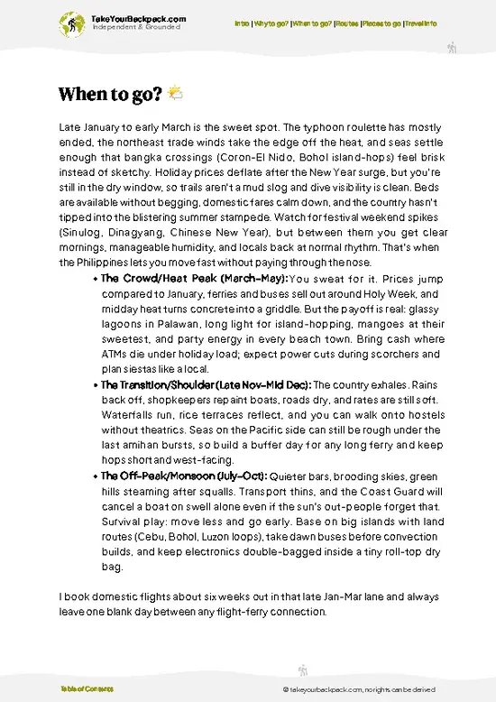
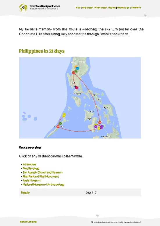
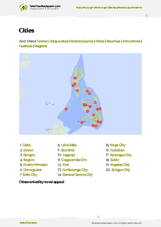
example page 0 from our offline Travel Guide for Philippinesexample page 1 from our offline Travel Guide for Philippinesexample page 2 from our offline Travel Guide for Philippinesexample page 3 from our offline Travel Guide for Philippinesexample page 4 from our offline Travel Guide for Philippinesexample page 5 from our offline Travel Guide for Philippinesexample page 6 from our offline Travel Guide for Philippinesexample page 7 from our offline Travel Guide for Philippines
The digital guide (505 pages) contains:
144 highlights, ranked by travel appeal
Optimized 7, 14 & 21-day travel routes
Cities, national parks, beaches, historical sites, ...
How to get around
Offline-friendly for travel without Wi-Fi
👉 Click to see all 30+ guide features

📅 Plan smarter in minutes, not weeks
Month by month travel advice
Festivals & national holidays
Budget expectations

🗺️ Go to the right places, skip the overrated ones
Honest pros & cons of destinations
Top hikes, parks & viewpoints
Lesser-known places most travelers miss
Clear “worth it vs skip it” guidance

🛏️ Travel smoothly without rookie mistakes
Best areas to stay
Transport systems explained simply
Common scams & safety advice
SIM cards, money & practical tips

🌍 Understand the country, not just visit it
Culture & traditions
52 Essential phrases & customs
Festivals worth planning around
Traveler-friendly historical context
Insights that make places more meaningful

📱 Built for real travel conditions
Fully downloadable PDF
Works completely offline
Optimized for phone use
Useful in remote areas & buses
Everything in one place
Save weeks of stressful planning
Get instant access to the full guide directly. 30-day money-back guarantee.


Sent to your inbox immediately after payment • 100% Secure Checkout
Best Backpacking Travel Advisor 2025 tourism awardBest Backpacking
Travel Advisor
2025
What others say about Take Your Backpack Guides:
⭐⭐⭐⭐⭐
Fantastic, amazing amount of information!
⭐⭐⭐⭐⭐
My goodness this is amazing, it's what I've been looking for hats off too you!
⭐⭐⭐⭐⭐
I think this is absolutely BRILLIANT
⭐⭐⭐⭐
Very complete and informative. It's still missing places, but I gotta to commend you
⭐⭐⭐⭐⭐
This is truly amazing, thank you, can't wait to explore it with my kids!
⭐⭐⭐⭐⭐
Awesome resource, thank you!
⭐⭐⭐⭐⭐
This is amazing! Can't wait to explore the ones I haven't seen
⭐⭐⭐⭐
I love this! Well done, great idea.
⭐⭐⭐⭐⭐
Thanks for taking the time to make this gem!
⭐⭐⭐⭐⭐
This might be the best website I've ever seen.
⭐⭐⭐⭐⭐
Congratulations, and thank you so much for your work; it's incredibly valuable.
⭐⭐⭐⭐
In all seriousness I think you did a great job pointing out the important spots
⭐⭐⭐⭐⭐
10/10 very good
⭐⭐⭐⭐⭐
As someone who's only just starting to visit regularly this is awesome, thank you.
⭐⭐⭐⭐
Thank you very much! I'm going to visit my dad, it's going to be very useful!
⭐⭐⭐⭐⭐
This is really cool! We'll be travelling for the first time and this definitely come in handy.
⭐⭐⭐⭐⭐
You are now our minister of culture, congratulations 👨‍💼
⭐⭐⭐⭐⭐
Just wanted to tell you that this is a pearl! Going to follow your recommendations.
⭐⭐⭐⭐⭐
This is so cool. I'll definitely be using the resource for my travels soon.
⭐⭐⭐⭐⭐
This is very impressive! Good work.
⭐⭐⭐⭐⭐
This is an amazing and informative site. Very well done!

🛏️ Where to stay?Best areas and accommodation options

If you enjoy meeting fellow travelers, consider choosing hostels with high ratings for atmosphere. On the other hand, if you prefer having your own space, a hotel might be a better option.

🥾 Hike detailsA practical overview of the hike

Total Distance: The trail to Mt. Kalatungan stretches approximately 14 kilometers (about 8.7 miles) one way, making it a round trip of around 28 kilometers (17.4 miles).

Estimated Duration: Expect to spend about 8 to 12 hours on the trail, depending on your pace and how many breaks you take to soak in the views.

Difficulty Level: This hike is generally rated as moderate to challenging. Be prepared for steep ascents and some rocky sections that require careful footing.

Starting Point: The trailhead is located in the town of Impasug-ong, Bukidnon.
  • Getting There: From Cagayan de Oro, take a bus
read more 👉
Total Distance: The trail to Mt. Kalatungan stretches approximately 14 kilometers (about 8.7 miles) one way, making it a round trip of around 28 kilometers (17.4 miles).

Estimated Duration: Expect to spend about 8 to 12 hours on the trail, depending on your pace and how many breaks you take to soak in the views.

Difficulty Level: This hike is generally rated as moderate to challenging. Be prepared for steep ascents and some rocky sections that require careful footing.

Starting Point: The trailhead is located in the town of Impasug-ong, Bukidnon.
  • Getting There: From Cagayan de Oro, take a bus or van to Impasug-ong, which usually takes around 2 to 3 hours. Once in Impasug-ong, you can hire a local tricycle or jeepney to get to the trailhead.

Major Landmarks Along the Route:
  • Camp 1: This is a good resting point with some basic facilities and a chance to meet fellow hikers.
  • Camp 2: A popular stop for overnight hikers, offering stunning views of the surrounding mountains.
  • Summit: The top of Mt. Kalatungan rewards you with panoramic views of the surrounding landscape, including nearby peaks and valleys.

Type of Terrain and Scenery: The trail features a mix of rugged paths, steep inclines, and rocky outcrops.
  • Terrain: Expect rocky trails, some muddy sections, and a few areas where you’ll need to scramble a bit.
  • Scenery: You’ll be treated to breathtaking views of lush forests, rolling hills, and, if you’re lucky, a glimpse of the sunrise from the summit.

Typical Vegetation and Wildlife:
  • Vegetation: The area is rich in diverse flora, including pine trees, ferns, and various wildflowers.
  • Wildlife: Keep an eye out for birds, monkeys, and maybe even a deer or two, especially in the early morning or late afternoon.

Pack your essentials, stay hydrated, and enjoy the adventure!
⚠️ Hiking info can sometimes be outdated or inaccurate. Before you hit the trail, check the latest conditions with locals. If you do spot anything that's off, I'd love to hear from you, so I can update it for fellow travelers.

🛡️ SafetyStaying Safe: What Travelers Should Know

The trail up Mt. Kalatungan is a mix of lush greenery and rugged terrain. Expect steep sections that demand your focus, especially after rain when footing can get slippery. Navigation is straightforward, but keep your map handy; the occasional fork can throw you off.

Weather can shift quickly, so pack layers and a rain jacket. The altitude isn’t extreme, but you’ll feel the burn in your legs as you climb. Wildlife is present, but encounters are rare. If you spot a monkey or a snake, admire from a distance and keep moving.

Timing is key; start early to avoid afternoon storms. Hydrate often, and savor that first cold beer at the summit—it’s a well-earned reward.

Other Filipino hikes near Mt. Kalatungan

Explore more nearby:

  • Mt. Dulang-Dulang—cloud forest, ancient trees, sacred summit| 23 km away
  • Mt. Kitanglad—towering radio masts, endemic flora, bird habitat| 24 km away
  • Mt. Apo—Philippines’ highest point, geothermal vents, boulder fields| 119 km away

👉 Discover all hikes

Or checkout all Philippines has to offer (think cities, towns, villages, national parks, hikes, beaches, festivals)
Country photo of Philippines

We 💚 feedbackIs it worth it?

The climb up Mt. Kalatungan is a sweat-drenched adventure, where every step rewards you with sweeping views of the Mindanao landscape. But be ready for the mud—it’s relentless and can turn your trek into a slippery challenge. Still, the moment you reach the summit, the effort melts away, leaving you with a sense of triumph and a breathtaking panorama that makes it all worthwhile.

✈️ When did I visit Philippines?
Philippines being one of my favorites, due to the people and their mentality. I visited it first in 2010 and came back in January 2016 as part of my 1.5 year world trip.

✍️ Help improve this page!
The information on this page is based on my own backpacking experience in Philippines, supplemented with up-to-date research and feedback from other travelers. Travel details can change, so if you notice anything outdated or incomplete, feel free to let me know.


🙋‍♂️ Give feedback

👋 Meet the founderWho’s Behind Take Your Backpack?

Johan, backpacker and founder of TakeYourBackpackHi, I’m Johan (Netherlands 🇳🇱), the creator of TakeYourBackpack. Over the past decade, I’ve backpacked through 80+ countries across six continents, gaining extensive experience with independent travel, long-term trips, and overland routes.

This site is built on a combination of firsthand travel experience and carefully curated insights from other backpackers. Many guides are based on places I’ve personally visited, while others bring together tips, observations, and practical advice shared by trusted travelers I’ve met along the way.

The goal is to provide realistic, experience-driven guidance — not generic itineraries — so you can explore destinations with better context, clearer expectations, and more confidence.

Get full country guide •
Instant download • 144 highlights • Full Offline guide